John and Mary Kormendy: Seabourn Cruise Around South America
These pictures are from a Seabourn cruise from Santiago, Chile, around Cape Horn to Antarctica, then to South Georgia and the Falkland Islands, then up the east coast of South America, up the Amazon River to Manaus and back to the Atlantic Ocean, and then via the Lesser Antilles to Miami, Florida. This web site is a chronological travelog that combines scenery and bird pictures.
This web site is finished.
Pictures are copyrighted and should not be used without permission.
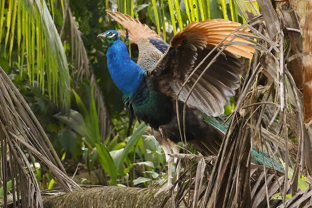
Birding in Chile
Pictures from this part of the trip are posted here.
Chile
We boarded the Seabourn Quest on January 27, 2023 and set sail at about 5:30 PM for our first two stops at Puerto Montt and Castro, Chile. Birds seen during landings there are posted in the Chile birding site. Next, the ship sailed south to Chilean fjord country and Patagonia.
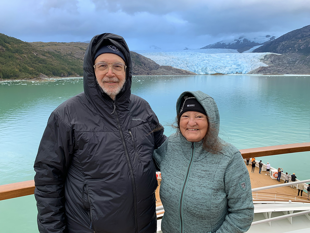
Our first sightseeing destination was El Brujo glacier. It flows into a deep fjord off the Patagonian ice sheet, the third largest on Earth after Antarctica and Greenland. We were lucky to see a substantial calving event as a partial sheet about 100 feet high slid off the glacier and into the ocean, with rumbling like distant thunder.
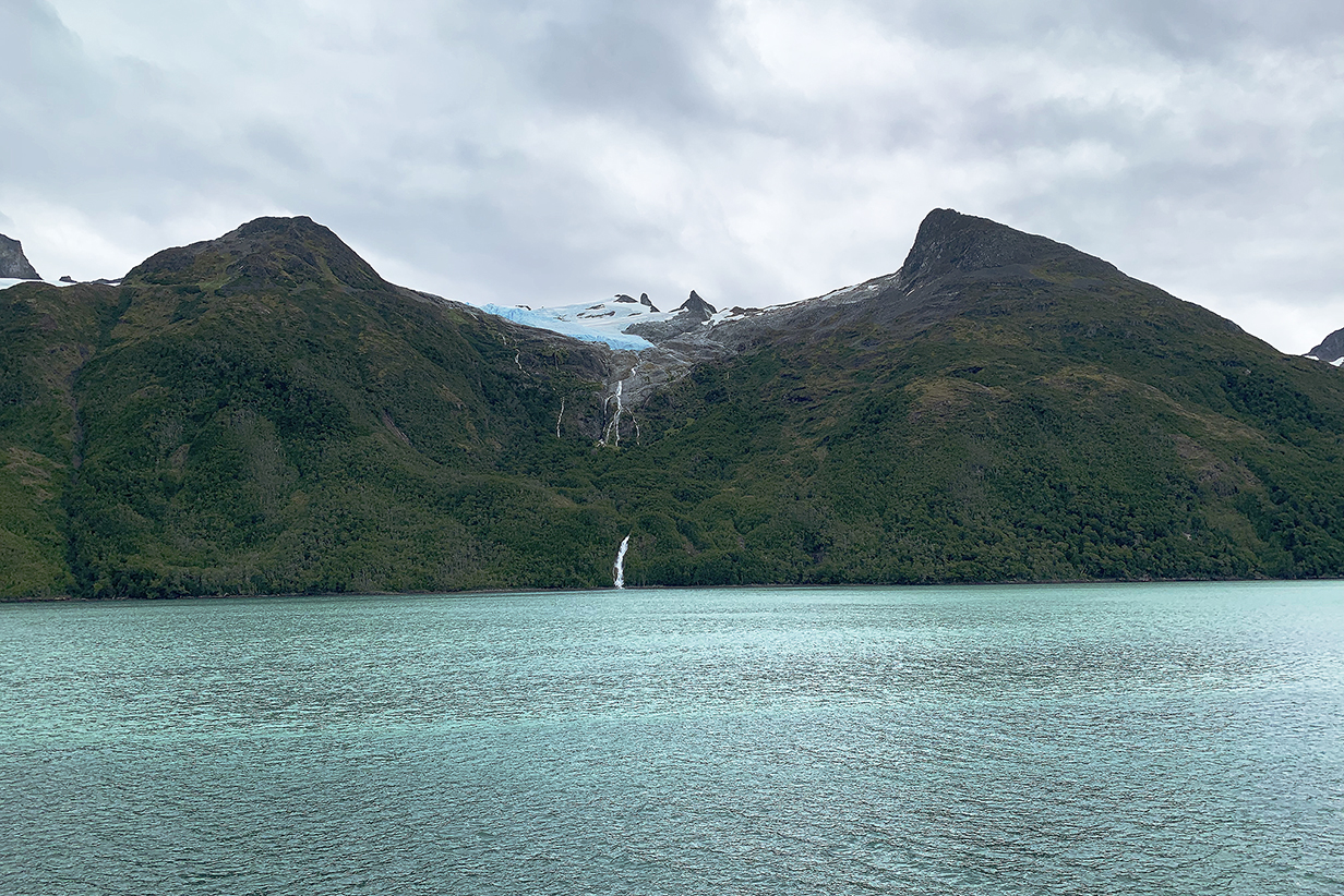
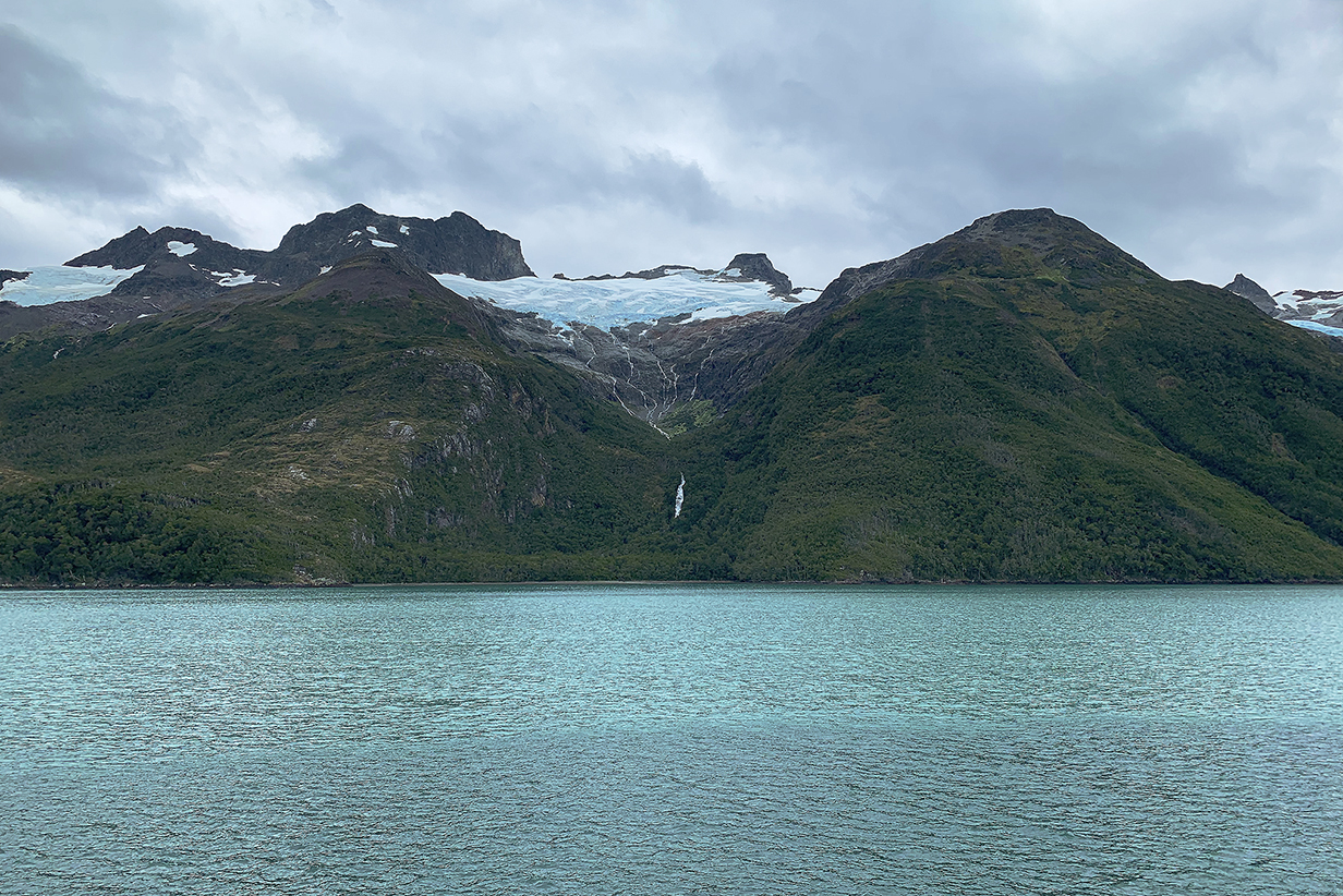
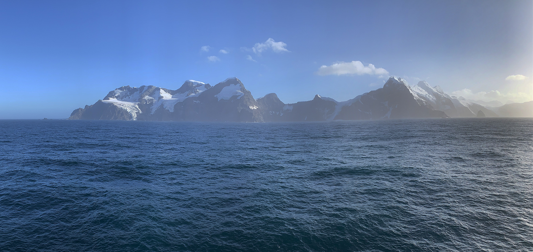
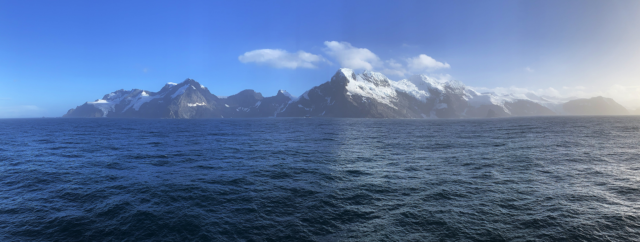
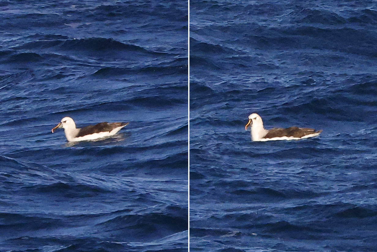
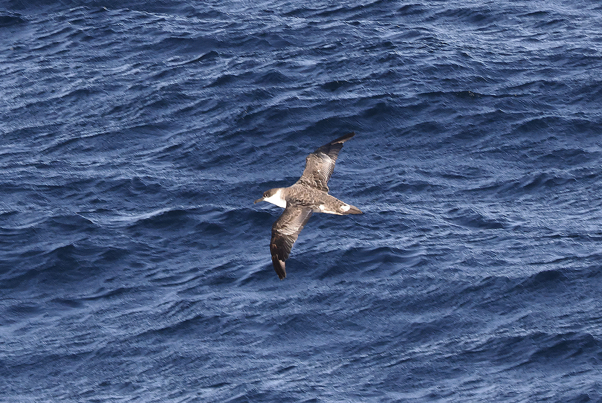
On 2023 February 3 = day 7 of the cruise, a surprise, actually announced last night by the captain: We are not sailing directly to Antarctica, because the winds and seas in the Drake Passage are "the worst of the season". Instead, the captain elected to sail the inland waterways, latterly the Beagle Channel, to Ushuaia. These pictures show two of many glaciers, melting in sea-level temperatures in the mid-50s F. In both cases, a hanging glacier at high altitude is all that's left. Small waterfalls feed down into a prominent cirque that was carved back when it was filled with a much bigger glacier. Out of the bottom of the cirque, a bigger waterfall reaches the sea. John spent 2-3 hours in pelagic birding, getting one new species, Imperial cormorant. We both enjoyed the peaceful passage in calm seas. Toward the end, there were hundreds of Black-browed albatross, many groups of half-a-dozen Magellanic penguins, mostly juveniles resting in the water between dives -- and gawking at the ship -- and a few other birds.
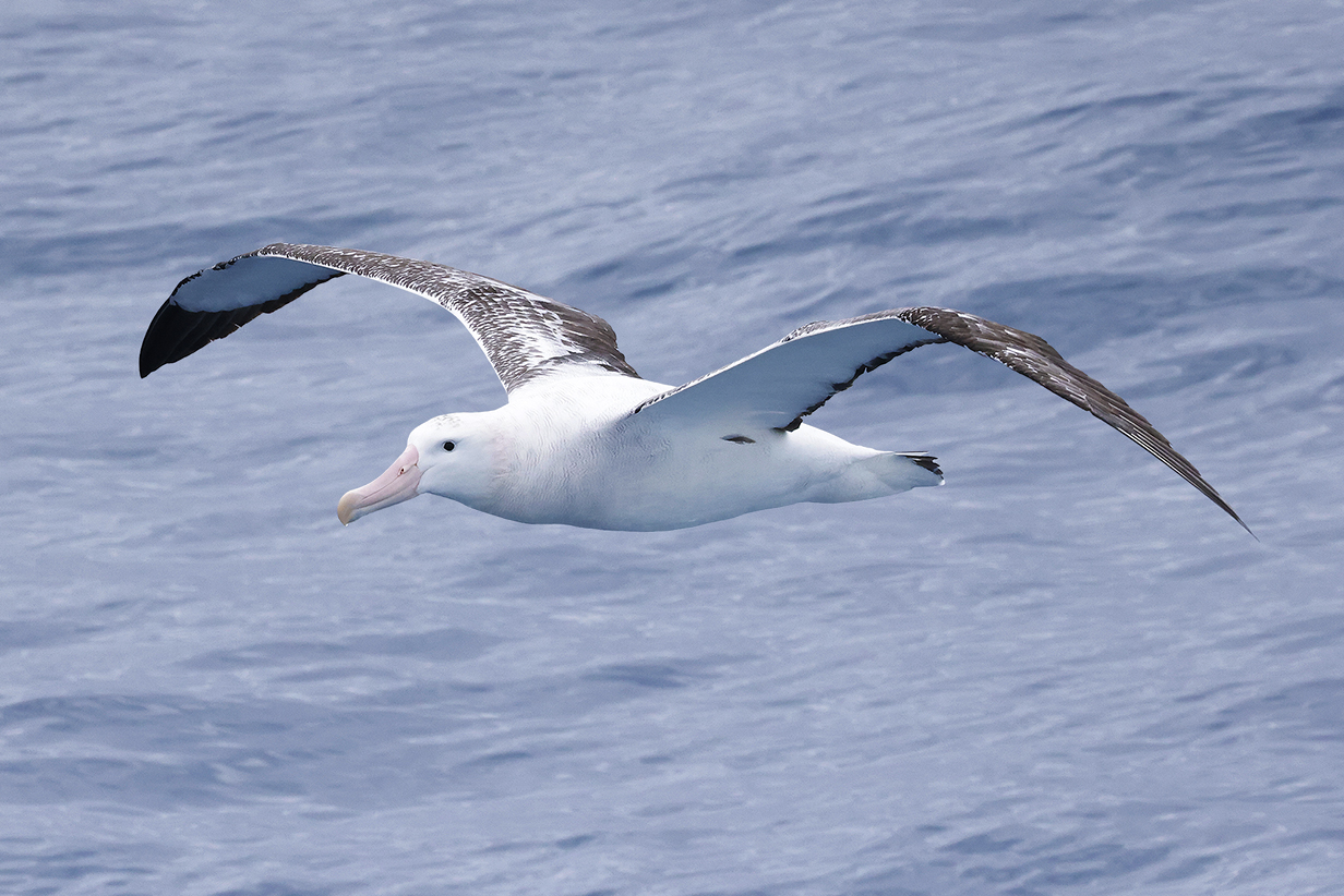
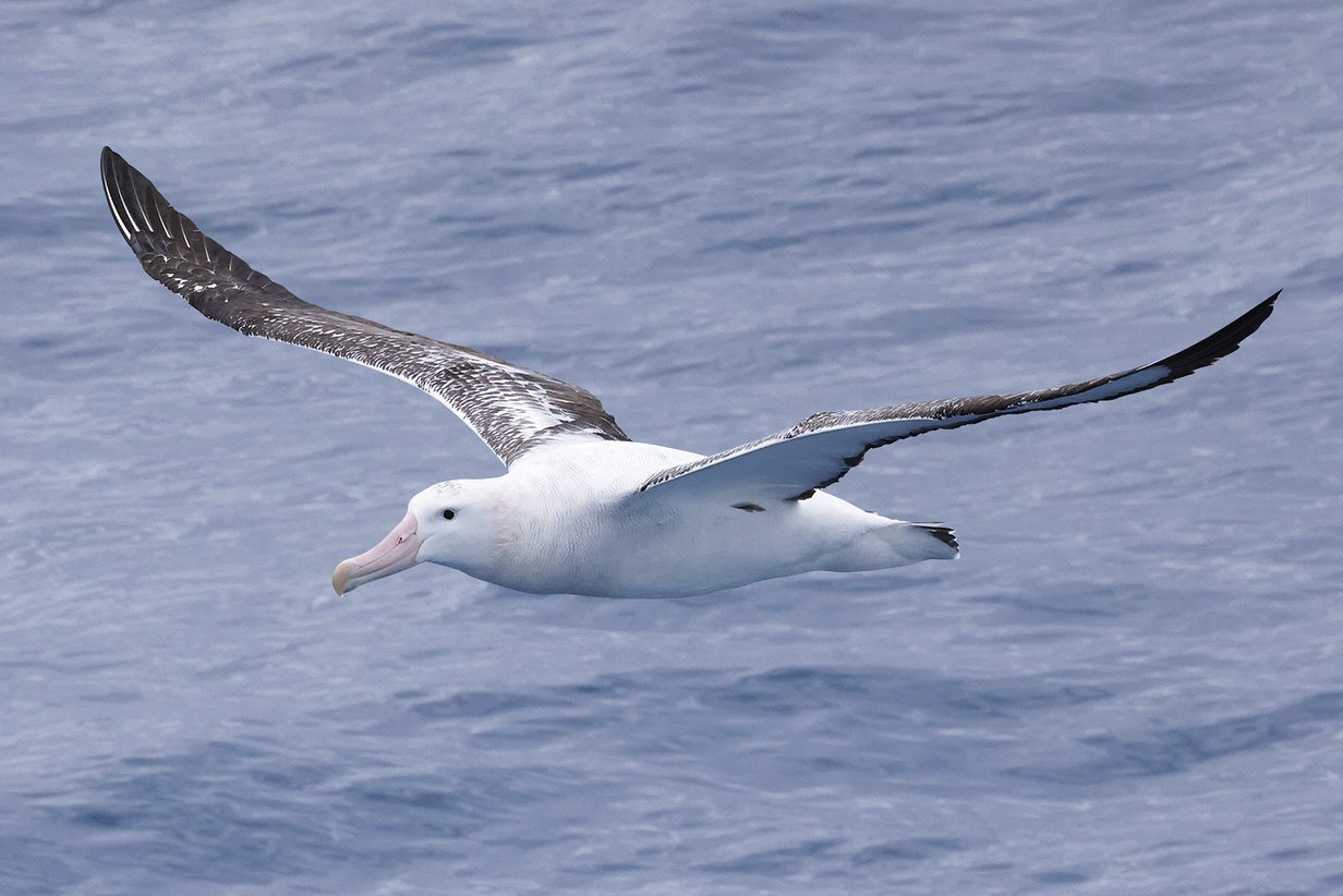
During the evening of February 3rd, we anchored in calm waters off Ushuaia, not going ashore. The ship could not get clearance on short notice ... but we spent 2 days in Ushuaia in December. We lifted anchor at midnight and headed south. By 6 AM, we were in open seas with swells of 10-20 feet, only a little awkward in a ship that takes > 400 passangers. Soothing, actually. Now, as I write this, it is 1:20 PM on February 4th. Seas are getting calmer, with occasional swells > 10 feet. By tomorrow, we should be in Antarctic waters. Always a pleasure to be sailing the open ocean, "alive" with waves and foam. Occasionally, a Wandering albatross swoops by, at home in brisk winds.
Antarctica
On 2023 February 5 = day 9 of the cruise, we reached Antarctic waters and King George Island, the biggest of the South Shetland Islands, off the west coast of the Antarctic Penninsula. We stopped briefly to allow our ship's crew to pick up an emergency supply of boots and parkas for passengers (including Mary) whose kit did not arrive at Punta Arenas as scheduled. This stuff had been delivered at Chile's Eduardo Frei Montalva Station, visible in the background of the picture below. Besides us, 4 other ships were in Maxwell Bay. We were treated to a surprising connection with our November/December 2022 cruise to Antarctica: Our ship, the Greg Mortimer, was there, together with her Aurora Expeditions sister ship, the Sylvia Earle:
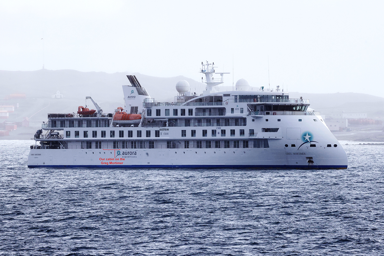
This is the Greg Mortimer, on which we cruised to Antarctica in late 2022. Our cabin was the one with the large balcony on the lowest deck that has balconies. It was perfect for pelagic birding, because the most interesting birds skim close to the waves. And it gave us wonderfully dramatic views of the biggest waves, which were at least 15 feet from trough to crest.
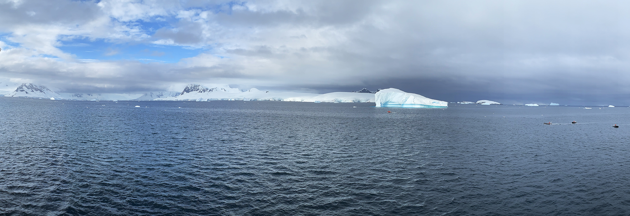
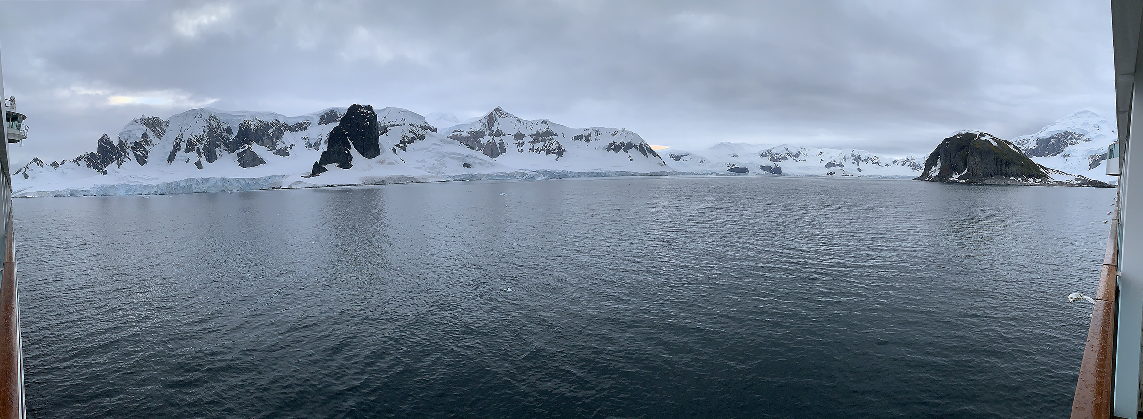
On 2023 February 6 = day 10 of the cruise, we made our second landing on mainland Antarctica at Portal Point (64 degrees 30 min S; 61 degrees 46 min W, on the NE part of the Reclus Peninsula on the west coast of Graham Land ). This almost-180-degree panorama shows the view from our balcony during the morning reconaissance by the crew, before the start of landings. Scroll right to see the full panorama. Left of the big iceberg is a low ice dome on the mainland. Left of the ice dome is our landing site at the black rocks on the shore.
Closeup of a big iceberg that is about as tall as the ship. Note how the water line has shifted as the iceberg has rolled in the past.
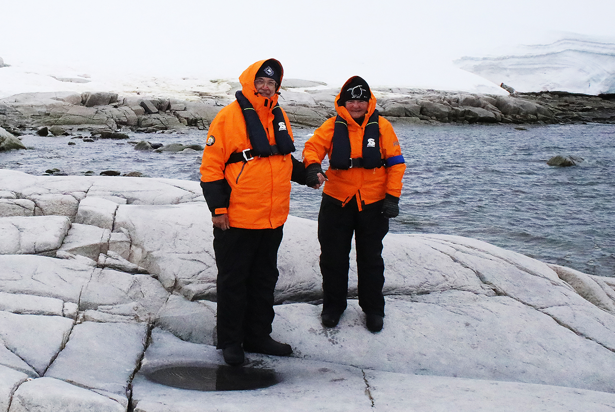
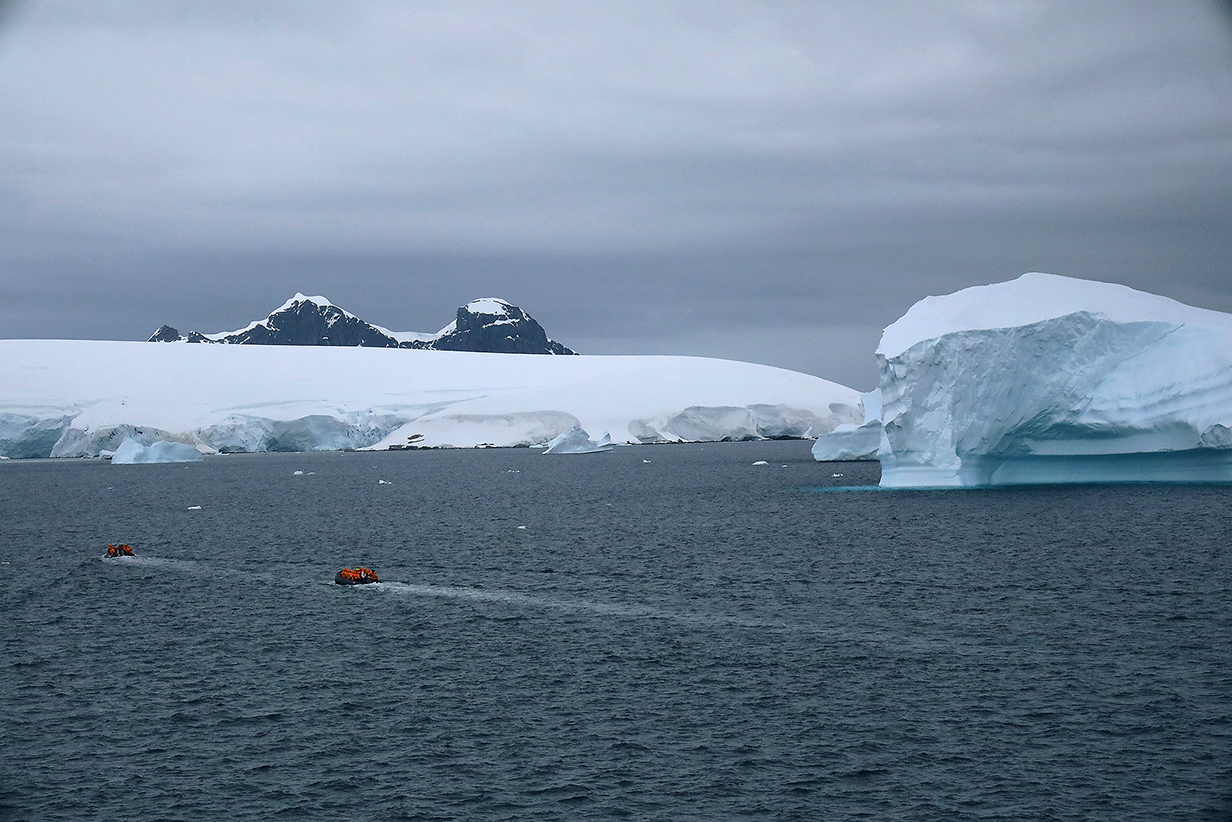
Second landing on mainland Antarctica, Portal Point, 2023 February 6.
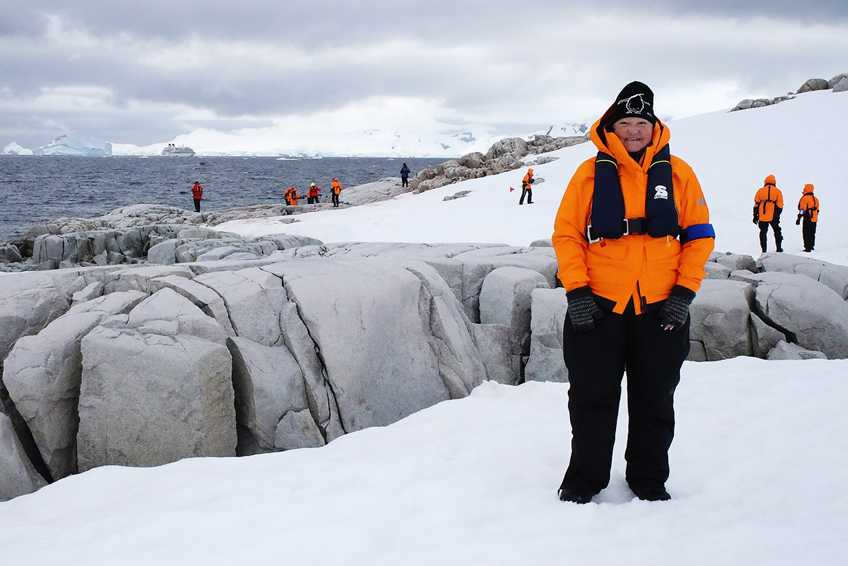
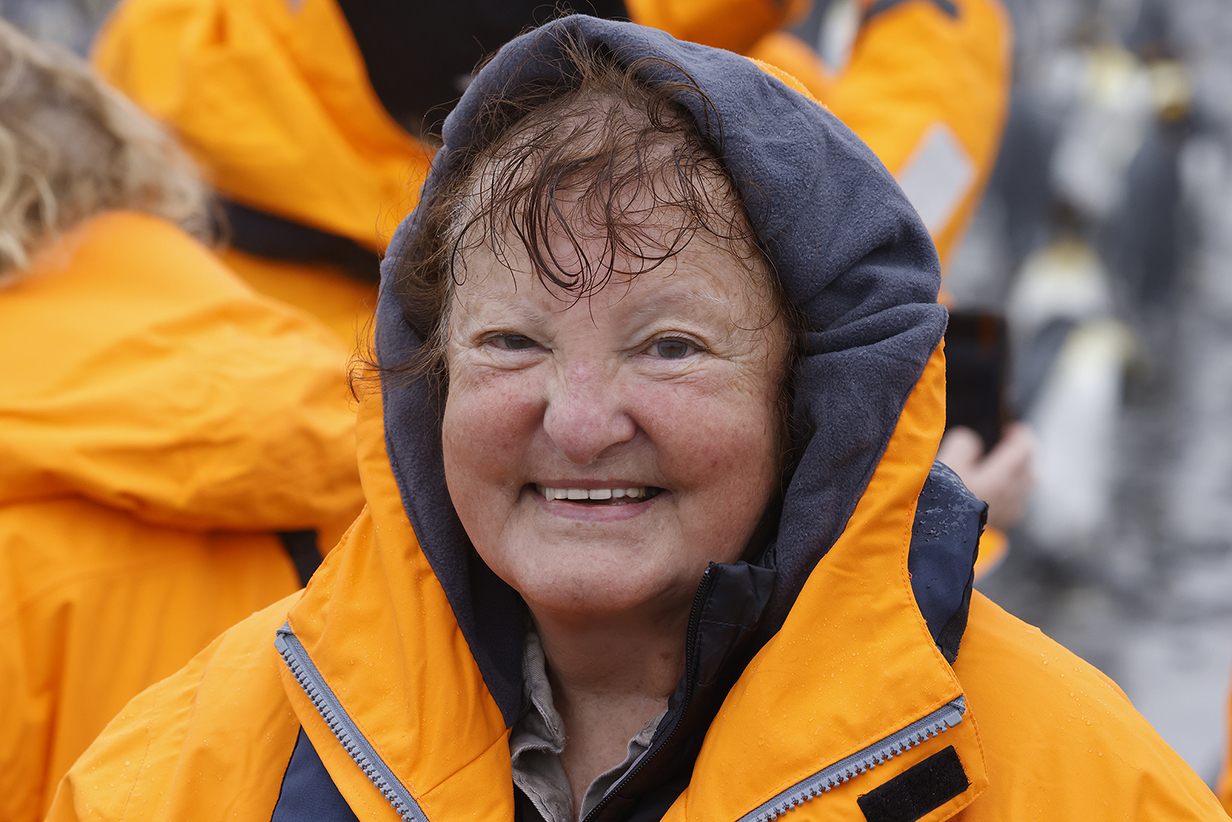
Mary at Portal Point, showing the Seabourn Quest about a mile offshore, a little farther away than the big iceberg pictured above.
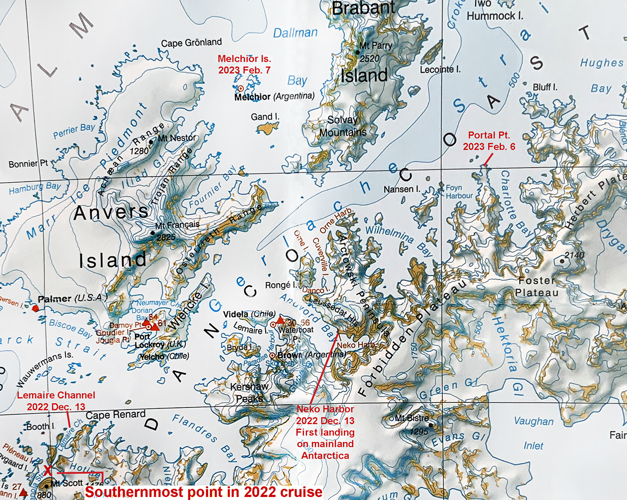
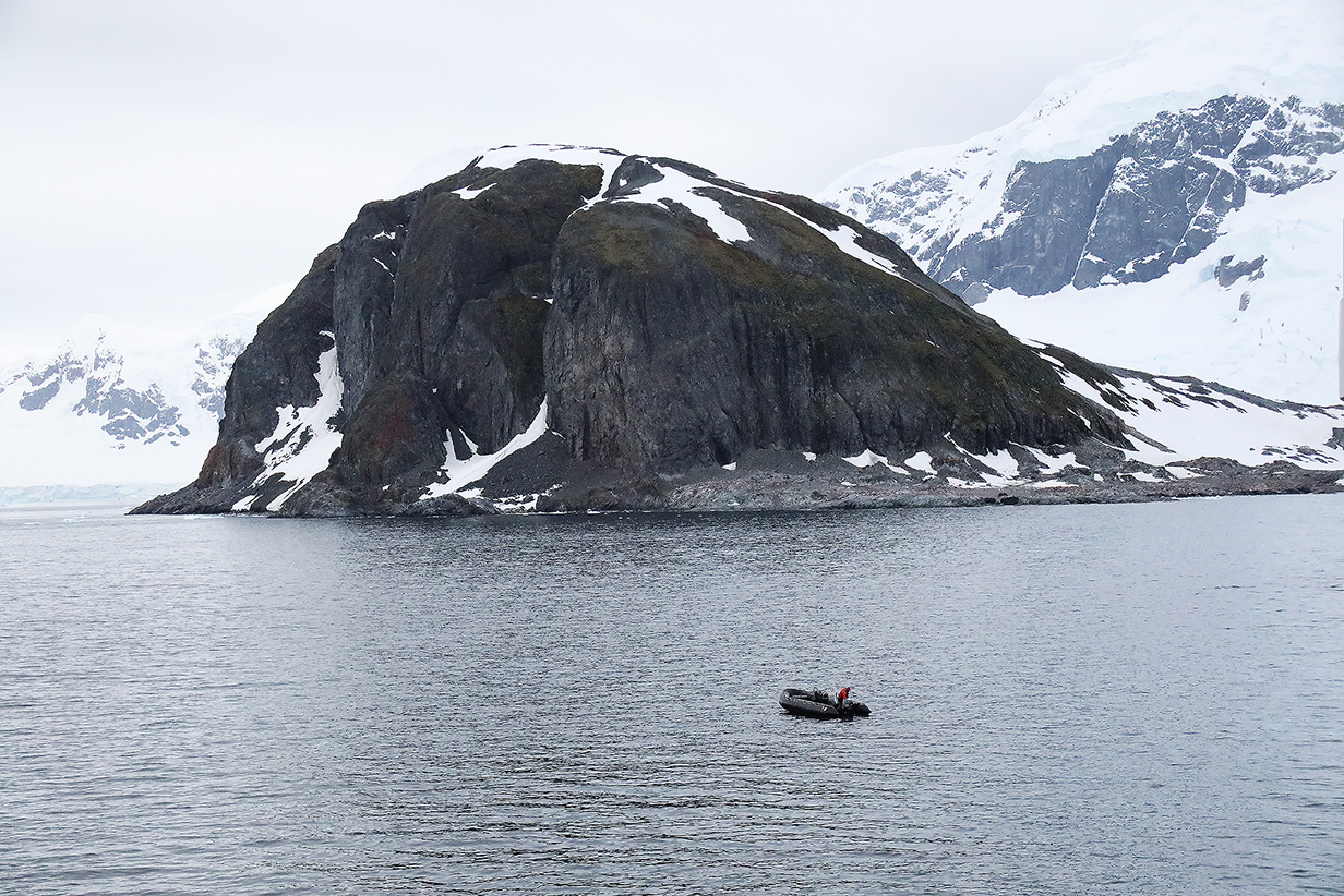
British Antarctic Survey map of the part of the Antarctic Penninsula and environs where we were on 2023 February 6 (above) and February 7 (below). Our second landing on mainland Antarctica was at Portal Point; our first landing at Neko Harbour in 2022 is also marked. Pictures below show the ring of glacier-covered Melchior Islands, where we had a zodiac excursion on 2023 February 7th.

Melchior Islands 180-degree panorama (scroll right to see it all) from the balcony of our suite. Our excursion for 2023 Feb. 7 was a zodiac cruise around the islands. Our zodiac driver estimated that the ice cliffs are about 300 feet high. My guess is 150-200 feet high for typical ice faces. Conditions were good: overcast but essentially calm winds and seas with temperature ~ 0 degrees C.
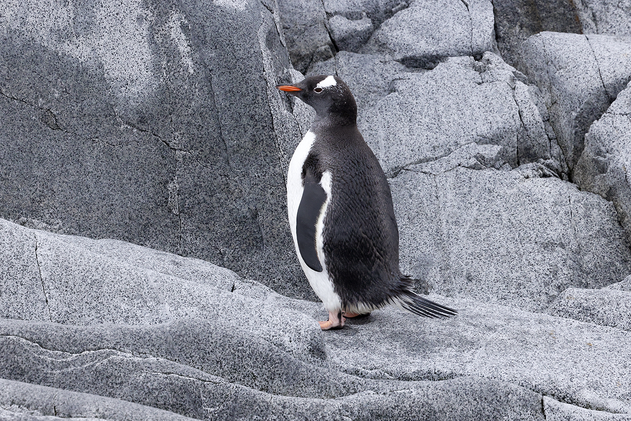
Gentoo penguin from the zodiac
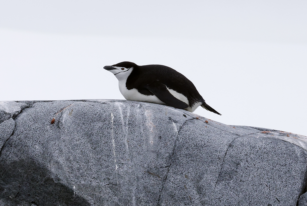
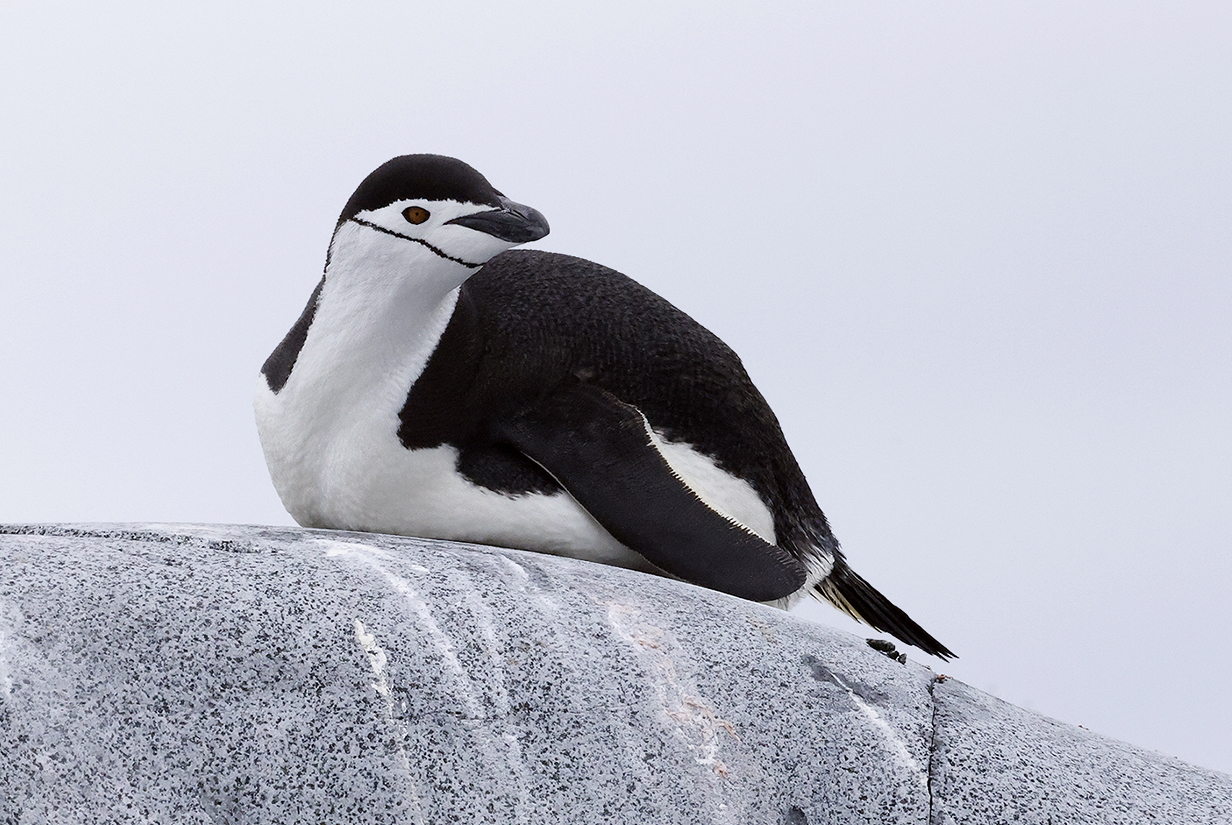
Chinstrap penguin from the zodiac -- one of 3 that we saw. This is the closest that we have gotten to a Chinstrap.
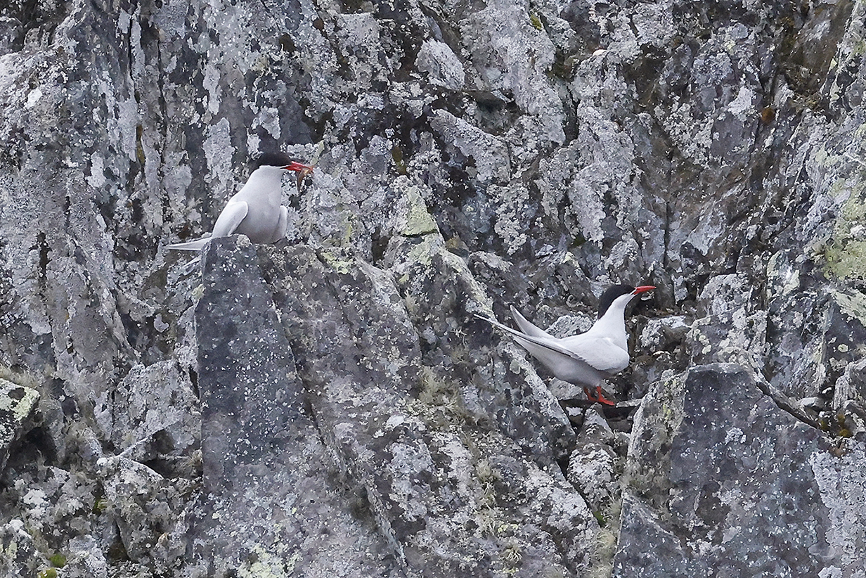
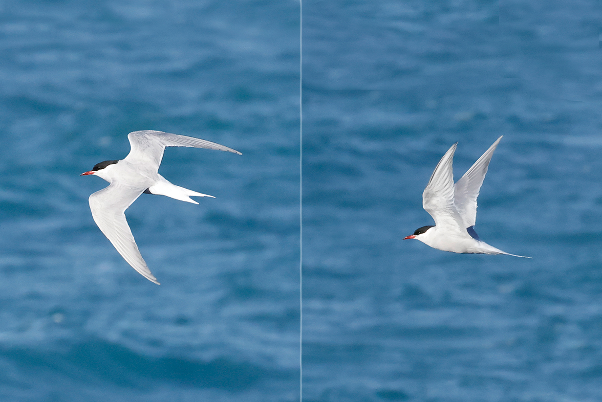
Antarctic terns were nesting on some of the cliffs surrounding the islands. The tern on the left has a fish.
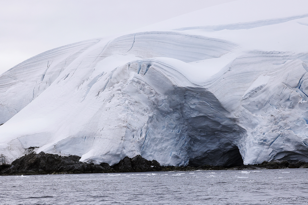
Ice cliffs and sea cave as seen from the zodiac cruise.
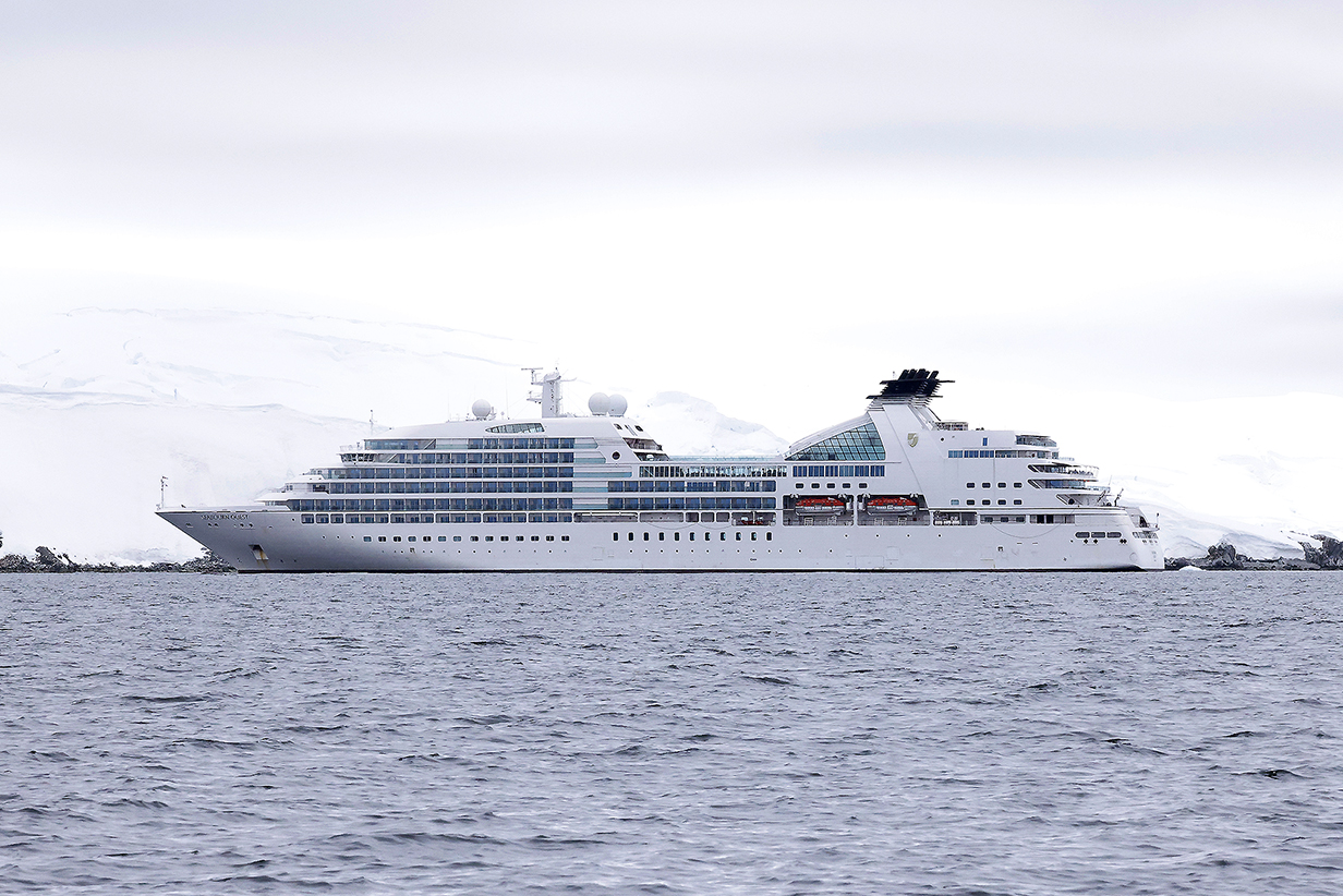
Seabourn Quest during the zodiac cruise
During the evening of February 7, after supper, we sailed south-east between Anvers and Brabant Islands toward the Antarctic penninsula. From about 8:15 PM until 9 PM, when we turned right = more westward, we were pointed at the absolutely spectacular Arctewski Penninsula and the Forbidden Plateau of the Antarctic mainland beyond. The view was magnificant and spellbinding. The map below shows the direction of the view. And the following pictures were taken as we sailed closer, just before we turned and this view disappeared behind the ship at 9 PM.
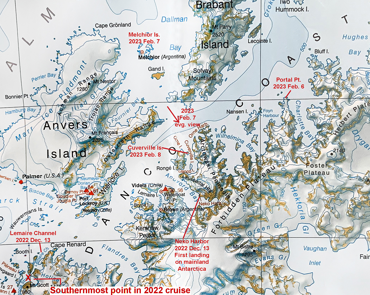
This adds to previous maps the direction of the spectacular view during the evening of Feb. 7 and the location of Cuverville Island, where we landed at 7 AM on February 8th.
This was the view south from about mid-way between Anvers and Brabant Islands; evening of February 7 at about 8:15 PM.
View SE at the same time as the previous picture. We rarely know exactly where we are -- or are looking -- but I think that this shows the Arctewski Penninsula end-on. This view was every bit as spectacular as the views of Lemaire Passage in December 2022. In fact, the mountains in the distance are higher -- ~ 1 mile high. I felt enormously privileged to immerse myself in this view for about 40 minutes, as we approached in the following pictures.
As the sun settled lower, approaching 9 PM, views got more and more dramatic.
Last full view of the Arctewski Penninsula before the ship turned south at 9 PM to enter the bay that contains Cuverville Island. Very memorable moment.
At 6 AM on 2023 February 8th, this is a panorama of the view of Cuverville Island (at right) and surrounding bay in mainland Antarctica. Scroll right to see the complete panorama. The Gentoo penguin colony extends from the base of the black mountain at right further to the right to and beyond our landing site.
We were lucky to be in the first group to land this morning, at 7 AM. At that time, winds were still calm and the temperature was 28 degrees F.
This is the rock massif at right in the panorama. Gentoo penguins nest at its base.
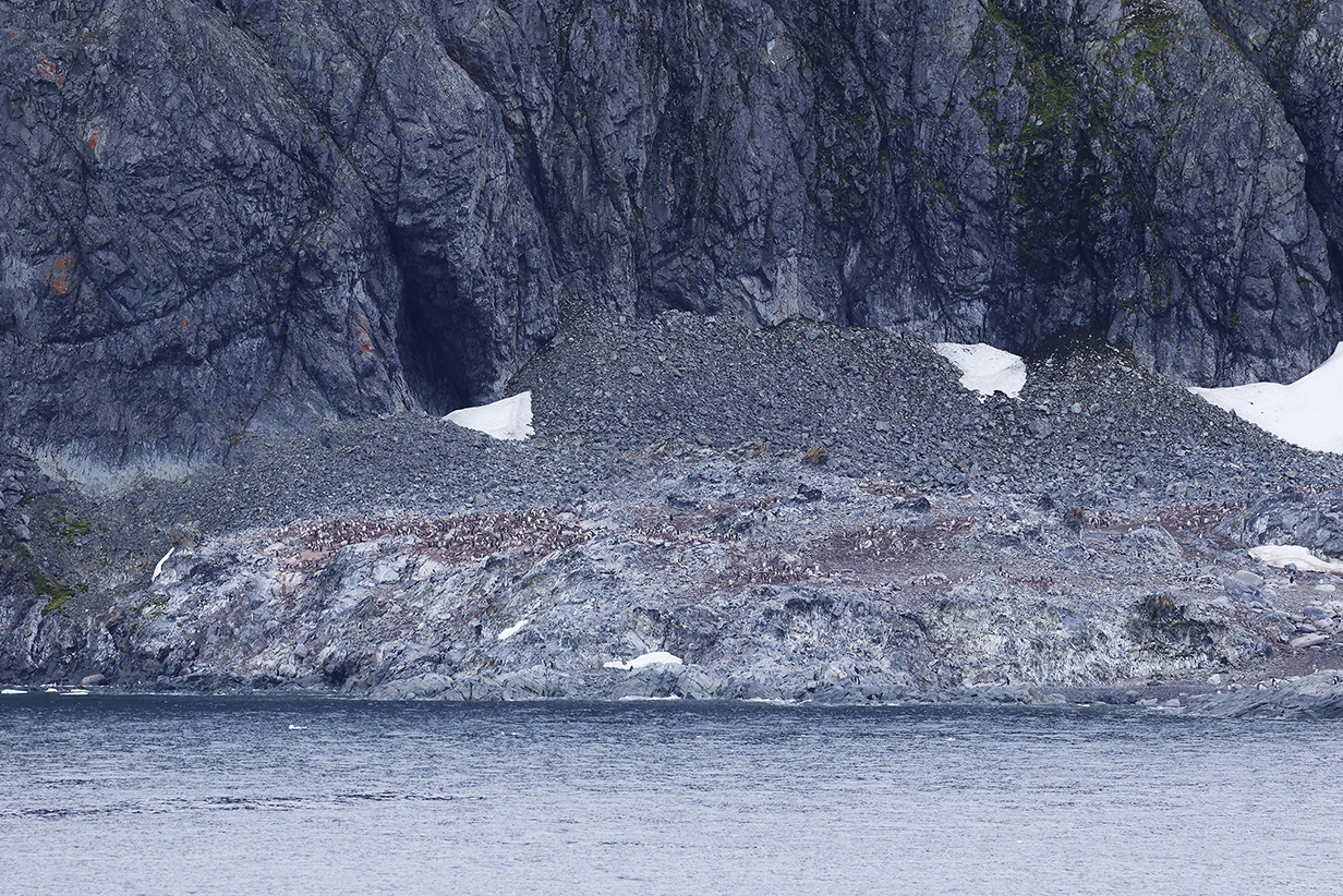
Still from our balcony, before our shore excursion, this shows the part of the Gentoo colony that's at the base of the rock massif. Penguin excrement is red, because that's the color of the krill that they mainly eat.
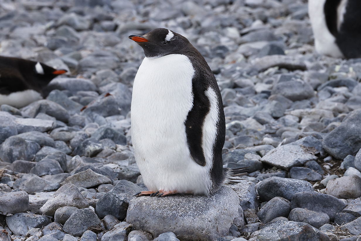
Gentoo penguins are very well fed at this time of the year.
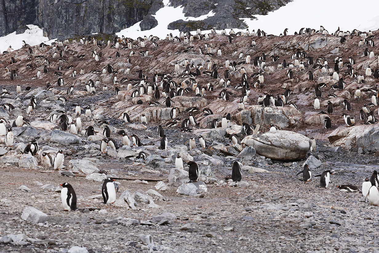
Gentoo penguin colony (Many birds have chicks.)
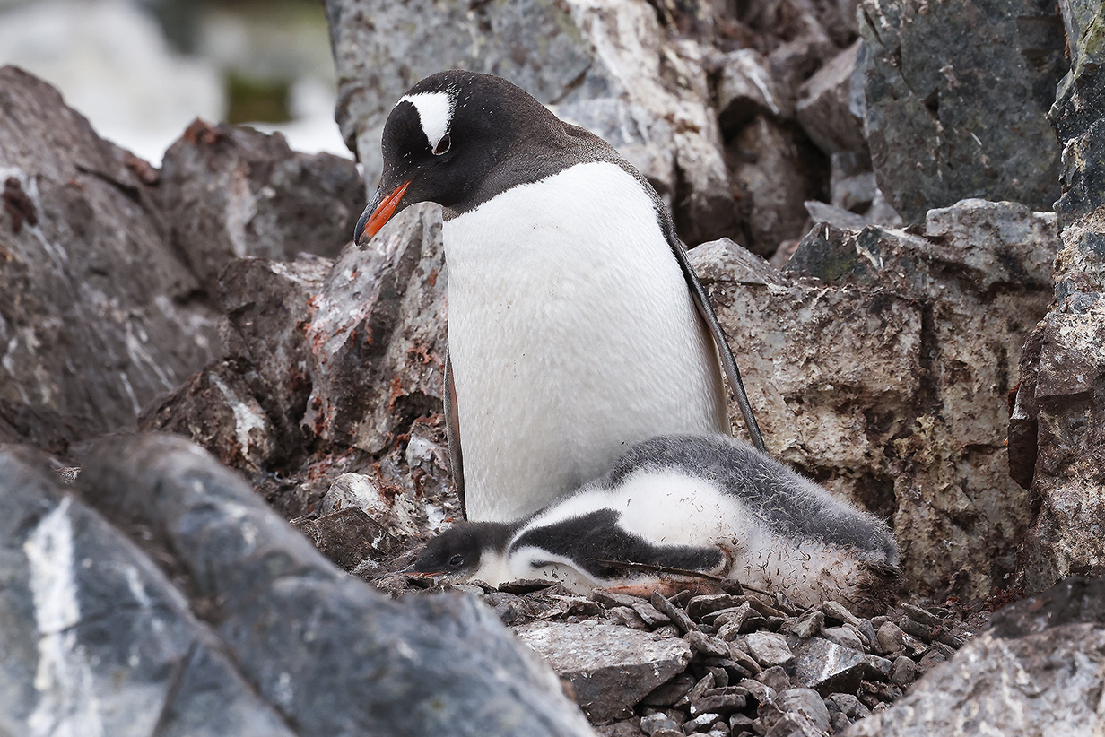
Gentoo penguin and chick
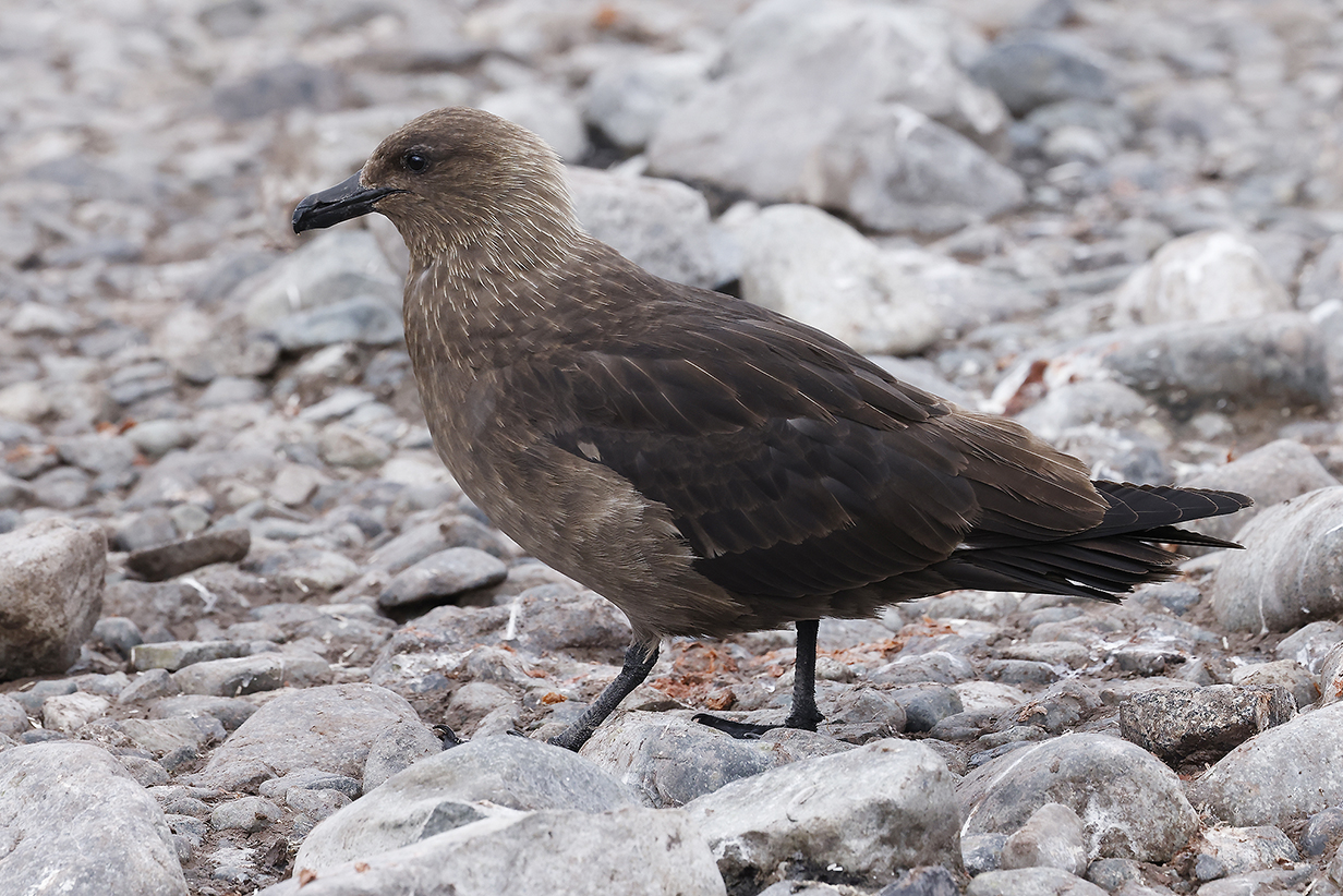
Brown (Subantarctic) Skua were always around, looking alert ... if not exactly "lean and hungry". But the season was getting late for easy pickings of young penguin chicks.
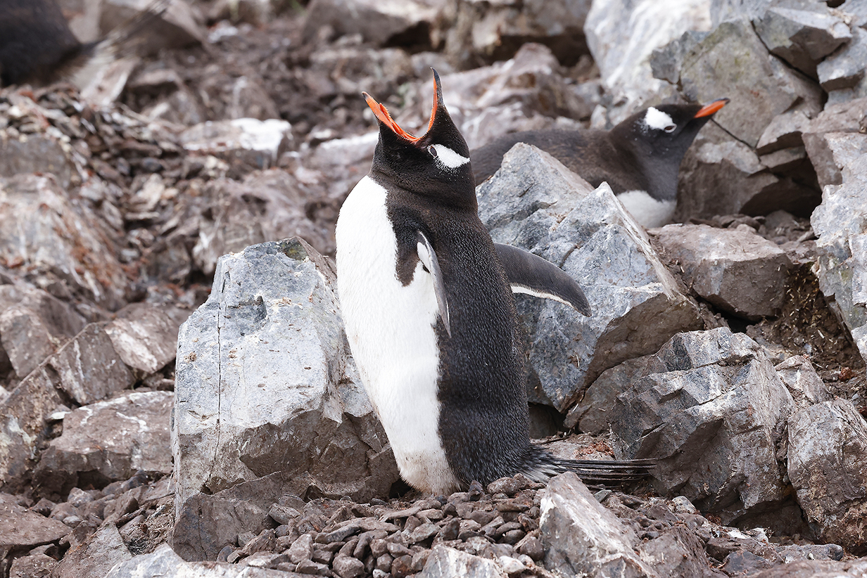
Still, if you're a Gentoo penguin, there's always a good reason to squawk.
We were very lucky today to be in the 7 AM first group to land. By 8:30 AM, we were back on the ship. By 10:30 AM, a gathering storm increased winds to 50-70 knots and all further landings were canceled.
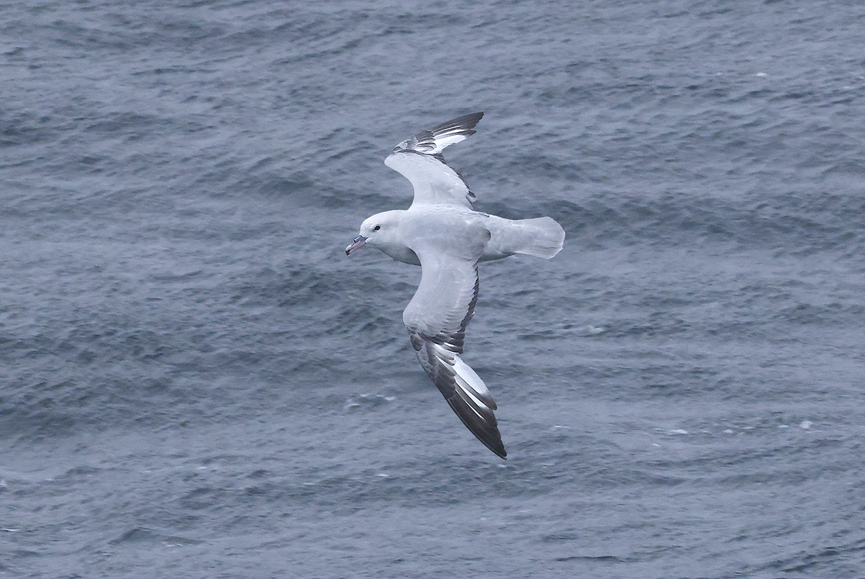
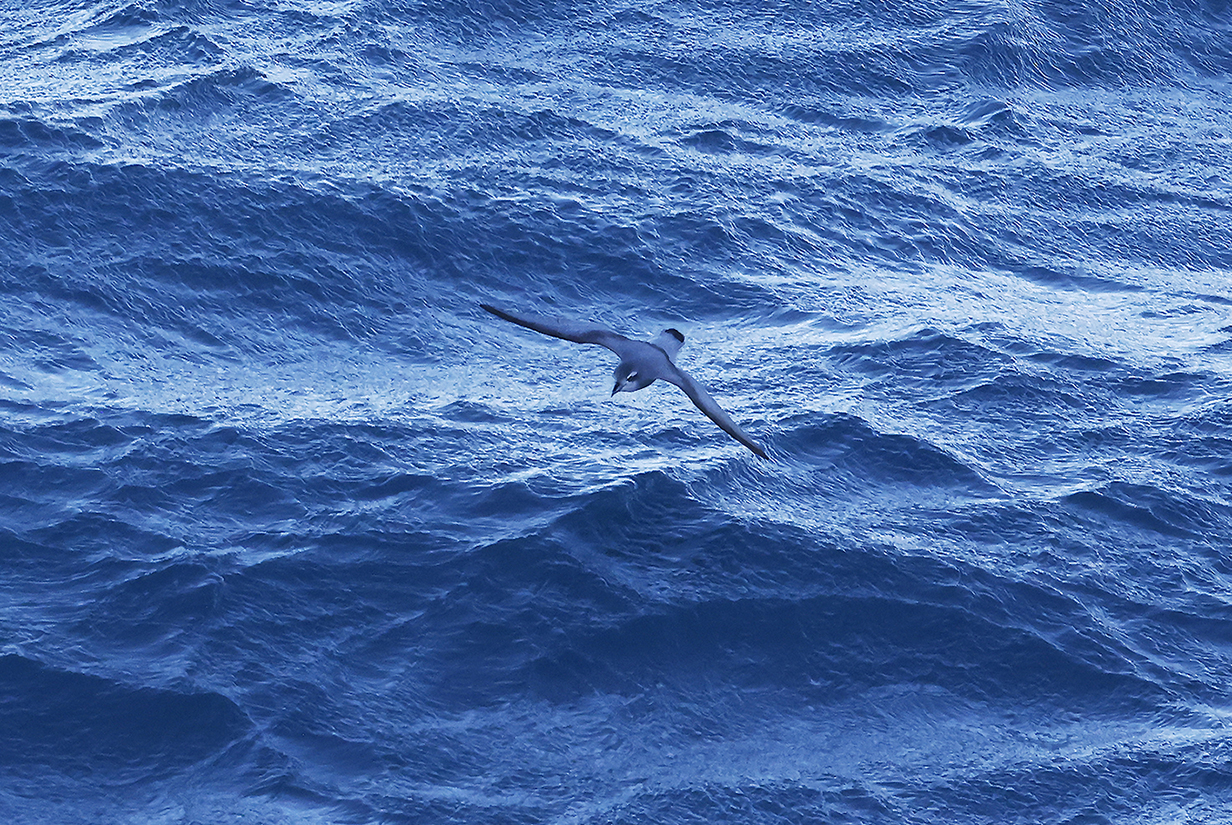
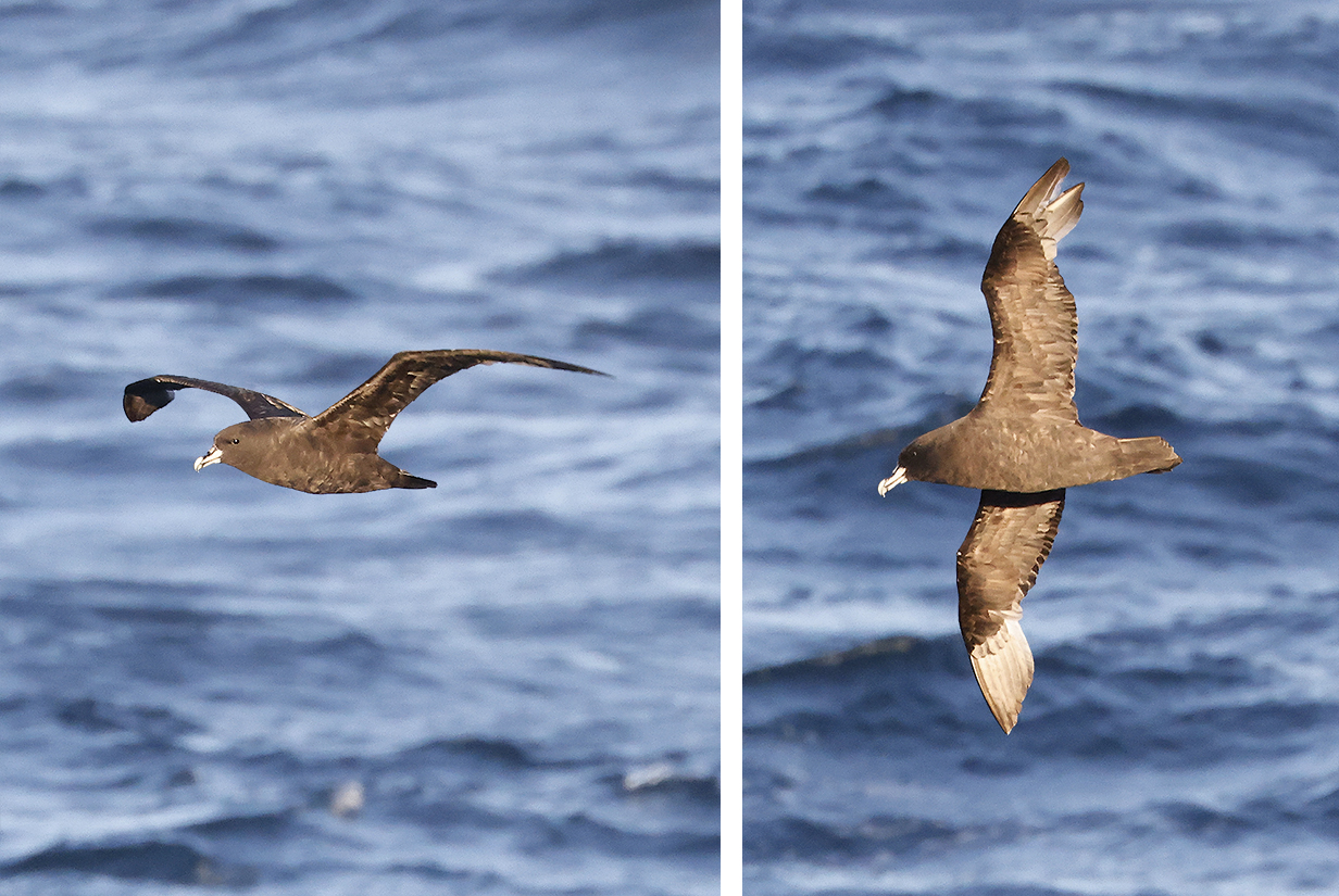
Southern fulmar (By mid-afternoon, winds were steady at 50 knots or more. The captain announced that some gusts were up to 70 knots. Sleet and later snow screamed by in vertical sheets. Seas kept getting rougher until by 6 PM many swells were ~ 10 feet from trough to crest. Crests were blown off by the wind. Meanwhile, several dozen Southern fulmars flew by, swooping seemingly effortlessly in the wind and flying by from stern to bow, faster than the ship and almost exactly upwind. Marvellous adaptation. This bird came by early, when wind and sleet were not yet too strong. I continued pelagic birding for more than an hour: I also saw several Antarctic terns but no other birds. After supper, the storm strengthened further. As I write this, it is 9:30 PM and time to crash.)
High winds continued all night and the captain aborted our planned excursion to Hope Bay at the north end of the Antarctic Penninsula. Instead, Seabourn Quest sailed off NE to Elephant Island and eventually to South Georgia Island.
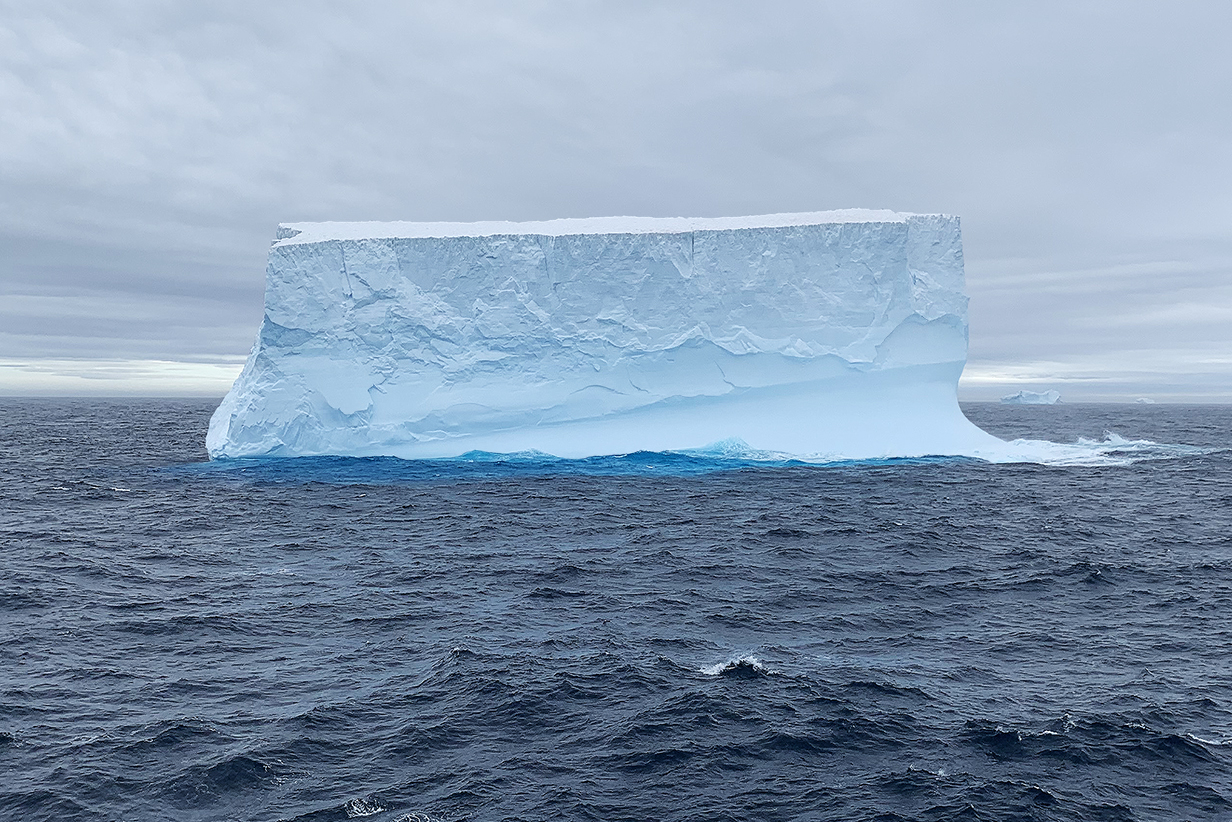
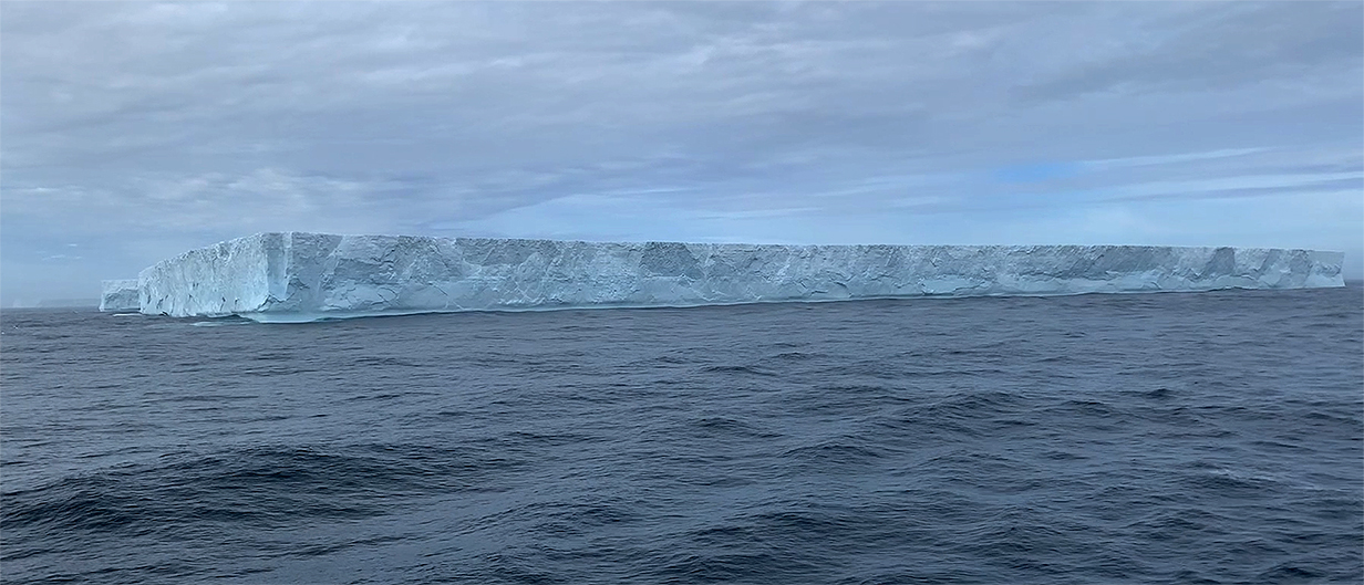
By the morning of February 9th, we were far enough north of the Antarctic Penninsula to start to see tabular icebergs (probably) broken off the Larsen Ice Shelf on the east side of the penninsula.
Iceberg (morning of February 9)
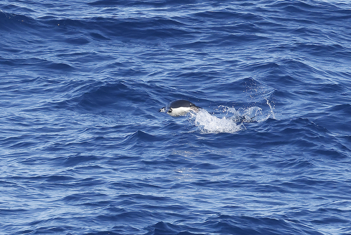
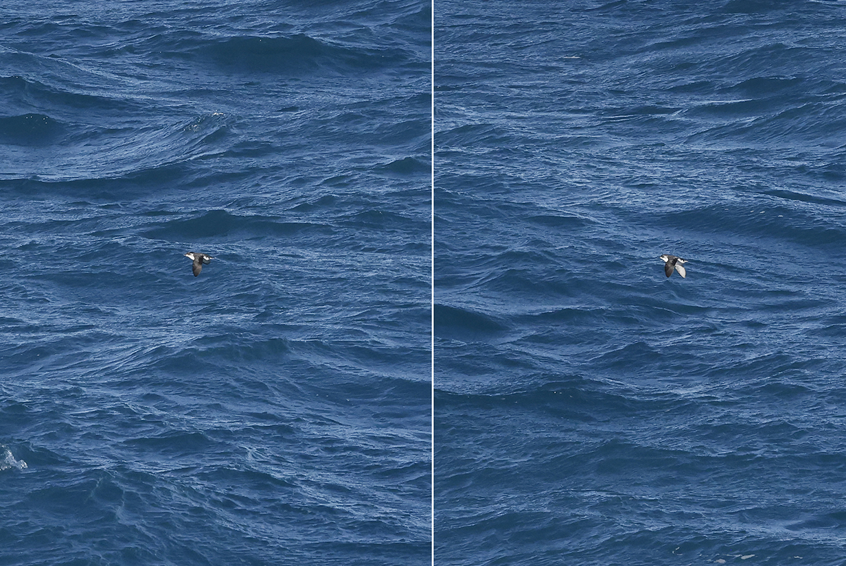
Chinstrap penguin "porpoising" while fishing hundreds of miles from shore
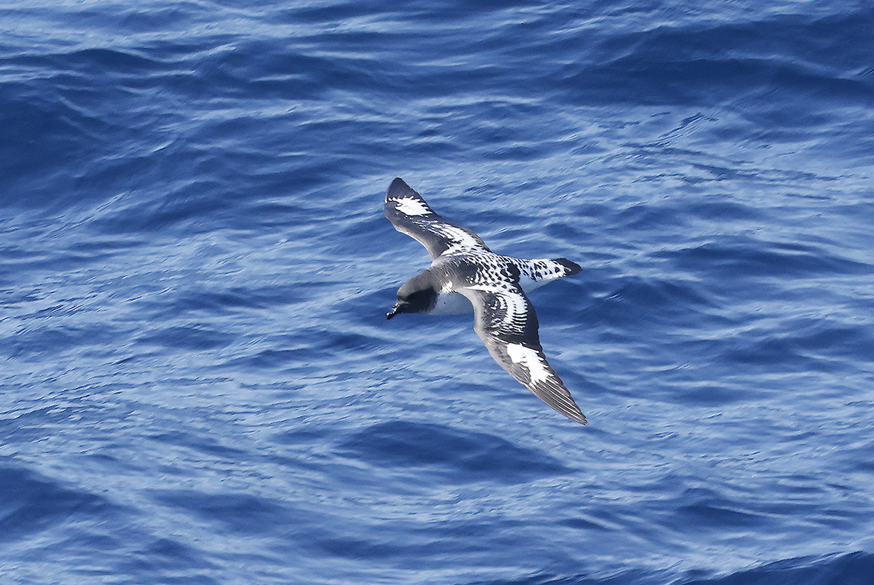
Cape petrel (not a very good picture, but hopefully better ones are to come as we get closer to South Georgia Island)
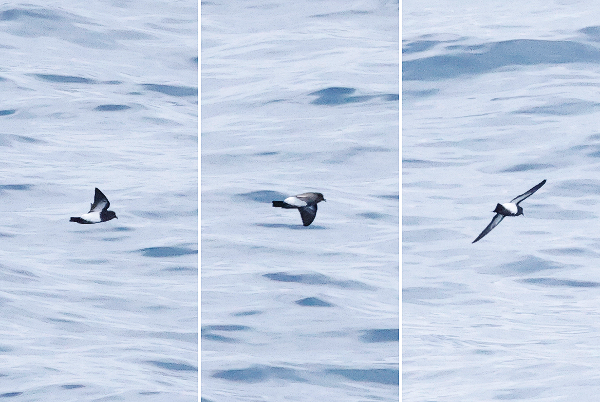
Wilson's storm-petrel (Typical pelagic birding picture -- the bird came barely close enough to be seen and recognized but not close enough for good pictures. Characteristically, the belly is all black and the legs stick out beyond the tail. This was a sunny morning and the pictures are processed as little as possible (slight sharpening and very slight contrast-enhancement but no manipulation of color saturation. In general, I will log such sightings but will not illustrate them here unless birds are new or of special interest .)
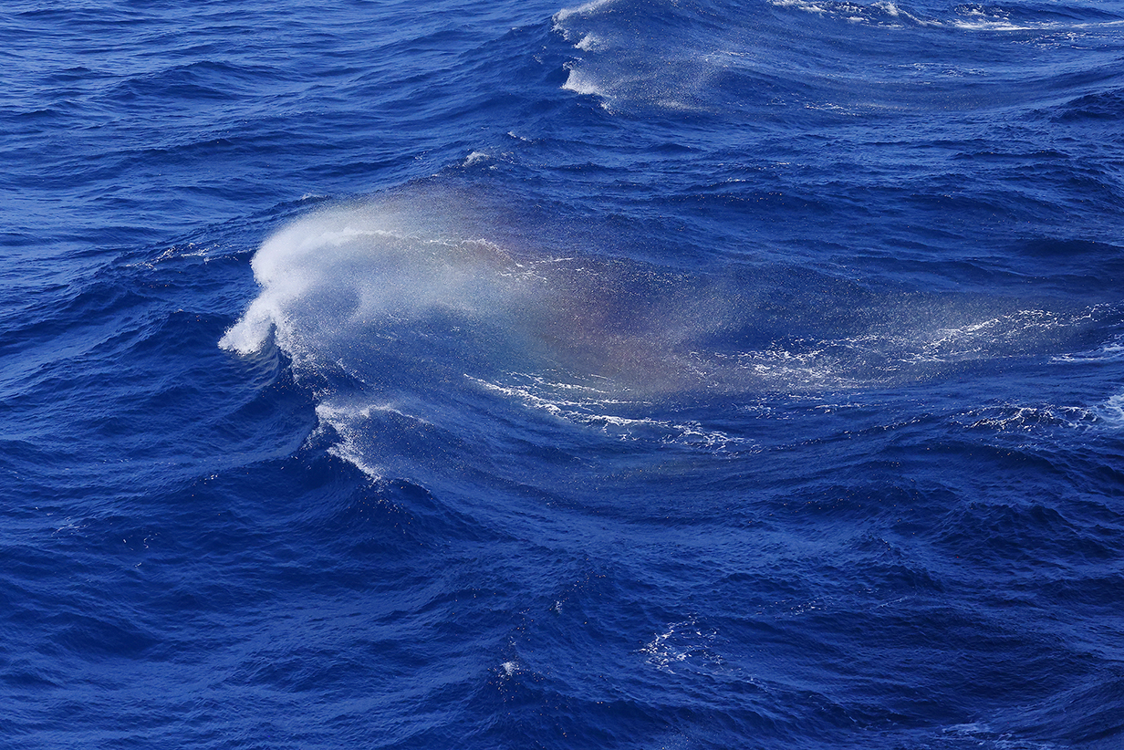
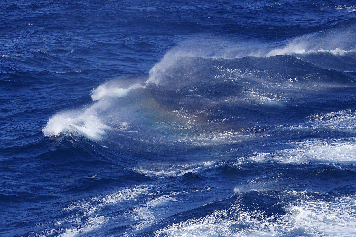
Rainbow flashes in mist blown off of wave crests by the brisk afternoon wind during a now-glorious sunny day. I increased the color saturation here by 35 % to emphasize what is hard to capture in the fraction of a second that the rainbow lasts. Conditions for pelagic birding were cold but beautiful. And, north of the Antarctic Penninsula, there were now more birds.
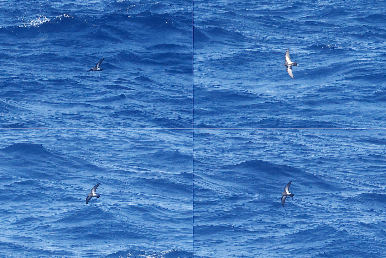
Antarctic prion during PM pelagic birding (never came close)
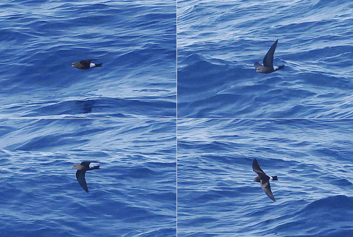
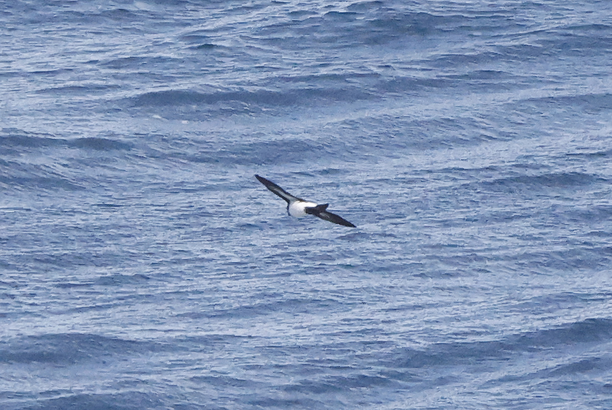
Black-bellied storm-petrel (All 4 images are of the same bird.)
Black-bellied storm-petrel (This is a different bird.)
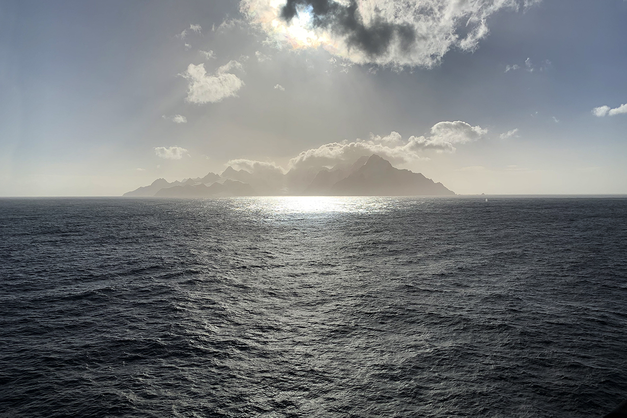
Elephant Island
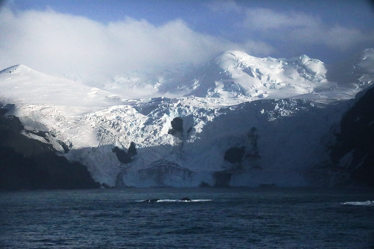
The good consequence of leaving Antarctica early due to high winds was that we passed Elephant Island in evening sunlight instead of at night. The island is famous in the history of Antarctic exploration because Earnest Shackleton and his remaining crew, who had survived unimaginably harsh conditions while his ship was icebound for 2 years and eventually sunk, dared the unbelievably dangerous job of sailing for help in a small boat, going NE: They managed two landings on Elephant Island ... and then had to sail still farther ENE to get to Sough Georgia Island. So our passage NE to Elephant Island, then west along its northern coast, and eventually (after the following pictures) onward ENE toward Sough Georgia had historical significance as well as being spectacularly scenic.
Moreover -- and this is not shown in the pictures below -- the east side of the island had O(100) whales, spouting all around us as we enjoyed the view. Hundreds of Cape petrels patrolled what the whales revealed to be food-rich waters. And all around, Chinstrap and Gentoo penguins were "porpoising" as they fed. The ship's crew and passangers went quietly crazy watching all this: I think that the whales made a bigger impression than the island.
Our first views of Elephant Island as we approached from the South must have been rather like Shackleton's. For us, this was the start of an hour-long scenic adventure. For Shackleton and his crew, it was an explosion of hope that their lives were saved.
This panorama shows the eastern part of the island now from the more northern side. We have passed the point of Shackleton's first landing -- it was near the left end of the island as seen here.
This is a panorama from just a little farther west along the north shore of Elephant Island. Shackleton's second landing -- after being driven from his first landing on a narrow beach by spring tides -- would have been toward the right of this picture.
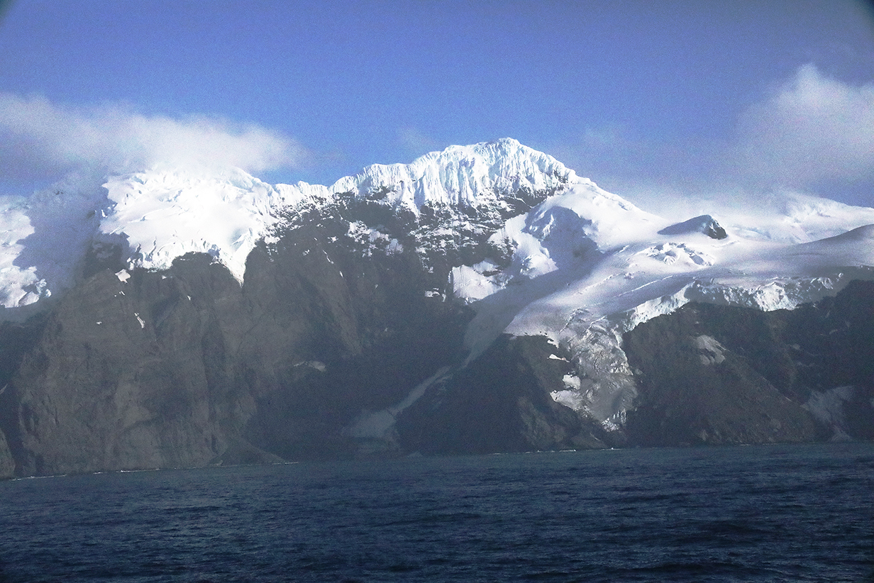
Glaciers on Elephant Island. These mountains are about 3000 feet high.
More glaciers. We are just south of 61 degrees S latitude and conditions here can be harsh.
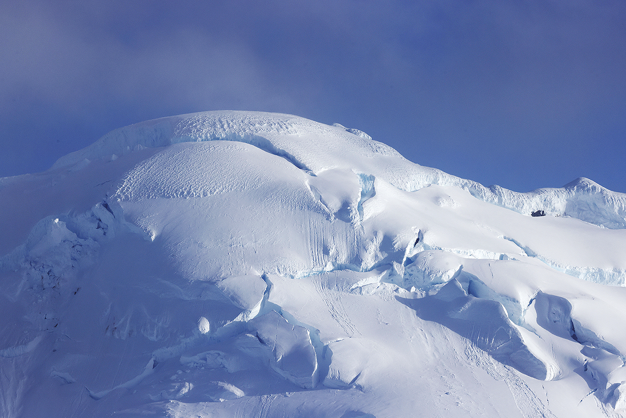
Ice cap of the mountain in the previous picture
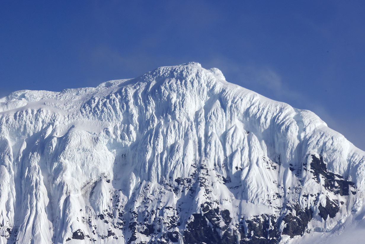
The 2nd picture before the above one shows two peaks. This picture is a closeup of the "ice mushrooms" atop the right peak. The top of the left peak is in clouds in the earlier picture; it's ice mushrooms are shown below.
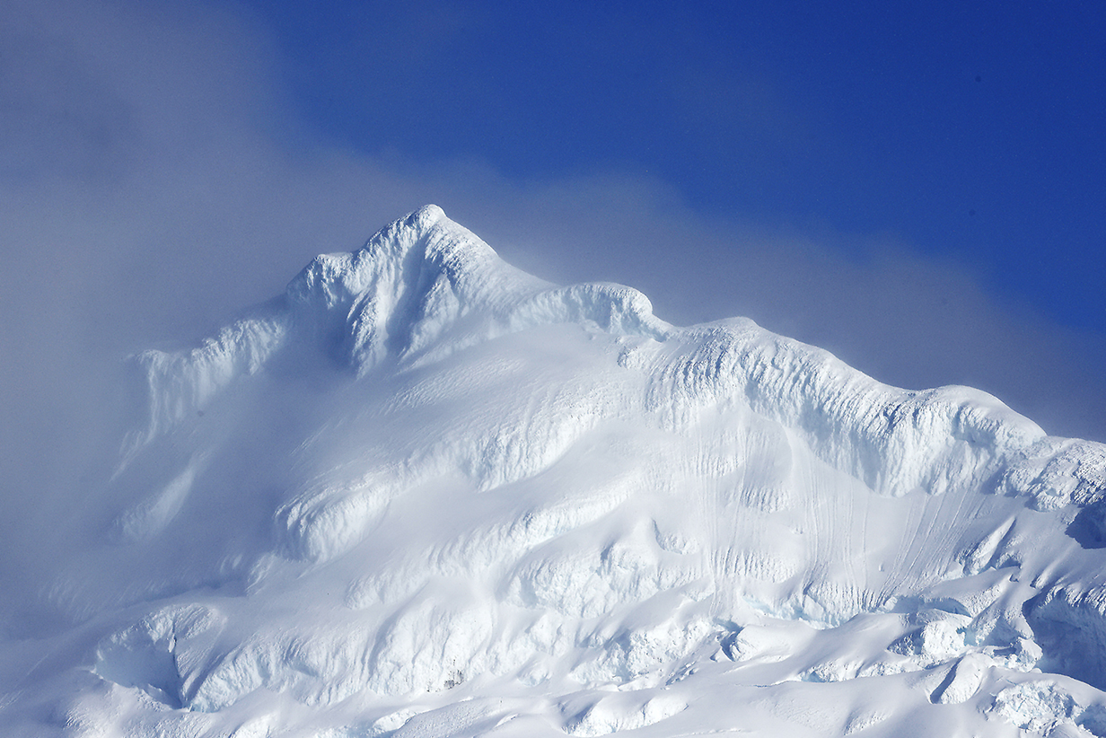
I have a fascination for the ice mushrooms that top many mountains in the far southern hemisphere. The most famous of these is on Cerro Torre, a 9000-plus-feet-high, almost vertical granite tower in the Patagonian cordillera. It is sometimes described by mountaineers as Earth's "hardest mountain to climb" ... because you have to cut your way through an ice cap that overhangs all sides of the mountain. This summit is less extreme. But it is very impressive and harshly beautiful.
After passing Elephant Island, the ship turned ENE toward Sough Georgia Island. We had a very satisfied dinner.
South Georgia Island
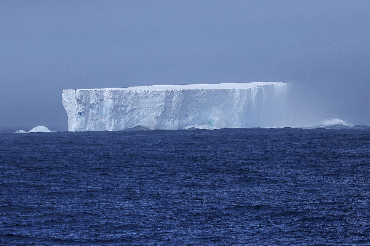
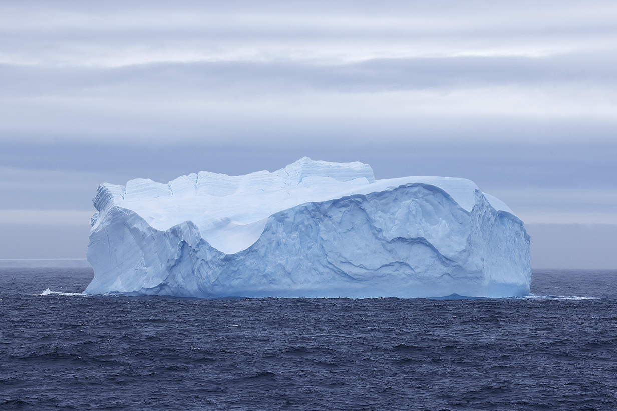
As I noted before the Elephant Island interlude, we were now (February 10th) far enough NE to start to get big tabular icebergs that presumably calved off the Larsen ice shelf. We thought that this one was big until we passed MUCH bigger ones:
This is the smaller side of a monster iceberg that was more than twice as long as the width shown here. Here is a movie of us passing the bigger iceberg.
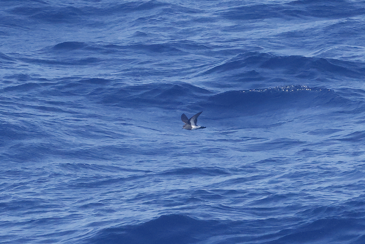
Antarctic prion seen during pelagic birding on 2023 February 10, on the way to South Georgia Island. Still not close enough.
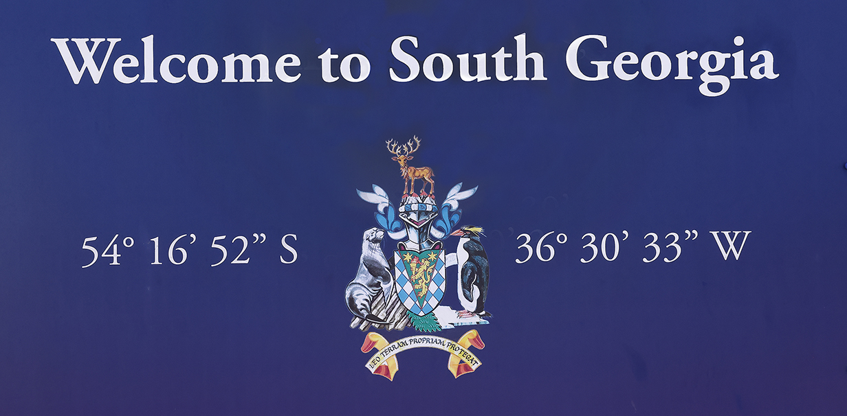
The next series of pictures is from John's Sunday, February 12th landing at Grytviken, South Georgia Island. This sign at the post office introduces the series and gives its coordinates.
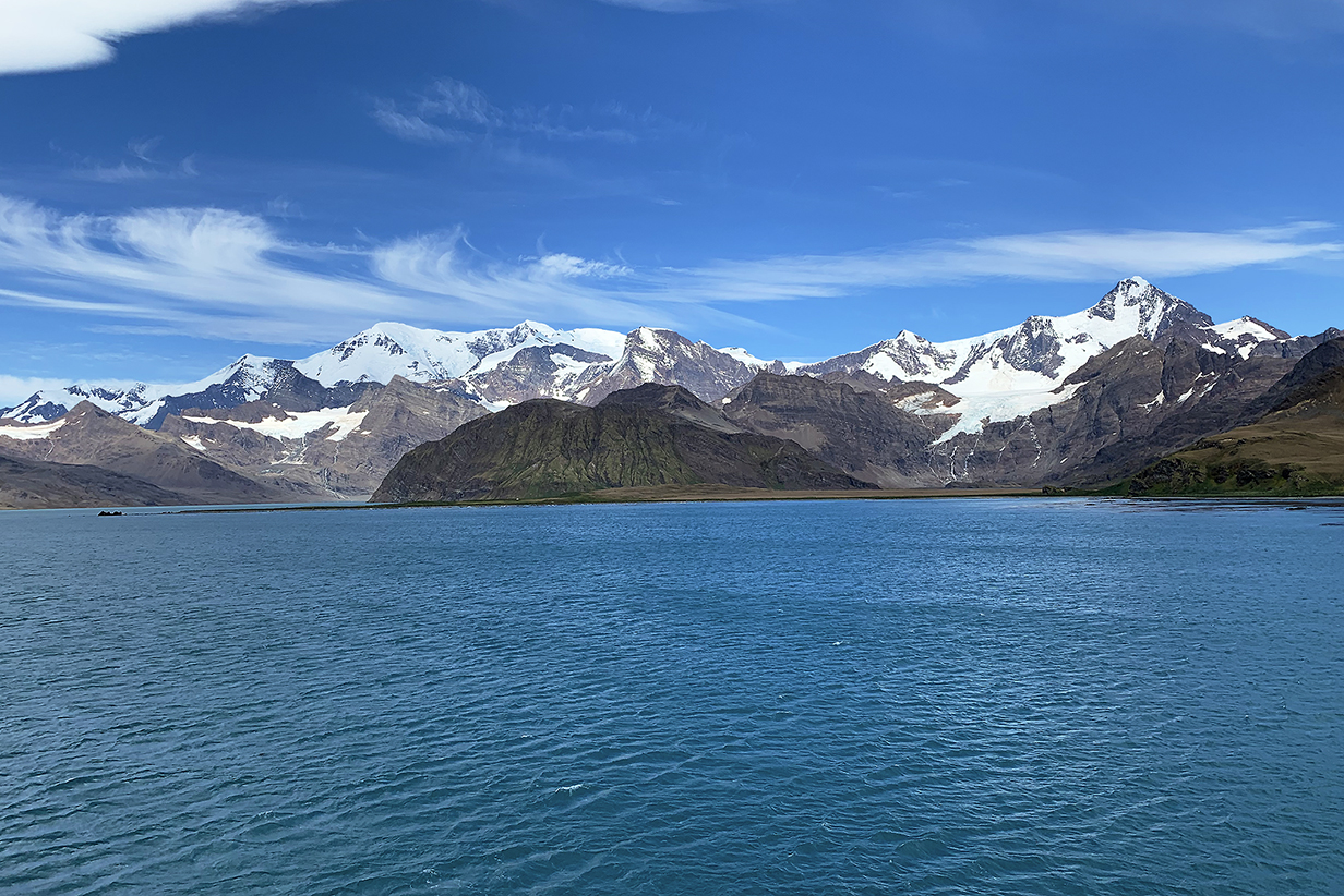
Closeup of the mountains south of Grytviken
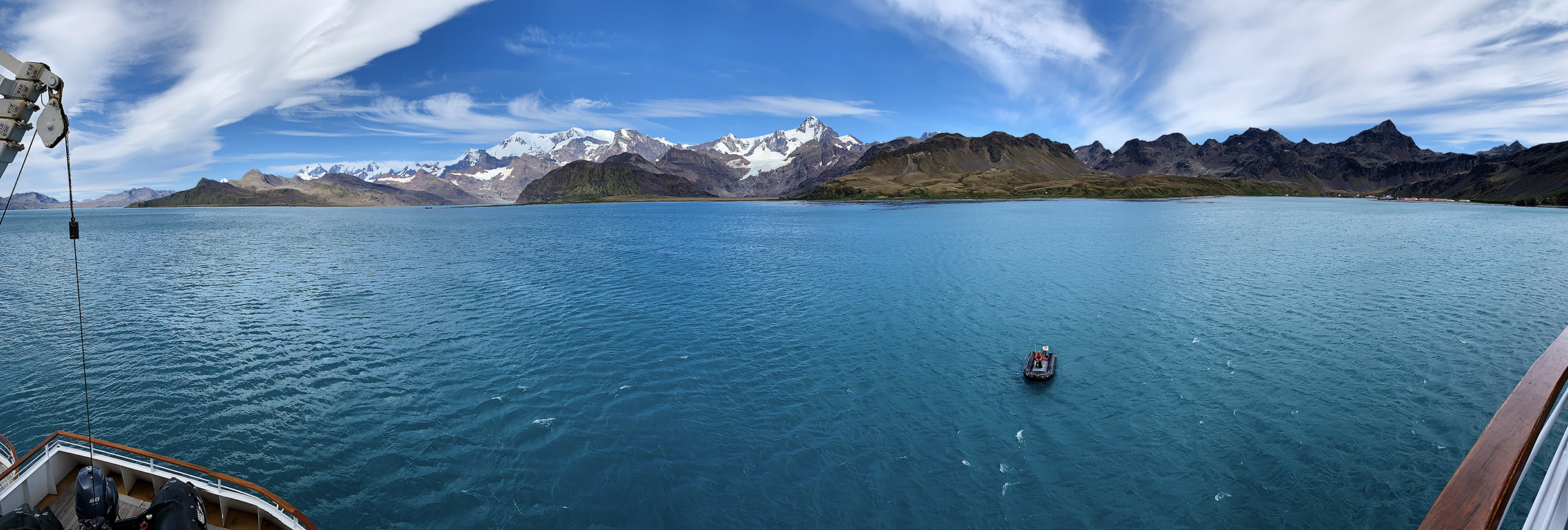
Panorama of King Edward Cove with Grytviken at right
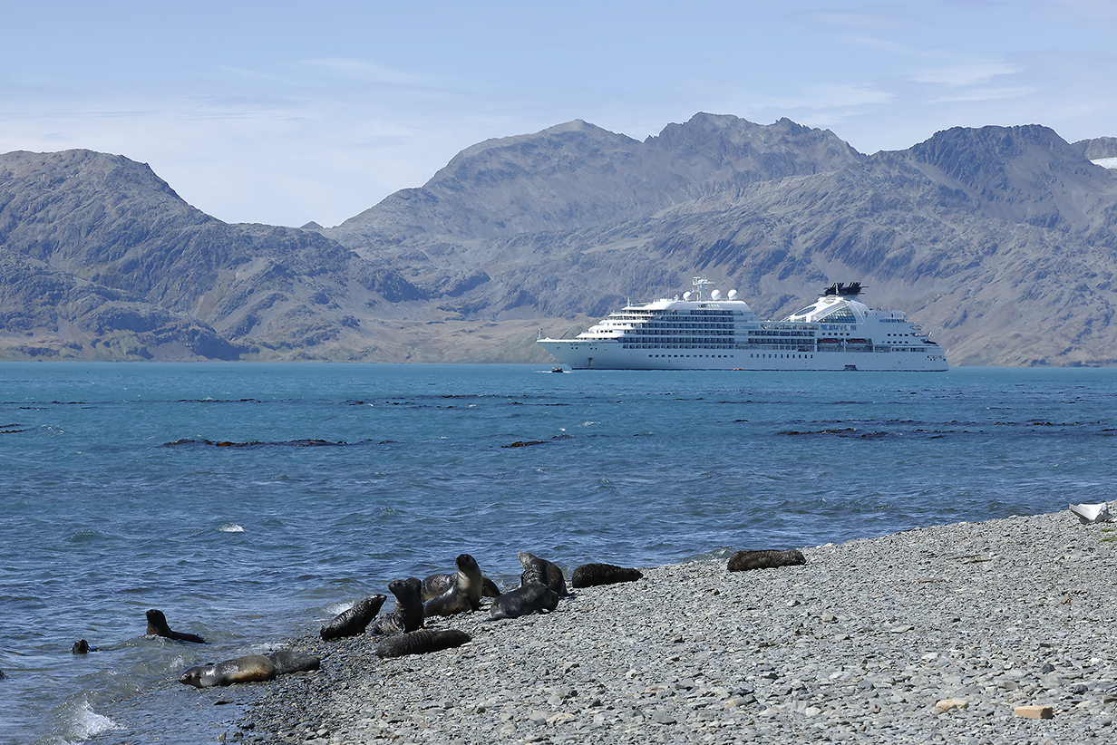
Looking back at Seabourn Quest with fur seals in the foreground. They were the main wildlife at this time of year: most are young pups with a few mothers still present. There were also a few Elephant seals, actually -- this time -- blocking access to the cemetery.
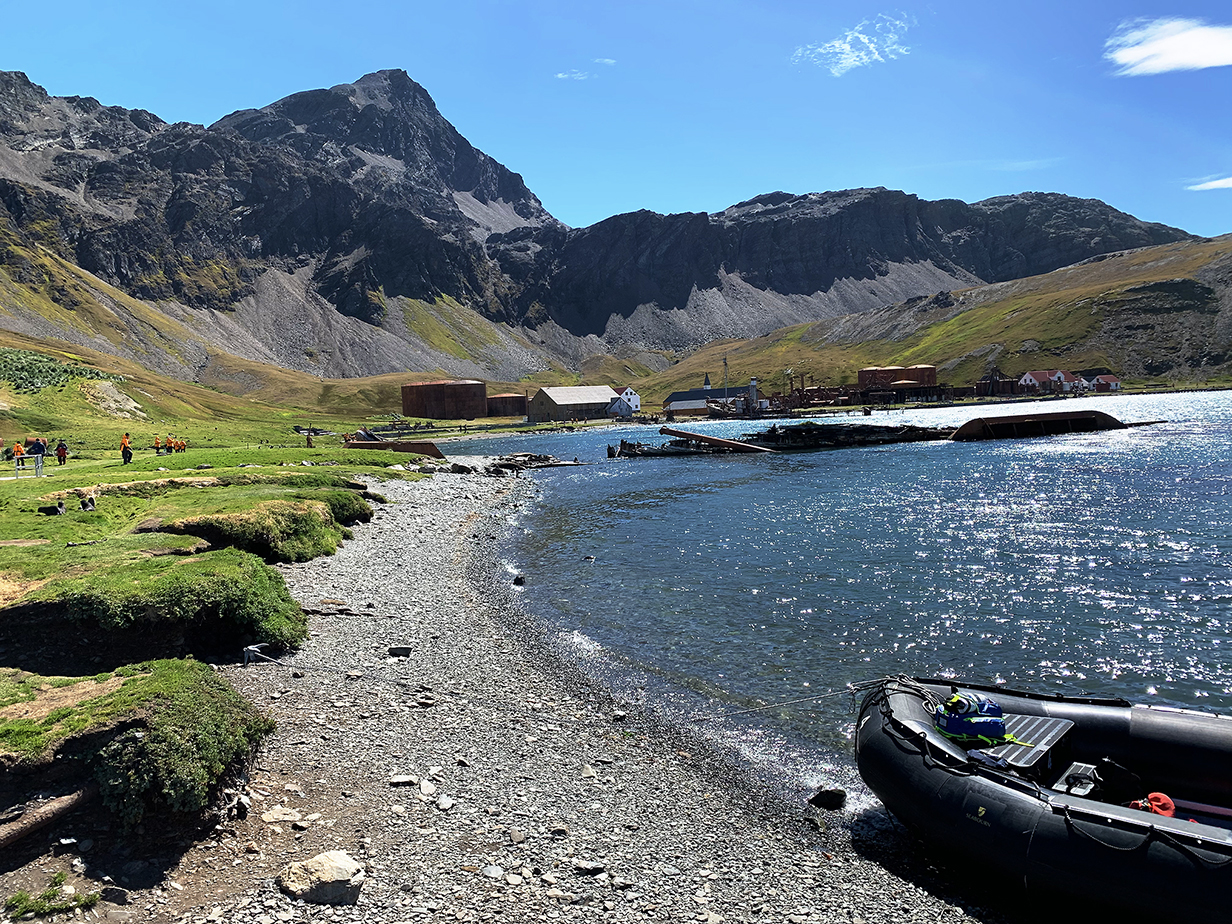
From the landing at the cemetery where Sir Ernest Shackleton is buried, this is a view of the largely abandoned whaling town of Grytviken (active 1904 - 1966).
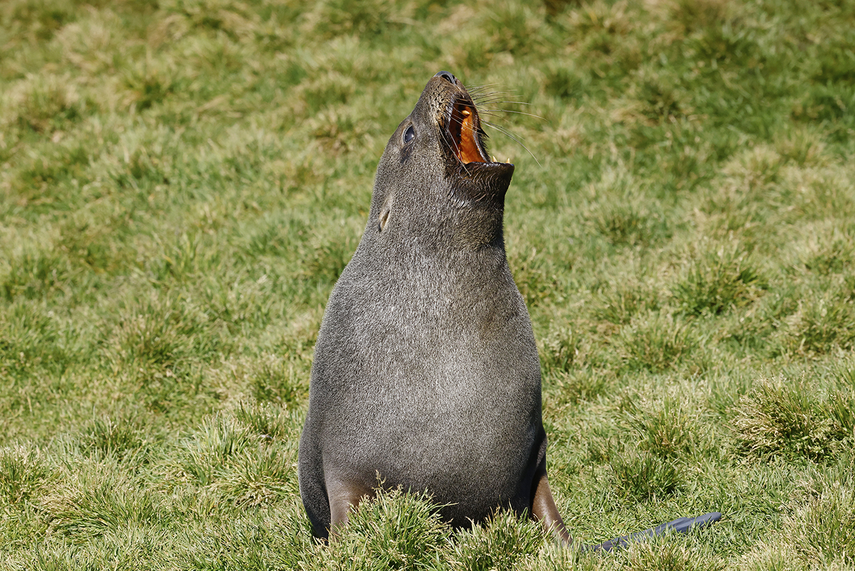
Fur seal (adolescent or adult female)
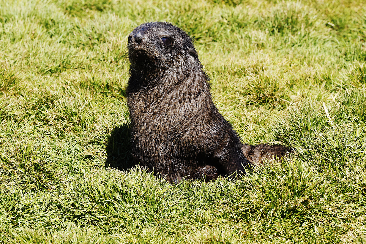
Fur seal pup (very cute and very playful)
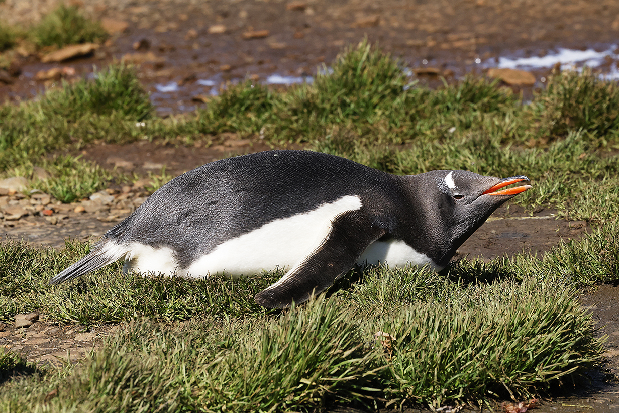
Gentoo penguin (John saw 2 Gentoos and about five King penguins.)
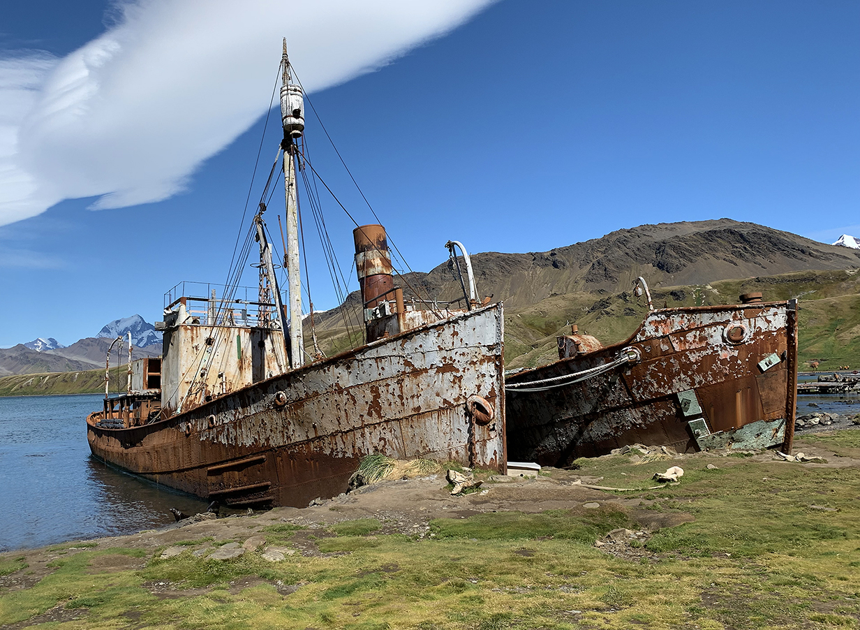
Defunct whaling ships in the harbor. Many of the whaler's buildings have been dismantled, but much of the ironwork remains, rusting away.
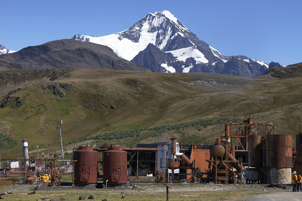
We do not dwell here on the history of whaling but will conclude the section on Grytviken with the stark contrast between humankind's less-than-happy history, at least here, and the majesty of nature. Happily, the mountains and wild areas leave the strongest impression on us.
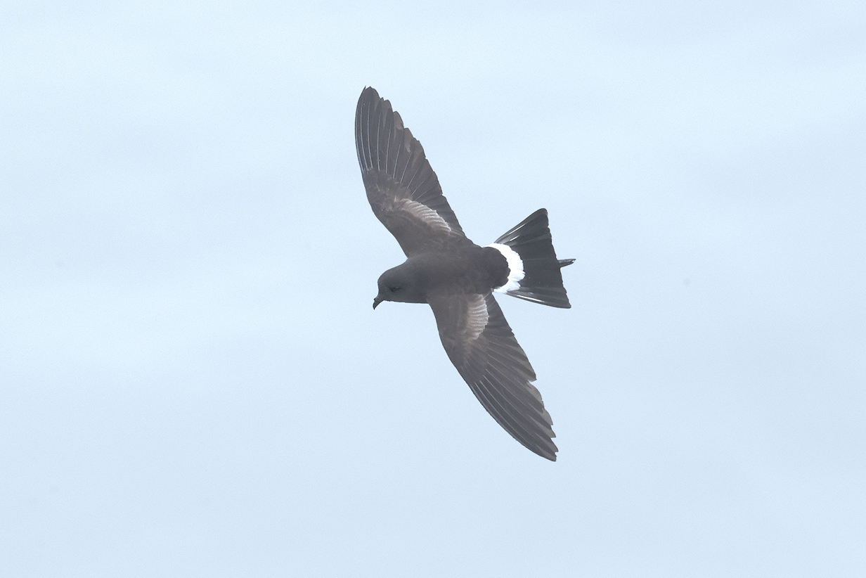
Antarctic tern (during pelagic birding between Grytviken and Stromness)
South Georgia diving-petrel (Identified by Seabourn's bird guide: this species is very difficult to see, to photograph, or to ID. You need to be on a small boat close to the bird, not up on deck 6, far from the water, on a big ship that the bird does not particularly like to approach. On the other hand, John will never see this species again.)
Antarctic prion (hard to differentiate from Broad-billed, but IDd by Seabourn's ornithologist)
Stromness Harbour (Shackleton Valley near the center: the highest mountains behind it are about 2000 feet high. Buildings of the abandoned whaling station, Stromness, are at far left. We made a quick stop here for historic reasons on the evening of February 12th, 2023 before sailing on for Salisbury Plain, where we landed the next morning (below).
Quoting Wikipedia: "In 1916, Ernest Shackleton and a small crew landed on the unpopulated southern coast of South Georgia at King Haakon Bay after an arduous sea voyage from Elephant Island in the 22-foot (6.7 m) lifeboat, James Caird. Shackleton, along with Tom Crean and Frank Worsley, then trekked across South Georgia's mountainous and glaciated interior in an effort to reach help on the populated northern shore of the island. After 36 hours of crossing the interior, they arrived at Stromness. ... All men were [eventually] rescued from Elephant Island."
Our 2022 December Antarctica cruise dropped off a group of energetic hikers at Fortuna Bay, on the other side of the mountain ridge seen here. They redid the last part of Shackleton's crossing to Stromness -- in much easier conditions and without the debilitating previous 2 years of being stranded in Antarctica and sailing from there via Elephant Island to the south side of South Georgia -- but nevertheless a signficiant (and historic) hike. Our ship, the Greg Mortimer, conducted a landing at Stromness to pick up the hikers.
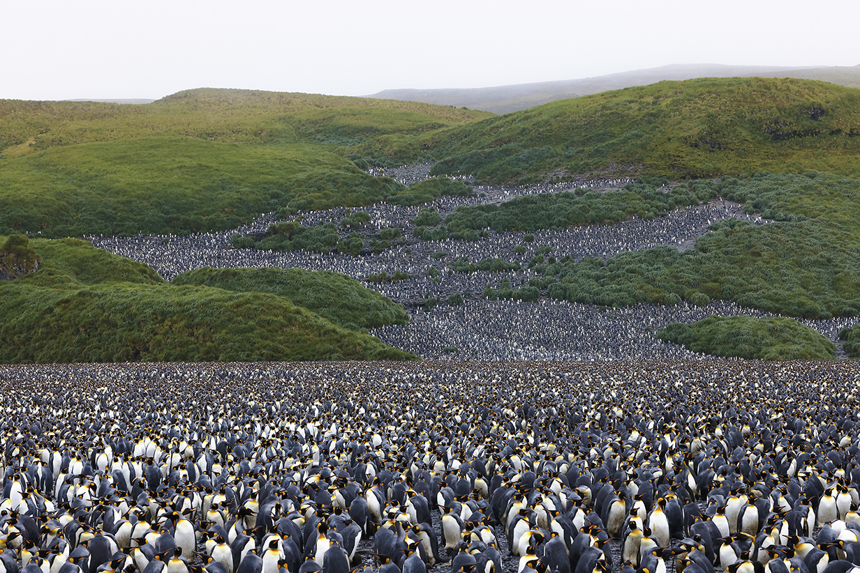
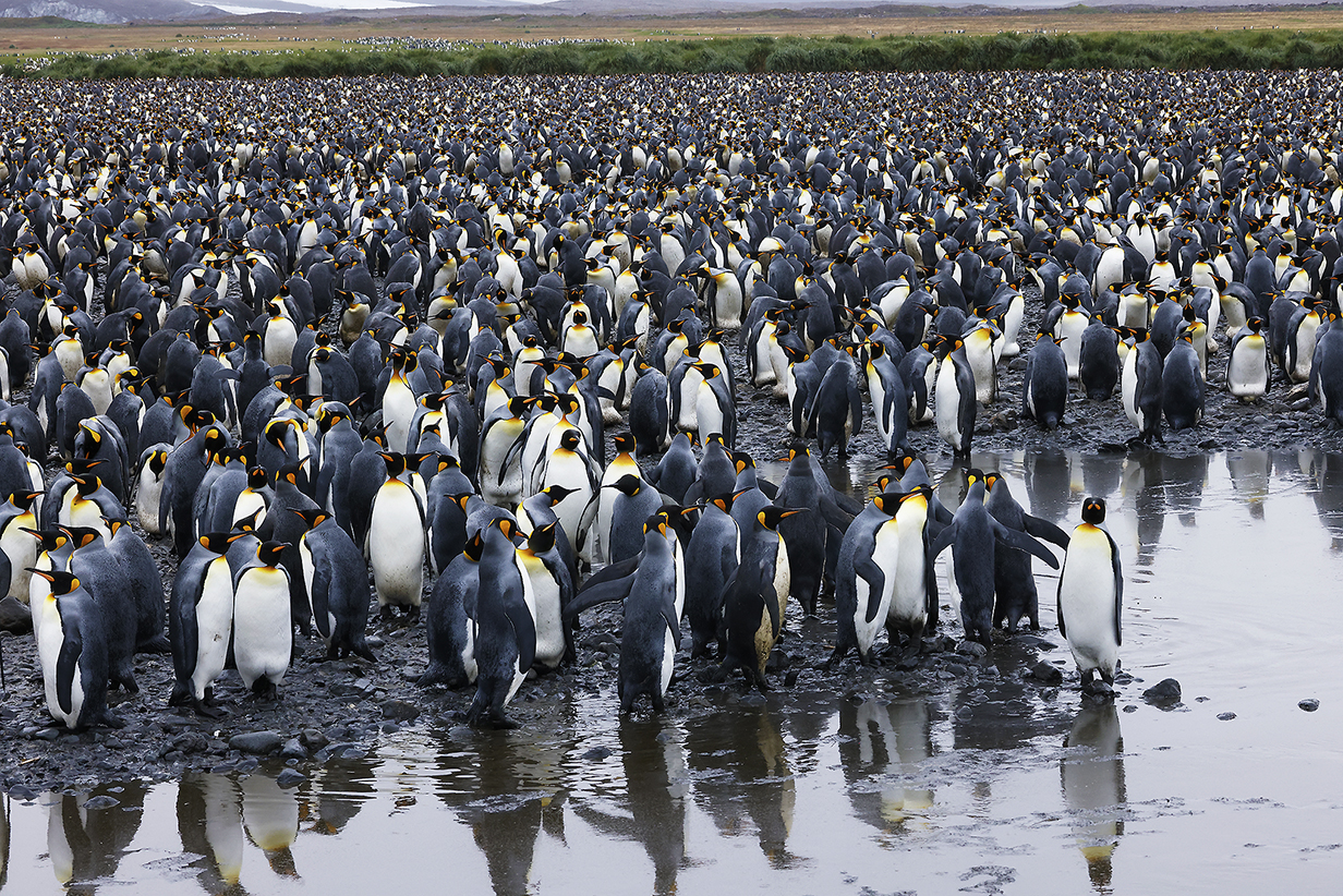
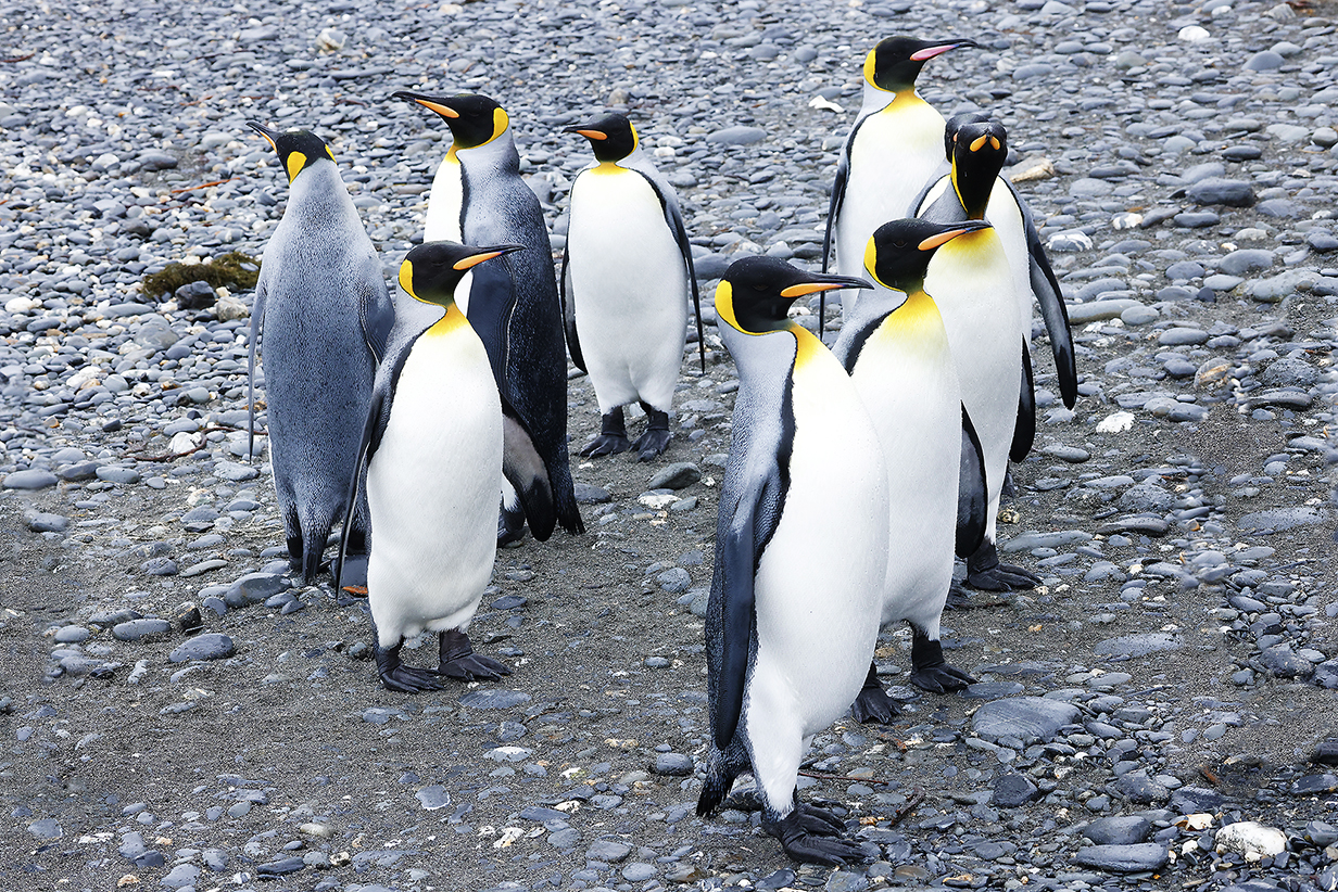
Salisbury Plain, South Georgia
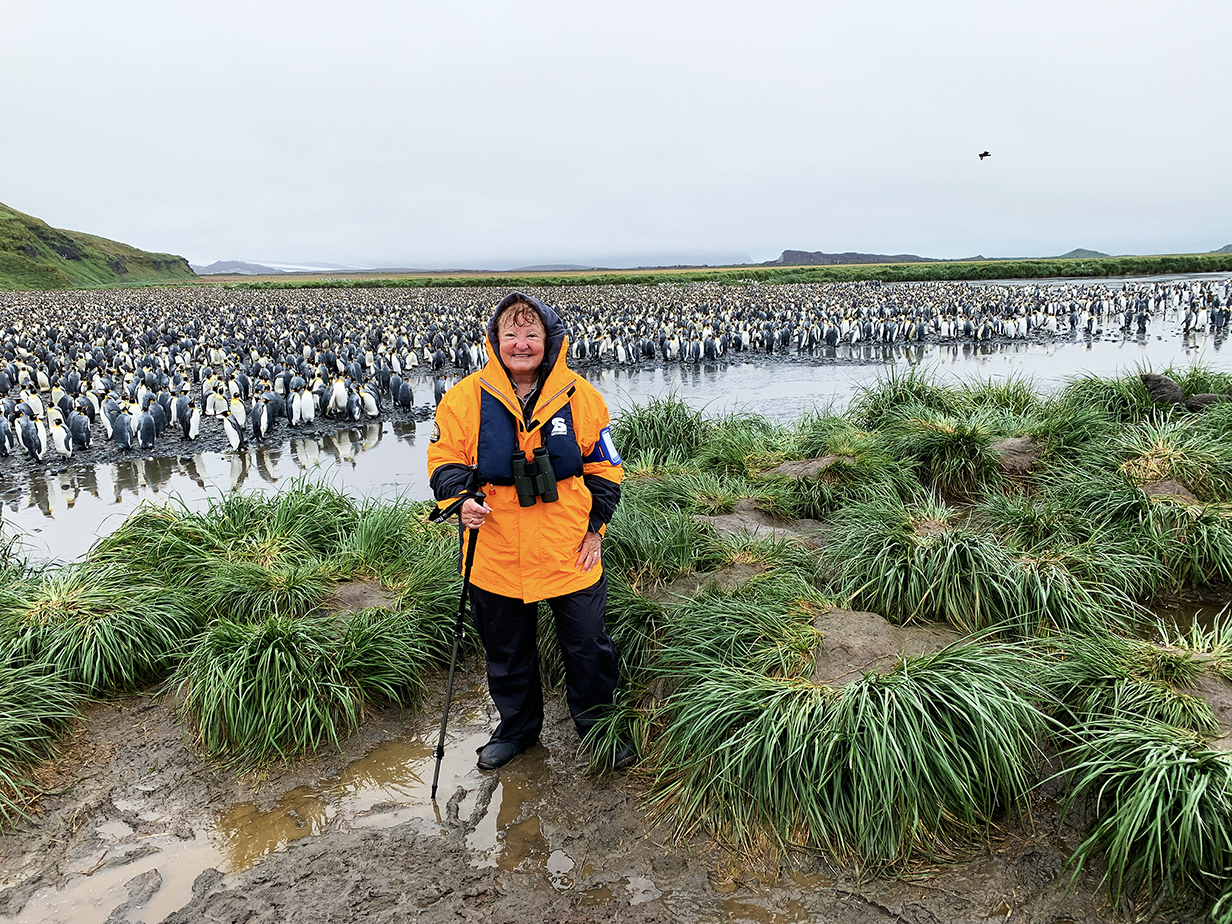
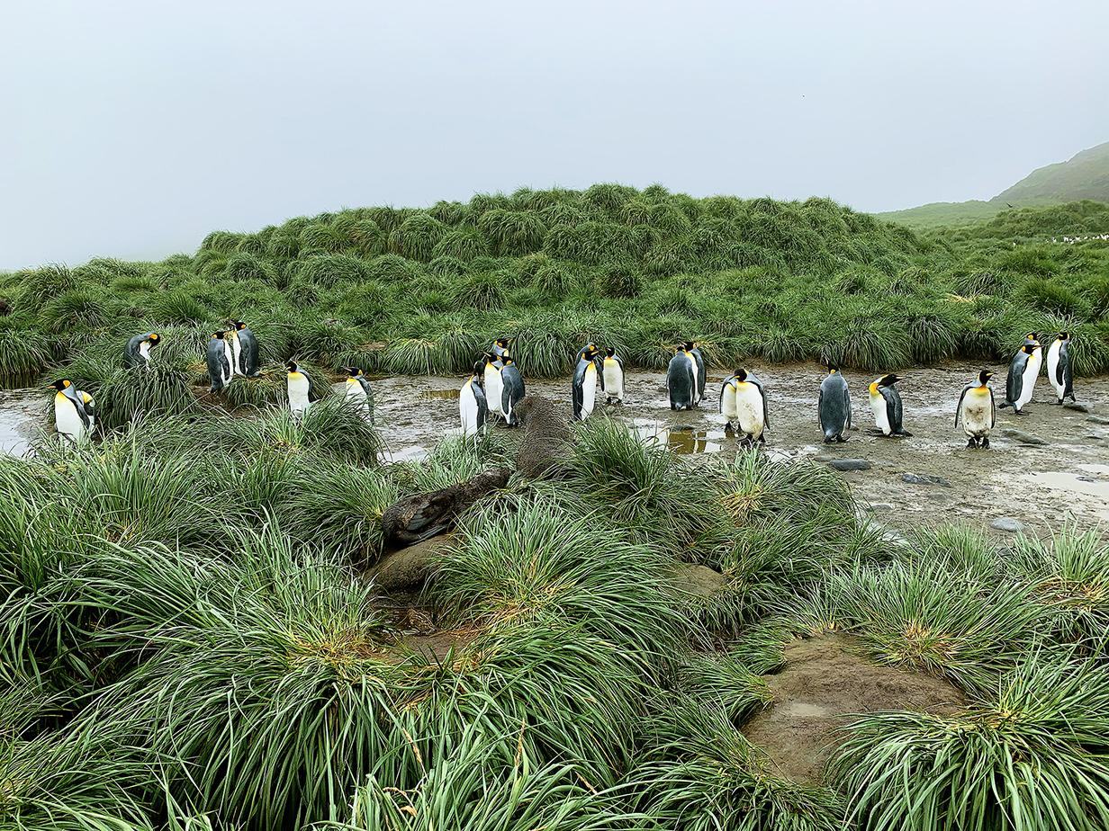
This is the biggest nesting colony of King penguins on South Georgia Island, with -- we are told -- about 60,000 pairs of nesting penguins and several 10s of thousands of single penguins. Many of the latter are last year's yearlings: We visited here in December 2022, earlier in the breeding season; at that time, there were many yearlings in wooly, dark brown plumage. By now -- February 13th, 2023 -- most of these had moulted into adult plumage. One shaggy straggler is shown below. It was late now into the nesting season; some birds were brooding eggs, and we saw only one mating. This year's visit was on a rainy, foggy morning, but we had good luck -- the fog cleared somewhat, and the rains stopped -- while we huguely enjoyed our second visit to this spectacular place.
A raft of King penguins getting ready to land -- as we had just done, in our case via zodiac -- at Salisbury Plain, South Georgia.
Both times, Mary was spectacularly happy at Salisbury Plain.
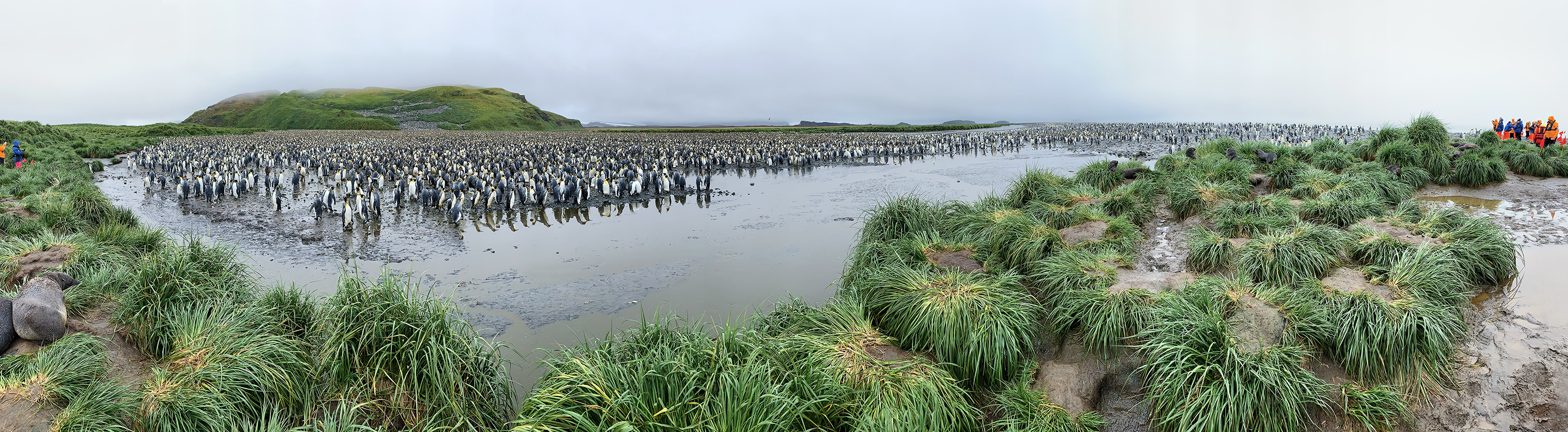
This is a 180-degree panorama of the King penguin nesting colony on Salisbury Plain. Scroll right to see the full image.
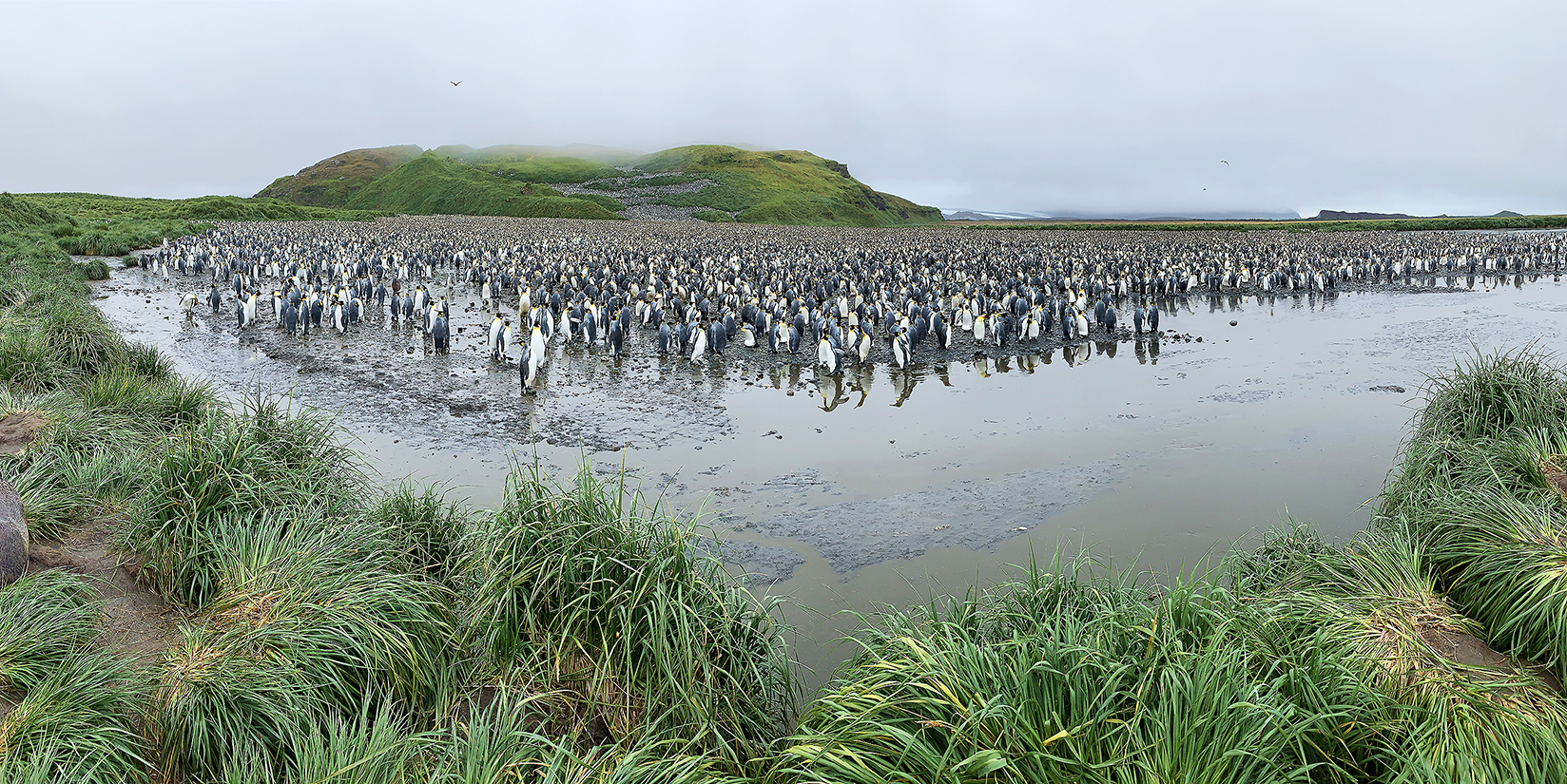
Slightly more close-up panorama of Salisbury Plain
Closeup of the zig-zag of the colony up the hill. How do the penguins near the top ever get to and from the ocean?
King's creche (part)
A caucus of King penguins
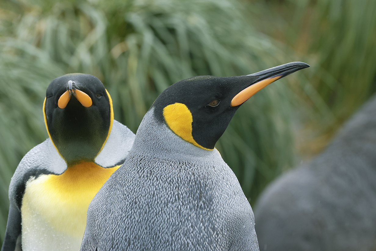
King penguins ("head shot")
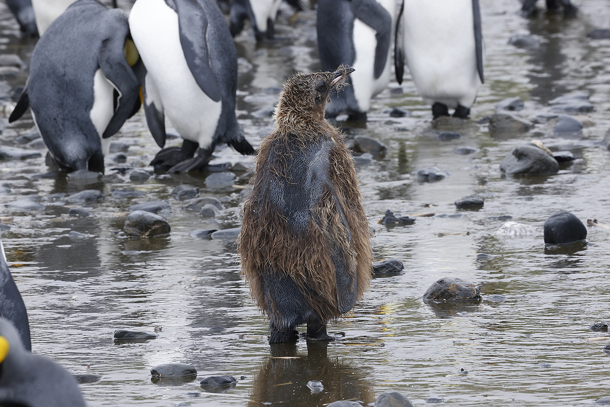
Moulting! (When we were here in December, there were major swaths of shaggy but neatly brown yearlings throughout the colony. Now only a few birds were still moulting to adult plumage. This is the most disreputable one left.)
A promenade of Kings
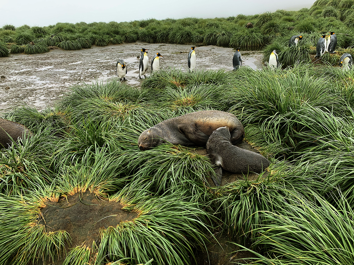
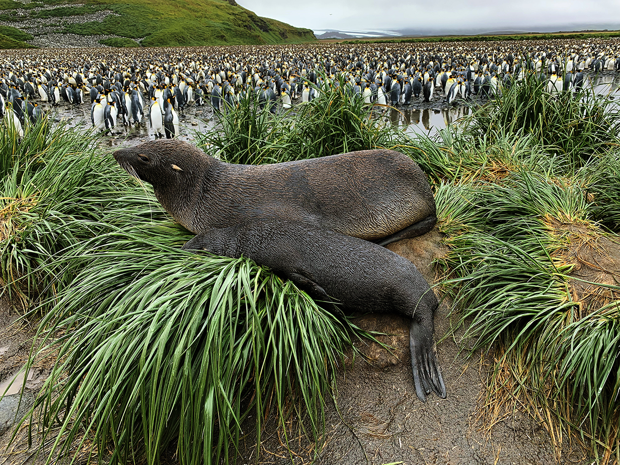
Fur seals -- mothers and pups -- were still present; long after the mating season, the males were long gone. So the atmosphere was peaceful and playful.
Mary at the end of the Salisbury Plain landing -- pure joy
Wilson's storm-petrel were feeding near the landing platform on Seabourn Quest. They "dance" on the water to nab a bite. I managed to get a few pictures, even though they are always hard, fluttering erratically, and even though it is hard to get a good picture of a mostly black bird with black eyes against a light background.
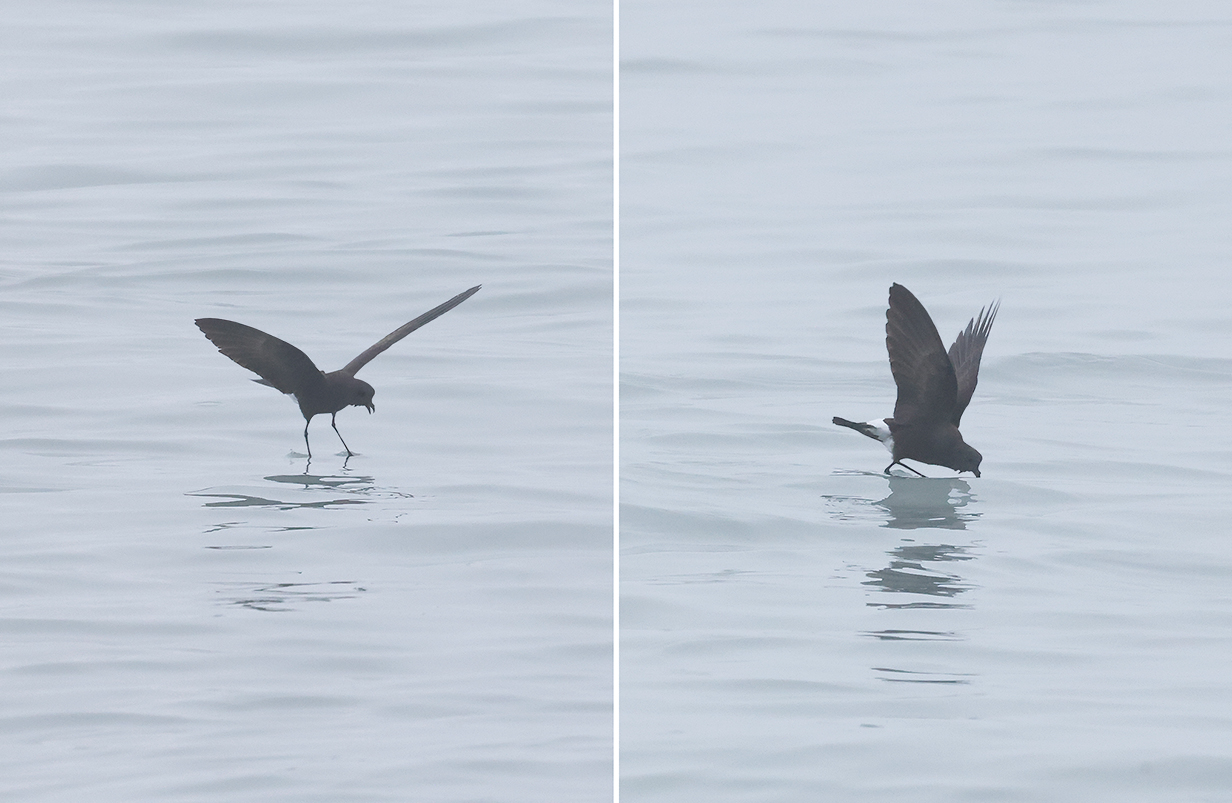
Wilson's storm-petrel (The point of all this swooping is that occasionally something tasty appears on the surface of the water. Then storm-petrels and petrels "dance" on the water and nab a snack. We very much enjoy this delicate ballet.)
End of Salisbury Plain
Pelagic Birding Between South Georgia and the Falkland Islands
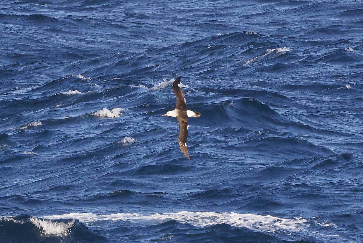
Gray-headed albatross (February 14, 2023 in the morning)
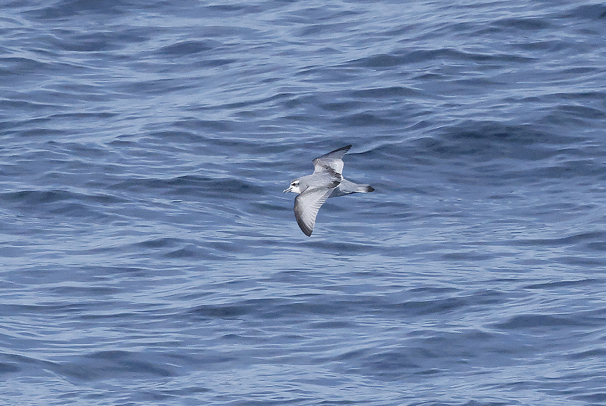
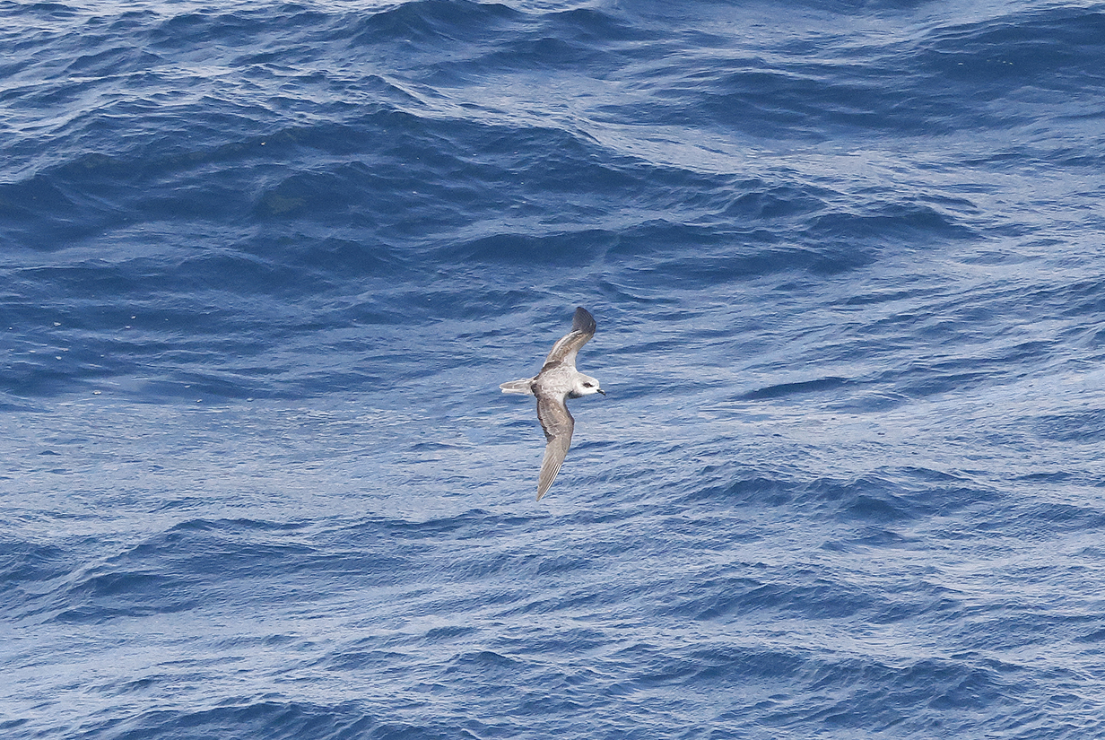
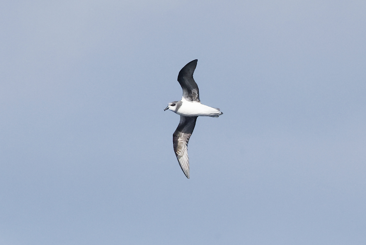
Soft-plumaged petrel (This is John's life bird, February 14, 2023, confidently identified by the Seabourn Quest's ornithologist, Joe Cockram. The all-very-white belly contrasting with the all-dark underwing is diagnostic. Plus the dark face and breast band contrast with the white throat.)
Great shearwater (This is John's life bird, also on February 14, 2023. Confidently IDd by Joe Cockram and convincing.)
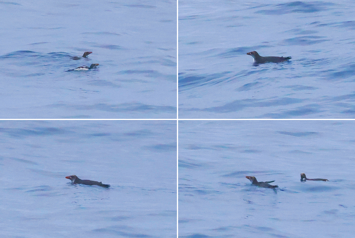
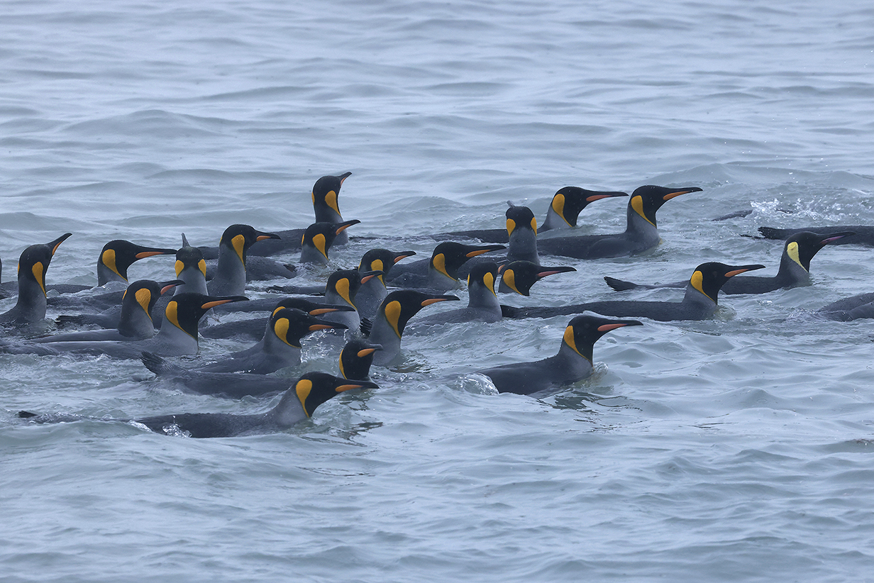
Macaroni penguins (These are John's life birds -- third pelagic life bird of the day on February 14, 2023. Confidently IDd by Joe Cockram. I concur: bills are massive, consistent with Macaroni and not Rockhopper, as is the light spot at the base of the bill. In the water, the yellow tufts are plastered flat onto the head and neck, but there is a clearcut hint of them in some pictures. I increased the color saturation by 50 % to make this more clear. This is not the way that I like to get a life bird ... but there is a substantial chance that these are the only Macaroni penguins that I will ever see. Anyway, the ID seems definitive enough.)
Black-bellied storm-petrel (These are 3 not-very-good pictures of the same well-marked bird, included to contrast with White-bellied storm-petrel, seen a few days later in the trip.)
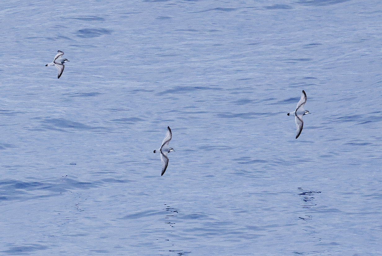
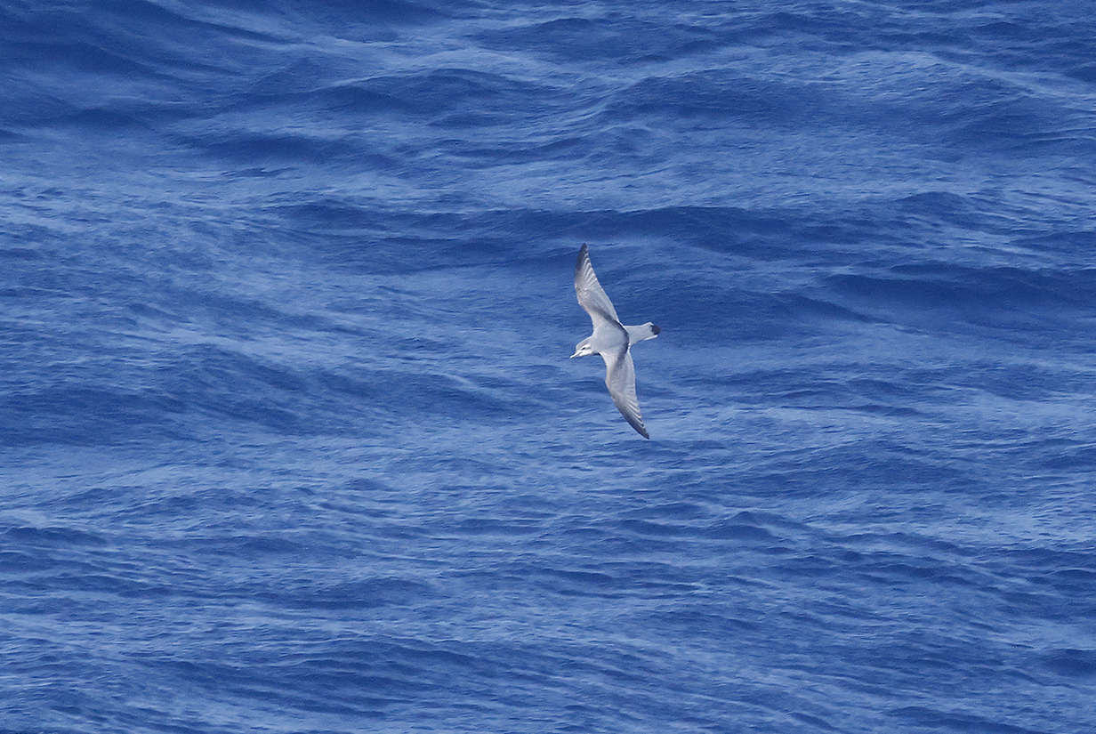
I think that these are Antarctic prions, although we were well into the range of Slender-billed prion. Please email me if I am wrong. It was very common to see groups of 3-6 birds flying together more or less in formation.
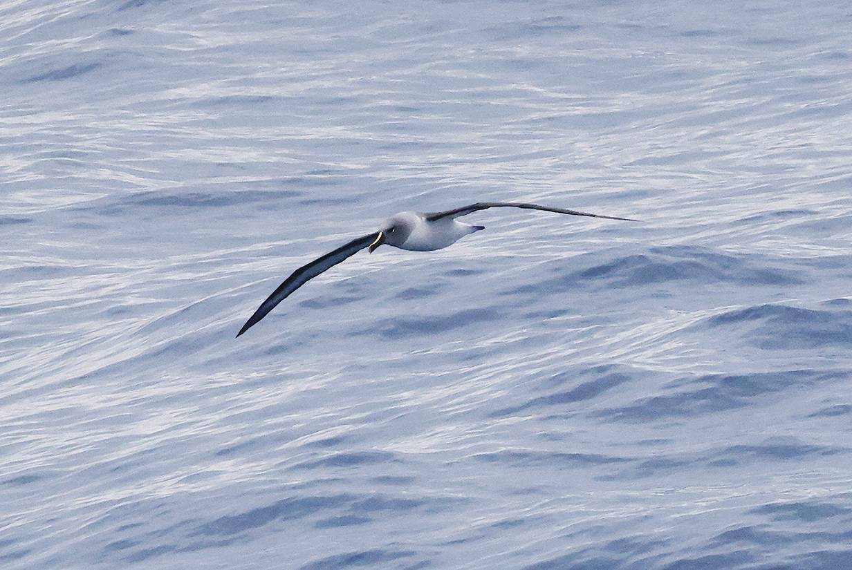
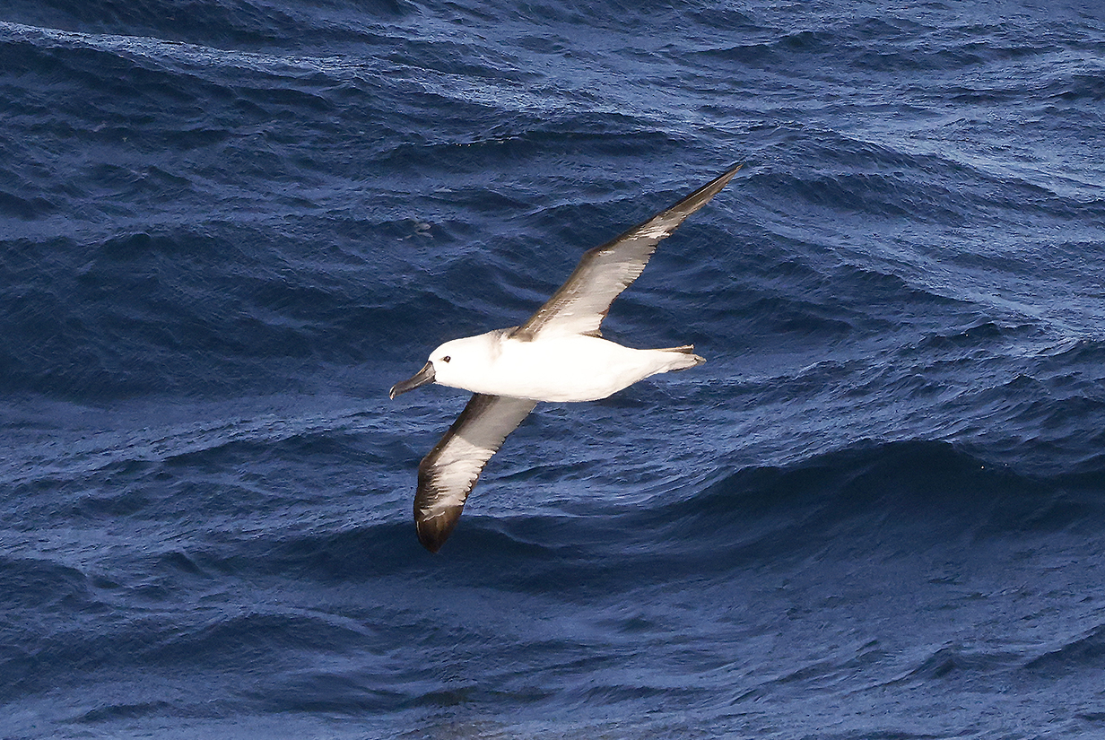
Wandering albatross (This bird came unusually close to the ship.)
Flying steamer-ducks in Port Stanley harbour from our balcony on Seabourn Quest. Otherwise, day 1 in the Falkland Islands was rather a loss, with a cold, episodically rainy, and VERY windy (up to 35 knots) excursion to a bay that only had birds that we had seen better elsewhere. Let's hope for a better tomorrow on New Island.
New Island, Falkland Islands
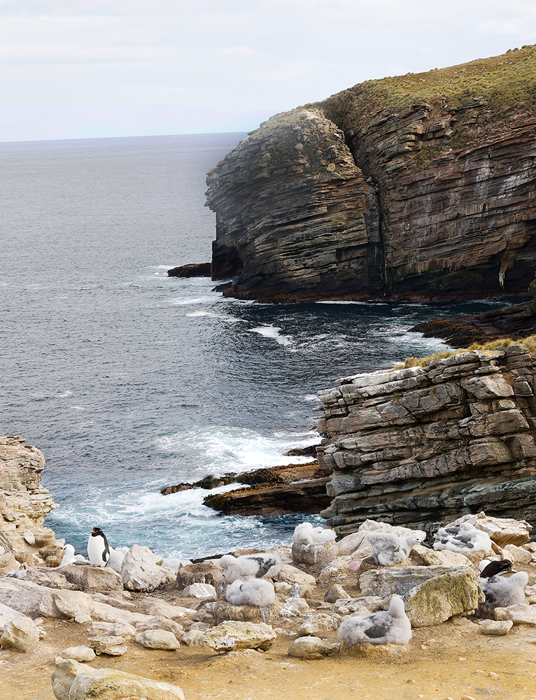
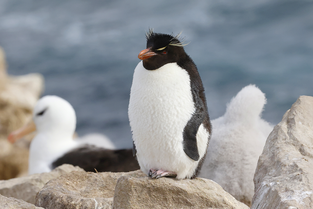
Our second stop in the Falkland Islands and our last landing in Antarctic waters was at New Island (below). This proved to be one of the two best landings in the far south (Salisbury Plain was the other). New Island consists of rolling hills covered with tufts of grass and bushes. After landing on the east side of the narrow part of the island, it was necessary to hike about 3/4 of a mile and about 500 vertical feet upward along a good hard-mud-and-grass road to west-side cliffs and a nesting colony of Black-browed albatross and Imperial cormorants. Also close were Southern rockhopper penguins (spectacularly cute) and Striated caracara, both new birds for John. John got 4 life birds during this landing, which makes it one of the best of the trip. There are lots of pictures in this section in New Island!
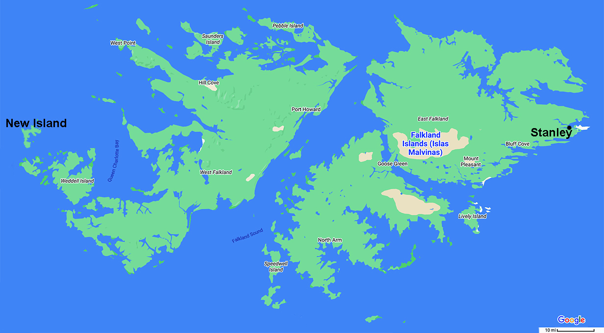
New Island (west side of the Falklands) and Port Stanley (east side, where we landed yesterday)
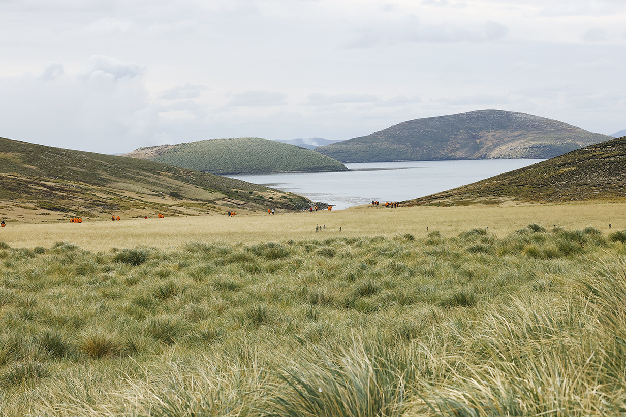
Hills of New Island about half way along the hike. I took this picture on the way back to the ship, out of sight in the bay behind the hill at right. The orange parkas outline part of the walk down to the landing site. The nesting colony is about 1/4 mile behind me.
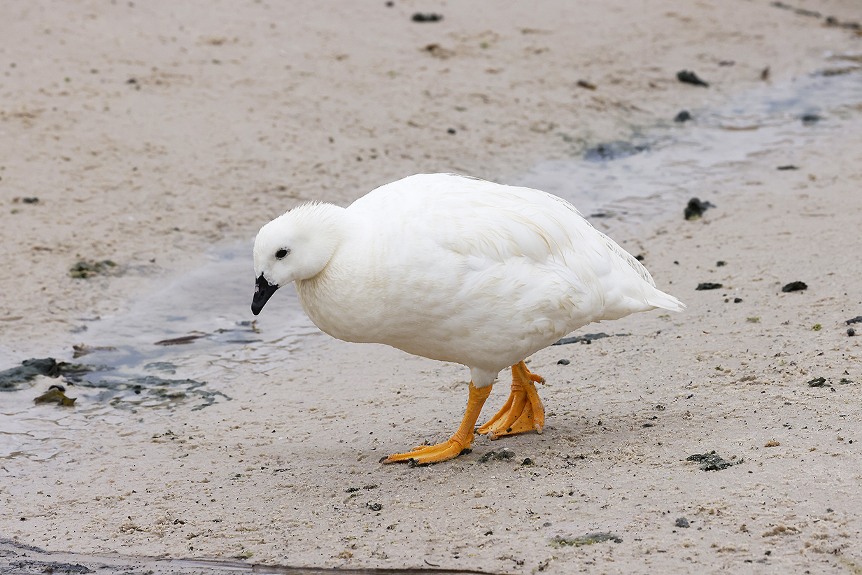
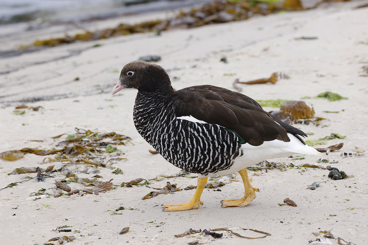
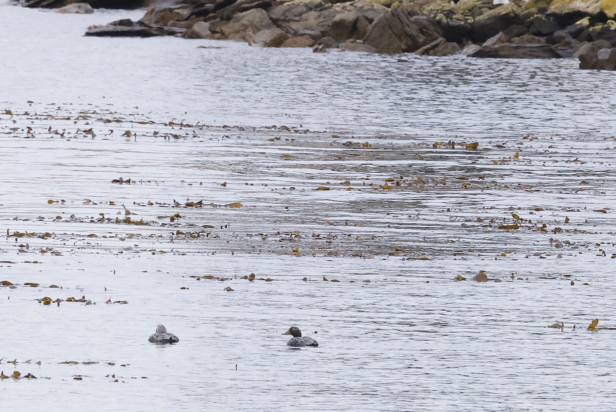
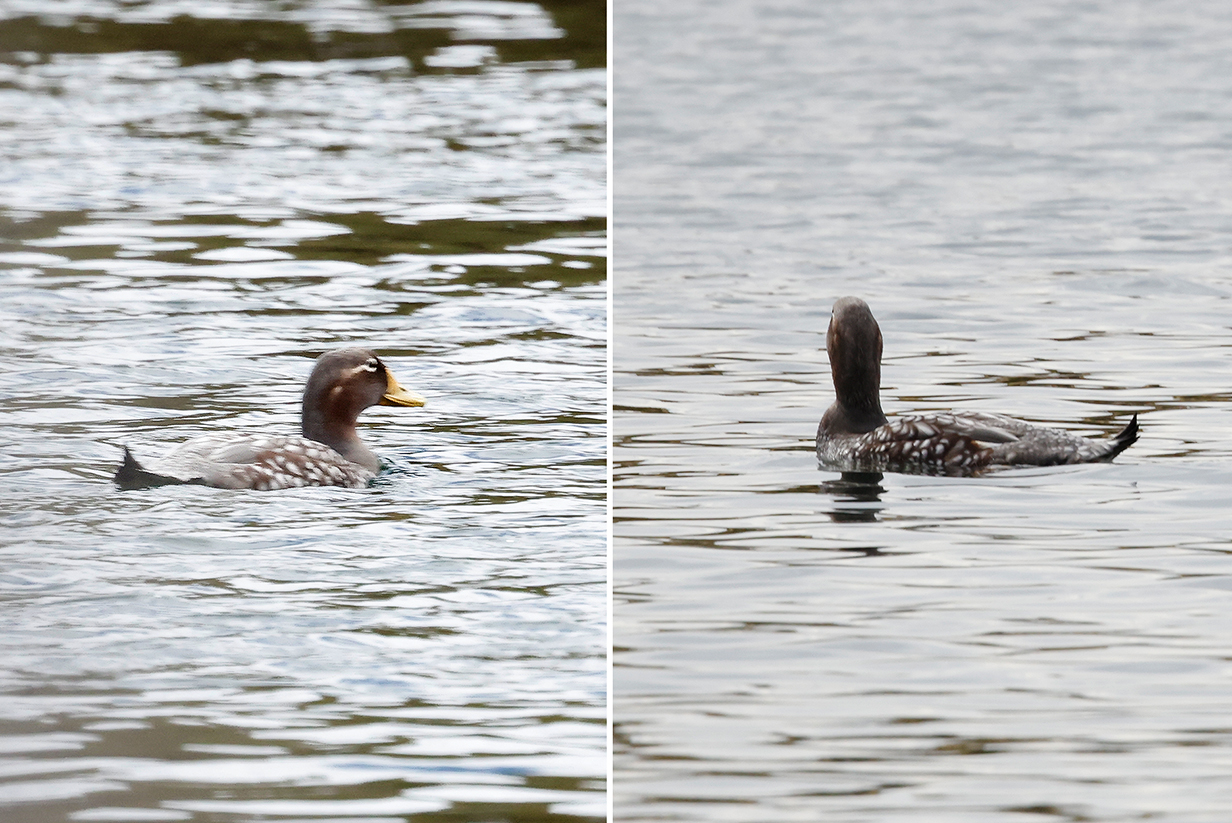
Kelp geese (male above; female below) were the most obvious birds on the beach where I landed. They are essentially never far away from kelp.
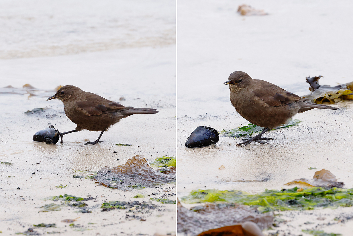
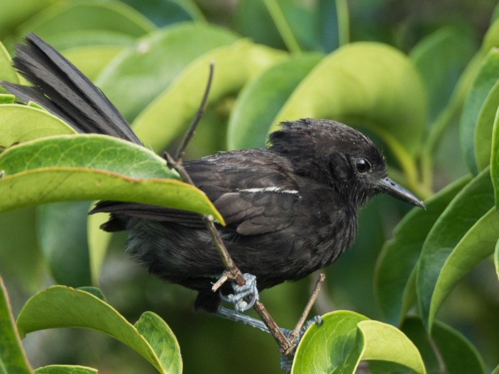
Blackish cinclodes (Thanks to a bird expert at the landing site, my first new bird of the day -- and a very good one -- was seen within minutes of landing.)
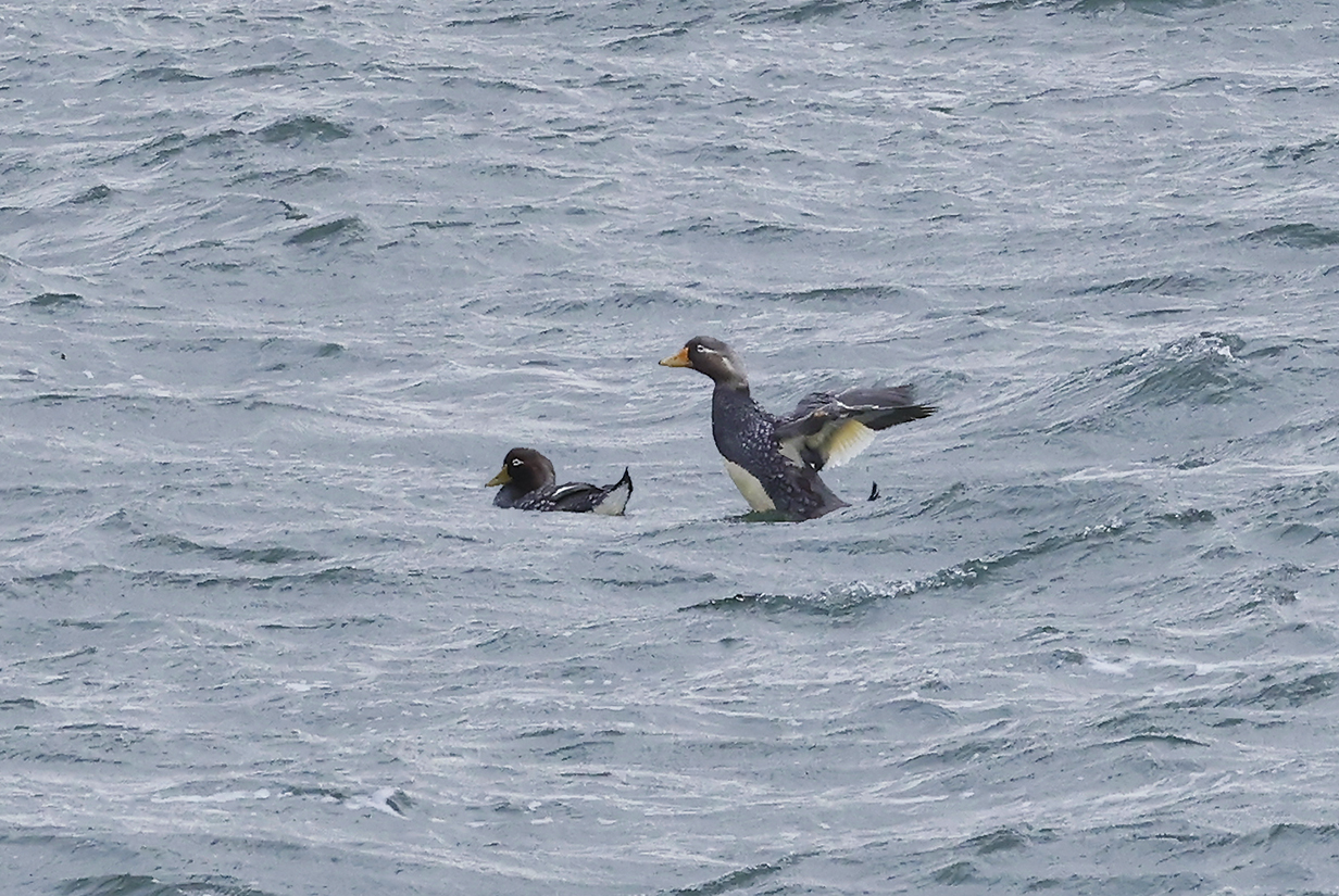
Falkland steamer-duck (This male at left and female at right are my life birds. Happily, the pair was not too far away in the harbour, and the site's bird expert, in answer to my question, was immediately able to point it out. This was my second life bird of the day.)
Falkland steamer-duck (This is almost certainly the same female that was one of my life birds at the start of the landing. But this was taken from the zodiac on the way back to the ship. Unfortunately, as is so often the case, the bird mainly faces away from me -- birds are not fond of intruders -- and the zodiac driver unhelpfully increased speed as soon as I started to take pictures. But the defining feature of this flightless duck is visible: the folded wings are (to quote the ID book) "ridiculously short" -- ending well in front of the tail. So I got a good look at this very rare bird.)
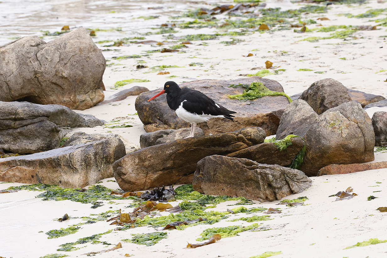
Magellanic oystercatcher at the landing site
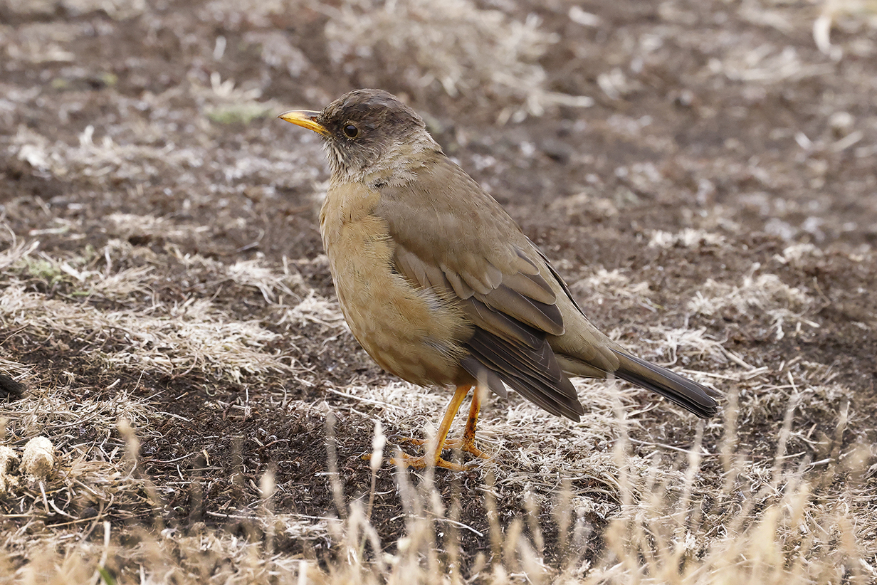
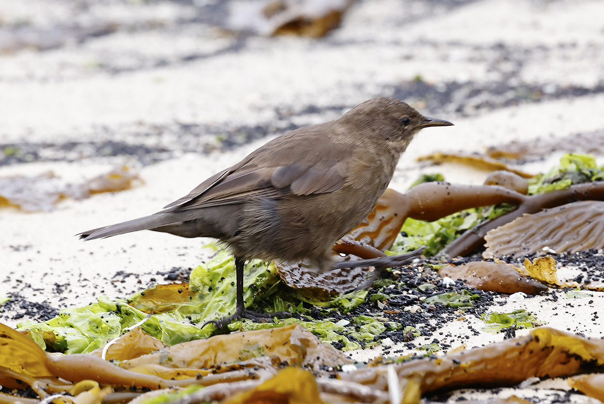
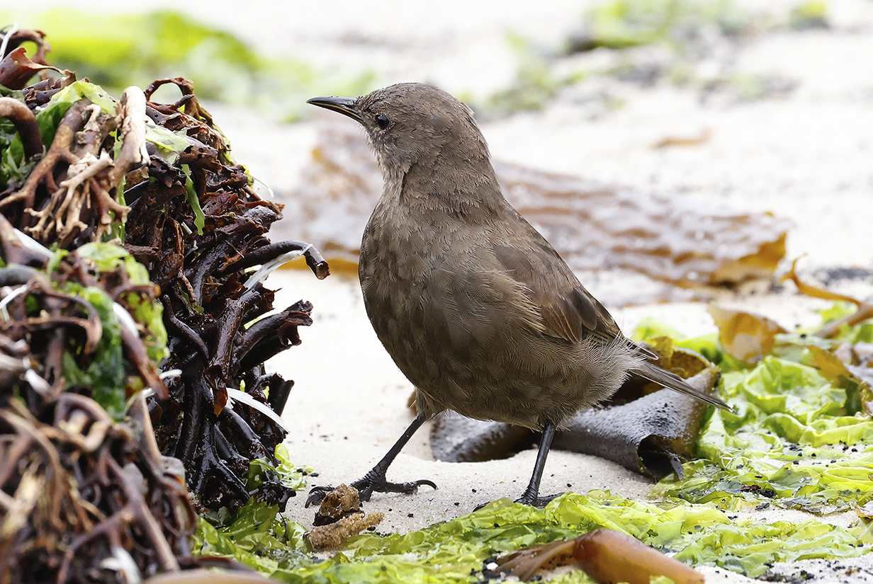
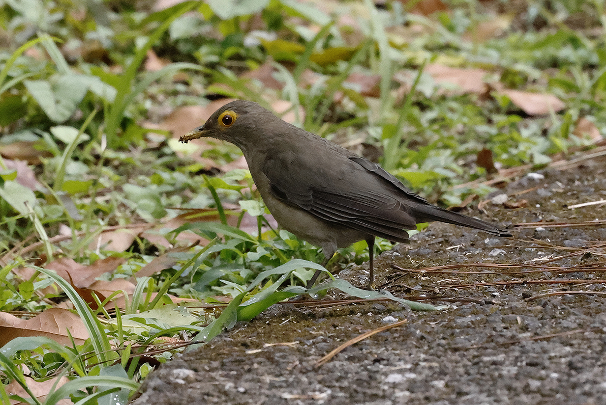
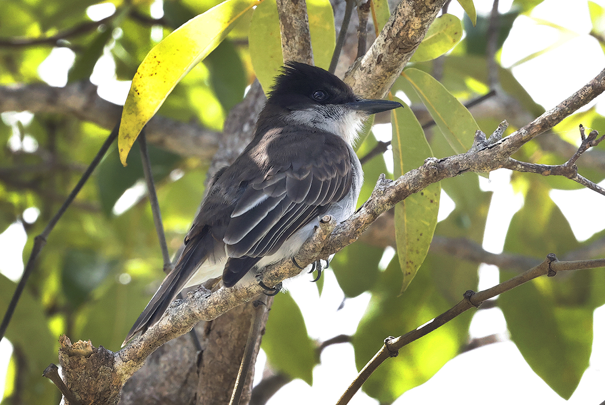
Austral thrush (common bird, seen near the start of the hike)
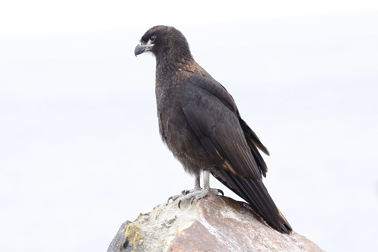
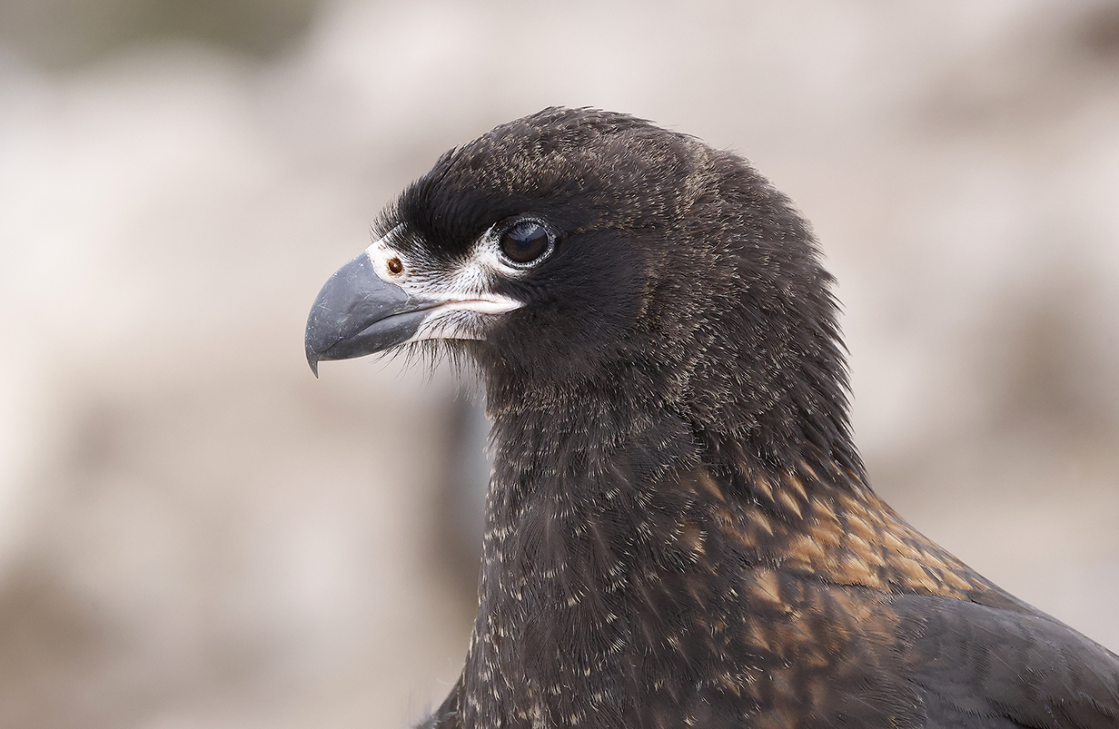
Striated caracara (This juvenile is my life bird. Many were around the nesting colony of Black-browed albatross, looking for easy pickings.)
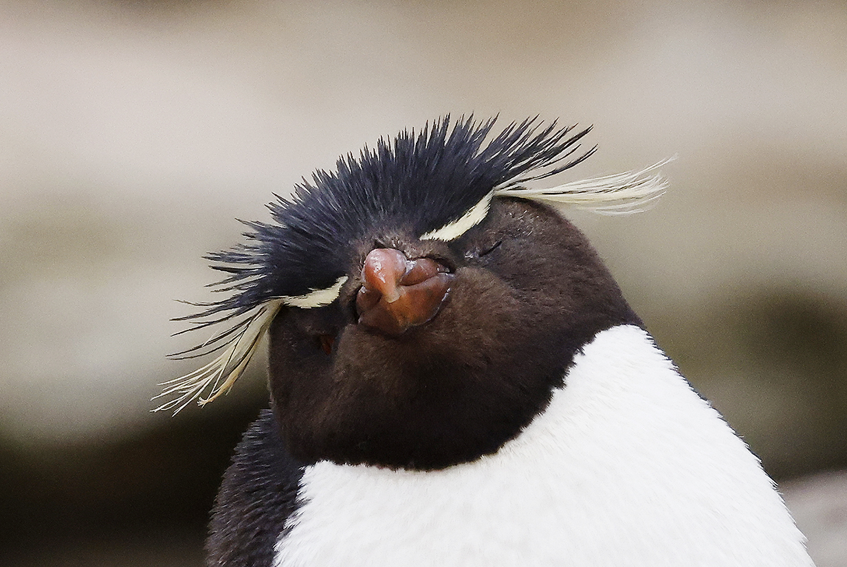
Southern rockhopper penguin (This is my life bird.)
Southern rockhopper penguin (This is also my life bird ... guarded by 2 young imperial cormorants?)
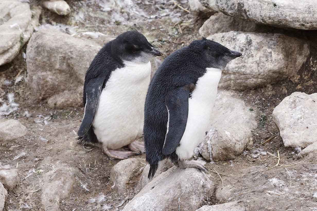
Young Southern rockhopper penguins
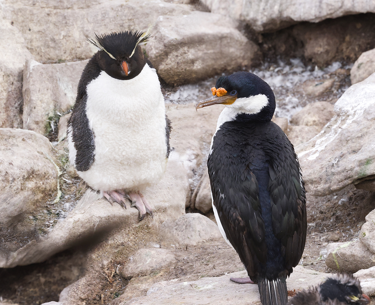
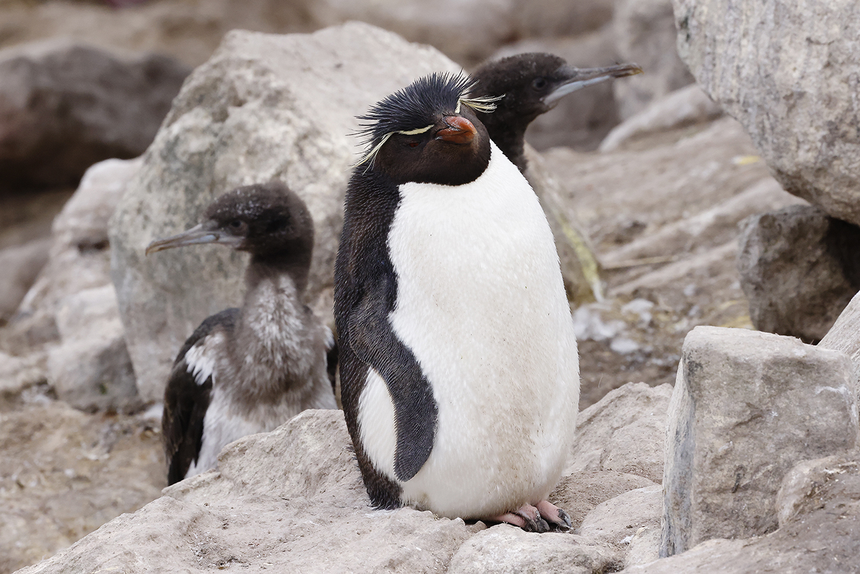
Adult Southern rockhopper penguin and Imperial cormorant
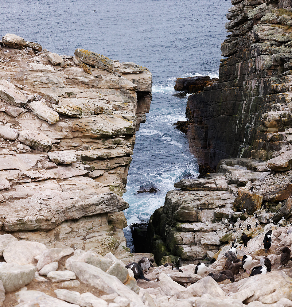
This is the center of the breeding colony, occupied only by a few cormorants. This was taken at about the same place as the above pictures. Most of the cormorants that follow are on the right side of the gulch. Most of the Black-browed albatross nests are on the left side of the gulch, reaching up to within a few feet of where we were allowed to go on the left = south rim of the gulch. This picture looks westward.
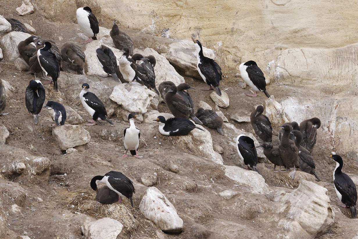
Imperial cormorant nests: Chicks have a variety of ages.
Many Imperial cormorants and a few Black-browed albatross nests on the far side of the gulch ... plus a few Rockhopper penguins. You need to be a good rock hopper to get up here!
Southern rockhopper penguin
Black-browed albatross on nest with somebody else's chick at left. The albatross creche came up almost to our feet: we could get within about 15 feet of the nearest birds for excellent looks. We are very familiar with Black-browed albatross, from this trip, from our first pelagic off the Cape of Good Hope in Africa, and several times in between. Nice now to see them nest.
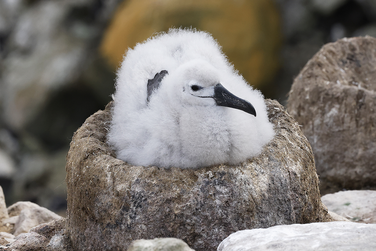
Black-browed albatross chicks
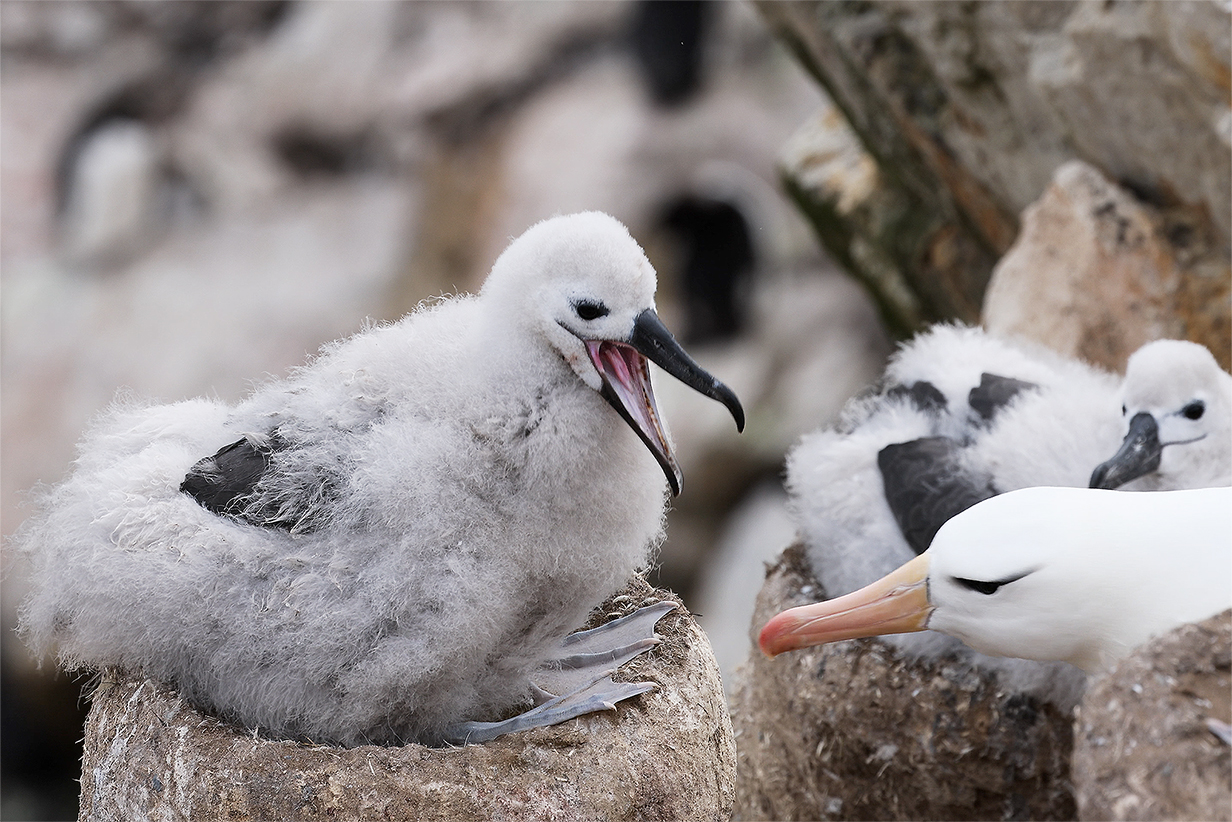
Movie (462 Mb) of a hungry albatross chick begging for food. Seems that the delivery has already been made. (Caution: turn on the sound.)
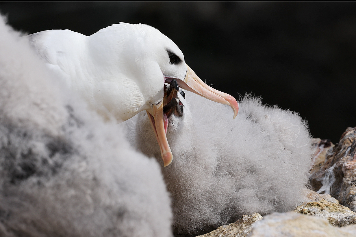
Movie (395 Mb) of a hungry albatross chick begging for food. Success!
This shows the rookery gulch now from the south rim. the penguin at lower-left is shown again in the next picture.
Southern Rockhopper penguin (In the context of the foregoing picture of the rookery gulch, it is astonishing to contemplate how much rock hopping is required from this spot every time you want to feed in the ocean.)
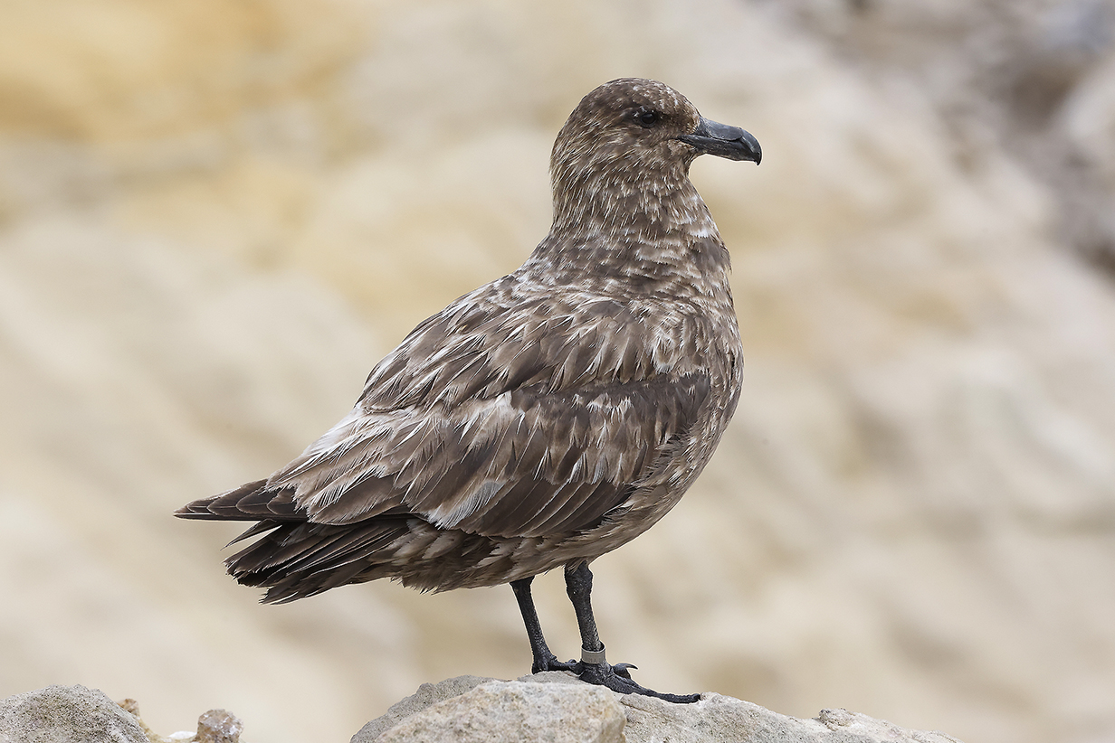
Brown skua (With everybody's chicks growing toward adulthood, the season of plentiful easy food is over.)
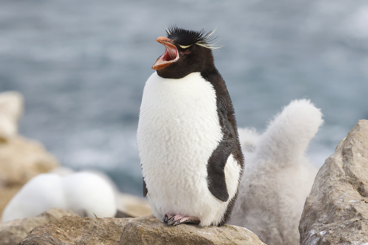
OK, I can't resist including one more penguin picture...
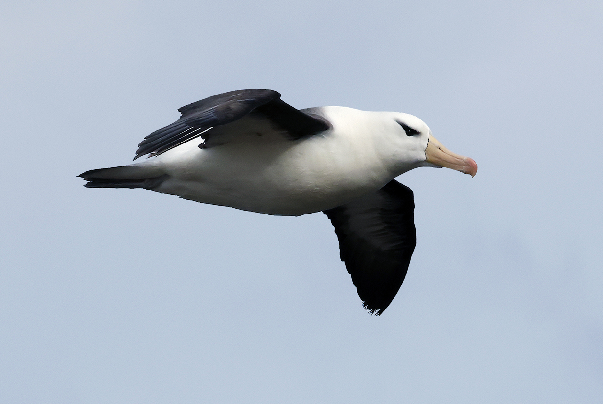
Black-browed albatross (Of course, this is the best place to get pictures of soaring birds, too.)
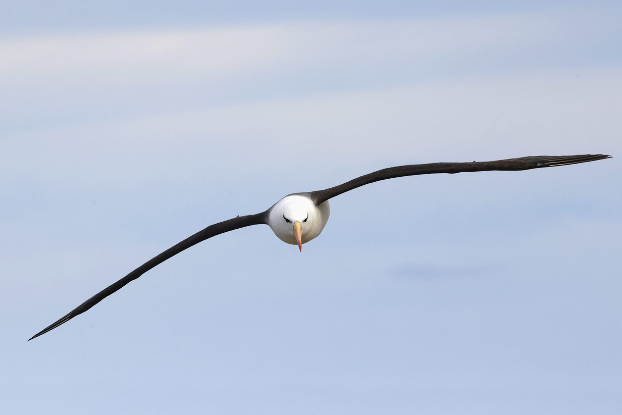
Black-browed albatross (A head-on view lets us appreciate the tremendous wingspan of an albatross.)
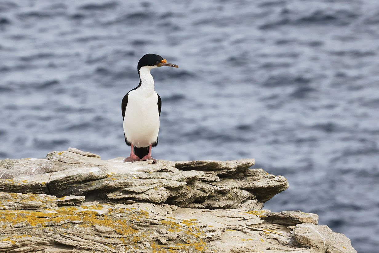
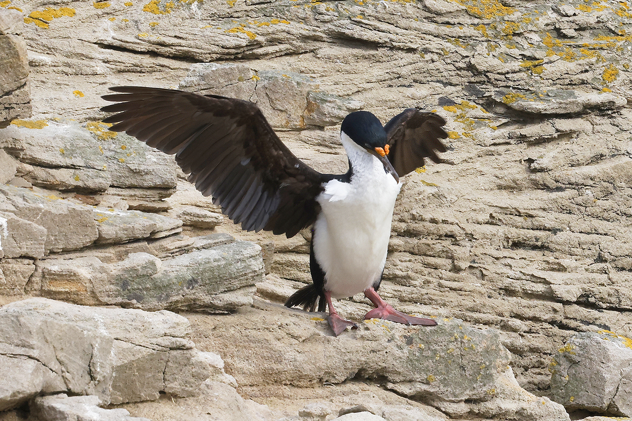
Imperial cormorant
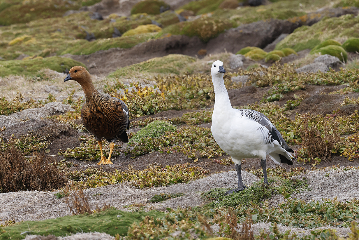
Upland geese on the way back to Seabourn Quest
The Antarctic world is a land of contrasts; here, old vs. new. At left, a Falkland steamer-duck
Preparing for my last zodiac ride of the "Adventure Cruising" part of the trip -- back to Seabourn Quest. No Falkland steamer-duck!
End: New Island; Start: Pelagic Birding February 17, 2023
Whales created -- I think -- more excitement among passengers than any other sighting, including birds and scenery. On the way out from New Island, there were unbelievably many whales in all directions. Sometimes several whales were visible at once, blowing and breaching.
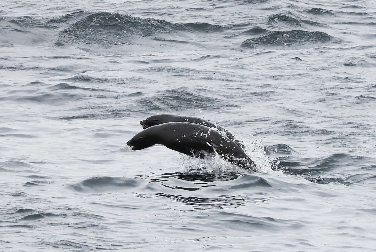
Fur seals were breaching in all directions, too. Marvelous teeming of life!
Pelagic Birding Between the Falkland Islands and Uruguay
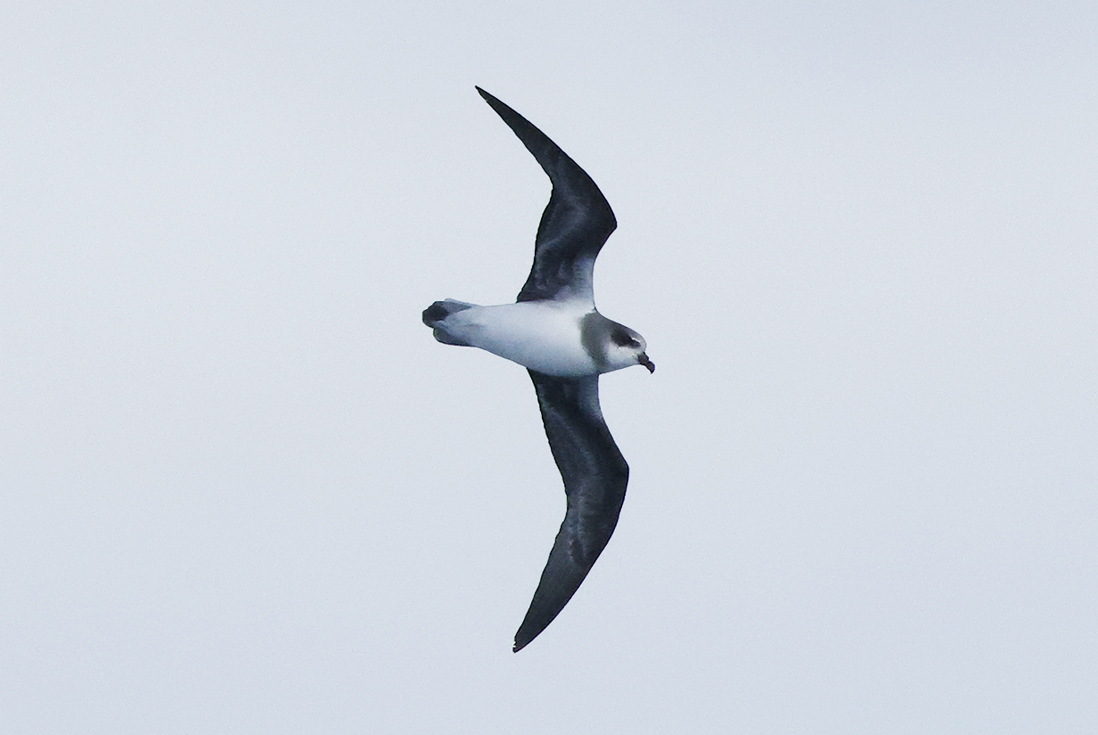
Soft-plumaged petrel was new just a few days ago on 2023 Februry 14. Now, on February 18, they were common and even came reasonably close.
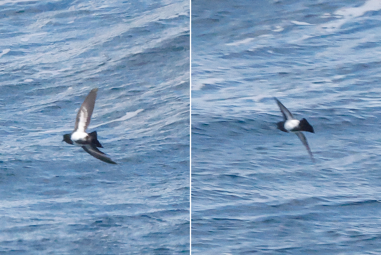
Black-bellied storm-petrel (These are not good pictures, but I include them to contrast this bird with White-bellied storm-petrel, below. Note how the black color of the tail extends broadly up the belly, eventually becoming the narrow belly stripe that is characteristic of Black-bellied storm-petrel.)
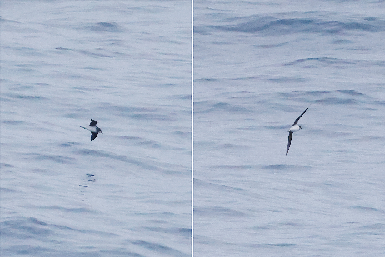
White-bellied storm-petrel (This is John's life bird. In contrast to Black-bellied storm-petrel, above, the belly here is bright white starting just forward of the tail. Also, the rump is white, characteristic of storm-petrels, not uniformly dark as in Soft-plumaged petrel, farther above.
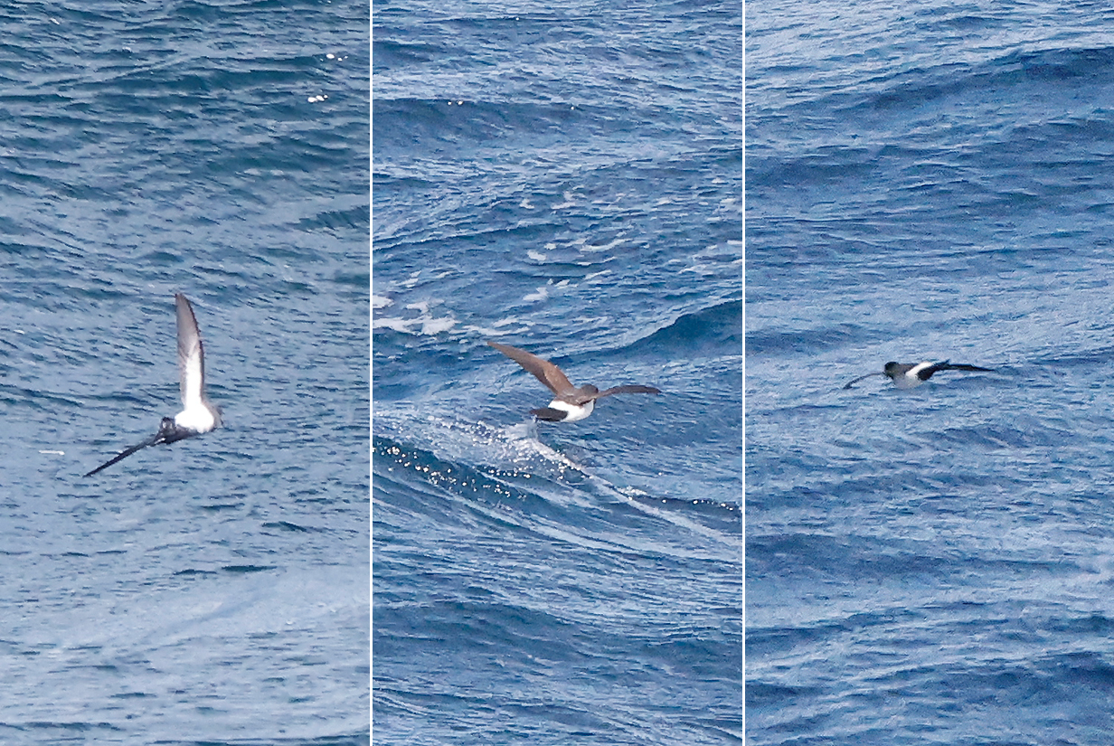
Black-bellied storm-petrel (left) is contrasted again with White-bellied storm-petrel (center and right) ... even though we almost always got looks at birds only as they were flying away from the ship.
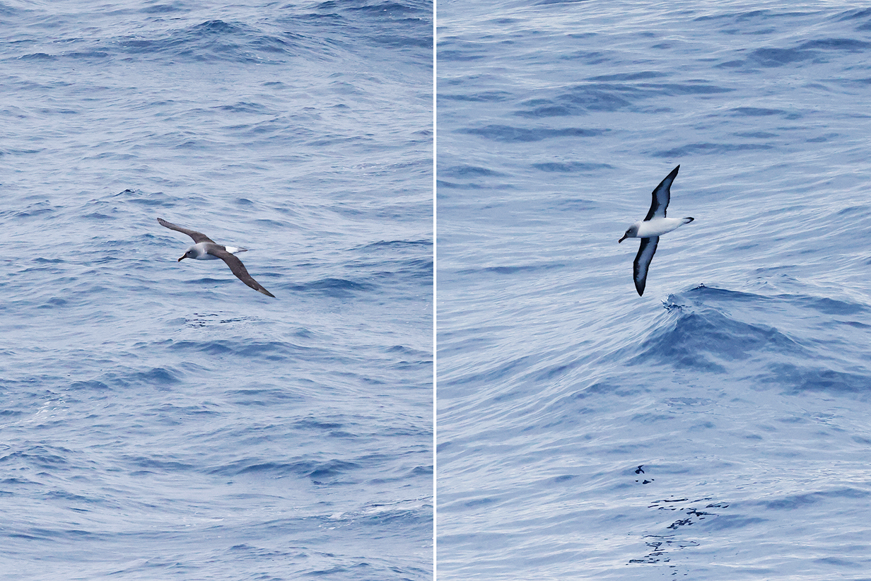
Atlantic yellow-nosed albatross (The first bird is a juvenile: it is John's life bird. The other two birds are adults.)
Great shearwater (still not close enough for a good picture)
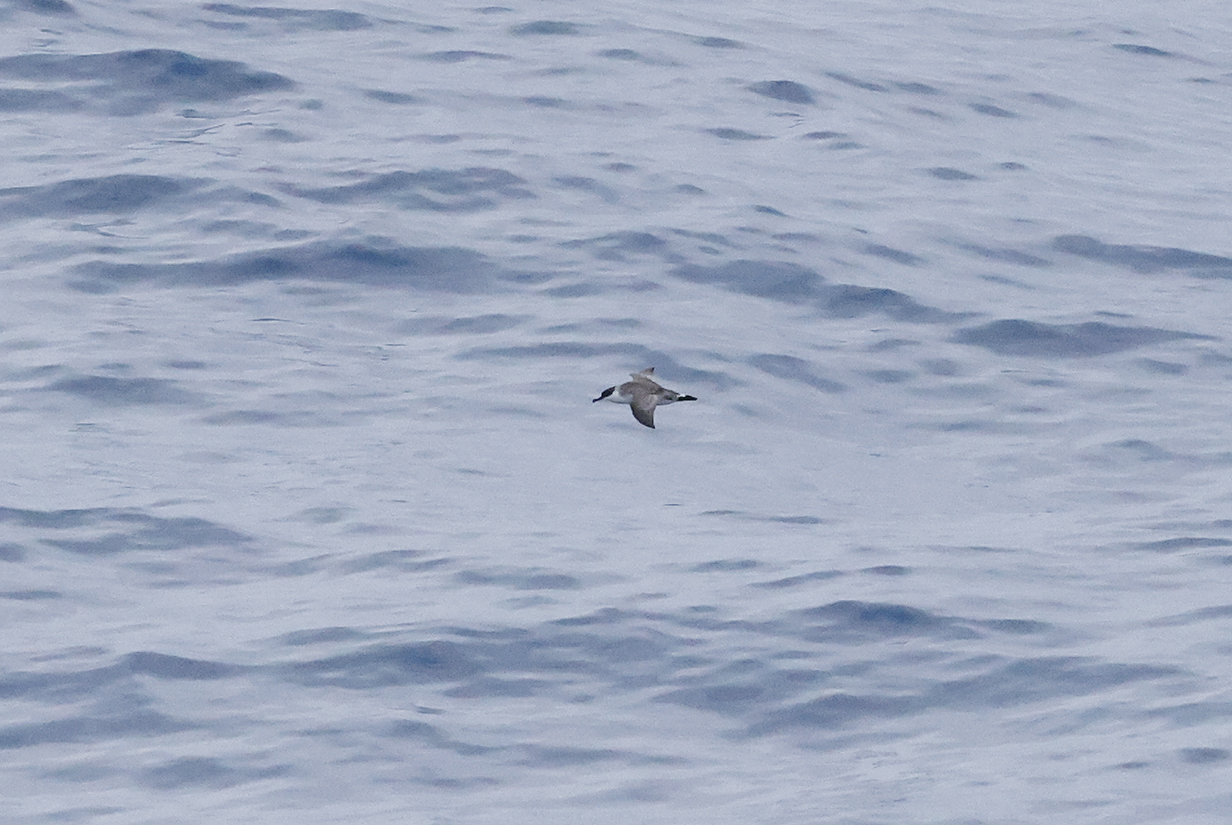
White-chinned petrel is the most common one on this and many other trips. Here, the very small white chin patch is clear, especially on a larger version of this picture.
South America
From the Falkland Islands, we sailed for 2 days NNE to Montevideo, Uruguay. Pelagic birding during that sail is covered above. This section starts the middle (roughly) third of the cruise, in which we are due to sail north along the east coast of South America, up the Amazon River to Manaus and back to the Atlantic, and on up to Guiana. From there starts the last (roughly) third of the cruise, in which we island-hop our way north via the Lesser Antilles and Puerto Rico to Miami.
Montevideo, Uruguay
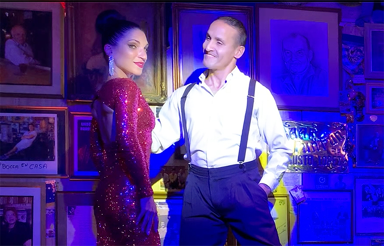
Uruguay is John's first and Mary's second (after Chile) new country of the trip, John's 48th and (I think) Mary's 49th. Montevideo makes a very good impression -- neat, safe (we are told), and (to quote many online sources) "the most livable capital city in South America". We took a 4-hour Seabourn tour of the city, ending in Bar Fun Fun with a spectacular tango show:
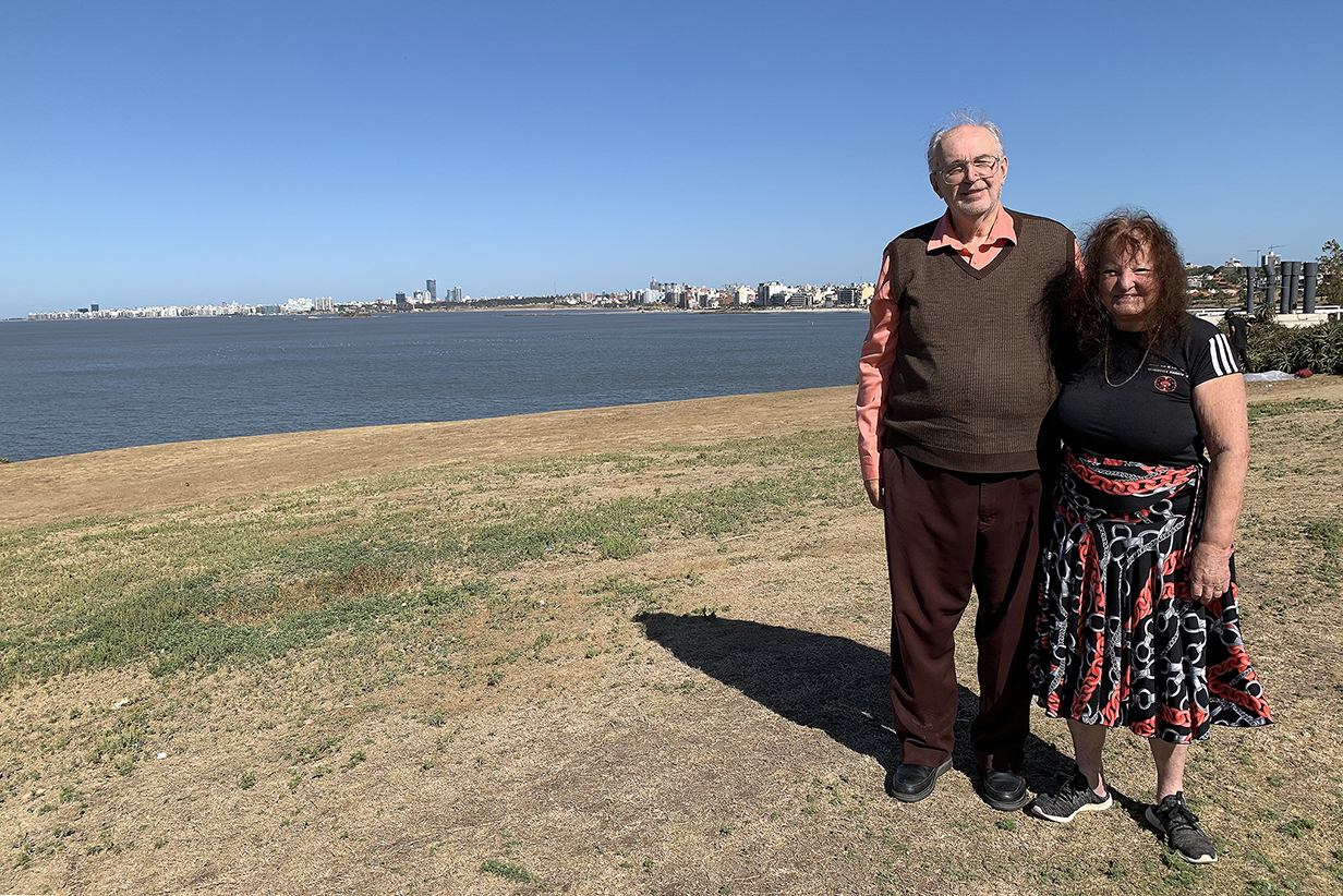
Montivideo across the Rio de la Plata estuary from north of the city center
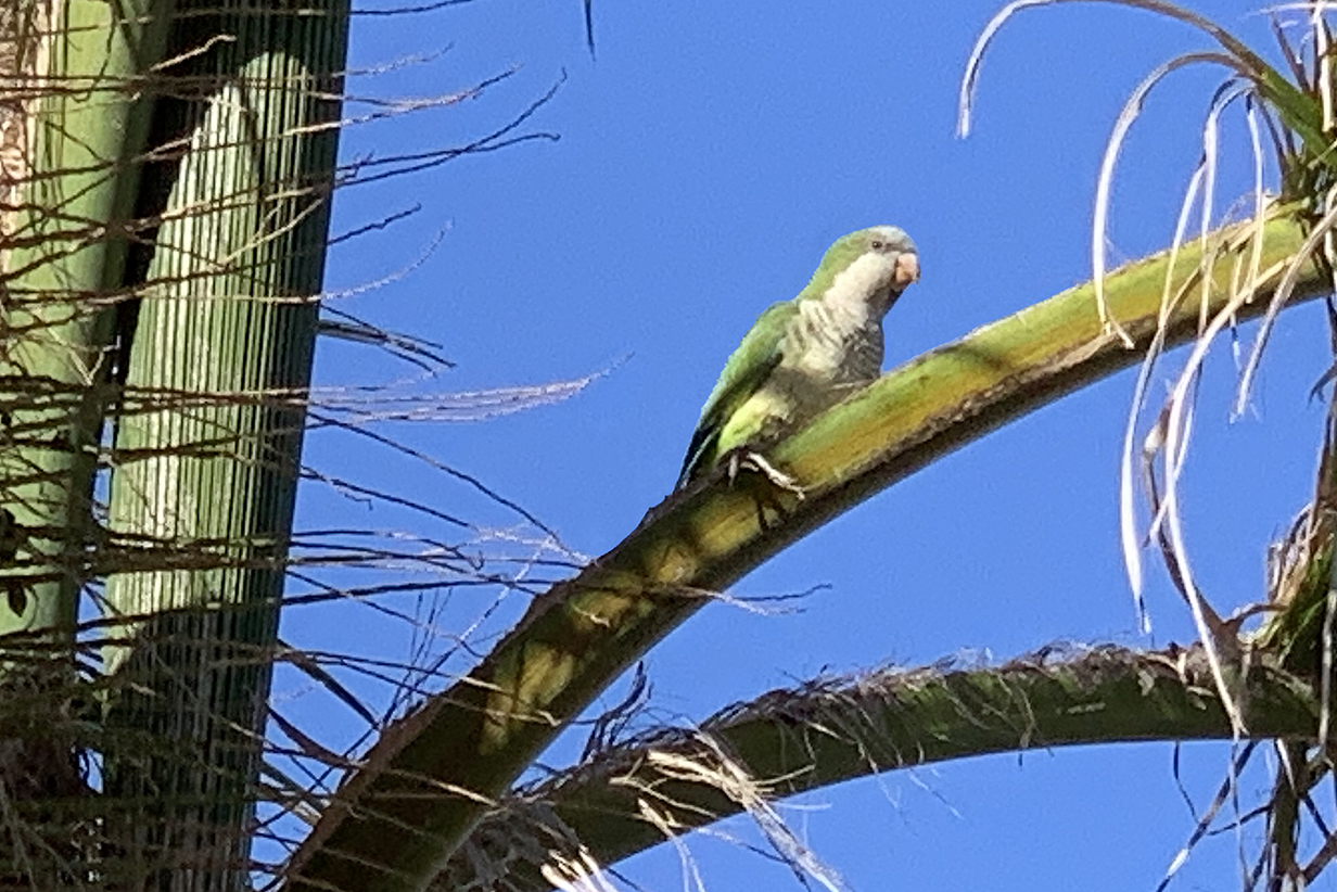
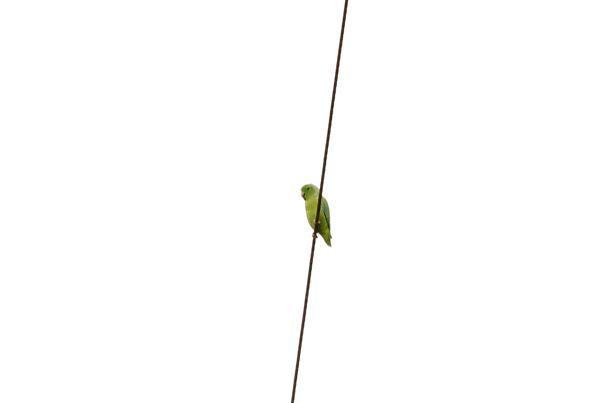
Our guide told us that there are "green parrots!" in the park of the above city-view picture. Turns out -- no surprise -- that they are (ubiquitous) Monk parakeets. As shown even in this iphone picture.
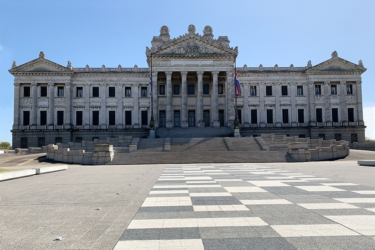
Palacio Legislativo, the Uruguay legislative parliament building. It was designed by Italian architect Vittorio Mean, with interiors designed by Gaetano Moretti. It was built between 1904 and 1925 with some decoration not completed until 1964. Beautiful building.
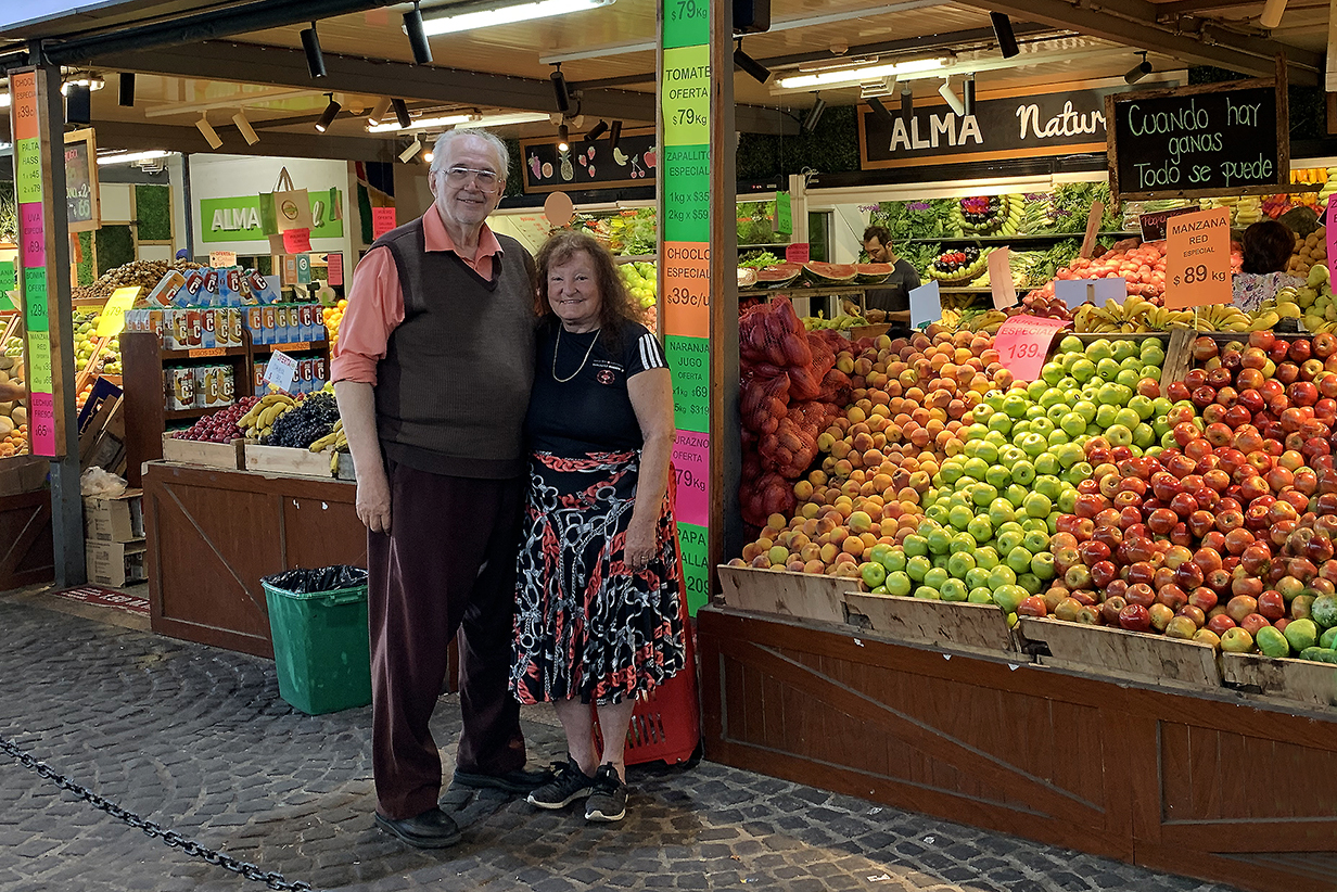
This is a small part of the main downtown market, which combines produce sales with more standard "mall" stores.
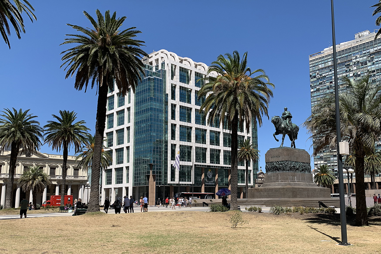
The Plaza Independencia includes, as centerpiece, this statue of Jose Gervasio Artigas Arnal (1764 - 1850), the "father of the Uruguyan nation". As a military general, he fought in the Spanish-American wars that freed Uruguay to be an independent country. His mausoleum is under the square. The glass tower left of the statue is the Presidencia, which includes the offices of the President of Uruguay.
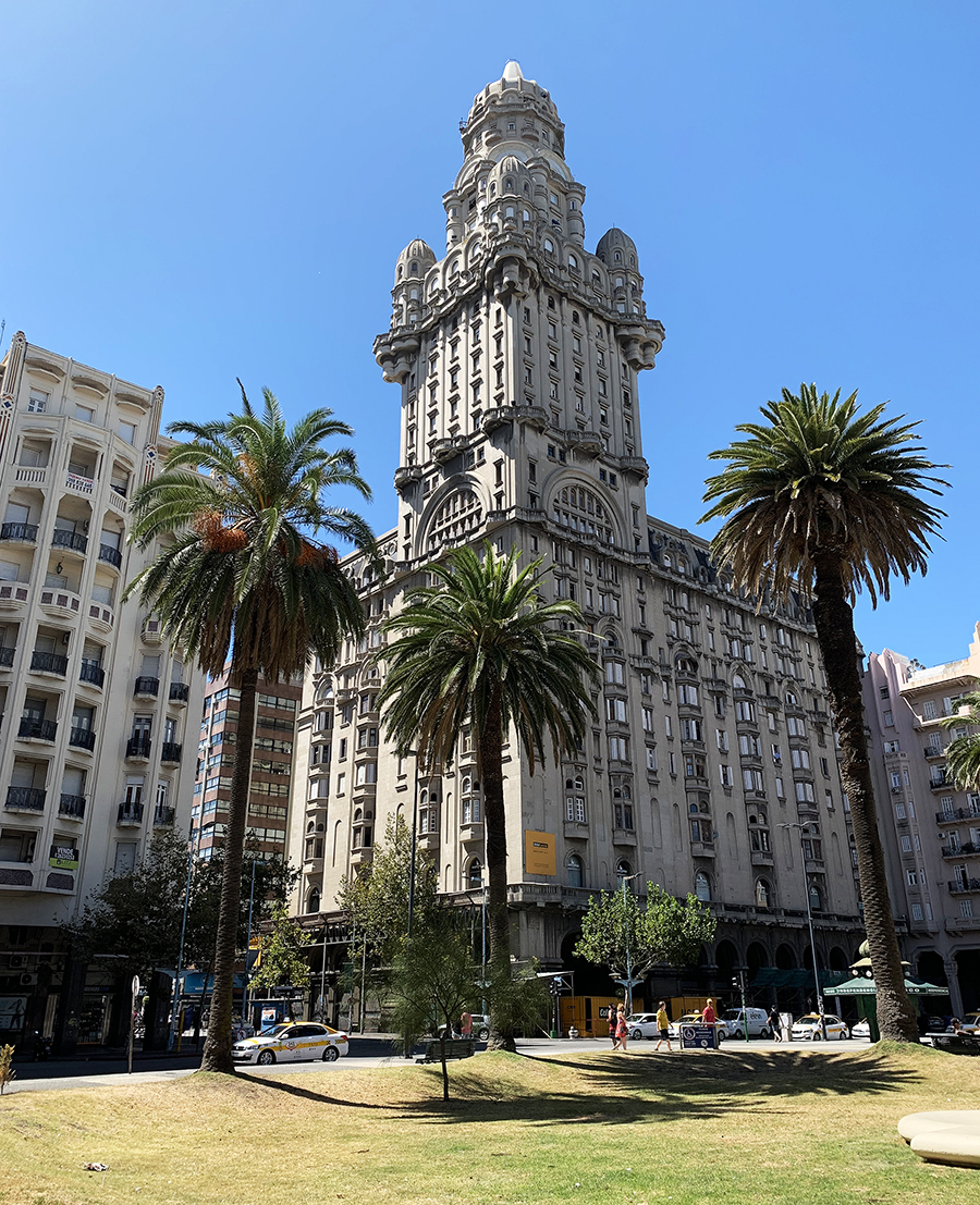
Also on Plaza Independencia is the Palacio Salvo. Paraphrasing Wikipedia, it was designed by Mario Palanti, an Italian architect living in Buenos Aires, who used a similar design for the Palacio Barolo there. Finished in 1928, Palacio Salvo is 95 m (312 ft) high and was briefly the tallest building in Latin America. It now houses offices and private residences. I include it in part because it is an important icon of Montevideo but mainly for another reason:
Palacio Salvo sits on the site where the coffee shop La Giralda was previously located. It is famous as the place where Gerardo Matos Rodriguez wrote his tango La Cumparsita in 1916. Tango is THE iconic music of Montevideo and Buenos Aires. And we were treated to a spectacular performance of tango as the climax of our city tour.
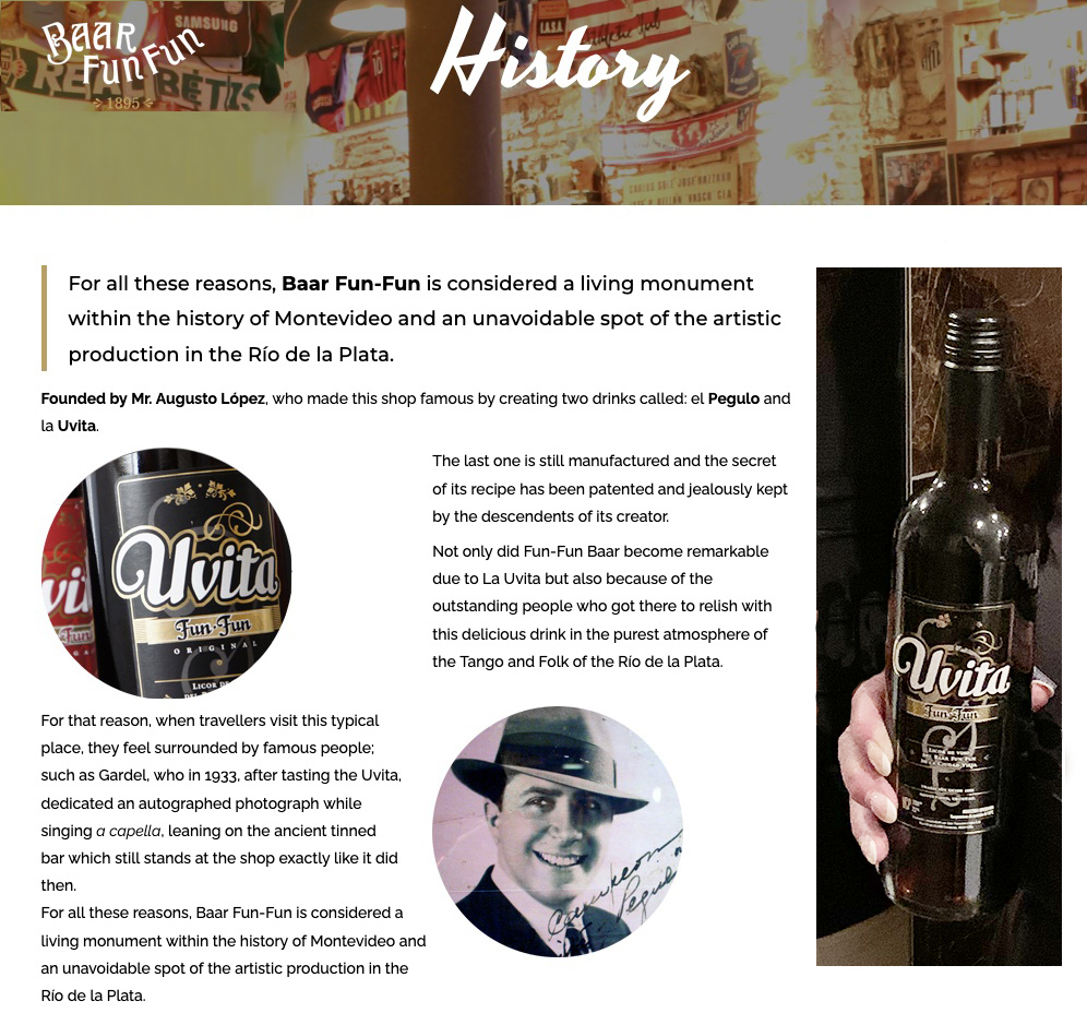
The tango show took place at the Baar Fun Fun, introduced above via a screen capture from its web site. Also, as described on Wikipedia, it is a famous center for tango performance. Their show for us was superb. Baar Fun Fun was founded in 1895 by Augusto Lopez. Currently, it is owned and run by his great grandson, Gonzalo Acosa Lopez, who is also its principal male dancer. The bar is also famous for Uvita, a liqueur that was served to all of us before the show. John, who is not exactly a connoseur of liqueurs, found it delicious. Mary would happily have bought a case if we'd had enough money and carrying power with us.
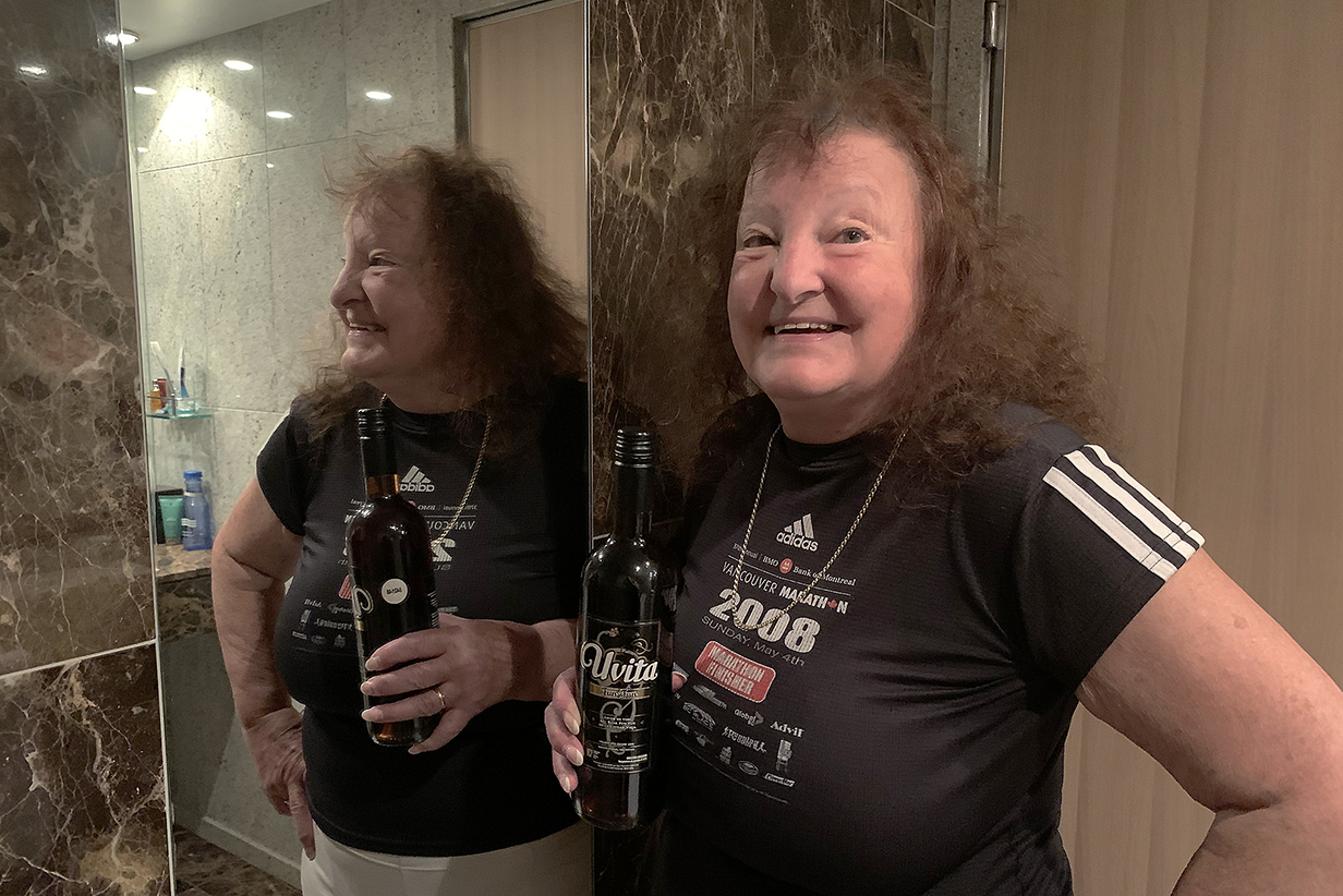
She will have to be satisfied with one bottle and its reflected memory. For this trip, anyway ...
One more detail before the tango: The name of the bar has nothing to do with the English meaning of the word "fun". Rather, its first owner had a stutter, and he ofen wondered if the bar was still "fun-fun-functioning" (the word is similar in Spanish). At the same time, we doubt that the owners miss or regret the double entendre.
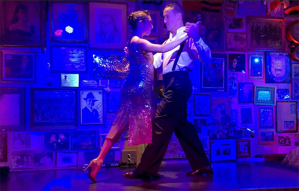
Tango 1 movie (157 Mb), starting with a round of Uvita toasts. I regret that I didn't catch or write down the names of the two ladies dancing in this and the following movie. All three dancers are absolutely world-class -- I doubt that you can see better tango dancing anywhere. All three are multiple winners of world tango championships. It was a great privilege for us to watch them perform.
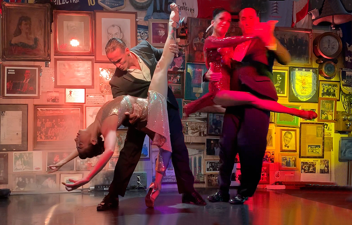
La Cumparsita (the "little parade") was originally composed as a march by Uruguayan musician Gerardo Matos Rodriguez in 1916, when he was 17 yr old. He took the piece to Roberto Firpo, who converted it to a tango. It has become an iconic signature piece of classical tango, performed here to perfection by the dancers of Baar Fun Fun. This is a 144 Mb movie of La Cumparsita. (Gonzalo Acosa Lopez appears twice in the above picture through the magic of Photoshop.) I am extremely grateful to the dancers for allowing me to include three of their dances in this web site.
Punta del Este, Uruguay
On February 22, 2023, Seabourn Quest stopped for the day at Punta del Este, Uruguay. It is a beach resort with the flavor of Monte Carlo. Many tourists come here -- far more than the resident population -- including rich people from Brazil and Argentina and also weekenders (because the place is expensive) from Montevideo. Visitors include many famous names of the past 75 years, during most of which time the place must have been much more pristine than its present rows of high-rise hotels and apartment buildings. Miles of sand beaches look very inviting. The night life is famous ... although it is not our style and anyway not on our schedule. We made a brief landing to see highlights. I include one:
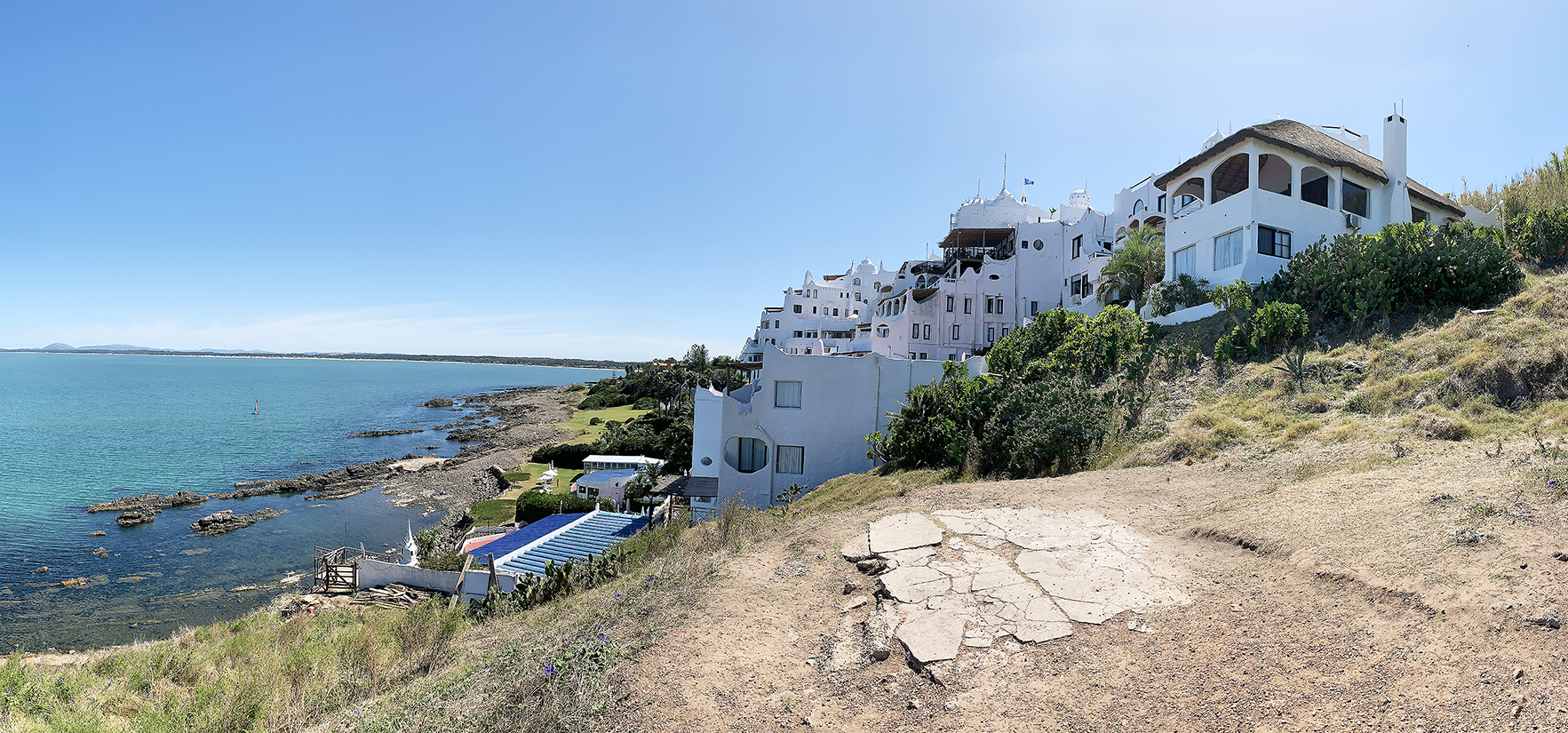
Casapueblo (panorama) is a museum, hotel, and private residence of the family of the Uruguayan artist Carlos Paez Vilaro (1923 -- 2014). His style is Afro-Uruguayan abstract, often appealing. Casapueblo is itself an eclectic art work, with echoes of white-washed buildings in Santorini, Greece, but also (according to the artist) of the nests of birds like the Rufous hornero.
Interesting factoid: Carlos Paez Vilaro is the father of Carlos Miguel Paez Rodriguez ("the man of the iron spirit"), one of the survivors of the famous October 13, 1972 crash in the Andes of an airplane carrying a Uruguayan rugby team.
Ilhabela, Brazil
Our first stop in Brazil was the island of Ilhabela. It is a tropical resort with many beautiful sand beaches and lots of tourists. We hoped to do some birding -- the Atlantic coastal rain forest is almost all gone, and the remnant on this island includes unique species. Unfortunately, we could not find a guide. So we had a rather vanilla tour to one of the nicer beaches and one of the many waterfalls.
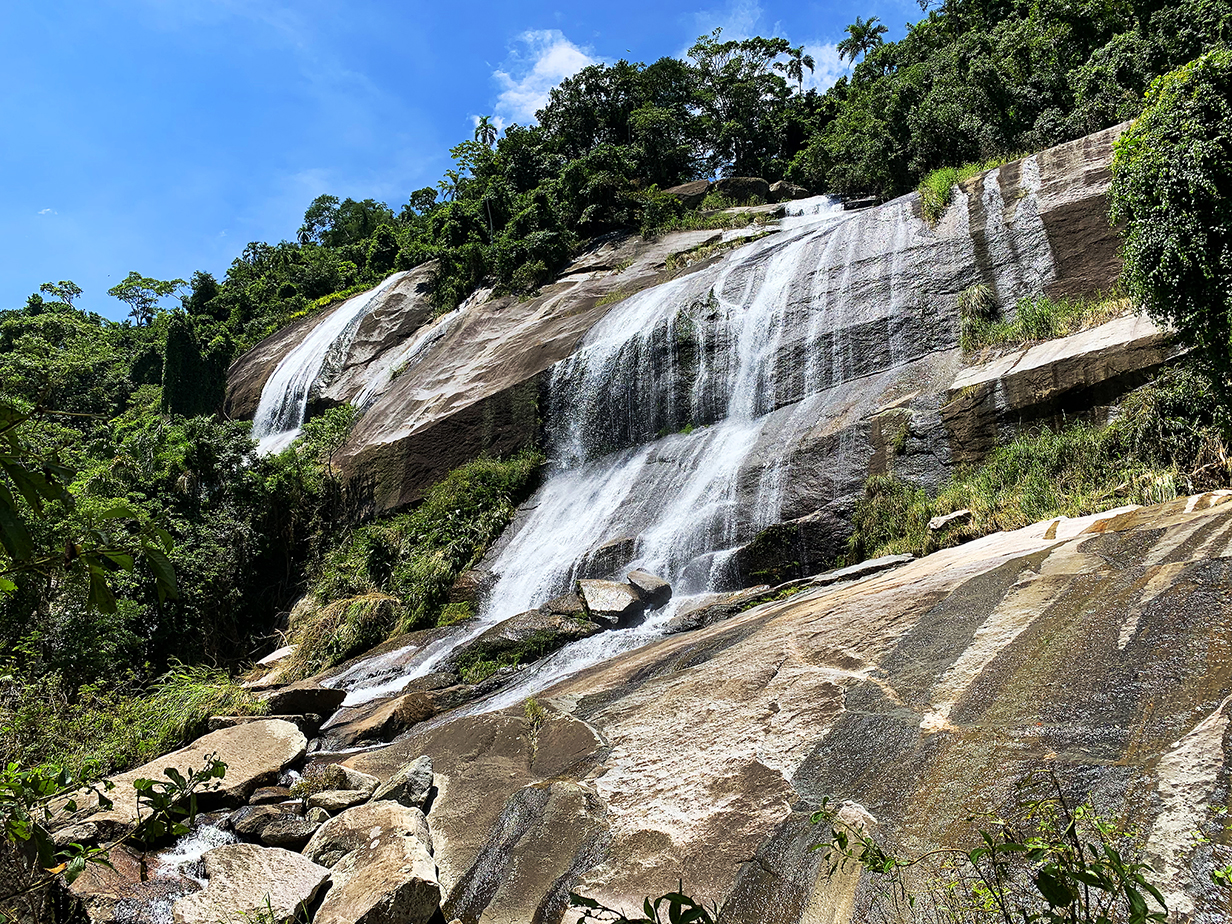
Agua Branca (White Water) falls
Rio de Janeiro, Brazil
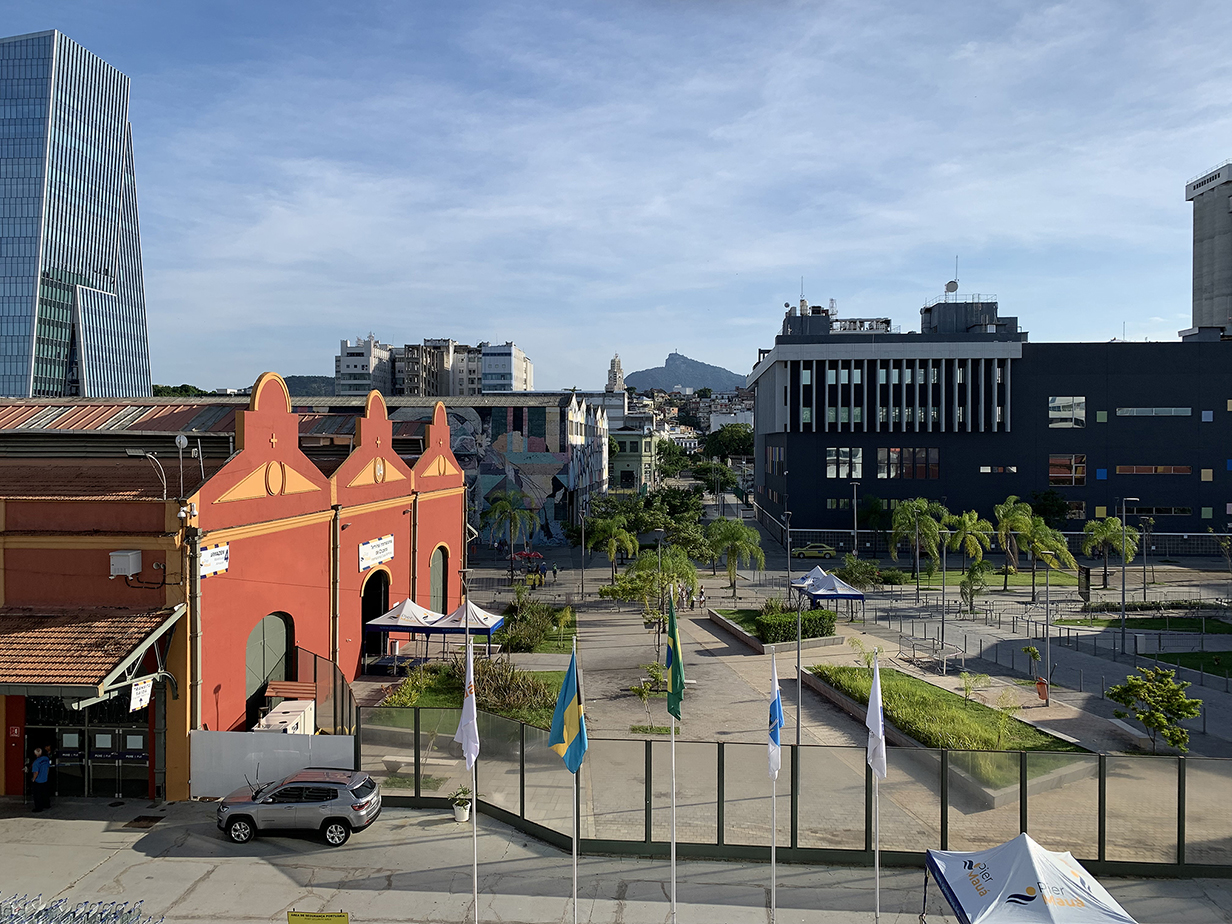
Christ the Redeemer statue seen from our balcony on Seabourn Quest
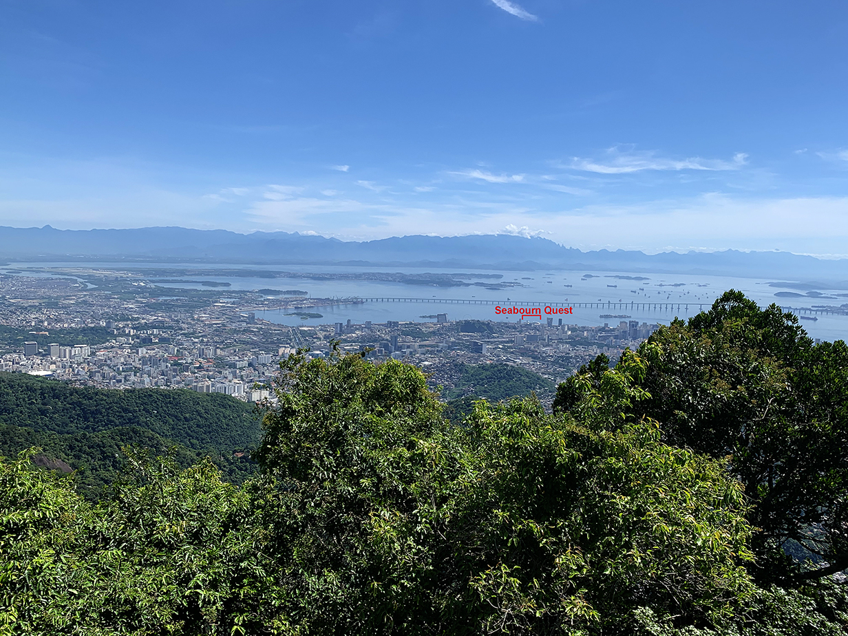
Seabourn Quest and northern Rio de Janeiro from the base of the Christ the Redeemer statue on Corcovado Mountain
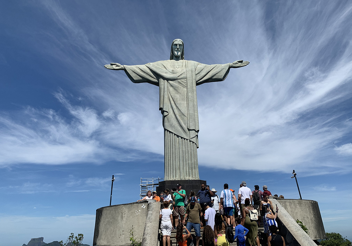
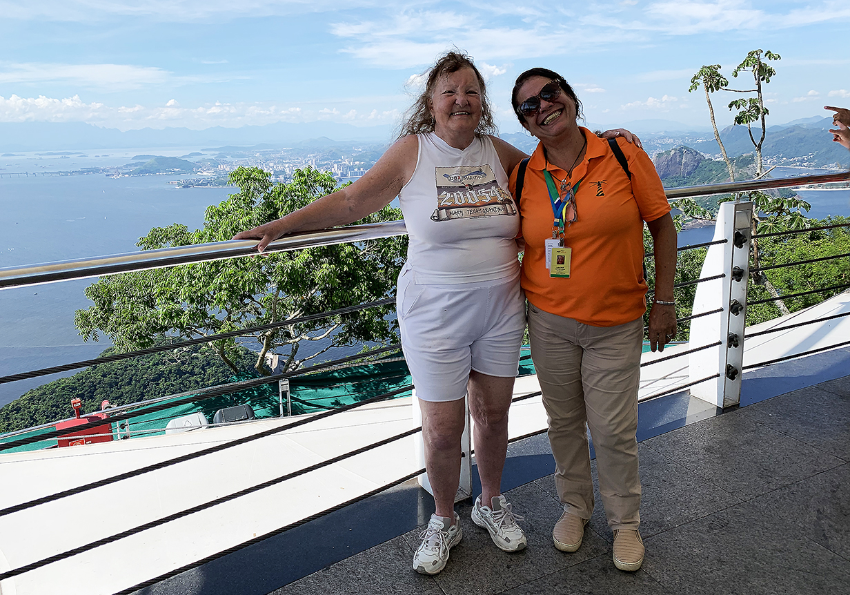
Christ the Redeemer statue on Corcovado Mountain. The statue is 98 feet high, excluding the pedestal. Its arms stretch 92 feet wide. It was constructed in 1922-1931. Romanian sculptor Gheorghe Leonida designed the face. Corcovado is 700 m = 2300 feet high and provides spectacular views of the iconic city of Rio de Janeiro. In this picture, Mary and our guide are the leftmost two people.
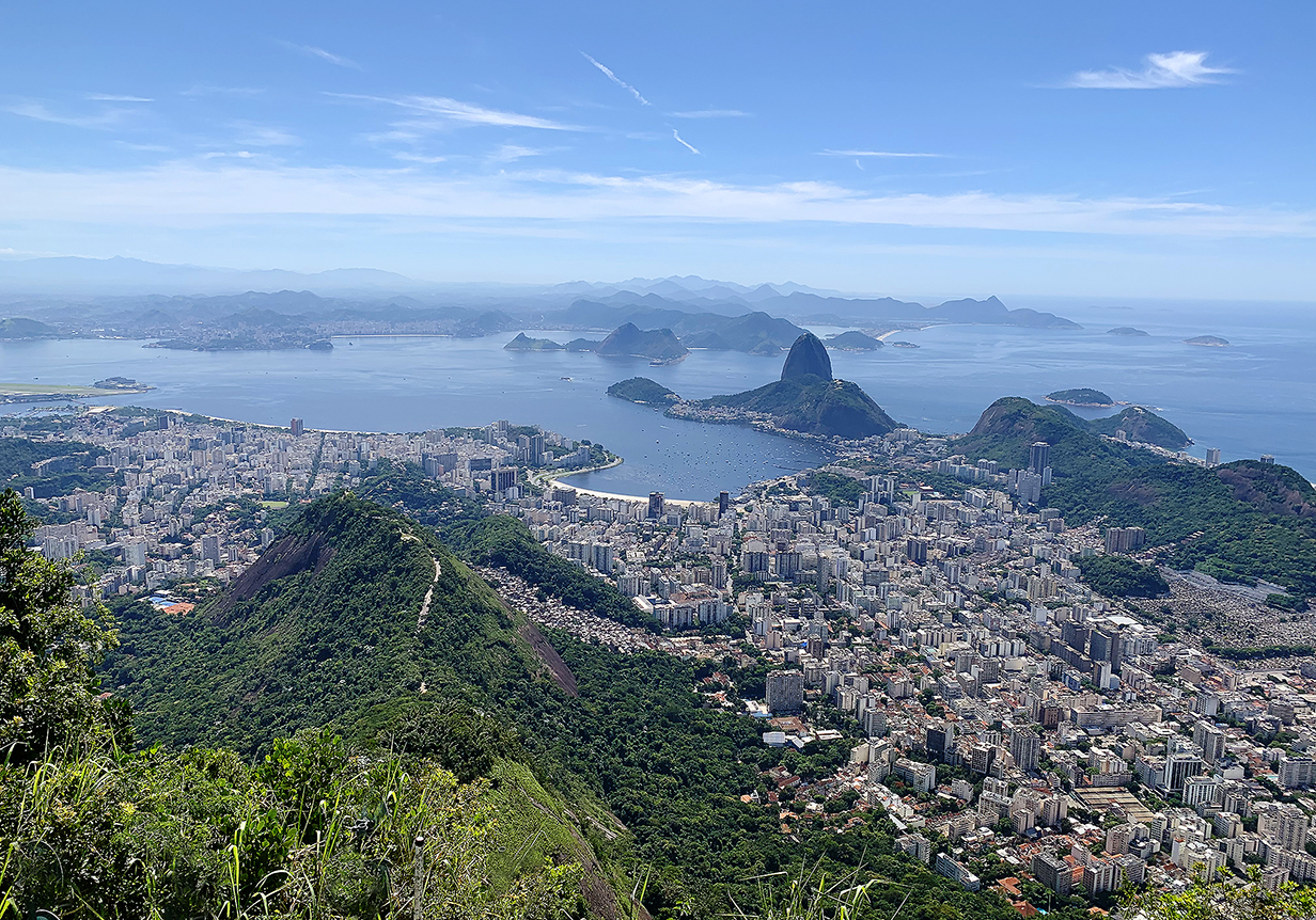
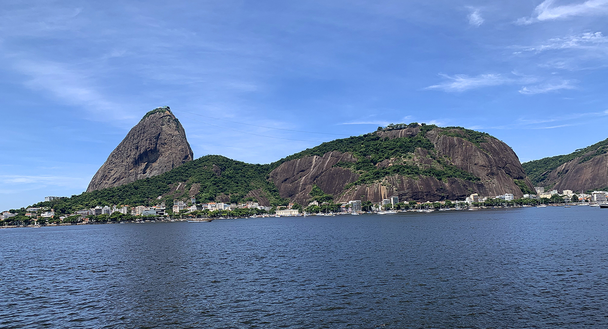
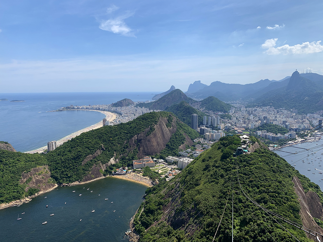
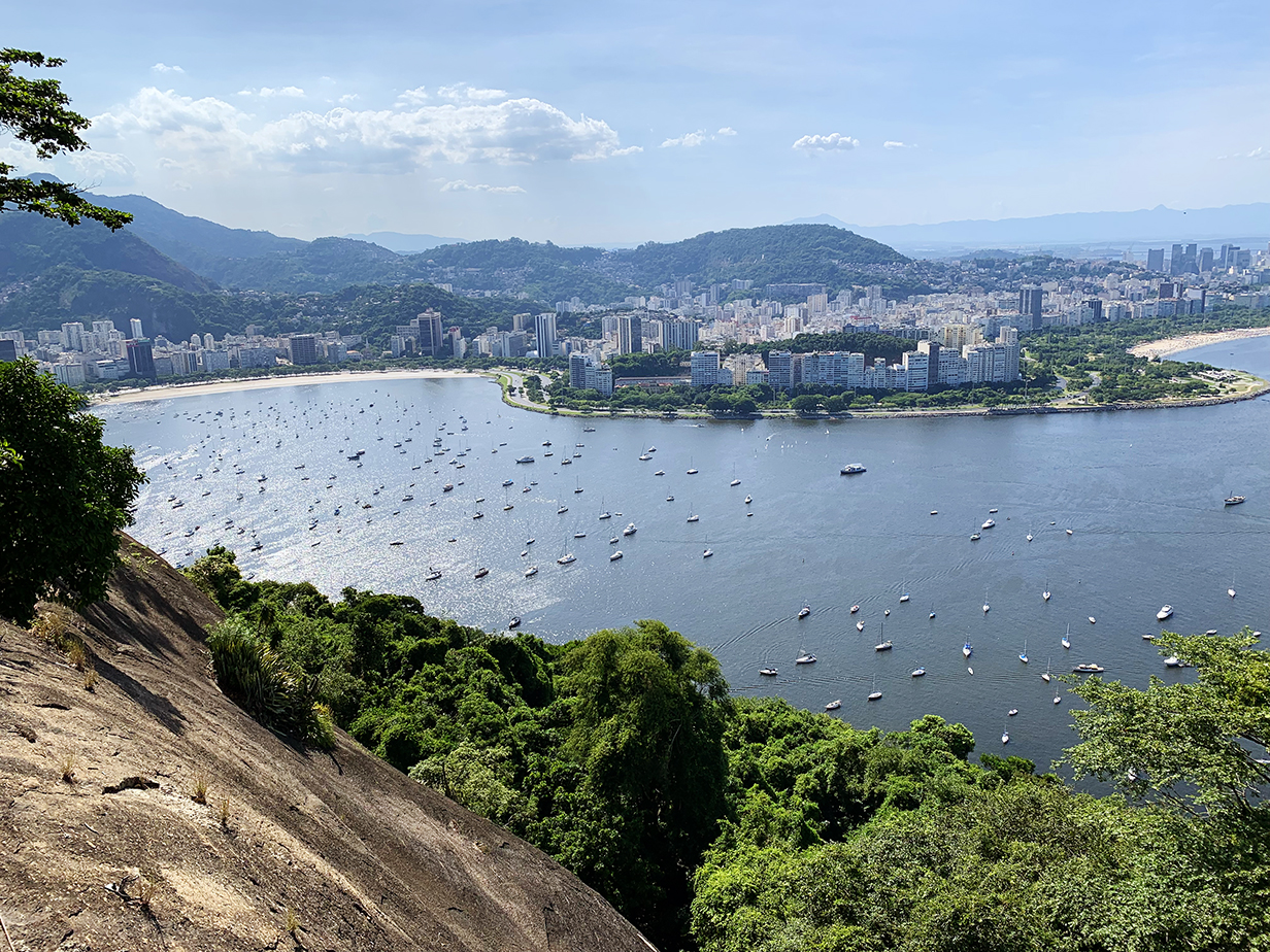
Sugar Loaf (396 m = 1300 feet high) and downtown Rio de Janeiro
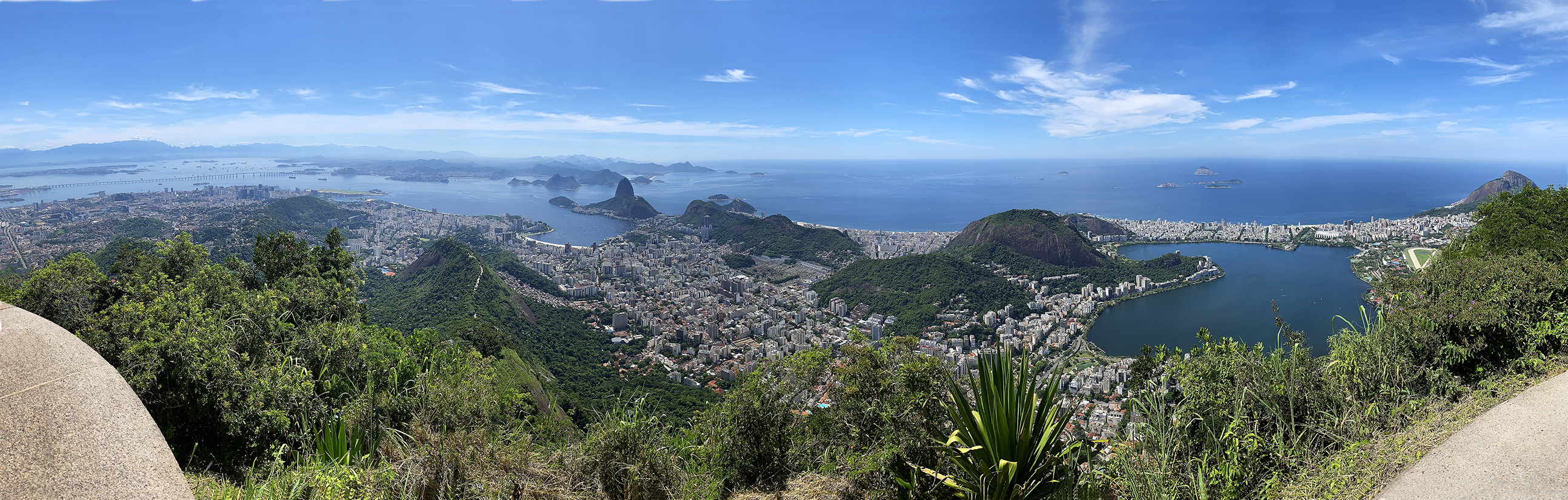
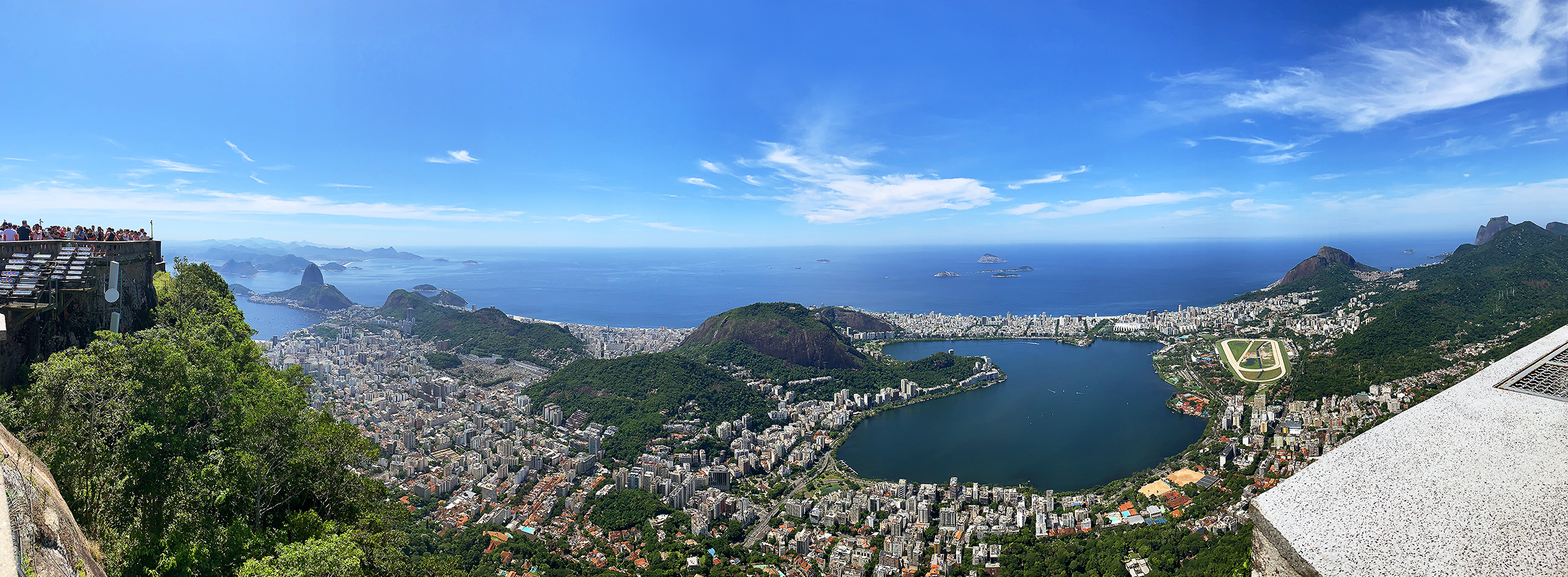
Rio de Janeiro panorama from Corcvado (scroll right to see it all)
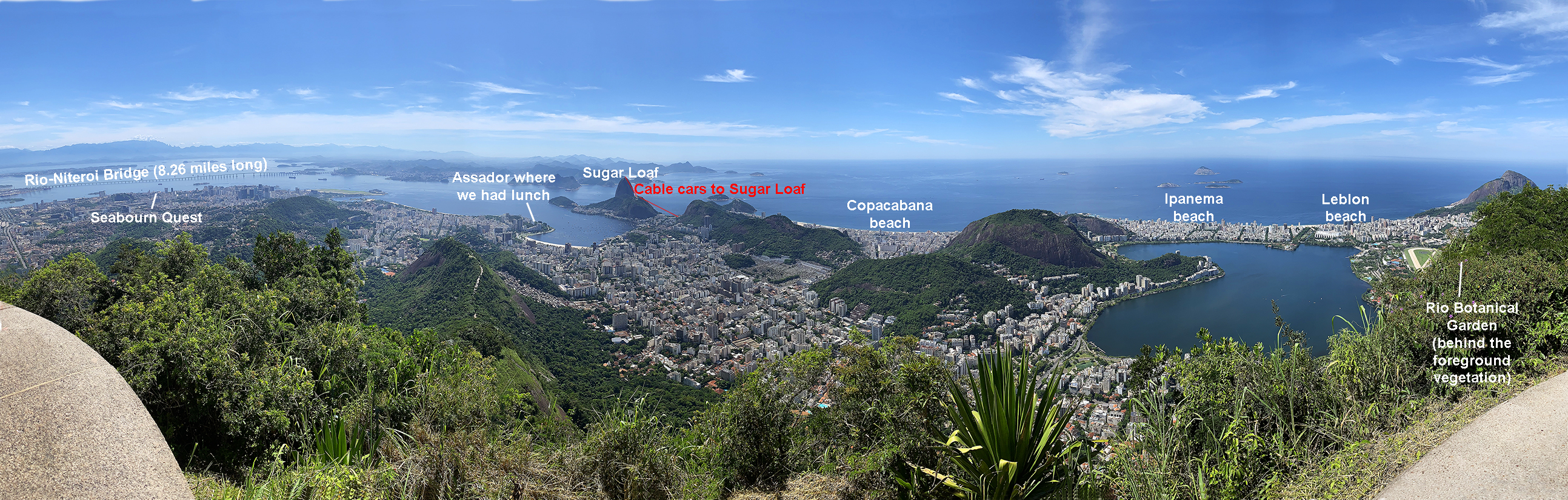
Annotated Rio de Janeiro panorama from Corcovado
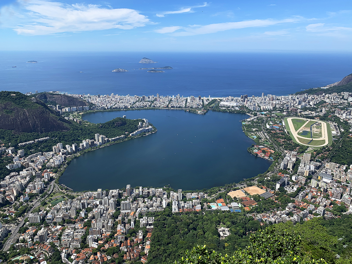
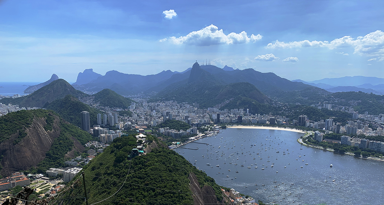
Ipanema and Leblon beaches are beyond the lagoon and the strip of highrise buildings that separates the lagoon from the ocean. The Rio botanical gardens are the green area to the right of the racetrack near the right side of the picture. We birded there -- not very successfully -- on the day after this tour. This picture is one of the iconic views from Corcovado.
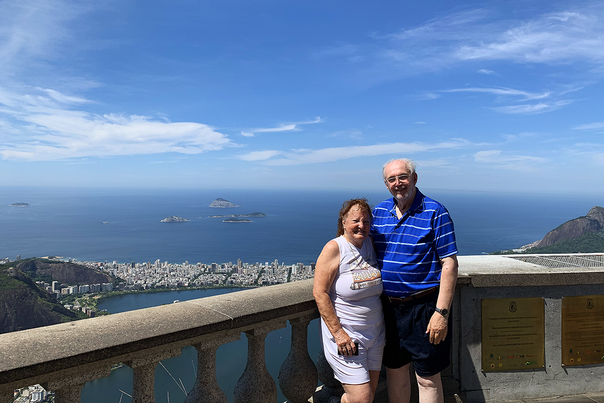
John and Mary at the above viewpoint
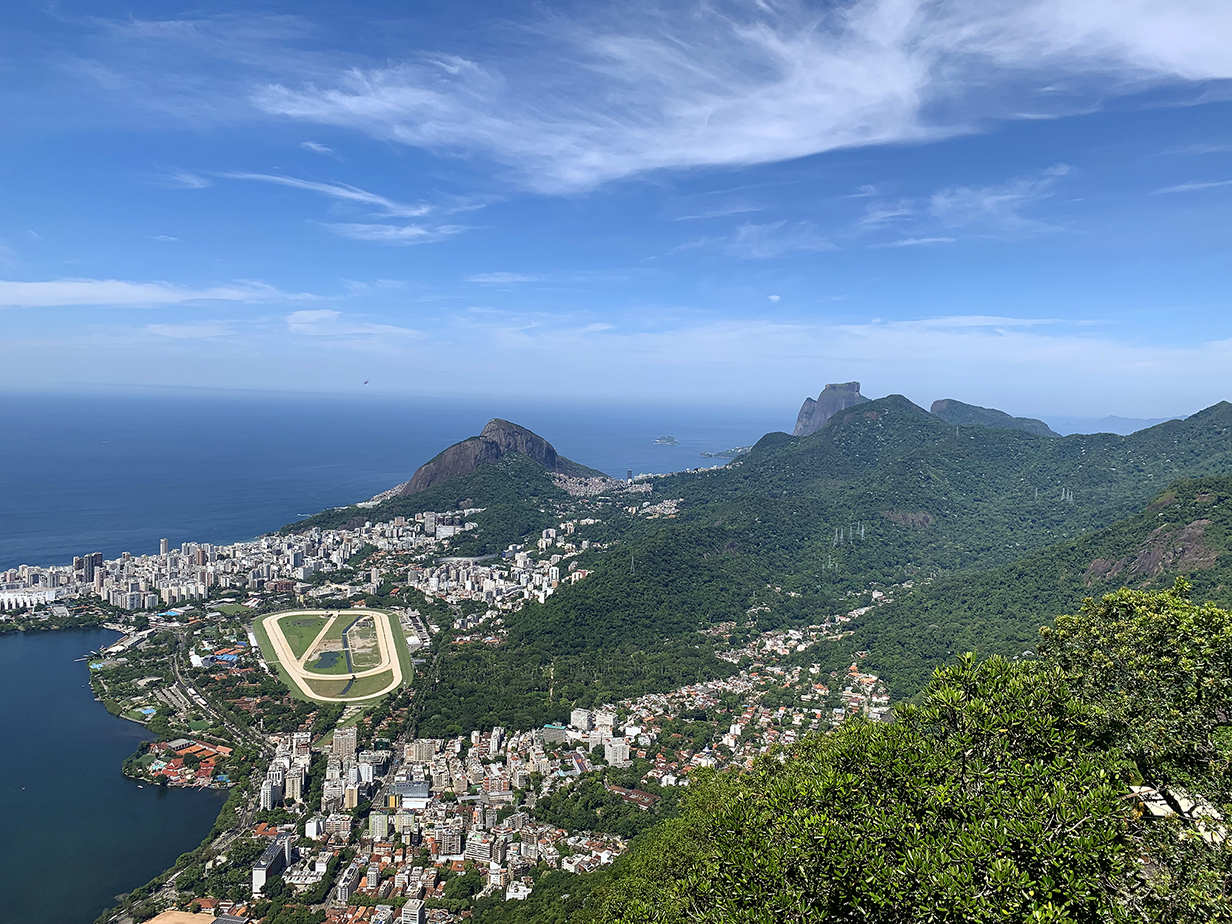
South side of Rio de Janeiro: Leblon beach is beyond the most distant buildings at left, and the Rio botanical gardens are the flattish green area to the right of the racetrack. Again, this view is from Corcovado.
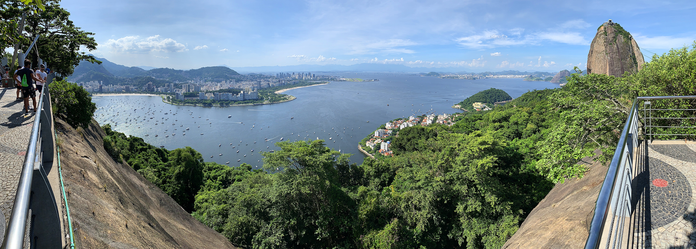
One more panorama of Rio from Corcovado: Sugar Loaf at left to the botanical gardens at right
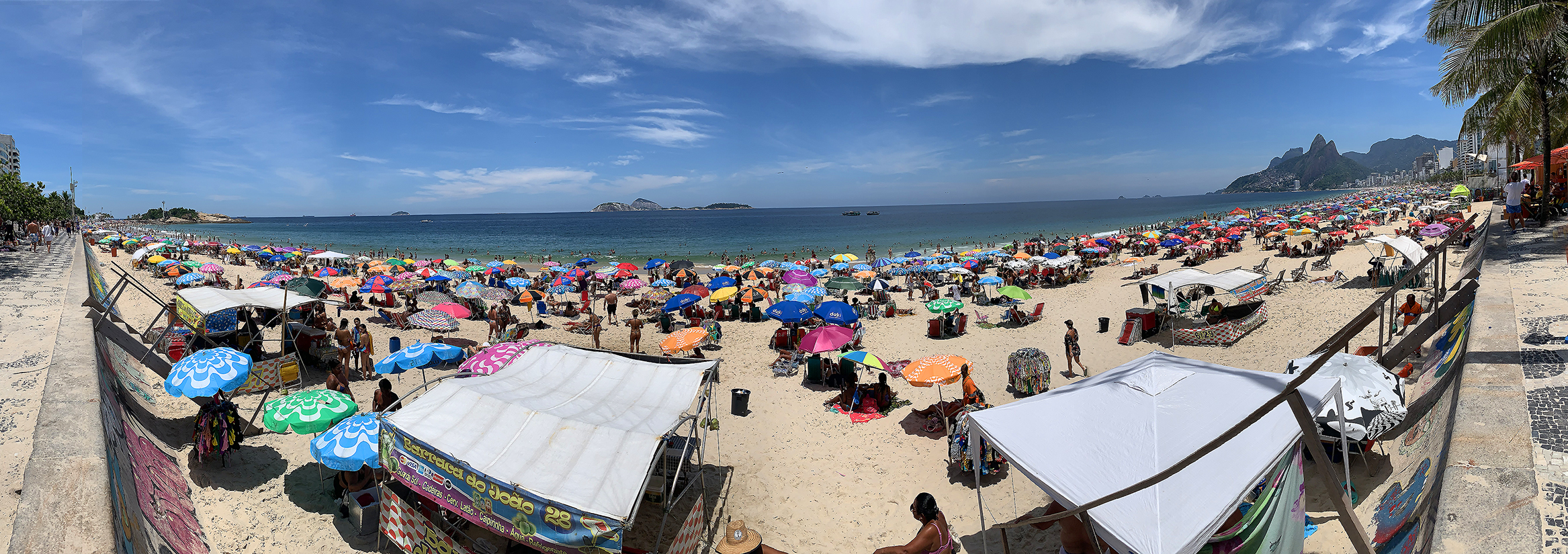
Ipanema and Leblon beaches (John remembers crossing from Copacabana beach via the rocky area at left to the left = north side of Ipanema beach in 1980. There were a lot fewer people then! Scroll right to see the whole panorama.)
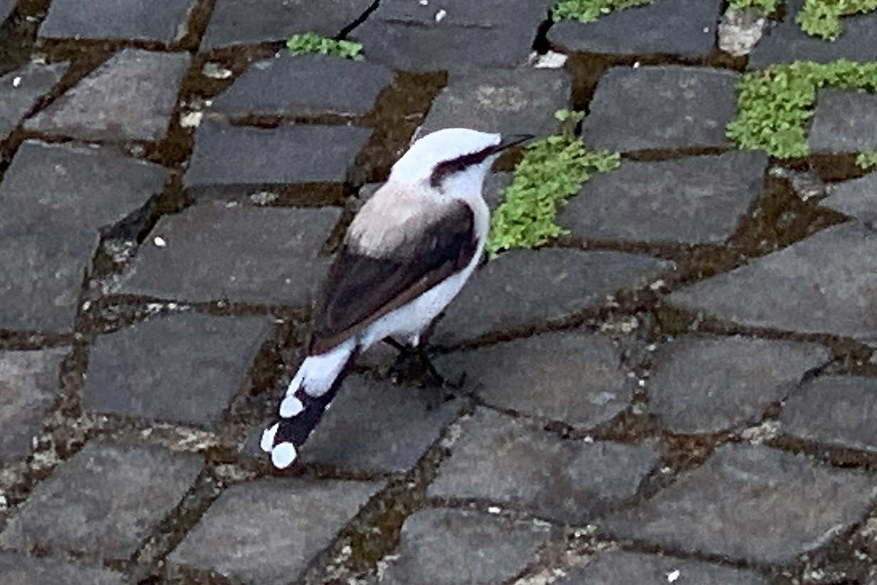
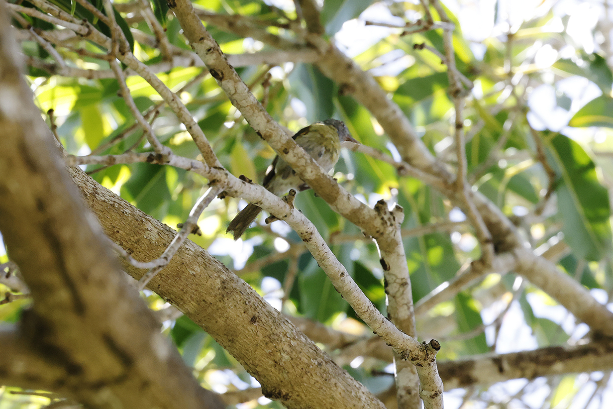
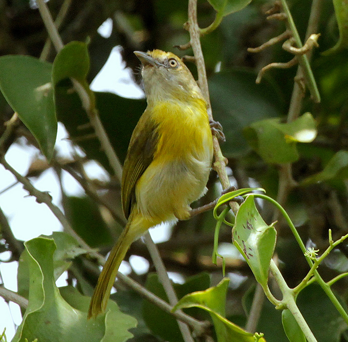
Masked water-tyrant (roadside near the beaches -- iphone photo!)
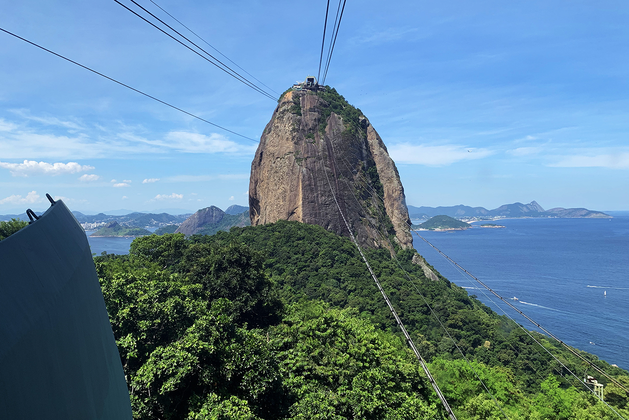
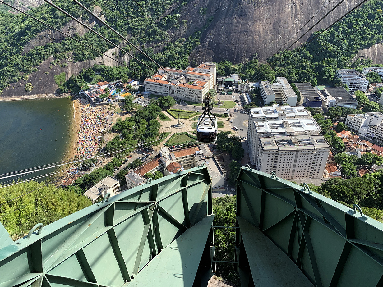
Sugar Loaf and the last stretch of the cable car to it as seen from where we had lunch. We ate at a churrascaria called Assador Rio's -- upscale and with an excellent view of Sugar Loaf. Waiters continually circulate with barbecued meats on skewers; you ask for whatever strikes your fancy, and you do not leave hungry. Churrascarias are among our favorite aspects of Brazil.
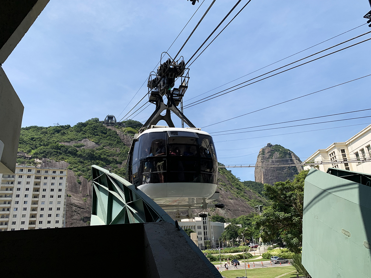
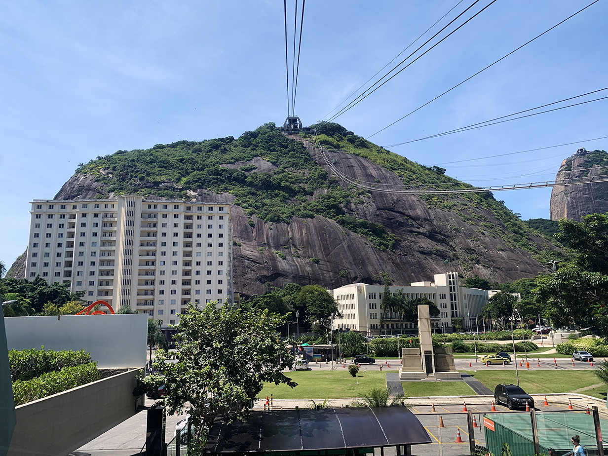
This is the first leg of the cable car ride up to the summit of Sugar Loaf mountain.
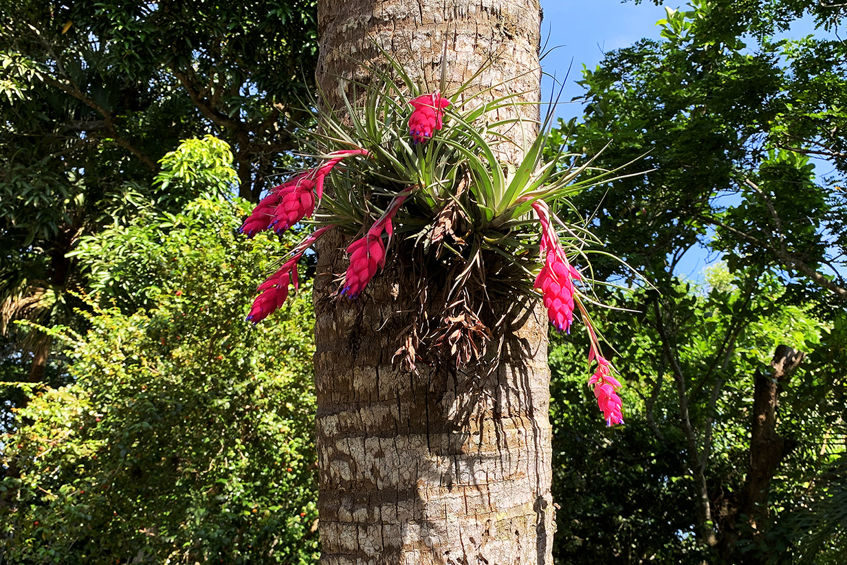
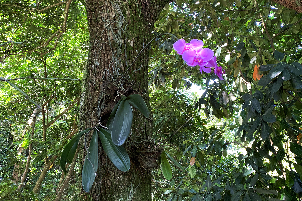
As everywhere in tropical forests, the trees in the forest at the middle level are decorated with bromeliads and orchids.
This is the second part of the cable car ride up Sugar Loaf mountain.
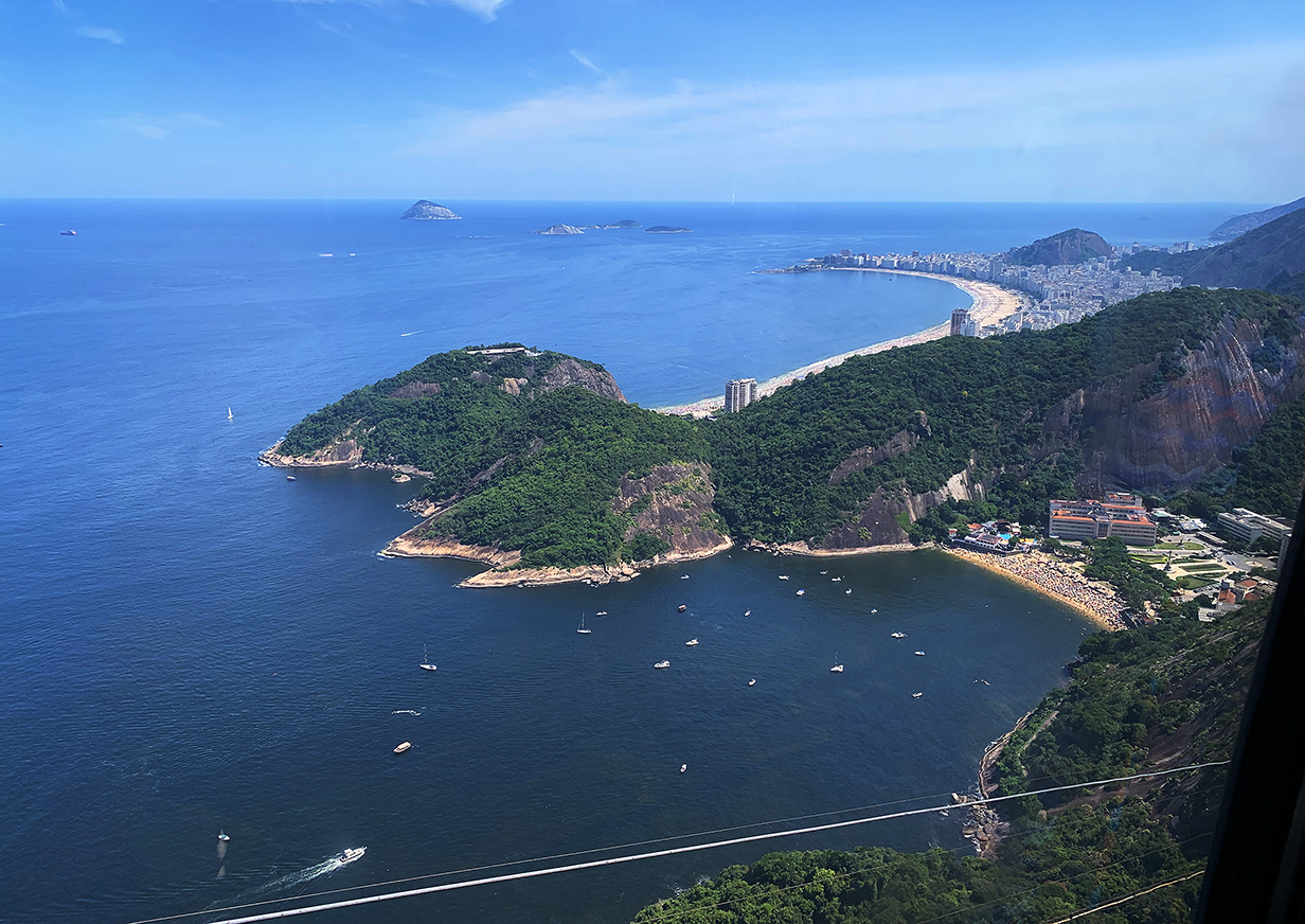
From part way up the cable car ride, this view shows Praia Vermelha or Red beach in the foreground and Copacabana beach in the background. In 1980, John stayed for several days in the highrise hotel that's about 1/3 of the way along Copacabana beach from the near side. He has been looking forward to sharing the Rio experience with Mary for as long as they have been together. On this magic day, it was everything we both hoped for.
This is much the same view from the top of Sugar Loaf.
And again: the view south from Sugar Loaf, this time also showing the mid-level facility and Corcovado in the background.
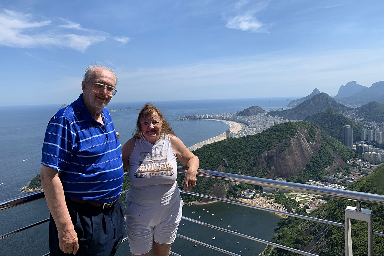
Mary and our guide and north Rio from the top of Sugar Loaf. They must be making an impression ... because even the tourists are pointing them out.
Downtown Rio plus the mid-level facility and Corcovado in the background from the summit of Sugar Loaf.
Rio de Janeiro downtown and northern part -- a panorama from the mid level on the way down from Sugar Loaf
Yachts in Rio harbour
Cable car ride back down to the city and the end of one of the best days of the cruise
Rio de Janeiro: Birding the Botanical Garden
Violet-capped woodnymph
Green-headed tanager (not entirely cooperative)
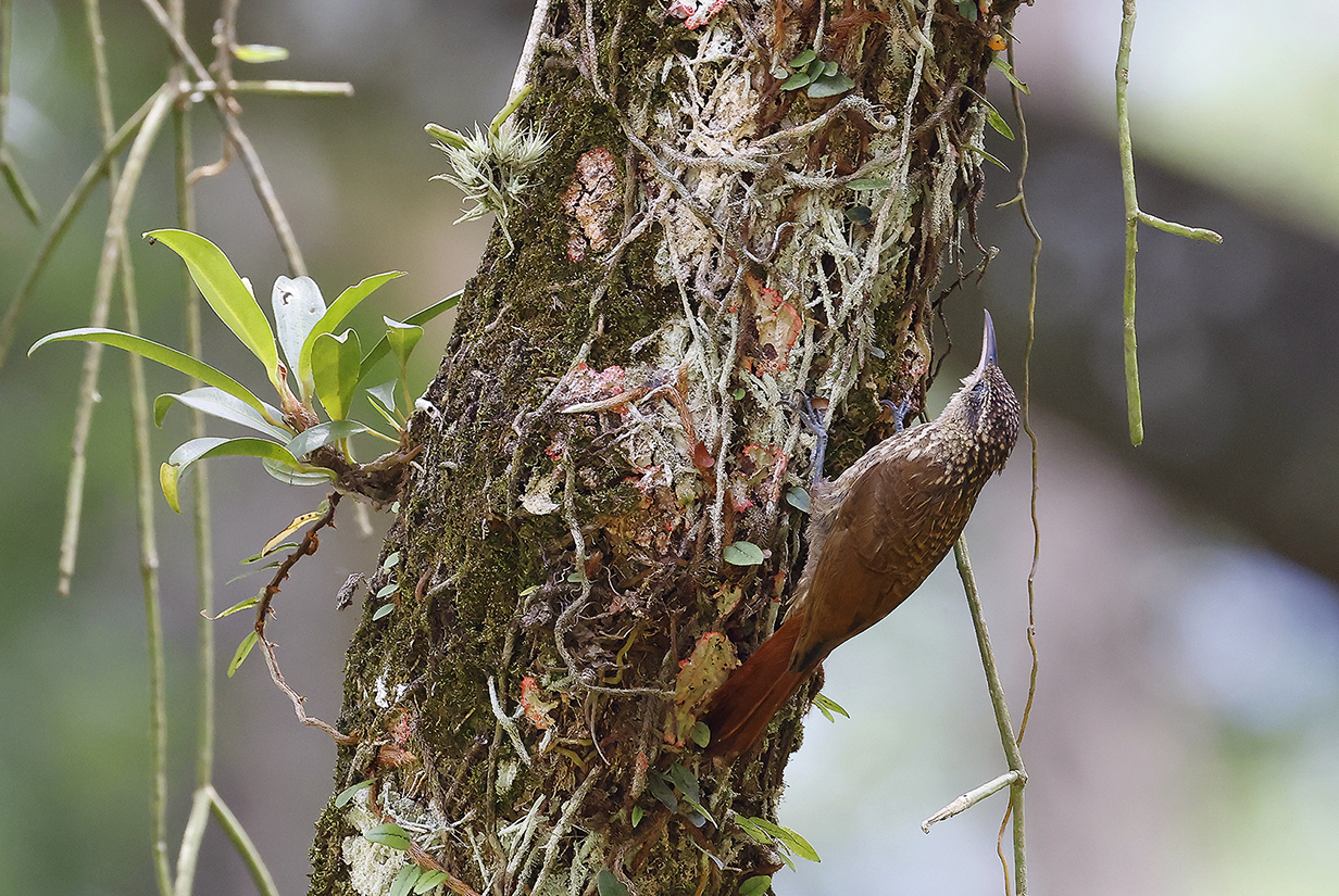
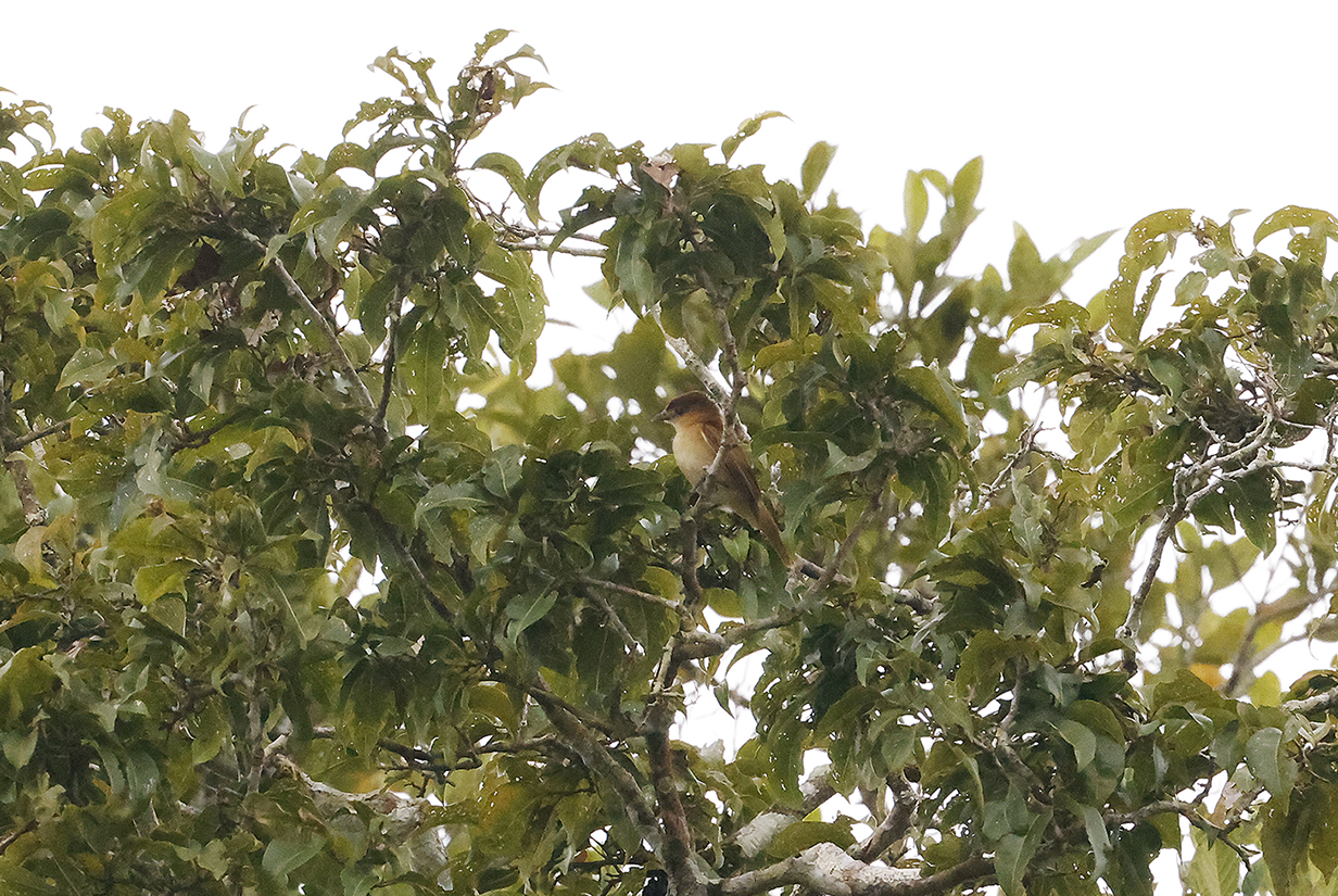
Lesser woodcreeper
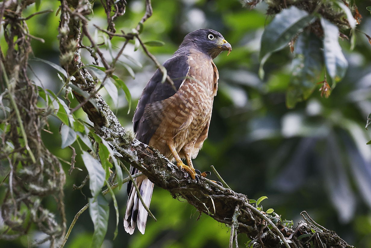
Roadside hawk (strange bill -- genetic anomaly? hybrid?)
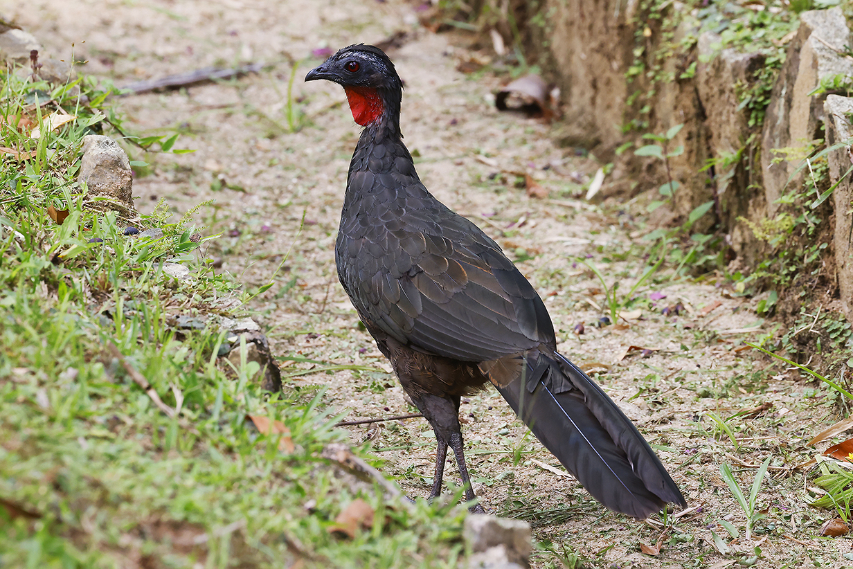
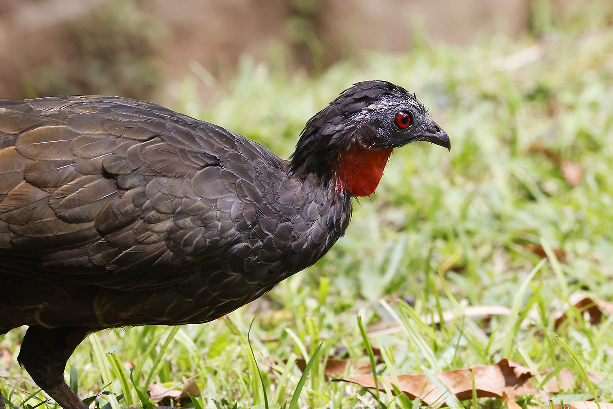
Rusty-margined guan
Armacao Dos Buzios, Brazil: Birding
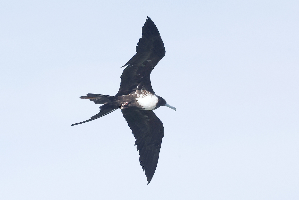
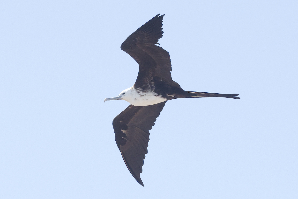
Magnificent frigatebirds in the harbour (Neither of these are breeding adult males.)
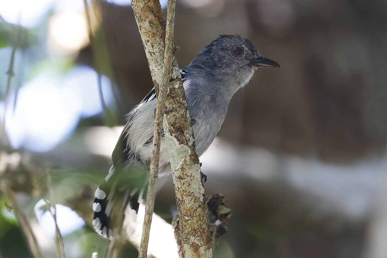
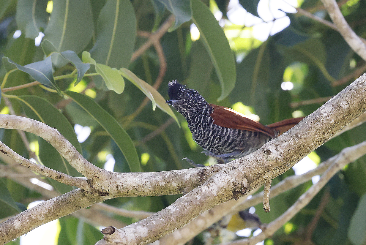
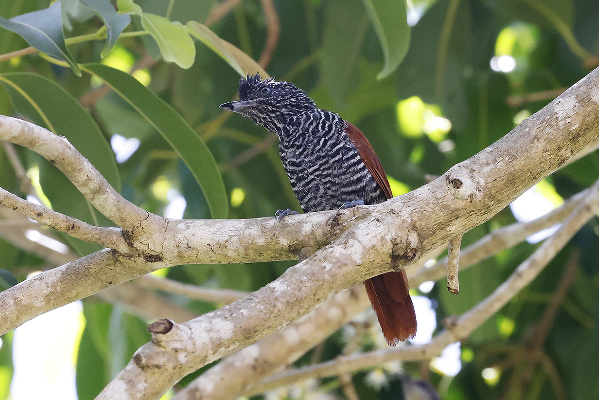
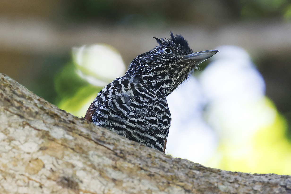
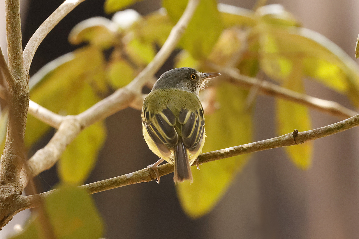
Sooretama slaty-antshrike (This male is our life bird.)
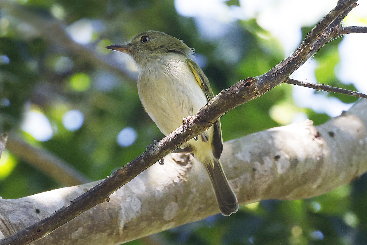
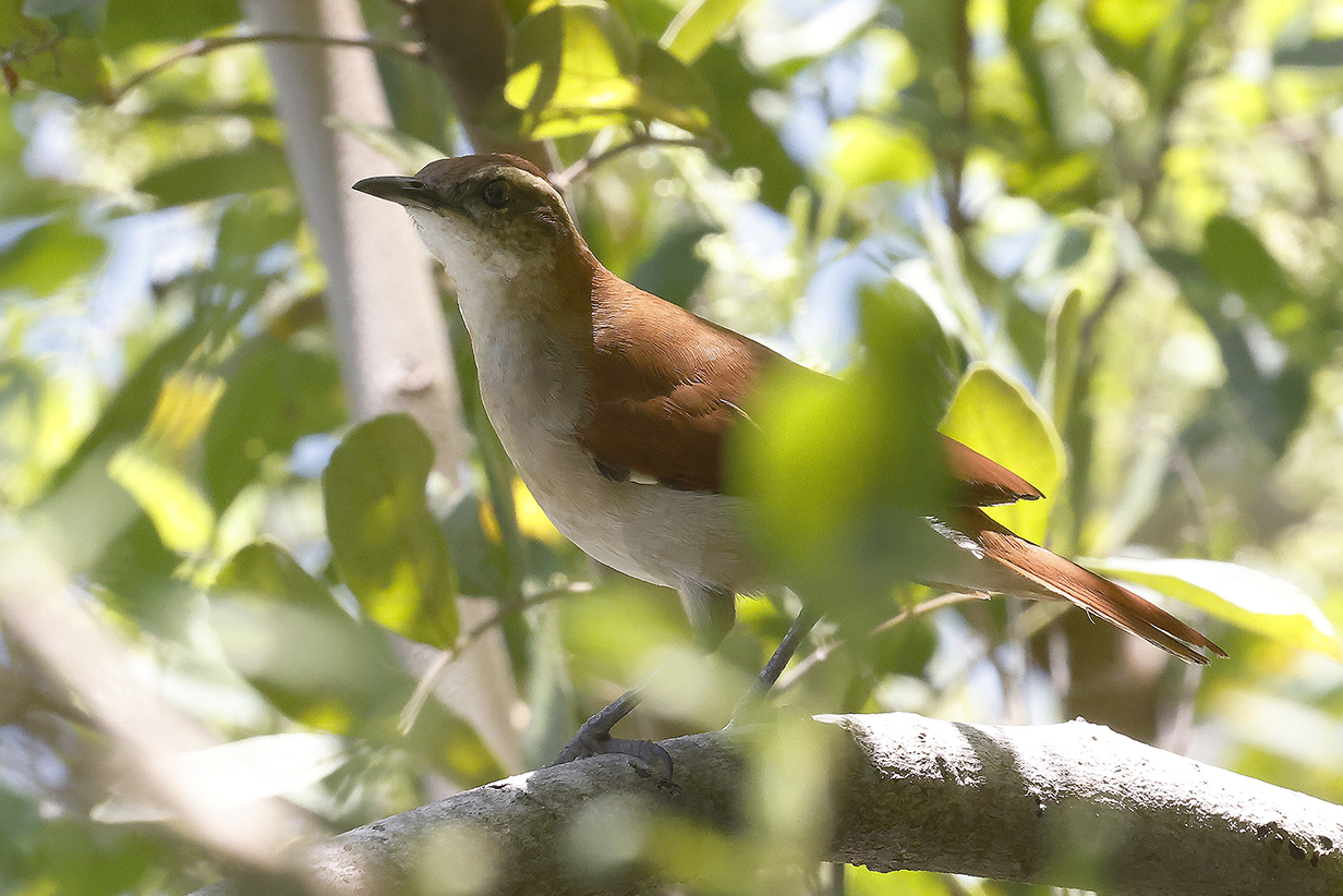
Hangnest tody-tyrant (This is Mary's life bird. It was not new for John.)
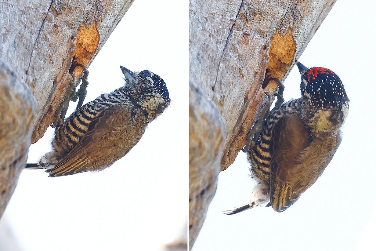
White-barred piculet (Nesting can be a real headache.)
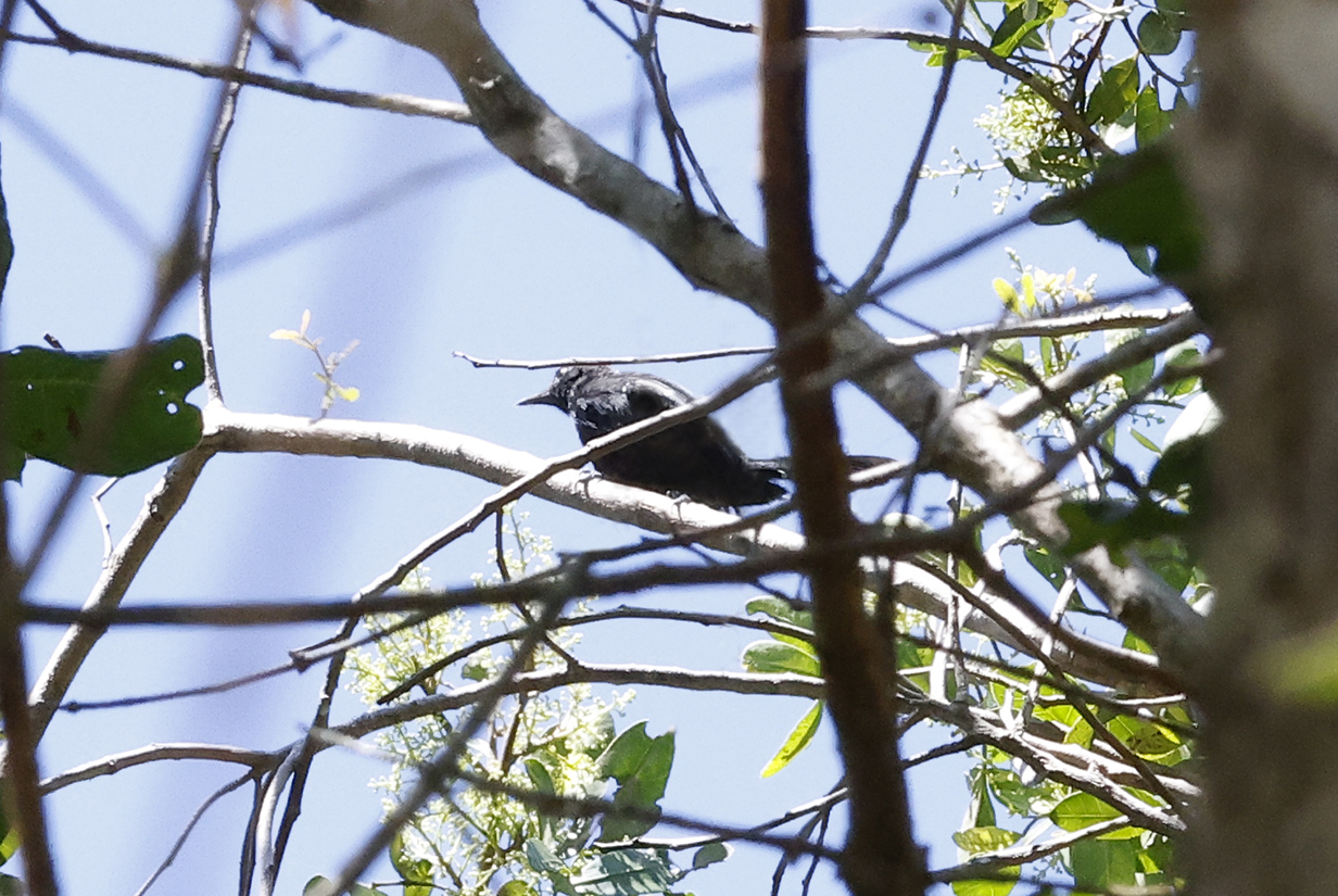
Restinga antwren was the hardest life (or any other) bird of the day. It flits nonstop deep in the bushes, so neither we nor the camera ever got a clear view of the whole bird at once. I managed only this terrible picture of what is, however, an important endemic of this region. The species is threatened, and the world range is hardly bigger then the roughly 180 km from Rio de Janeiro to Buzios. Here in Buzios, it was locally common, and we saw -- however badly and briefly -- several birds and heard more.
Restinga antwren as illustrated in ebird (copyright Luana Bianchini).
The next new bird for John was Brazilian tanager -- a beautiful bright red and black male -- but he did not cooperate for a picture.
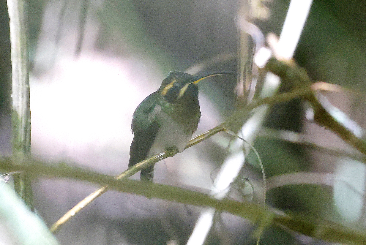
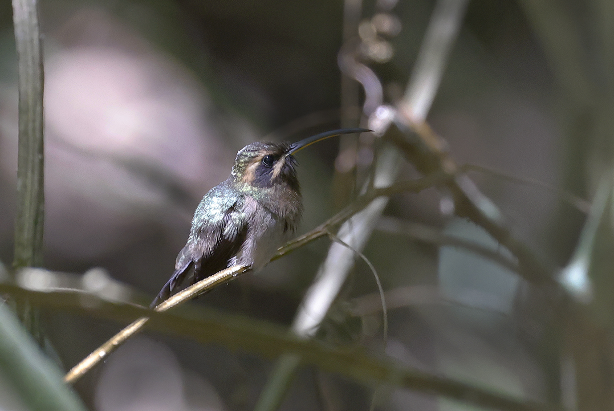
Minute hermit (This is John's life bird. The first picture especially shows the yellow lower bill. Both pictures were taken through a long and not-perfectly-clear tunnel in the foliage -- a lucky view of a co-operatively perched bird.)
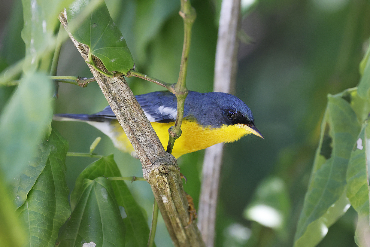
Tropical parula (startlingly gorgeous colors)
Yellow-chinned spinetail (I don't know whether this is a different subspecies from the one that we saw in the Peruvian Amazon near Iquitos, but the yellow chin -- almost invisible there -- is very obvious here.)
Yellow-chinned spinetail
Chestnut-backed antshrike (This is our life bird.)
Wing-banded hornero (This is our life bird.)
Lemon-chested greenlet (This is our life bird. It was very difficult to see or to photograph -- it kept flitting mostly faster than I could follow with camera or binoculars. But the defining features were clear, even in this photo: gray face with white eye and dark pupil, green breast, white belly, and even the red spot under the bill (see below).
Lemon-chested greenlet photo from ebird (copyright Terrry S. Baltimore and photographed in Rio de Janeiro).
Pelagic Birding Between Buzios and Recife
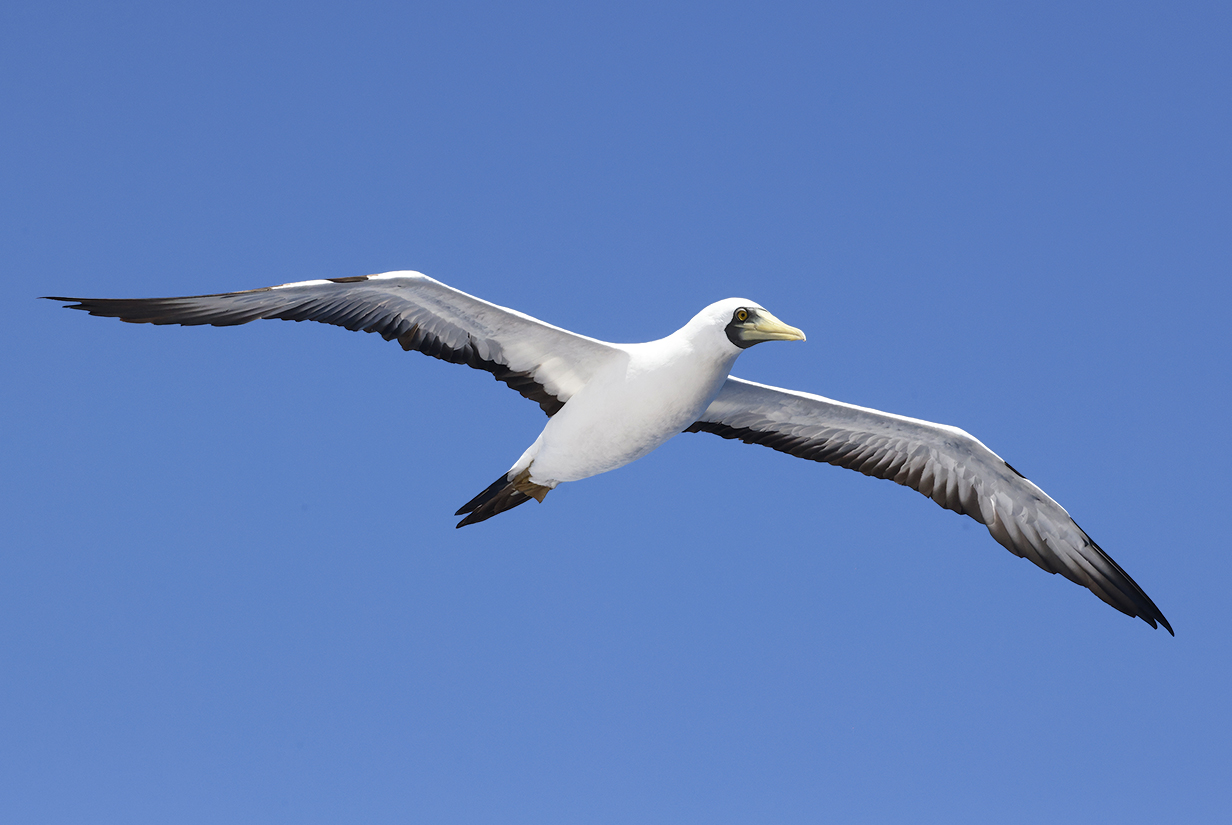
Masked booby (On March 1, 2023, five birds spent the morning "surfing" the winds over our bow. They were our life birds, and this is one of them.)
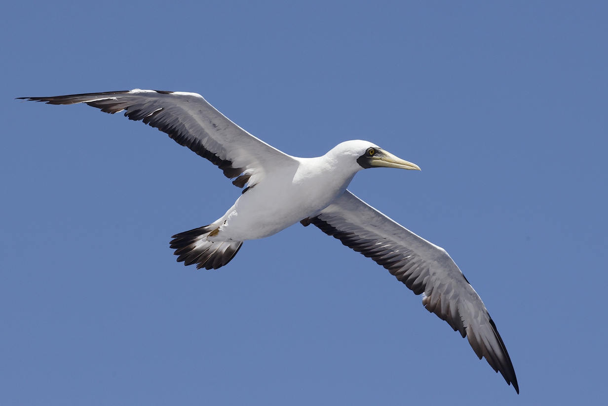
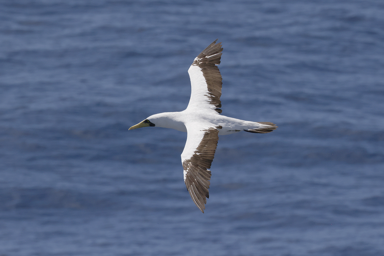
Masked booby
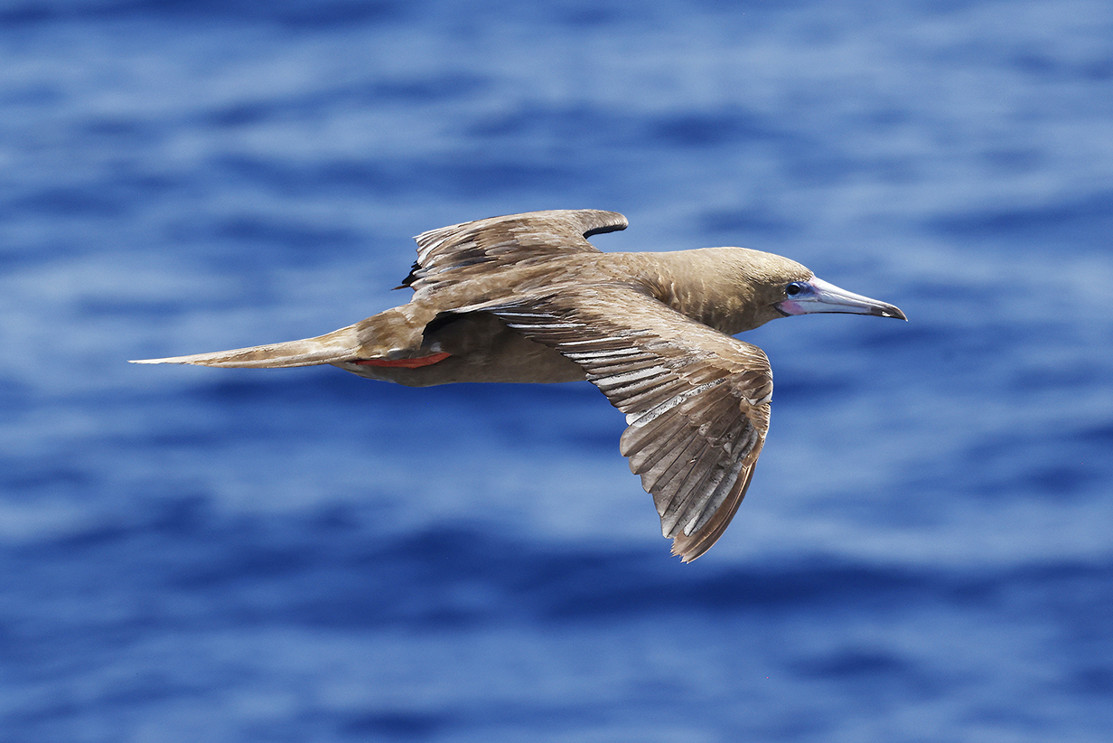
Atlantic Red-footed booby (one bird with the Masked boobies)
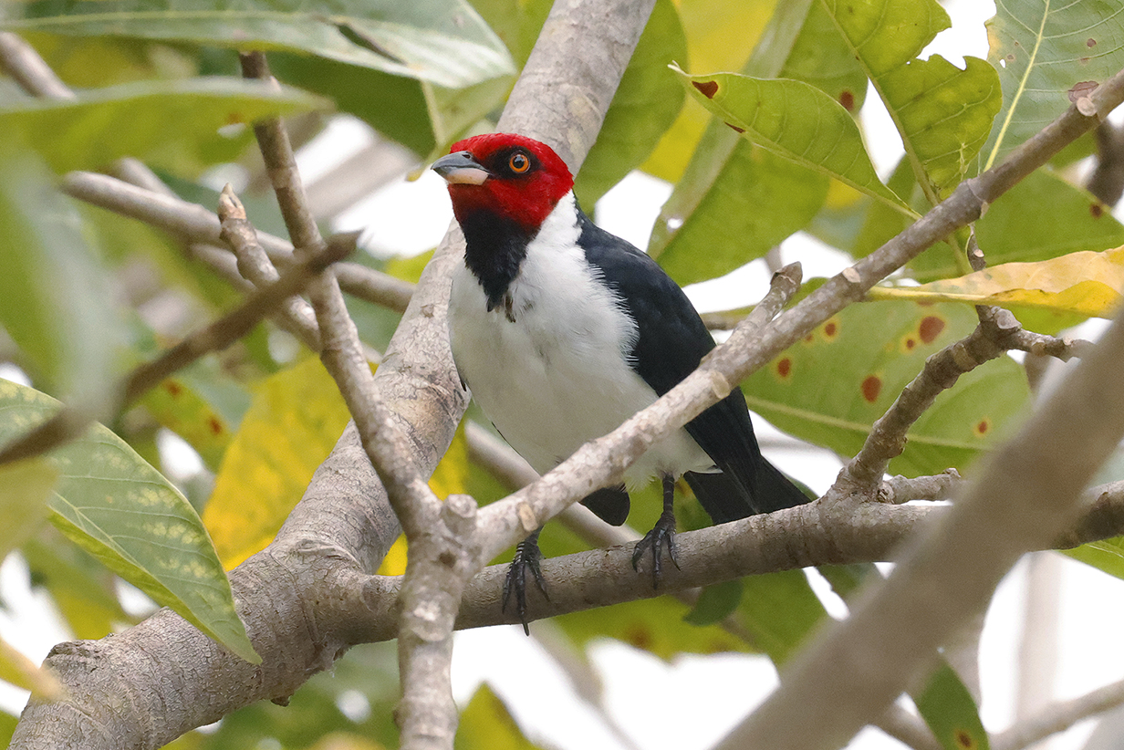
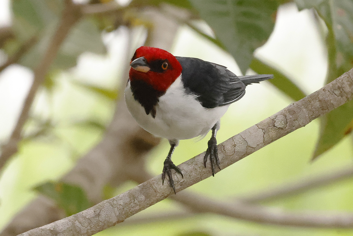
Recife, Brazil
Paraphrasing Wikipedia, Recife is the 4th-biggest urban area in Brazil, with a population of ~ 4 million people. It was founded in 1537 by the Portuguese as the main harbor of the Captaincy of Pernambuco, known for the production of sugar cane. Later, it was the capital Mauritsstad of the 17th-century colony of New Holland established by the Dutch West India Company. Now it is the main port of the state of Pernambuco. It is built on the confluence of many rivers, and we had a catamaran tour of its canals. As the "Brazilian Venice", it was a somewhat disappointing mixture of rundown colonial buildings that needed (and in many cases were getting) renovation and blocks of glass-and-concrete high-rises. Our short tour made one stop that was charming, the shopping center of the Casa da Cultura.
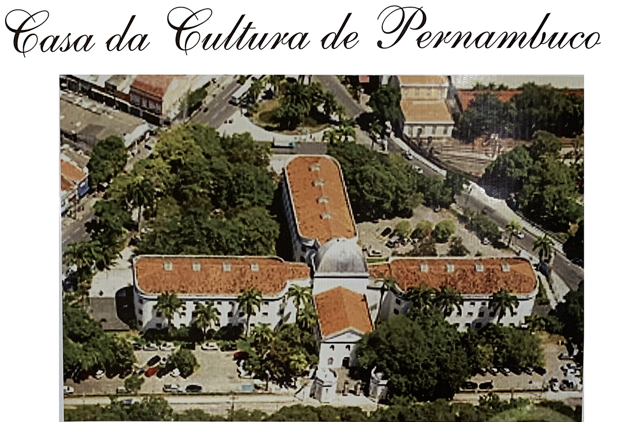
From 1855 to 1973, this building was a prison. Now, the former cells (with one grim exception) have been converted into shops packed with clothing and souvenirs. And crowded with people.
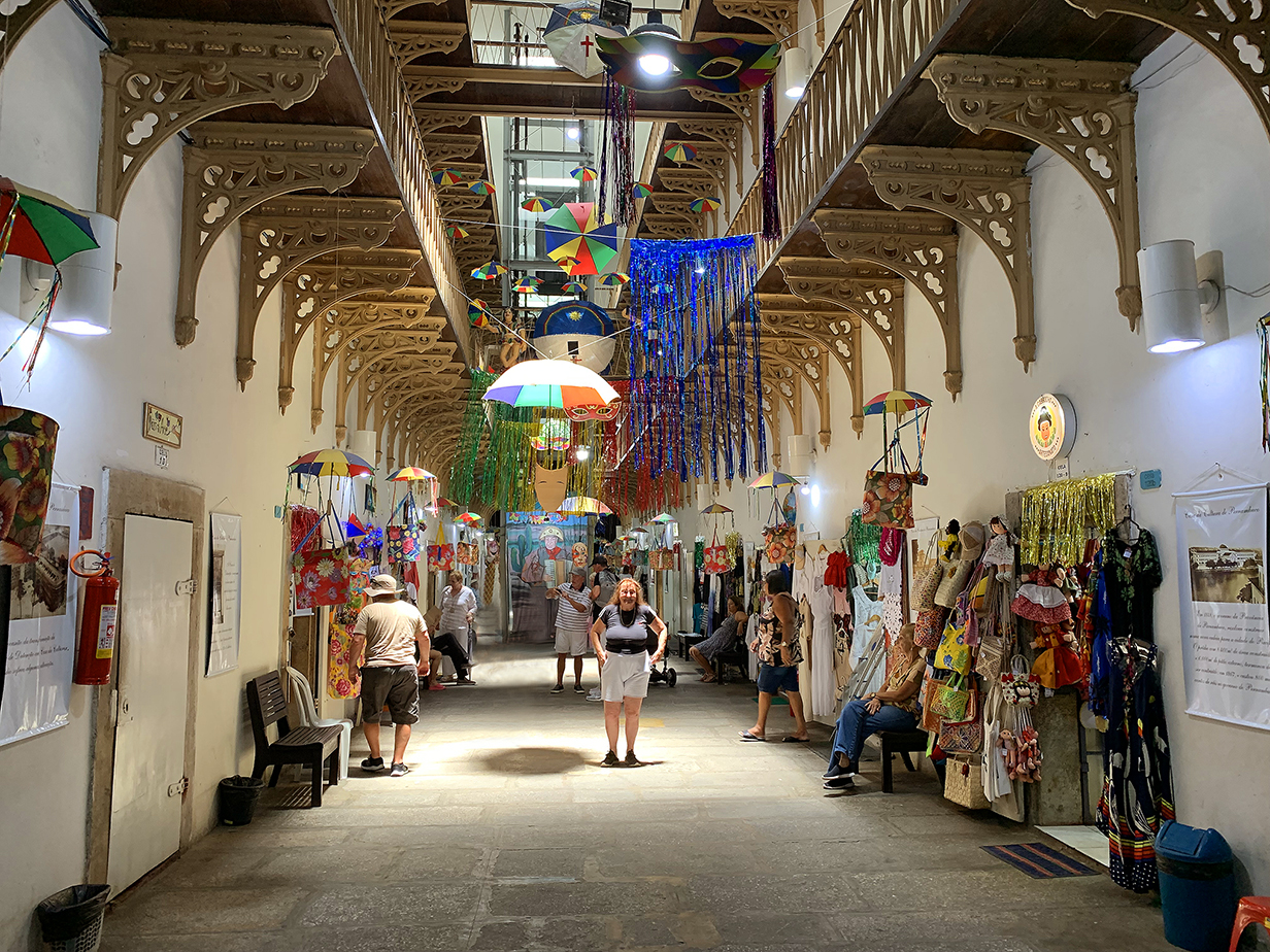

Casa da Cultura souvenir shops
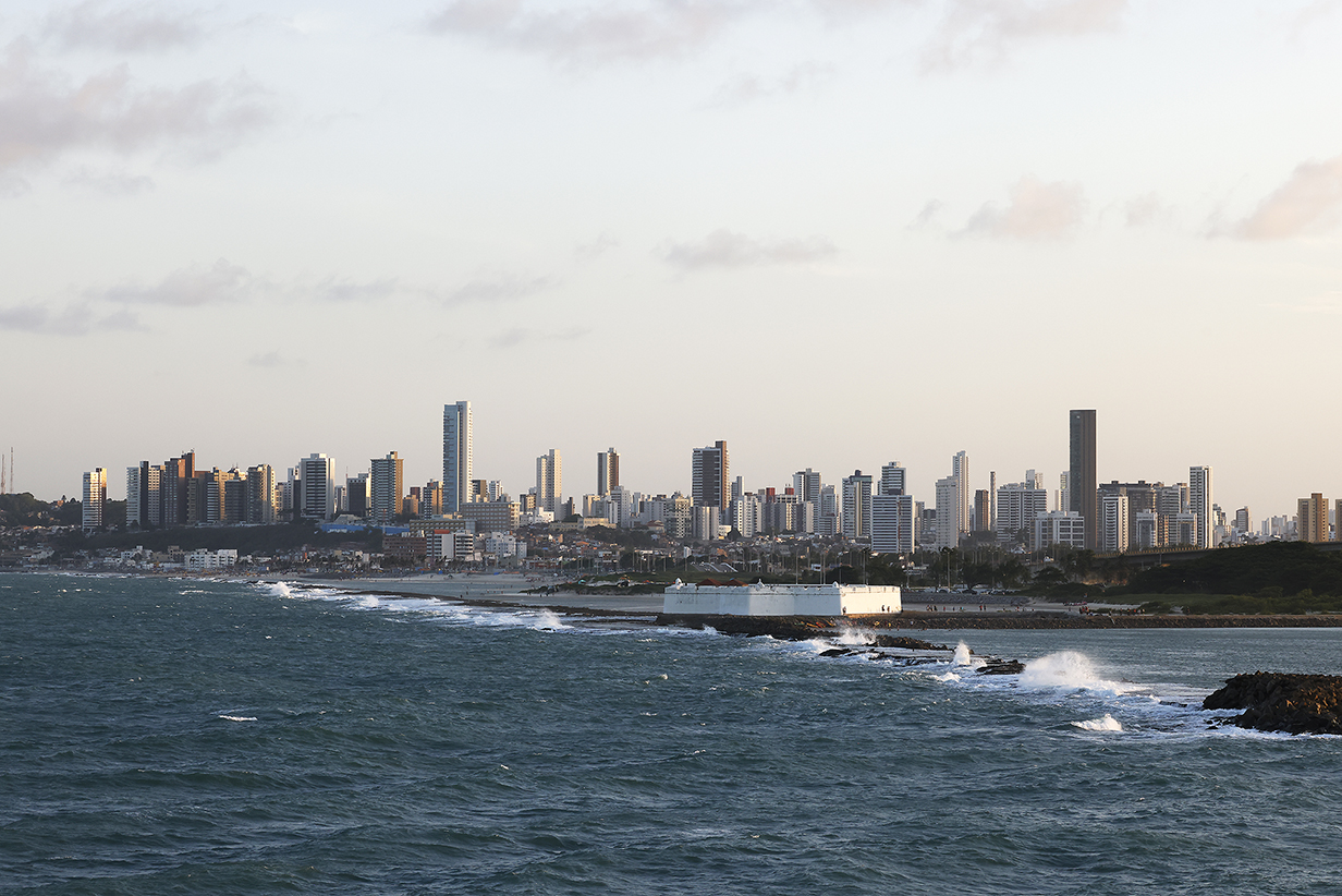
Natal, Brazil
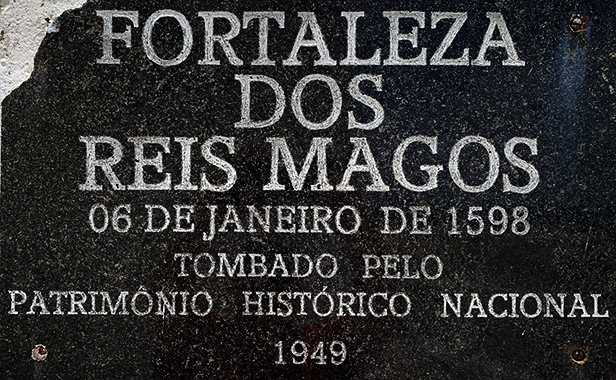
Seabourne Quest's next stop was Natal, the most north-eastern major city in Brazil and the capital of Rio Grande do Norte province. At latitude 5 degrees 47 min S, it is completely tropical. Our weather was hot but otherwise perfect. With a population of almost a million people, Natal has the usual forests of high-rise apartment buildings but is nervertheless very congenial. We visited two tourist attractions, the "largest cashew tree in the world" (so claimed) and the Fort of the Magi-Kings -- the "Forte dos Reis Magos". The Portuguese started construction on January 6, 1598, the Christian feast of the Epiphany. So they named the fort after the Three Wise Men of the Christmas nativity.
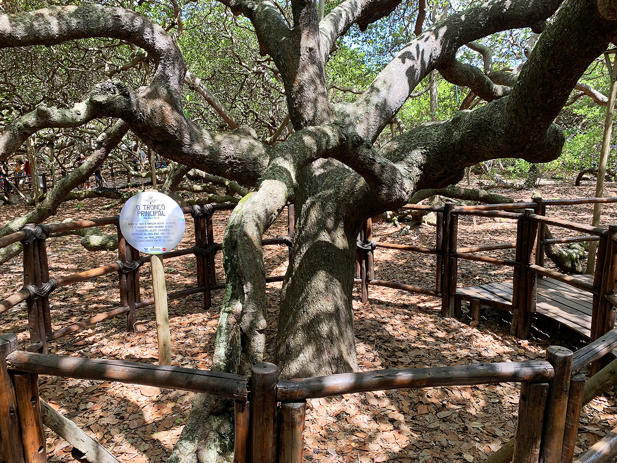
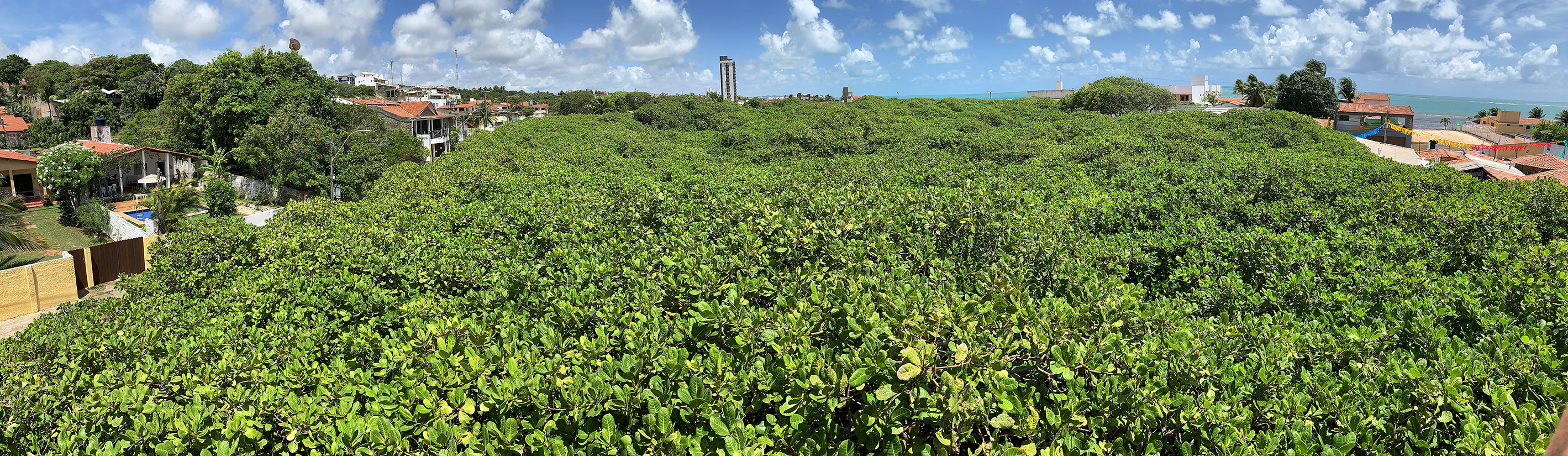
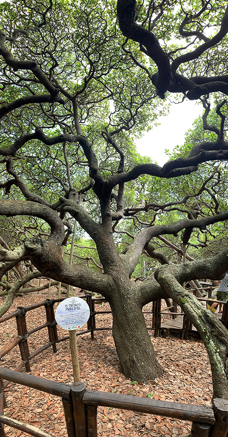
This is the original, main trunk of the cashew tree. It has spread out into a city-block-sized tangle of branches, roots, and subsidiary trunks. When branches bend down to the ground under their own weight, they take root and the tree spreads. It now has an area of about 2 acres and a radius from the main trunk of about 260 feet. It produces > 60,000 fruits each year. According to Wikipedia, "based on its growth characteristics, the tree is estimated to be more than a thousand years old." Its genetic anomaly is not reproduced in its nuts, although Wikipedia mentions at least one other, similar-sized tree in another city.
This panorama that includes the main trunk begins to give you a feel for how remarkable it feels to wander through the maze of trunks and branches.
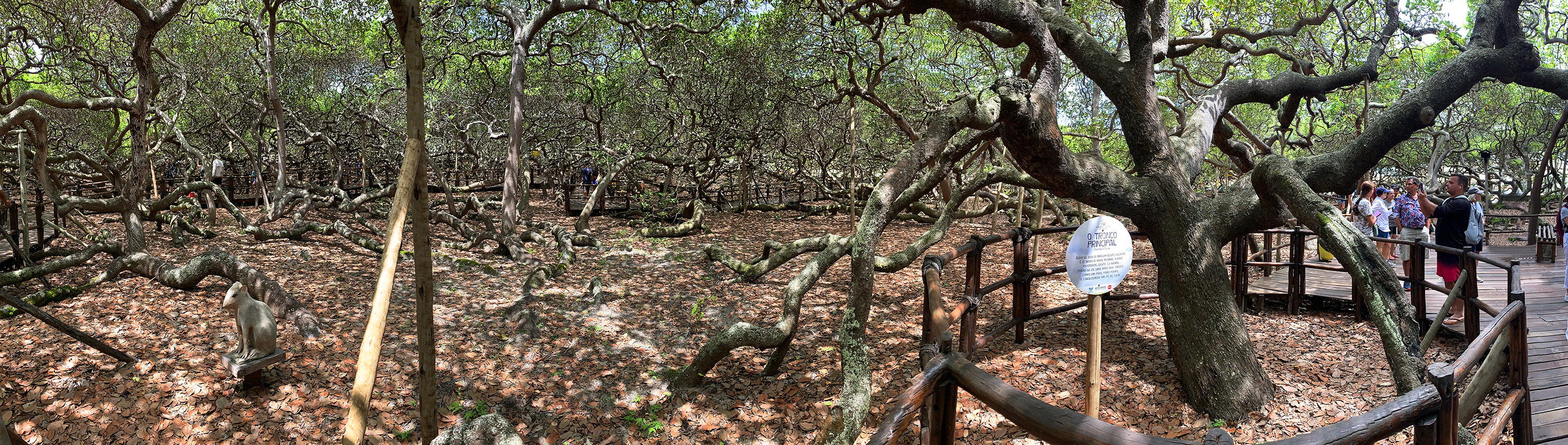
Another panorama of the giant cashew tree (Scroll right to see it all. It is all one tree.)
Vertical panorama from the tangle near the ground into the canopy
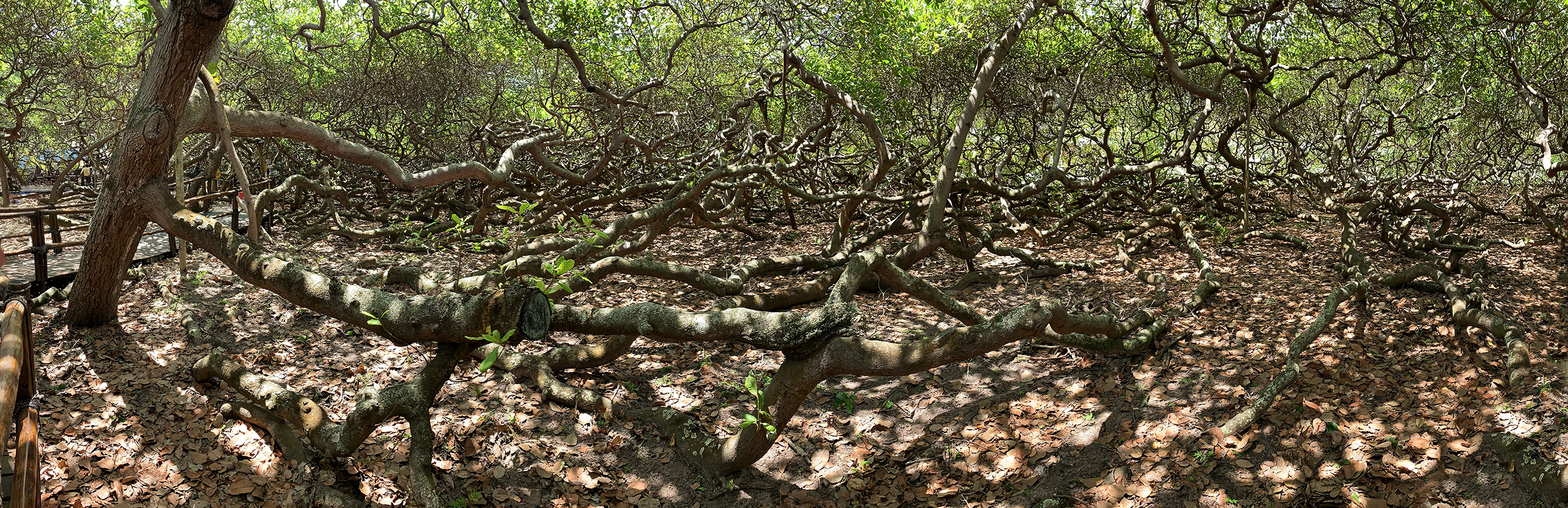
From an elevated viewing platform, this is a panorama of the canopy of the cashew tree. Except in obvious places near the top, this is all one tree, multiply connected, especially underground. And it is trying to spread across the surrounding roads. Efforts are under way to buy those properties and to restore them to a state that would allow the tree to grow further. A lot of souvenir stands would have to be eliminated first!
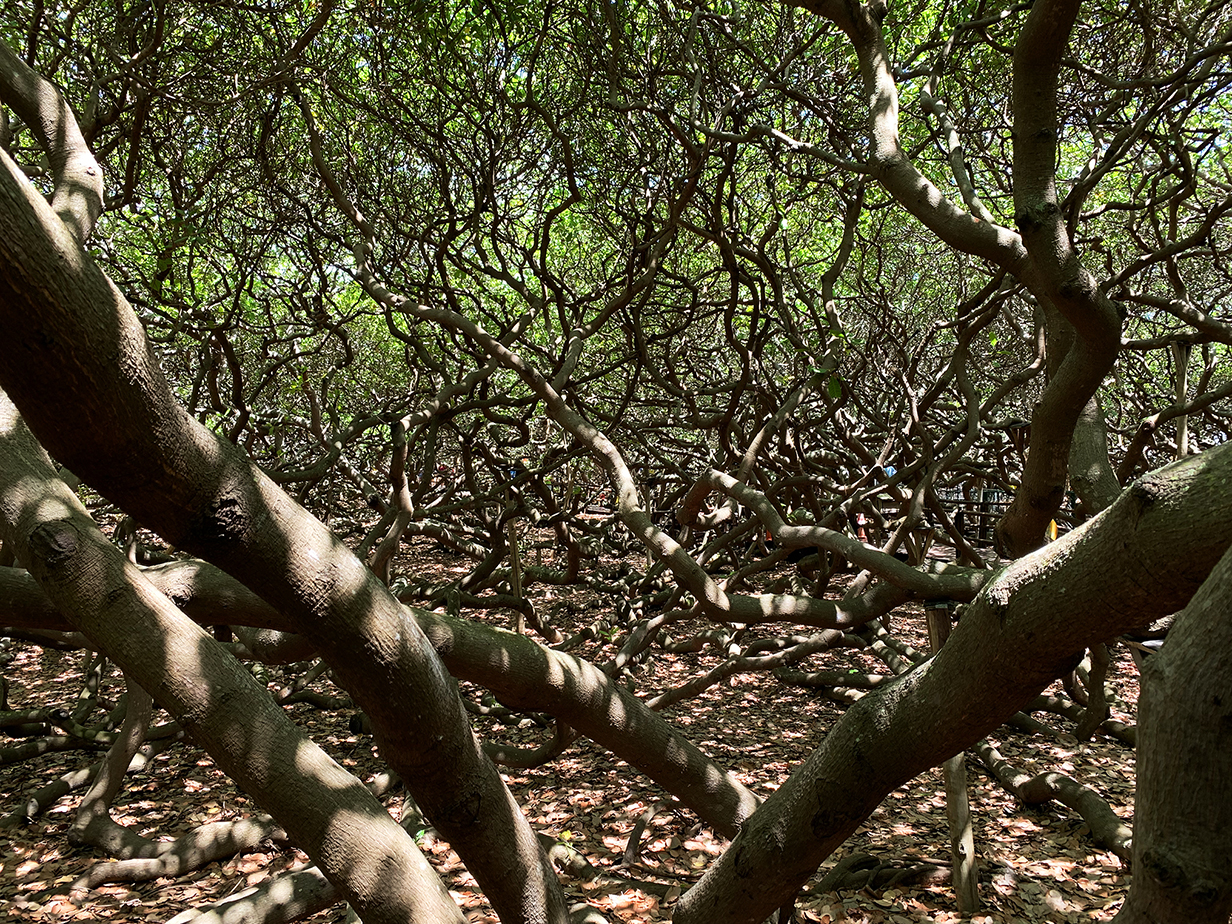
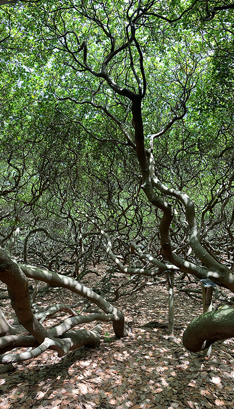
Spectacular tangle
One more vertical pano of the main trunk of the cashew tree
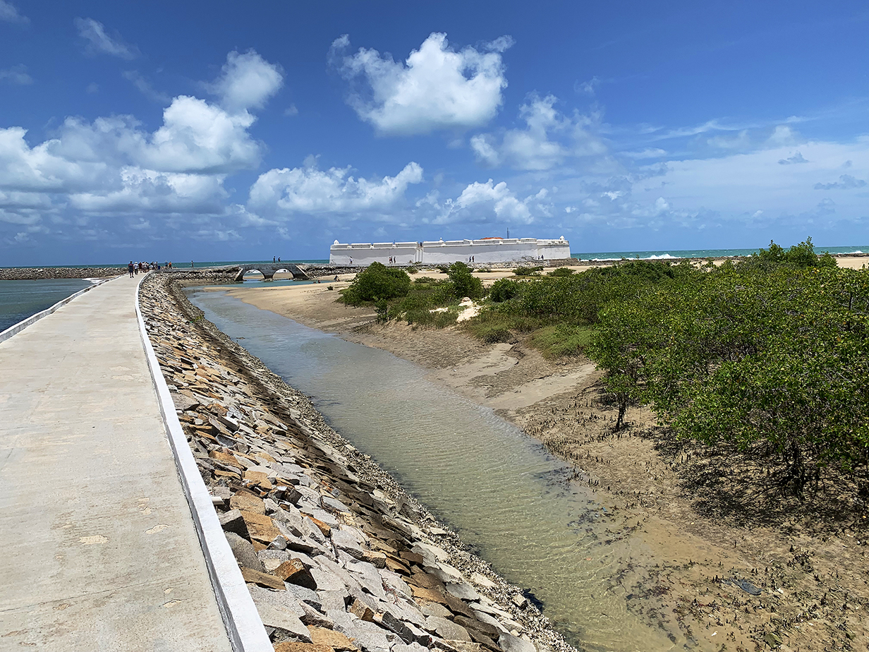
Star-shaped Forte dos Reis Magos from the approach causeway. Natal ("Nativity" or "Christmas" in Portuguese) was founded on December 25, 1599, giving the village the name associated with the fort. The fort and city were occupied by Dutch forces from 1633 to 1654, but, like the rest of Brazil, are mostly associated with Portugal.
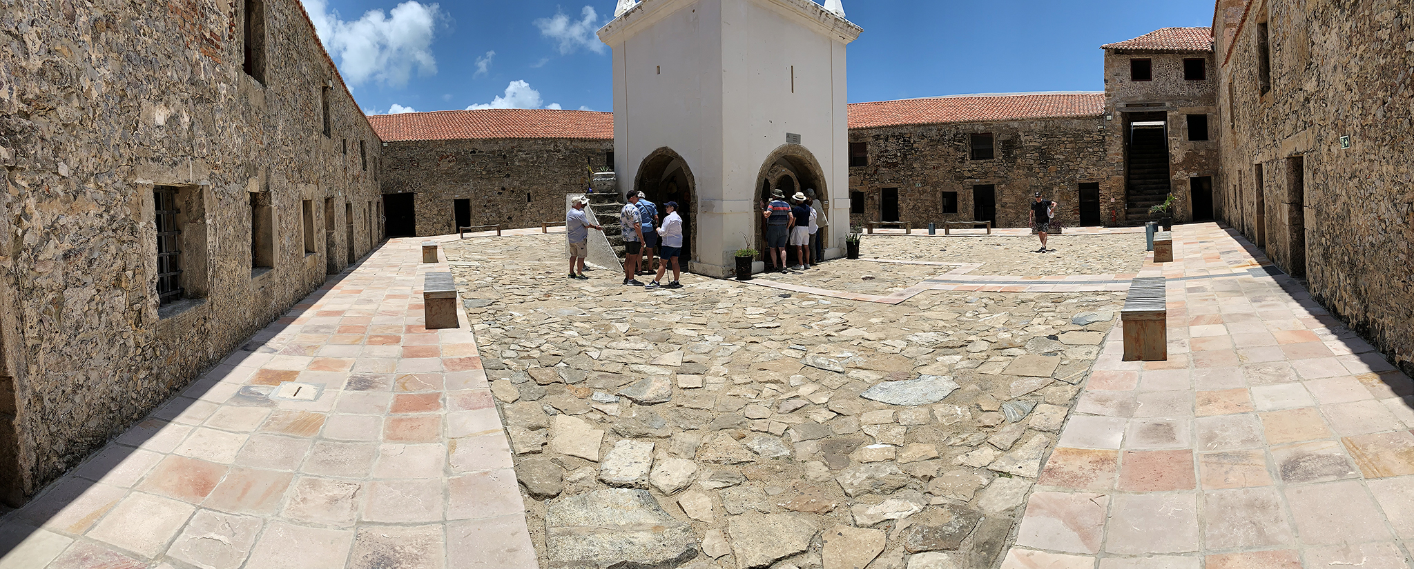
Panorama of the central courtyard of the fort. Offices and utilities occupy rooms around the outer walls. People in this picture and the last one give some sense of scale. The walls are robust, but no natural resources are connected with the fort, and I would not like to imagine the job of holding out for very long against a siege.
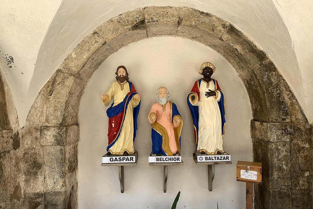
The fort is named after the "Magi Kings" of the nativity.
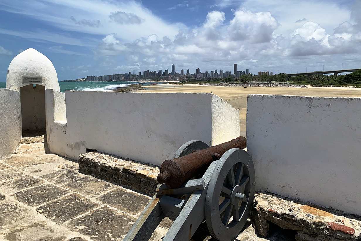
Canon and the modern city of Natal. As I said: lacking infrastructure support, I would not like to defend this fort, not even with canons and not even against 16th- or 17th-century adversaries.
Gray-breasted martin sitting on and flying against the battlements of the fort. I am not sure of the ID: if I am wrong, please email me.
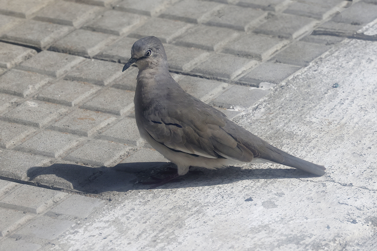
Picui ground-dove (on the streets of Natal, photographed through the window of our bus)
As we sail away from Natal, one more stark contrast: the 16-th century fort and the 21st-century city
Amazon River, Brazil
One of the most important features that persuaded us to take this Seabourn cruise is that it sailed up the Amazon river to Manaus and back to the Atlantic, with many stops on the way. We birded the upper stretches of the Amazon (or its main tributaries) in Ecuador at Sacha Lodge near the Rio Napo in 2017 and especially in 2021 and in Peru in a cruise out of Iquitos in 2022. And we birded the (somewhat meager but very important) remnant forest south of Belem in 2008 (no pictures are posted). But we had never visited or birded the center of the Amazon basin. The Seabourn cruise spent less time there than we might have hoped, and it was not well set up for birding, but it was an good start on a very important region. Here's where we made landings:
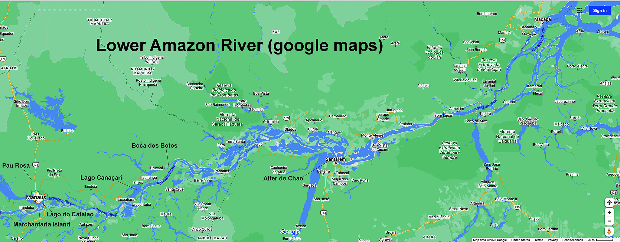
Google maps map of the lower Amazon River (scroll right to see the full panorama to the delta at the Atlantic Ocean). Our first two landings were a not-very-effective small boat tributary cruise out of Santarem and a zodiac ride to a small lake somewhat upriver from Santarem. We then had parts of 2 days out of Manaus: there, we had an excellent guide and did very well until heavy rain clobbered the second day at 8 AM. Heading back downstream, we had a zodiac ride at Boca dos Botos and a shore excursion at Alter do Chao. In both places, John birded essentially by himself, without a guide. Boca dos Botos yielded one life bird, and both places yielded a few good pictures. These stops are covered in more detail in the sections that follow.
Santarem, Brazil
Smooth-billed ani
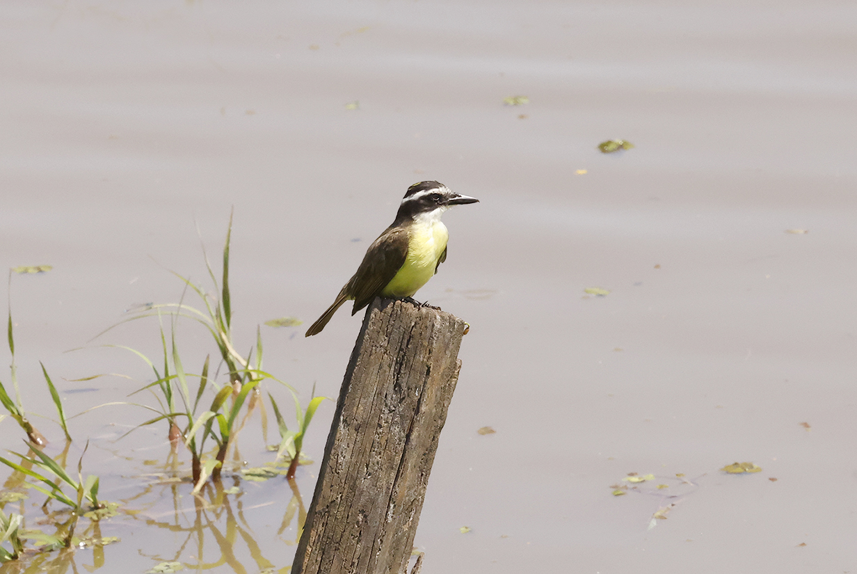
Lesser kiskadee
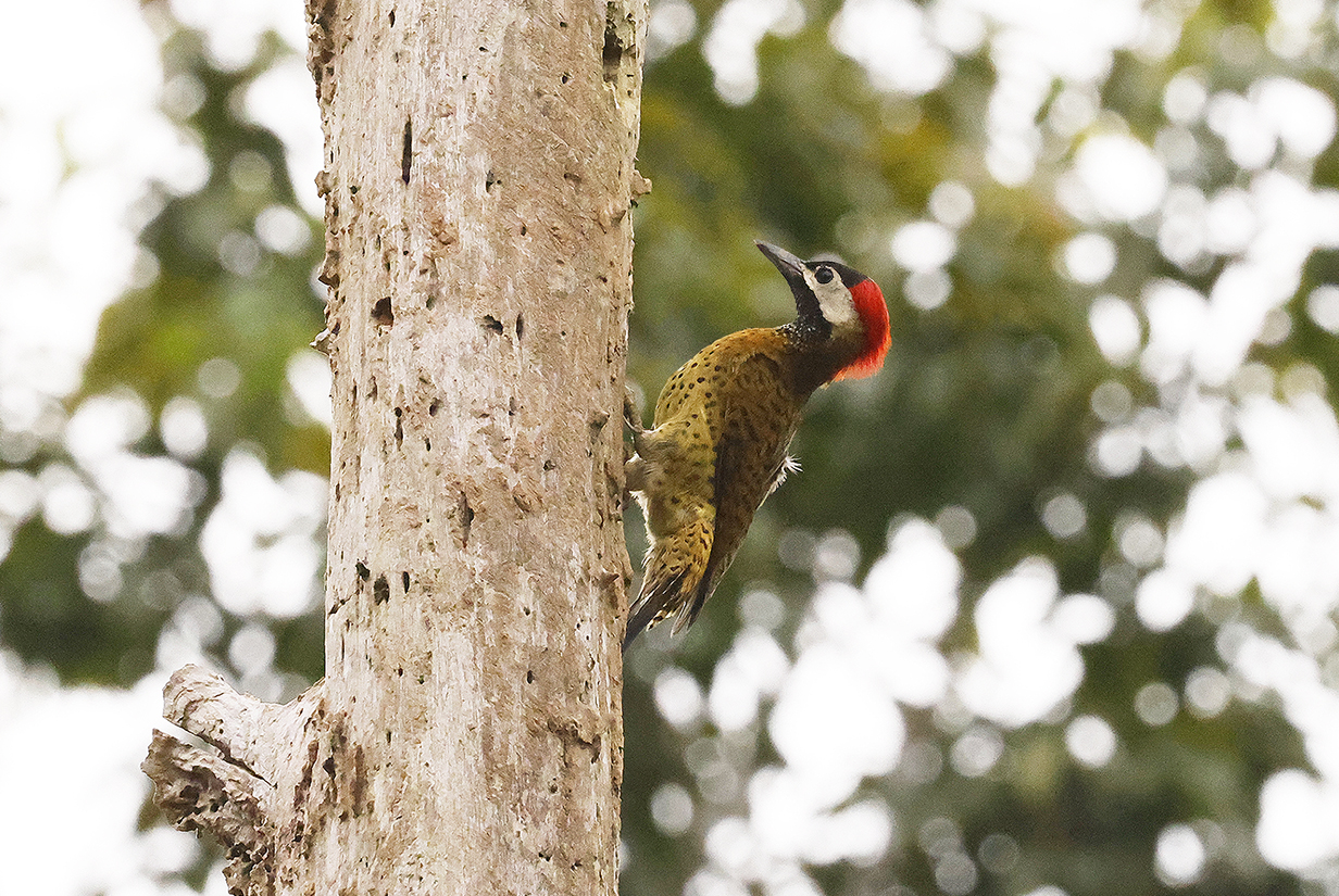
Great black hawk (Note the 2 white bands in the tail.)
Lago Canacari, Brazil
On the evening of March 10, 2023, we made a brief stop at Lago Canacari (see map, above). John took the zodiac excurison, which was picturesque but which yielded no interesting birds. We did see river dolphins, and they are what interested the zodiac driver and passengers.
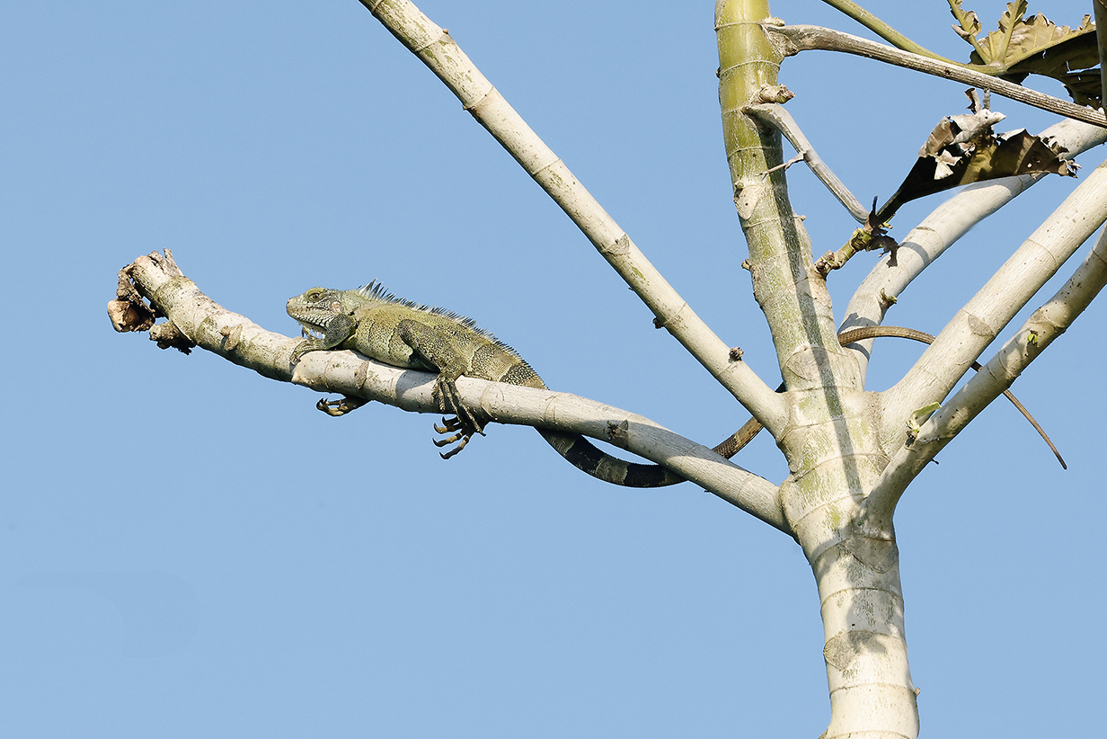
Iguana
Manaus, Brazil
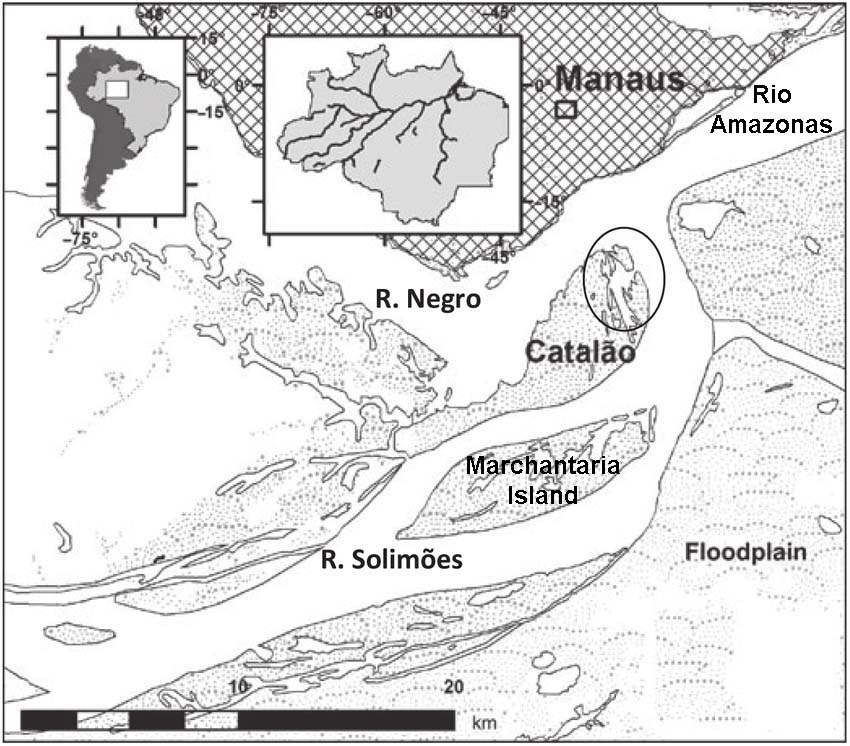
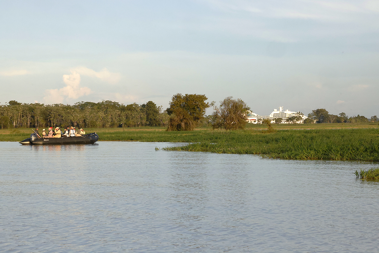
Our guide in Manaus was a professional ornithologist, Ms. Priscilla Diniz (jdinizpriscilla@gmail.com). Thanks to her, John got 12 life birds -- 5 of those came in the 1 hour that we had on day 2 before torrential rain clobbered us at 8 AM. Mary got 7 life birds. We spent the first day on an extended boat tour of the local Varzea habitats; i. e., places that are flooded during the rainy season. Our time there was about 1/2 way into the flood season, so we spent quite a lot of time on waterways that google maps calls "dry land". This included Marchantaria Island and Lago do Catalao. The latter is at 3 deg 10 min 4 sec S latitude and 59 deg 54 min 45 sec W longitude. The above map can be found online by googling Lago do Catalao.
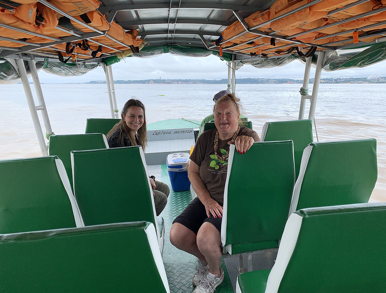
Meeting of the brown waters of the Rio Solimoes and the black waters of the Rio Negro to form what Brazilians call the Rio Amazonas. This also shows the boat in which we spent our first day in Manaus, March 11th, 2023, plus Mary and our guide, Priscilla Diniz. In the background is part of Manaus. Here, the color tables are normal.
Meeting of the waters 2: Here, I have increased the color saturation so that you can see the not-yet-mixed brown and black waters better. One advantage of birding in black-water areas is that there are few mosquitoes: the acidic black water is not conducive to the larval stage of mosquitoes. Also rather different from folklore about the Amazon is the temperature, which here is mid-80s degrees F and, except for the humidity, not especially uncomfortable.
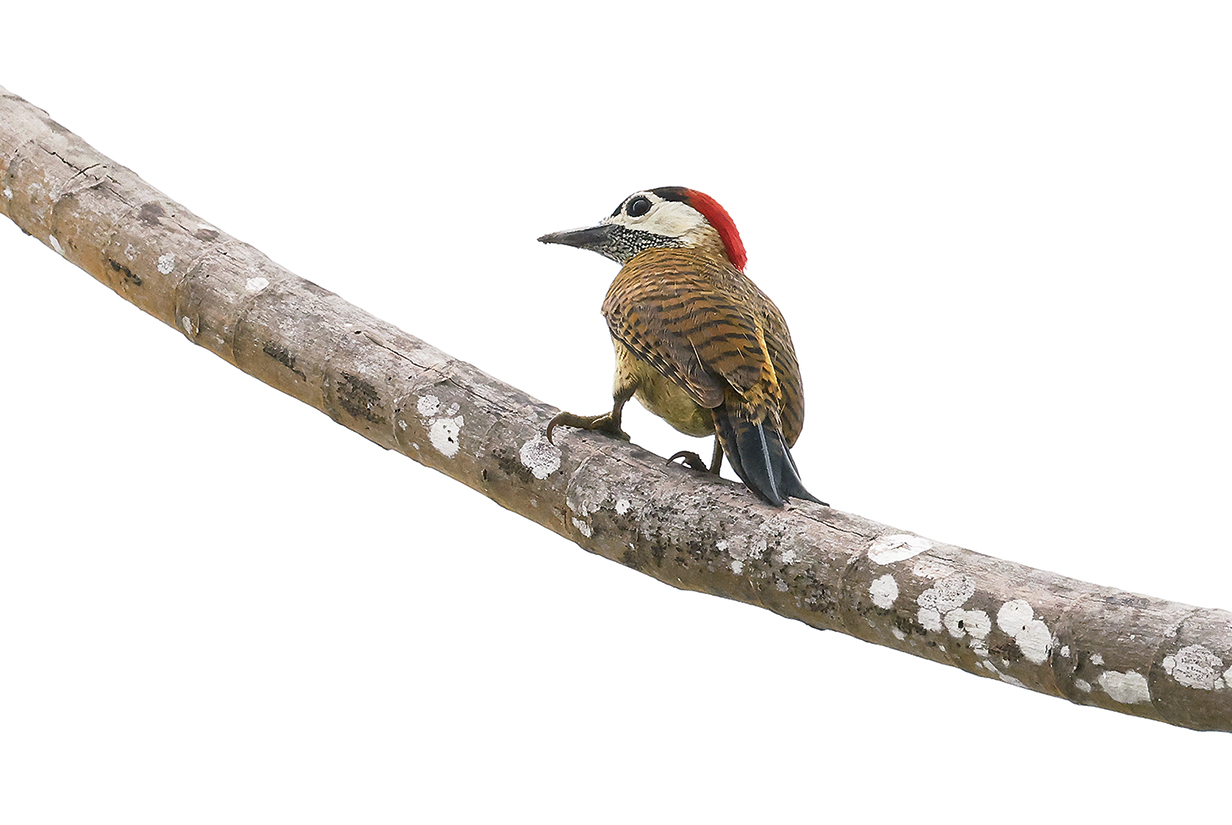
Spot-breasted woodpecker (female) (There is a better picture below, taken at Boco dos Botos.)
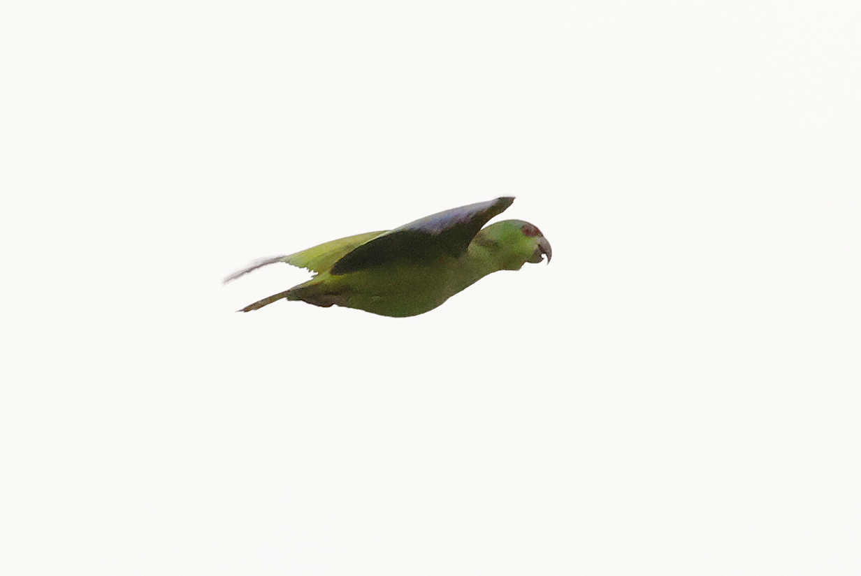
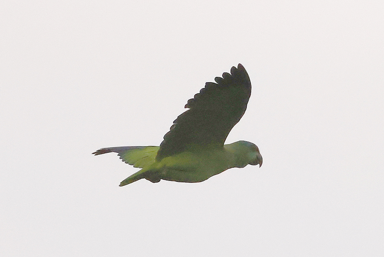
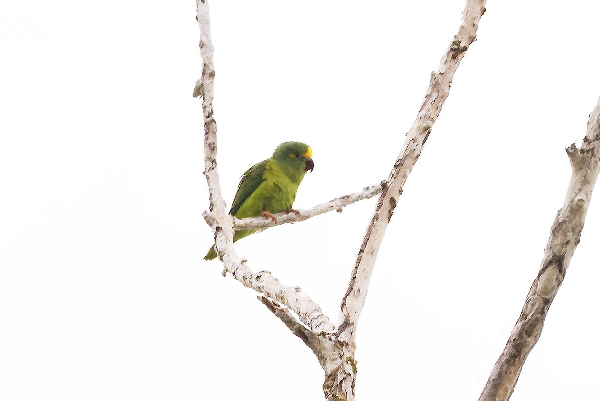
Riparian parrotlet (This is our life bird.)
Bluish-gray saltator
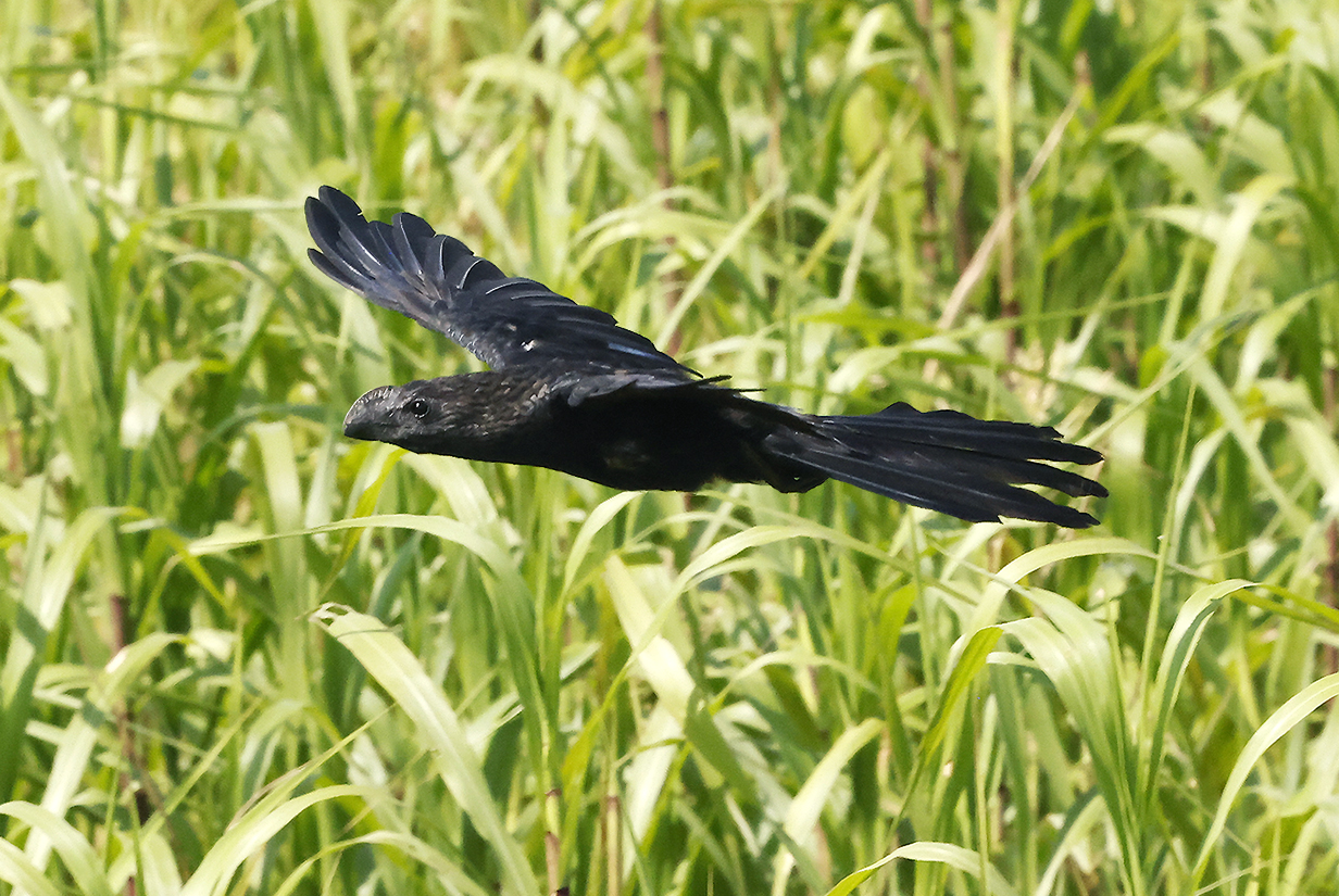
Greater ani
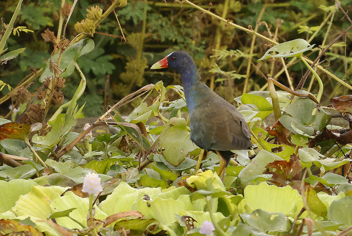
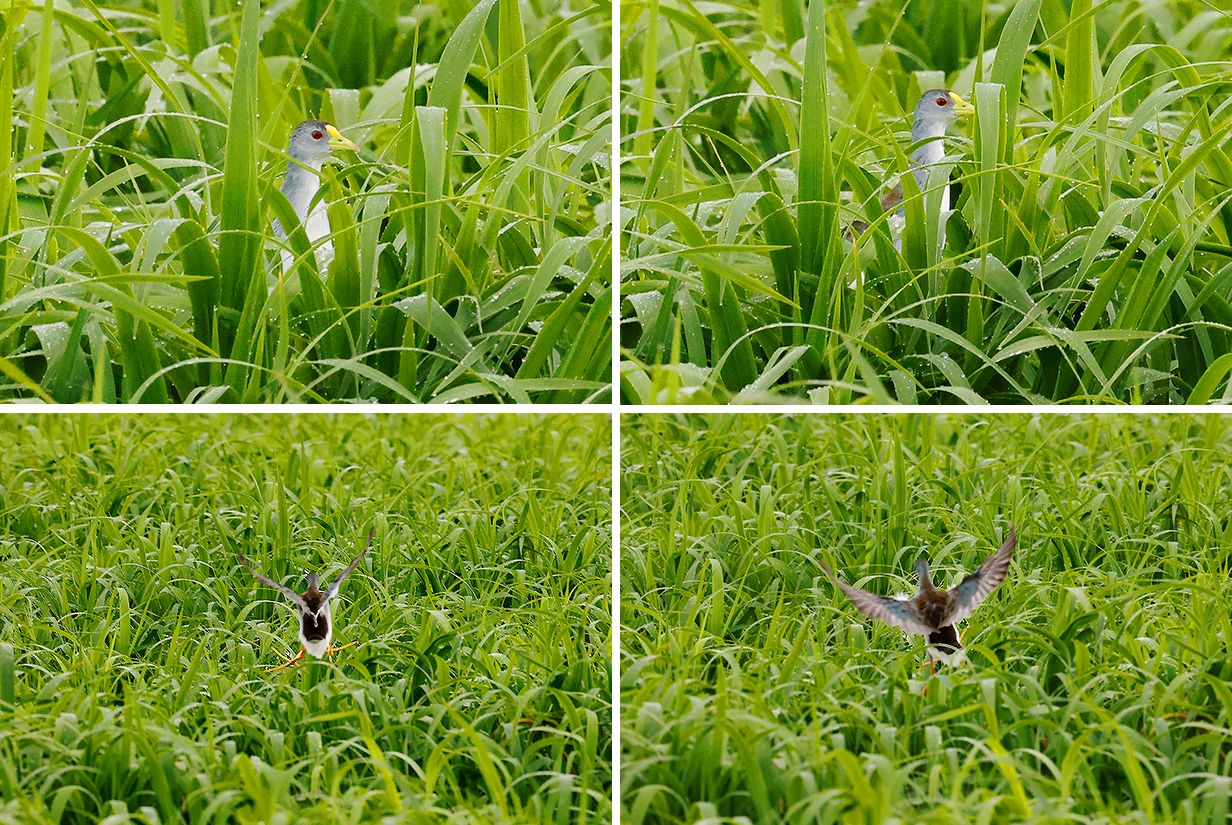
Purple gallinule
Lesser hornero
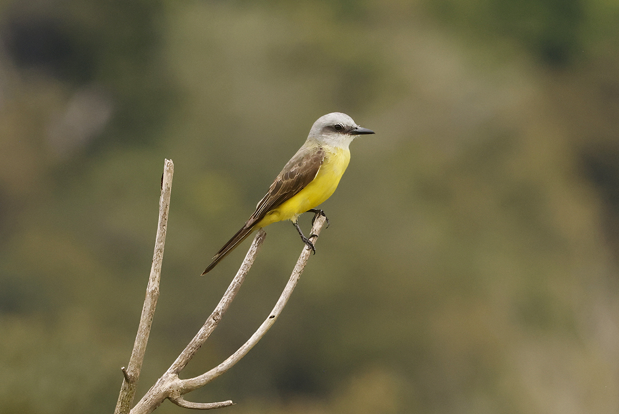
White-throated kingbird (This was our next life bird, but the bird shown here was seen a little later in the afternoon.)
Riverside tyrant (This is our life bird.)
Yellow-chinned spinetail
Parker's spinetail is a much-wanted iconic bird of Varzea islands. We first saw it near Iquitos in Peru but got much better looks on Marchantaria Island.
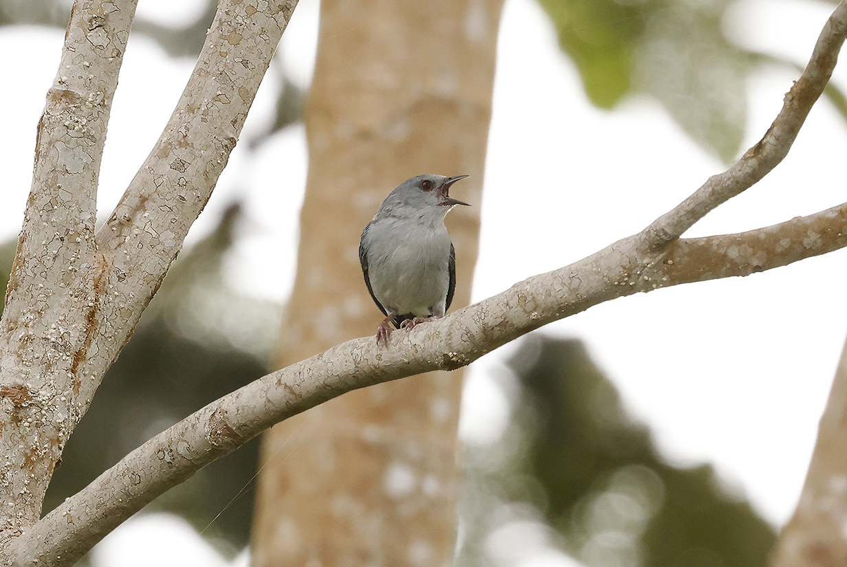
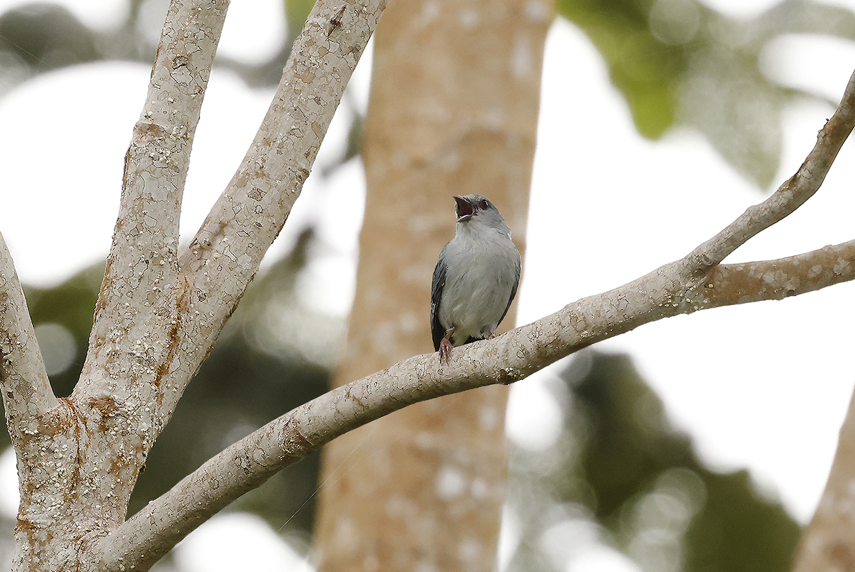
Pearly-breasted conebill (This is our life bird. It is not just a river island specialist (here on Marchantaria Island); it is also a Cecropia specialist, strongly preferring middle-aged trees. It took patient searching, but Priscilla finally found one at the third location that she tried. Once found, it was not subtle.)
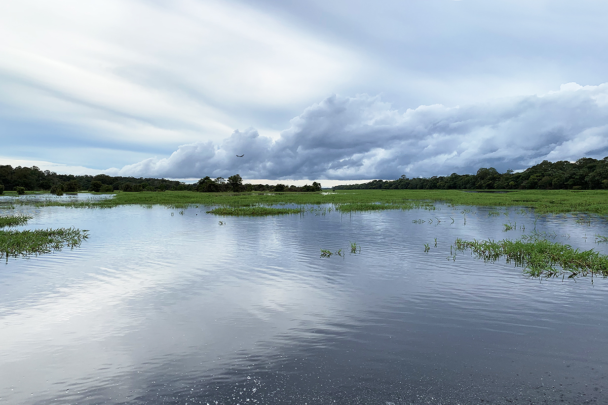
Lago do Catalao and vulture (Clouds threatened for much of the day, but we had only a brief shower that forced us to drape the boat with protective plastic and wait. Note that we are well into flood season: in the dry season, much of this view would be dry land. This is close to where we got Azure gallinule and Festive parrot.)
Azure gallinule (This is our life bird: very, very shy. Top: Keeping a wary eye on approaching danger? Bottom: YIKES -- I'm not staying around to find out!
Festive parrot (This is our life bird: our most convincing look was a flyby.)
Festive parrot
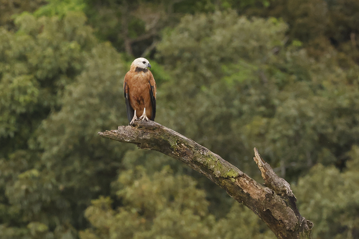
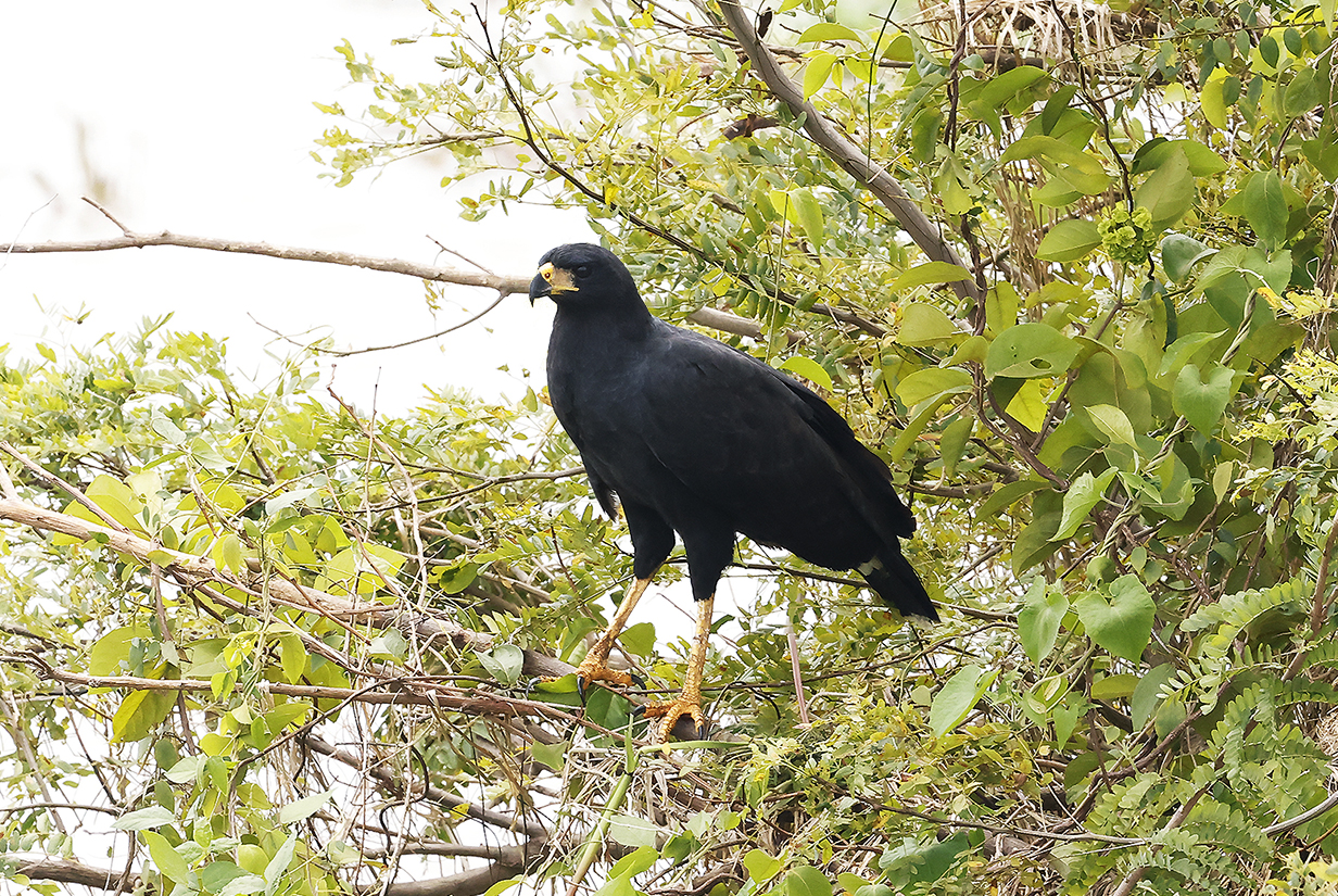
Black-collared hawk
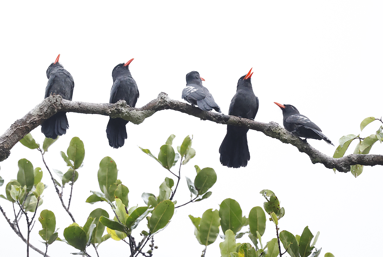
Black nunbirds (These are our life birds -- the first ones on March 12, 2023 at Pau Rosa, about 35 km north of Manaus and slightly west of Brazil highway 174. This was at about 7 AM. An hour later, torrential rains clobbered the rest of the day.)
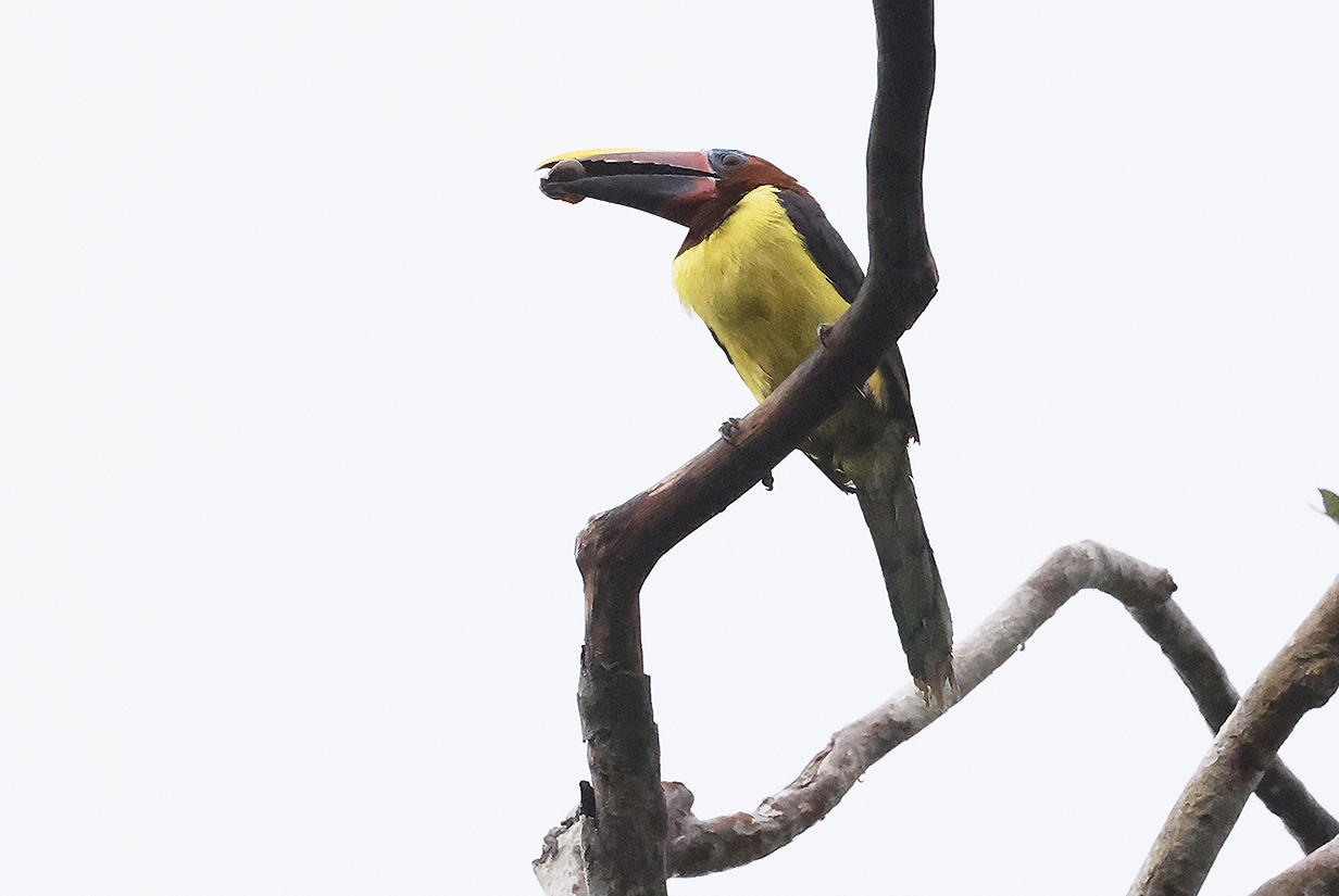
Green aracari (This female is our life bird.)
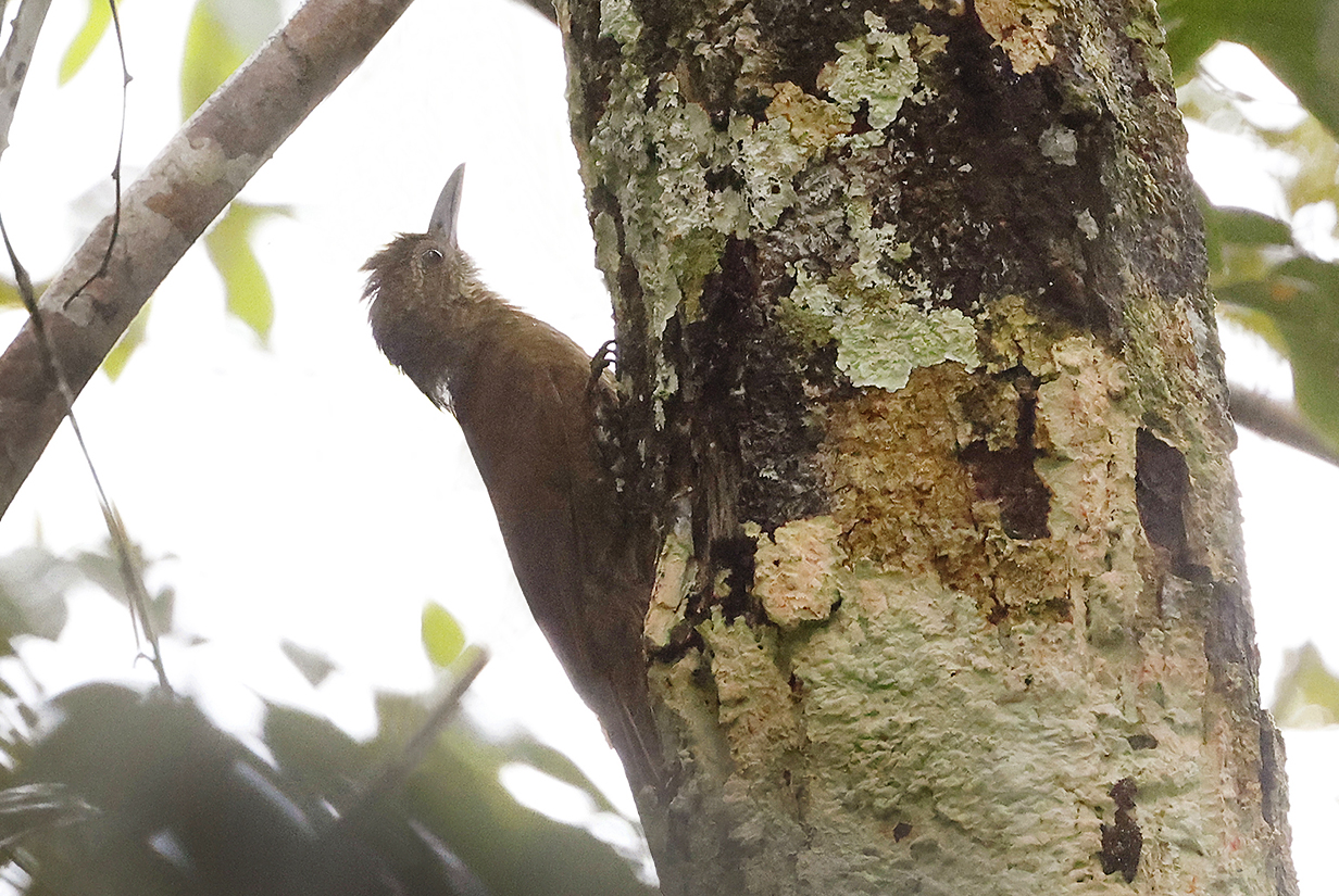
Amazon barred woodcreeper (This is John's life bird, confidently identified by guide Priscilla Diniz based on call, size, behavior, and morphology.)
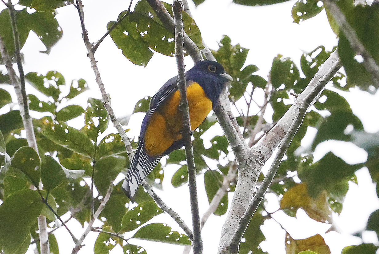
Guyanan trogon (This male is John's life bird.)
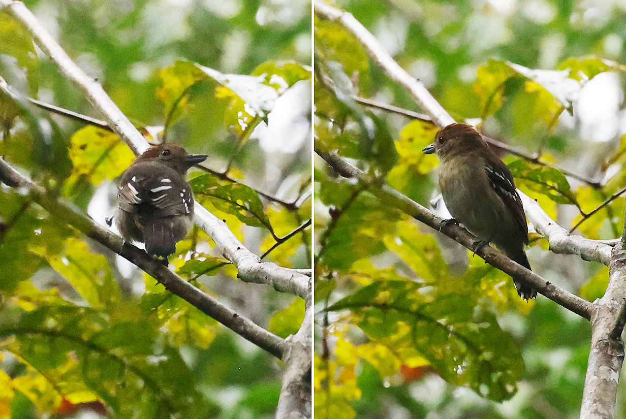
Northern slaty-antshrike (This female is John's life bird.)
A few minutes later, at 8 AM, rain started and gradually turned torrential. We "bailed out" at about 9:30 AM and had some difficulty getting through already-flooded roads to the Manaus harbour, from which we took a tender back to Seabourn Quest. The rain turned vicious, unfortunately doing a lot of damage and costing lives. We need to come back -- our successes in just an hour, this morning, emphasize how much species richness there is here to explore.
Boca Dos Botos, Brazil
On March 13, 2023 -- the day after our rainy time in Manaus -- John had a zodiac cruise in Boca Dos Botos, downriver from Manaus. The zodiac driver was not "into birds", so these are the birds that John managed to get by himself.
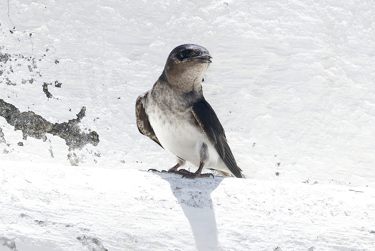
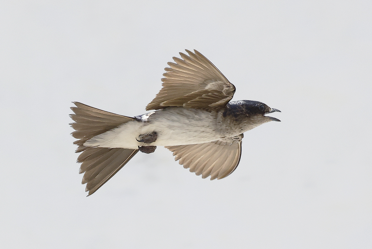
White-winged swallow
Cinereous becard (This female is John's life bird.)
Tui parakeet (This is the subspecies of the lower Amazon, Brotogeris sanctithomae takatsukasae, with yellow spot behind the eye. Note that this bird does not have a white iris, which is different from almost all pictures posted on the internet. I did find one picture of a bird with yellow spot behind the eye and a dark eye. I do not know whether this differentiates an additional race or subspecies.)
Spot-breasted woodpecker
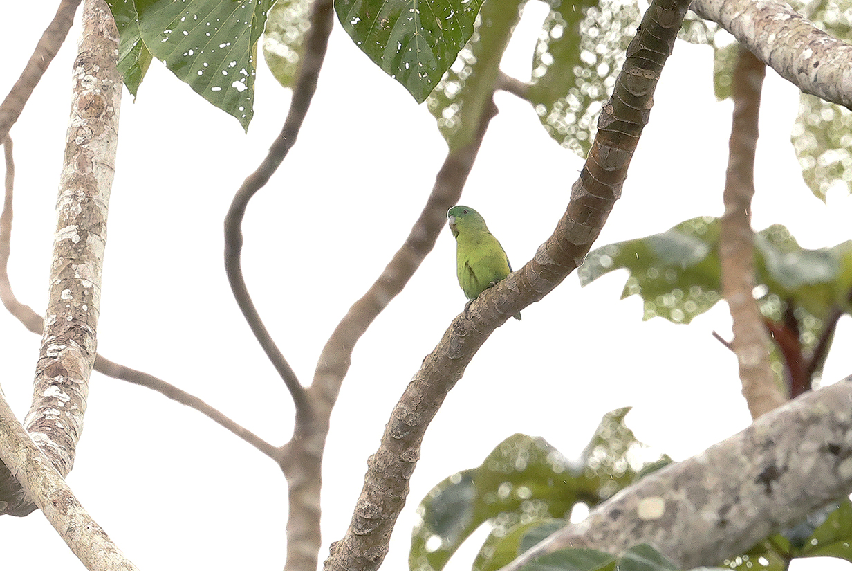
Green-rumped parrotlet (Not a good picture ... but a great bird, far away: just a speck sitting on a wire until you take a picture and get a nice surprise. Please email me [kormendy at astro dot as dot utexas dot edu] if the ID is wrong.)
Alter Do Chao, Brazil
Our final stop along the Amazon was at a sand beach and tourist town very near Santarem (see the map earlier in this web site). John walked along the beach on both sides of the tender landing site as far as possible before the sand and walkway disappeared under the rising river. This yielded no new birds, but it did provide opportunities to photograph previously-seen birds up close, because they were very used to people.)
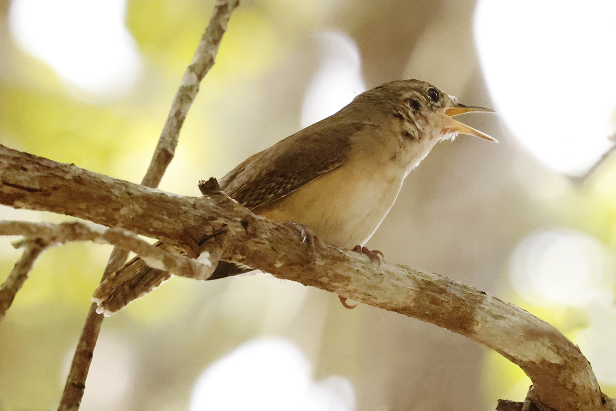
Buff-breasted wren (I think. Please email me if I am wrong.)
Spotted tody-flycatcher (Very cute)
Red-capped cardinal
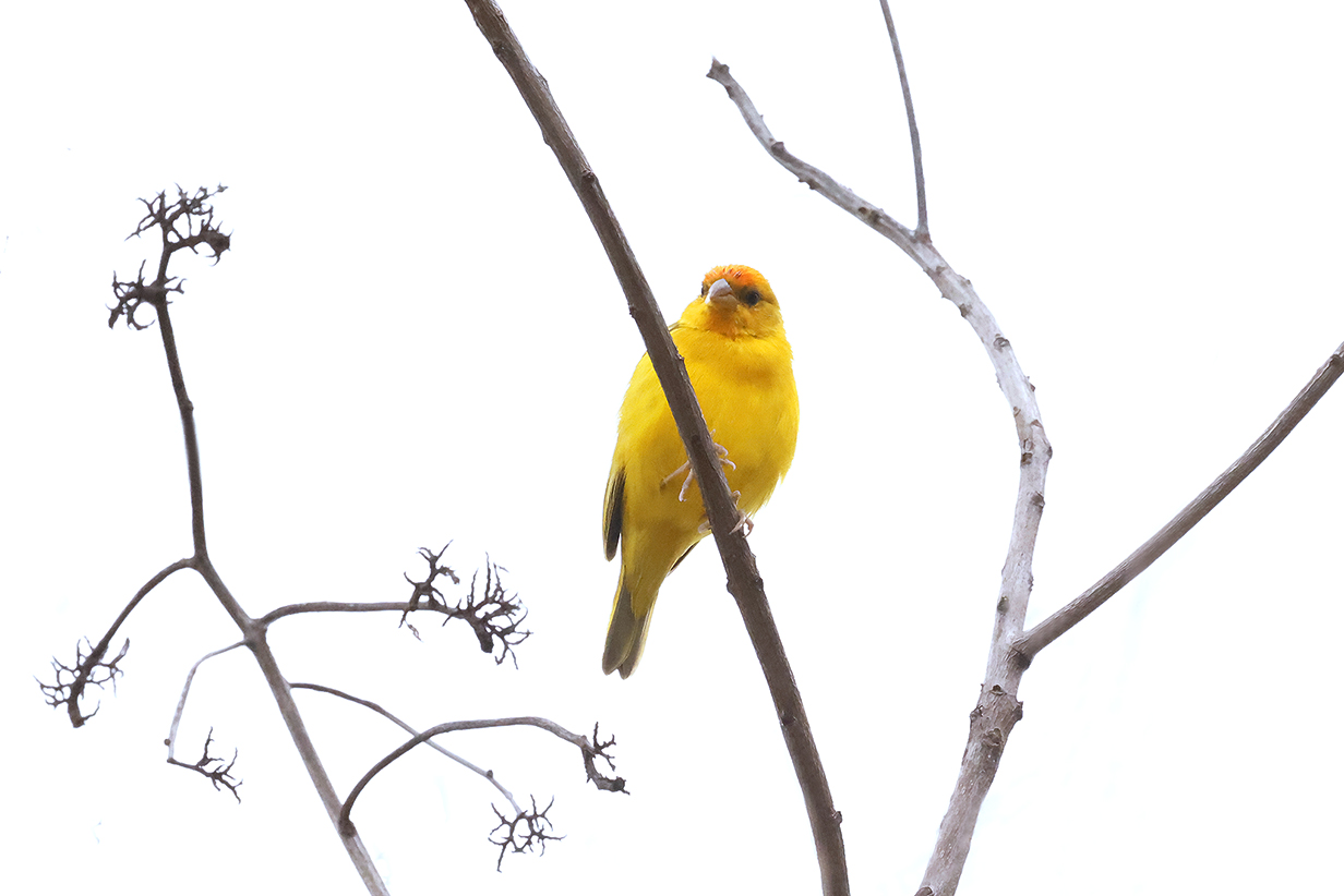
Saffron finch (Male -- not in its main range, in central Amazonia)
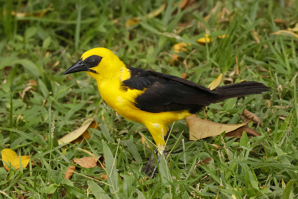
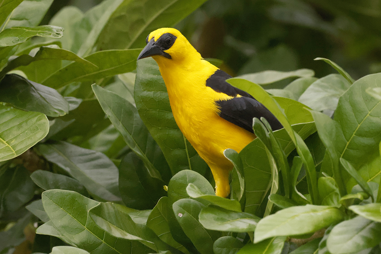
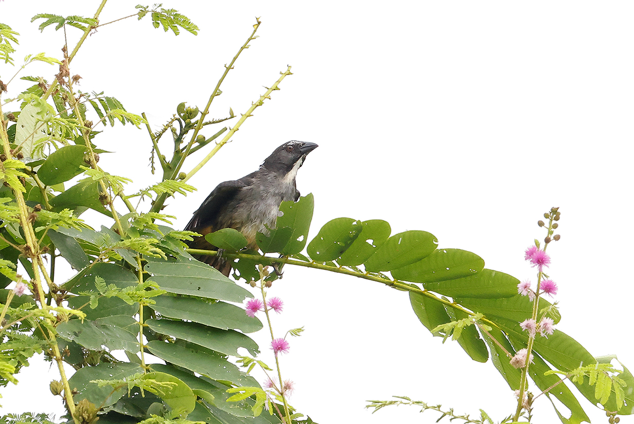
Oriole blackbird were especially numerous and easy at Alter do Chao.
Devil's Island, French Guiana
After our time in the Amazon, we sailed back to the Atlantic Ocean and then up the coast NW to what the ship and many people call "Devil's Island". Below is a Google Maps satellite picture of the three-island complex of what are formally called Les Iles du Salut or the Salvation Islands. The name was invented in the same spirit as the "Cape of Good Hope" ... though it has to be said that neither salvation nor good hope had much to do with what people -- convicts and settlers alike -- encountered when they got there. The islands are 11 km or about 7 miles off the coast of French Guiana. It and the islands are an overseas department of France and therefore are part of the European Union. In fact, Europe's Guiana Space Center is only a short distance away on the mainland. The giant building complex where rockets are assembled is visible from the islands. Ariane flight VA256 launched the James Webb Space Telescope from there.
Devil's Island was a part of a French penal colony from 1852 to 1953. It is notorious for its use to exile French political prisoners, the most famous of which was Captain Alfred Dreyfus. The island is "off limits" and we could not visit it.
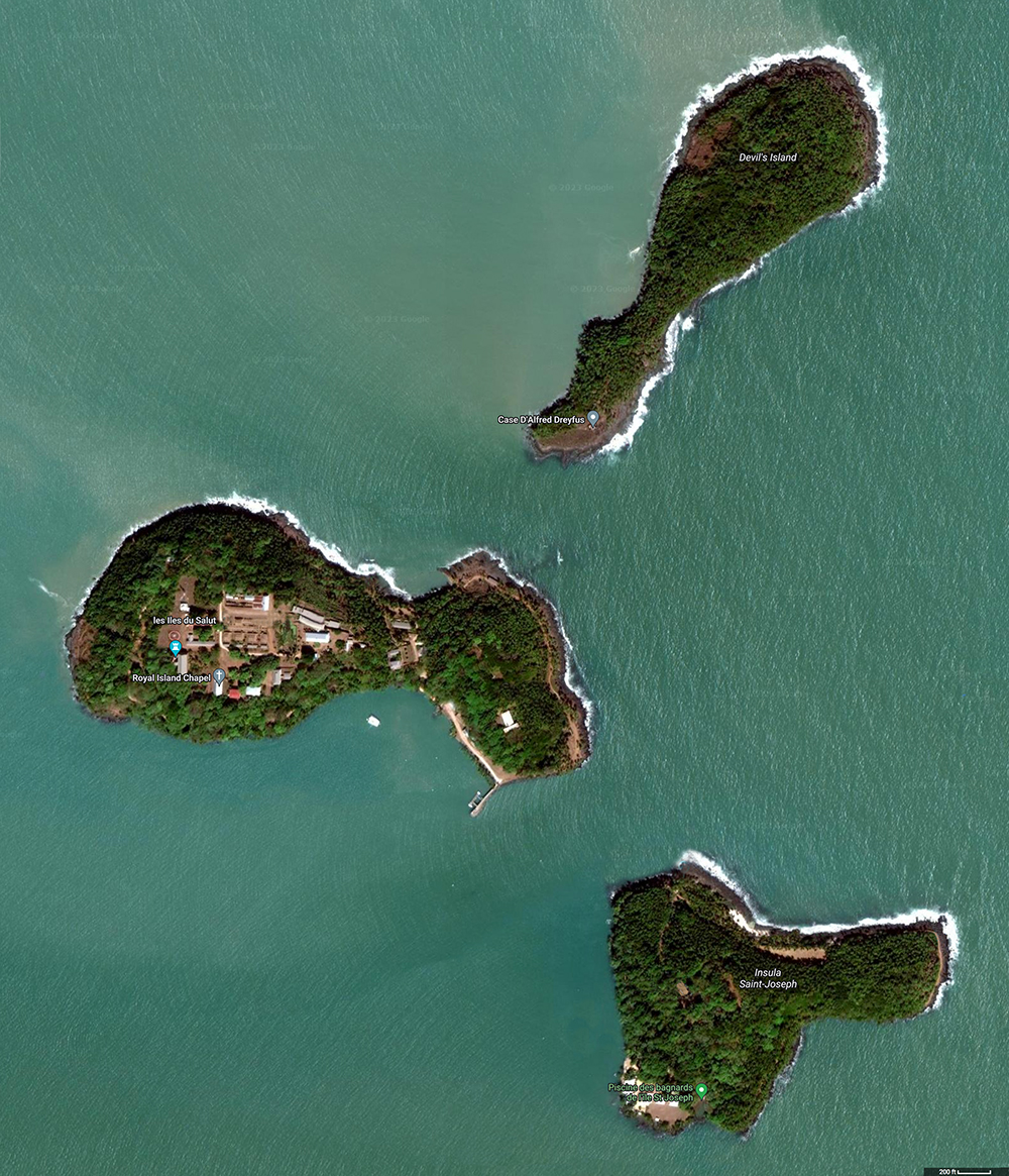
The Seabourn Quest anchored near the bottom-left of this picture. On the morning of March 17, 2023, we took a tender to the long dock on the biggest island. We then walked counterclockwise around the rim of the island to its narrowest part, then across that isthmus and back to the tender dock. The first pictures below are from this walk. In the afternoon, John took a zodiac excursion to St. Joseph Island, landing on the south-west side (the picture shows a light brown spot there). From there, he walked the steep trail up to roughly the center of the island, where the remains of the main prison complex are a picturesque ruin thoroughly overgrown with jungle. Both stops included as much birding as possible. Pictures are included below. Nothing new was seen.
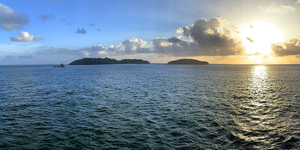
Royal and St. Joseph Islands from the balcony of our suite on Seabourn Quest in the morning, before our excursions. Devil's Island is hidden behind Royal Island.
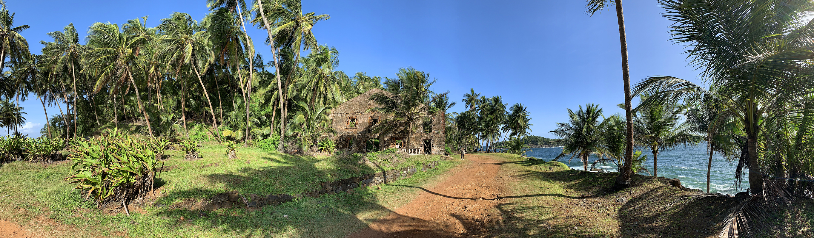
Panorama of an island paradise reclaimed by wilderness: This is the SE corner of Royal Island. Mary is standing just right of the overgrown building ruin. Scroll right to see the complete panorama. Devil's Island is in the right background.
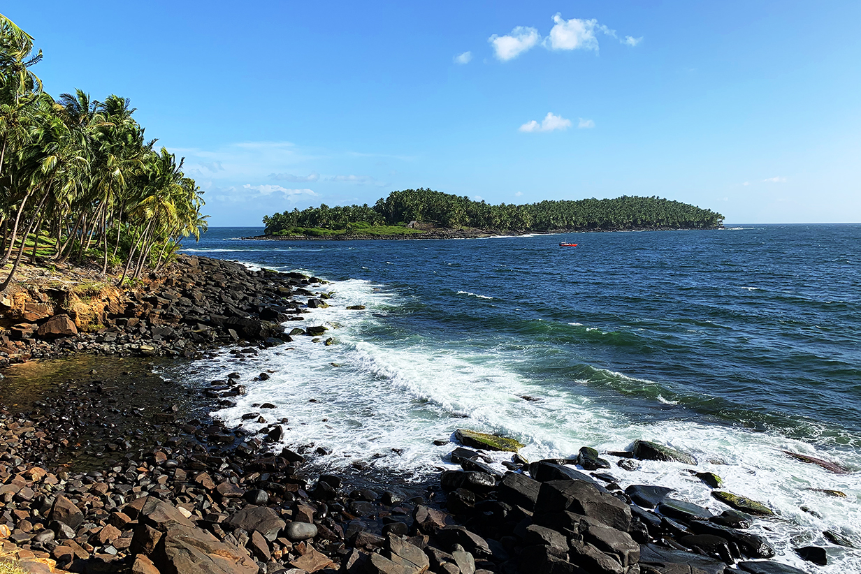
Devil's Island and the north coast of Royal Island. The channel between the two islands is only 180 m (about 600 feet) wide, but currents are so vicious here that, for most of their history as a penal colony, travel between the two islands was via a (now defunct) cable car! Dreyfus's house is visible. He lived there from 1895 to 1899 in much more horrible conditions than one might imagine from this picture. For example, the house was then surrounded by a close palisade that prevented view of the ocean. I do not dwell here on this low point in French history. But it was more than remarkable to see the 2023 sanitized version of its remains.
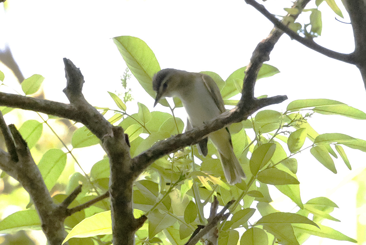
Chivi vireo (in a not-very-good picture) was the best bird seen on Royal Island.
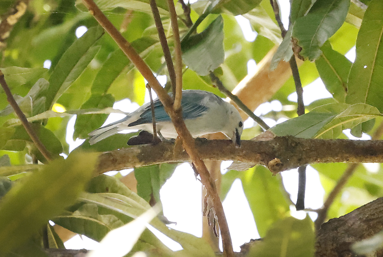
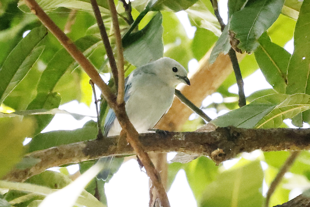
Blue-gray tanager (These are also not great pictures, but it is the first time I have seen or photographed the nominate Guiana subspecies, Thraupis episcopus episcopus. The whole head and shoulders are almost completely white.)
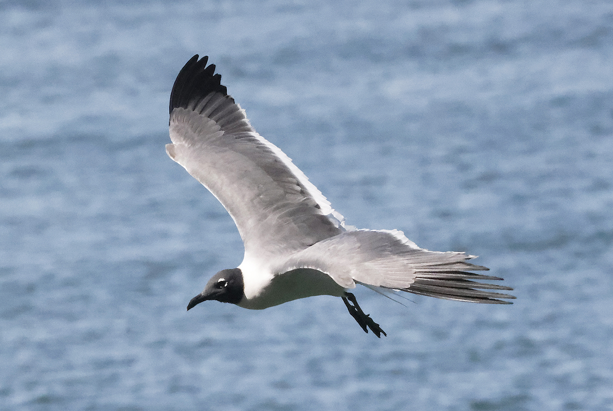
Laughing gull
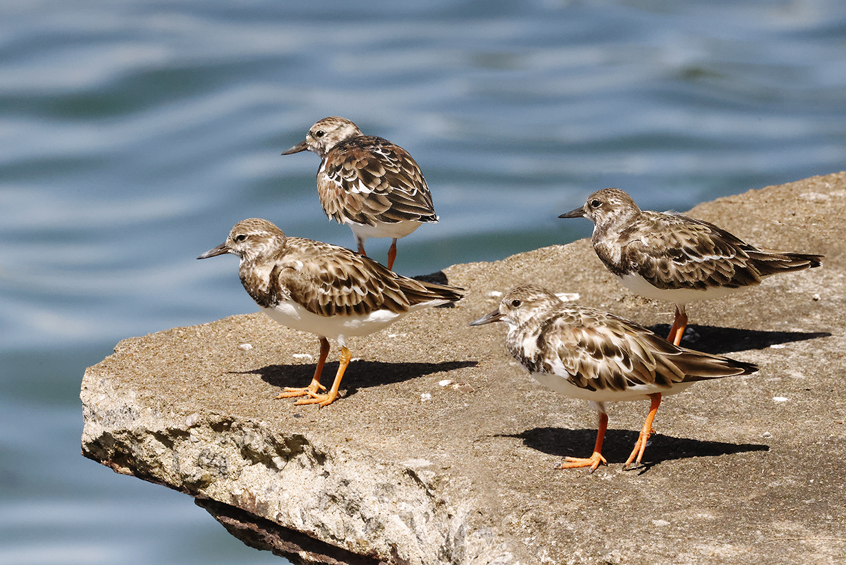
Ruddy turnstones in winter plumage
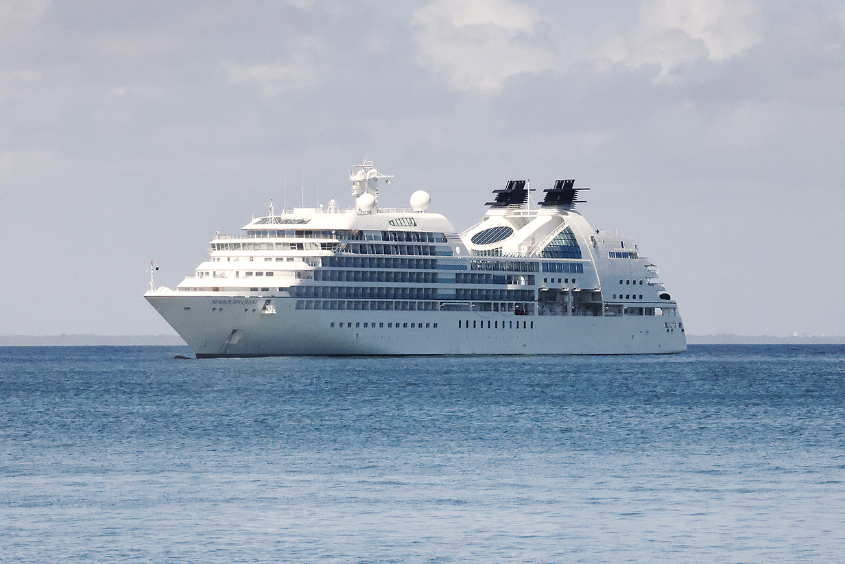
Seabourn Quest: We went back to the ship between the morning tender landing on Royal Island and the afternoon zodiac landing on St. Joseph Island.
Ruin of the main prison complex on the high point of St. Joseph Island. All the buildings are thoroughly overgrown with jungle. Scroll right to see the full apanorama.
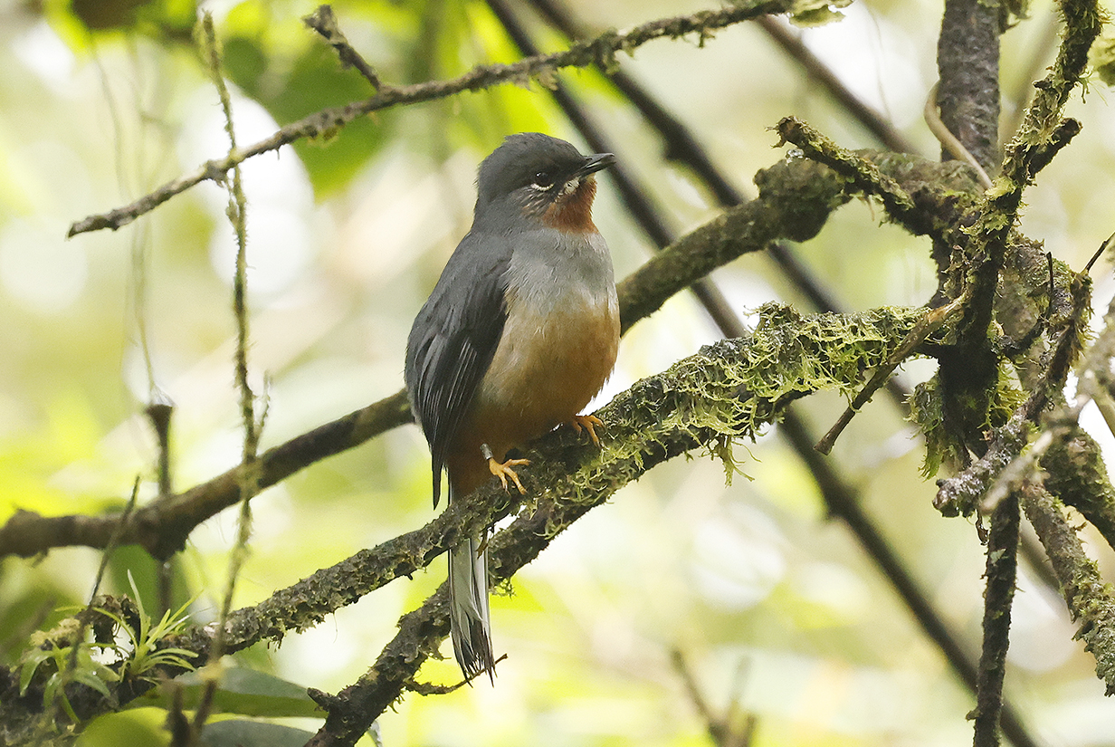
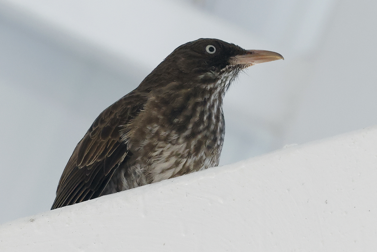
Pale-breasted thrush
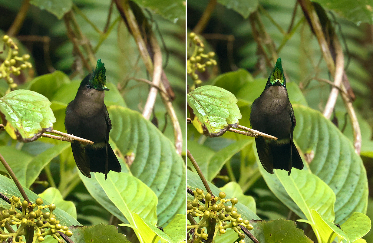
Who ordered this?
Yowzah!
Caribbean Islands
After leaving Devil's Island, French Guiana, the cruise stopped briefly at 5 Caribbean islands before ending at Miami, Florida. We were at Barbados on 2023 March 19, Martinique on March 20, Antigua on March 21, St. Kitts on March 22, and Puerto Rico on March 23. At St. Kitts, Seabourne arranged a beach barbecue and we just relaxed for a few hours. At the other islands, we birded as well as we could, with a good guide on Martinique, with just a private driver on Barbados and Antigua, and with only a Seabourn not-birding-oriented rain forest tour on Puerto Rico. John got 15 life birds in the Caribbean, and Mary got 9. We had a lot of trouble (not) finding birding guides: most guides that we did find were busy on the short notice that we could provide. We need to go back. Especially to Puerto Rico.
Because we birded and did not otherwise go sightseeing or "beaching", we mostly did not see the places that make Caribbean islands famous as vacation destinations. This, too, argues for our return.
Barbados
In Barbados, we had a private vehicle and driver and found promising sites online.
Zenaida dove -- in fact: this bird -- was our first life bird, gotten in a parking lot across the street from a defunct wildlife sanctuary.
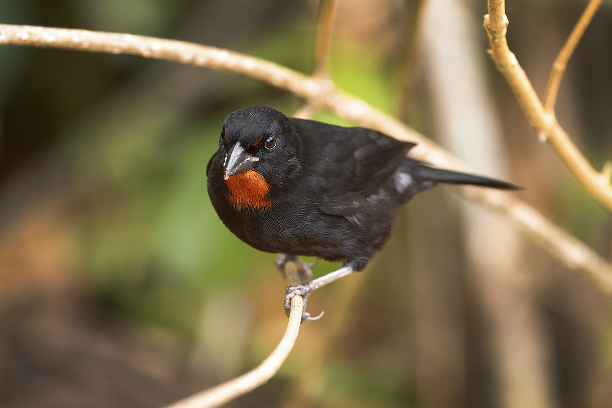
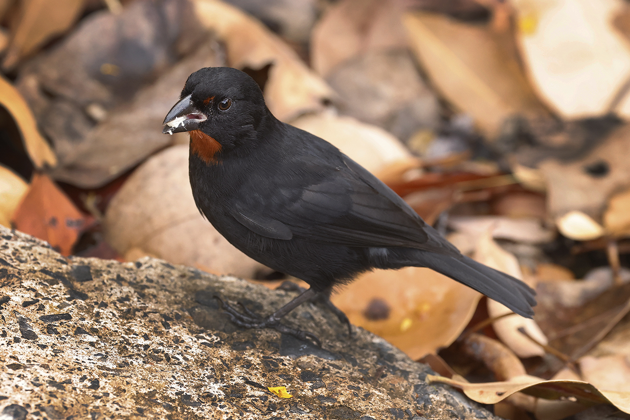
Barbados bullfinch (This is our life bird, gotten together with the Zenaida dove, above. We saw several more later in the day. And John got Lesser Antillean bullfinch in Martinique the next day. Male and female Barbados bullfinch both look life female Lesser Antillean bullfinch.)
Barbados bullfinch (later in the day)
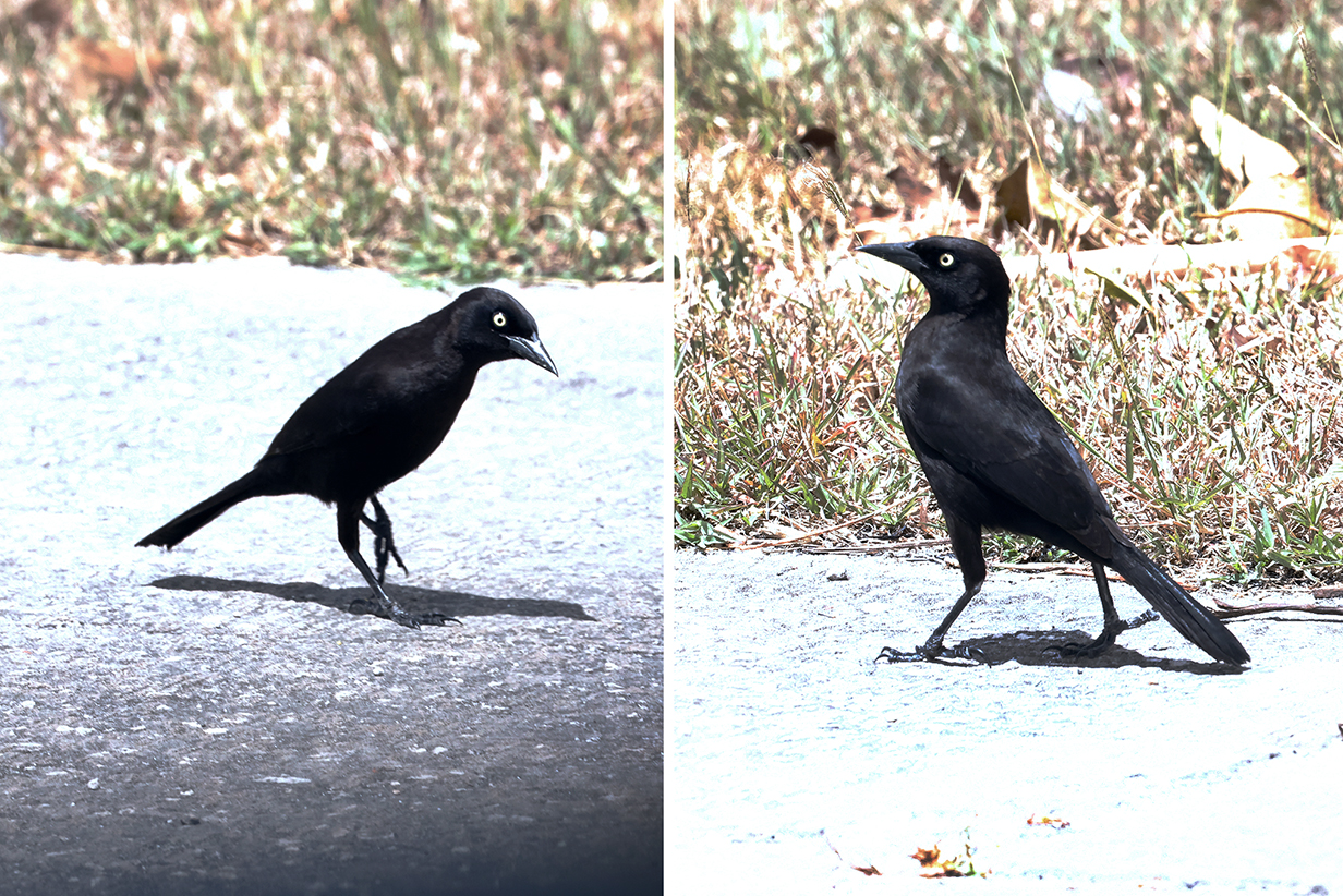
Carib grackle (Seen before only once, in Trinidad and Tobago. It is hard to get a good picture of a black bird on a sunny day. Still, this is one of the most common birds on the island, much like Great-tailed grackle in Texas, Boat-tailed grackle in SE coastal USA, or Common grackle in most of the USA and Canada. Always a pleasure to go to a new area where even some common birds are new once and interesting all day.)
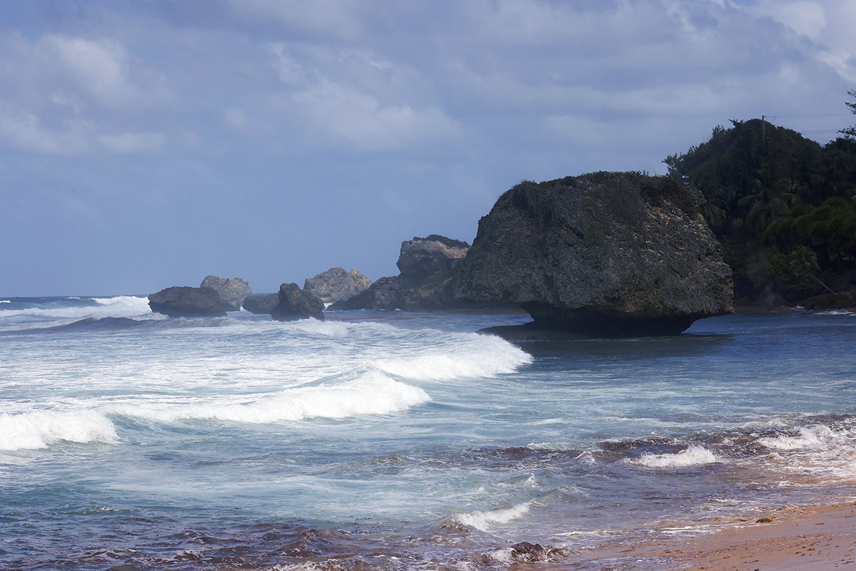
Bathsheba Beach on the east side of Barbados gets pummeled by waves from the Atlantic. In contrast, on the Caribbean, west side of the island, the beaches are calm, sandy, and gentle.
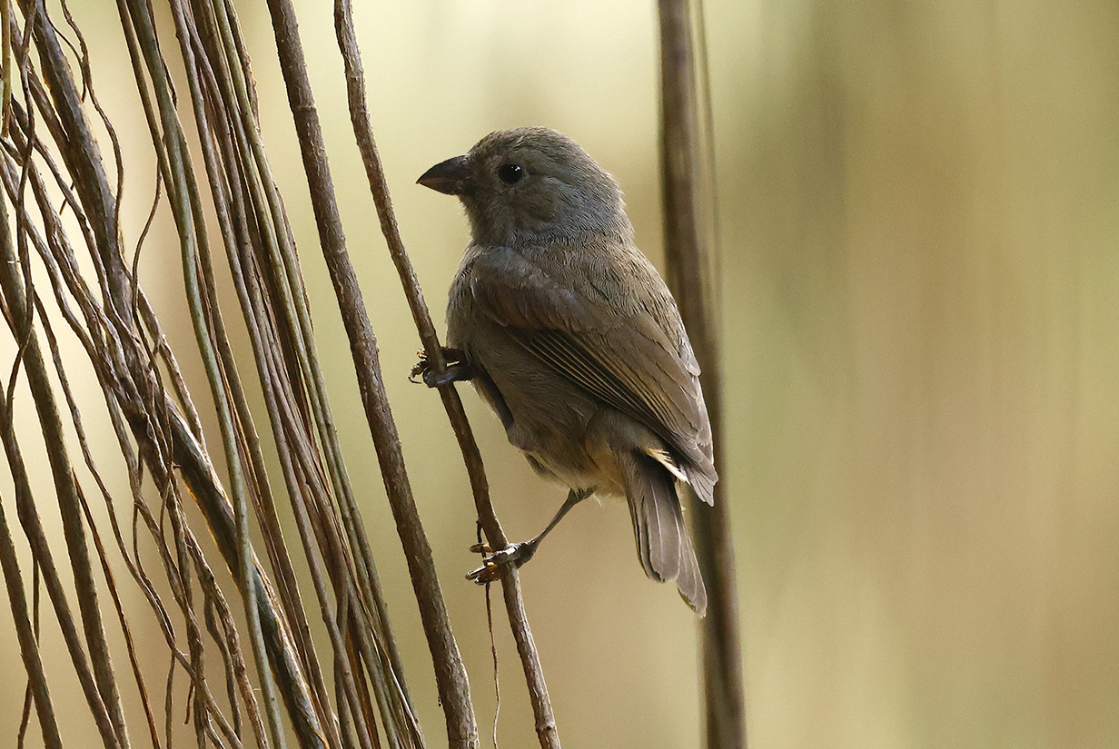
Barbados bullfinch (best look at this Barbados endemic -- in Andromeda Botanical Garden)
Green-throated carib (left) and Antillean crested hummingbird (right). John saw these two life birds within minutes of each other in Andromeda Botanical Garden. The crest of the crested hummingbird is vivid green from the front, i. e., the angle from which the irridescence is evolved to work. John saw flashes of brilliant green as the bird flew but was able to photograph it only the next day, on Martinique.
Green-throated carib (This again is John's life bird.)
Gray kingbird (Common and easy in northern South America, the Caribbean, and Florida, this one is at Andromeda Botanical Garden on Barbados.)
John got 5 new birds in Barbados; Mary got 3, and she got the hummingbirds, above, later in the trip. Not bad, considering that we had no guide. On to Martinique:
Martinique
Martinique is bigger than Barbados, with more varied habitats and therefore more diversity in birds. John was lucky to find an excellent guide, Beatriz Conde (biasconde@hotmail.com). Thanks to her, he got 7 new birds even on an intermittently rainy day.
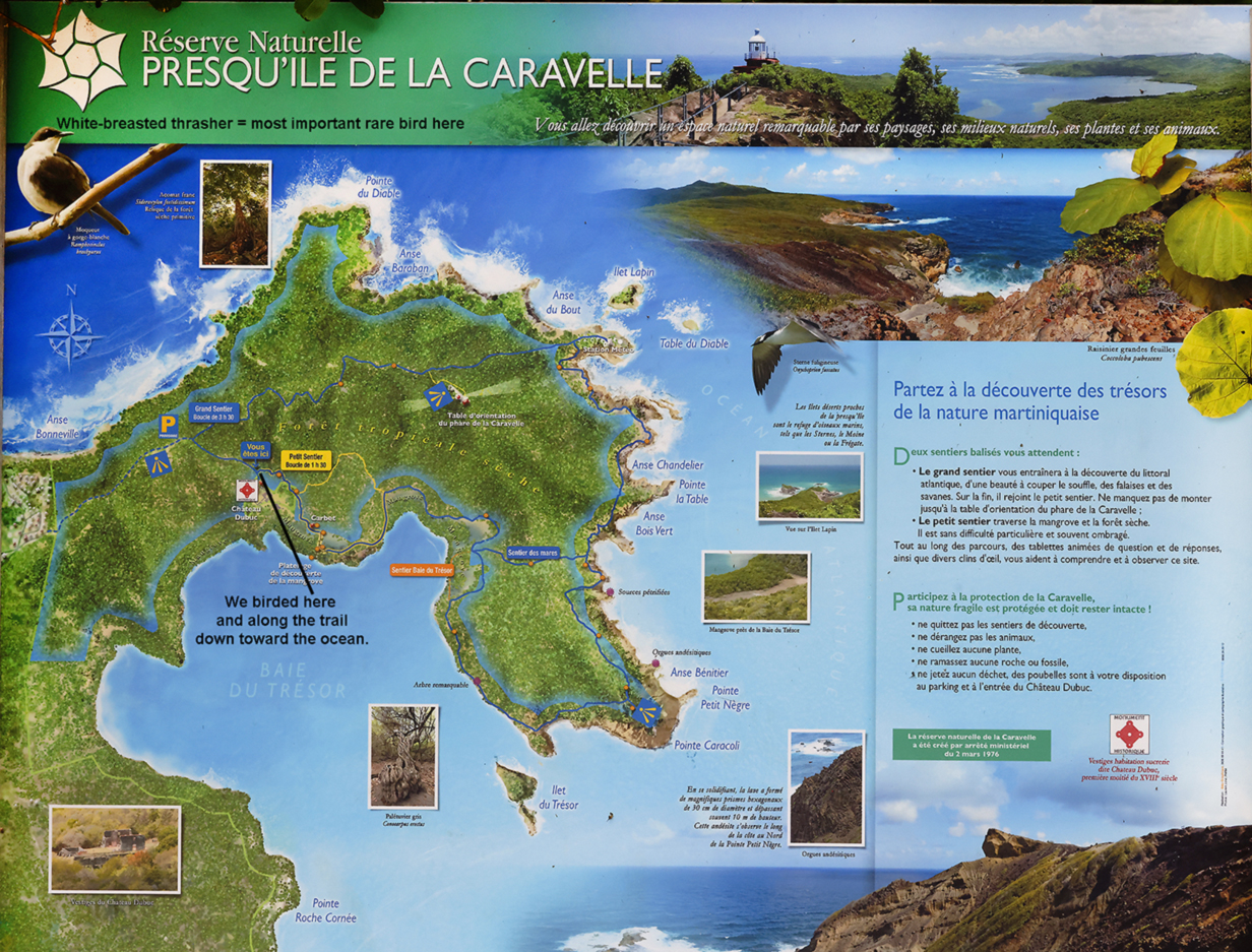
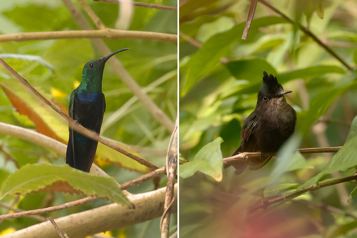
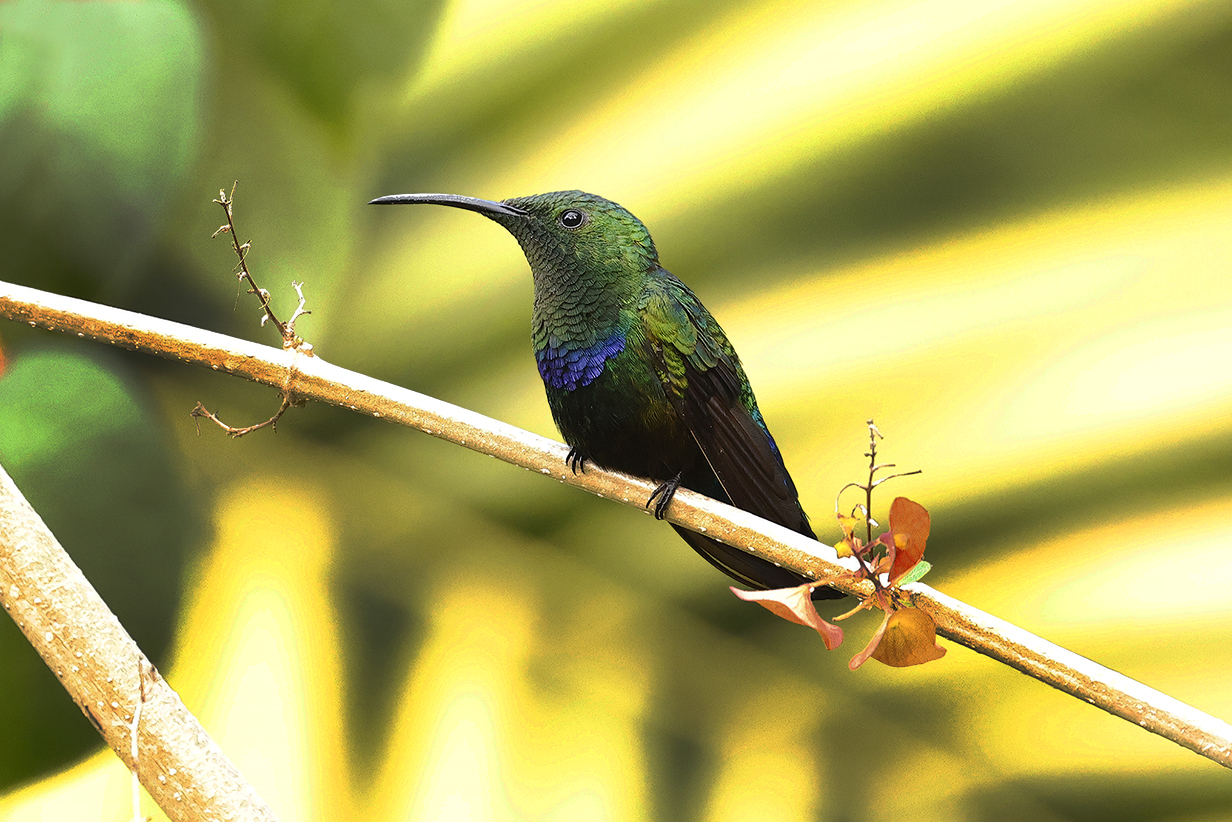
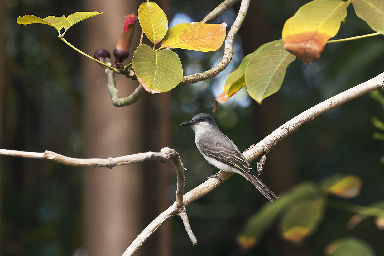
Our first stop was the penninsula Presqu'ile de la Caravelle on the side of the island opposite to our port at Fort-de-France. The drive was eminently worth while: it rained hard in the mountains but was (at least at first) fine and sunny at the nature reserve. Three life birds came almost within arms-length, clearly used to being fed by visitors. The prize bird here is White-breasted thrasher (top-left, above), one of the rarest birds that John has seen. The world population is estimated to be ~ 200-400 birds on Martinique and ~1300-1400 birds on St. Lucia. With patience, Beatriz found the bird and John saw and photograped several birds well.
Zenaida dove (much better views than on Barbados)
Carib grackle (male: ubiquitous here, too)
Carib grackle (female)
Lesser Antillean saltator (This is John's life bird. It is the Lesser Antillean version of its closest relative, Streaked saltator, whose range extends froms southern Central America through northern South America as close as Trinidad.)
Lesser Antillean saltator (several different birds)
Lesser Antillean bullfinch (male)
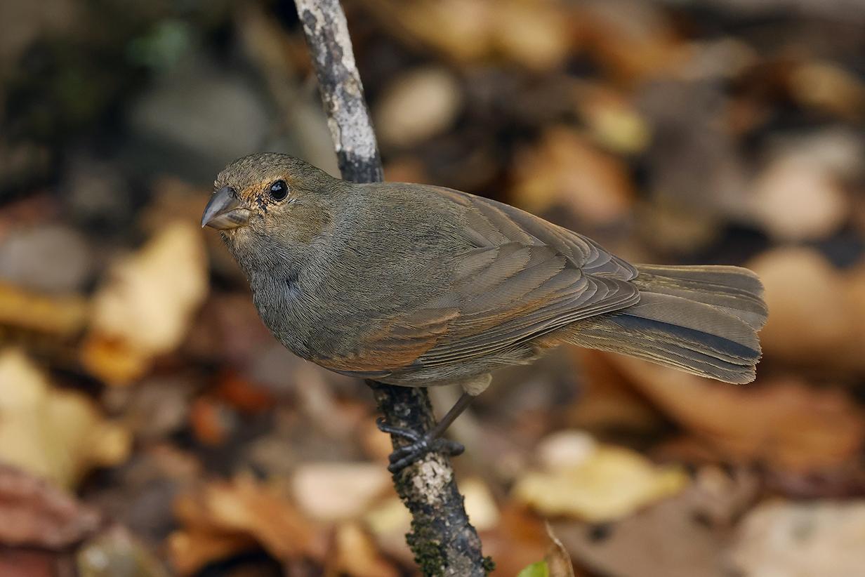
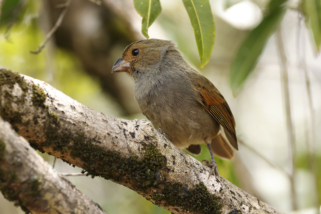
Lesser Antillean bullfinch (different females -- they look like both male and female Barbados bullfinch)
Bananaquit (Caribbean birds have almost-black throats.)
Tropical mockingbird
"Golden" Yellow warbler (male setophaga petechia ruficapilla on Martinique)
White-breasted thrasher (This is one of a small flock of birds that were John's life birds. Seeing them required patience, but they finally appeared and came close to us after a brief rain. Very rare: They were the prize birds of the day.)
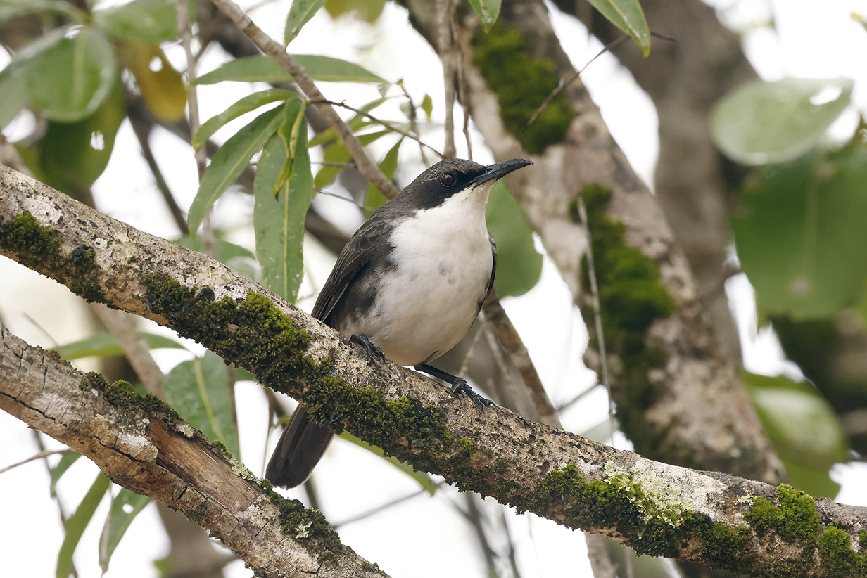
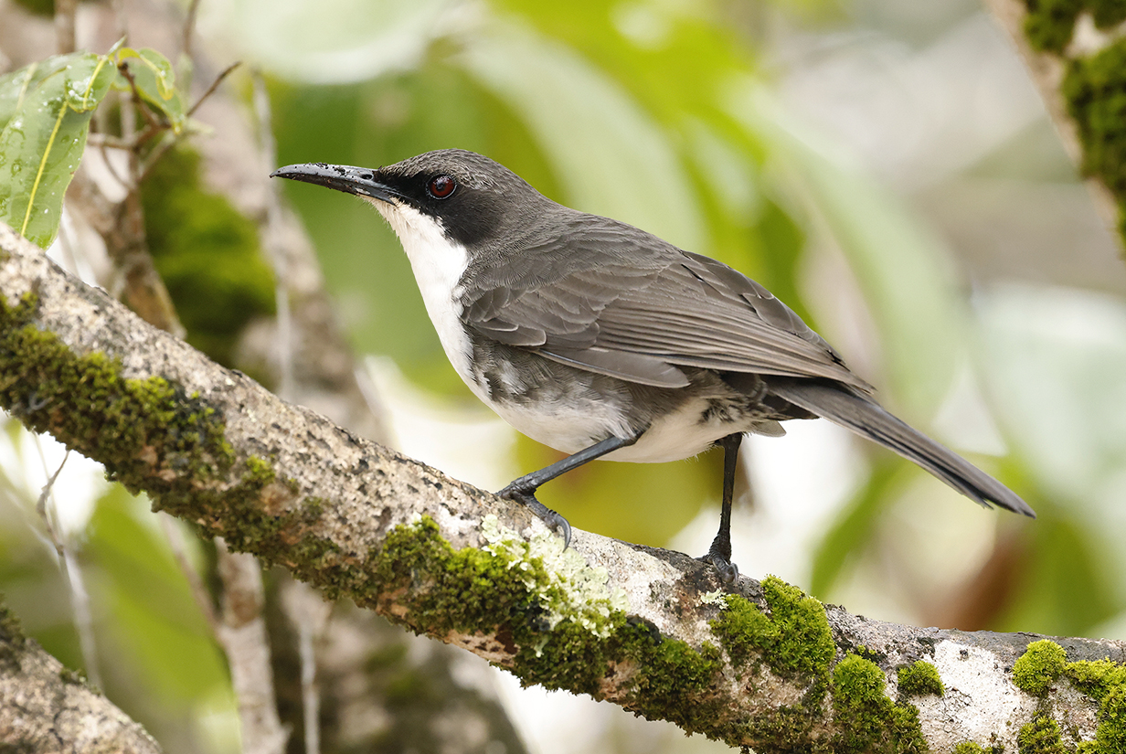
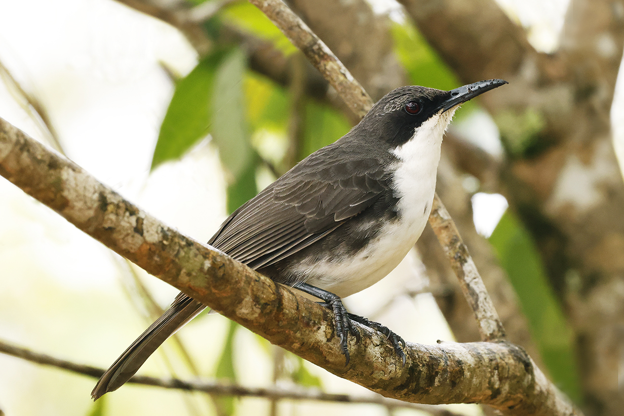
White-breasted thrashers (messy eaters)
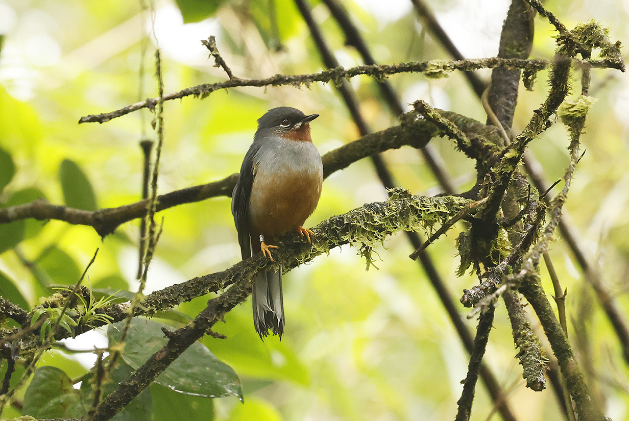
Rufous-throated solitaire (This is John's life bird in the lush rain forest near the Pitons du Carbet, north of Fort-de-France.
Antillean crested hummingbird (first seen on Barbados, but this picture shows the flash of bright green that intruders and potential mates see when the bird flies directly toward them)
Lesser Antillean bullfinch (one more female of a species seen many times throughout the day)
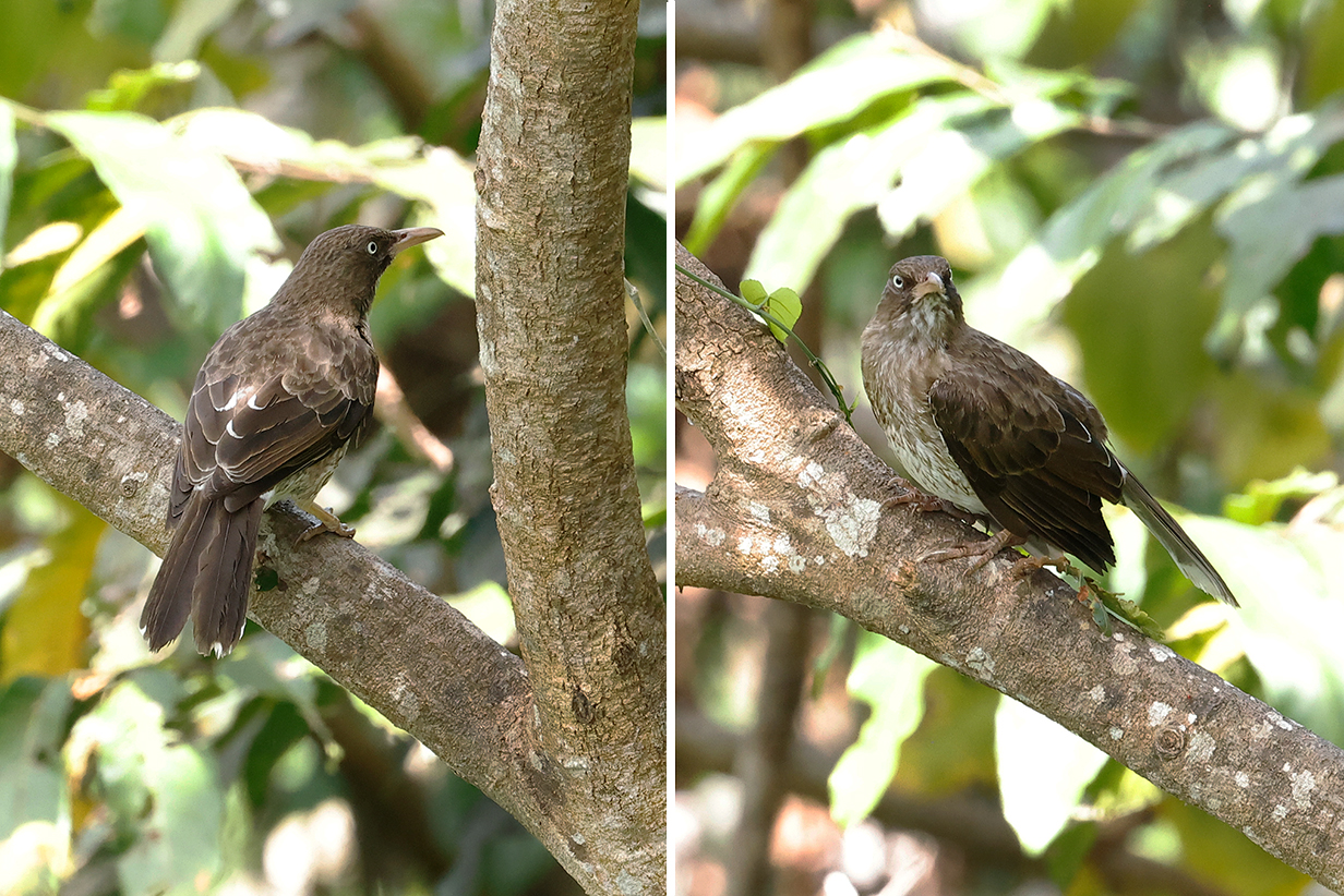
Spectacled thrush, commonly called Bare-eyed robin (This is yet another Turdus thrush -- numerous throughout the world. This one is Turdus nudigenis, which we previously saw in Trinidand and Tobago and which is closely related to North American robin (Turdus migratorius), European blackbird (Turdus merula), Pale-breasted thrush (Turdus leucomelas seen on Devil's Island, above), Austral thrush (Turdus falklandii) seen in Chile, Argentina, and the Falkland Islands), and more than a dozen other Turdus species seen in the Americas, Africa, Asia, Australia and New Zealand (introduced), and even Papua New Guinea.)
Bananaquit (ubiquitous in the Caribbean) on a banana flower
Antigua
On Antigua, we had a private car and driver but no good information on where to bird. Eventually, at various gardens in the north of the island, Mary got the two easy Lesser Antillean endemic hummingbirds, Green-throated carib and Lesser Antillean crested hummingbird and John got -- barely -- Caribbean elaenia.
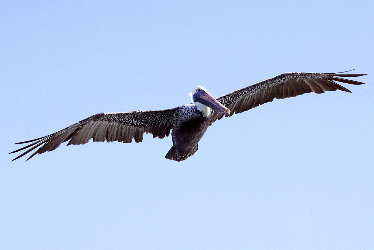
Brown pelican were common from Antigua to and including Florida.
Lesser Antillean bullfinch (This is Mary's life bird.)
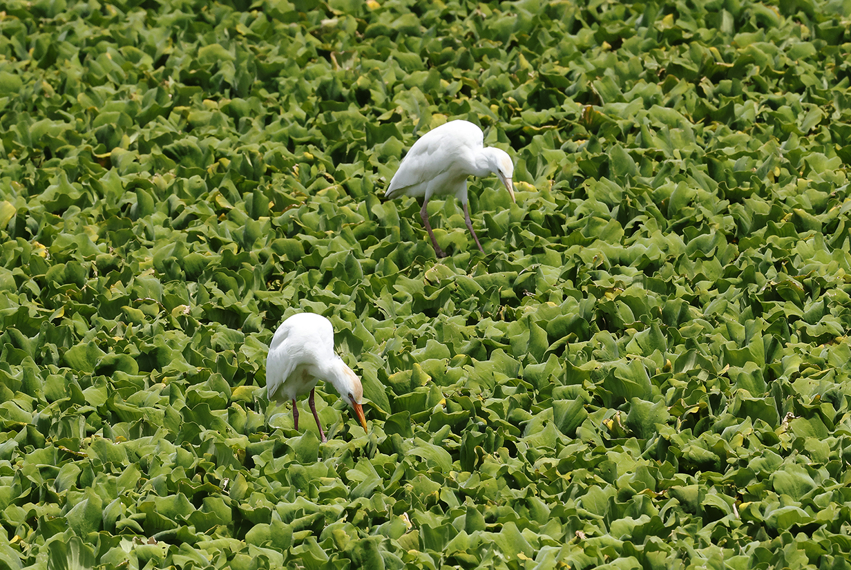
Our driver knew little about birding sites other than a few wetlands. So we spent much of the day seeing birds that we knew well, such as these cattle egrets.
Green-throated carib (We eventually found resorts with gardens in bloom. Then Mary got Green-throated carib and Antillean crested hummingbird fairly easily.)
Puerto Rico
Here again we did not book a guide in time: We had only a non-birding-oriented tour of the El Yungue National Forest. That was surprisingly not very birdy. We managed to get 4 life birds each, the ubiquitous and easy Greater Antillean grackle, Puerto Rican oriole (by good luck at the visitor center), Loggerhead kingbird (easy to spot on our own), and Pearly-eyed thrasher (pointed out at the visitor center by our tour guide). But first:
Brown booby followed our ship for much of the 2-day voyage from Antigua to Puerto Rico.
Greater Antillean grackle (We got this bird as soon as we debarked, right in San Juan harbour. This picture was taken later in slightly more congenial surroundings. Greater Antillean grackle looks intermediate between the smaller and more gracile Carib grackle of the Lesser Antilles and the bigger and more flamboyant Great-tailed and Boat-tailed grackles of (e. g.) inland Texas and the SE coastal parts of the USA, including Florida, respectively. All these species patronize the same couturier.)
Puerto Rican parrot is an endemic bird that we officially did not see. These were in an aviary in the El Yungue National Forest visitor center. They still occur in the wild, but we did not stay long enough or explore widely enough or get guided well enough to see them ... or, indeed, most of the ~18 Puerto Rican endemics. We now have found a guide and hope to return.
Loggerhead kingbird (This is our life bird at the El Yungue National Forest visitor center.)
Pearly-eyed thrasher (This is our life bird. Our guide knew enough about birds to tell us that this one often comes to the rafters of the El Yungue National Forest visitor center. That's how we got the bird.)
Pearly-eyed thrasher (This was our last life bird of the combined Chile and cruise parts of the trip -- number 101 for John and 73 for Mary.)
Pelagic Birding From Puerto Rico to Miami
We left Puerto Rico during the evening of 2023 March 23 and then were at sea for 2 days. During that time, John tried pelagic birding one more time. The only obvious bird was Brown booby, soaring often close to the bow of Seabourn Quest. There were frustratingly few and only subtle hints of other birds. Sometimes as many as a dozen tiny, light-colored ... birds? ... would flee off at right angles to the ship's direction. But they kept disappearing before John could get binoculars on them. Finally, he got pictures:
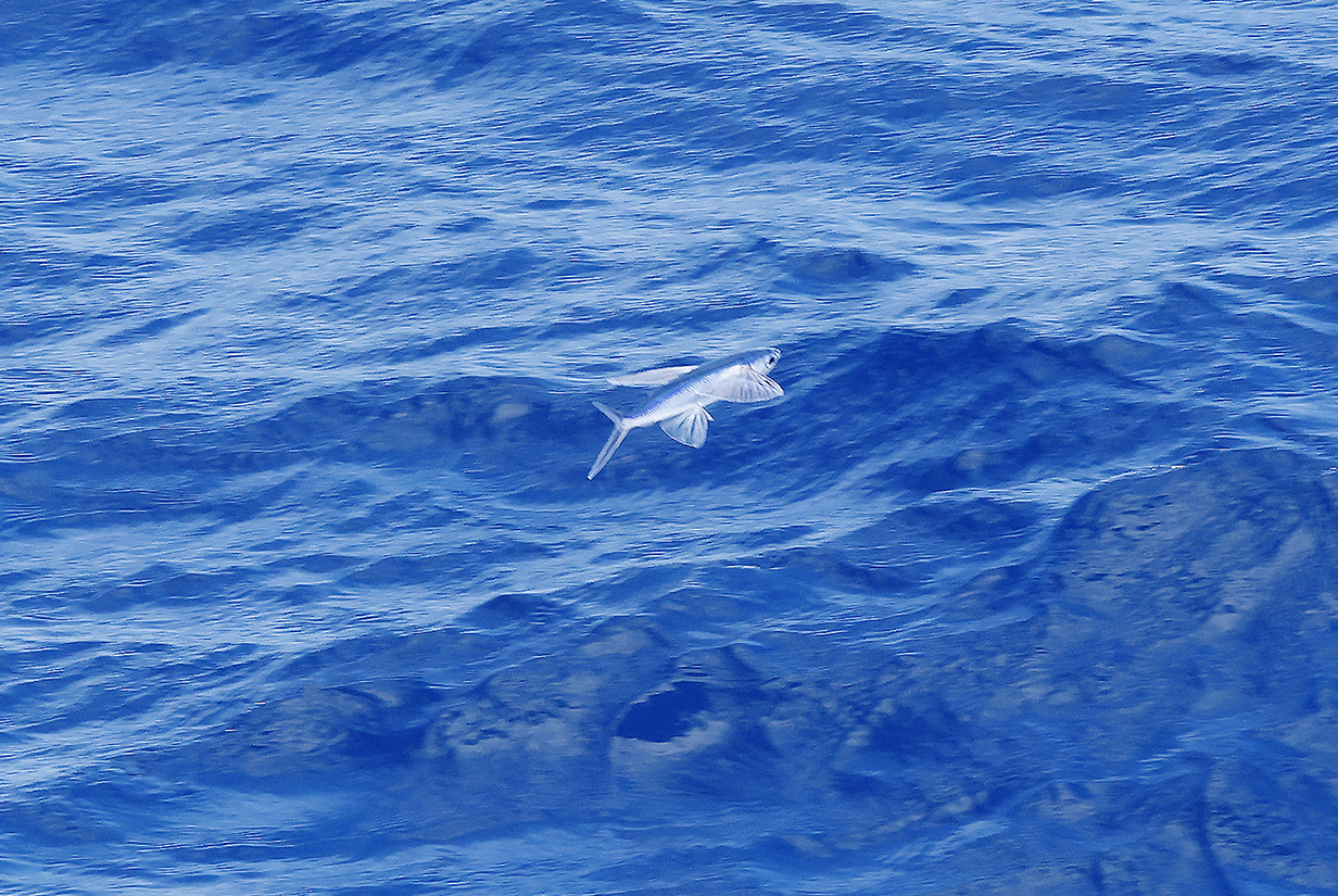
Surprise: They were flying fish! John saw about 100 of them in the 2-day sail to Miami. They disappeared quickly because their glides ended in the waves after ~ 100 feet. At least this shows that he was "Doing It Right" and not somehow missing birds. Pelagic birding outside polar regions is hard. There is so little food that birds are scarce.
Our 58-day cruise ended in Miami on the morning of March 26th -- richly varied experiences; spectacular sights; wonderful memories.
Our bird pictures from around the world follow standard ecozones approximately but not exactly:
Birds from the USA and Canada: our house, Hornsby Bend and greater Austin, Texas, California, Hawaii, Canada,
Neotropic birds from Central America and the Caribbean: Honduras, Costa Rica, Panama, Trinidad and Tobago
Neotropic birds from South America: Ecuador, Ecuador 2017, Brazil.
Western palearctic birds: Europe: Germany, Finland, Norway, Europe: United Kingdom, Europe: Spain, the Canary Islands, Europe: Lesbos, Greece, Israel
Eastern palearctic birds: China
Birds from Africa: The Gambia, South Africa
Indo-Malayan birds from India: North-west (Delhi, Uttar Pradesh, Uttarakhand) India: North-east (Assam, Arunachal Pradesh, Meghalaya) India: Central (Maharashtra, Madhya Pradesh)
Birds from Australia, New Zealand.
For our 2014 December trip to India, see this travelog.
For our 2016 May-June trip to India, see this travelog.
For our 2017 April trip to High Island, Texas, see this web site.
For our 2018 March trip to India, see this travelog.
For our 2018 May trip to China, see this travelog.
For our 2018 November trip to China, see this travelog.
For our 2019 April trip to High Island, Texas, see this web site.
For our 2019 July trip to China, see this travelog.
For our 2021 April trip to High Island, Texas, see this web site.
For the 2021 August 3 & 4 migration of Purple martins through Austin, see this web site.
For our 2021 December trip to Ecuador, see this web site.
For our 2022 January-February trip to Peru, see this web site.
For our 2022 July/August trip to Australia and Papua New Guinea, see this web site.
For our 2022 September trip to Bolivia, see this web site.
For our 2022 November-December pre-trip to Argentina (before our Antarctic cruise), see this web site.
For our 2022 November-December cruise to Antarctica, see this web site.
For our 2023 January birding in Chile, see this web site.
For our 2023 January-March cruise from Chile to Antarctica and around South America to Miami, FL, see this web site.
For our 2023 March-April birding in south Florida (after the Seabourn cruise), see this web site.
For our 2023 November-December birding to Sri Lanka, the Andaman Islands, and South India, see this web site.
For John's 2024 February-March birding in Colombia, see this web site.
For our 2024 May-June cruise from Iceland to Jan Mayen Island to and around the Svalbard Archipelago, see this web site.
For our 2024 June 25-30 stay in Paris, see this web site.
For our 2025 April 21 - May 3 trip to High Island, Texas, see this web site.
For our 2025 July 16-22 stay in Paris, see this web site.
For our 2025 July vacation and birding in Singapore, see this web site.
For our 2025 August birding in north-west Australia, see this web site.
For our 2025 August-October Seabourn cruise from Australia to Chile, see this web site.
For our 2026 January-February trip to New Zealand and 3rd cruise to Antarctica, see this web site.
For my 2026 March-April trip to Borneo and Singapore, see this web site.