John and Mary Kormendy: Birding Cruise to South Georgia Island and Antarctica (November-December 2022)
These pictures are from a Victor Emanuel Nature Tours birding cruise to the Falkland Islands (where, due to high winds, we did not land), South Georgia Island, the Antarctic Penninsula and surrounding islands. This web site is a chronological travelog that combines scenery and (in context) bird pictures. Birding was the raison d'etre for the trip, but the magnificent scenery turned out -- as expected -- to be arguably even more important.
Before the cruise, we had a 3-day "pre-trip" to Buenos Aires and Ushuaia, Argentina, and surroundings. We also had a 1-day "post-trip" of birding in Ushuaia after the cruise. Bird (but not travelog) pictures from this part of the trip are posted here.
We cruised on Aurora Expeditions's ship the Greg Mortimer. It is relatively small -- there were about 100 passengers -- and is specially designed for stability in rough Antarctic and Arctic seas. Everything about Aurora's "adventure touring" was superbly engineered, planned, and led. We had excellent weather for almost the whole trip, thanks significantly to Aurora's and Aurora team's flexibility in revising tour destinations and zodiac landings to take advantage of locally good weather in often stormy surroundings. Highly recommended.
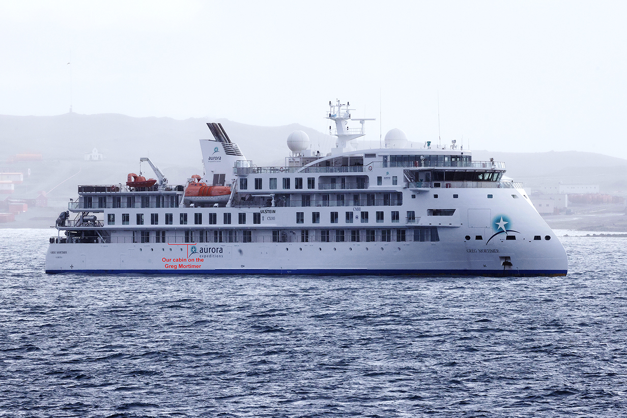
This picture of the Greg Mortimer was taken during our 2023 Seabourn cruise, when our routes fortuitously coincided in Maxwell Bay, King George Island, South Shetland Islands. Our cabin and balcony are marked. It was perfect for pelagic birding, because the most interesting birds skim close to the waves and our cabin on deck 4 was close to the water. A low cabin near the center of the ship is also more stable in rough seas, although our biggest waves -- in the Scotia Sea -- were only about 15 feet from trough to crest. Rocking of the ship was more soothing than threatening. We did not get seasick.
During the cruise, John and Mary got 23 and 15 life birds, respectively. The numbers are small, because there are not many species at high latitudes. But the birds are exceedingly special. We got 5 and 4 species of penguins, respectively, including >~ 200,000 King penguins. Most of the species are pelagic -- they live most of their adult lives at sea and on the wing, day and night, in storms and in good weather. They glory in high winds and come ashore only to nest and raise young. They are superbly adapted to conditions that we manage only by bringing our sheltered environment with us. We especially value pelagic birds because of their robust lives and because they are hard to see and harder to identify. Our VENT guide, Mr. Barry Lyon, was absolutely superb and very much needed. A few pelagic birds are included in the sections on South Georgia and Antarctica, but most are shown in separate section at the end.
Altogether, including the Argentina pre- and post-trips, John and Mary got 64 and 56 life birds respectively. Plus lots of scenery pictures (mainly) in South Georgia and Antarctica.
I am working on this web site now (2023 July) as I process and add more pictures. Pictures are copyrighted and should not be used without permission.
Landing on Mainland Antarctica
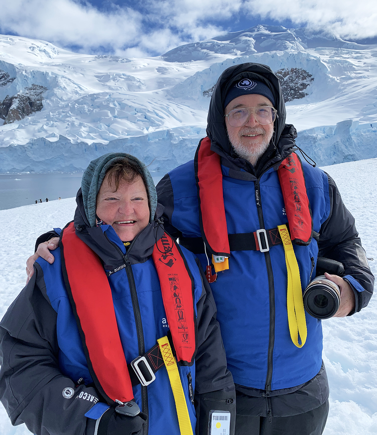
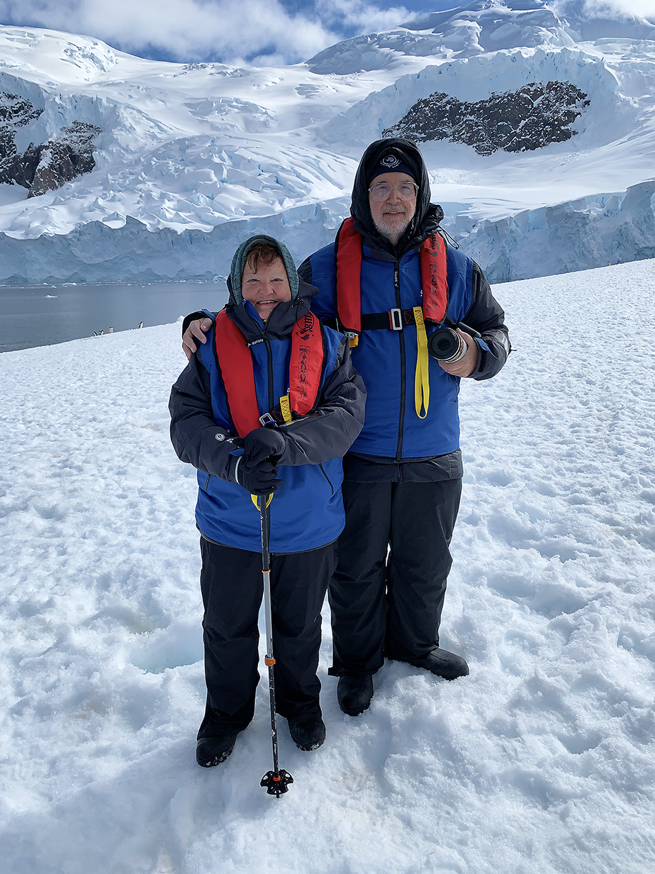
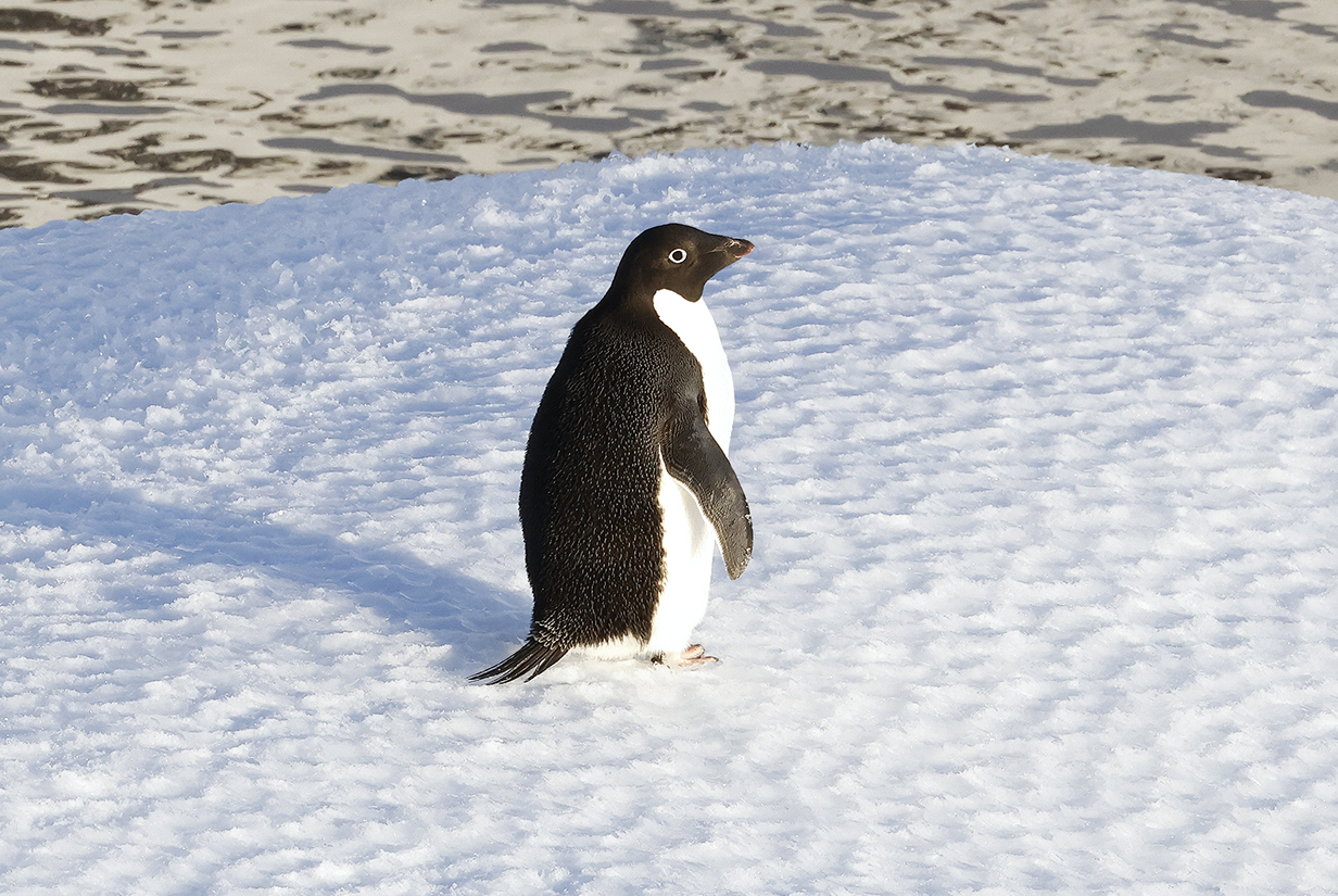
This was our only landing on mainland Antarctica, on December 13, 2022 at Neko Harbour. It was a fine, sunny day with temperatures just below freezing. We both tested positive for Covid-19 on Dec. 9 and emerged from quarantine just in time for our only chance to land on the mainland. Happily, after 6 (six!) covid vaccine shots, we felt only mild symptoms and were almost completely normal here. It turned out to be the happiest day of the trip.
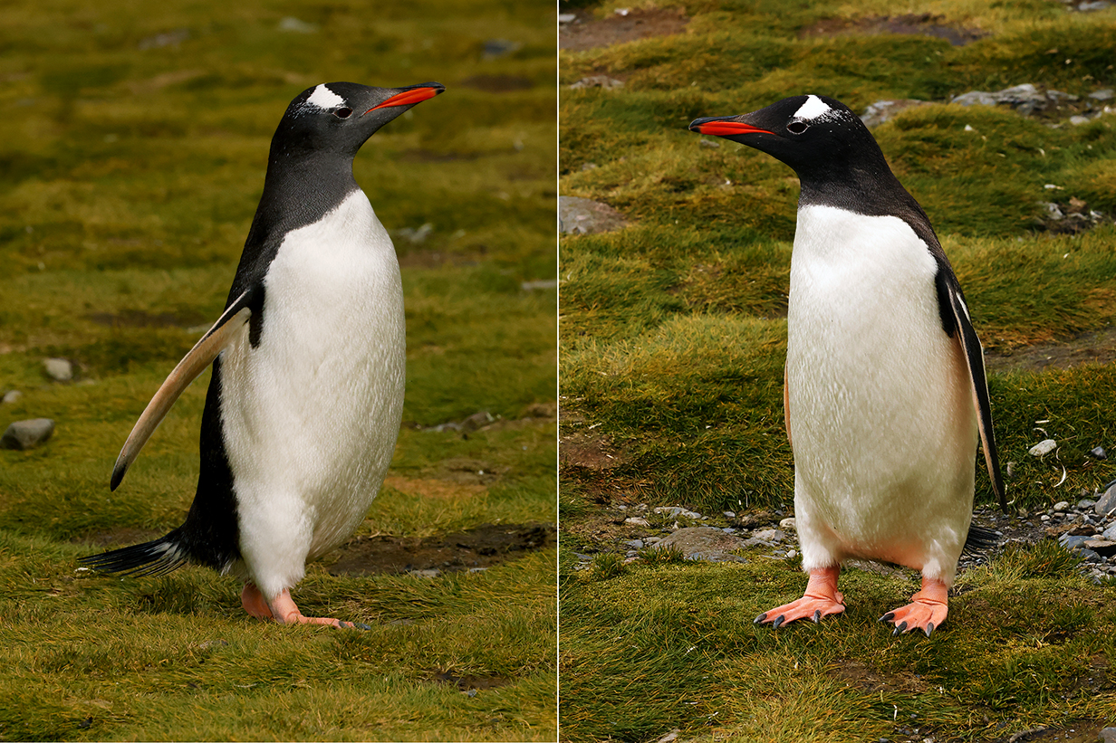
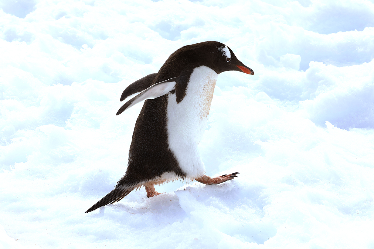
Gentoo penguins (background) are shown in more detail in the main pictures section, below.
Aboard Greg Mortimer
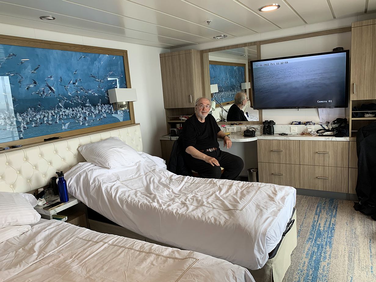
This shows most of the living area of our suite 429, including the compact but convenient "office" that John used to research and record our trip and its birds. This picture was taken on the last day of cruising from Antarctica back to Ushuaia. We use it here to introduce the "feel" of our voyage. The floor-to-ceiling window and the glass door to our balcony are out of sight to the right. The bathroom is directly behind the camera. The suite's hallway to the door to the ship's hall is, from the perspective of this picture, to the left of the bathroom. Being quarantined here for 4 days was not a great hardship, especially because we could see a lot from the balcony.
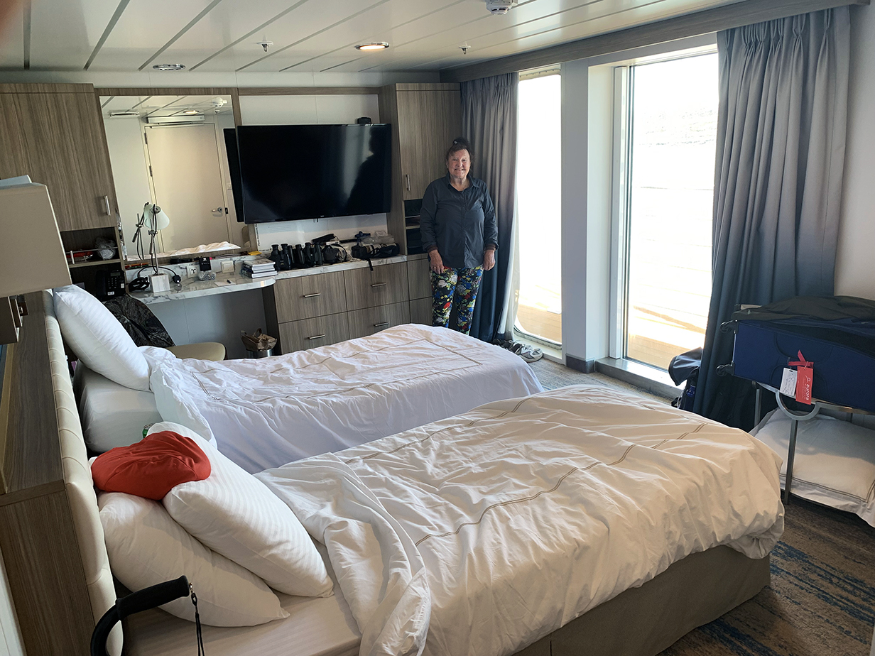
This is a better view of our very comfortable home on the Greg Mortimer.
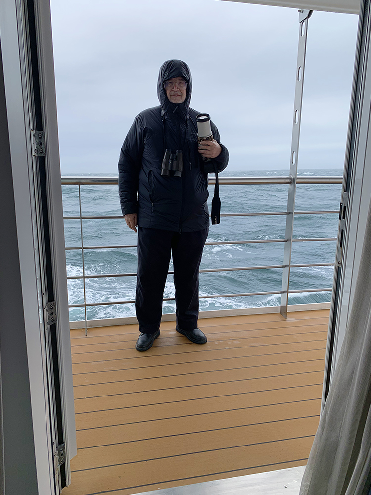
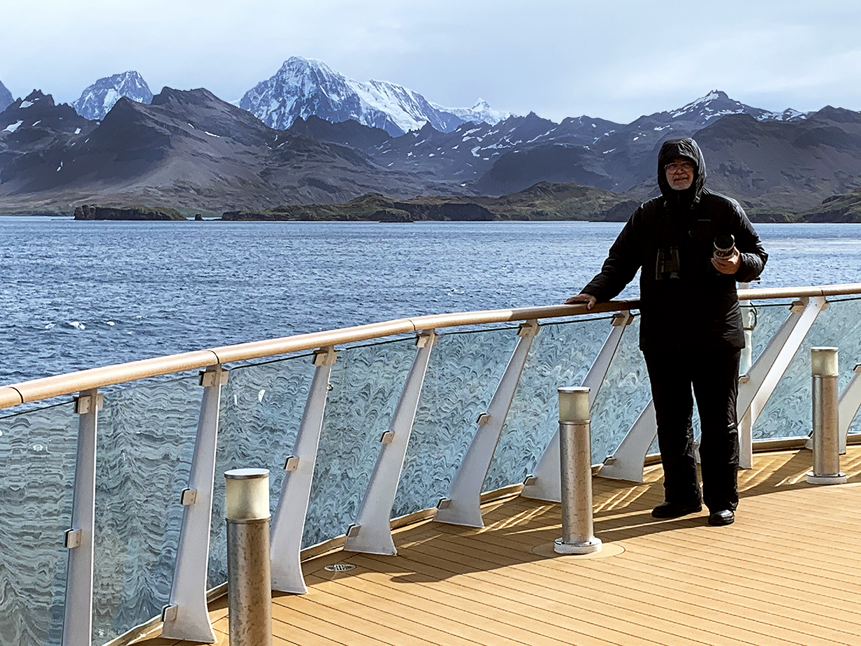
John, dressed for pelagic birding from the balcony of our cabin. Modern parkas are wonderful -- warm enough for all weather that we encountered and practically weightless. Pelagic birding was necessarily always done via a camera with 100-500 mm telephoto, usually used at 500 mm and occasionally used with sqrt(2) extender at 707 mm focal length. For me, binocular views are rarely good enough for a reliable ID; pictures show more detail even (or even especially) when the bird is far away. And my record is permanant and can be included in this web site.
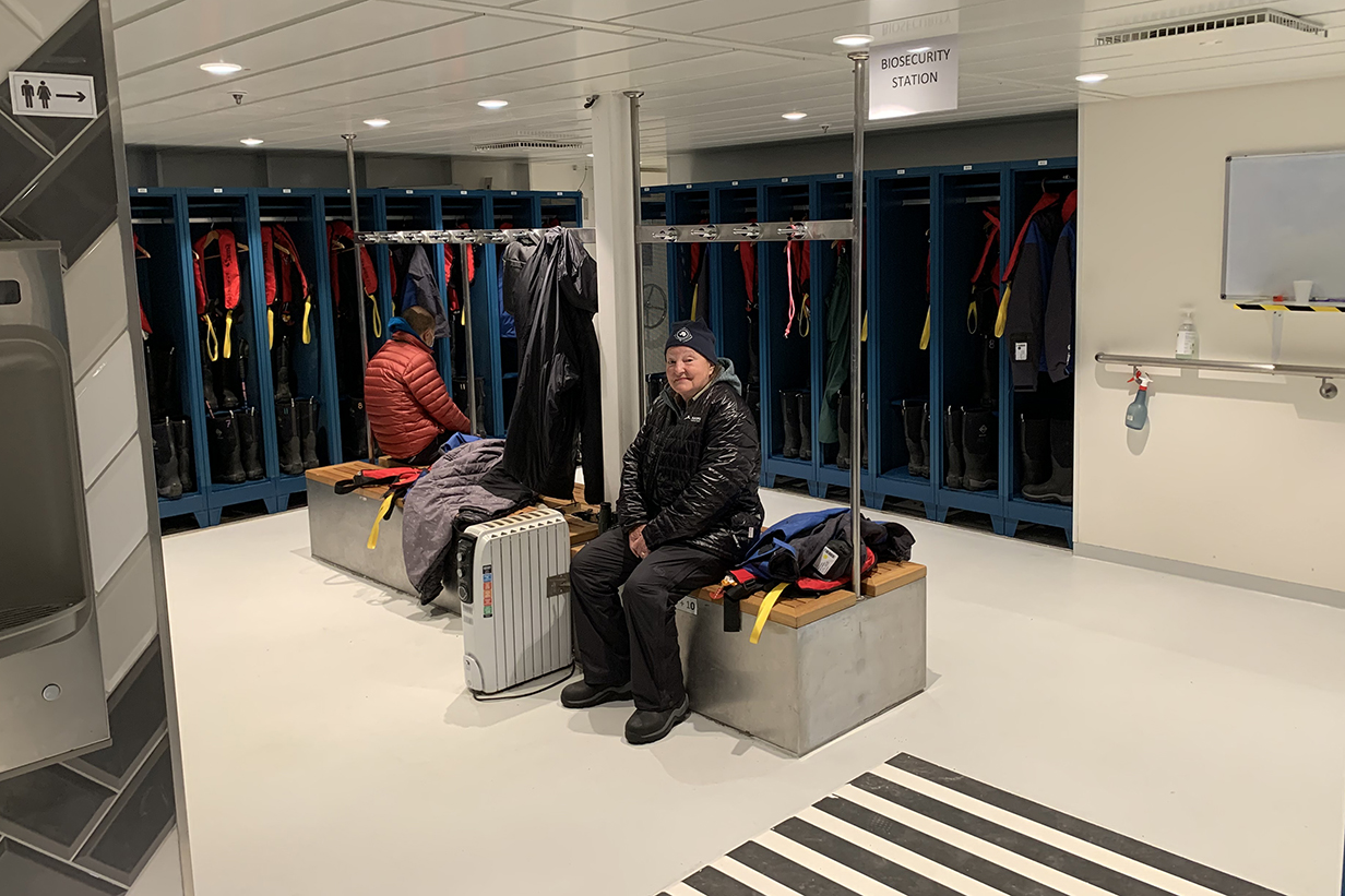
This is the "mud room" down the hall from and one deck below our suite. Our boots and parkas (provided by Aurora) were stored here. This is where we dressed for landings. Strict biosecurity protocols required that we clean all gear thoroughly and walk through disinfectant baths on the way to and from zodiacs. Protection of South Georgia Island from invasive species and from bird diseases is extraordinarily strict. Onshore, we were not allowed to sit down or to throw anything away. We have experienced the result of wholesale and (mostly) willful introduction of foreign species in Hawaii, with the result that endemic species there are at best severely whacked and in most cases (especially birds) extinct. The Hawaii that you see as a tourist is beautiful ... but nothing like Hawaii before the arrival of native Hawaiians and people from the rest of the world. So we were happy to see the extreme care enforced here, even though it was a strain not to be able to sit down, even on snow.
Route Map and Itinerary
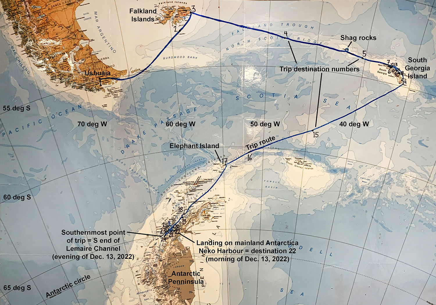
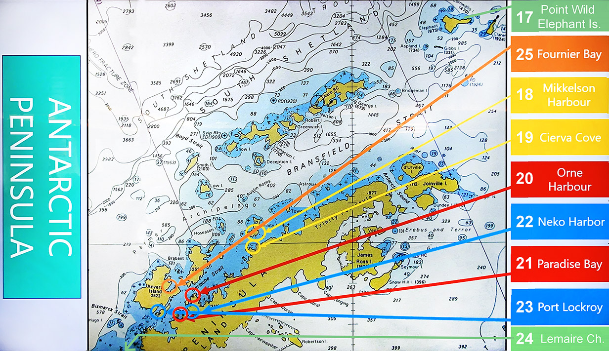
Route map of our cruise from Ushuaia - Falkland Islands - Shag rocks - South Georgia Island - Antarctic Penninsula - Ushuaia. From our last stop (25) at Fournier Bay (where we did not land, because of strong winds), we sailed essentially straight north back to Ushuaia. Here, I have annotated a map made and posted aboard the cruise.
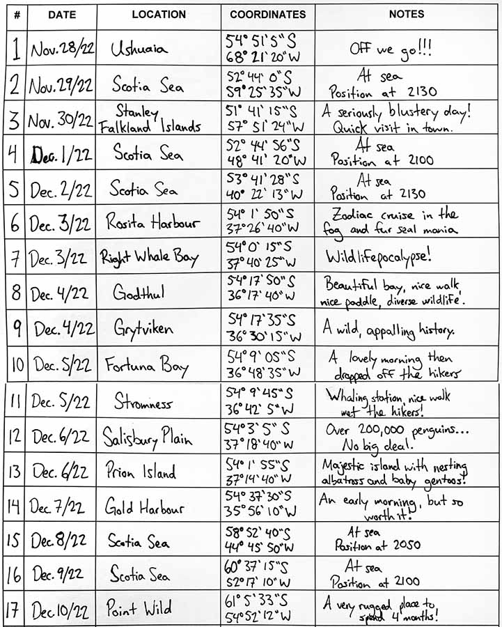
This is roughly the first 2/3 of our itinerary, from Ushuaia to The Falklands to South Georgia Island and to Elephant Island. Column 1 is the destination number in the above map. Column 2 names the place associated with that destination; its latitude and longitude are given in Column 3, and comments are in column 4. Point Wild is on Elephant Island and appears again below. We tested positive for covid on December 9 but were "given credit" that symptoms started on December 8th. So we were quarantined from December 9 - 12 inclusive, emerging from quarantine on December 13th, just in time for our first-ever landing on mainland Antarctica at Neko Harbour. During quarantine, we saw as much as we could from our cabin's balcony, and John did as much pelagic birding and bird photography as possible.
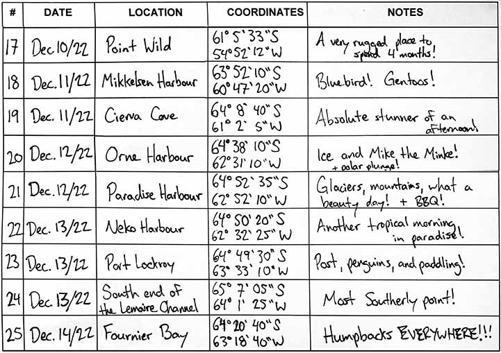
This is the Antarctica part of our itinerary. We were released from quarantine on December 13th, in time for our first and (in this trip) only landing on mainland Antarctica. The most spectacular views were of the Lemaire Channel, late on December 13th. From there, we made a brief stop but no landing at Fournier Bay and then sprinted back to Ushuaia ahead of strong winds. A few days -- notably our brief stop in the Falklands -- were too windy for landings, but mainly we had good weather. This was in large part because the Aurora team did a superb job of using islands to keep us sheltered from high winds that caused serious trouble for other cruise ships. The biggest waves that we saw were ~ 15 feet from trough to crest; the rolling of the ship was more soothing than stressful, and we did not get seasick.
Destination 1 - Ushuaia
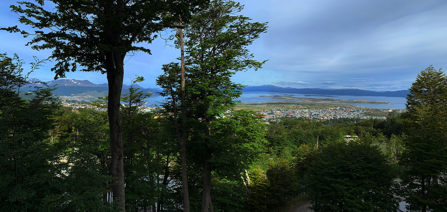
Ushuaia from our hotel in the mountains NW of downtown on the day before embarkation
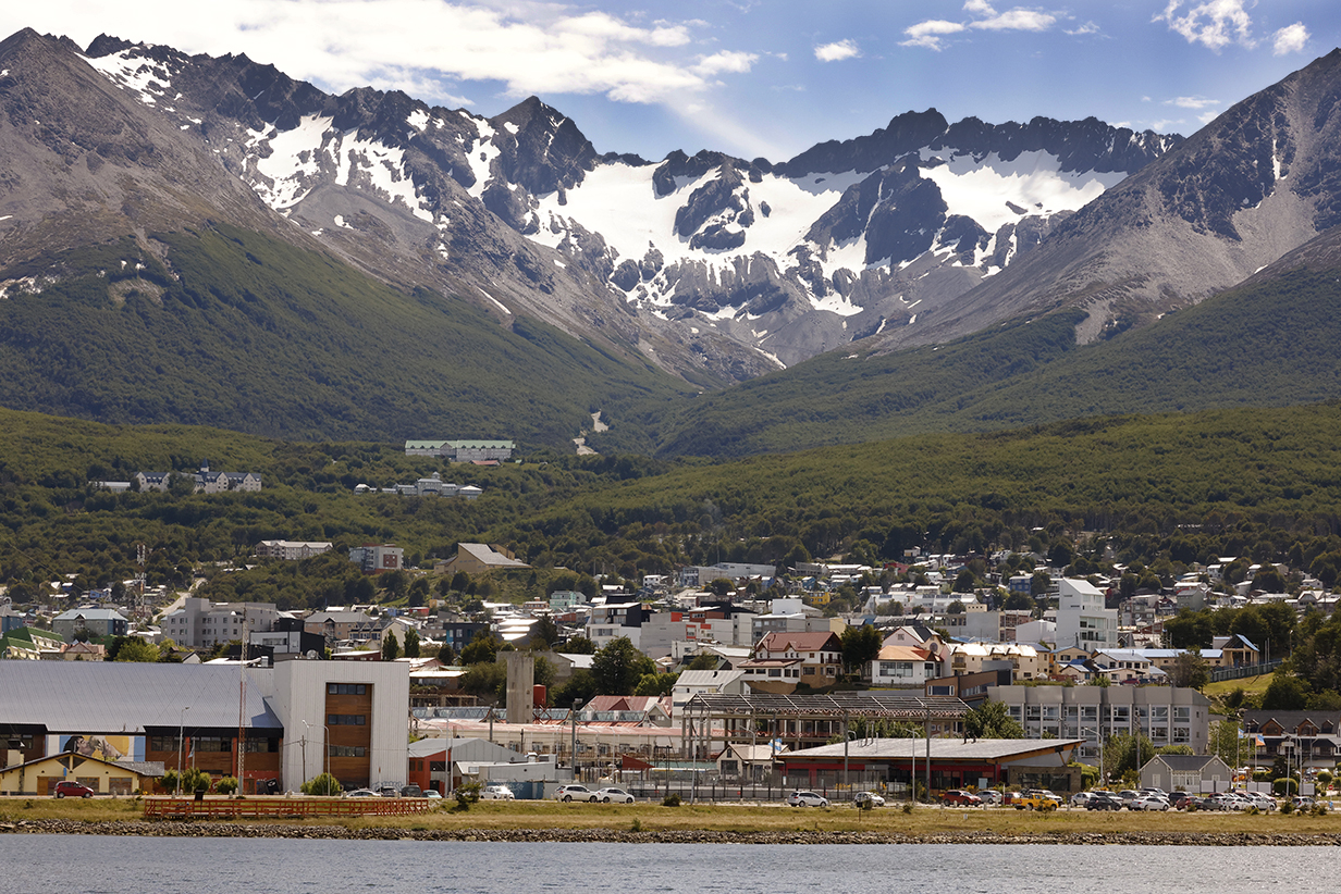
Ushuaia and mountains
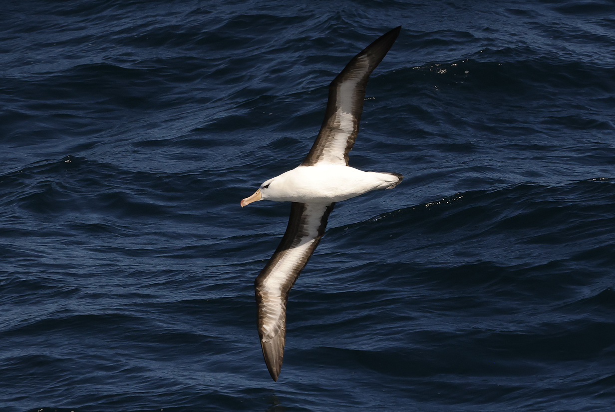
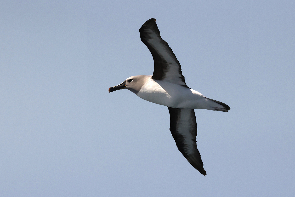
We did a lot of pelagic birding, especially during days at sea. This Black-browed albatross was seen early, while cruising from Ushuaia to the Falkland Islands. Pelagic birds are mostly documented in a section at the end, but I include a few pictures in context to preserve some of the flavor of the trip.
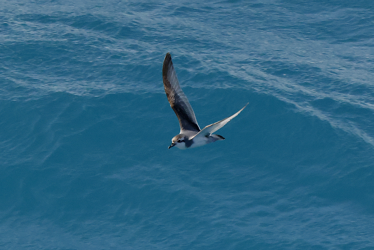
Slender-billed prion, also early in the voyage
Gray-headed albatross was new on the first full day of the cruise, November 29, 2022.
3 - Stanley, Falkland Islands
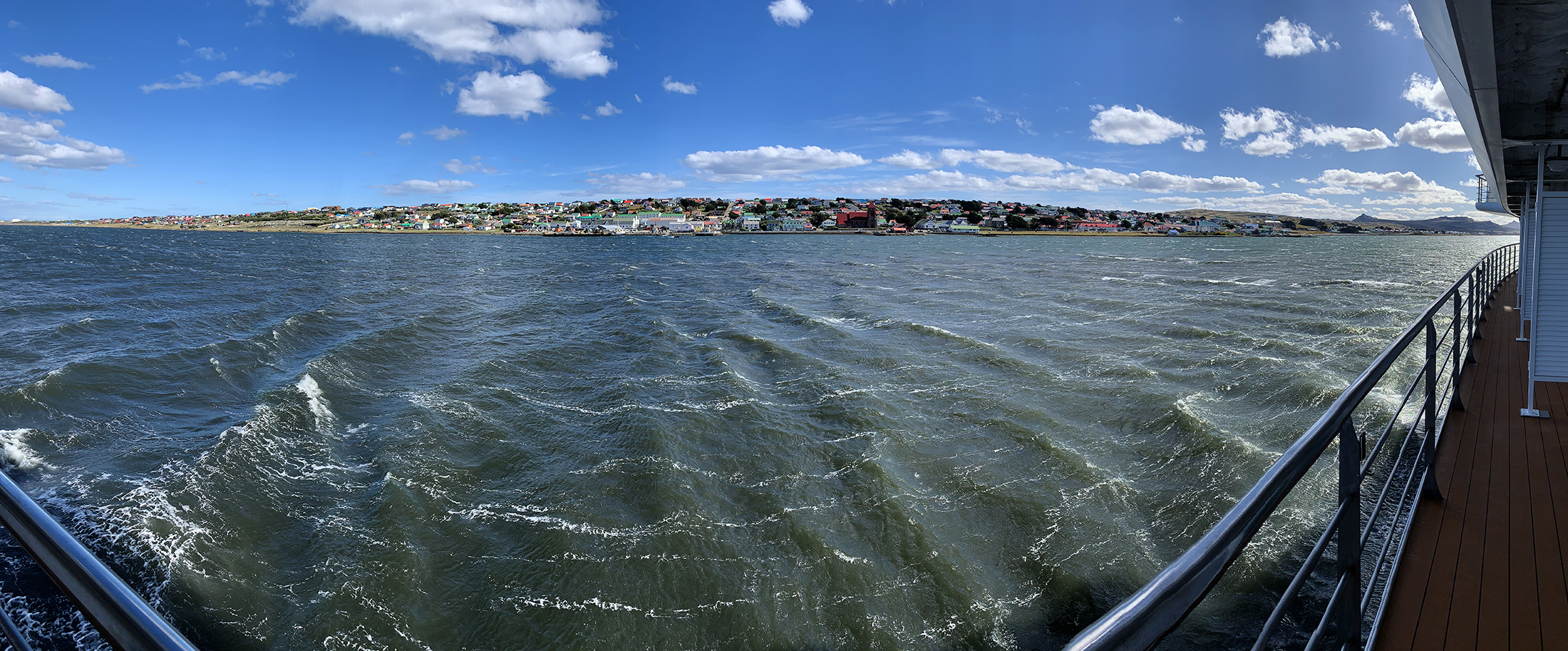
Port Stanley, Falkland Islands, in a 180-degree panorama (It was very windy, so we skipped the brief landing here, and the ship skipped other possible destinations in the Falklands. We did better during our Seabourn cruise, when we both took a (not very productive and still very windy) shore excursion to Port Stanley and vicinity and John took a wonderfully successful shore excursion to New Island.
South American tern (This is John's 4000th life bird, near the harbour at Stanley, Falkland Islands, on November 30, 2022. The confident ID by Barry Lyon is based in part on the birds range and on the dark line along the trailing edge of the wings. Note also the long, chunky bill.)
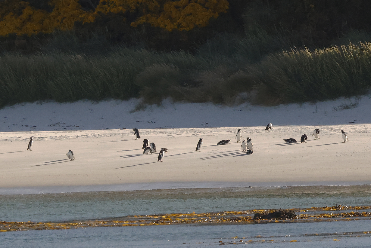
Magellanic penguins on a Falkland Islands beach, one of 5 new penguins species seen during this trip. Unfortunately, it was too windy to land, so this was the best look that we got.
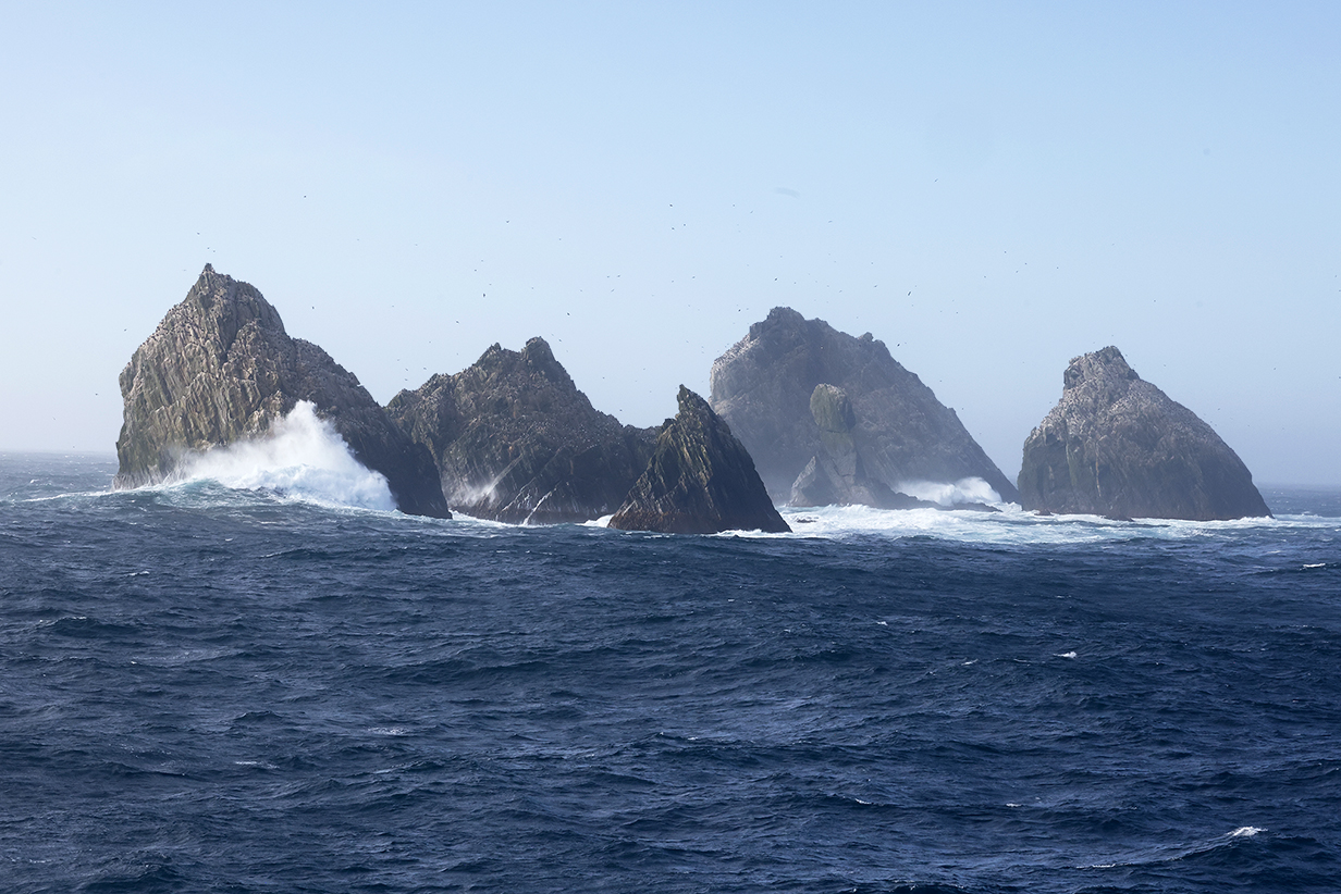
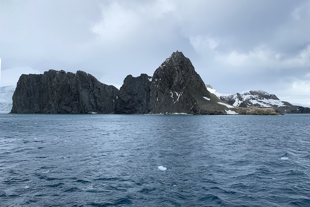
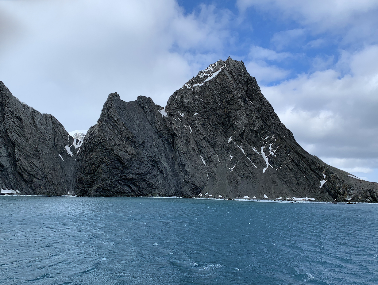
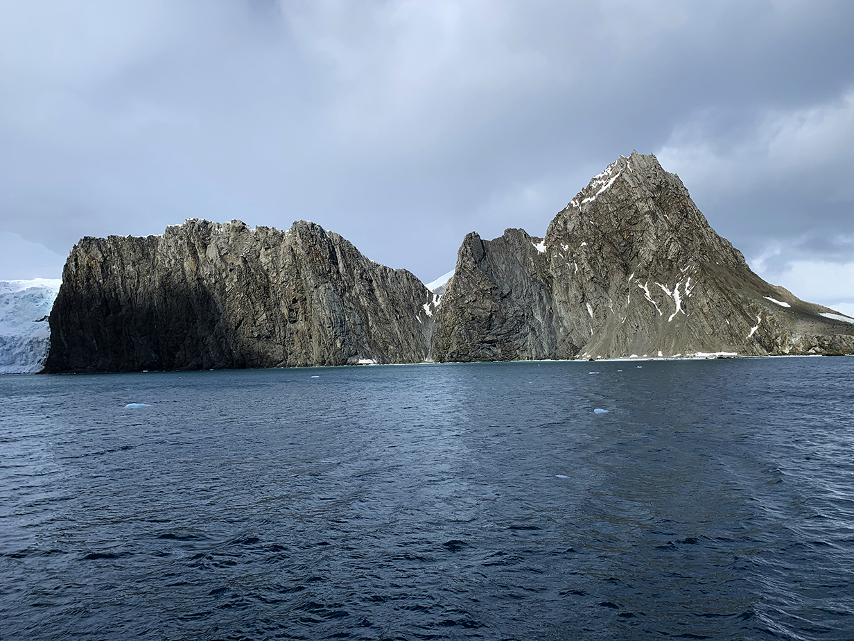
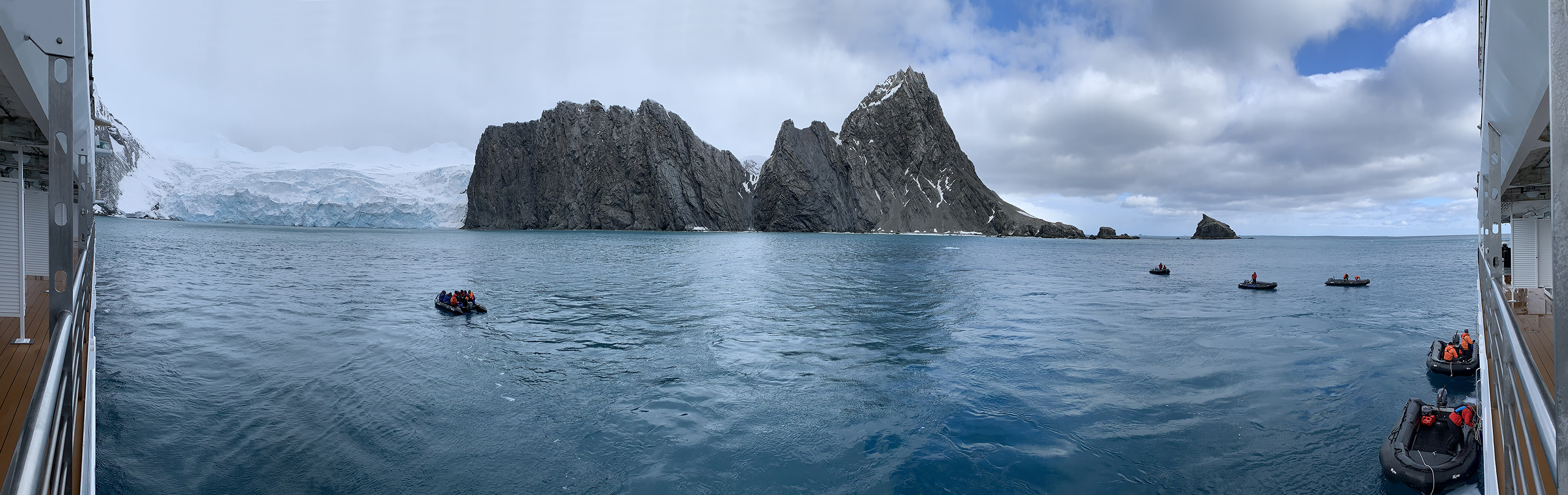
~ 4.8 Shag Rocks
On December 2, 2022, we passed Shag Rocks -- six small islands 620 miles east of the Falkland Islands and 250 miles west of South Georgia. Wikipedia says that they cover less than 49 acres. The highest peak is 246 feet above sea level, and they stand in water that's ~ 1047 feet deep.
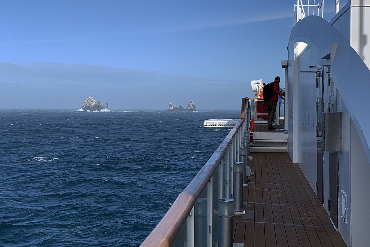
Approaching Shag Rocks -- a lonely outpost for us but perfectly isolated and safe for nesting birds
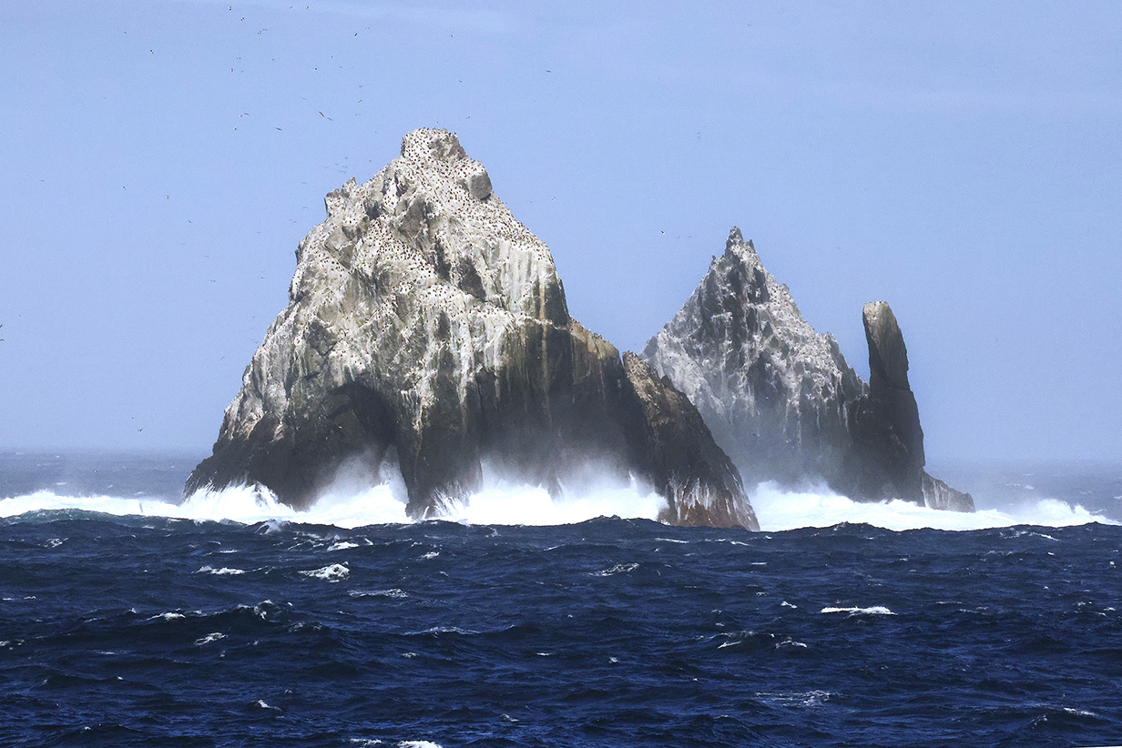
Approaching Shag Rocks in evening sunlight. They are covered in birds, mainly South Georgia shags.
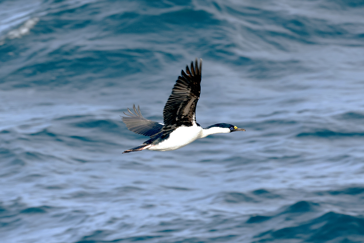
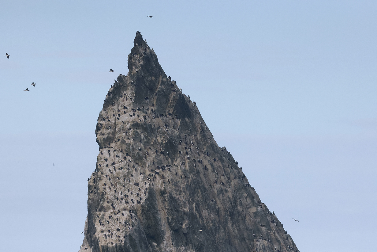
South Georgia shag (Leucocarbo georgianus) -- new on this trip -- has a nominal range that includes Shag Rocks and South Georgia Island. We saw them regularly for the next few days.
Leaving Shag Rocks on the way to South Georgia Island, evening of December 2, 2022
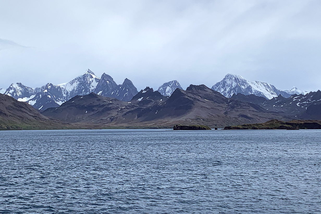
South Georgia Island
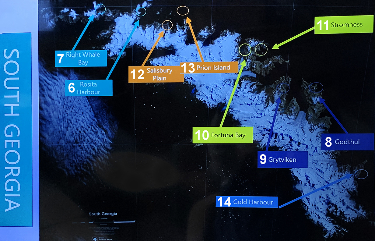
Map of Sough Georgia Island showing our destinations numbered in white. Most of them were landing sites. Our first landing was at 6 = Rosita Harbour, below:
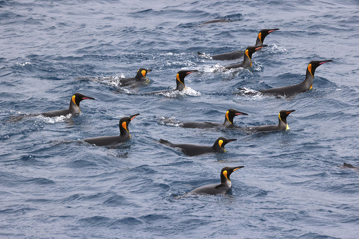
We saw our first King penguins swimming off South Georgia Island.
6 - Rosita Harbour
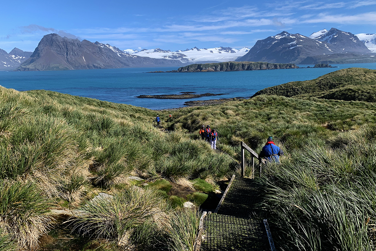
Our first zodiac landing was at Rosita Harbour on September 3, 2022.
The bay where we landed was dominated by fur seals, with a few King penguins near the shore and lots more just a little inland. The tricky aspect of landings in South Georgia was to stay far enough away to preserve the safety of penguins and seals. They were rarely aggressive, but they were often curous and wanted to come close to us. Then you had to back up warily ... while being careful that you did not as a result get too close to animals that were behind you. And that were also curious.
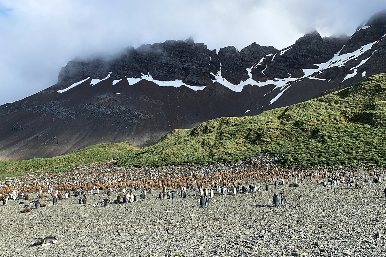
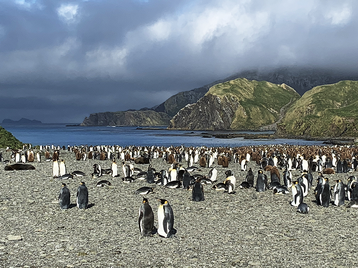
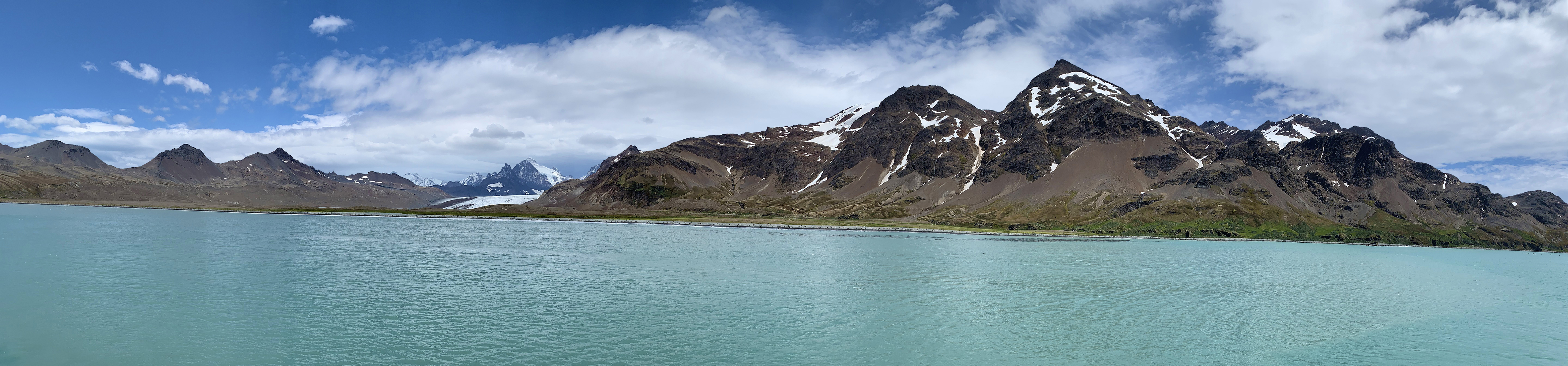
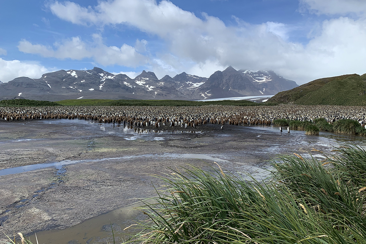
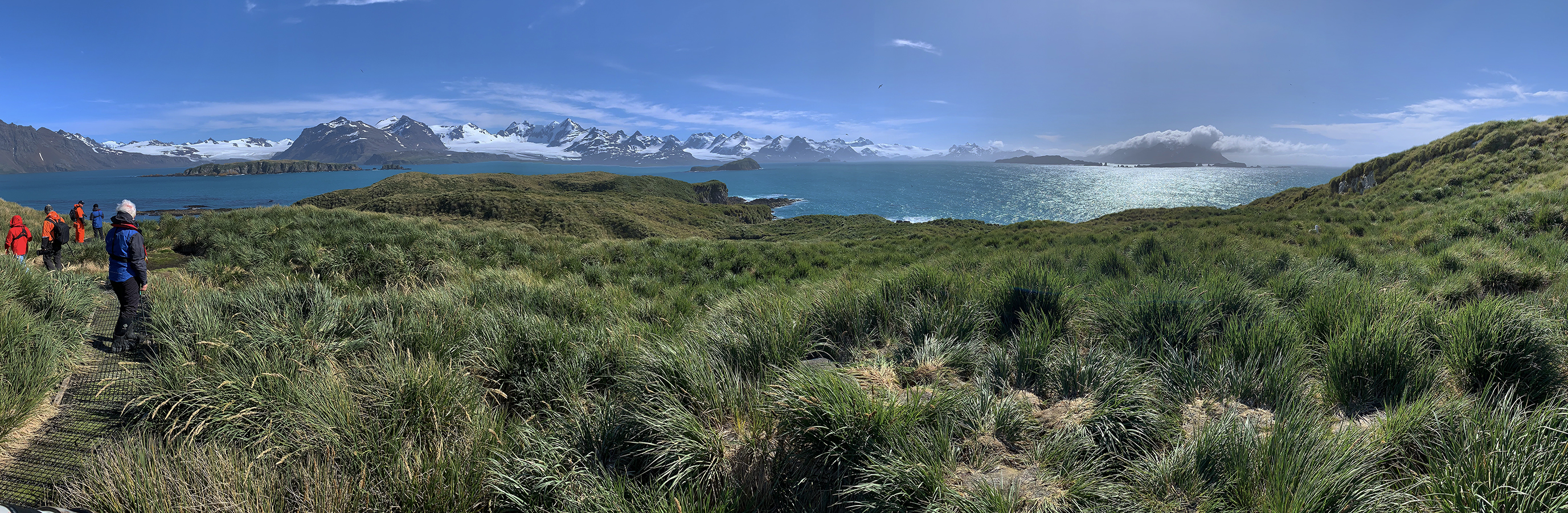
Rosita Harbour panorama from near the shore: scroll right to see it all. Just inland from the beach, King penguins already outnumbered seals by a lot. The main concentration of penguins shown below is on the low plateau at the foot of the hill in the distance at left. A few people can be seen approaching the low part of the plateau, from which we approached the main colony shown below.
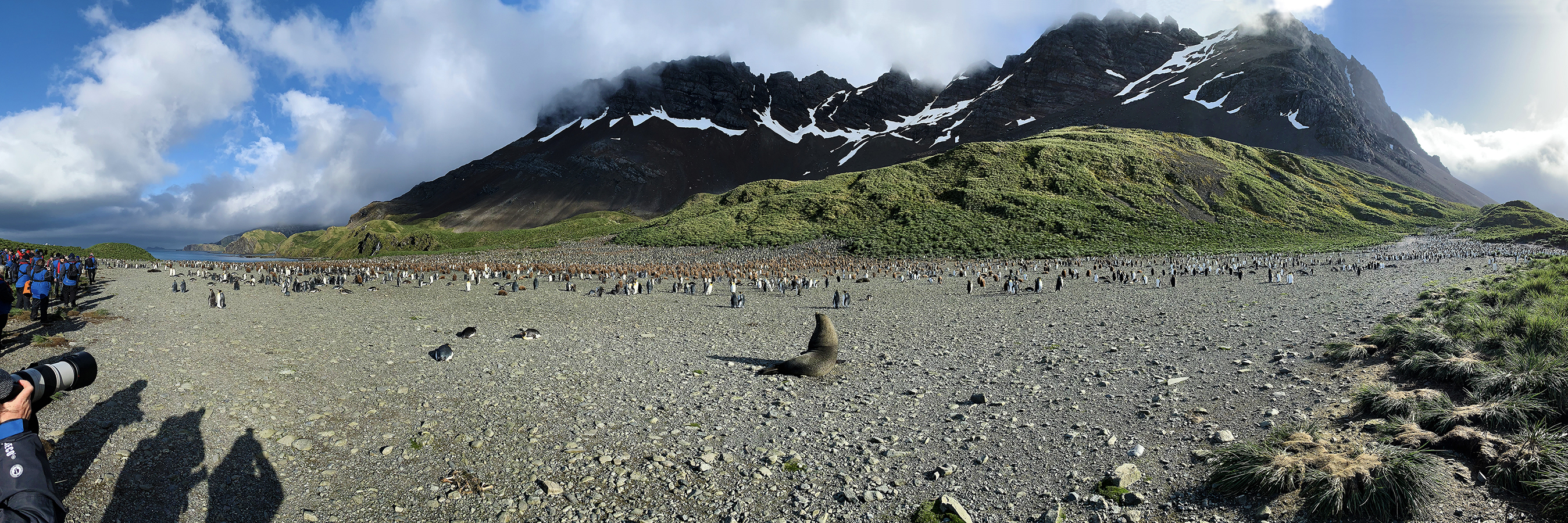
Rosita Harbour on South Georgia Island was our first big colony of many thousands of King penguins. Plus at least one fur seal. Scroll right to see the full panorama.
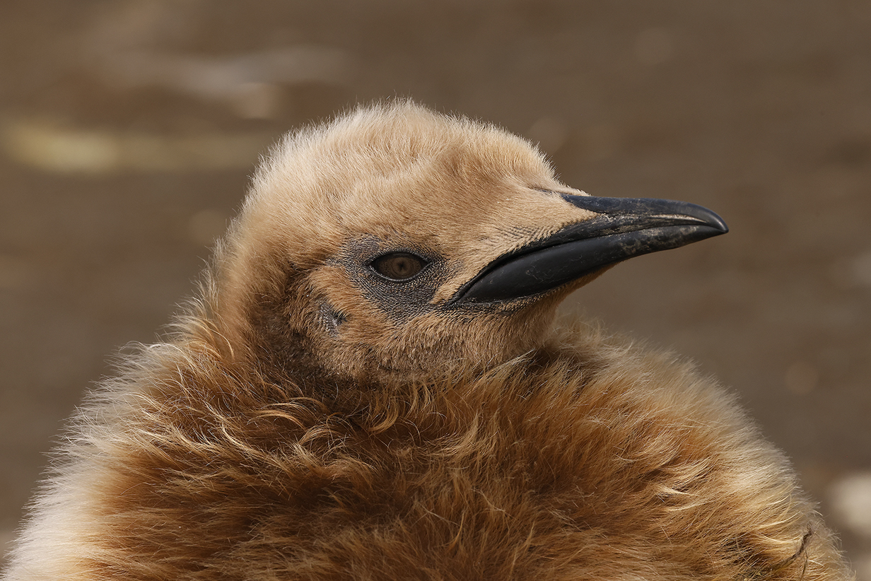
King penguin yearlings are conspicuously well fed -- they have to survive without food while they moult out of their brown down into adult "tuxedo" plumage.
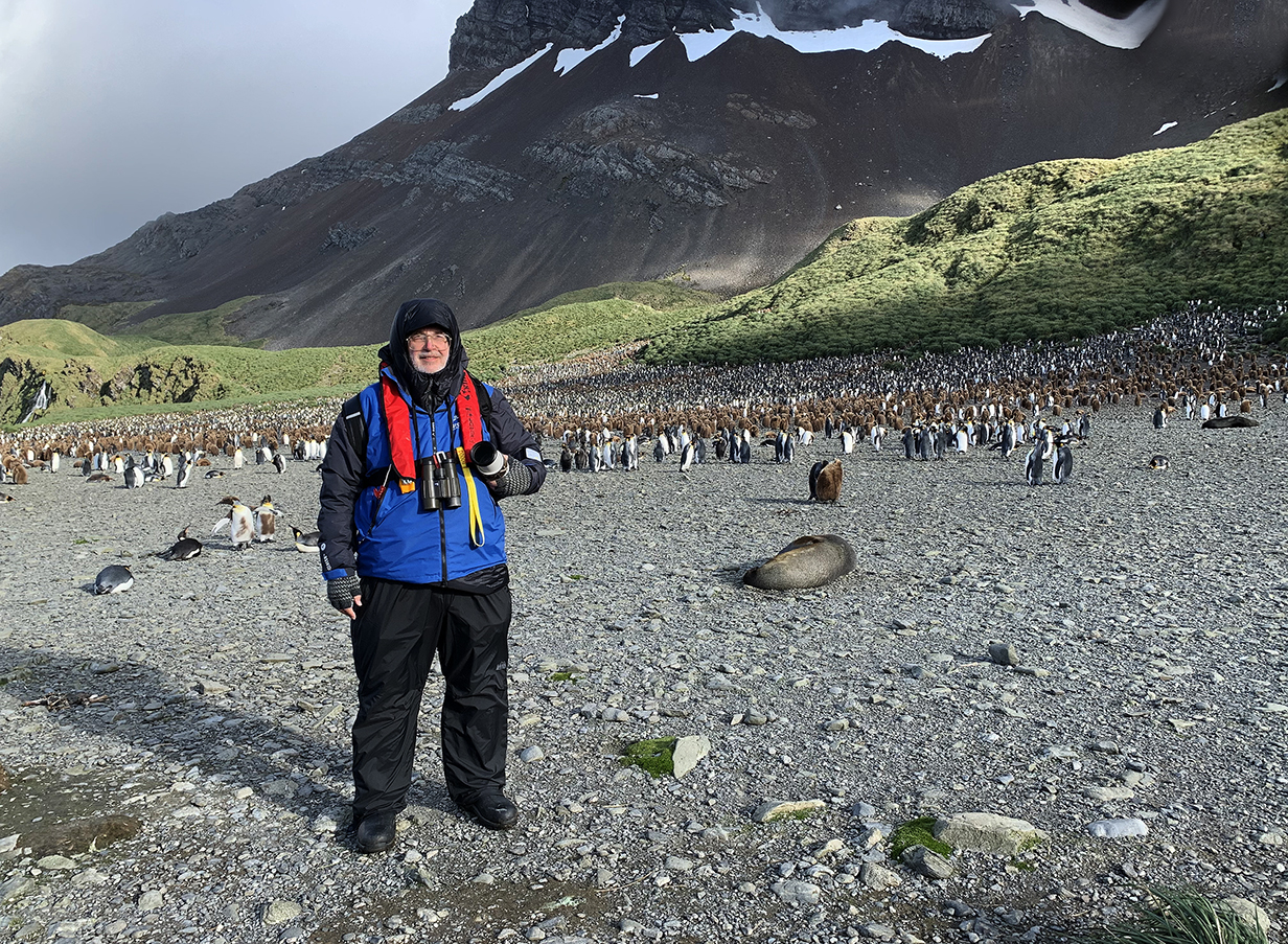
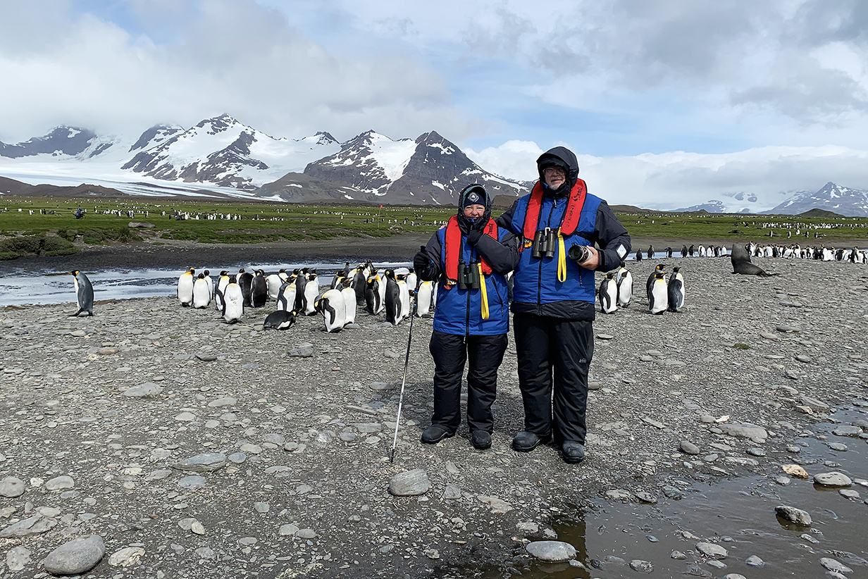
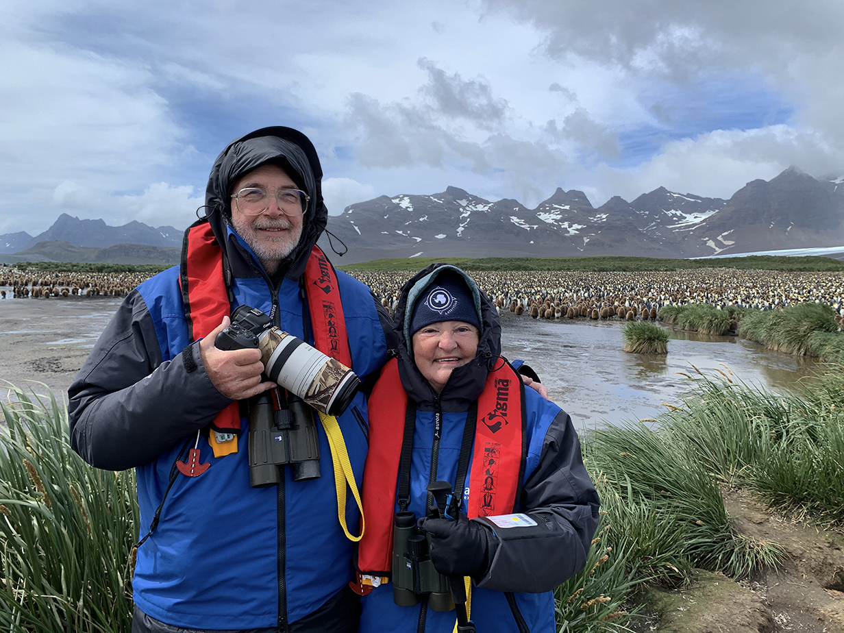
John and penguins (photo by Barry Lyon) Note the cold-weather gear: calf-high boots for landings, which -- in up to a foot of water -- were almost always wet, waterproof overpants, because you get splashed in zodiacs, invisible inner fluffy parka plus outer blue shell, red lifevest, which had to be adjusted for John's size, so he never took it off, ashore, and sometimes gloves. South Georgia was easy, always above freezing temperatures. In Antarctica, temperatures were usually at or a few degrees below freezing: still not difficult. Here, Rosita Harbour was a superb first landing.
King penguins in magnificent setting
King penguins
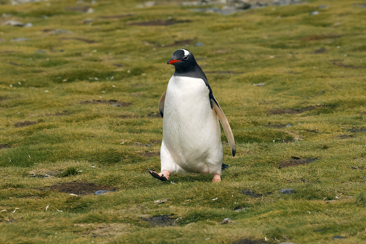
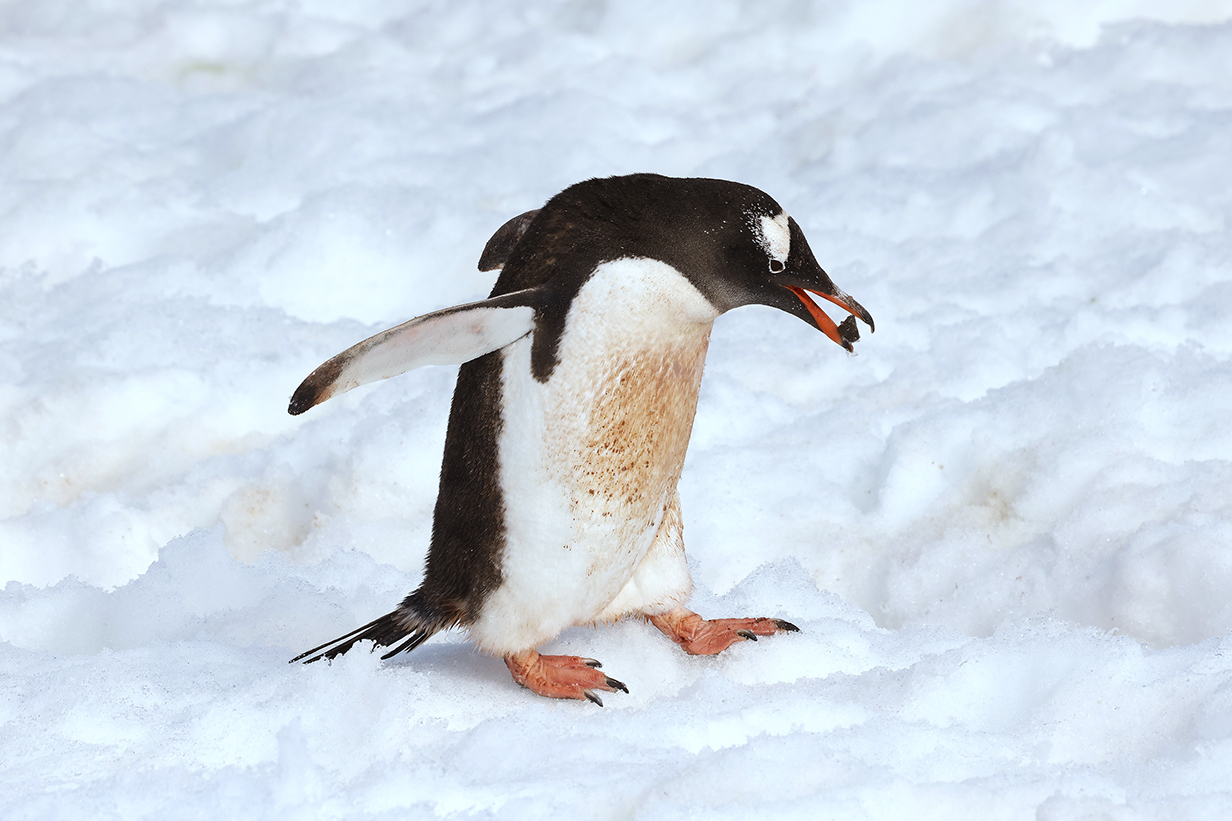
Here comes our life bird Gentoo penguin!
During the rest of the trip, we saw, conservatively, maybe 1000 Gentoo penguins. This was our first one, at Rosita Harbour.
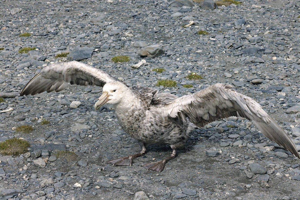
Southern giant-petrel
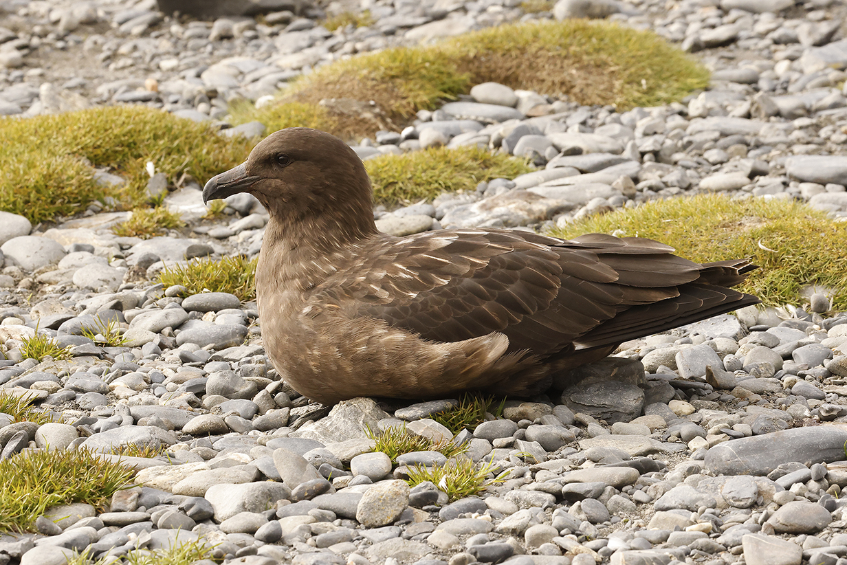
Brown skua (always around nesting penguins and always on the lookout for vulnerable chicks)
8 - Gothhul
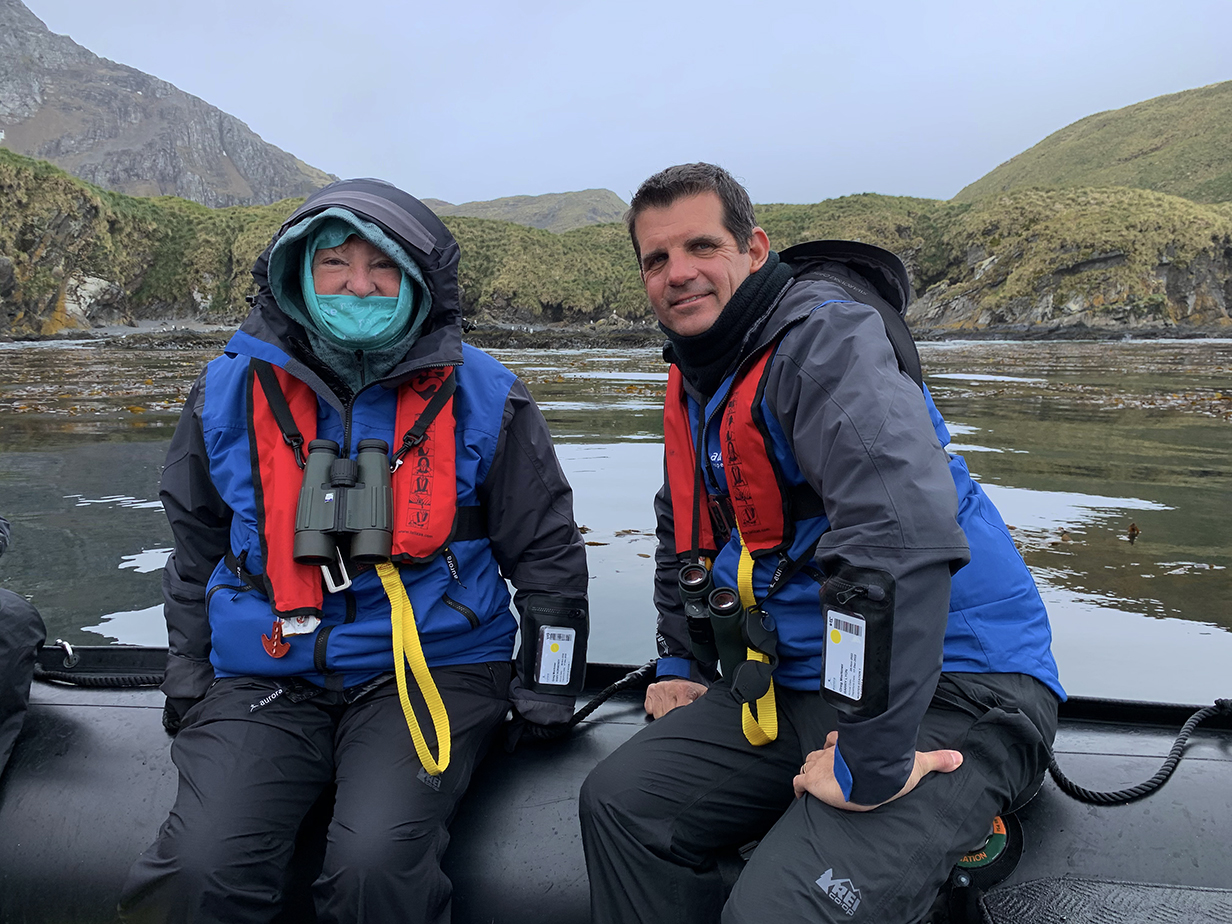
During the morning of December 4, 2022, we took a zodiac cruise around the bay at Godthul = destination 8. Zodiac cruises were generally colder than landings. Here Mary -- well prepared for cold winds -- is with our superb guide, VENT's Barry Lyon. Occasionally, we got life birds during zodiac cruises; on this one, we saw Snowy sheathbill for the first time. After the zodiac ride, the ship was repositioned for the afternoon landing at Grytviken.
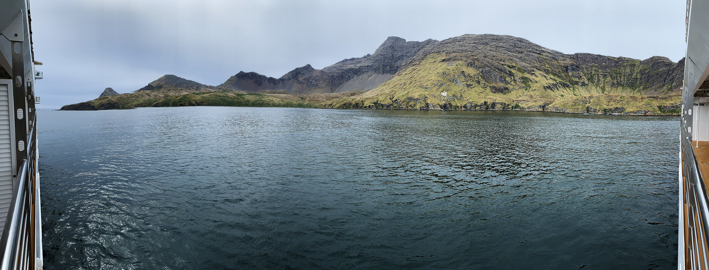
Panorama of Godthul ("Good Hollow" in Norwegian) from the balcony of our cabin on the Greg Mortimer
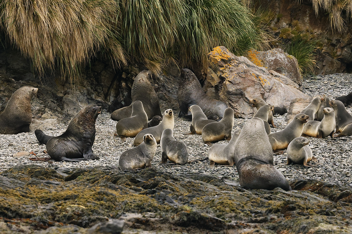
Fur seals during the zodiac ride
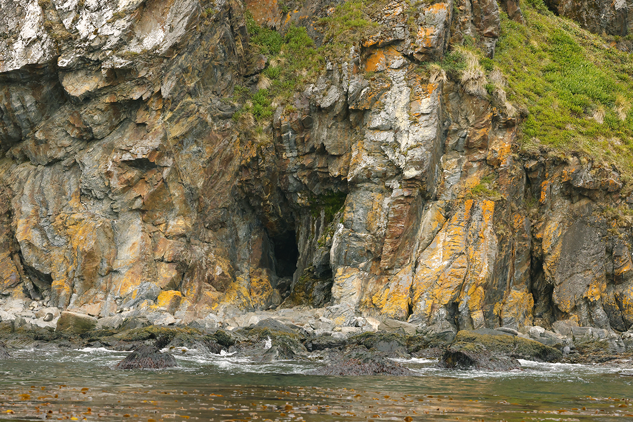
Rugged cliff and cave, lichen, and grass
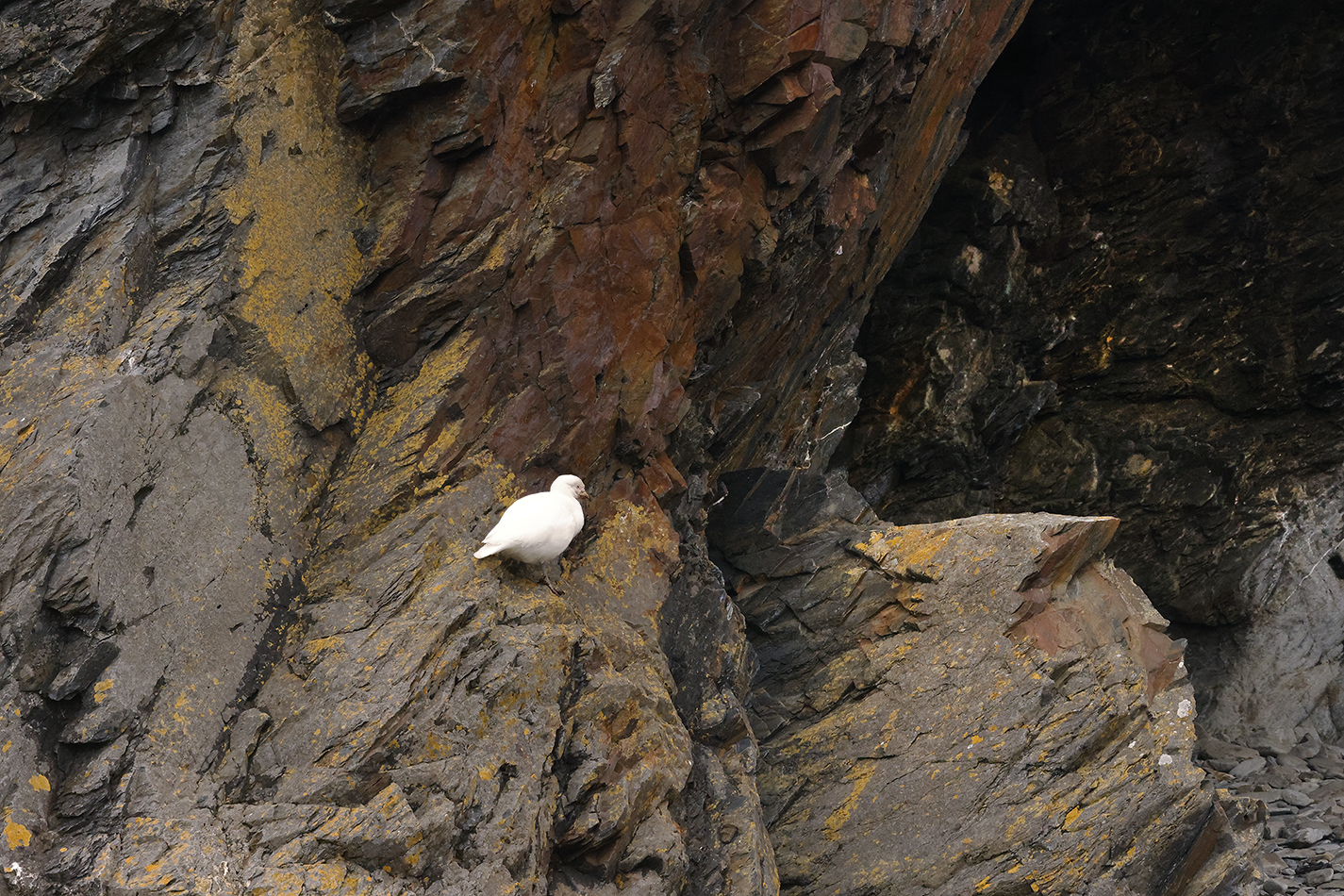
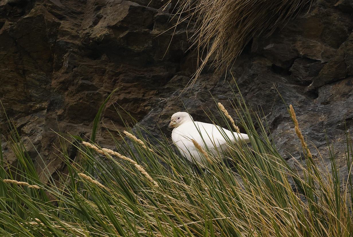
Snowy sheathbill -- new here -- nested in the cliffs around Godthul.
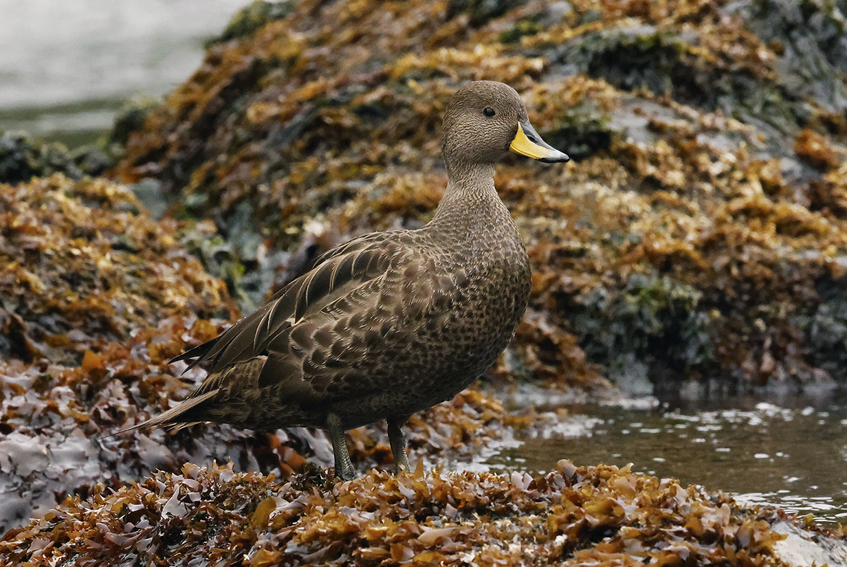
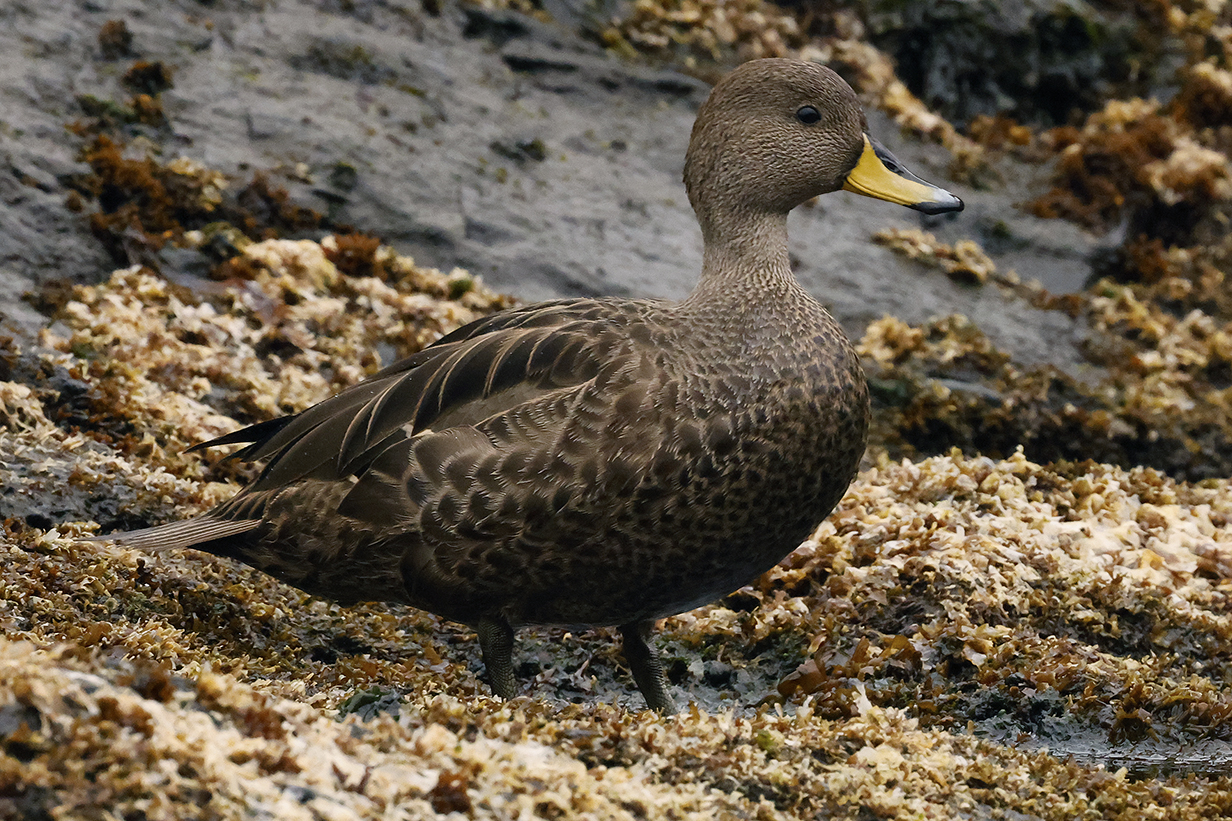
Yellow-billed pintail (The South Georgia subspecies is nominate: Anas georgica georgica.)
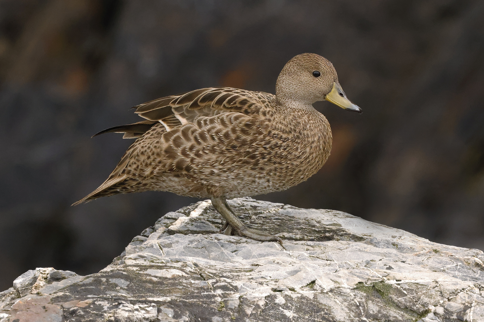
Yellow-billed pintail one more time -- beautiful duck well seen
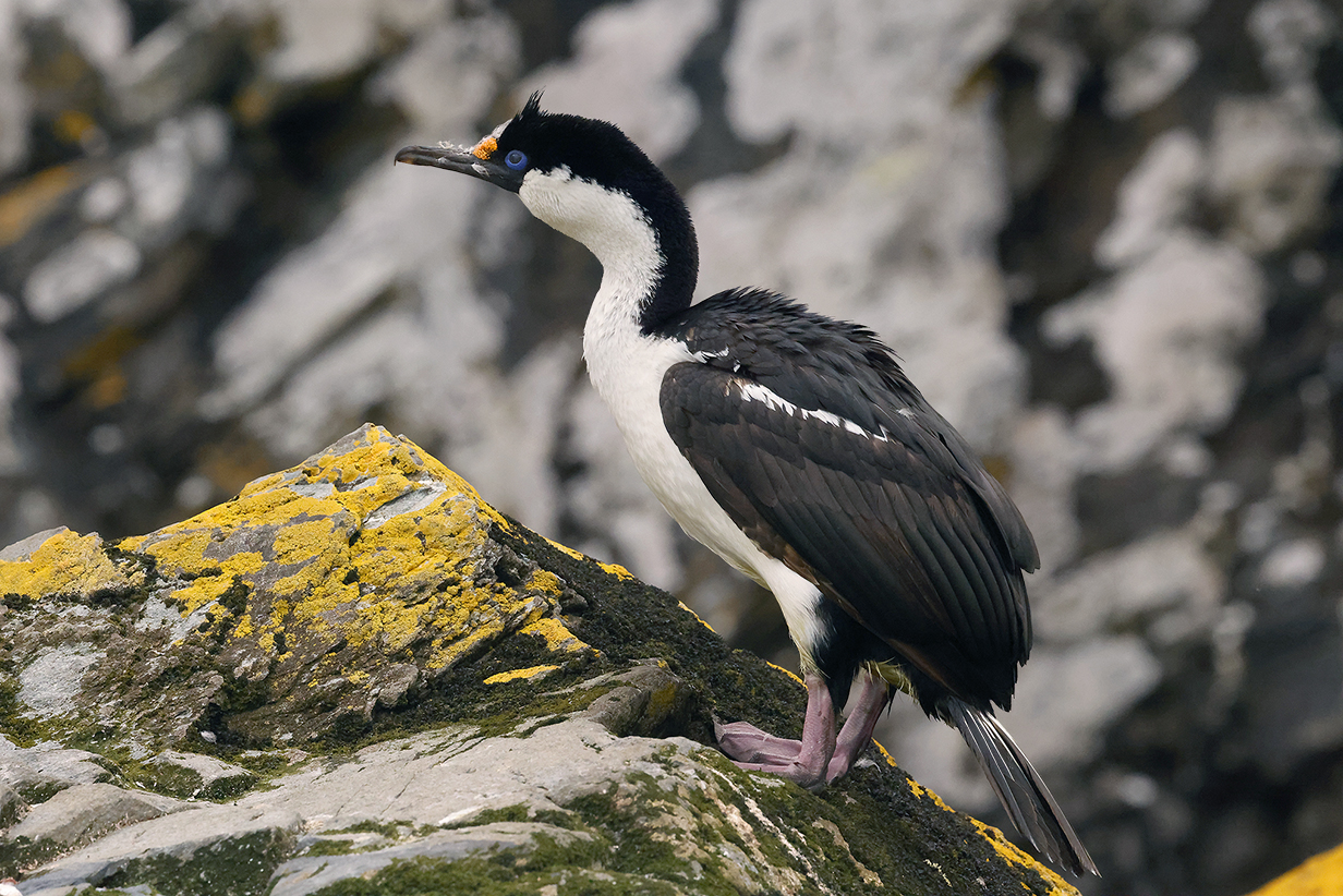
South Georgia shag -- same species as on Shag Rocks
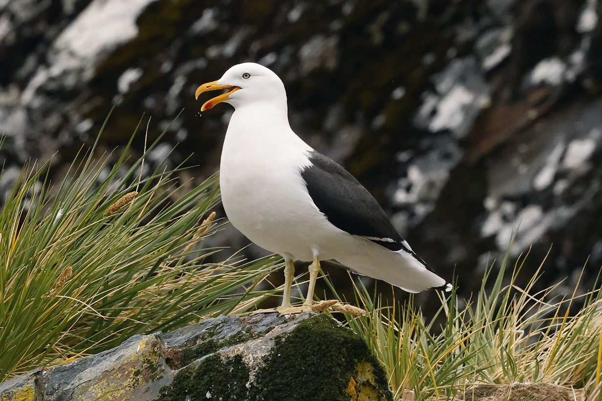
Kelp gull
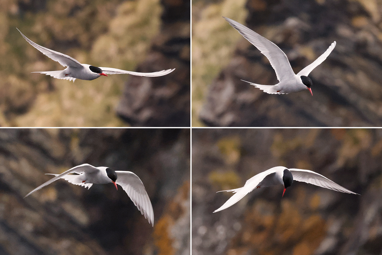
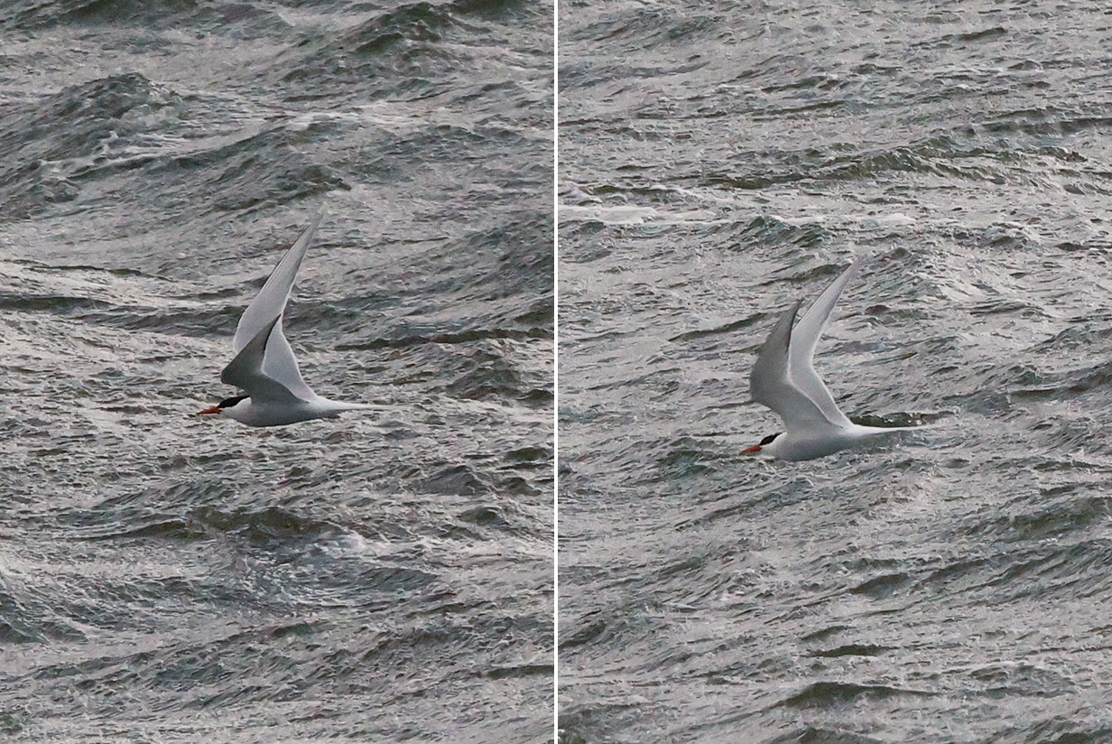
Antarctic tern in full breeding plumage
9 - Grytviken
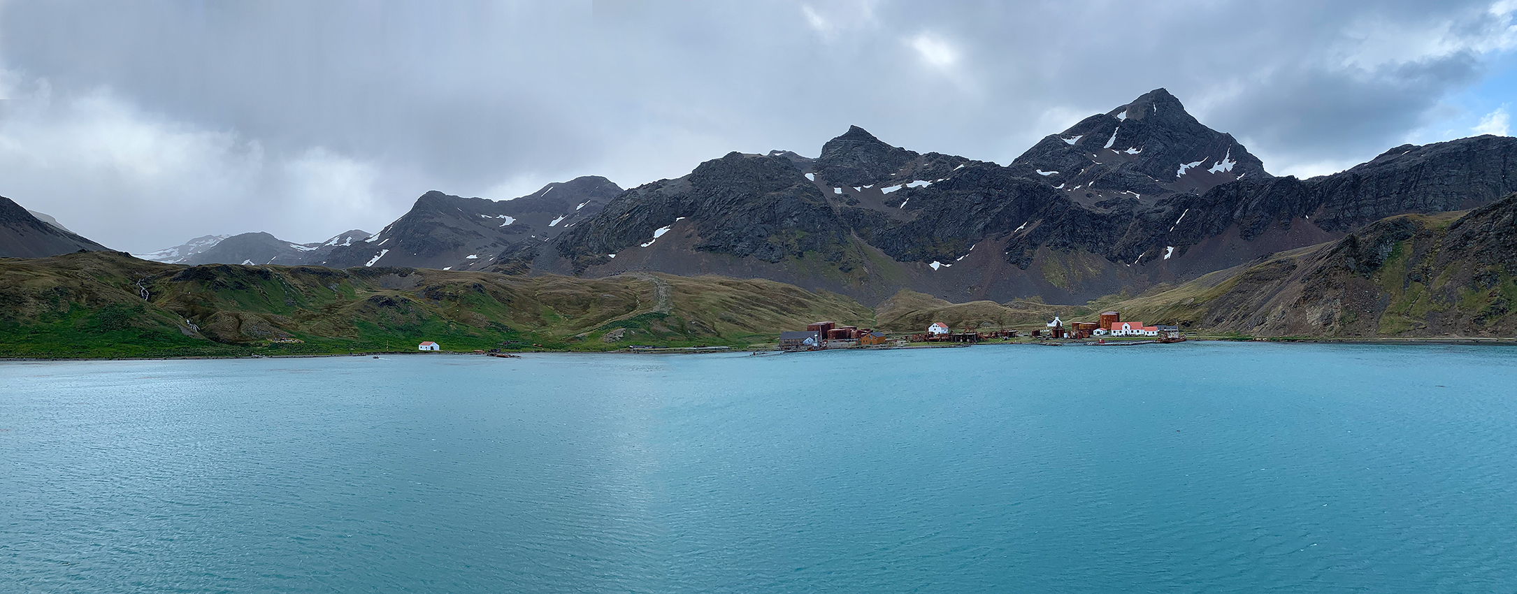
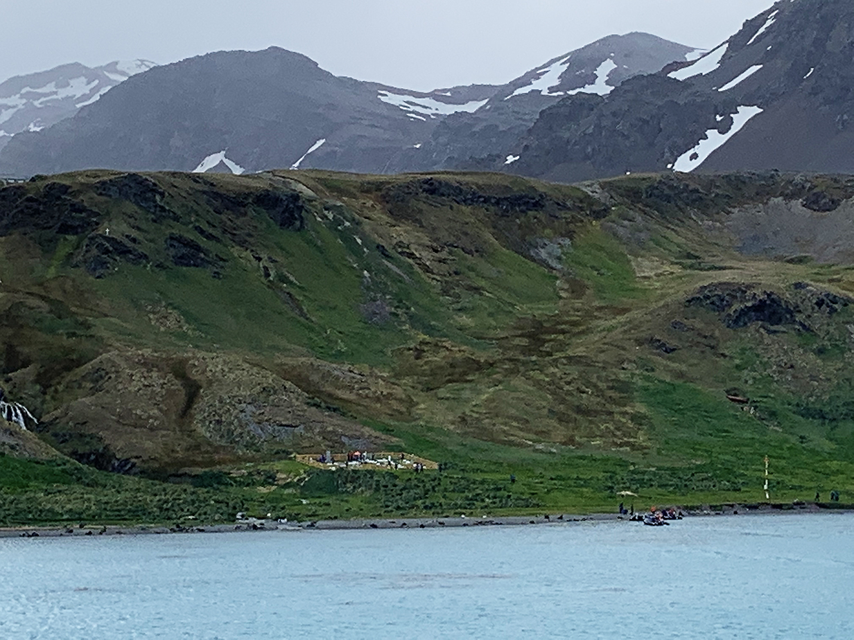
Grytviken was a whaling station from its founding on November 16, 1904 until 1966. The whaling detritus is not charming, but the surroundings -- like the rest of South Georgia Island -- are peaceful and magnificent. The cemetery at left includes the graves of Sir Ernest Shackleton and his "right-hand man", Frank Wild. Scroll right to see the full panorama. These pictures were taken from the balcony of our suite on Greg Mortimer.
Grytviken cemetery (Sir Ernest Shackleton's grave has the only stone that is taller than the wall that surrounds the cemetery.)
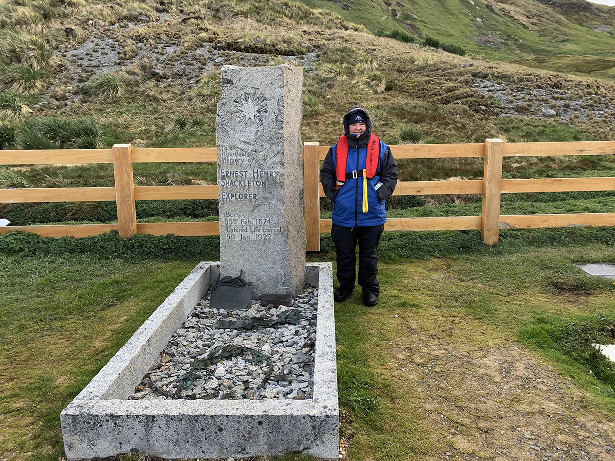
Grave of Sir Ernest Shackleton (1874-1922), Grytviken, December 4, 2022
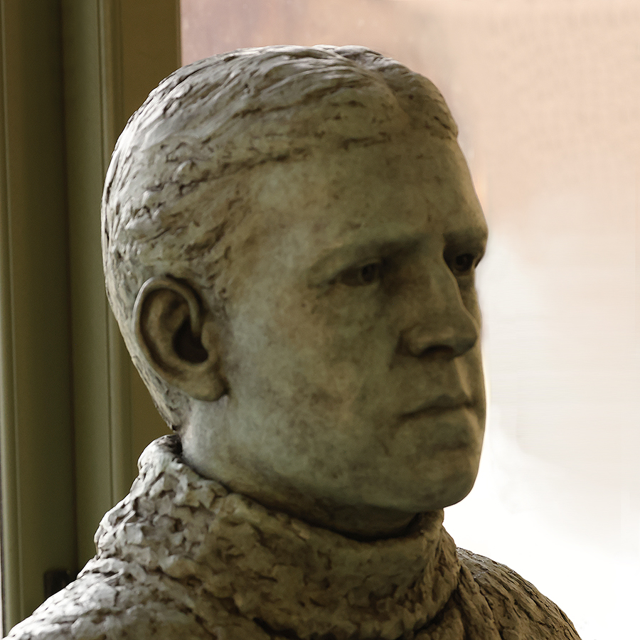
Bust of Sir Ernest Shackleton in the museum at Grytviken. The remarkable oddysey of the 1914-1917 Imperial Trans-Antarctic Expedition is posted here and summarized briefly in these web pages in the sections on Fortuna Bay, Stromness, and Elephant Island, below. Further pictures of these places and their connections with Shackleton's trip are posted in the web pages on our second cruise to Antarctica.
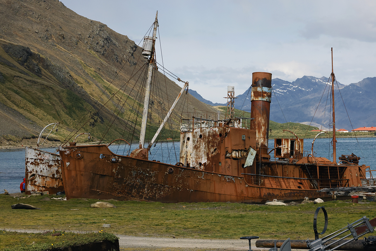
Derelict whaling ships at Grytviken harbour
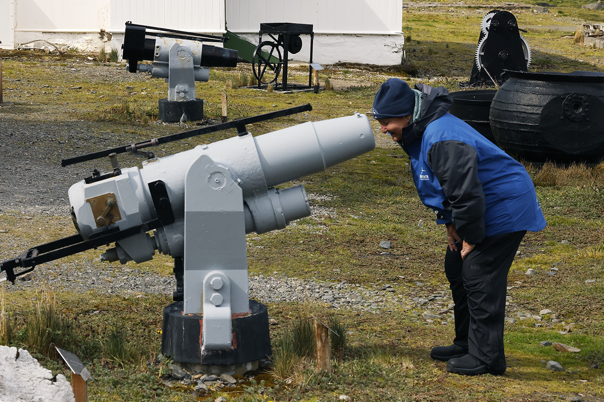
Mary and cannon outside the museum at Grytviken
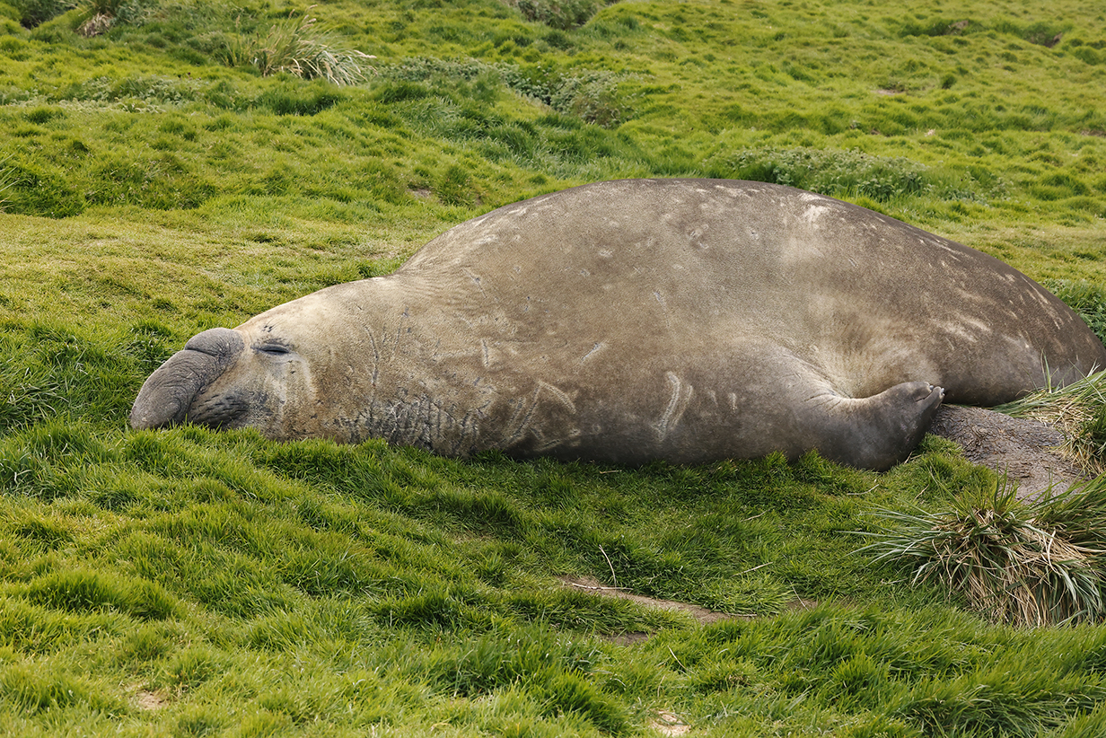
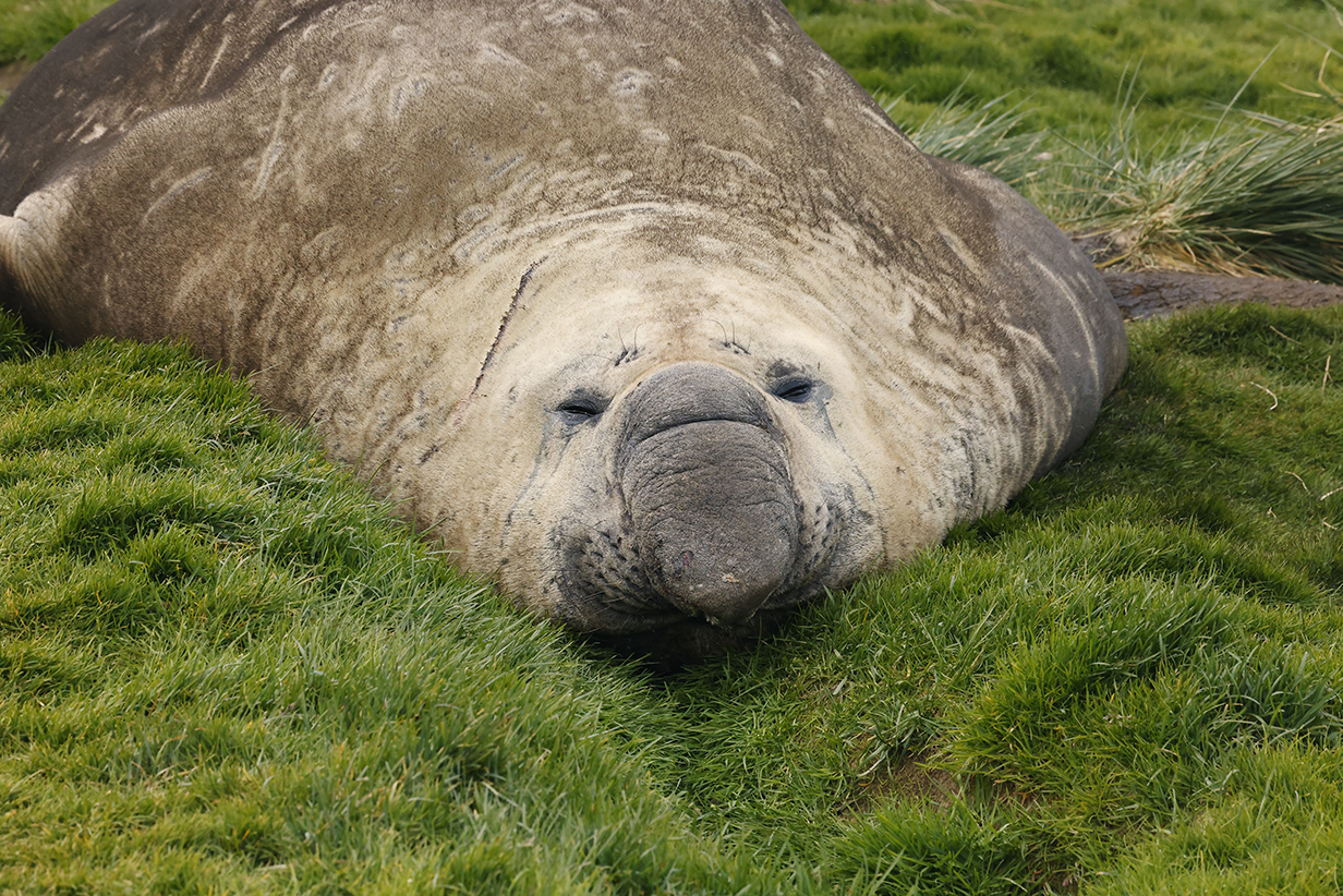
Sleepy male elephant seal "beach master" (mating season is over)
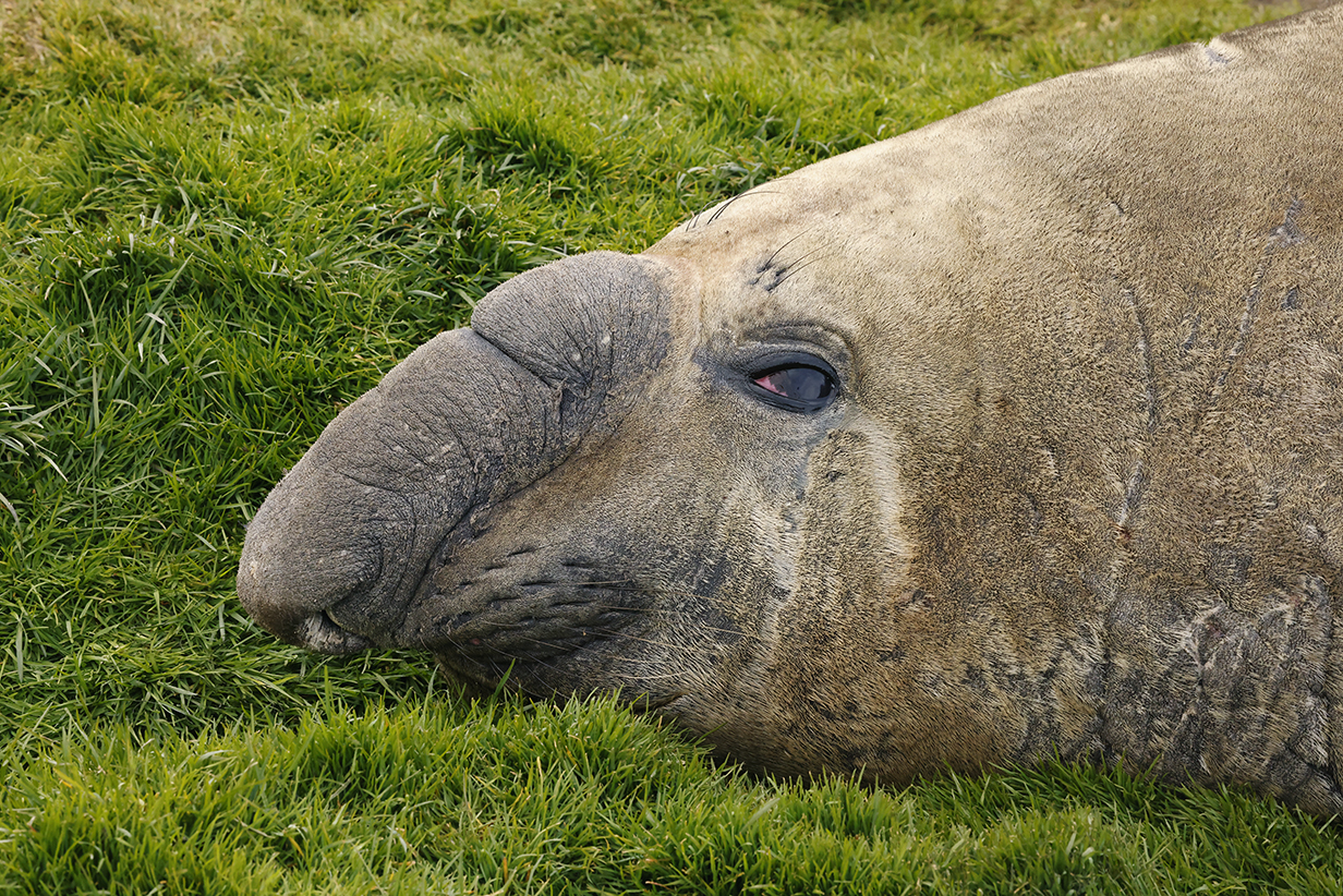
Elephant seal (Hello?)
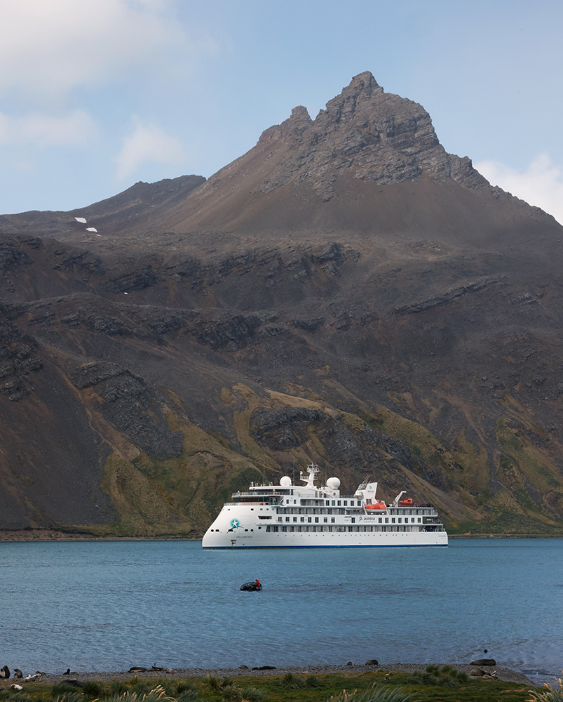
Greg Mortimer from the cemetery at Grytviken. We took a zodiac back to the ship from here, and then the ship set sail for Fortuna Bay.
10 - Fortuna Bay
Fortuna Bay on the morning of December 5, 2022. Scroll right to see the full panorama.
Abstracted from Wikipedia: The epic 1914-1916 odyssey of Sir Ernest Shackleton and crew culminated in a hike from Fortuna Bay to Stromness Harbour, where there was a whaling station and the means of rescue. Shackleton and crew began what was intended to be the Imperial Trans-Antarctic Expedition (effectively) on September 27, 1914 in Buenos Aires. His ship, the "Endurance", was trapped in Antarctic ice from January 19, 1915 until she broke up on November 21, 1915 and sank in 9869 feet (3008 m) of water. After camping for months on the ice, Shackleton and crew managed to take lifeboats to Elephant Island (see above map); Wikipedia says that "this was the first time they had stood on solid ground for 497 days". Elephant Island is spectacularly wild and uninhabited (see pictures below and from our Seabourn cruise), so they had to push further for rescue. Shackleton and 5 crew members sailed in the 20-foot lifeboat "James Caird" 720 nautical miles to South Georgia Island. They then had to hike across 32 miles of glaciers and mountains from the west to the east side of the island. The last leg of the journey was from Fortuna Bay across the hills at left in this picture to Stromness Harbour. Our ship deposited hikers on the shore here, and they repeated Shackleton's trip-ending hike ... albeit in much easier conditions: well fed and well rested, with good hiking gear, and with a sure and comfortable return to the Greg Mortimer in the afternoon. Mary and I stayed aboard our ship.
Here is a very nice description of Shackleton's odyssey.
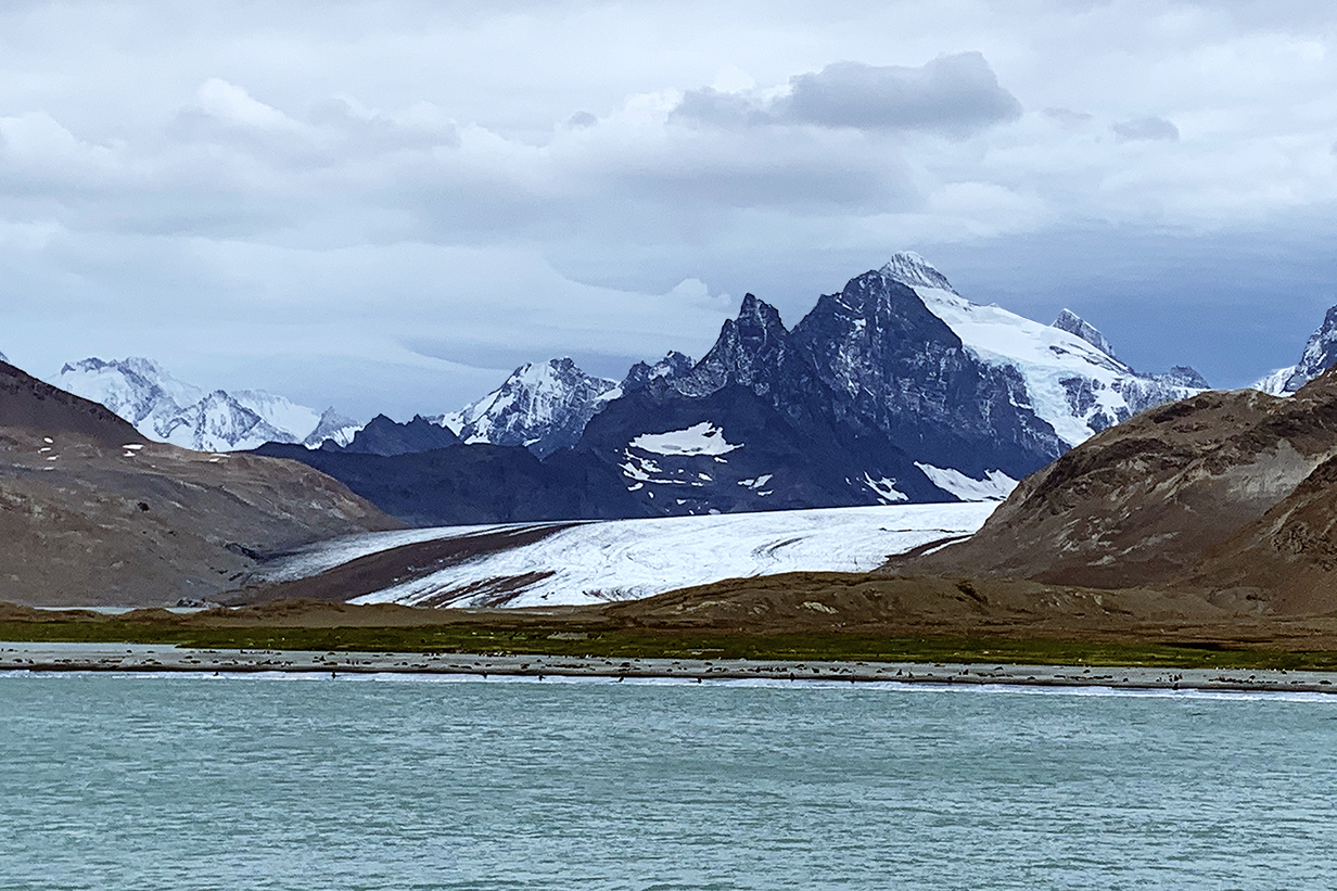
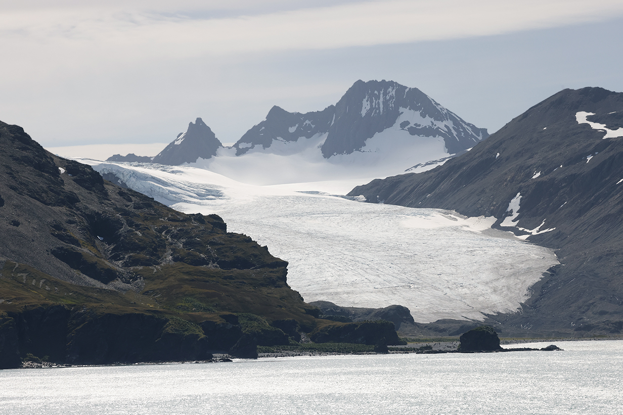
Fortuna Bay and glacier (The mountains in the background are about 1000 m high.)
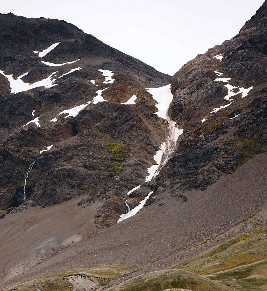
This looks like the runoff channel from a glacier cirque.
Tortured rock and King penguins
King penguins and hills
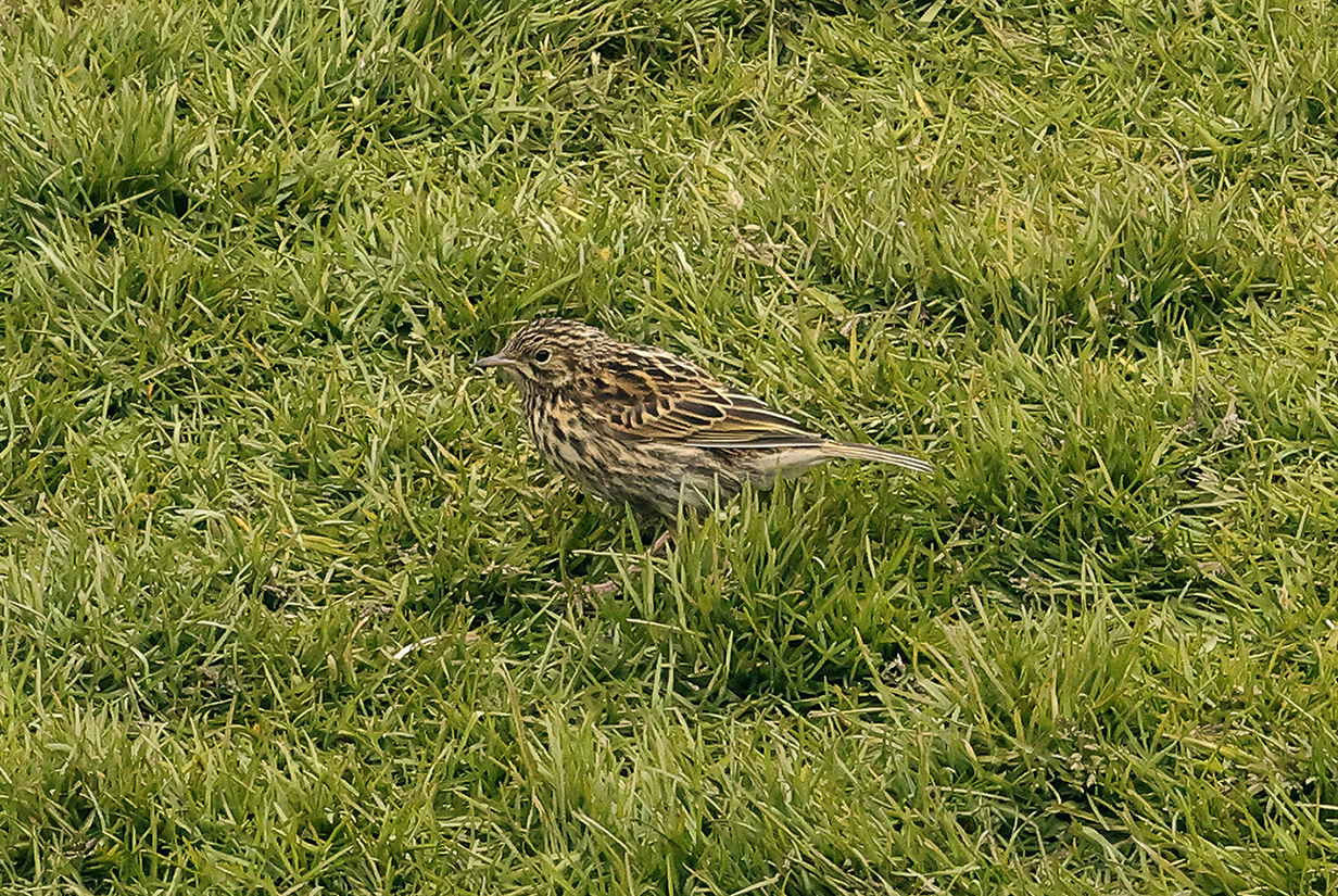
South Georgia pipit (This is John's life bird, in grass fields at Fortuna Bay. People have worked hard to eradicate rats that arrived via sailing and whaling ships; now, South Georgia pipits have made a good comeback. Strong emphasis on controlling invasive species -- including strict rules on our ship -- are very worth while.)
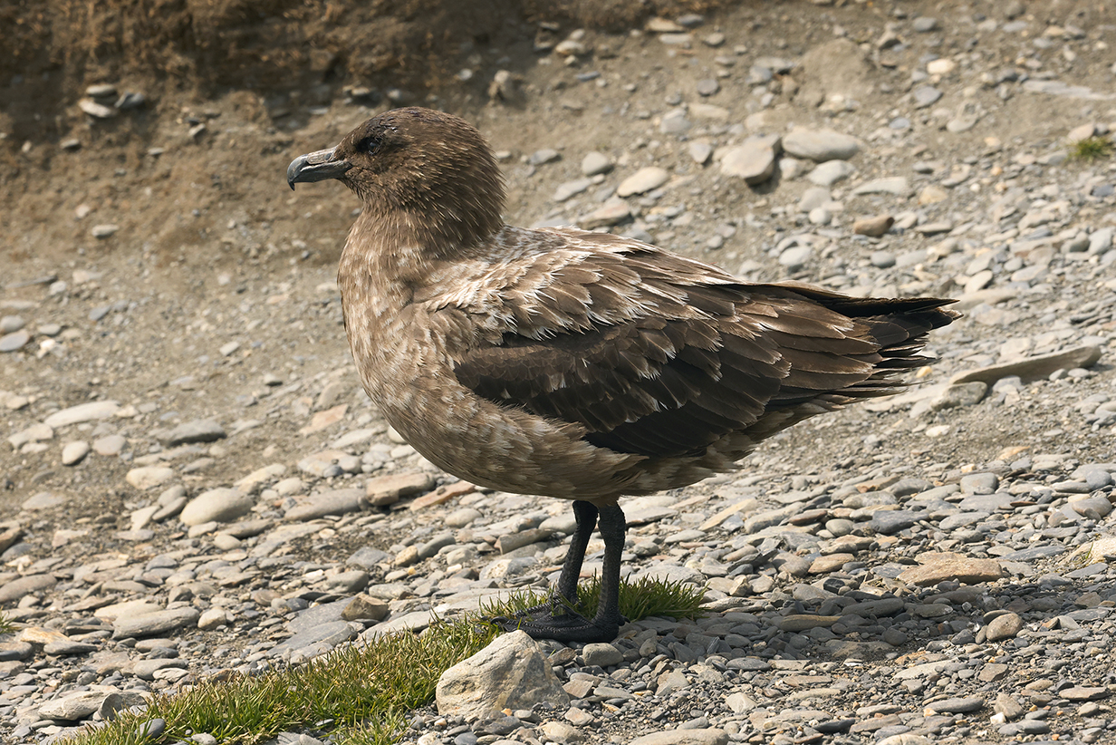
Brown skua
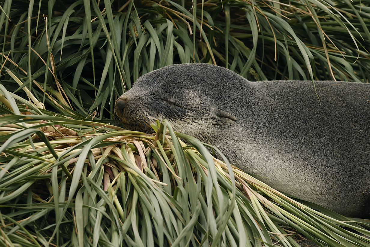
Sleeping fur seal (always around at all landings)
After our morning landing at Fortuna Bay and after we dropped the hikers off to repeat the last leg of Shackleton's journey across the island, we headed off to Stromness to pick them up in the afternoon. This shows the glacier in Fortuna Bay from a different angle as we had started east (left, in this picture).
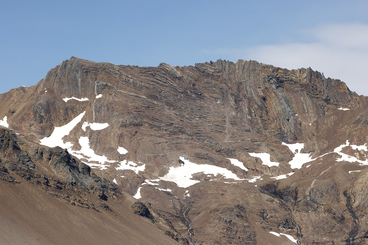
Contemplate the forces required to bend layers of rock -- surely laid down horizontally and gently by sedimentation onto the floor of an ancient sea and later buried deep within the Earth -- and there to bend them smoothly and without losing their coherence into an acute angle. Because this can only have happened under enormous pressure and therefore deep within the Earth. Much later, the layers were uplifted and eroded to expose these cliffs. We have seen similarly bent and folded -- but still distinct -- layers in many places on Earth, notably in the Himalayas. To see them here, on an island thousands of miles from any continent, stokes fascination with the complicated history of our planet.
11 - Stromness
In the afternoon, Greg Mortimer picked up the hikers who had crossed the hills from Fortuna Bay. The whaling station at Stromness is abandoned now and off-limits. We did not participate in the afternoon landing.
Repositioning the Greg Mortimer to Stromness Bay took about 1.5 hours. John and guide Barry Lyon (who took this picture) spent the time pelagic birding.
White-chinned petrels taking off ... not so easily, from the water
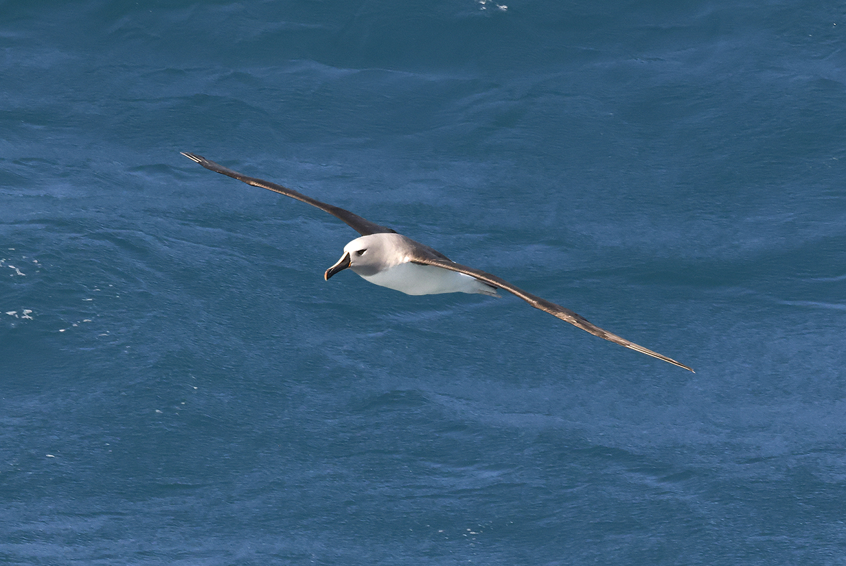
Gray-headed albatross
Light-mantled albatross (This is John's life bird, seen December 5, 2022. The bird never came close enough for a good picture, but the light blue cutting edge of the bill is visible in the better picture at right.)
Light-mantled albatross (still not close)
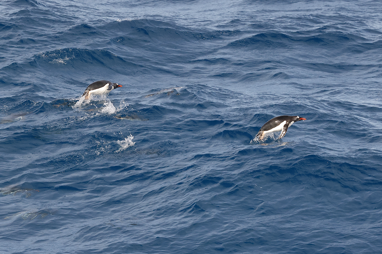
Gentoo penguins porpoising
Mountains around Stromness bay
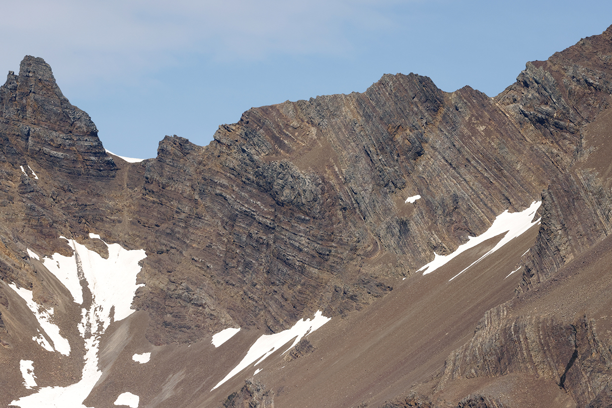
These folded rock layers form the south-east headland of Stromness Bay and are clearly visible from the pass in the mountains that separate Stromness from Fortuna Bay to the west. It is said that, from this pass, Shackleton recognized these folded rocks and therefore knew that they had made it to Stromness. In our enormously gentler times, we flatter ourselves to think that we can imagine the relief that he and his crew felt on reaching help after their long ordeal. I suspect that we have no idea of their depth of feeling -- or, indeed, of the force of will and the physical toll that were required to make success possible. All of the crew, including people left at the other side of South Georgia Island and those left at Elephant Island, were eventually -- but not easily! -- rescued.
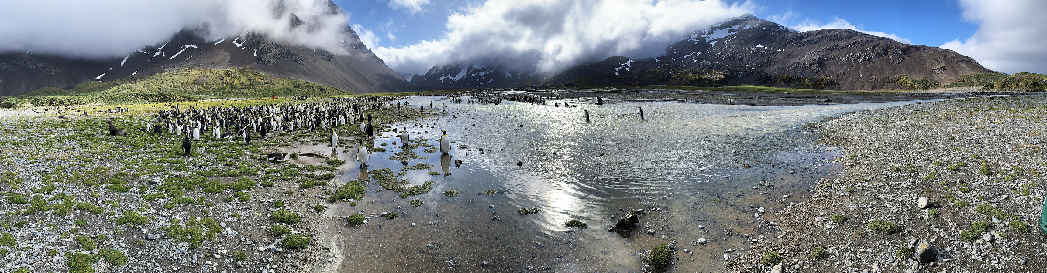
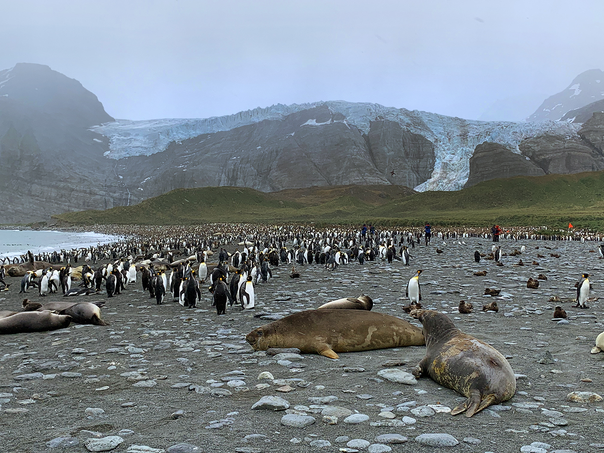
12 - Salisbury Plain
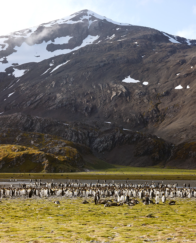
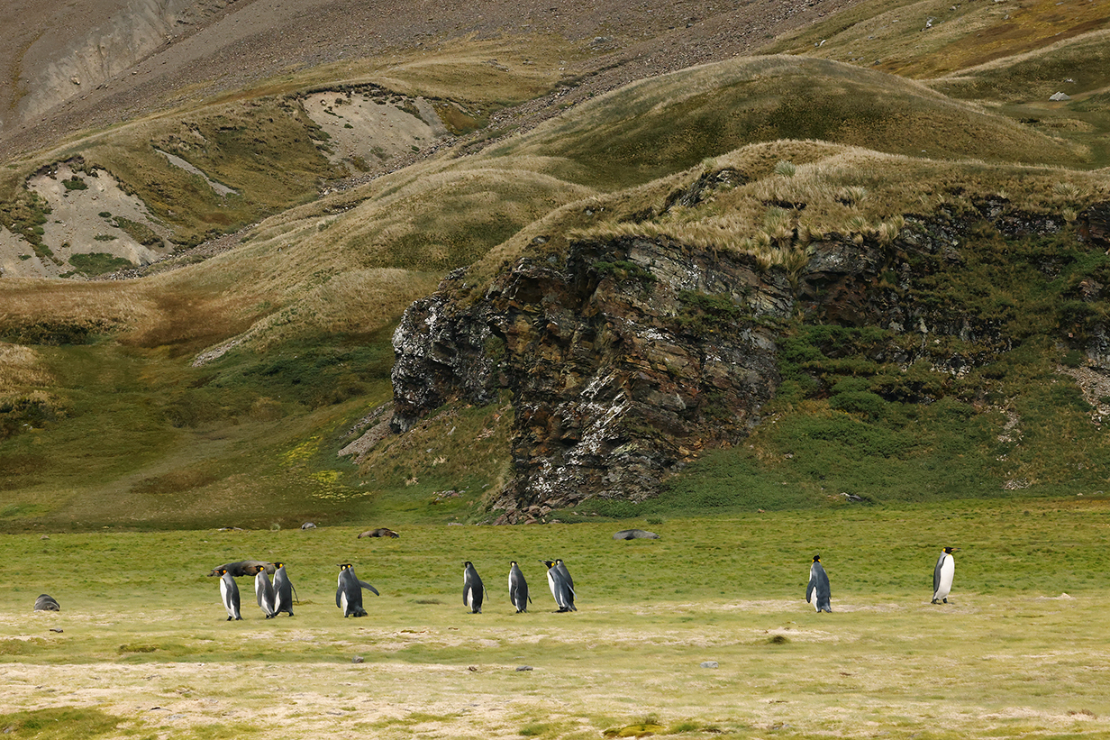
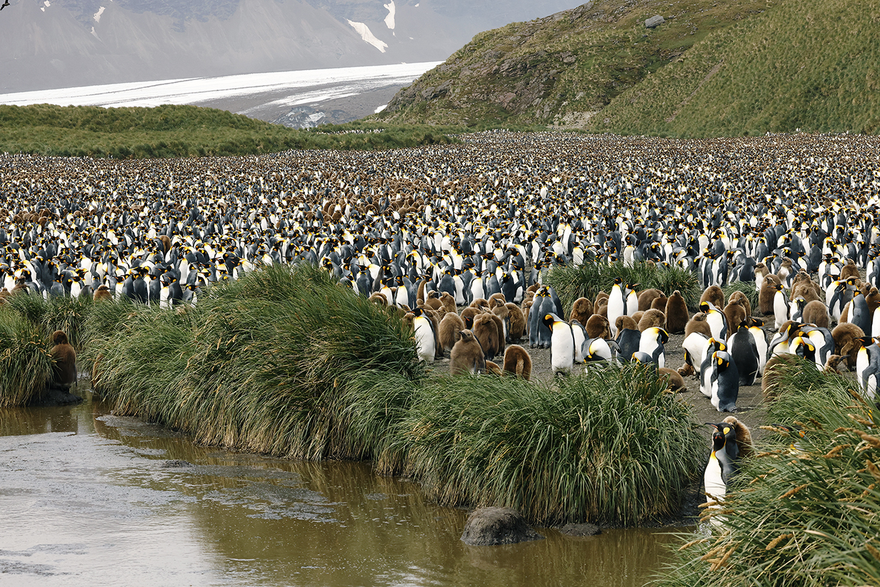
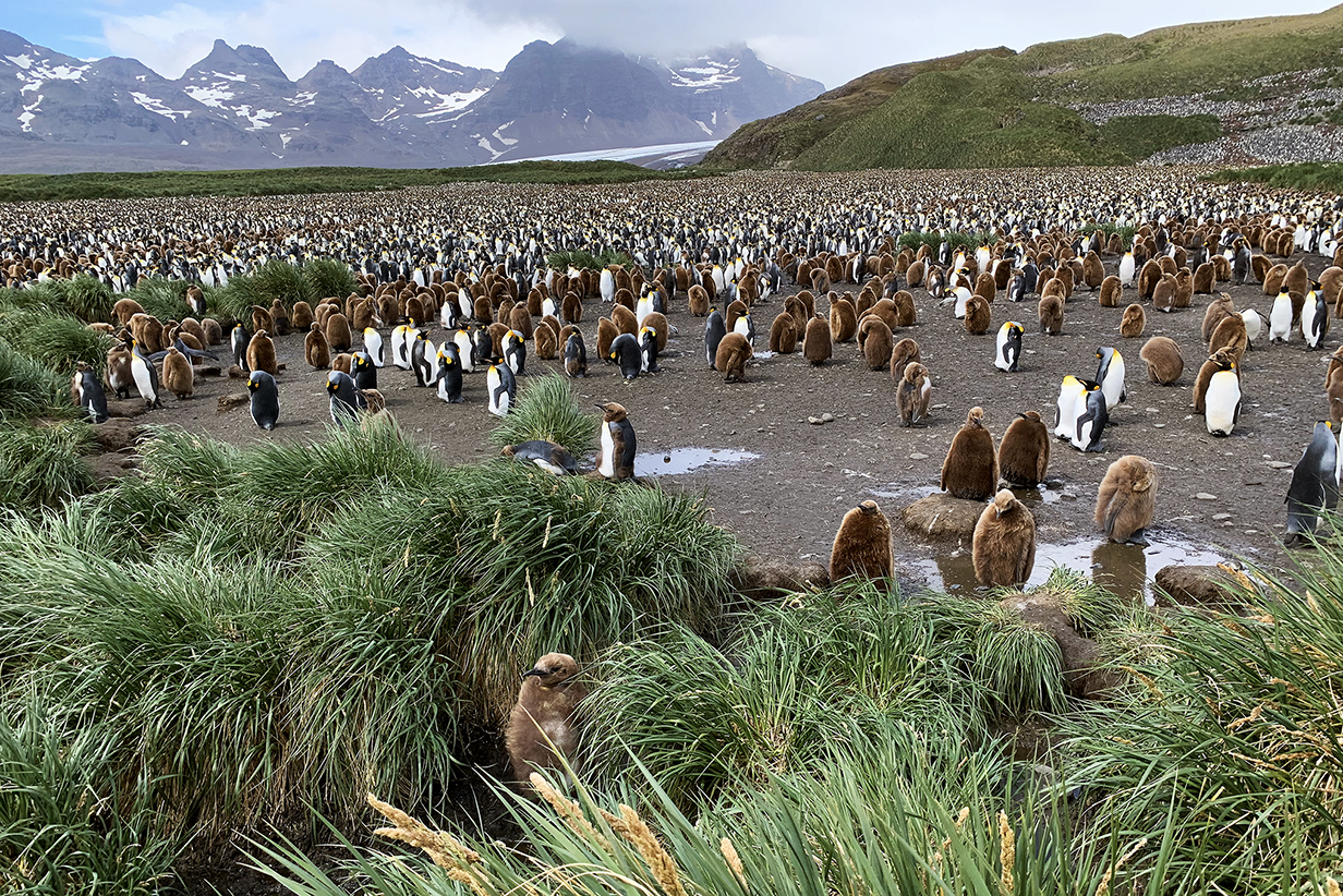
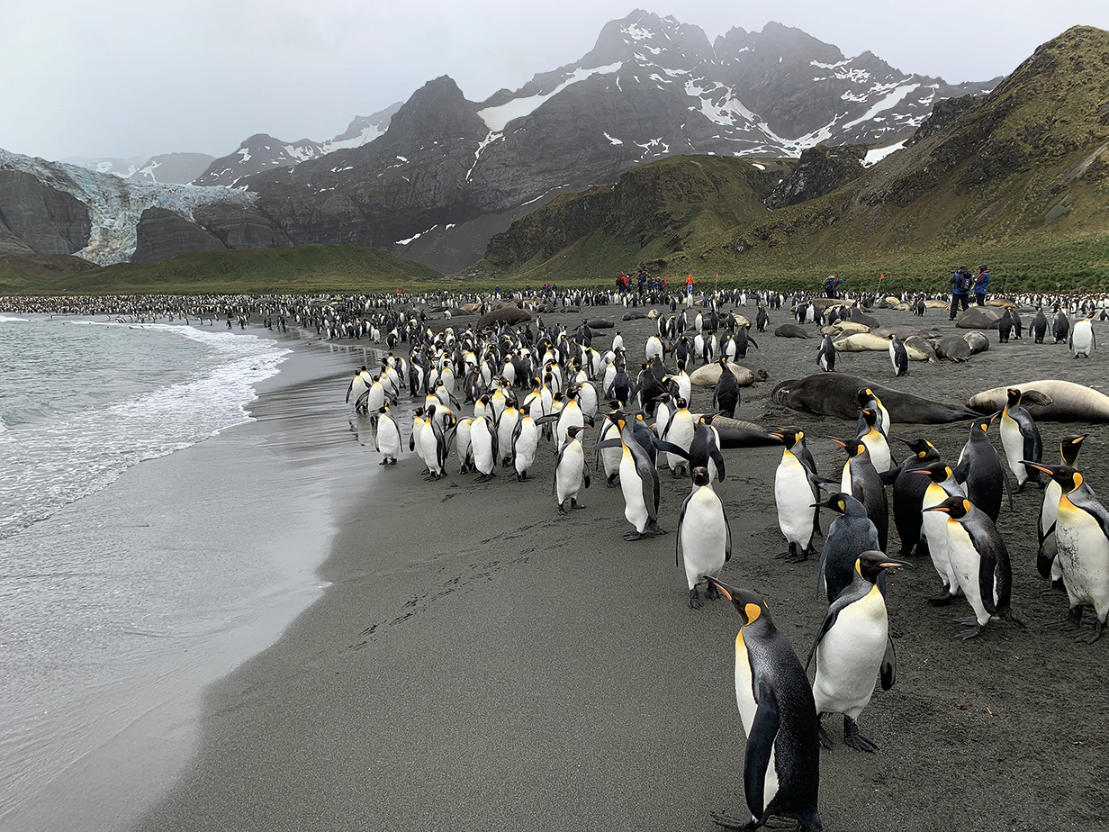
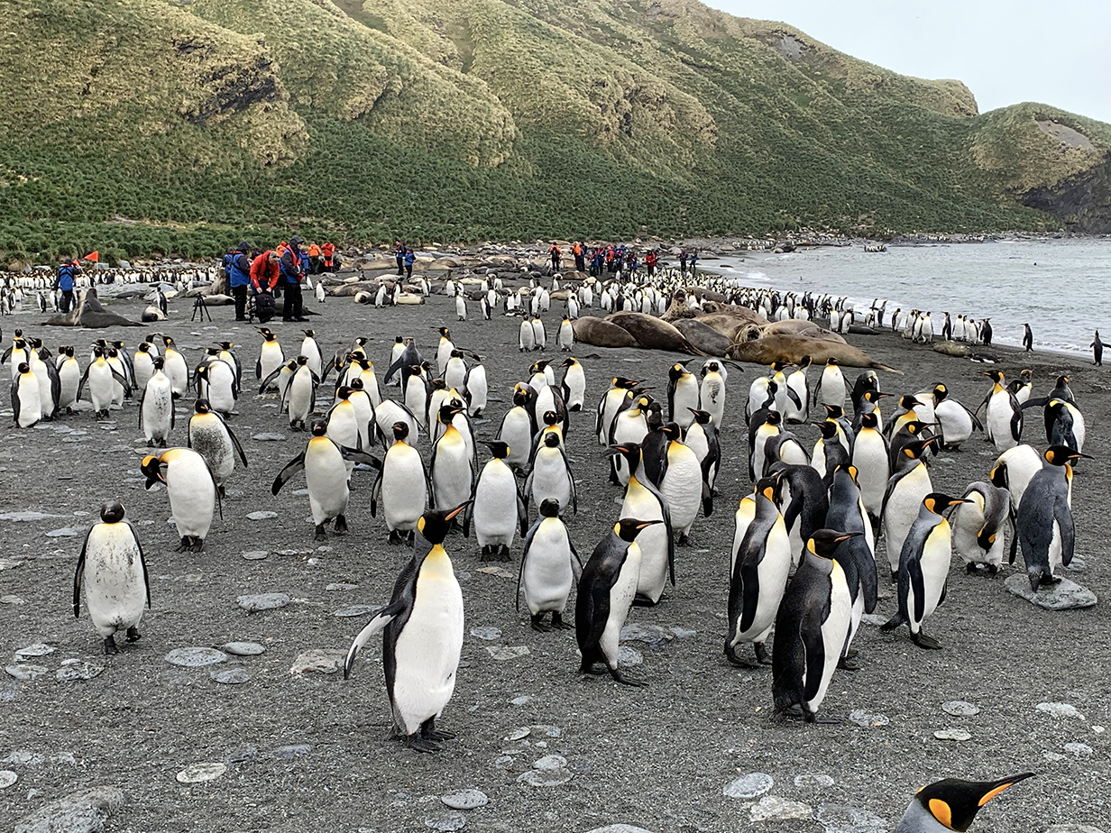
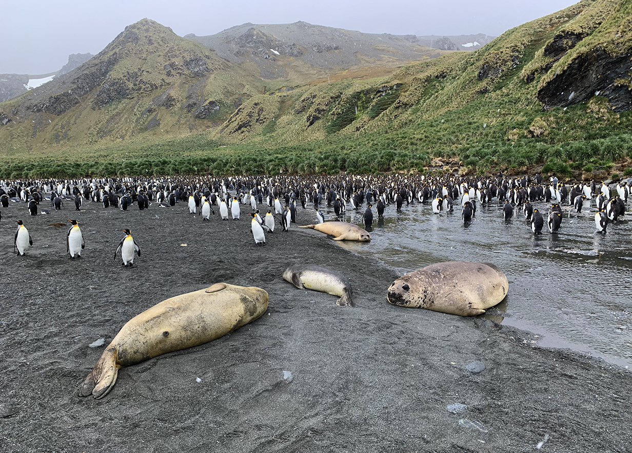
This is Salisbury Plain on South Georgia Island, site of the biggest colony of King penguins that we saw. It was a cold and windy morning ... but wonderfully worth the effort to land and walk ~ 1 km along a first pebble-covered and then sandy beach to the main colony.
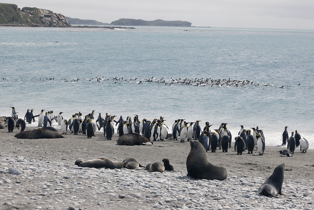
Here, King penguins were swimming to shore to land among the many aggressive Fur seals. Everybody was warned to stay a respectful and safe distance away from seals and penguins.
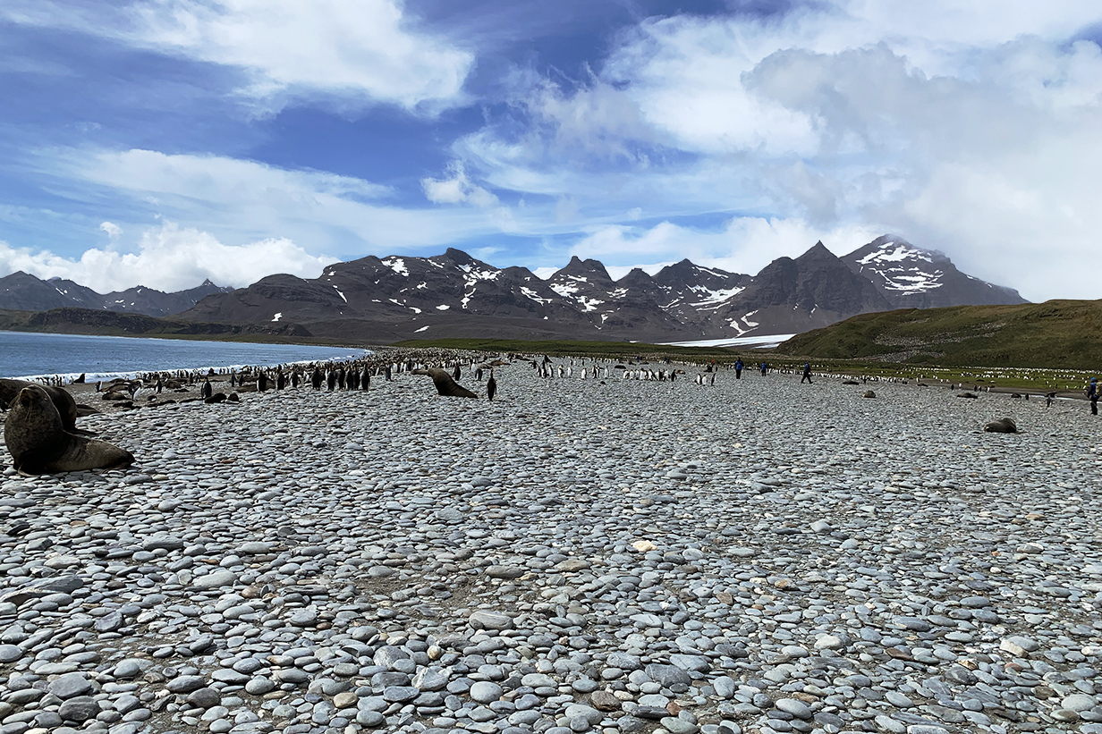
Landing site at Salisbury Plain. The main colony of King penguins is visible in the distance, zigzagging up the hill at right.
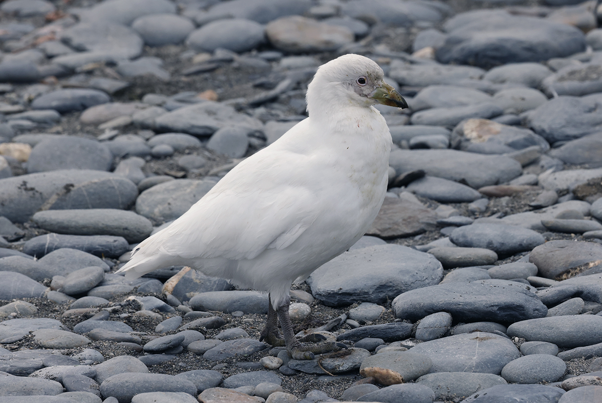
Snowy sheathbill were all around us at Salisbury Plain.
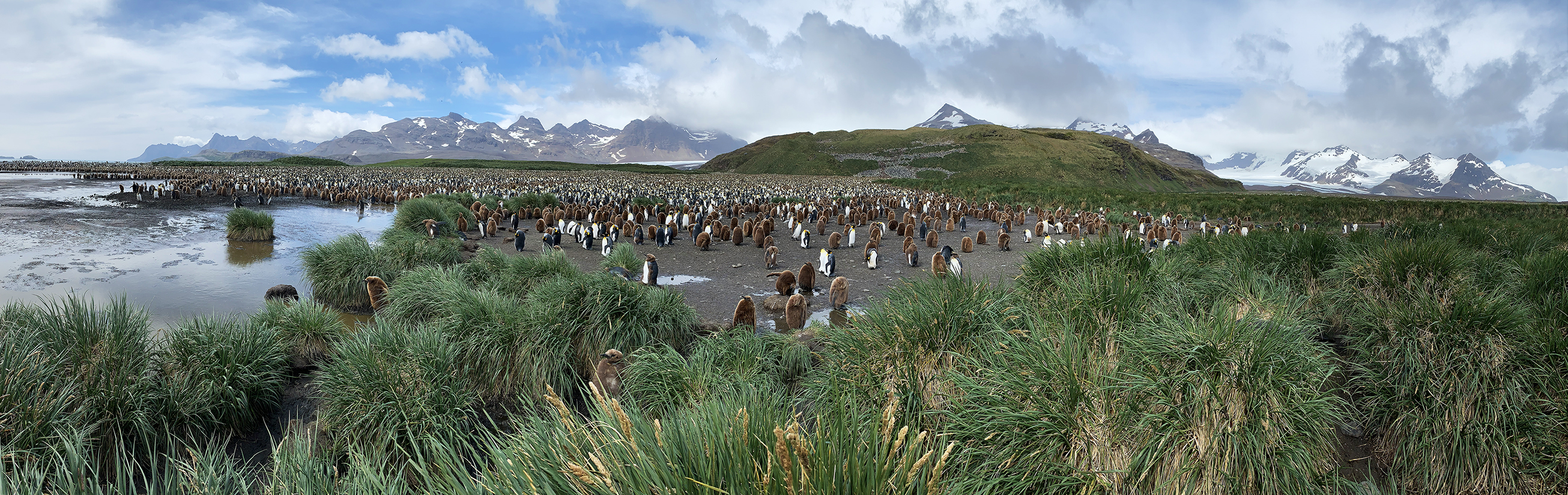
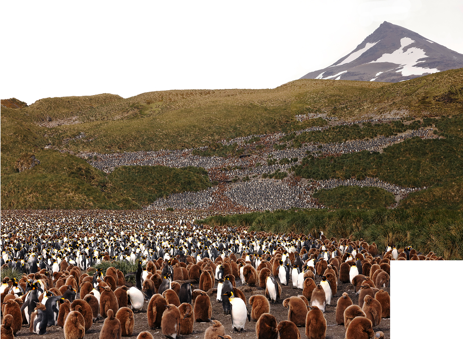
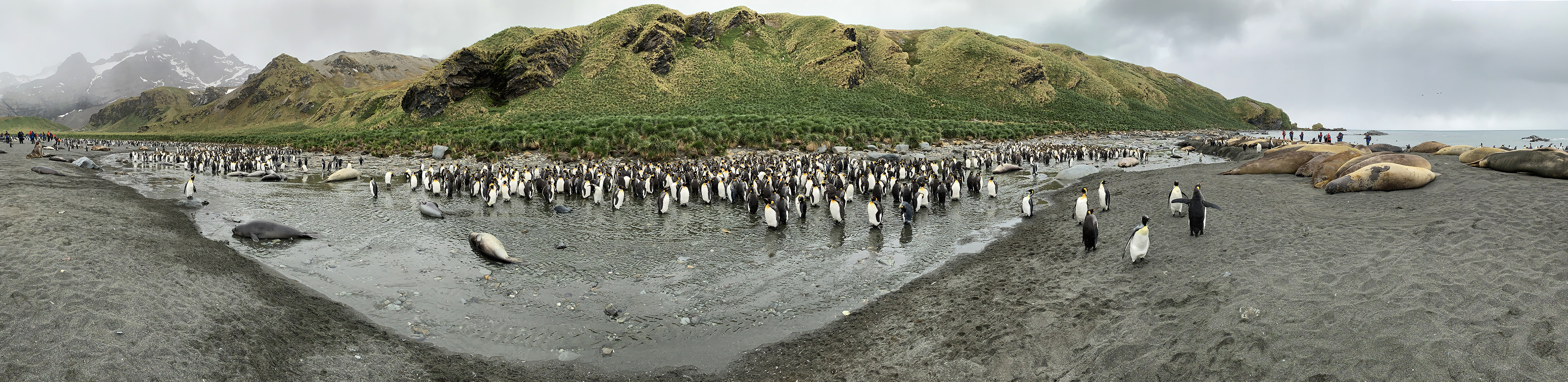
This is a ~120-degree panorama of most of the King penguin colony at Salisbury Plain. Estimates vary but most commonly suggest that about 120,000 penguins nest here. The next pictures zoom in first on the central part of the colony and then on the left part. Scroll right to see the full panorama.
This gives an overview of a part of the King penguin colony. The brown birds in the front are yearlings that will soon moult to adult plumage.

This is the middle cluster of mostly adult penguins (with yearlings congregating all around) in the middle of the previous picture.
This part of the colony is to the left of the parts shown in the above pictures. The colony is separated from the ocean by a narrow lagoon with penguins on both sides.
Another view. Note the glacier in the background, which reaches the sea behind the leftmost penguins in the picture.
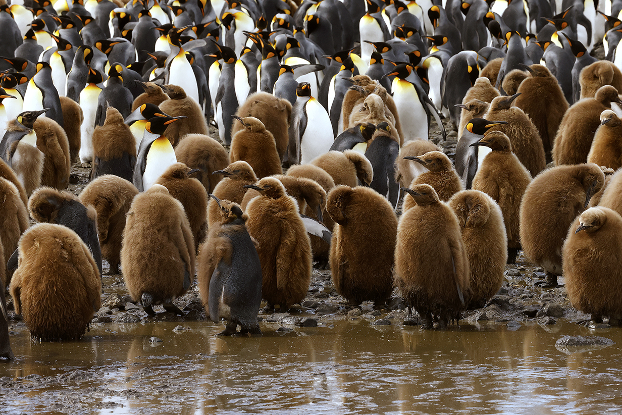
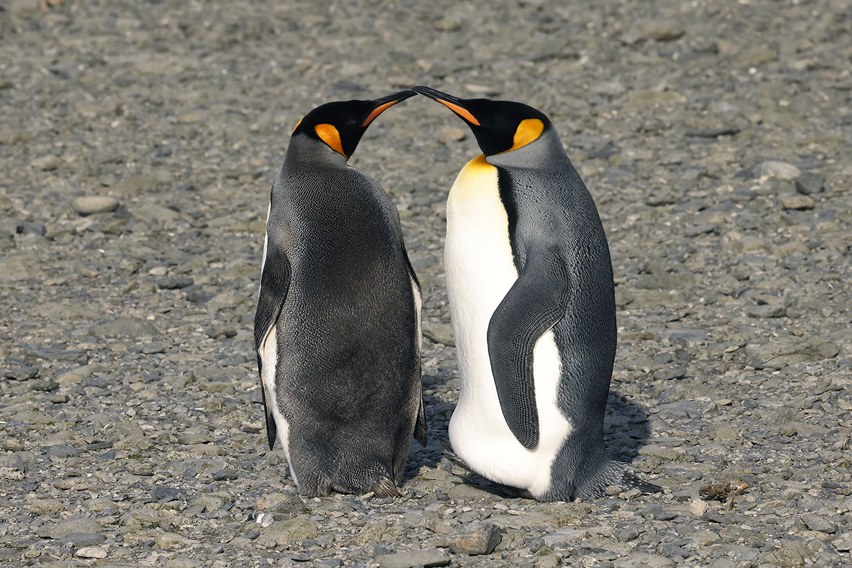
Closeup of King penguin yearlings. From the laying of eggs to the fledging of chicks takes 14-16 months. Some of these yearlings are already moulting into adult plumage.
More even than most youngsters, yearling King penguins are very endearing. Adults are very elegant. Having seen these pictures, you will probably not be surprised that we picked King penguins as our "trip bird".
Salisbury Plain was our happiest landing on South Georgia Island.
Salisbury Plain was the morning landing on December 6, 2022. The afternoon landing was on Prion Island:
13 - Prion Island
Our afternoon landing was on Prion Island. This is a panorama of the view from the summit of hills covered with tussock grass and nests of (among others) Wandering albatross and Gentoo penguin. The trail from the landing site was very well made and convenient. Scroll right to see the complete pano.
Trail back down to the landing site on Prion Island. Gentoo penguins nested closer to the shore.
The breeding season on South Georgia Island is much longer and much more benign than the ones on and around the Antarctic penninsula. Here, we saw several species of albatross on nests. Also, Gentoo penguins here were taking care of young chicks, whereas on Antarctica, breeding was just beginning.
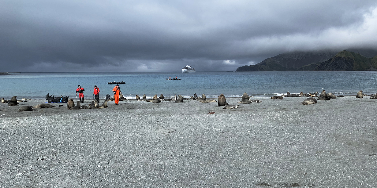
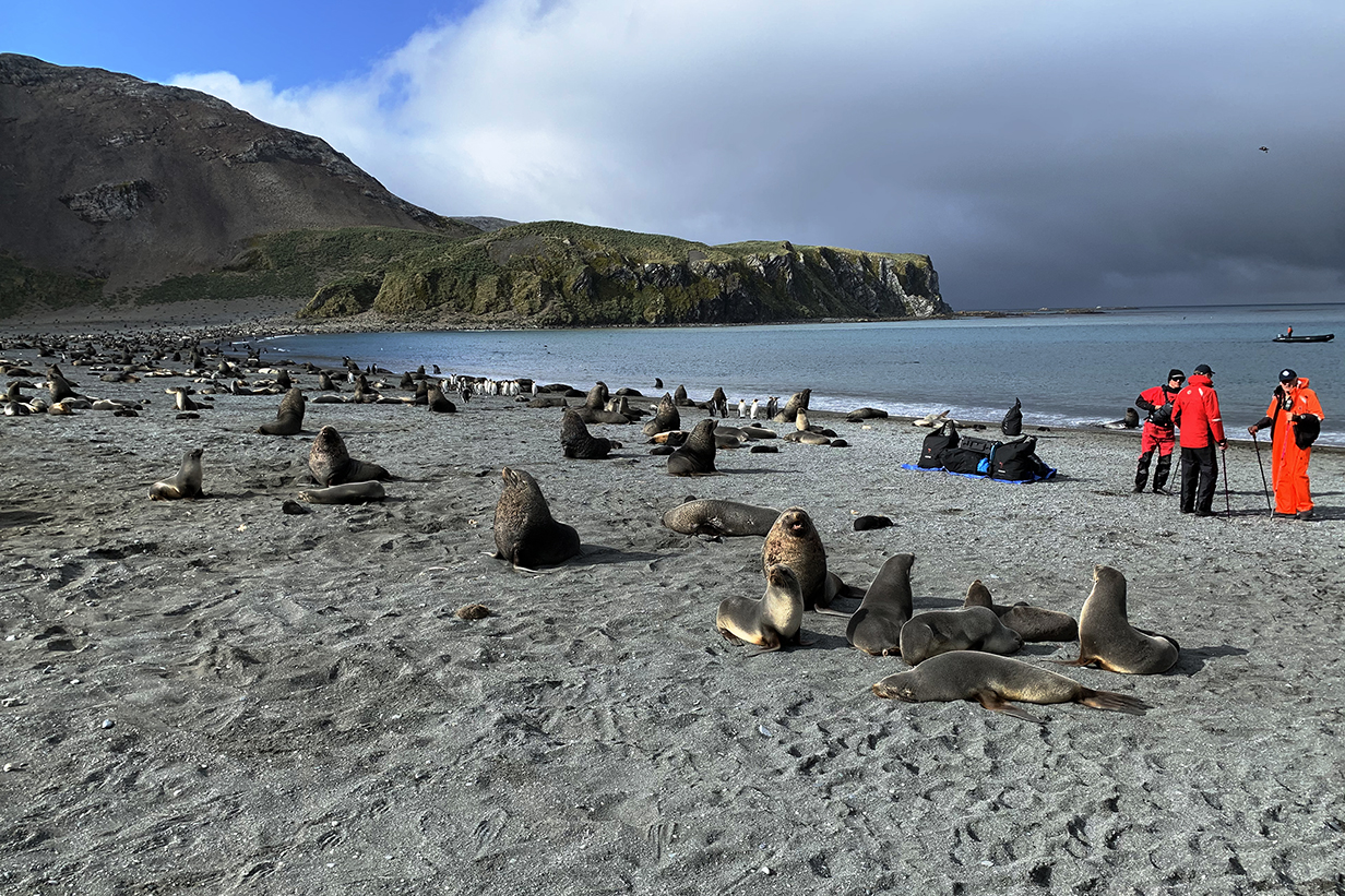
14 - Gold Harbour
Gold Harbour -- Destination 14 -- was our last landing on South Georgia Island, on December 7, 2022.
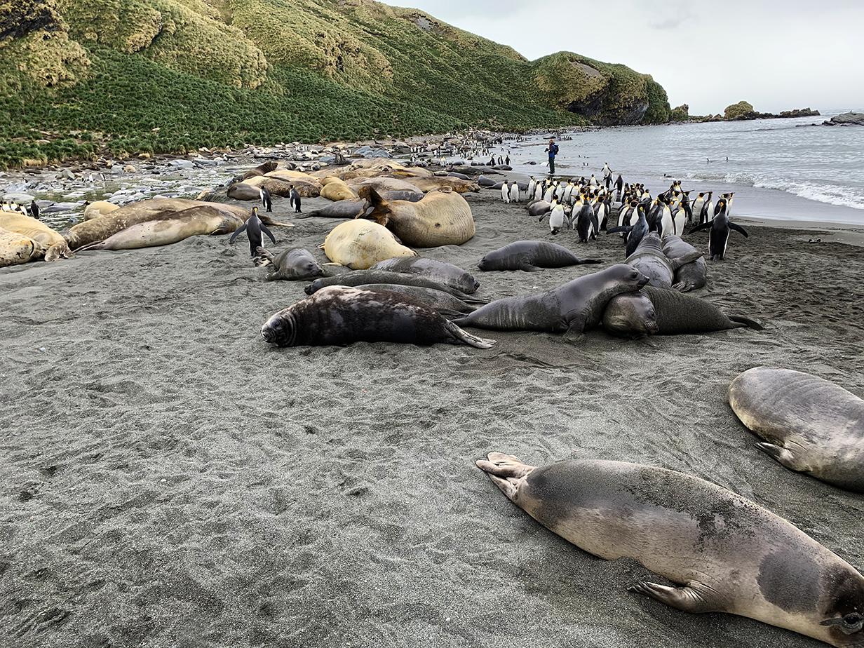
Fur seals (gray), Elephand seals (bigger and brown), and King penguins at the landing site at Gold Harbour. The sparring Elephant seals shown below are in the distance here.
Gold Harbour panorama (scroll right to see it all)
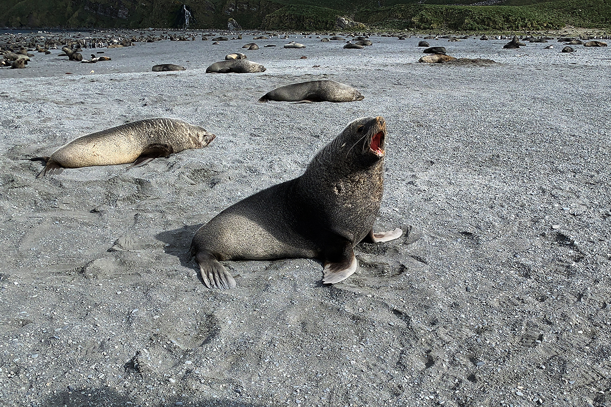
Several expedition crew members repeatedly said that South Georgia Island is their "favorite place on Earth". Gold Harbour vividly showed why. The beach here was the busiest yet, with many Fur seals and Elephant seals, a big colony of King penguins, Brown skuas mostly sitting in the wind, and Snowy sheathbills almost underfoot. Curious seals and penguins came close to investigate us and required strategic retreats. Seals loved to play with the flag poles that marked allowed trails. Male elephant seals sparred sporadically, even though breeding season was finished. A loud chorus of braying King penguins enveloped us from all sides. Rafts of Kings came in on the waves or headed out cautiously from shore. The enthusiastic teeming of life was totally charming. And the weather at first was calm. John enjoyed the pageant for about an hour, before the wind got brisk and it started to rain and snow. It was a wonderful last outing. Pelagic birding after we sailed for Antarctica was also superb: John got 3 life birds in three, 1 hour to 1 hr 40 min pelagic birding sessions in the afternoon. Pictures follow.
More views of Gold Harbour
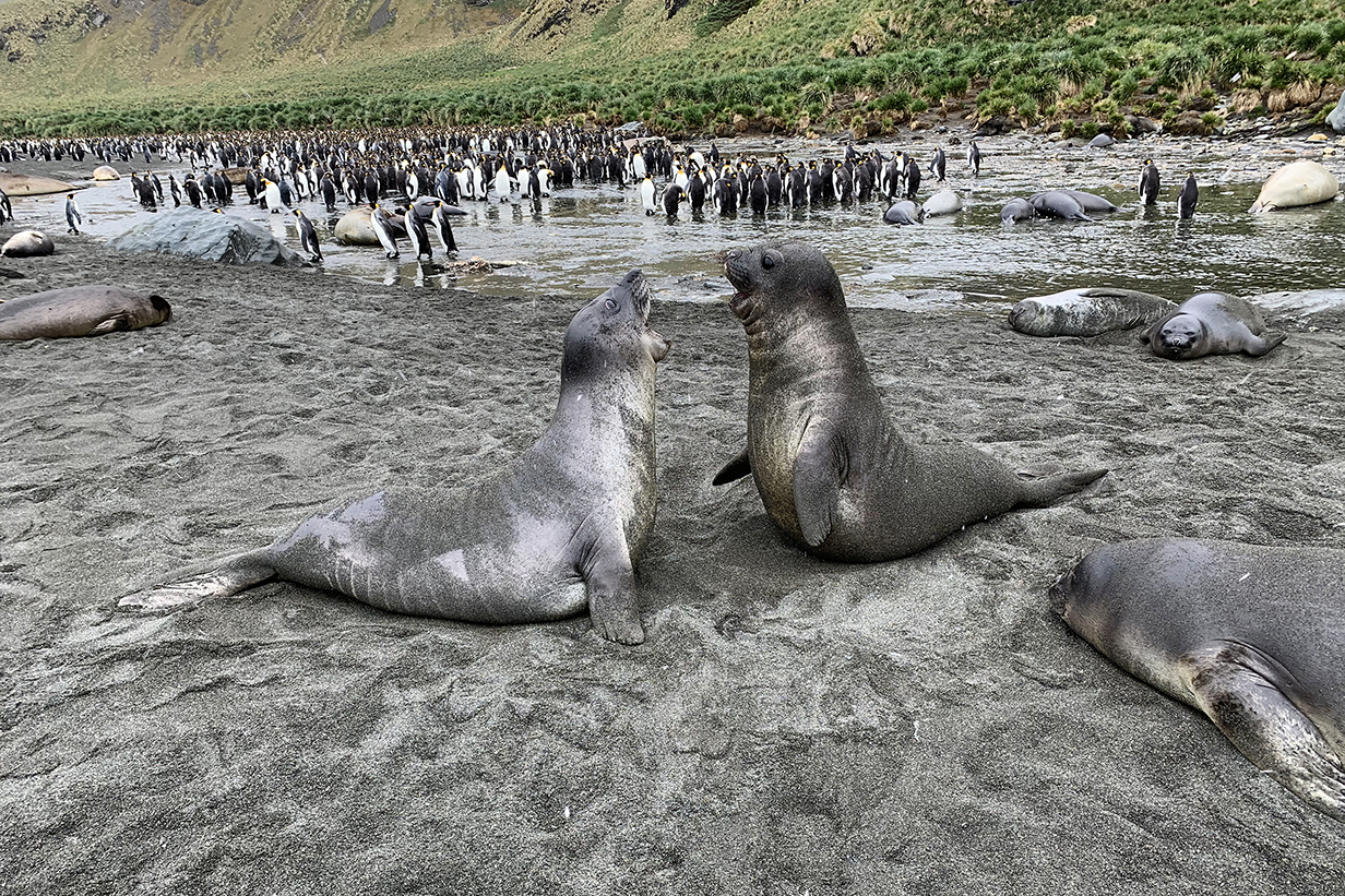
Sparring fur seals -- not especally serious, at this late season
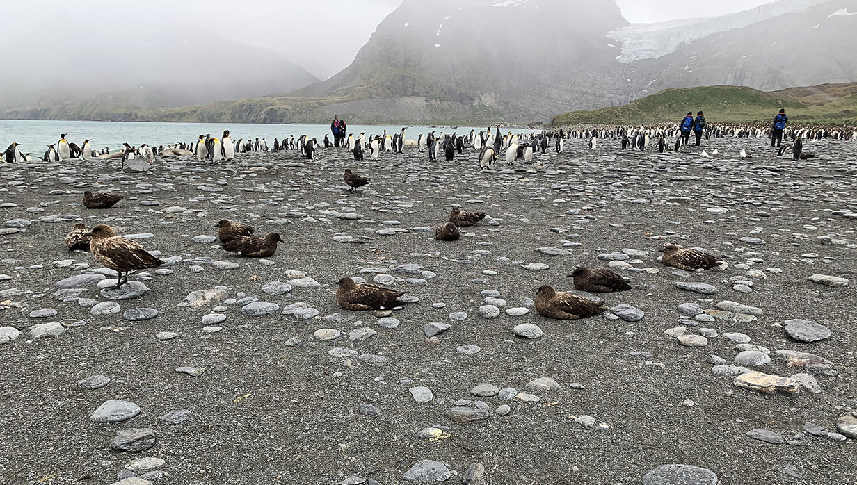
Brown skuas sitting in the wind. Three Snowy sheathbills are at right. Clouds are starting to close in. Light rain is about to start.
15 and 16 - Scotia Sea
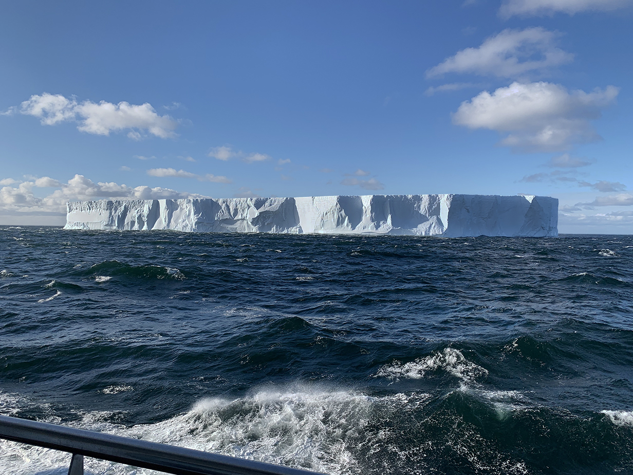
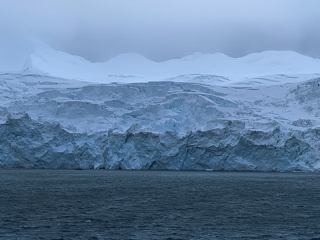
Tabular icebergs were the first sign that we were approaching Antarctica. We passed this one on the day after the Gold Harbour landing: December 8, 2022 at 18:30. We were sailing the Scotia Sea just short of destination 15 on the route map near the start of these web pages. Presumably, big tabular icebergs have broken off of the Larsen C ice shelf on the east side of the Antarctic Penninsula. Icebergs that are 10s of miles in size have been calving off of it, especially since 2016. This one is smaller, but we saw an iceberg that was more than a mile wide during our Seabourn cruise in 2023.
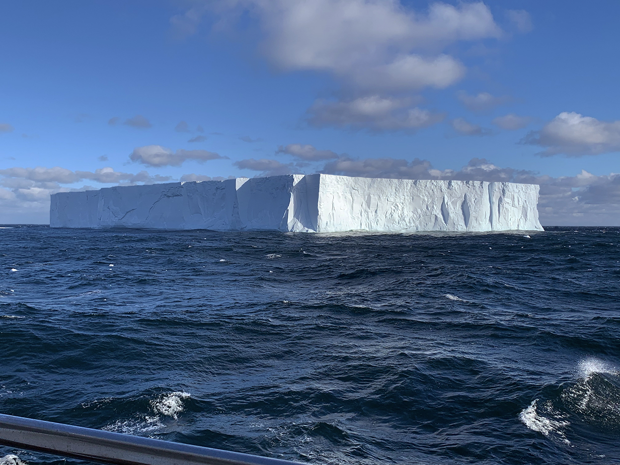
This is a different, almost square tabular iceberg seen just a little later. Icebergs of various sizes -- mostly much smaller -- became more frequent as we got closer to Antarctica.
Cape (or Pintado) petrels started to follow the ship, sometimes only a few at a time and other times streams of a dozen or more birds. This was at 10:16 PM on December 9, 2022, near Elephant Island. At 61 degrees south latitude, the sun stays up late in the day. We were quarantined with covid at the time, so this was taken from our balcony.
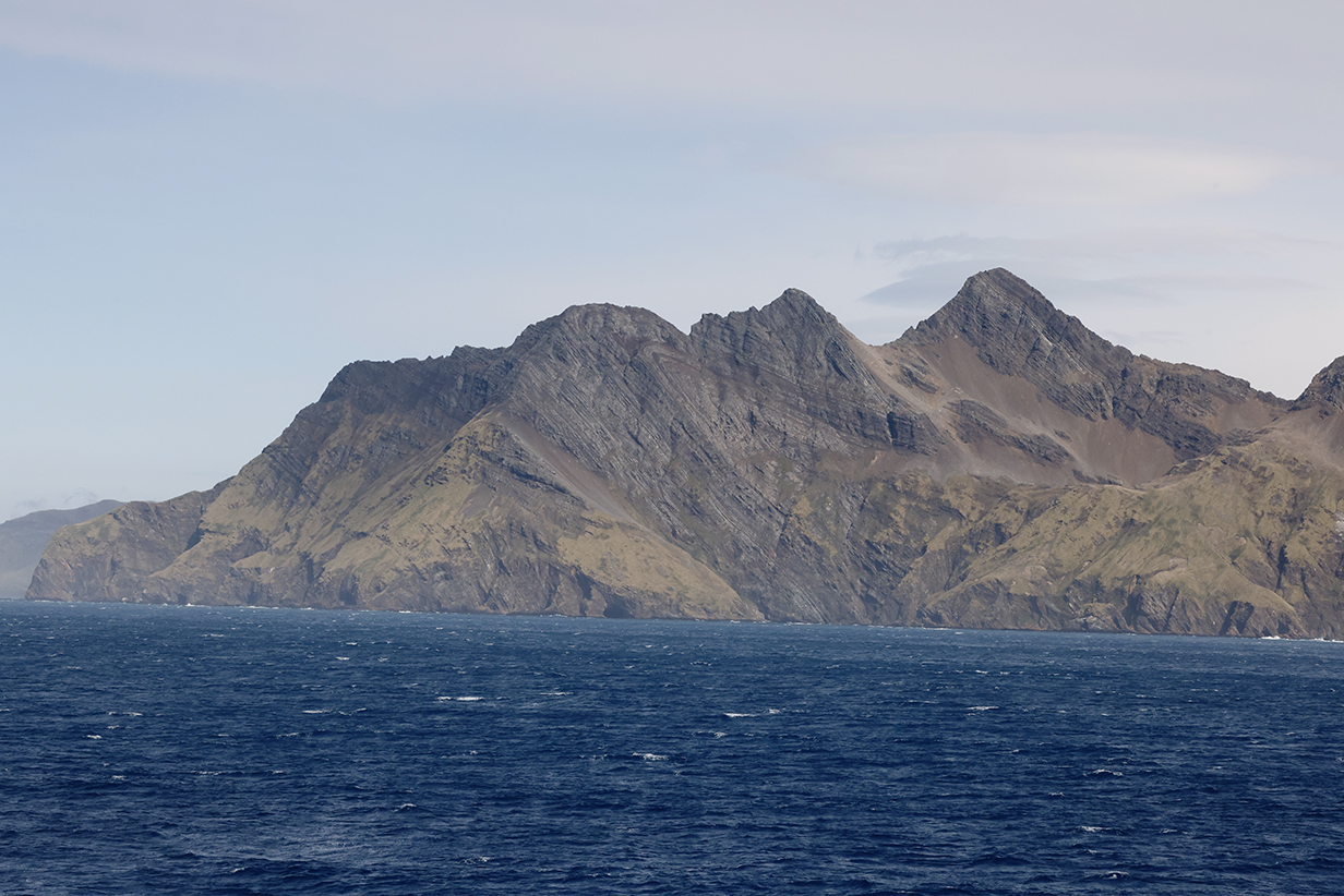
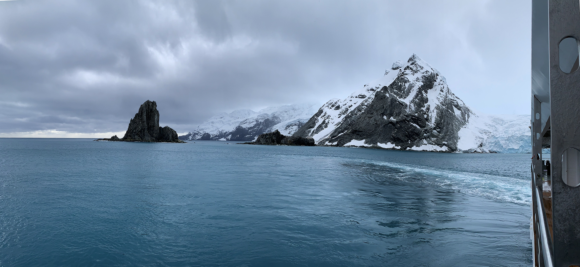
17 - Point Wild, Elephant Island
We passed Point Wild on Elephand Island (destination 17) on December 10, 2022. This was the 3rd day of our covid quarantine, so we saw only what we could see from our balcony. And we did not get to hear announcements of where we were. It took some work to reconstruct exact locations: lots of pictures of Elephant Island are posted on the web, but most do not identify landmarks. The best description that I could find both of the sights that we saw and their relation to the odyssey of Sir Ernest Shackleton is here. The Greg Mortimer first passed Point Wild, where Shackleton and his crew made their second landing on Elephant Island and where most of his crew waited while Shackleton and five companions sailed on to South Georgia Island (see descriptions of Fortuna Bay and Stromness).
Approaching Cape Belsham (the most prominent dark rock formation), the Furness Glacier (to its left), and Point Wild (destination 17, out of sight behind the ship, at left) at 08:20 on December 10, 2022.
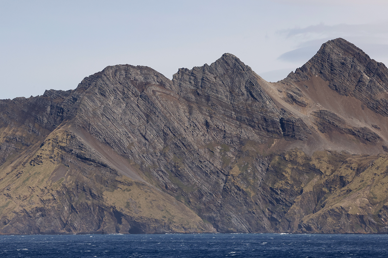
Cape Belsham, Elephant Island
A few minutes later, clouds parted enough to let sunlight in.
Panorama of Cape Belsham and the Furness Glacier. Quarantined to our cabin, we could not go on the zodiac cruises.
Another panorama showing Cape Belsham right of center, the Furness Glacier to its left, and Point Wild at left. Point Wild was named after Frank Wild, the second-in-command of Shackleton's expedition. Wild is buried next to Shackleton at Grytviken.
Furness Glacier
Leaving Point Wild on the way to Antarctica
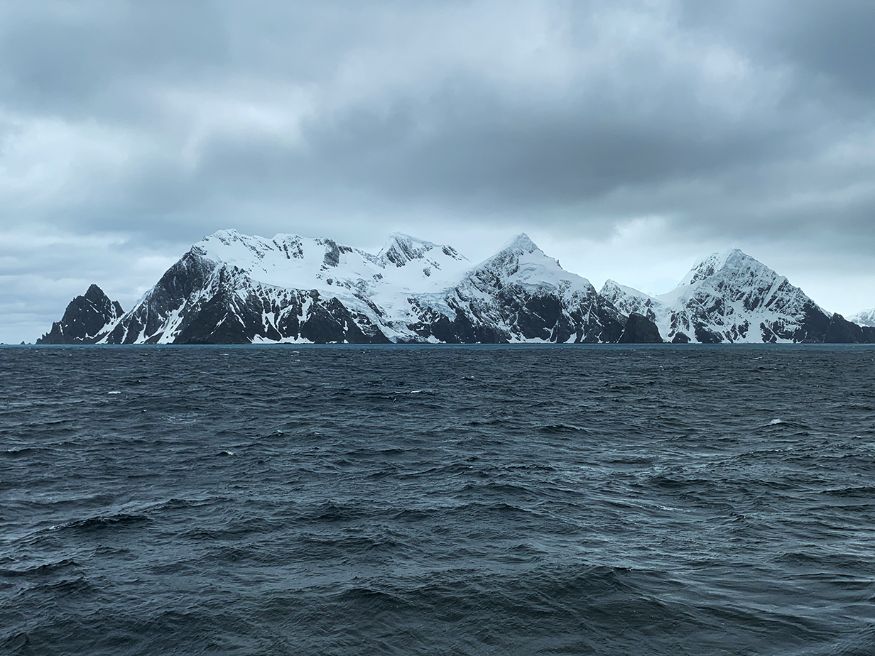
A last look at Elephant Island
Antarctic Penninsula
Antarctic Penninsula map posted by the ship with destinations numbered as below
Route map as posted on the ship at the end of the voyage
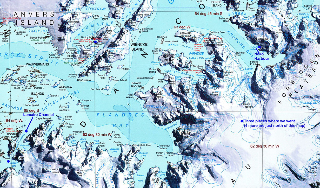
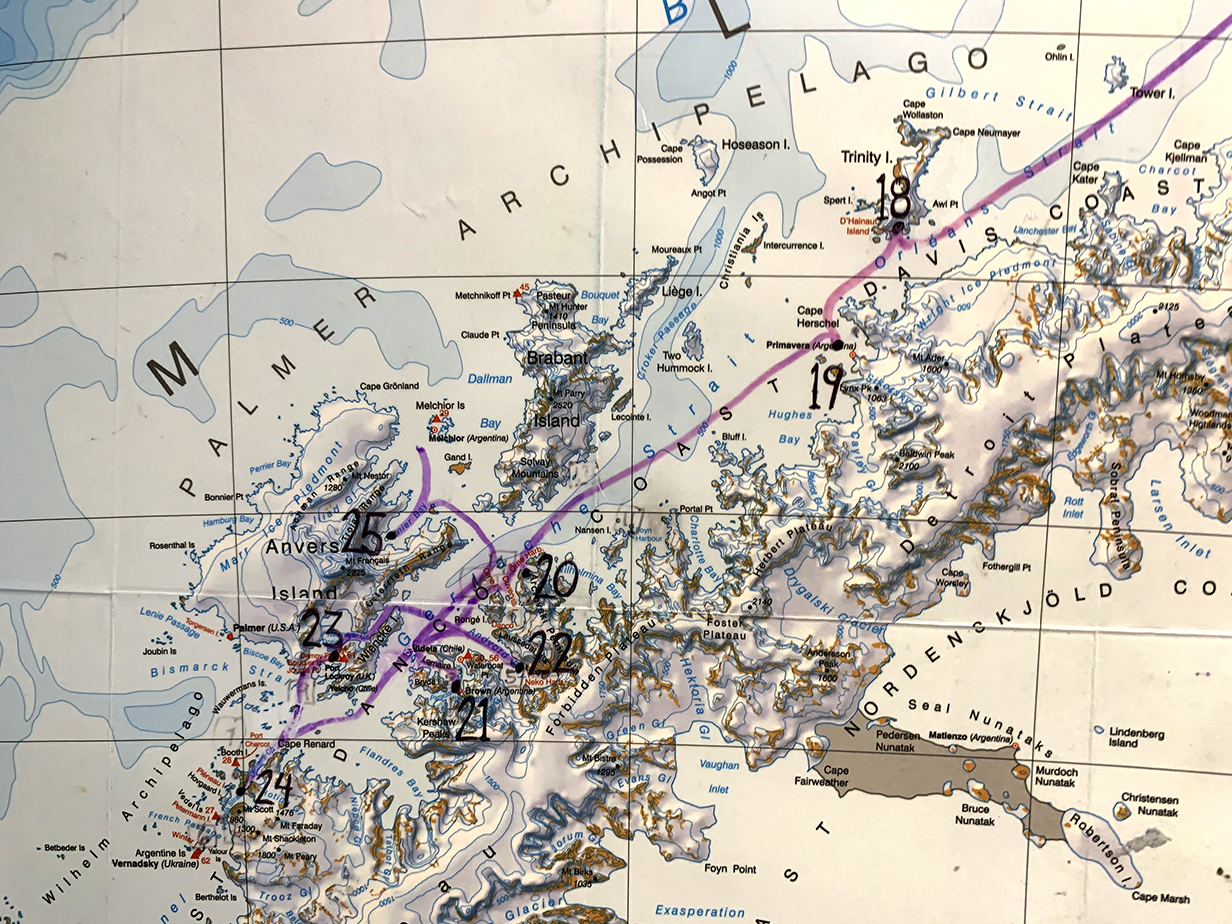
This is a better Antarctic Penninsula map showing Neko Harbour (where we landed on the mainland), Port Lockroy, and the Lemaire Channel. Paradise Harbour (destination 21) is also on the map, west of Neko Harbour.
This again is the Antarctica part of our itinerary. We were released from quarantine on December 13th, in time for our landing on mainland Antarctica. The most spectacular views shown below were of the Lemaire Channel during the evening of December 13th. From there, we made a brief stop but no landing at Fournier Bay and then sprinted back to Ushuaia ahead of strong winds.
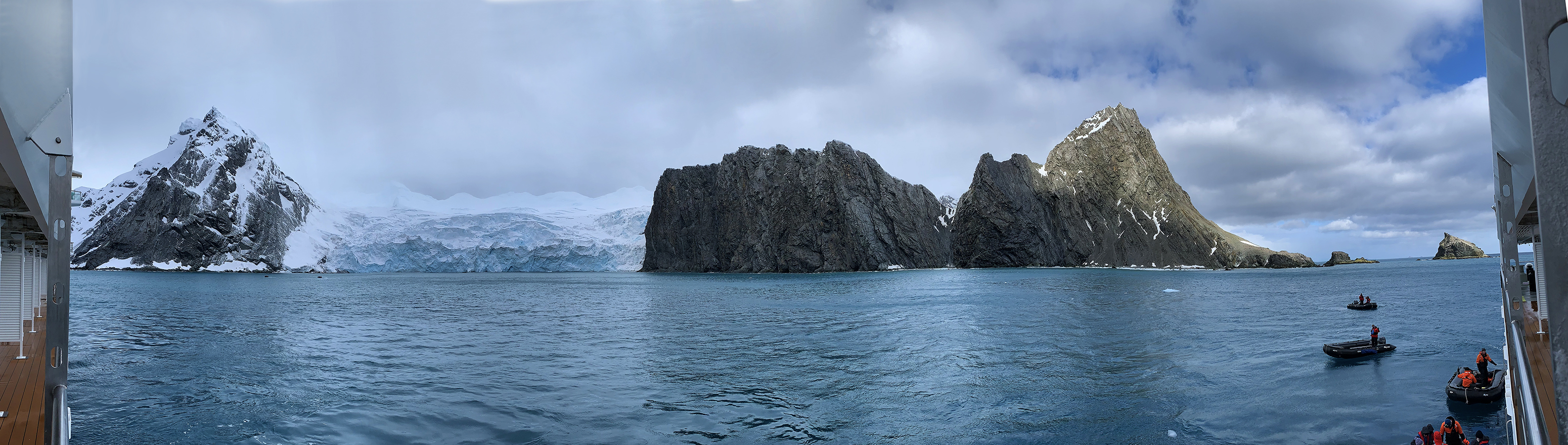
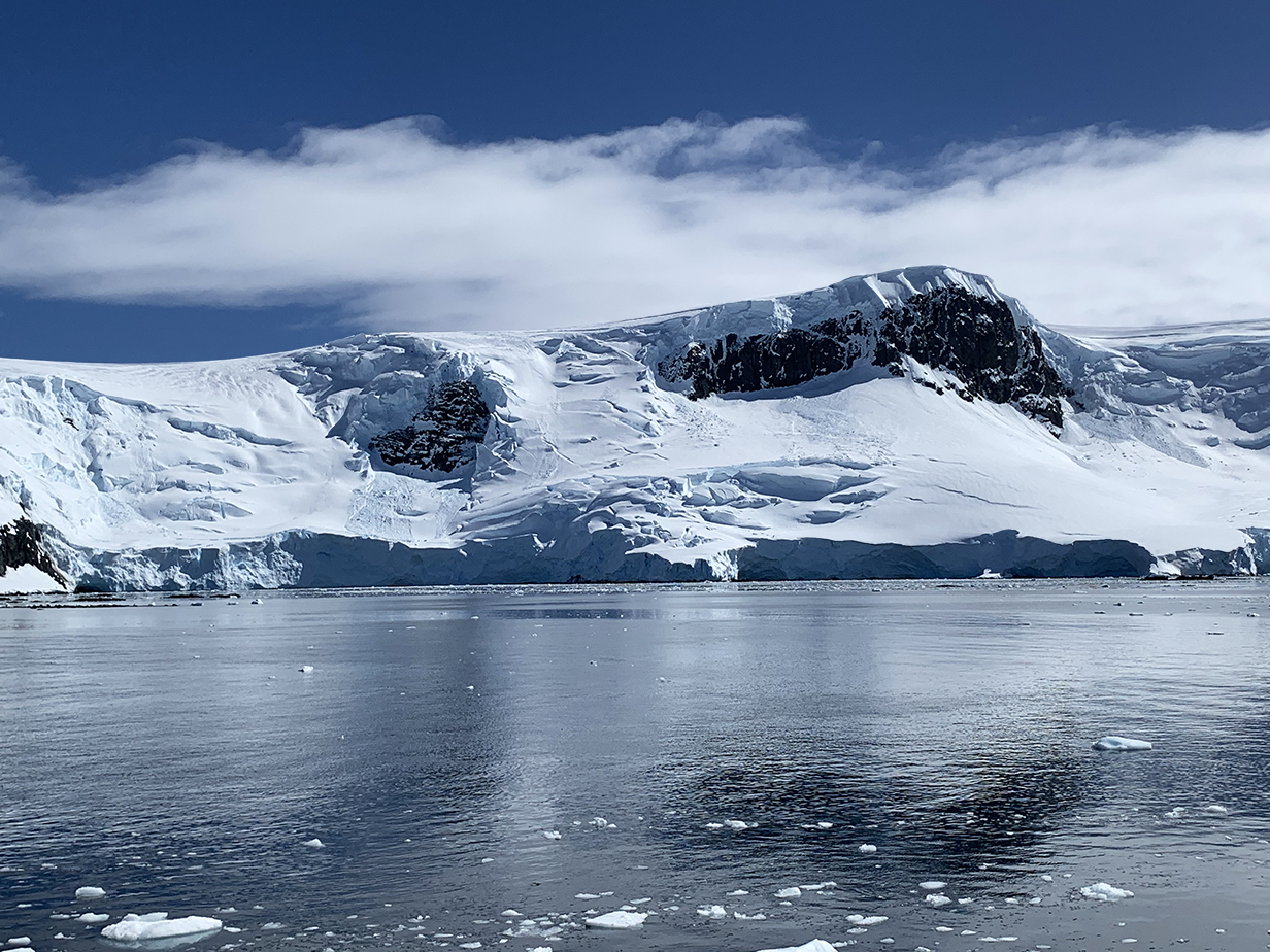
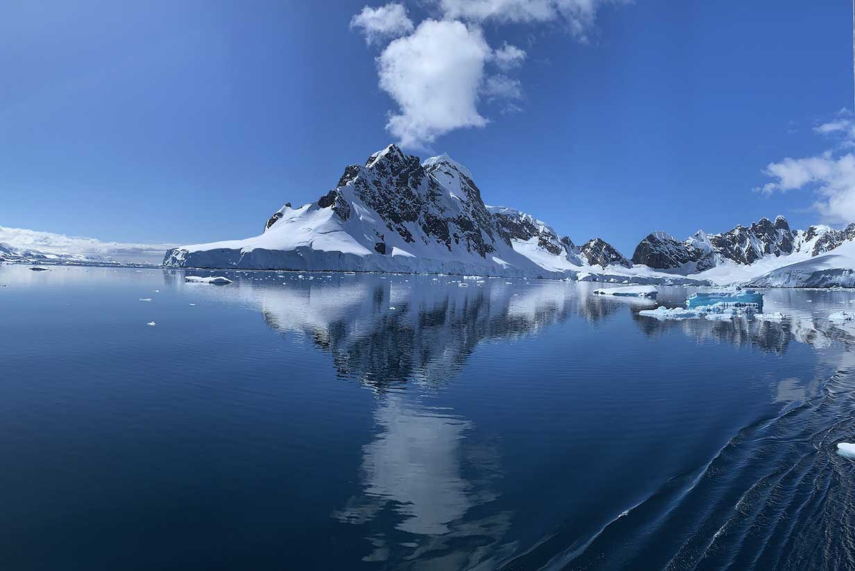
18 - Mikkelsen Harbour
Mikkelsen Harbour was our first stop in Antarctica. This was quarantine day 4 for us, so all pictures from today and tomorrow are still from our balcony. Scroll right to see the full panorama. The big round hill is Trinity Island. The mountains in the distance at right are on the mainland.
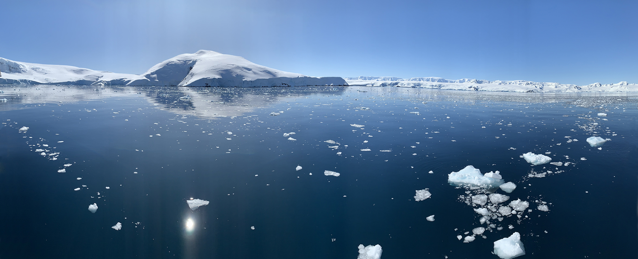
This picture is processed as little as possible. It wonderfully captures the feel of Antarctica in perfect weather -- the glorious glacier-covered vastness, the pristine blue of clean water and hazeless sky contrasting with white ice, cold clean air, and the silence, the stillness, that captures the spirit and calms the mind. The magnificence enveloped us over and over, in the next few days. Especially in the Lemaire Channel. It is no wonder that people become obsessed with Antarctica.
Trinity Island (Most substantial islands that we saw were capped with thick glaciers. The mainland is even more thickly glacier-covered:)
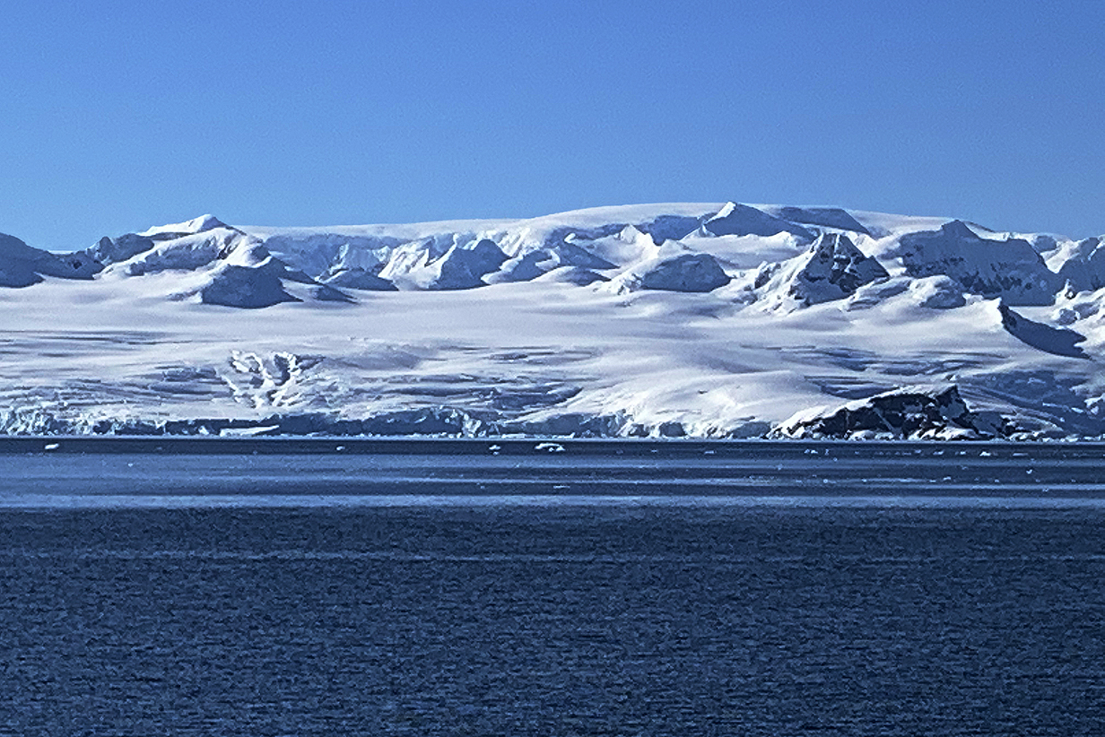
Mainland Antarctica from Mikkelsen Harbour (far right in the above panorama)
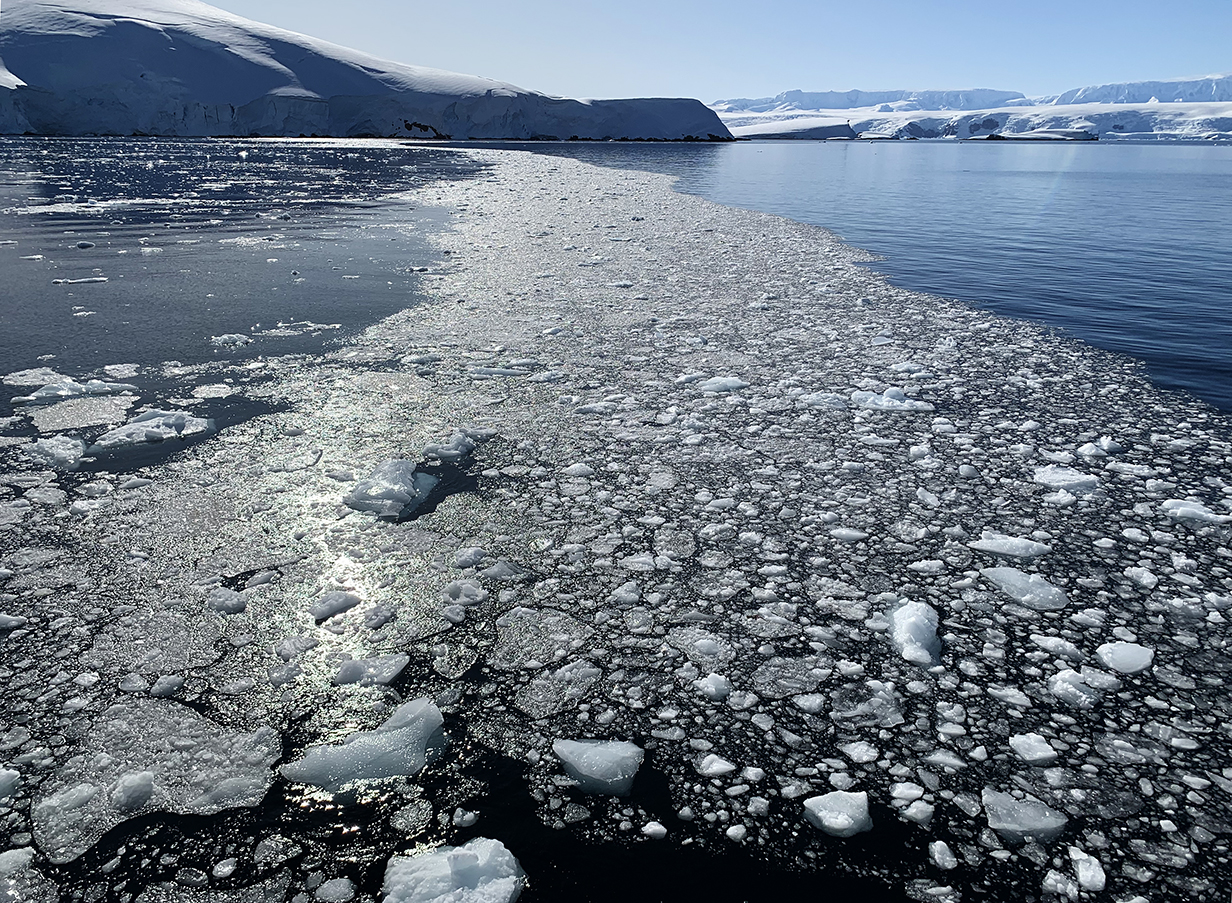
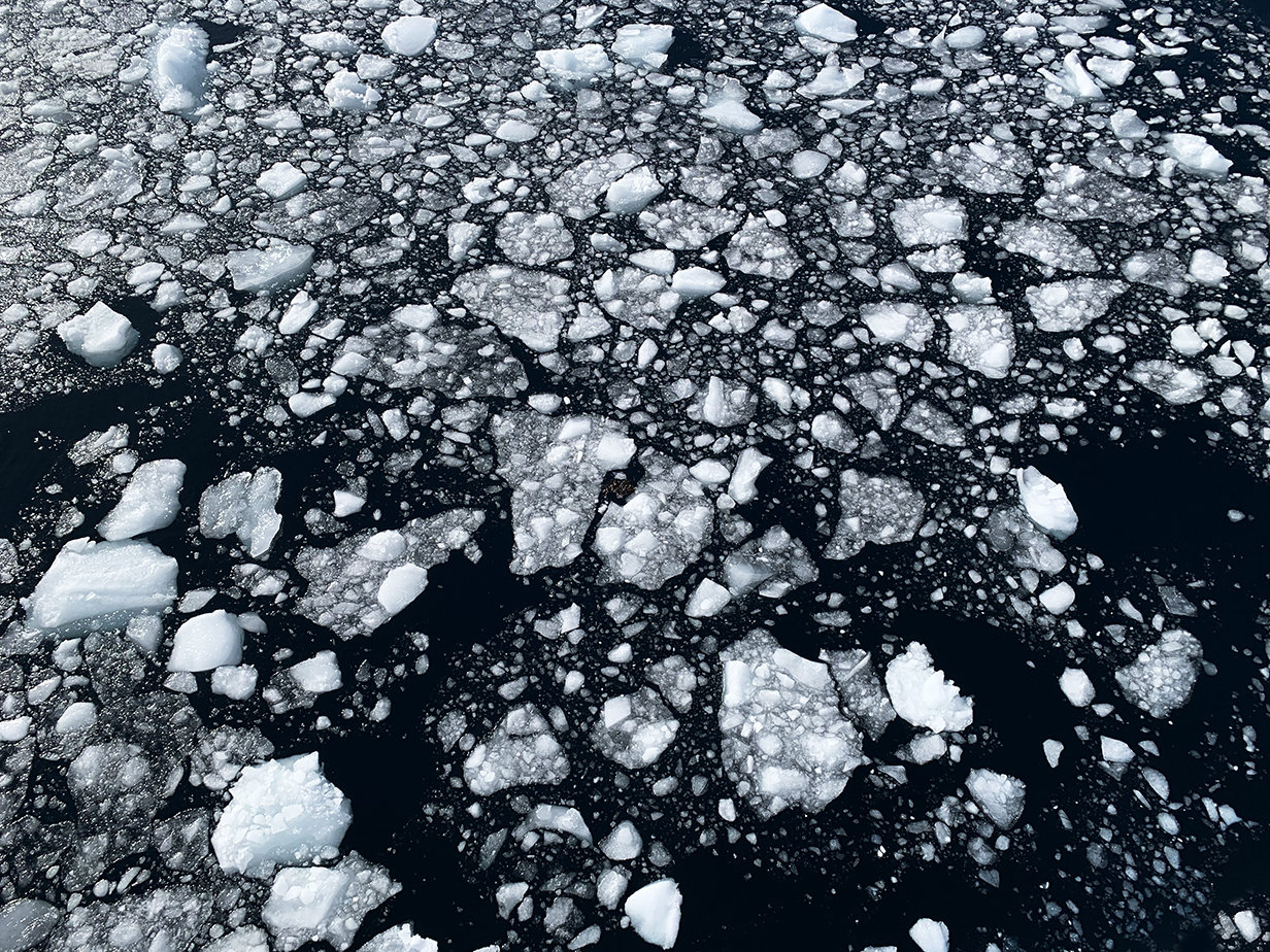
The play of ice and water was slowly evolving abstract art.
Mikkelsen Harbour 180-degree panorama a little later and farther into the bay
Closeup of mountains surrounding Mikkelsen Harbour bay
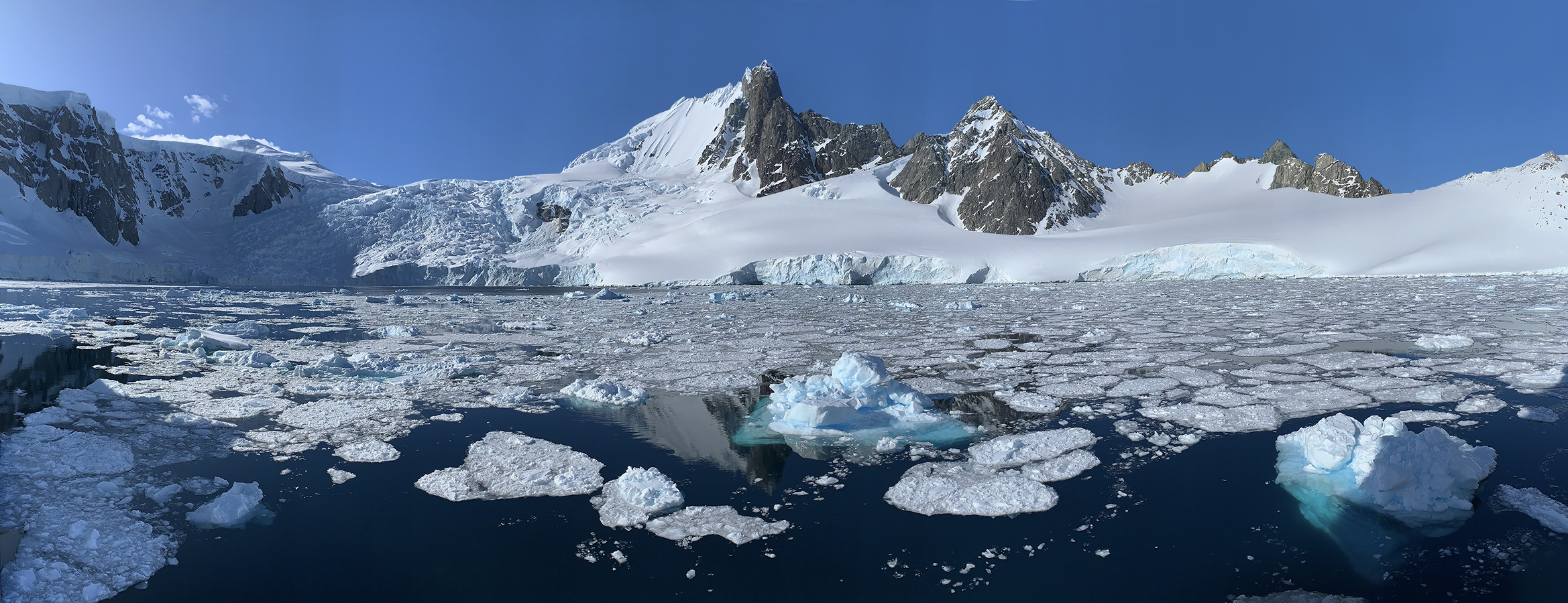
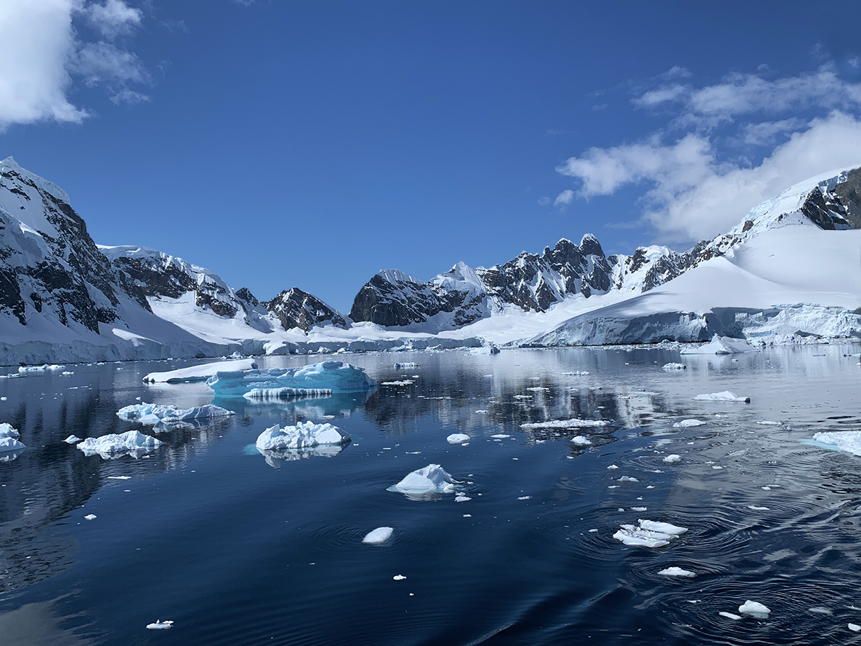
19 - Cierva Cove
Vicinity of Cierva Cove -- December 11, 2022: still quarantined
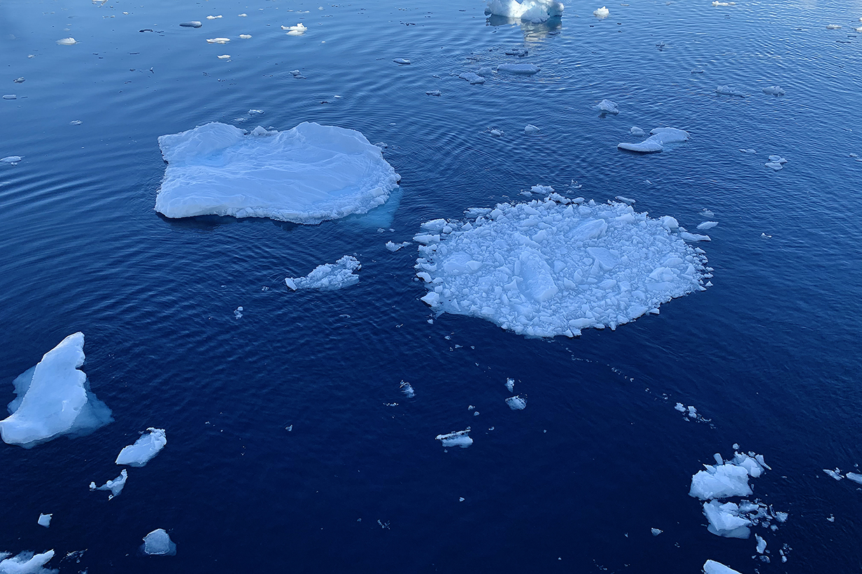
Sometimes it was relaxing to just watch the ice art flow.
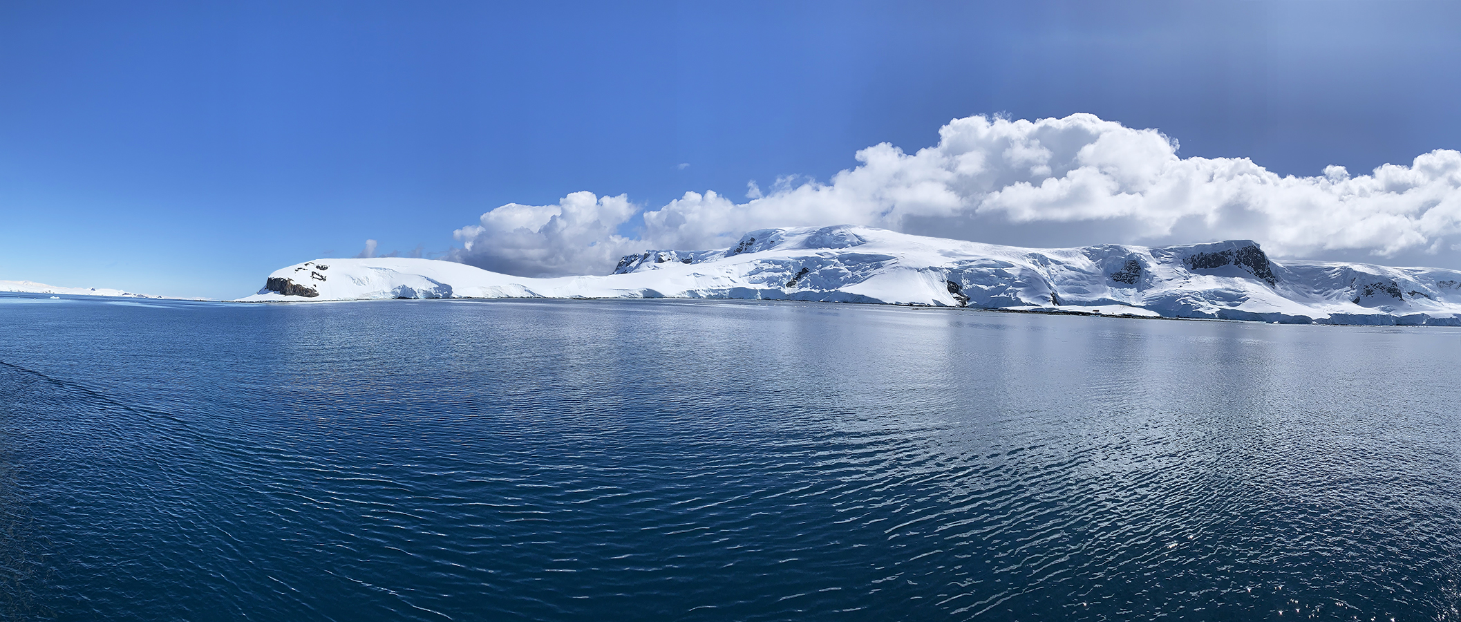
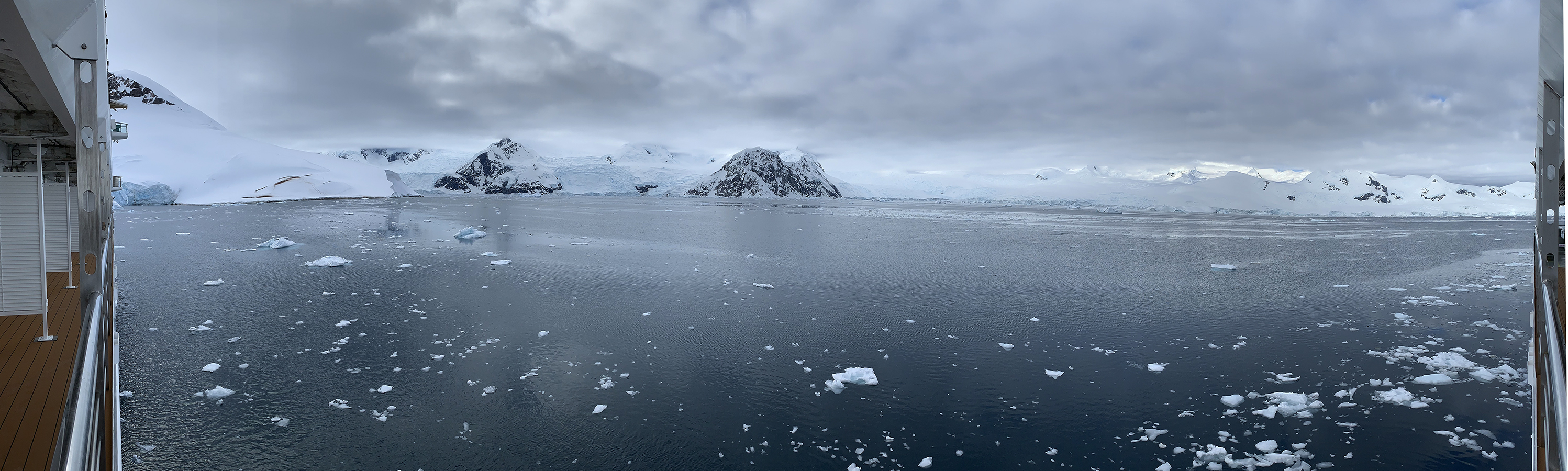
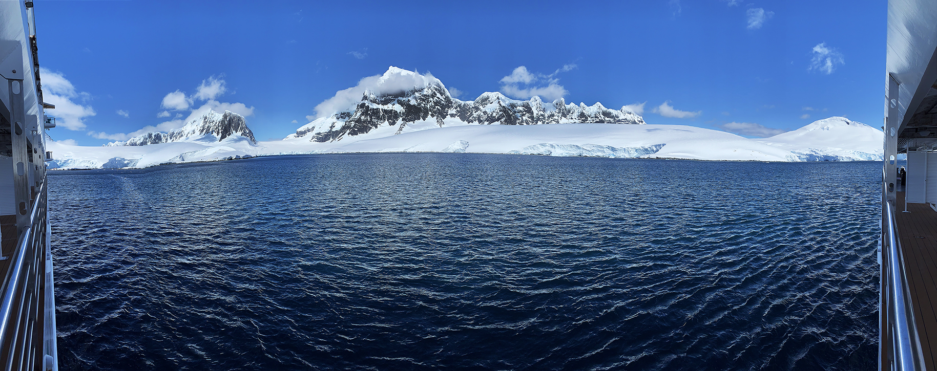
20 - Orne Harbour
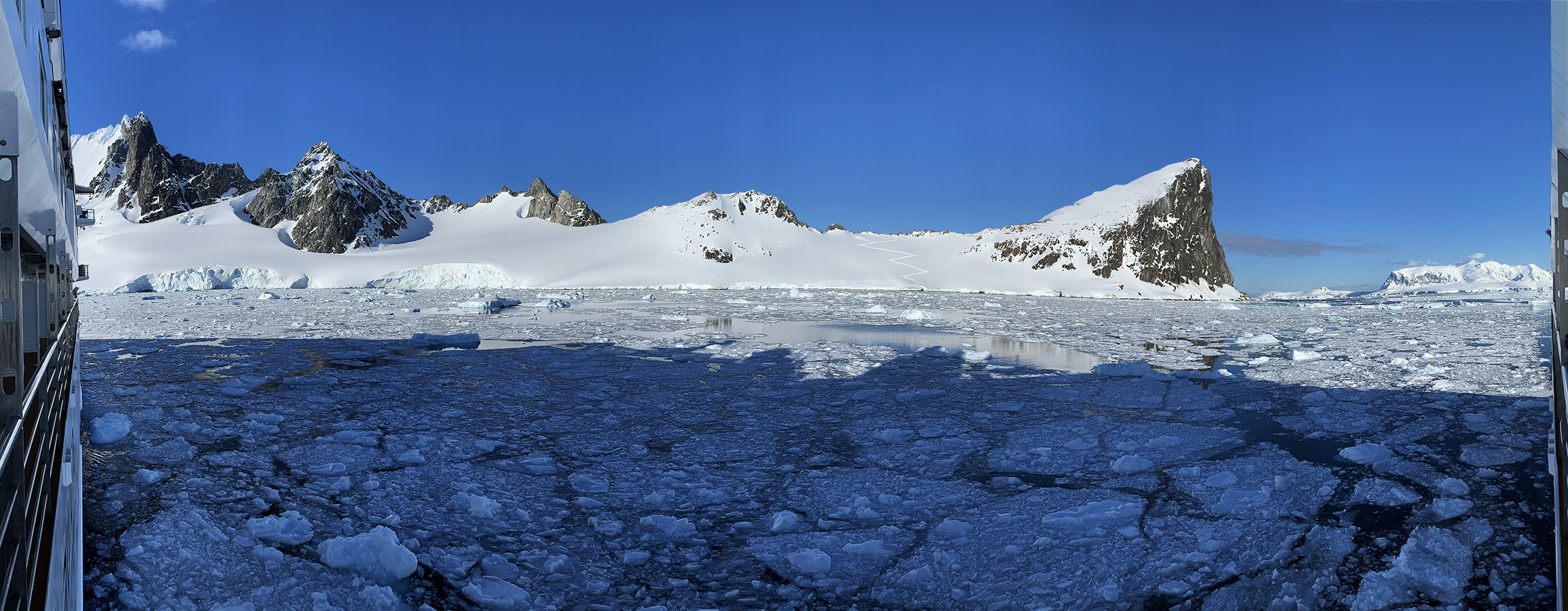
Orne Harbour 180-degree panorama on the morning of December 12, 2022. The zigzag in the snow was a penguin path between the ocean and nesting sites. Despite destination names such as Orne Harbour, there were no people or buildings here. The stillness was wonderfully palpable. This was the last day of our quarantine, so we were not allowed to take part in landings. But the views from our cabin were spectacular.
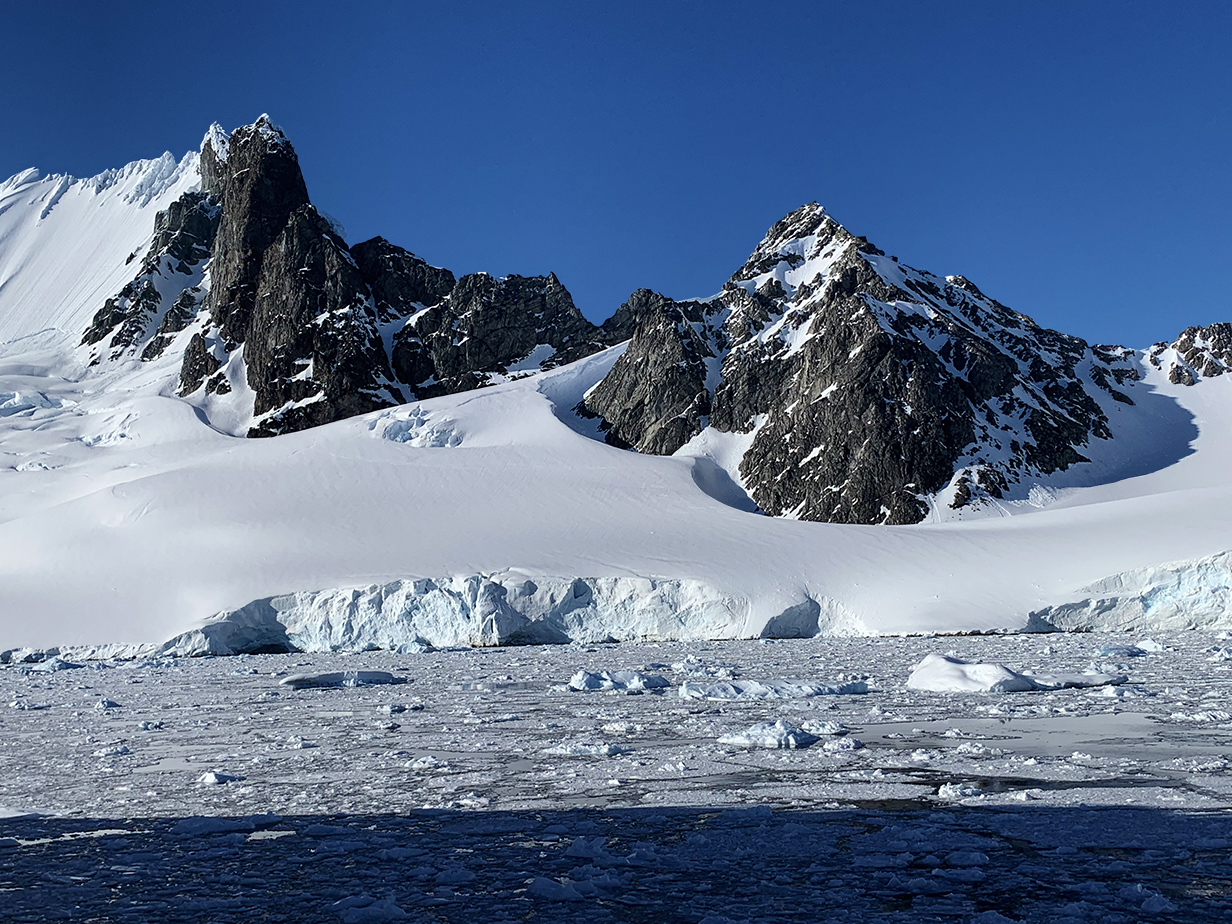
Orne Harbour mountains
One more 180-degree panorama or Orne Harbour, showing the head of the bay and its glacier. Scroll right to see the full picture.
Panorama from the above glacier still further left, as the ship turned in Orne Harbour's bay.
Closer view of the mountains in the middle distance of the previous picture. We are turning into a side bay shown in more detail below.
Side bay: Orne Harbour
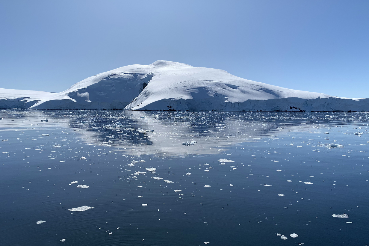
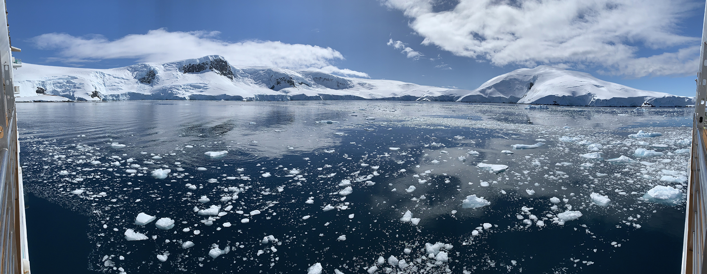
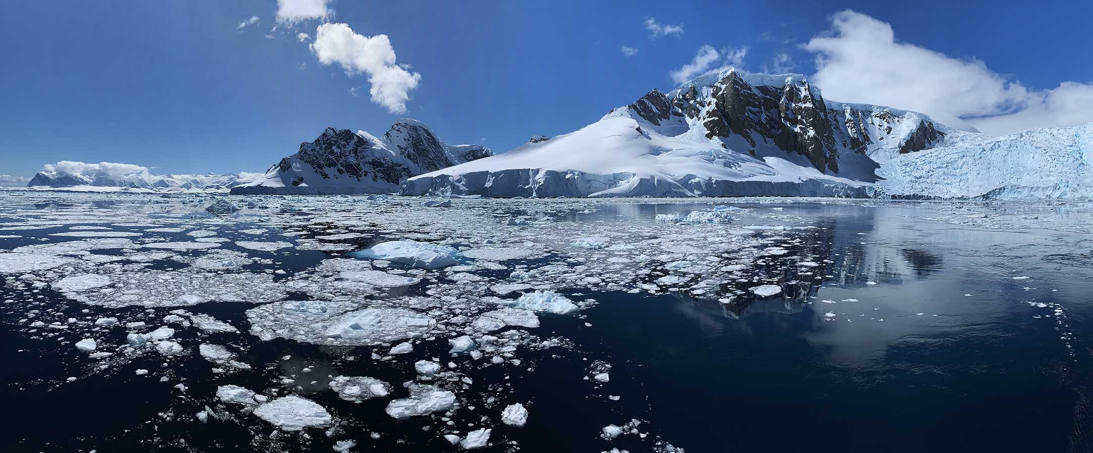
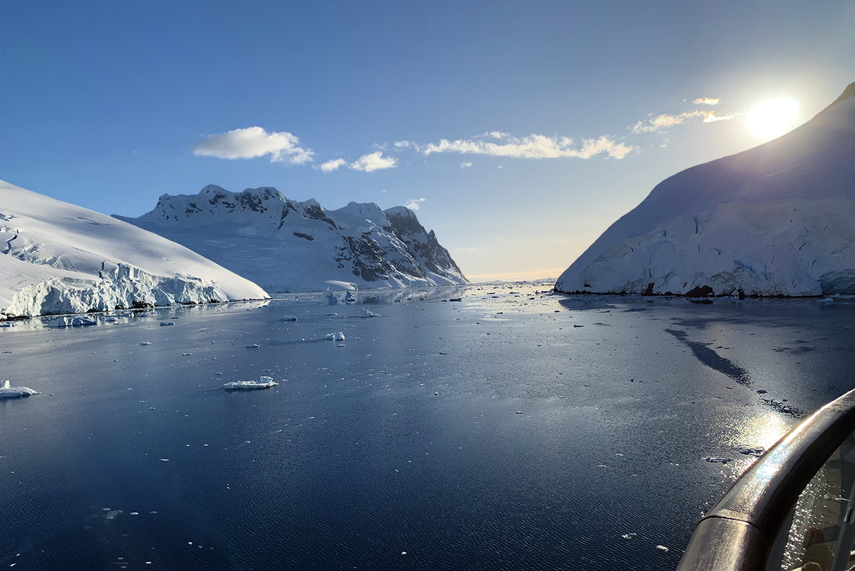
22 -Neko Harbour
Approaching Neko Harbour at 8:45 AM on the morning of December 13, 2022. Today, we were finally released from covid quarantine just in time to make our first landing on mainland Antarctica. Fortunately, the weather improved a lot during the day -- it was perfect by the end of our landing and stayed that way all day. Scroll right to see the full 180-degree panorama.
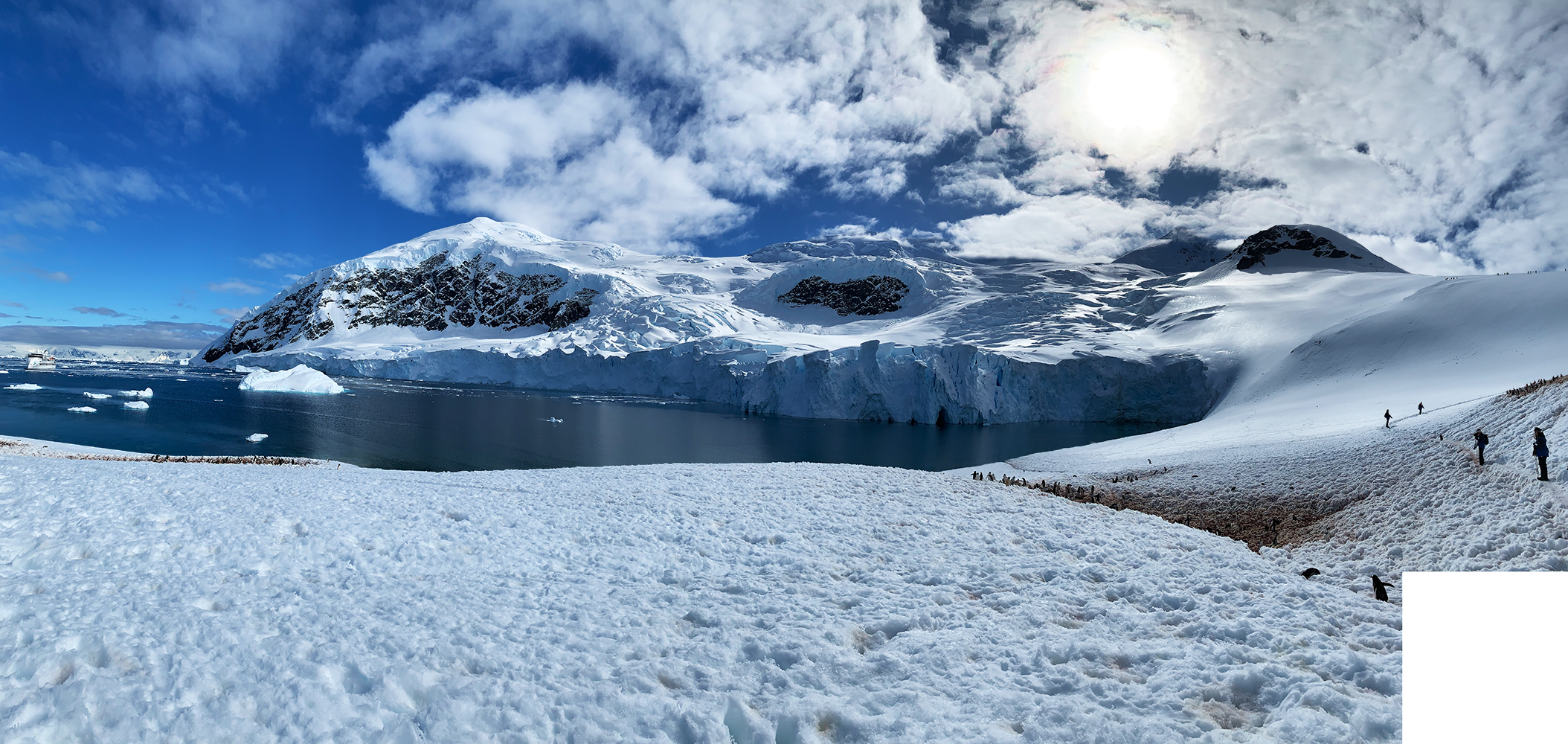
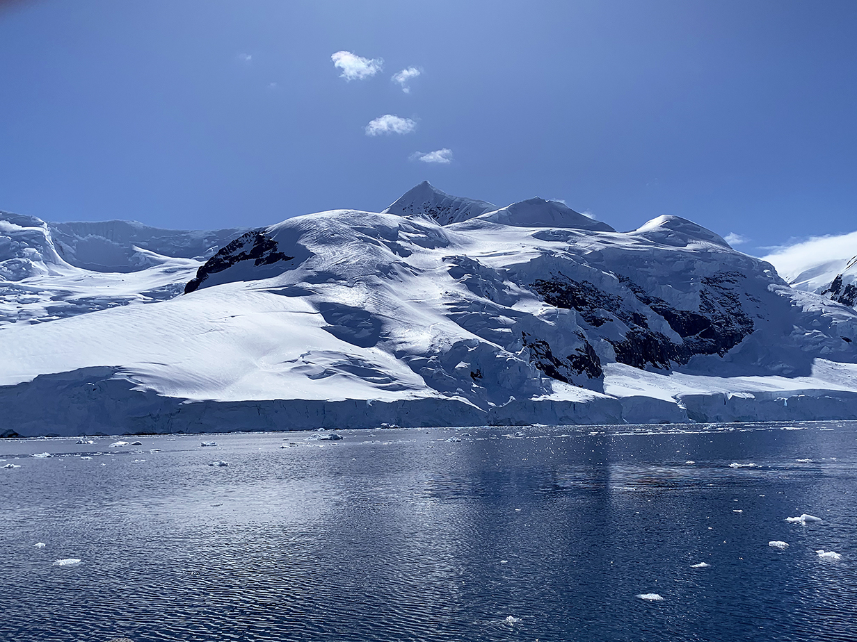
Our only landing on mainland Antarctica was at Neko Harbour on December 13, 2022. Spectacular mountains and glaciers surround these hills, which are the site of several small colonies of Gentoo penguins. After landing on our 7th and last continent, we sailed through the Lemaire Passage, later in the evening (below), to our southernmost point of the trip. This was the happiest day of a spectacular trip.
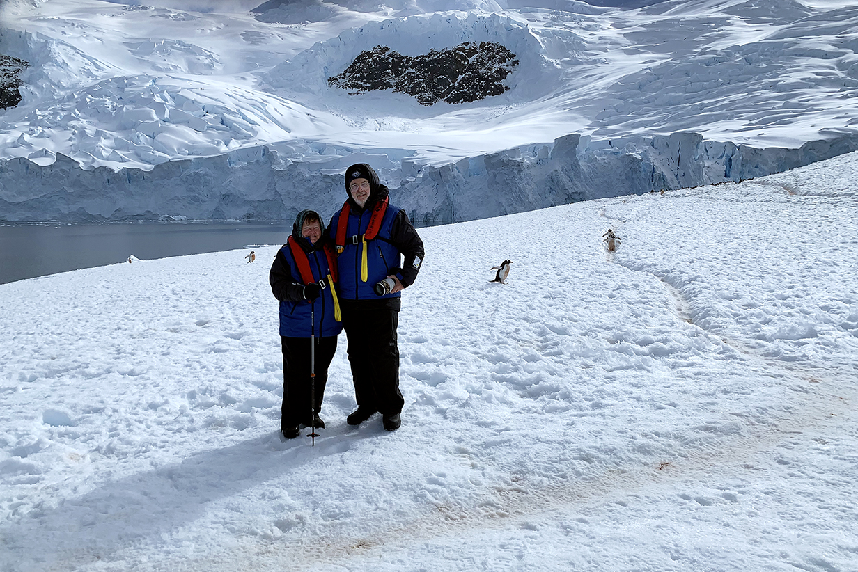
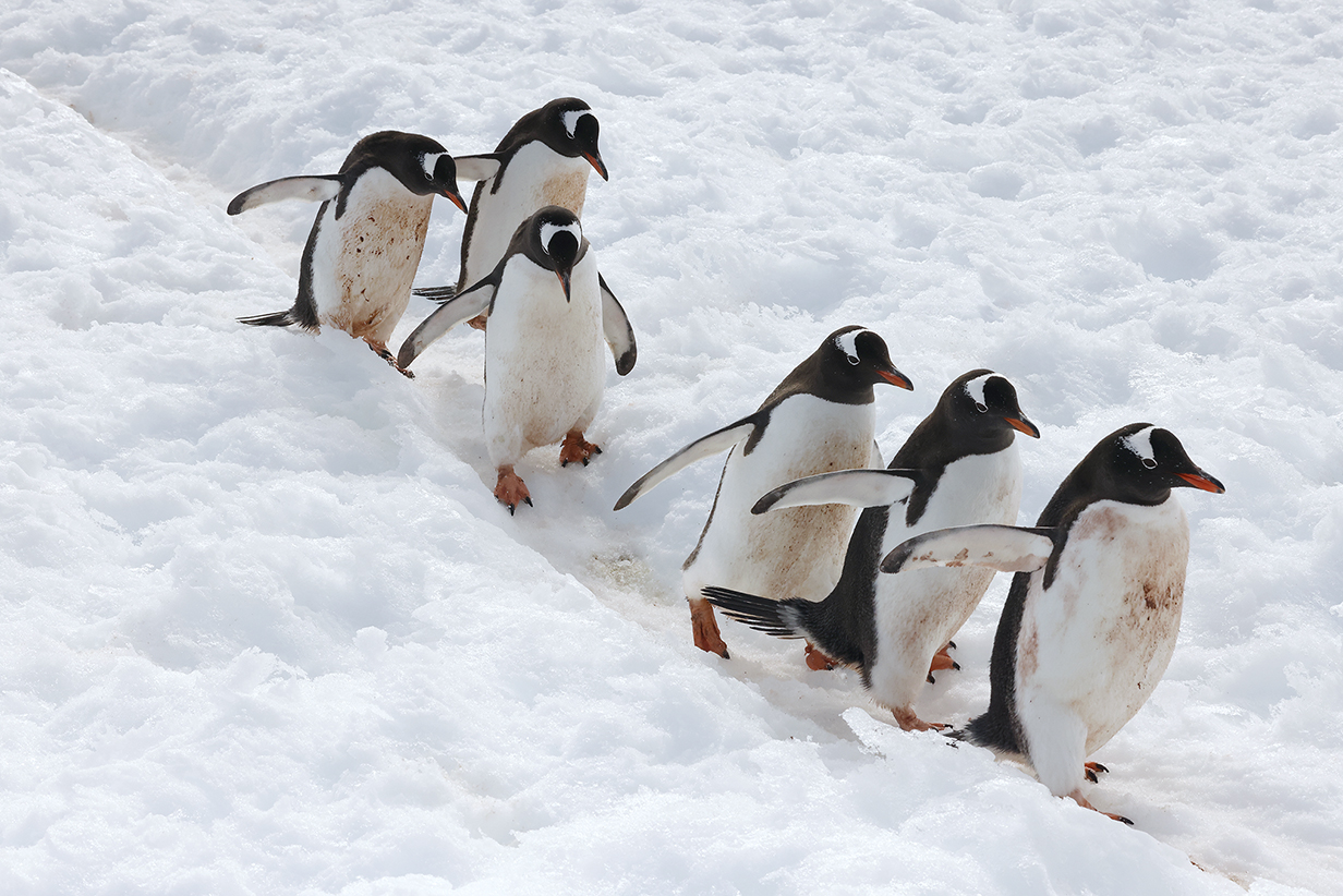
On the mainland of the Antarctica penninsula with Gentoo penguins. The two paths at right lead to the penguin colony just over the rim of the hill and shown in the next picture.
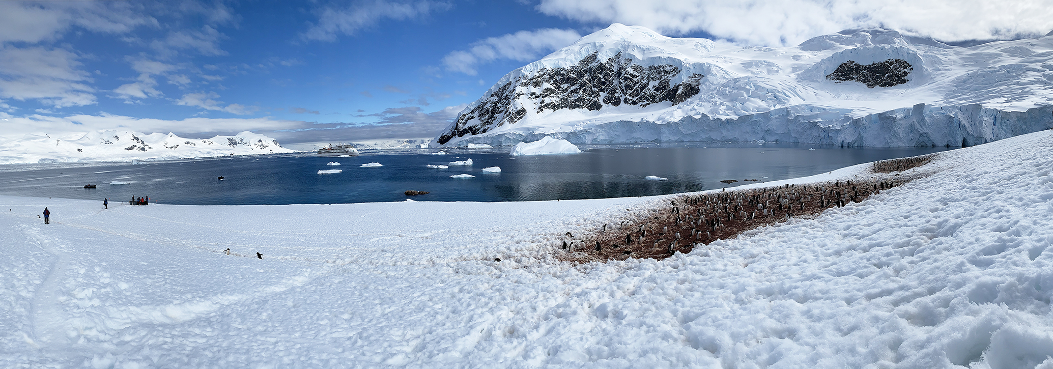
Two of about half-a-dozen Gentoo penguin nest sites at Neko Harbour. Our cruise ship, the Greg Mortimer, is shown in the bay; from there, we took a zodiac to the landing site just out of sight at middle left. Up the slope from that is the cache of life vests (although we continued to wear ours) and just up the slope from that and near the second-leftmost person is the place where we were photographed, above. Scroll right to see the complete panorama.
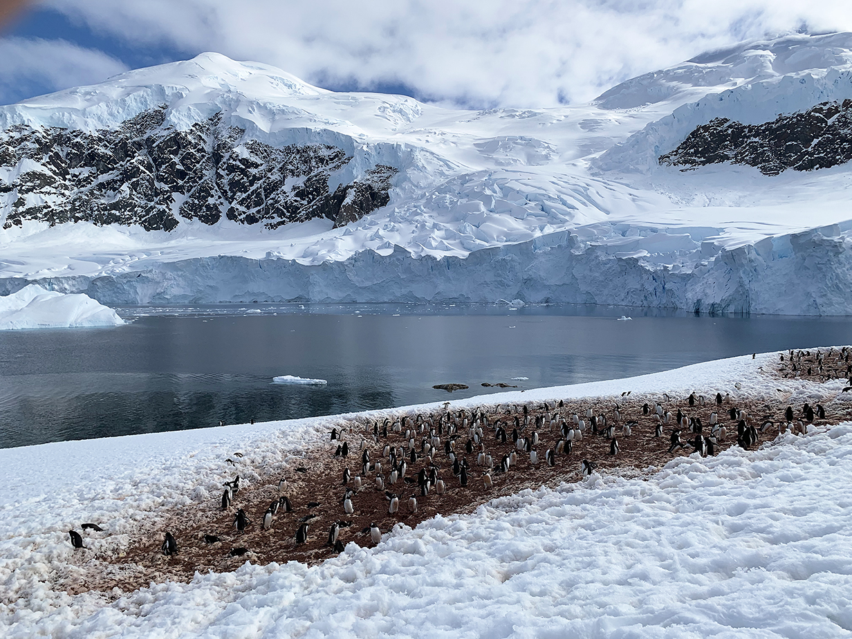
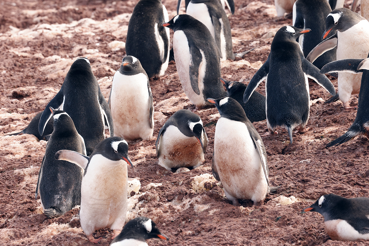
Gentoo penguins have many smallish nest sites, unlike King penguins, which nest in colonies of thousands and even tens of thousands.
Gentoo penguin on a mission.
In fact, many Gentoos were on the same mission ...
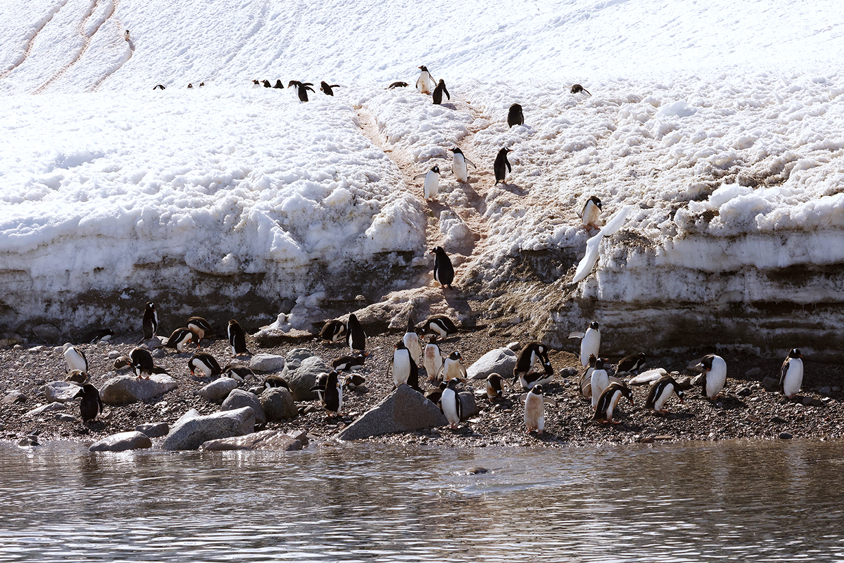
... which took them down to the narrow rocky shore between glacier and ocean.
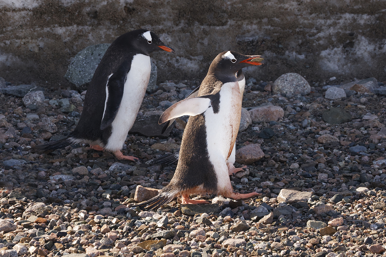
The purpose was to collect a rock ... to impress the ladies. Gentoos make rough nests out of pebbles. And they shamelessly steal pebbles from each other.
The climb back up to the nesting colony is not entirely easy.
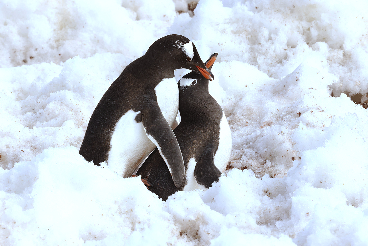
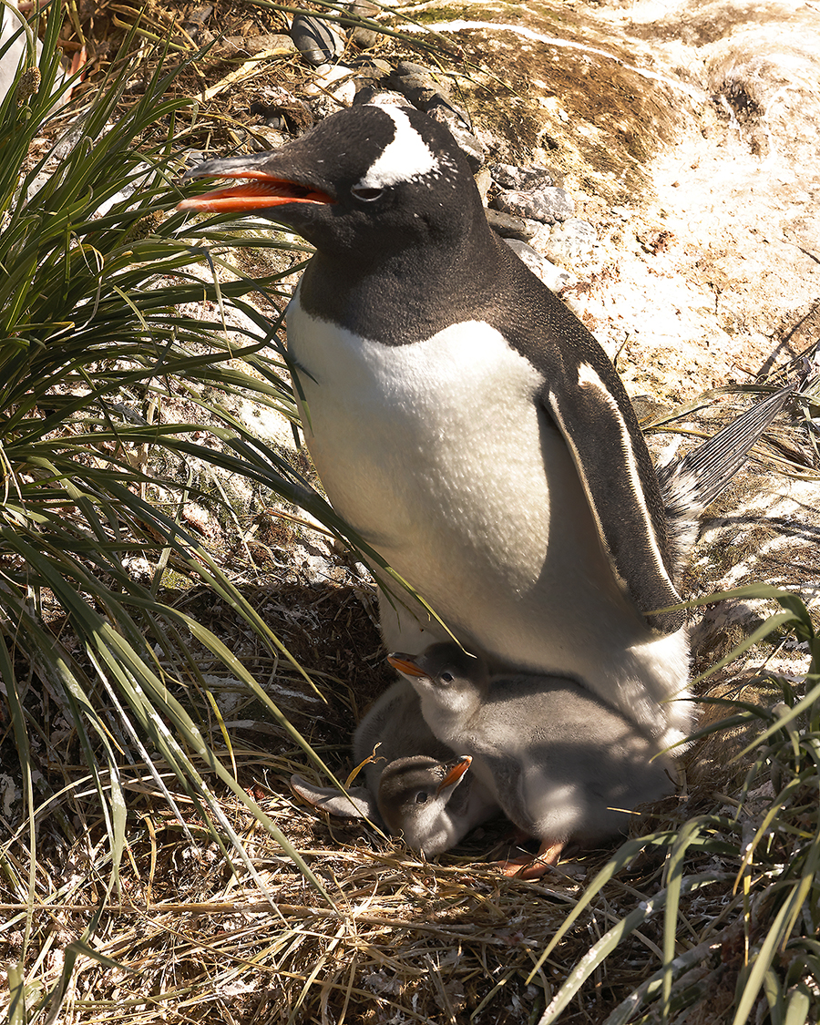
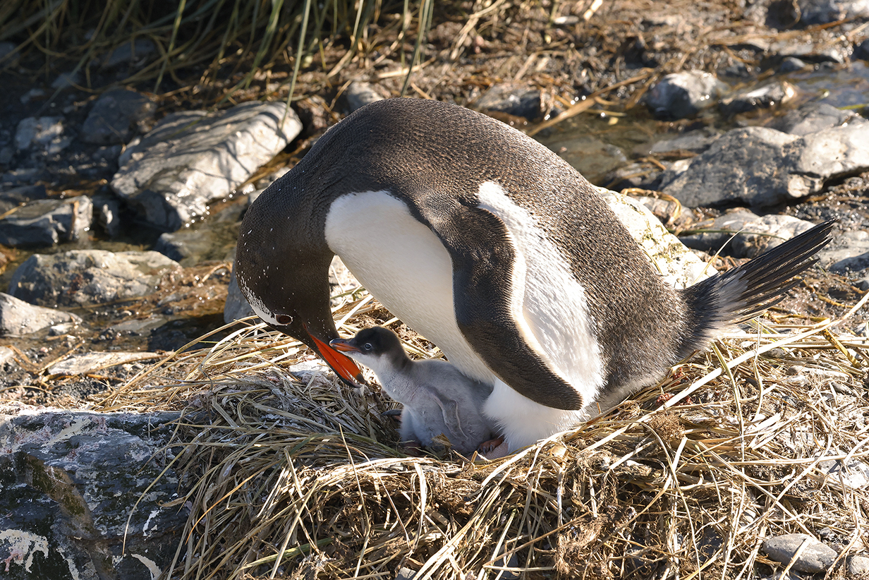
But if the lady is suitably impressed ... well: it's mating season. In fact, the Gentoo pairs are pretty well synchronized: we saw no less than 4 matings in the ~1 hour that we watched. Synchronization favors survival, in part because the nesting season here on the Antarctic penninsula is short enough so that they have to hurry to raise chicks and in part so that there are many chicks to dilute the danger from predators. Lots of Skuas will hover around to grab chicks, once they hatch.
But when we were at Neko Harbour, only a few penguins already had eggs. Meanwhile, in South Georgia Island, the nesting season is longer and Gentoos already had chicks (q. v. above).
One more panorama of the landing site at Neko Harbour
After the Antarctica landing, we were taken on a zodiac cruise around the next bay south of Neko Harbour. This is part of the view of the mountains and glaciers around that bay.
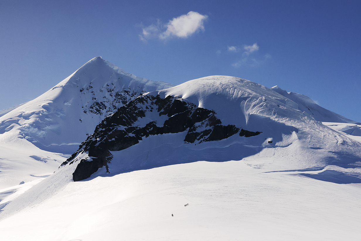
Pictures do not do justice to the immensity of the landscape. This picture of hikers from our ship gives a better feel for scale. The mountain on the skyline is also shown in the previous picture.
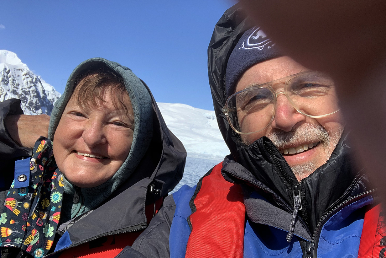
John and Mary during a zodiac cruise around the bays at Neko Harbour. John is very good at covering up part of the iphone camera lens, especially in a fast-moving zodiac.
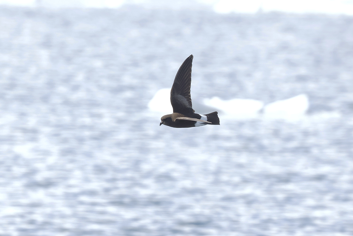
Wilson's storm-petrel is one of the most common pelagic birds but is tiny, always on the move, fast, and hard to photograph. This was taken during the above zodiac cruise.
This is a 180-degree panorama of the view from our stateroom balcony while we were sailing SW from Neko Harbour during the afternoon of December 13, 2022. This must be near Port Lockroy. Scroll right to see the full panorama.
23 - Port Lockroy
Sailing SW from Neko Harbour in mid-afternoon, near Port Lockroy
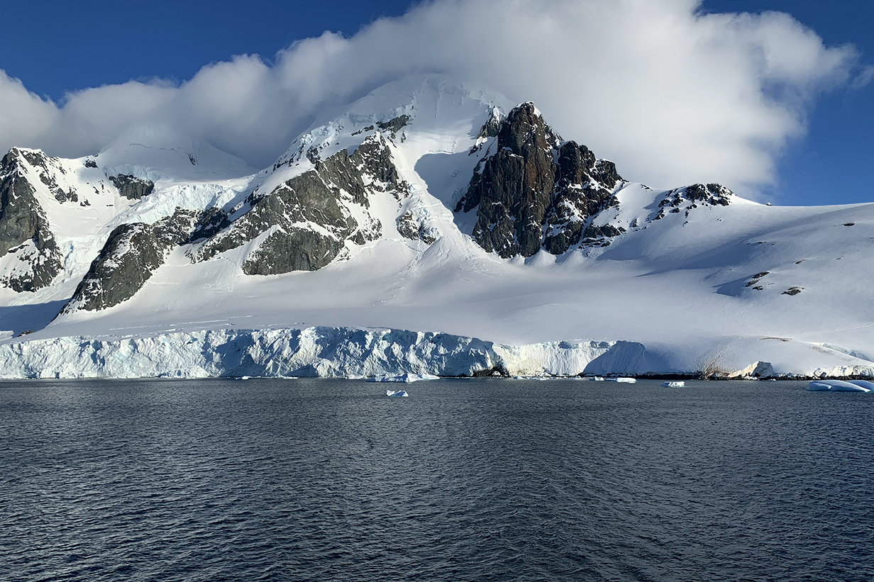
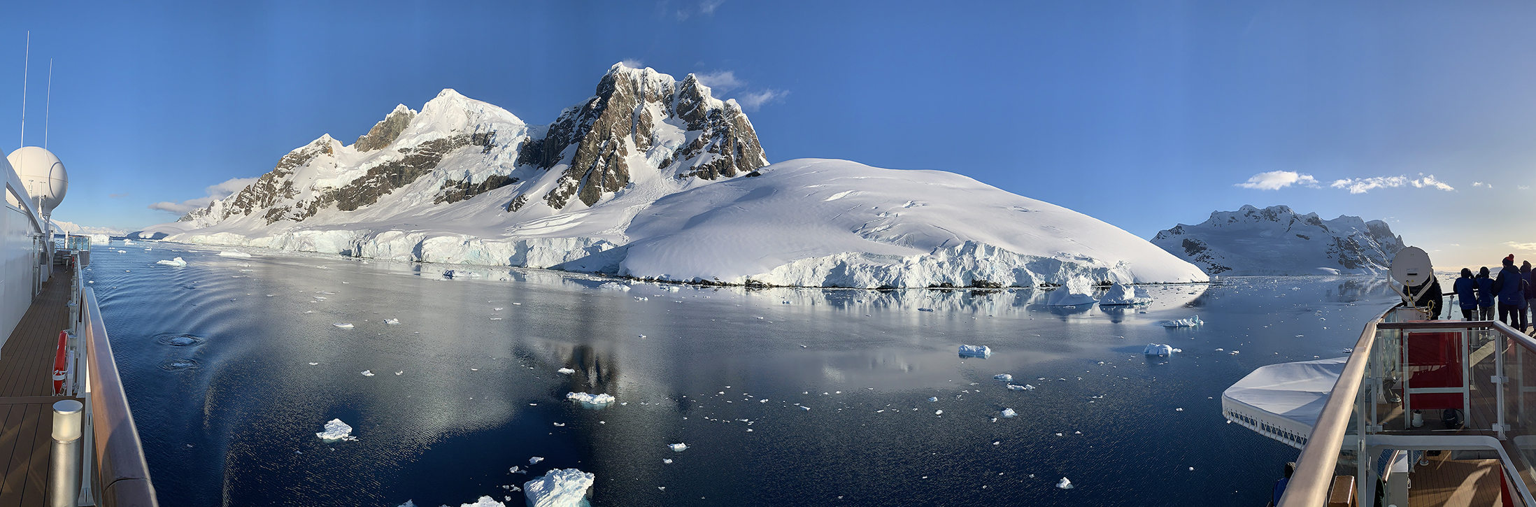
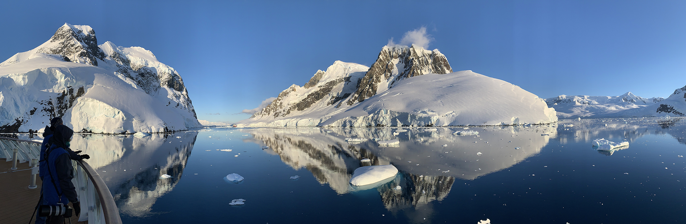
24 - Lemaire Channel
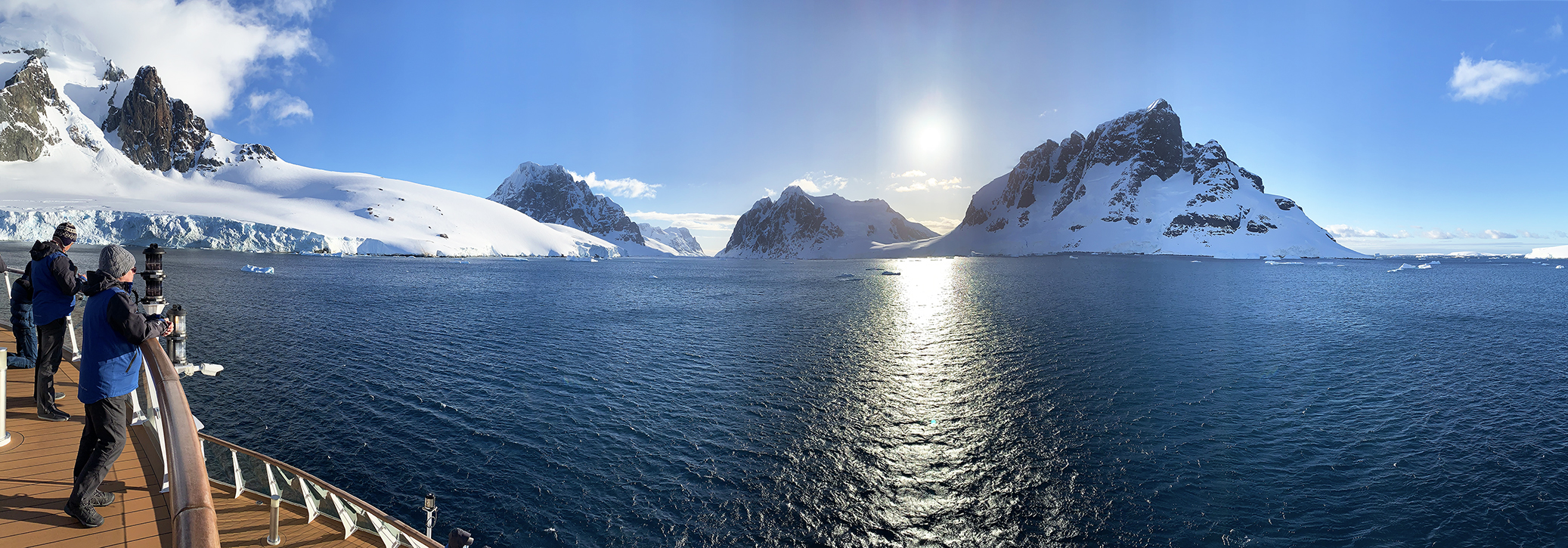
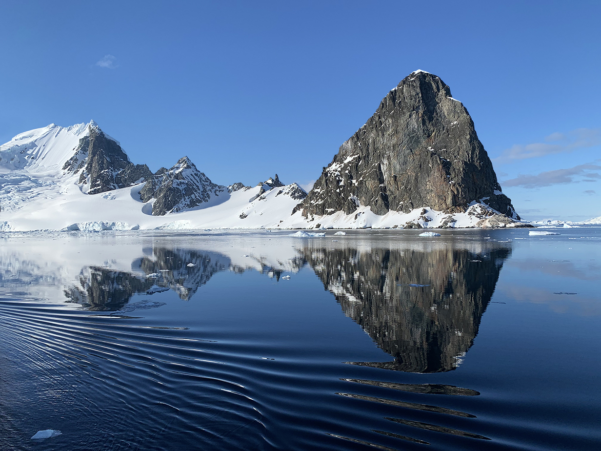
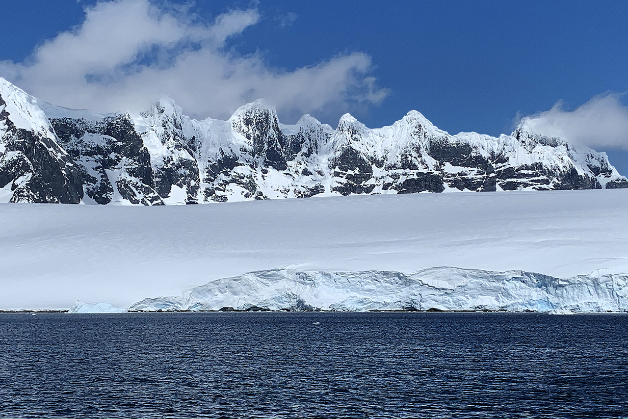
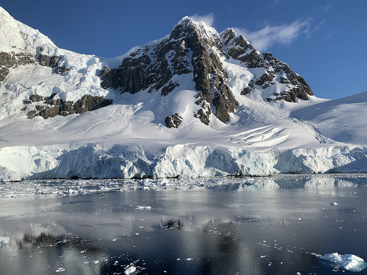
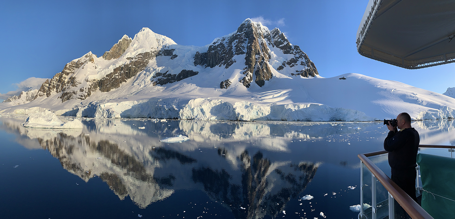
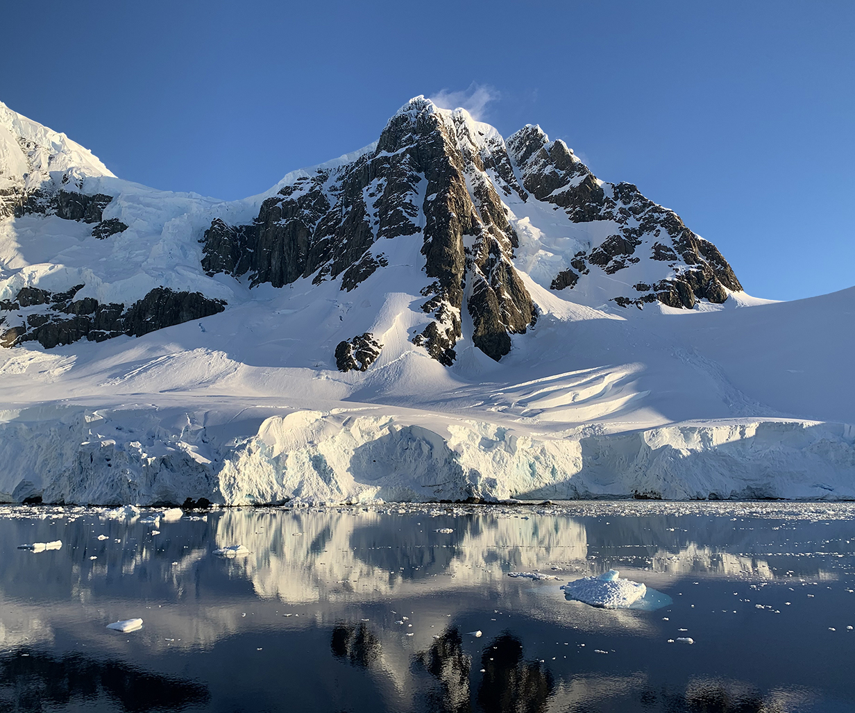
Around 9 PM, we entered the Lemaire Channel, which has some of the most dramatic views along the Antarctic penninsula. Our heading here is roughly SW, so the direction to the Sun is a clear indication of our very southerly latitude (here just south of 65 degrees S). The entance to the channel is between the central two mountain massifs: the left one is on the Antarctic mainland; the right one is part of Booth Island. The channel is 11 km long and only 1600 m wide at its narrowest. The mountains on either side are almost that high. The resulting views are spectacular, and the shelter provided by the mountains usually protects the passage from strong winds. When we passed through, winds started out light and became almost dead calm along the way. Wonderful climax to the best day of the trip. Scroll right to see the complete panorama.
Approaching the narrow part of Lemaire Channel
Approaching Lemaire Channel
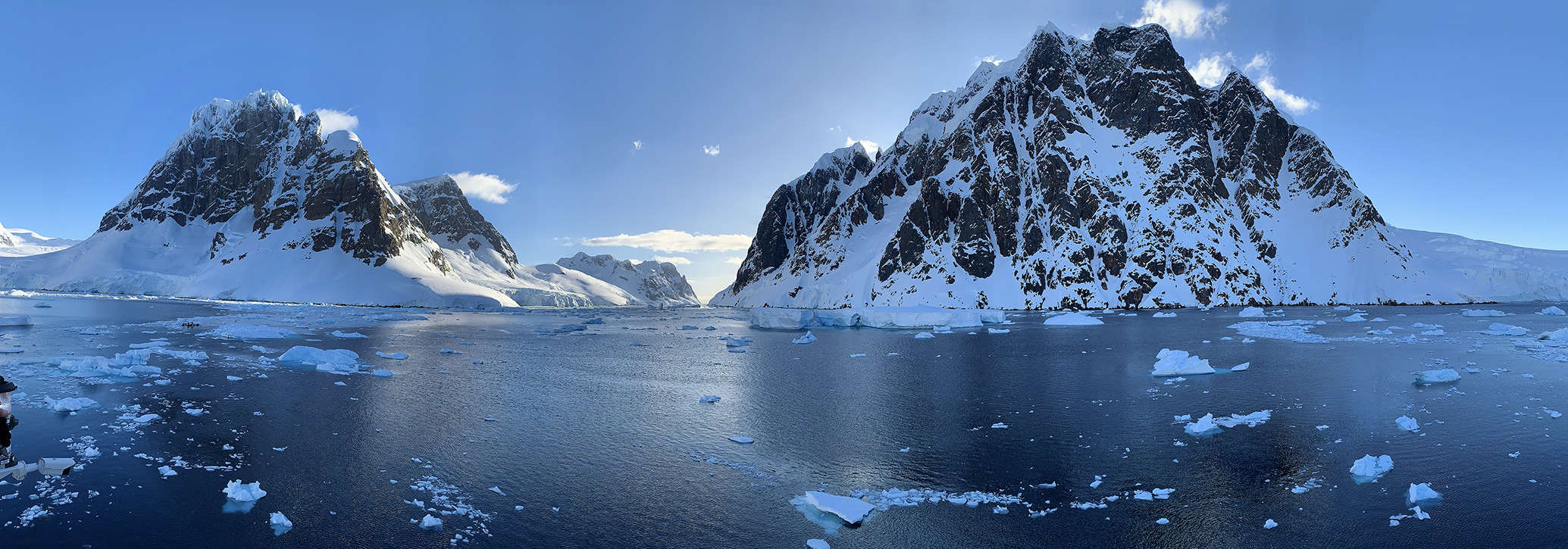
Continental side of the narrow part of Lemaire Channel
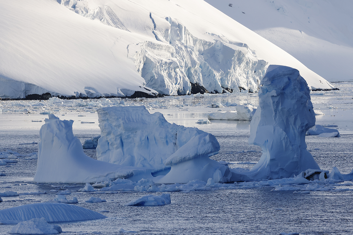
There were unusually few big icebergs in the channel, but there were enough to slow us down as the captain steered between them.
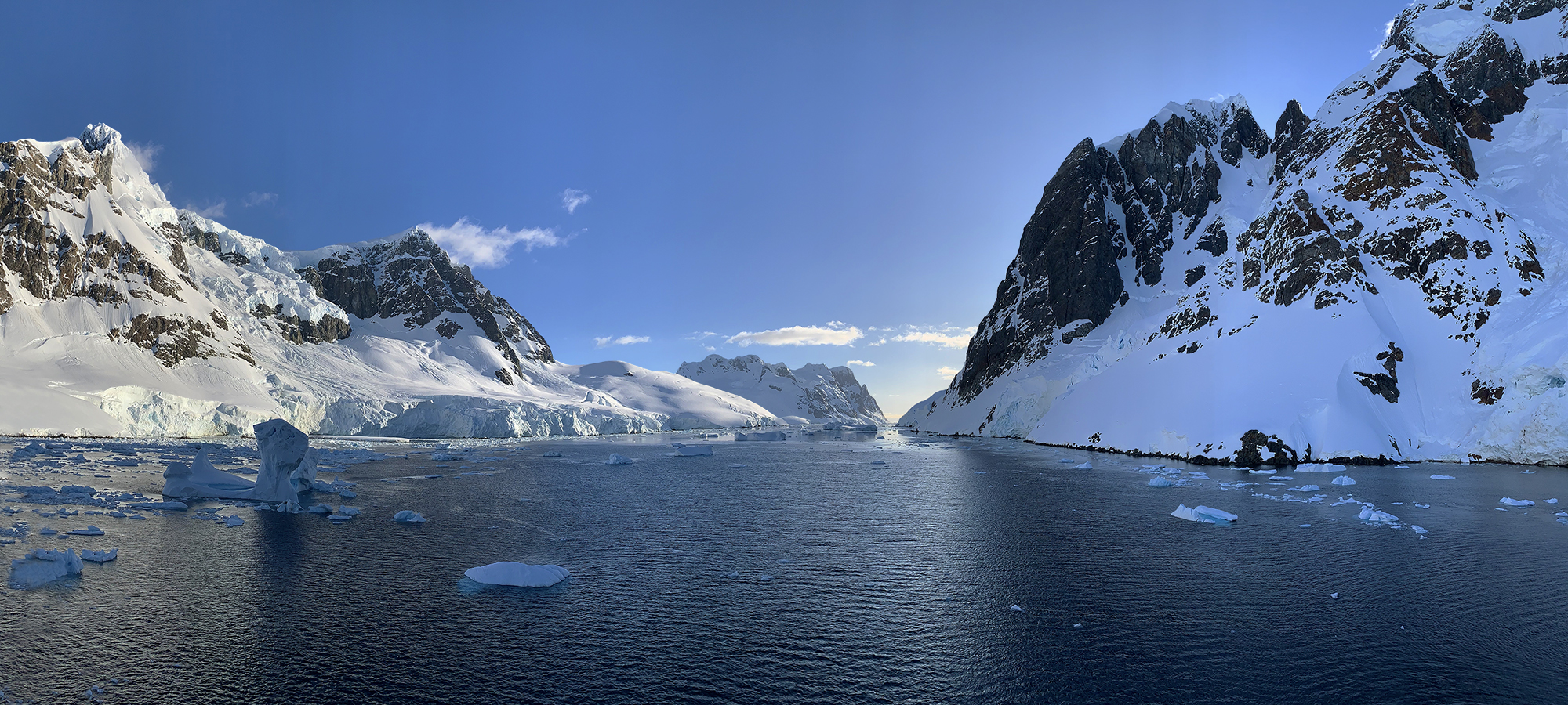
This panorama shows roughly the narrowest part of the Lemaire Channel.
Approaching the south end of Lemaire Channel at 9:50 PM on December 13, 2022
This is a 180-degree panorama: Emerging from the narrow part of Lemaire Channel and looking back at continental Antarctica toward the NE. At almost 10 PM, it was sunny and calm and very very still. Magic.
Looking back at Lemaire Channel from the southernmost point of our trip, latitude 65 deg 6 min 46 sec S; longitude almost exactly 64 deg W. Completely calm. Scroll to the right to see the complete 180-degree panorama.
We waited here for about 15 minutes while another cruise ship -- visible in the distance -- entered the channel going NE. We then followed. When we emerged from the channel, the Greg Mortimer started a sprint back to Ushuaia. This was to avoid high winds predicted to get worse over the next 2 days. Still, thanks to good luck and excellent planning by the expedition crew, we never experienced seas that were rough enough to make us seasick. John and VENT's Barry Lyon continued pelagic birding as much as possible all the way back to Ushuaia.
Meanwhile, late in the present evening, we had been scheduled to sail farther south to our only accessible colony of Adelie penguins. That plan had to be abandoned, because we lost too much time in going slowly through the Lemaire Channel as the ship was steered around the bigger ice floes. But we "lucked out": on one of the medium-sized ice floes behind the biggest and nearest iceberg in this picture, two Adelies were sleeping. As we passed near them on the way back NE, they woke up, posed nicely for us, and then dove into the water. So John got his 5th species of penguin for the trip. (Mary, meanwhile, had to sleep through the Lemaire passage.)
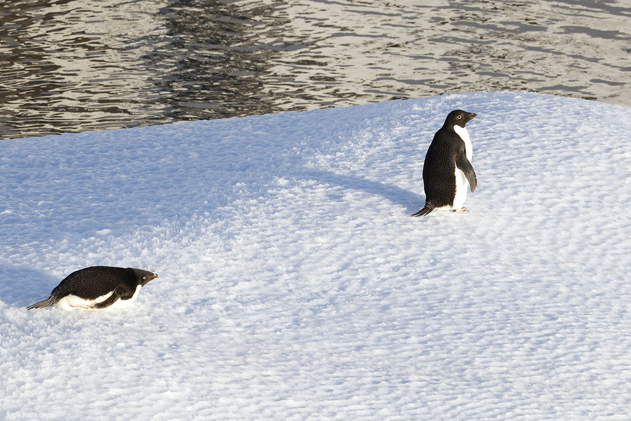
Adelie penguins on an ice floe near the south end of the Lemaire Channel. These are John's life birds.
One more time: at 10:30 PM on the way back NE through the Lemaire Channel. You can tell that you are having an extraordinary experience when the ship's captain comes out on the bridge deck to take pictures. We were lucky to have a superb captain -- a cheerful Russian with not much English but plenty of emotion and charm.
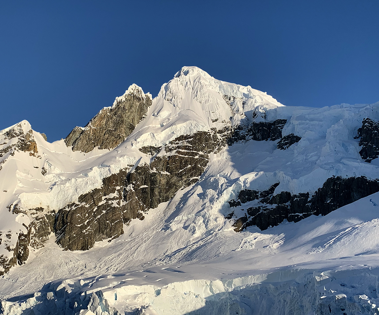
Southernmost peak (top, shown above a bit earlier in the evening) and the next peak northward on the mainland side of Lemaire Channel, on the way back north through the channel. These peaks are roughly 1000 m high. These pictures were taken at 10:45 PM, just before John went to bed at the end of a magical day.
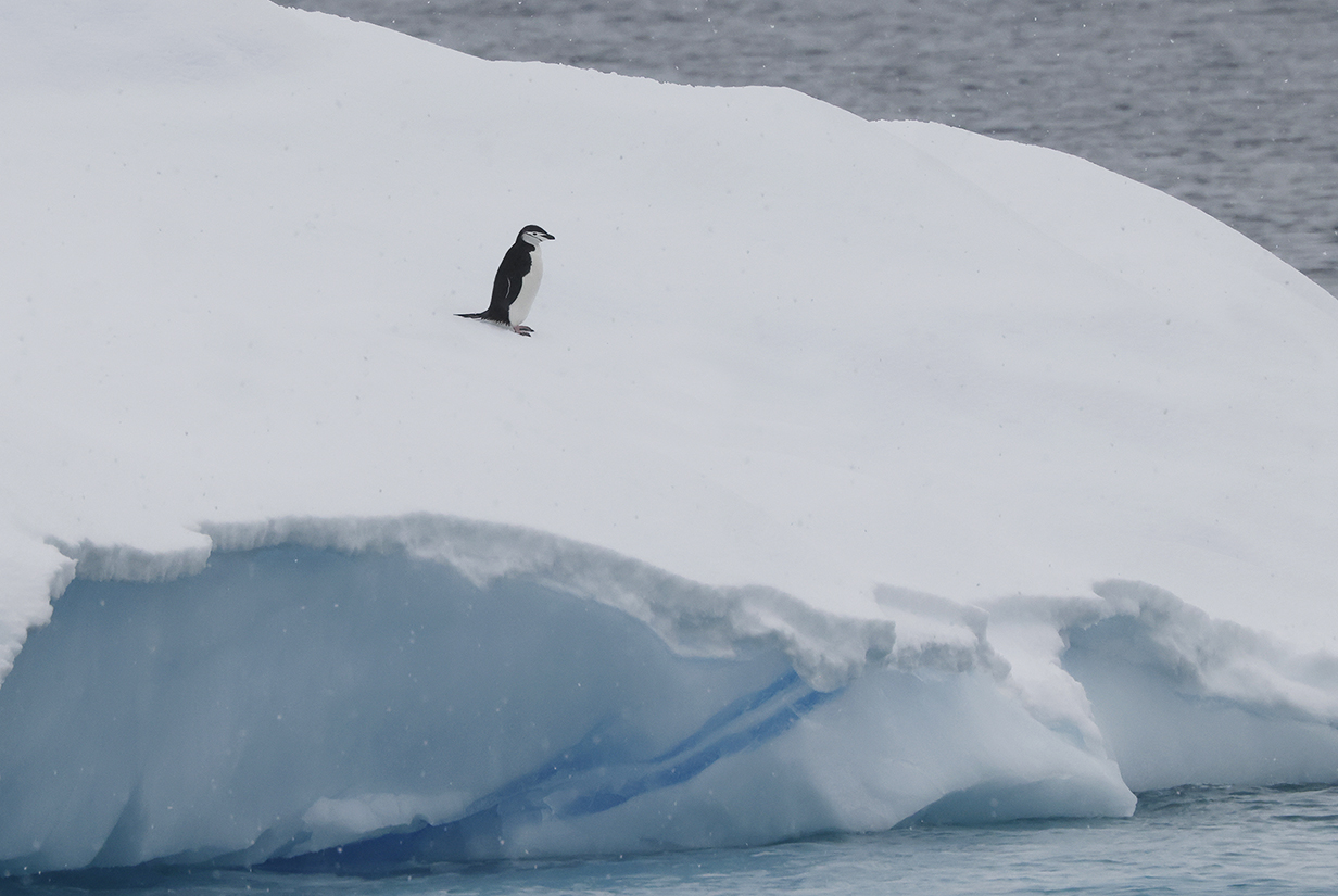
Chinstrap penguin resting on an iceberg. When we tested positive for covid, we were confined to our cabin earlier in the trip when landings were possible at Chinstrap nest sites. We saw them from our balcony but could not get close. This is the closest that we got to a Chinstrap ... in light snowfall.
Tierra del Fuego
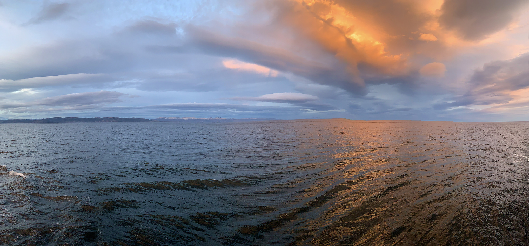
Sunset panorama, approaching Tierra del Fuego at 11 PM on December 16, 2022
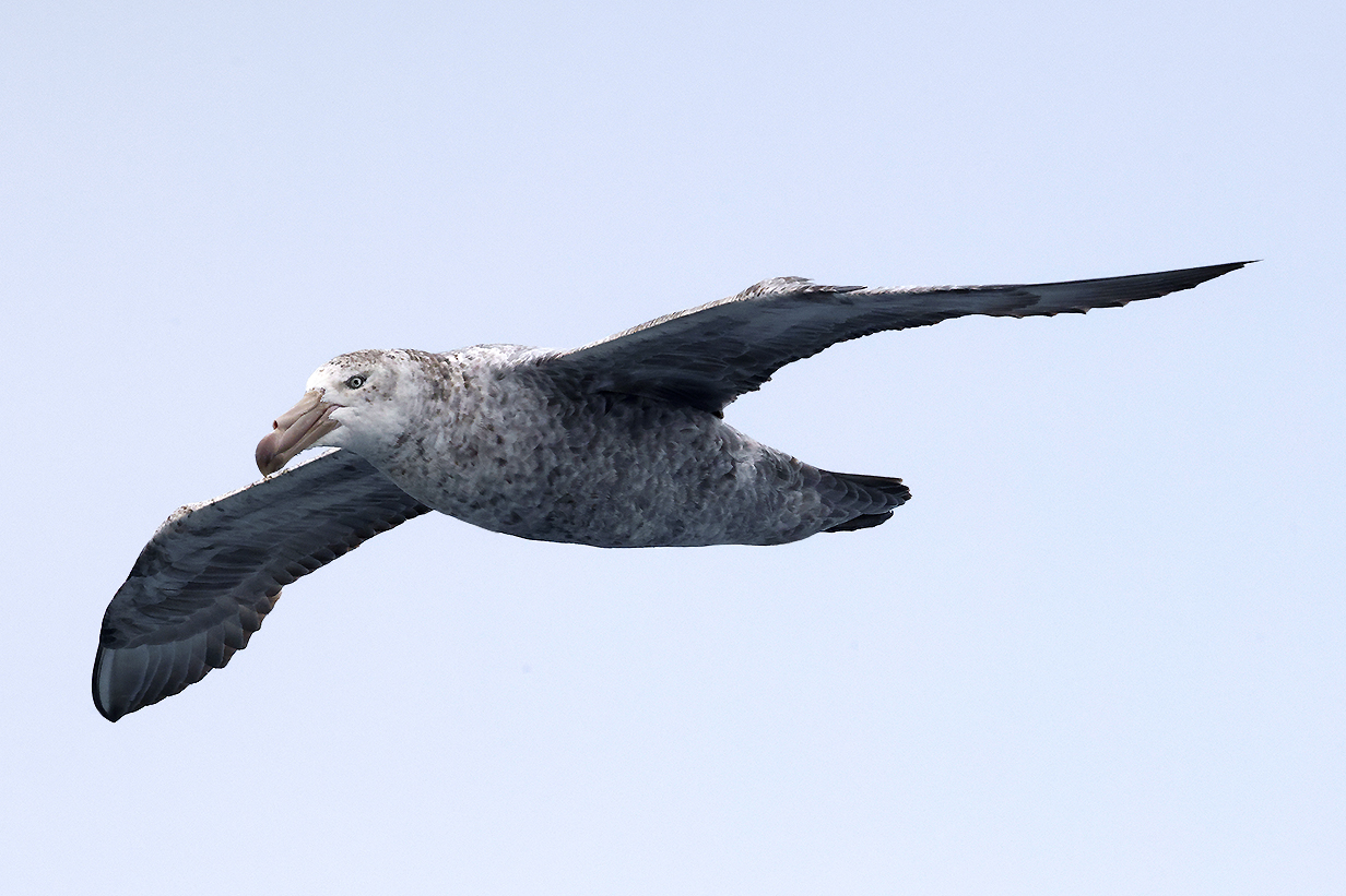
Pelagic Birding
A continuing highlight of this trip was pelagic birding. Except when breeding, these birds spend most of their lives at sea, flying out of sight of land.
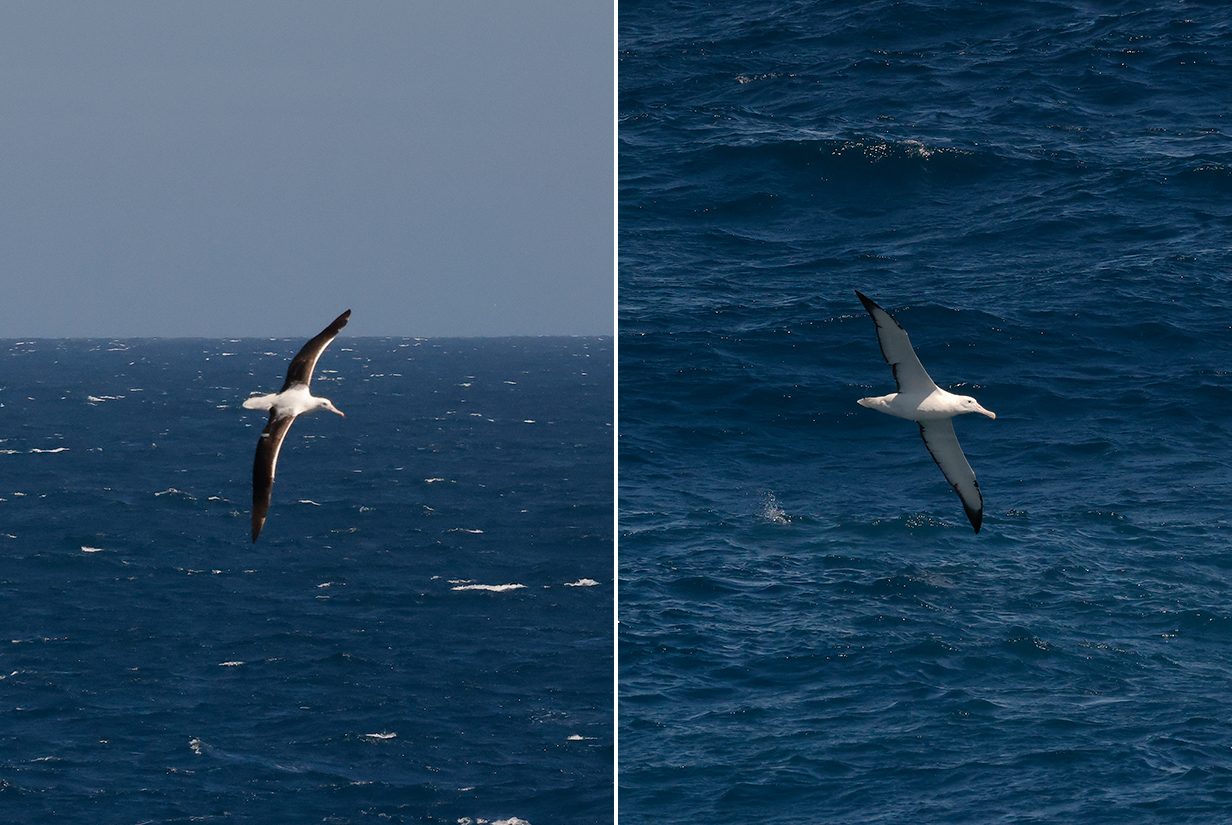
Southern royal albatross, seen soon after leaving Ushuaia. These are not good pictures -- birds at this stage of the trip did not come close -- but guide Barry Lyon pointed out characteristic features such as the clean black-and-white colors, white tail, and especially the white leading edge of the wings. Clements does not split Southern and Northern Royal Albatross, so for now, this is Diomedea epomophora epomophora. It is not a life bird: we have seen it in New Zealand.
Southern royal albatross, seen shortly after leaving the Falklands. Note the dark line along the cutting edge of the bill.
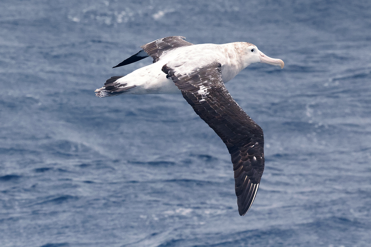
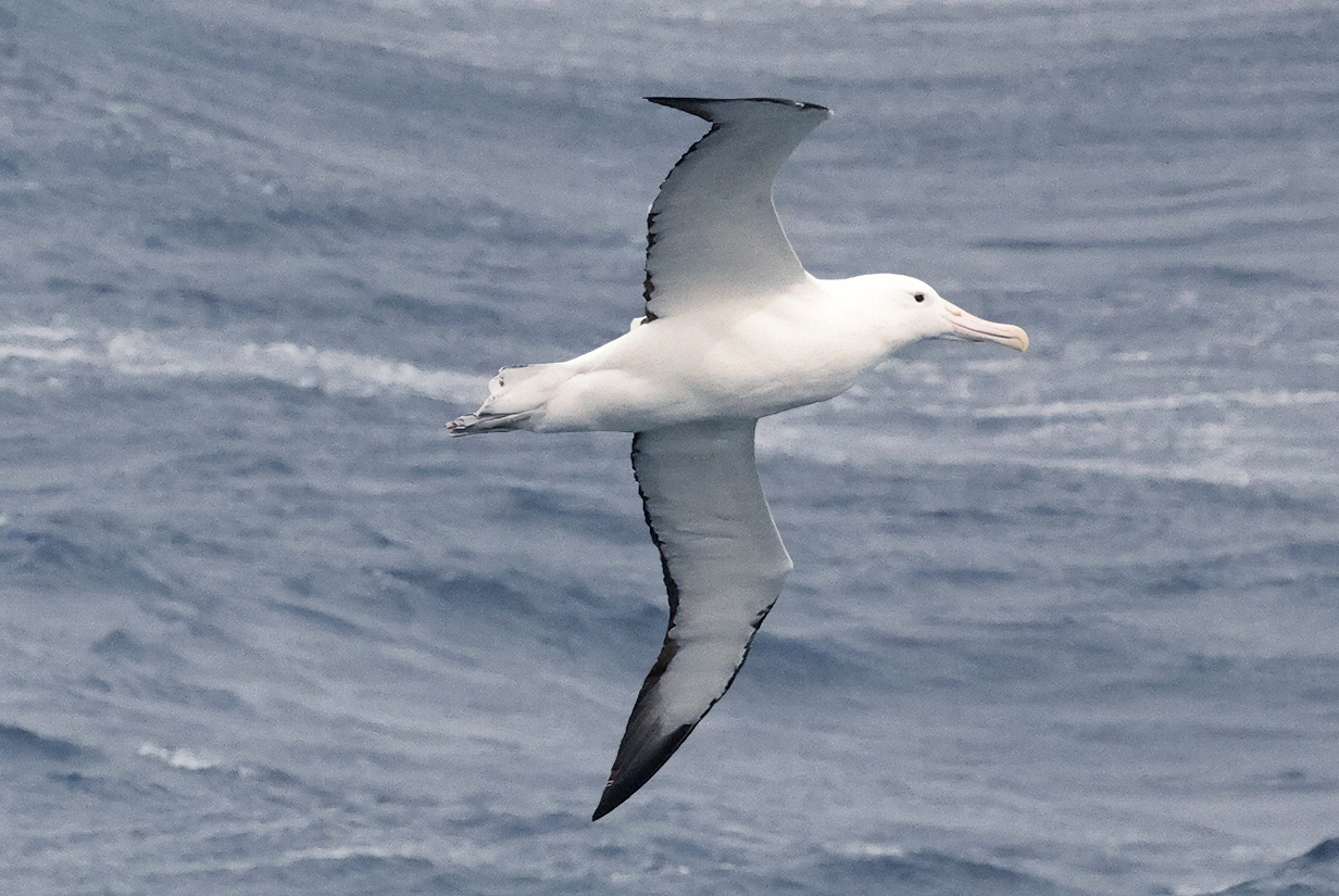
Wandering albatross is the iconic pelagic bird. This is the "snowy" subspecies, Diomedea exulans exulans, found mainly between southern South America, South Georgia Island, and the tip of the Antarctic penninsula.
Gray-headed albatross was new for John on November 29 and for Mary on December 3, 2022.
Gray-headed albatross between Fortuna and Stromness Bays
Light-mantled albatross (This is John's life bird, seen during pelagic birding between Fortuna and Stromness Bays, December 5, 2022. The bird never came close enough for a good picture, but the light blue cutting edge of the bill is visible in the better picture at right.)
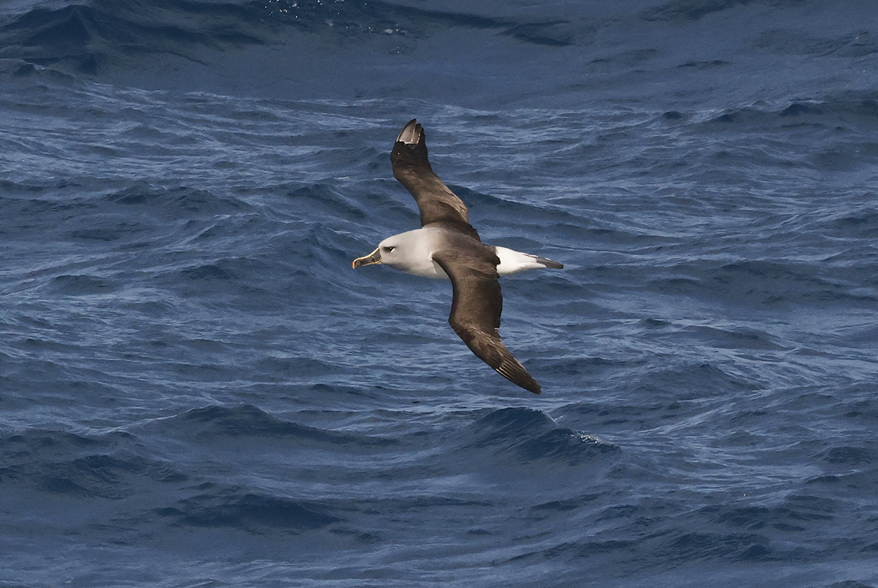
Black-browed albatross was probably the most common albatross seen during this trip and elsewhere, as long ago as our pelagic off the Cape of Good Hope. This one was seen early, while cruising from Ushuaia to the Falklands.
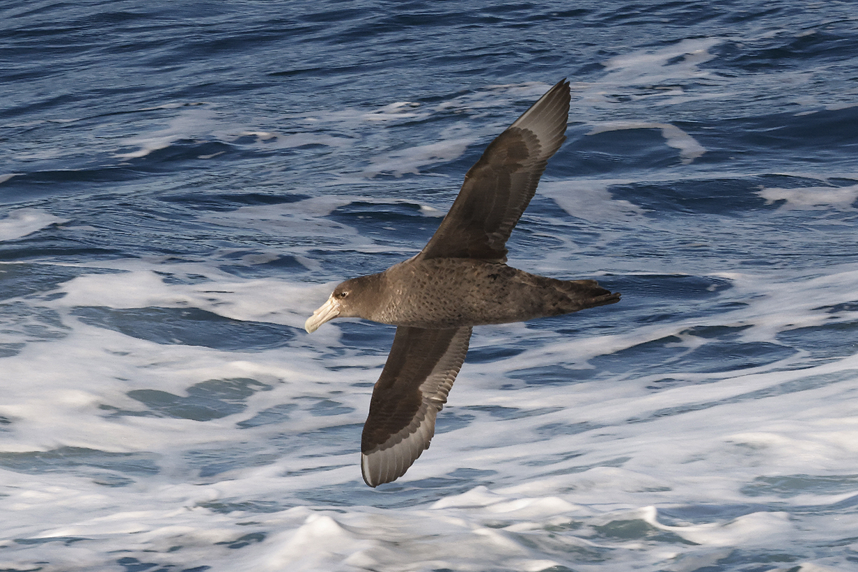
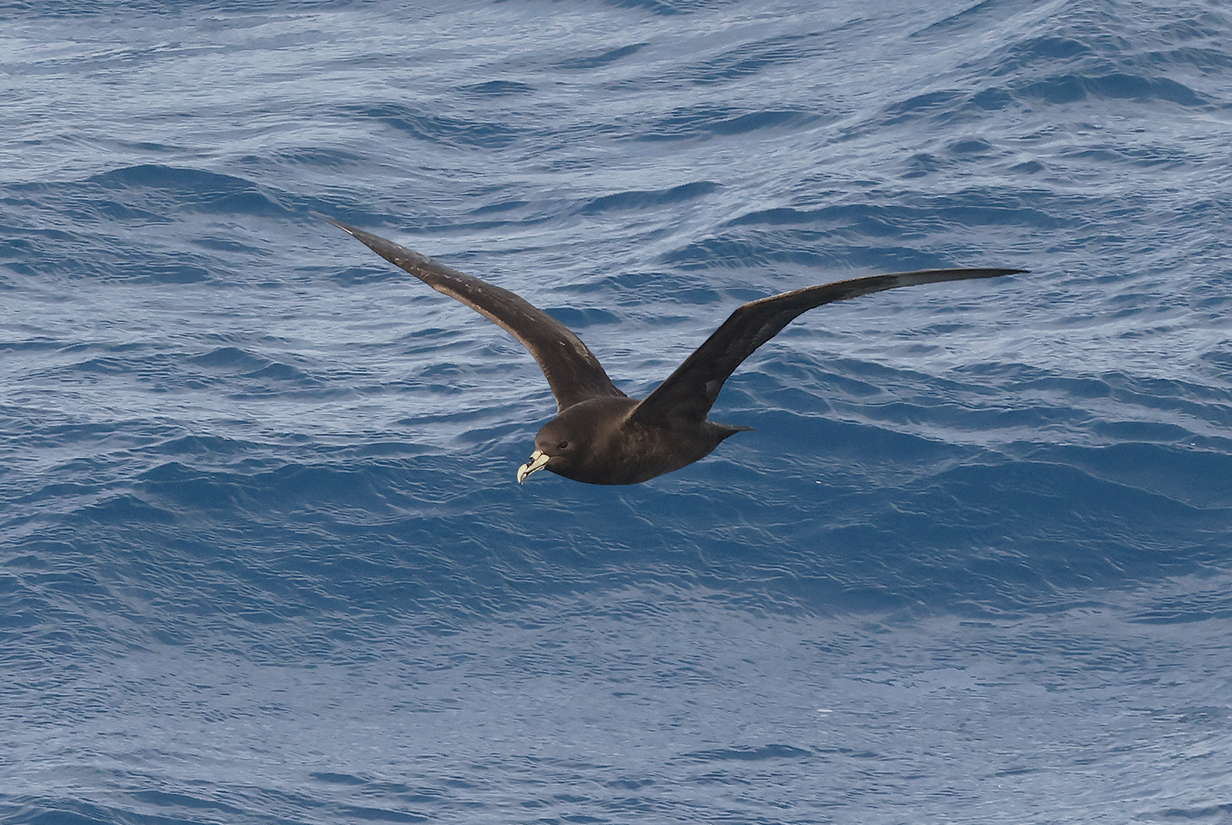
Southern giant petrel was one of the commonest and most easily identified pelagics.
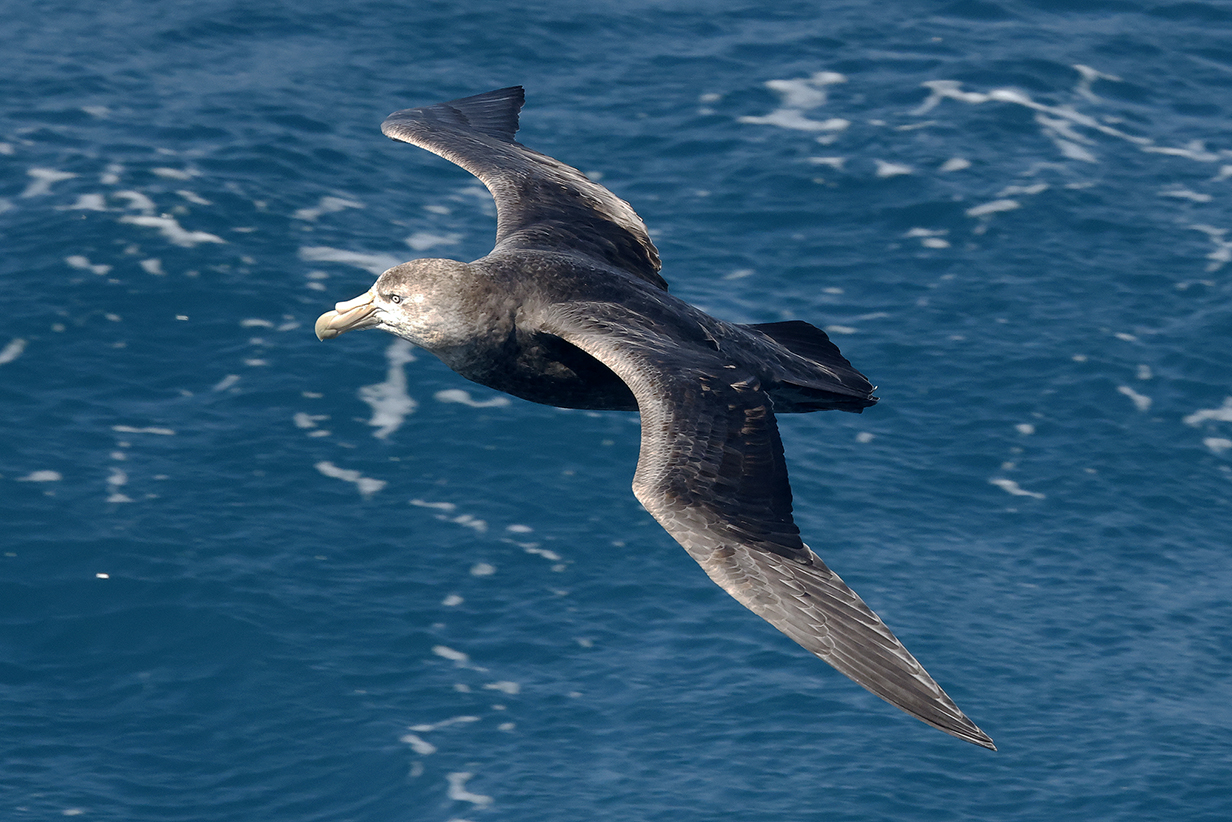
Norhern giant petrel (note the pink tip to the bill)
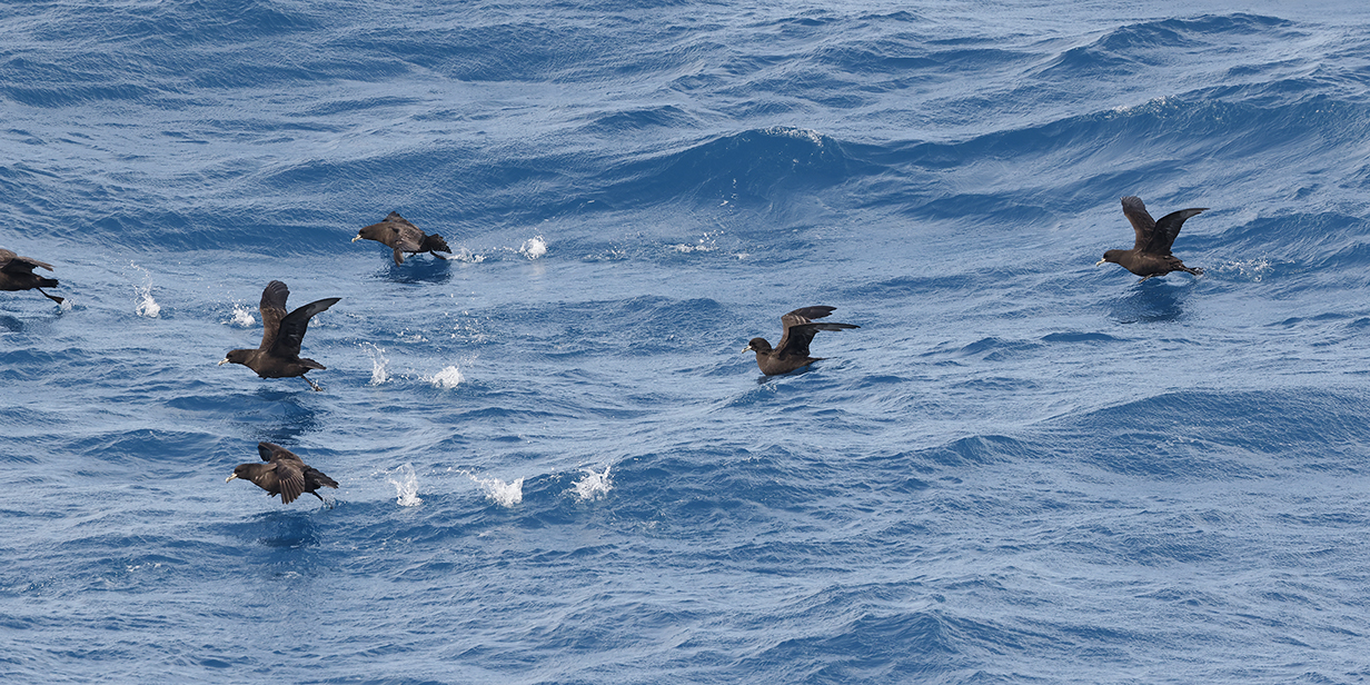
Cape or Pintado petrel was the most common bird that followed the ship, especially in near-Antarctic waters, sometimes a dozen or more at a time. We first saw this species off the Cape of Good Hope in 2004.
White-chinned petrel near Fortuna Bay. This is a species that we have seen often and well, beginning during a pelagic south of the Cape of Good Hope.
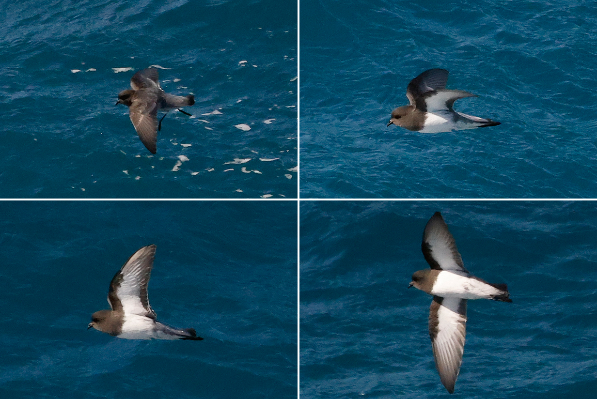
Gray-backed storm-petrel (This is John's life bird on November 29, 2022.)
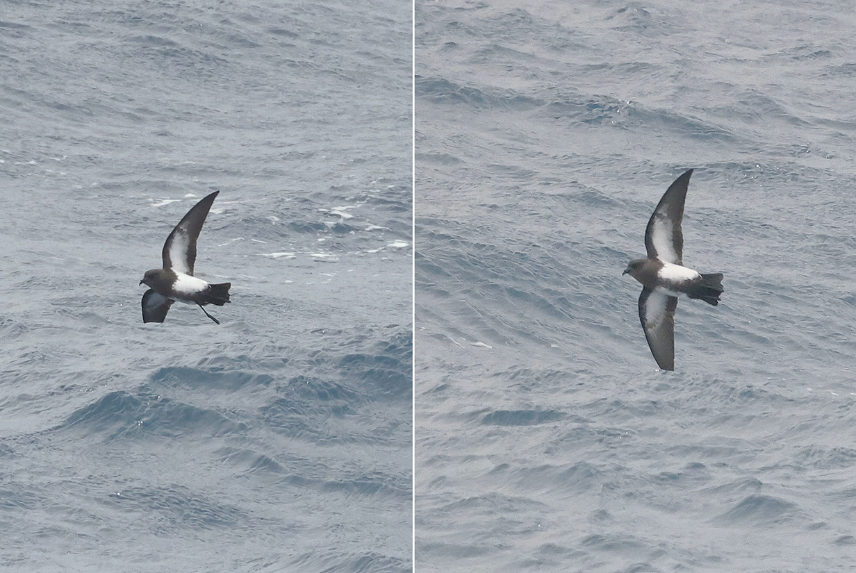
Black-bellied storm-petrel (This is John's life bird on December 2, 2022.)
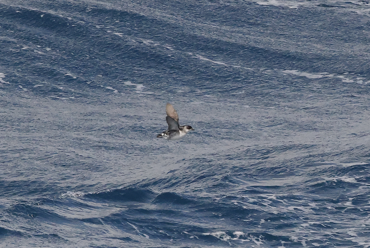
South Georgia diving-petrel (This is John's life bird.)
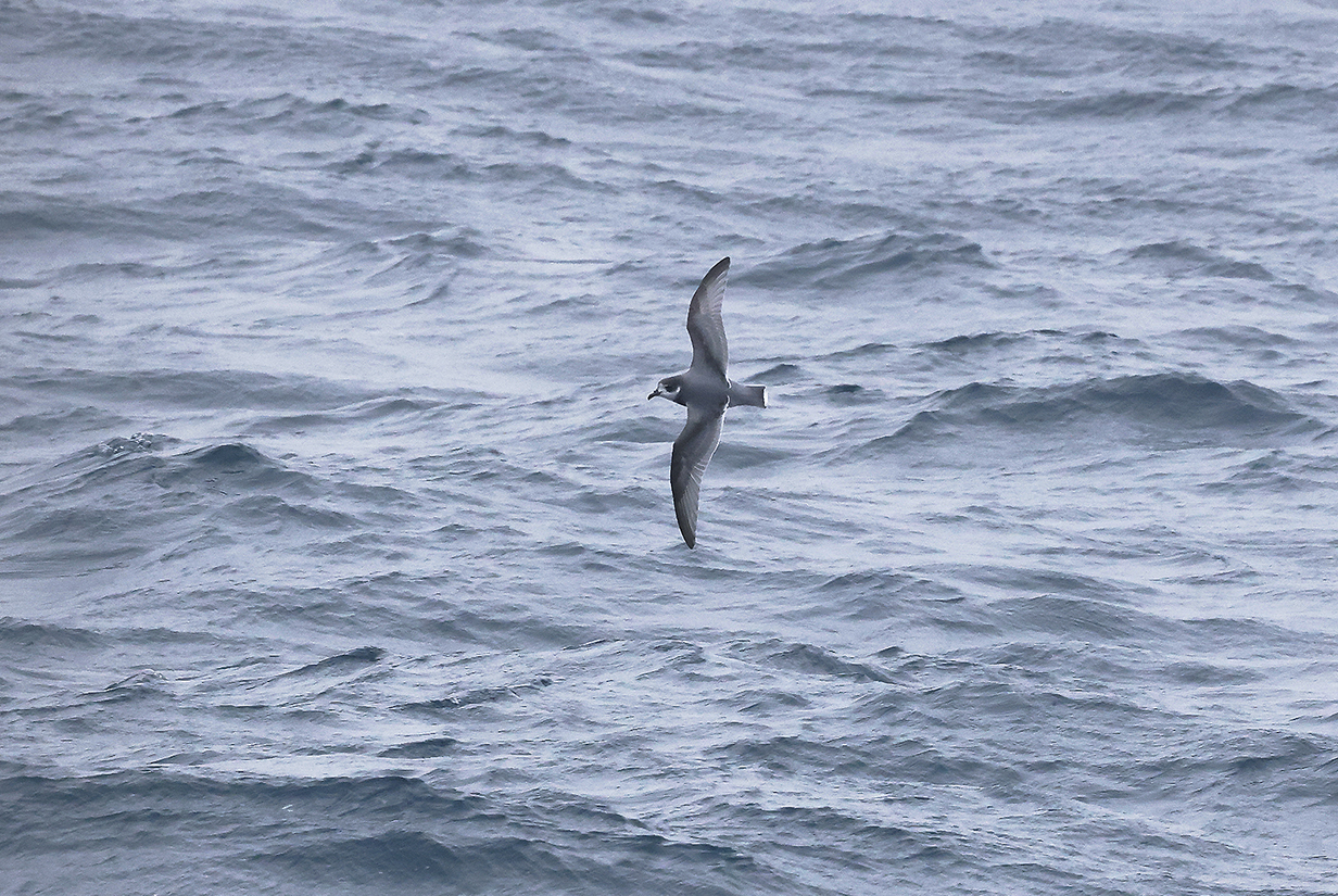
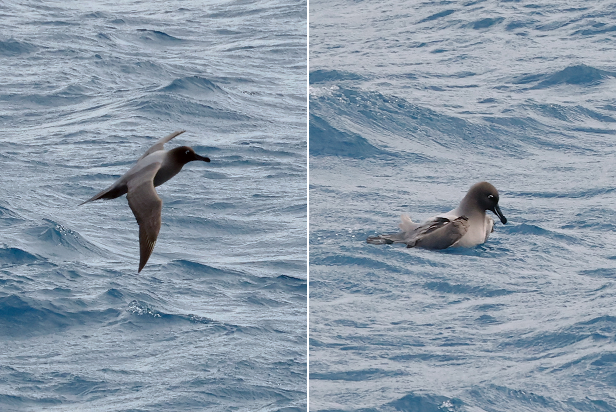
Blue petrel was new for John on December 7, 2022. He never saw it close enough to get a good picture.
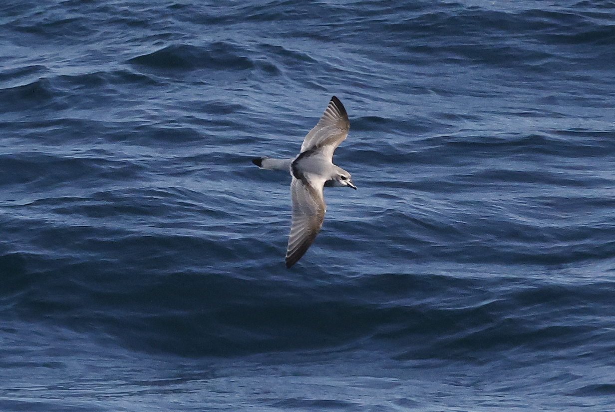
Slender-billed prion early in the voyage
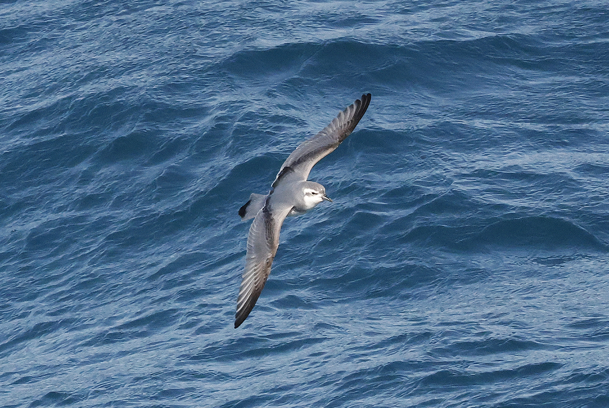
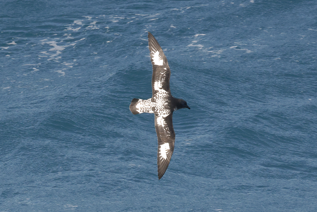
Slender-billed prion is not easily distinguished from Antarctic prion (below) when seen side-on, although the white eye stripe is usually more pronounced. But seen (here: almost) from the front, the bill is dramatically more slender than the wedge-shaped bill of Broad-billed prion. Note: These are different birds.
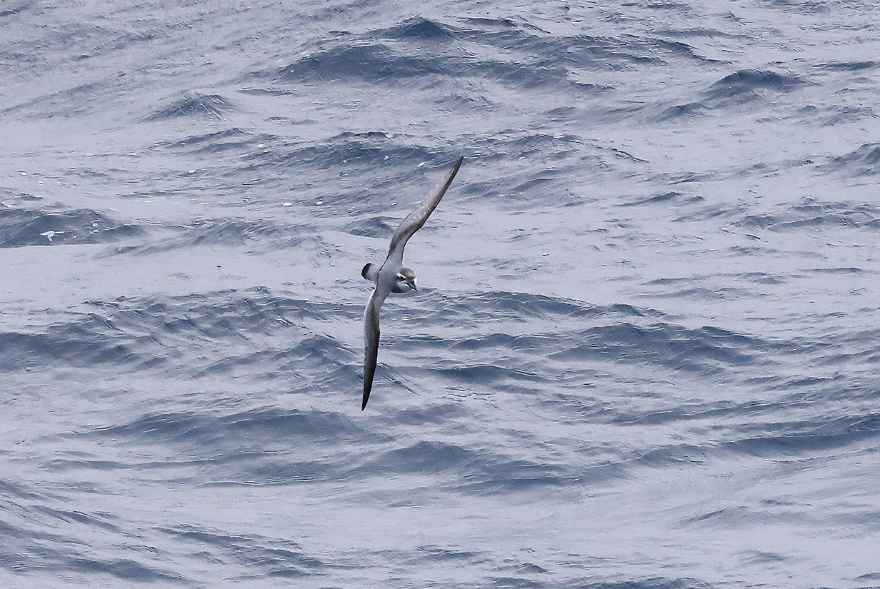
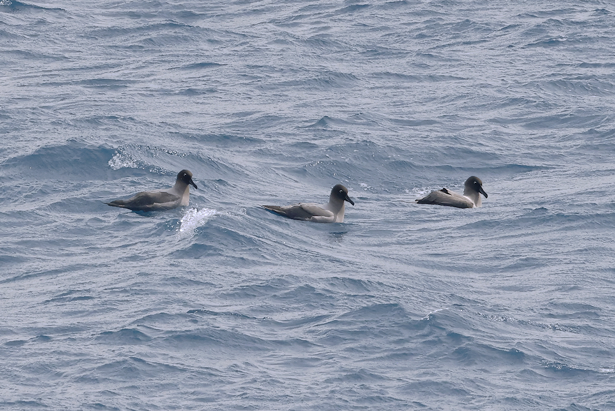
Antarctic prion (This is a notably "well endowed" bird. We briefly thought that it and two other birds traveling with it might be Broad-billed prion. That would have been a remarkable life bird, rare here. But pelagic birding experts assure us that they are Antarctic prions. And in truth, during our second Antarctic adventure, when I had time to check ebird in more detail, I had come to the same suspicion. On that trip, I also saw comparably well endowed birds. My thanks to VENT's Barry Lyon for the correction. Prions are difficult in part because, like many birds (Greater and Lesser yellowlegs are a notorious example), there is a lot of range in mophology, in the present case: bill size. Anyway, the bird illustrated here was seen on the way back to Ushuaia. Slender-billed prion was new and seen often near Ushuaia, and Antarctic prion was new and seen often from South Georgia Island to Antarctica to -- here -- the Drake Passage.)
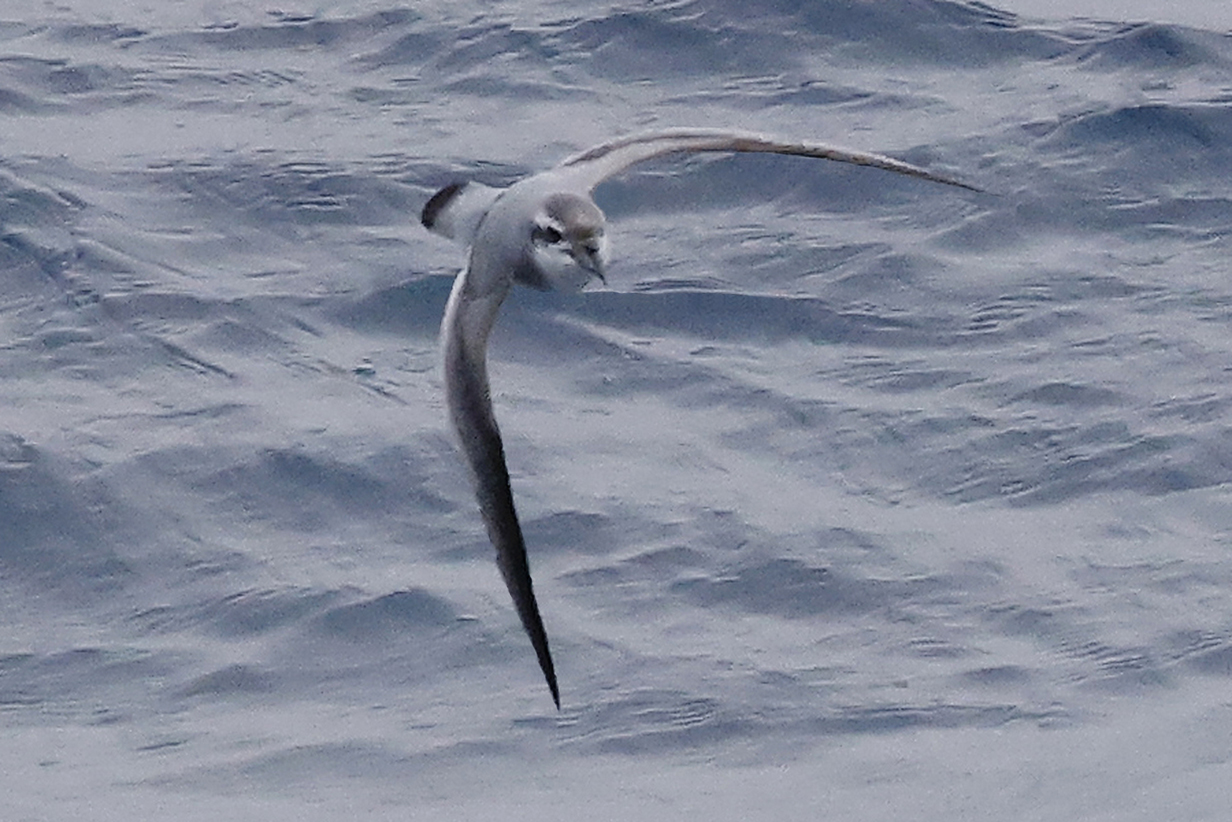
Antarctic prion ... I think. This bird illustrates how hard it is to distinguish Antarctic and Slender-billed prion, even when seen relatively close to front-on. This bird was seen early in the voyage, near the Falklands, where most prions were Slender-billed. I did not remark on the ID at the time. But now that I see the picture in more detail, the bill looks a bit chunky, and the eye stripe is narrower above the eye than farther back. Also, the chest band is notably dark and prominent. This effect can be enhanced by increasing picture contrast. Still, my guess is that this is Antarctic. If an expert sees this picture and disagrees, I would be grateful for a correction sent to kormendy at astro dot as dot utexas dot edu. Thanks!
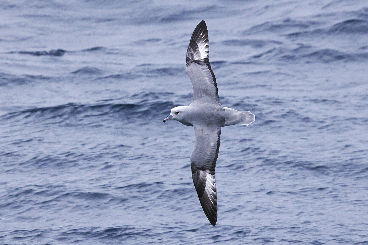
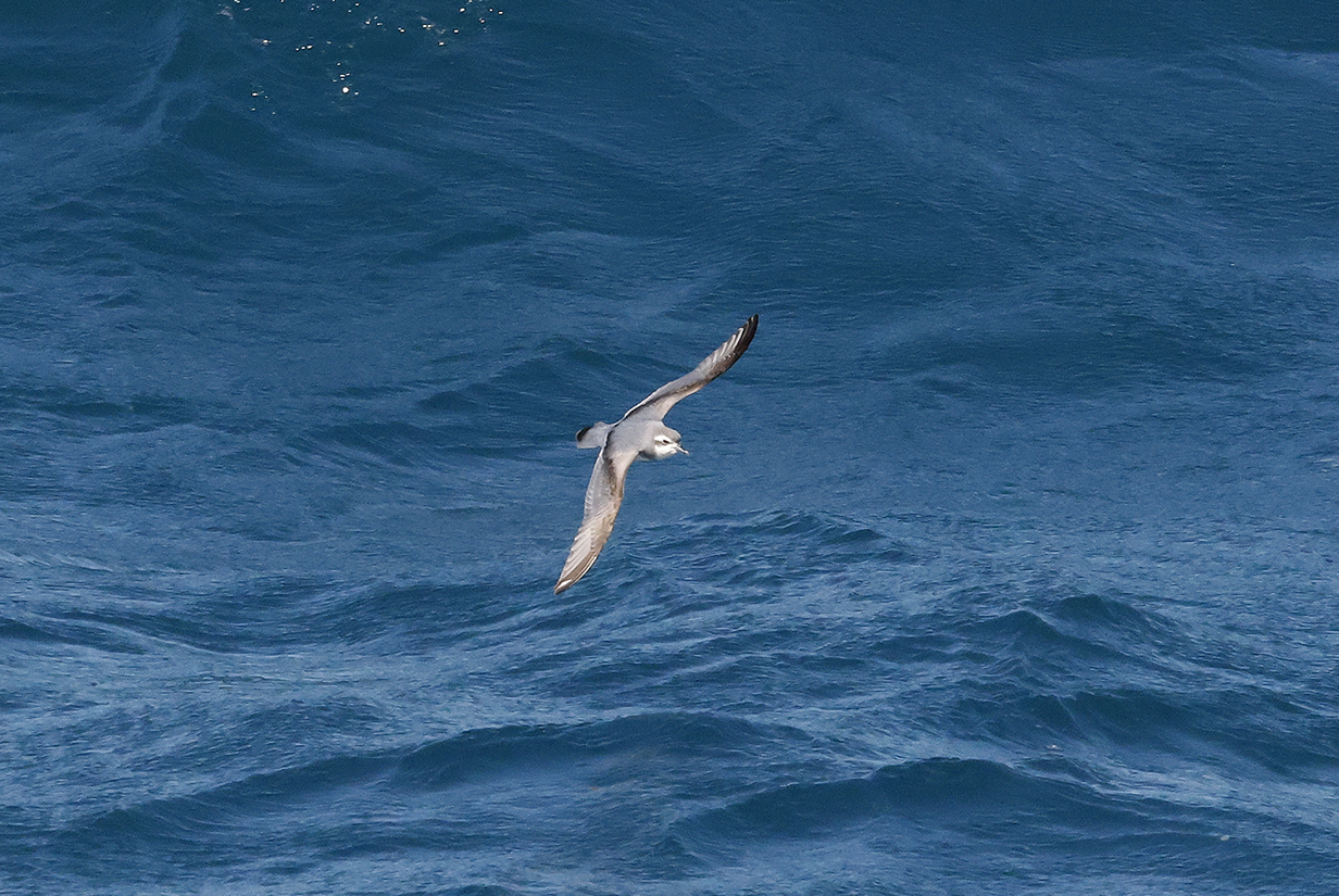
Southern fulmar from the balcony of our cabin. This species was new earlier in the trip. It was one of our favorites, elegant and easy to identify.
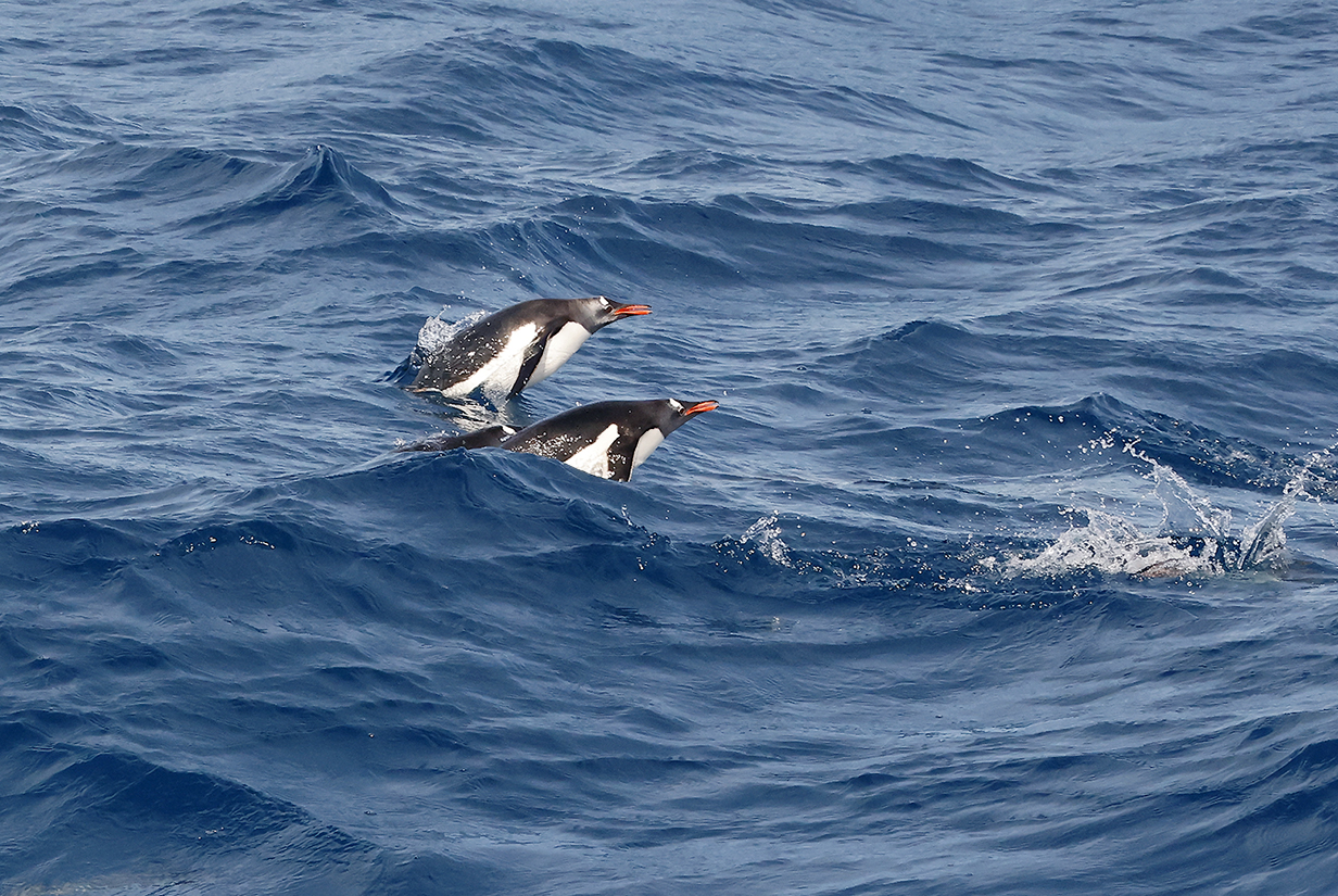
Gentoo penguins porpoising (This was between Fortuna Bay and Stromness Bay, but we saw penguins in the water fairly often around South Georgia Island and the Antarctic Penninsula.)
This is the end of the pictures from South Georgia to Antarctica. The birds that we saw in Argentina, near Buenos Aires and -- before and after the cruise -- near Ushuaia, will be posted here.
Our bird pictures from around the world follow standard ecozones approximately but not exactly:
Birds from the USA and Canada: our house, Hornsby Bend and greater Austin, Texas, California, Hawaii, Canada,
Neotropic birds from Central America and the Caribbean: Honduras, Costa Rica, Panama, Trinidad and Tobago
Neotropic birds from South America: Ecuador, Ecuador 2017, Brazil.
Western palearctic birds: Europe: Germany, Finland, Norway, Europe: United Kingdom, Europe: Spain, the Canary Islands, Europe: Lesbos, Greece, Israel
Eastern palearctic birds: China
Birds from Africa: The Gambia, South Africa
Indo-Malayan birds from India: North-west (Delhi, Uttar Pradesh, Uttarakhand) India: North-east (Assam, Arunachal Pradesh, Meghalaya) India: Central (Maharashtra, Madhya Pradesh)
Birds from Australia, New Zealand.
For our 2014 December trip to India, see this travelog.
For our 2016 May-June trip to India, see this travelog.
For our 2017 April trip to High Island, Texas, see this web site.
For our 2018 March trip to India, see this travelog.
For our 2018 May trip to China, see this travelog.
For our 2018 November trip to China, see this travelog.
For our 2019 April trip to High Island, Texas, see this web site.
For our 2019 July trip to China, see this travelog.
For our 2021 April trip to High Island, Texas, see this web site.
For our 2021 December trip to Ecuador, see this web site.
For our 2022 January-February trip to Peru, see this web site.
For our 2022 July/August trip to Australia and Papua New Guinea, see this web site.
For our 2022 September trip to Bolivia, see this web site.
For our 2022 November-December pre-trip to Argentina (before our Antarctic cruise), see this web site.
For our 2022 November-December cruise to Antarctica, see this web site.
For our 2023 January birding in Chile, see this web site.
For our 2023 January-March cruise from Chile to Antarctica and around South America to Miami, FL, see this web site.
For our 2023 March-April birding in south Florida (after the Seabourn cruise), see this web site.
For our 2023 November-December birding to Sri Lanka, the Andaman Islands, and South India, see this web site.
For John's 2024 February-March birding in Colombia, see this web site.
For our 2024 May-June cruise from Iceland to Jan Mayen Island to and around the Svalbard Archipelago, see this web site.
For our 2024 June 25-30 stay in Paris, see this web site.
For our 2025 April 21 - May 3 trip to High Island, Texas, see this web site.
For our 2025 July 16-22 stay in Paris, see this web site.
For our 2025 July vacation and birding in Singapore, see this web site.
For our 2025 August birding in north-west Australia, see this web site.
For our 2025 August-October Seabourn cruise from Australia to Chile, see this web site.
For our 2026 January-February trip to New Zealand and 3rd cruise to Antarctica, see this web site.
For my 2026 March-April trip to Borneo and Singapore, see this web site.