John and Mary Kormendy: Seabourn Cruise 2025
This web site contains the pictures from our 80-day Seabourn Cruise from Darwin, Australia, west and south to Broome, Australia, then back to Darwin and on via Indonesian New Guinea, Papua New Guinea, the Solomon Islands, the Santa Cruz Islands, Fiji, Tonga, Samoa, the Cook Islands, French Polynesia, including Tahiti, Pitcairn Island, Ducie Island, Easter Island, and the Juan Fernandez Islands, ending up in Santiago, Chile.
The trip and this web site are finished -- at most, I may add a few more pictures.
The whole 3.5-month trip including stops in Paris, Singapore, and birding in NW Australia (links at the end
of this posting) was epic, with an enormous variety of wonderful (and a few not-so-wonderful) experiences.
We enjoyed it immensely. John took part in many excursions off the ship, concentrating on nature and often
birding with private guides while ship's passengers did something else. Mary is handicapped by crippling
back pain that results from many marathons and other long walks. She mostly enjoyed the wonderfully
comfortable life on the ship, seeing what she could from the ship and taking part in 2 off-the-ship
excursions, the Mitchell Falls helicopter tour on August 29 and our submarine dive on September 30.
Together with the pre-cruise stops in Paris, Singapore, and NW Australia, this was a once-in-a-lifetime
extravaganza.
Or maybe not. We would be happy to do something like this trip again.
The purpose of this web site is to catalog our memories, not to showcase the trip for public readers. So I include pictures that are not very good when they document sightings that are important to us. All pictures are copyrighted and should not be used for commercial purposes without our permission.
Itinerary and Maps
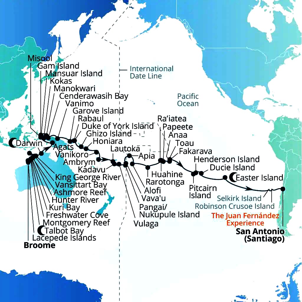
This shows the itinerary of the second part of our cruise, from August 24 in Broome, Australia, until October 30 in San Antonio (near Santiago), Chile. The first part of our cruise from August 13 to August 24 visits the same places from Broome to Darwin but starts in Darwin and does them in reverse order.
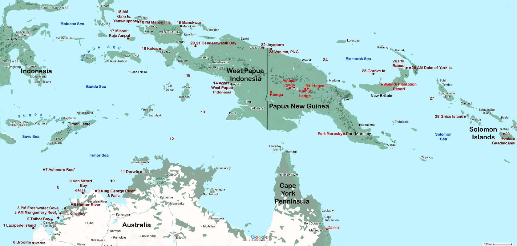
This map shows the part of our Seabourn cruise from Broome, Australia to the Solomon Islands. We chose to begin our cruise in Darwin, Australia, and first cruise from Darwin to Broome with all the stops shown here but in reverse order. They are then repeated on the day numbers of our (formally separate, second) cruise from Broome to Chile. The numbers printed in dark red before each destination name are day numbers out of Broome. Printed in bright red are places where we birded during our 2022 July-August trip to Australia and Papua New Guinea -- see this web site for pictures.
This was an "expedition cruise" with exact itinerary dependent to some extent on conditions like weather and (twice) on the need for ship's maintenance in ports (Darwin, in the middle of the trip, and Fiji). So the exact route and dates of our various stops sometimes were changed in real time, usually by 1 or 2 days. For example, the sea day between Ashmore Reef and mainland Australia was eliminated in favor of an added stop at Kuri Bay. I skipped that excursion. We stayed for 2 days extra in Pape'ete; this was actually a great benefit, because it gave me more time to bird. So the schedule in the maps is not quite correct. Web site postings give correct dates.
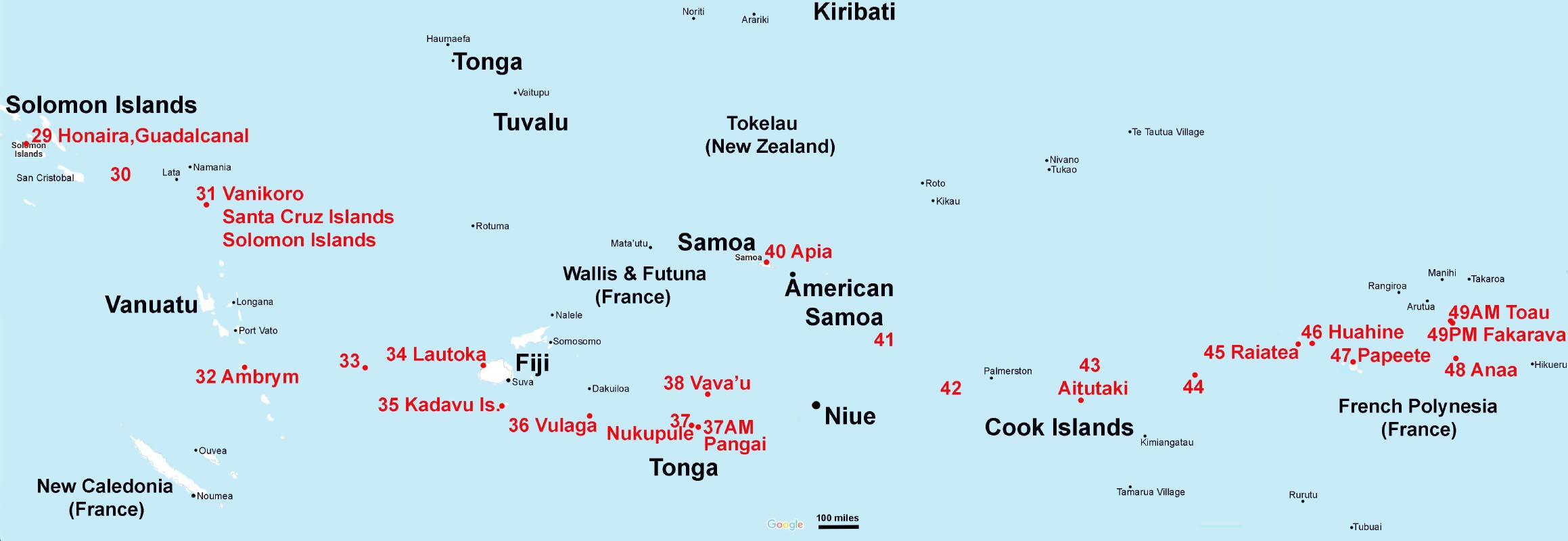
This map shows in more detail our destinations during the next part of our cruise, from the Solomon Islands to French Polynesia. Again, red numbers are day numbers starting with 0 in Broome, Australia. It's a wide map: scroll right to see the full panorama.
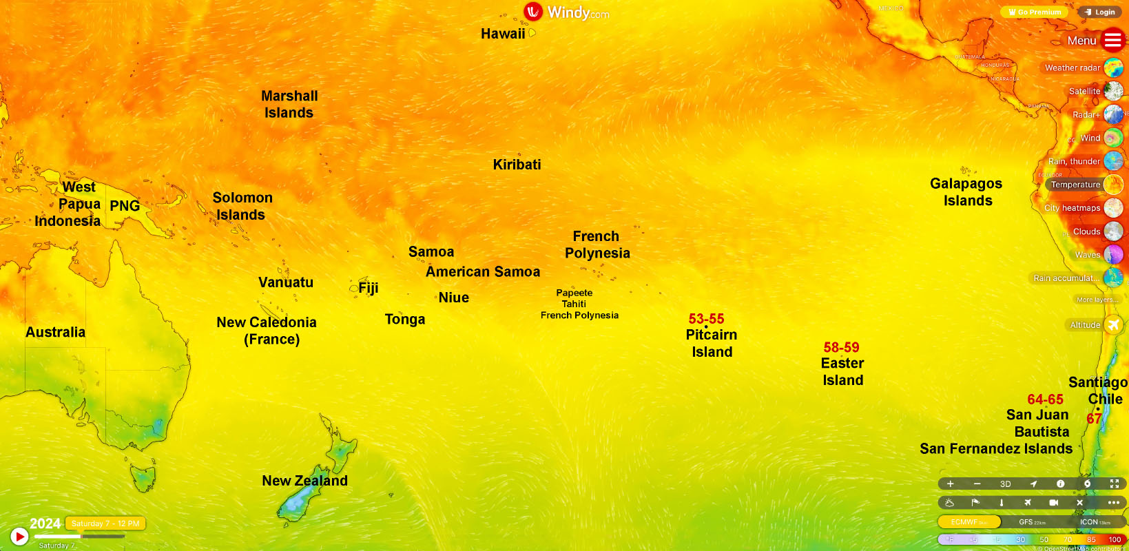
To see the relative locations of the last stops on our cruise, we need to shrink the above maps by a lot. The resulting shows destinations from West Papua Indonesia and Papua New Guinea all the way to our final docking in San Antonio, the port of Santiago, Chile. This map was made from the "Windy Waves" web site encoding surface temperature. "Windy Waves" is a superb tool to check weather and sea conditions, especially during an ocean cruise but useful also to check (e. g.) temperatures and rainfall on land.
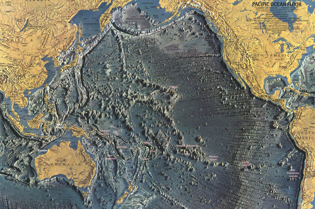
This shows many of our destinations on a relief map of the Pacific Ocean floor published many years ago by National Geographic. Most islands that we visit are the tips of volcanoes, sometimes in isolated burn-throughs of the Earth's crust and sometimes parts of mountain chains of volcanoes. It is remarkable how many times volcanoes have burned through the relatively thin Earth's crust that makes up the ocean floor. This map wonderfully puts our destinations in a global geoplanetary context.
Trip Bird
Tahiti monarch (October 12, 2025, near Pape'ete, Tahiti)
This is probably the second-rarest bird that I have ever seen. Whacked by many threats, the world population (uncertain because some of its habitat is hard to explore) was recorded in 1997 as 21 birds. Aggressive protection has helped it to increase to an estimate of 25-100 adults in 2019 and 100-200 birds now. I was fortunate to be guided in the (closed to the public) Tahiti Monarch Preserve, Captage Papahue, by two dedicated wardens. I saw and photographed 4 birds, two very well and 2 at greater distance. Having had the experience of looking for similarly threatened and rare forest endemic birds in Hawaii, this sighting means more to me than most others, during this trip and elsewhere.
Scenery and Birds
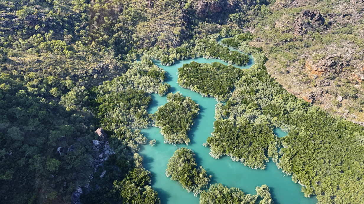
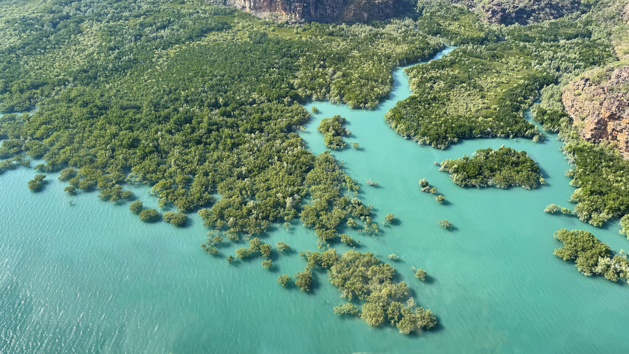
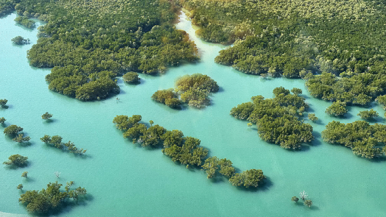
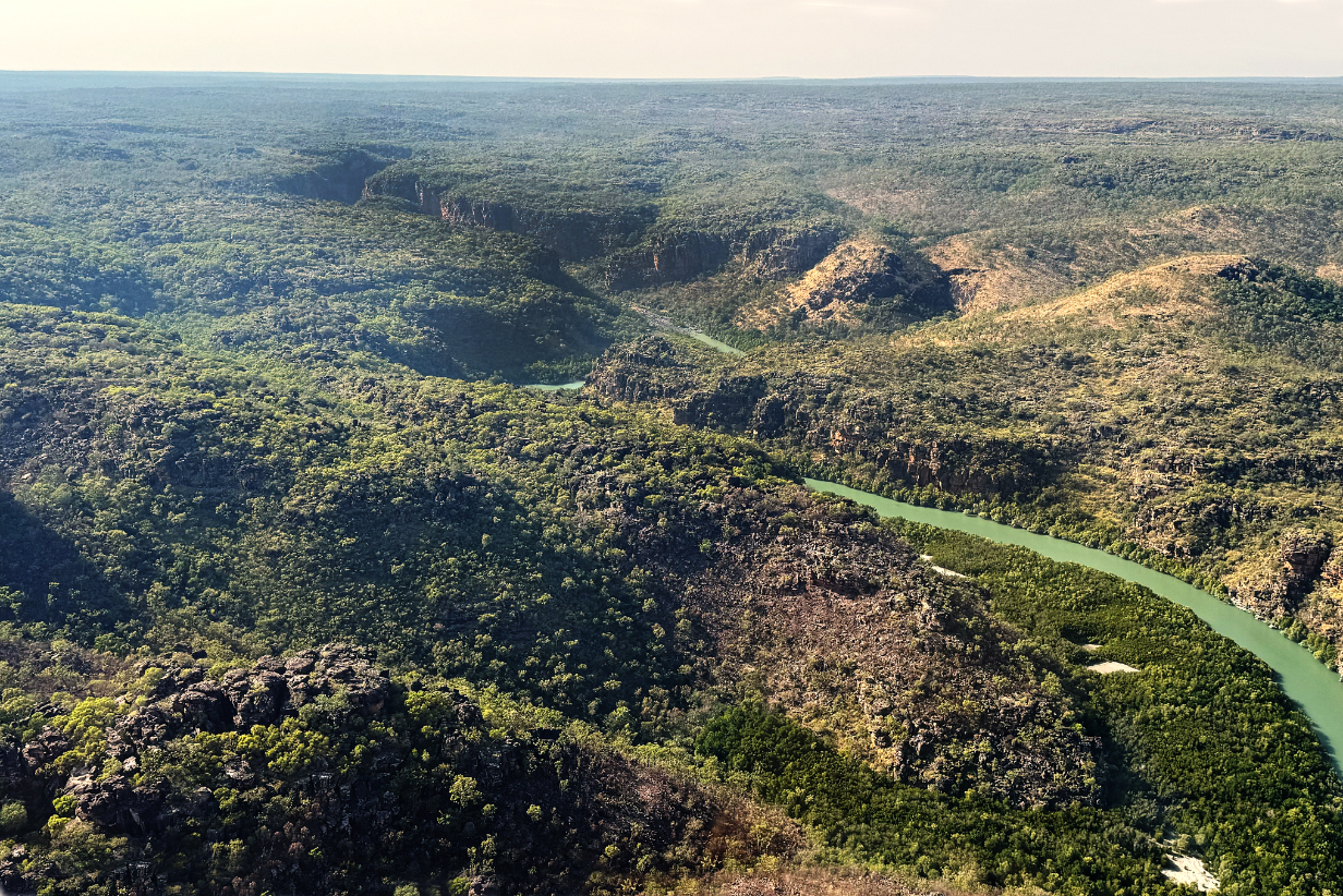
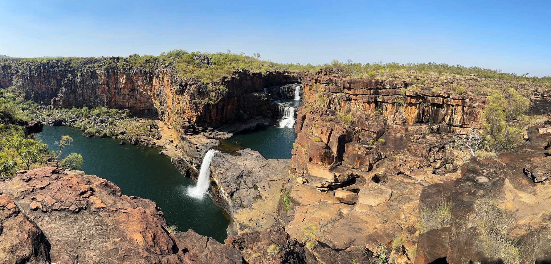
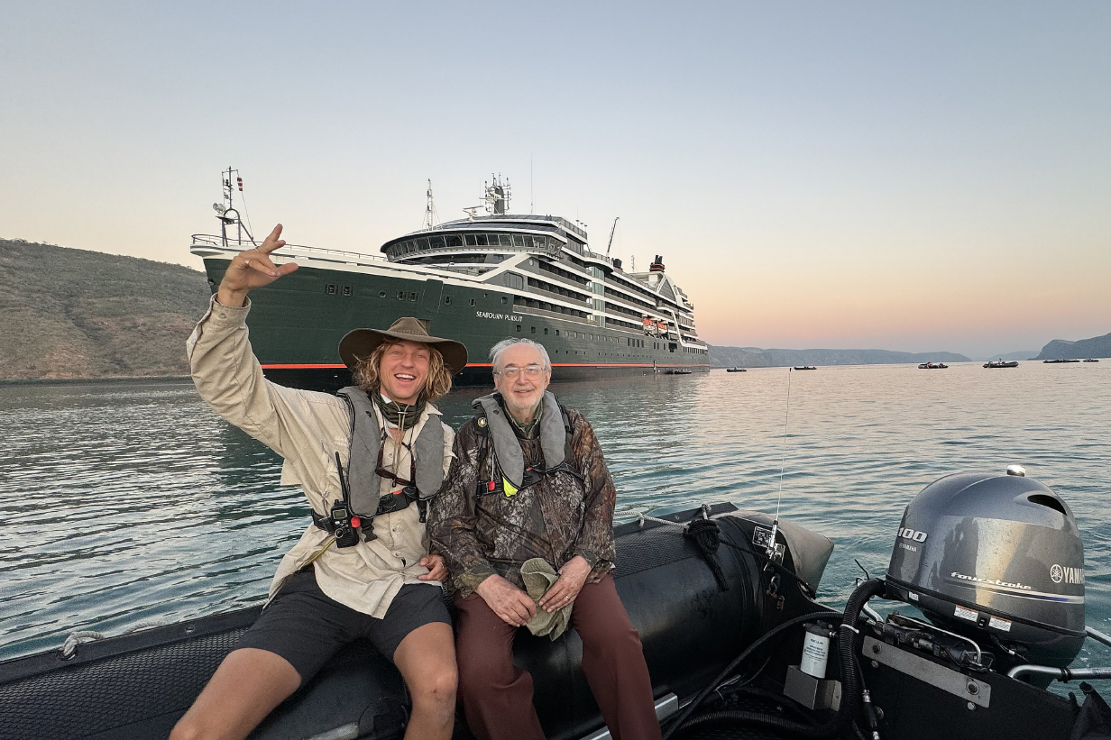
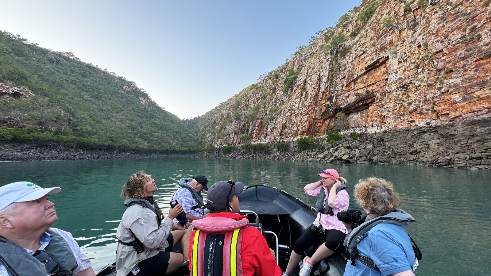
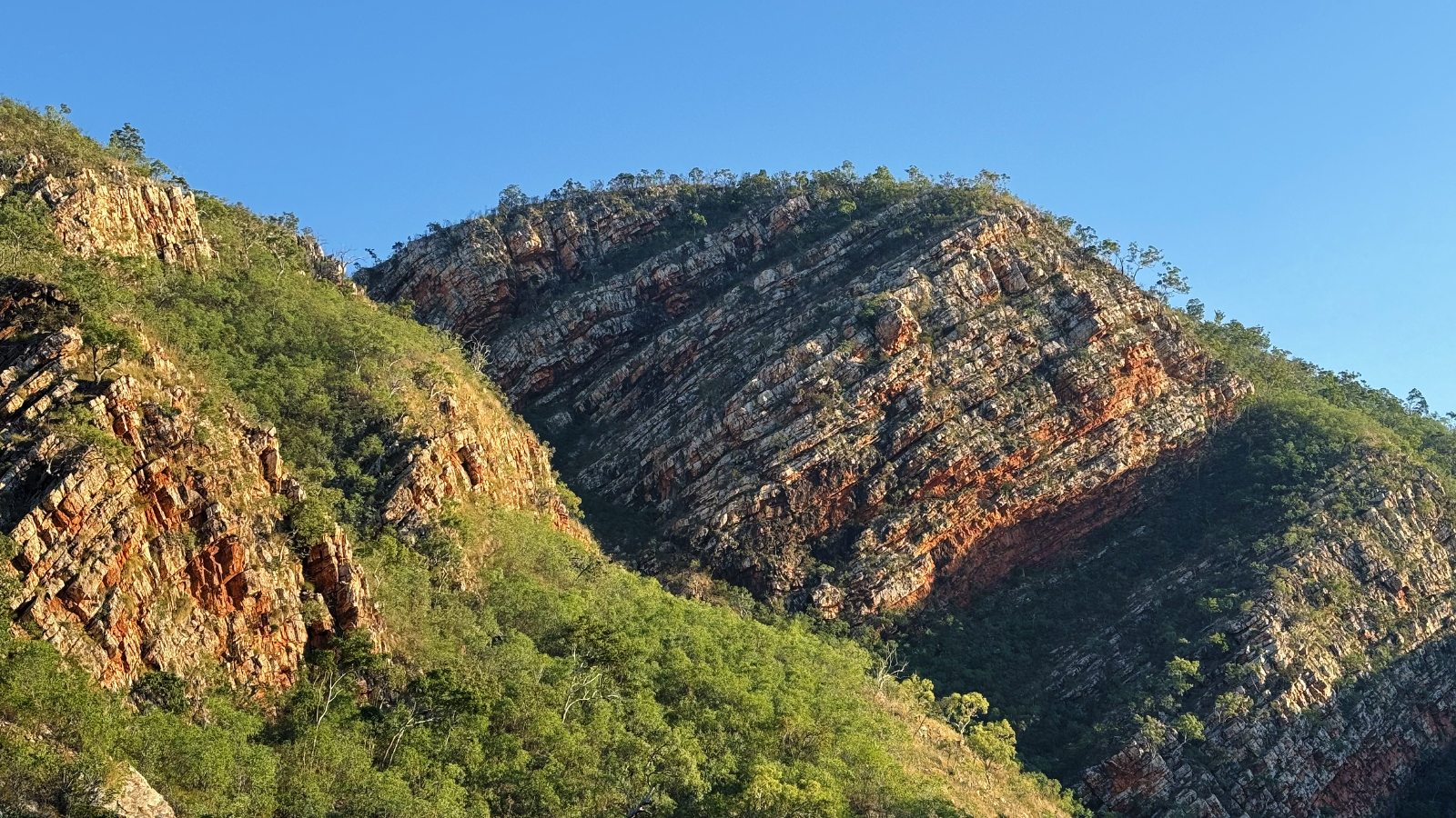
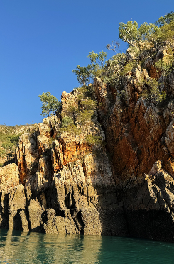
August 15, 2025: Koolama Bay and King George River and Falls zodiac cruise
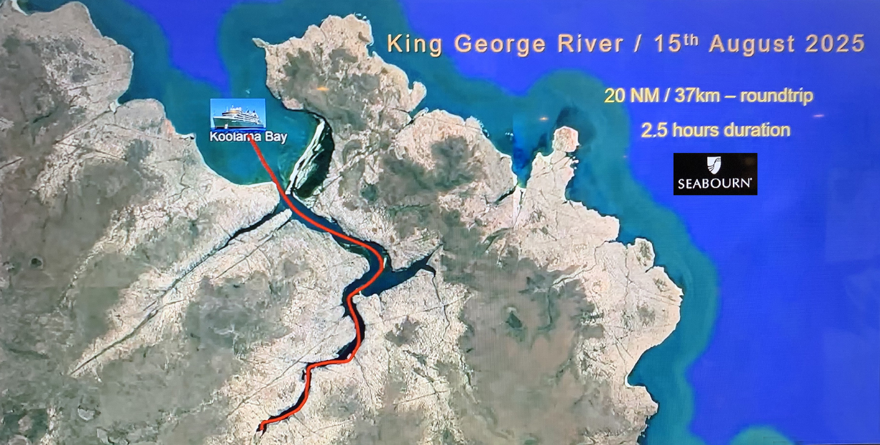
Our first stop was at King George River, SW of Darwin. The ship provided this map of the route of our 20-nautical-mile zodiac cruise up the tidal part of the river to the famous twin falls. Actually, I took this cruise as part of a photography course let by ship's photographer Harry Aslan Rogers. We first cruised up the mangrove-sided channel toward the bottom-left of the main river channel starting near its mouth. Went in as far as we could, until the left- and right-side mangrove banks merged. Then we cruised up the main river to the twin falls. This gave us a wonderfully detailed look at the ornate landscape and its wildlife. Especially the birds.
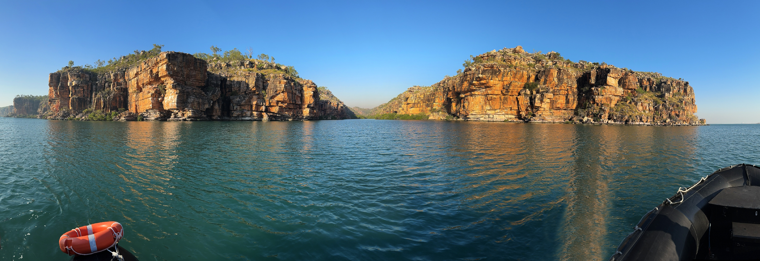
This is a more-than-180-degree panorama of Koolama Bay, the entrance to the river gorge. Here and throughout our zodiac cruise, the scenery was spectacular. Pan right to see the full pano.

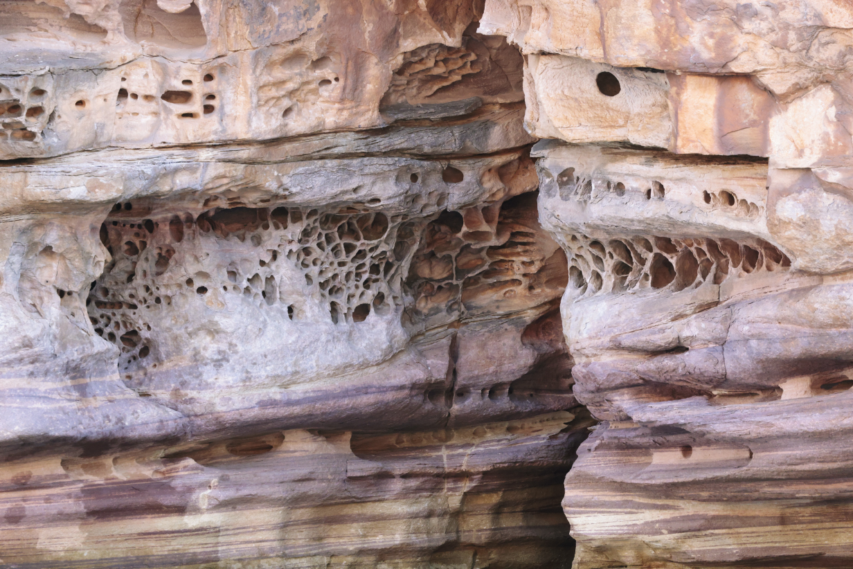
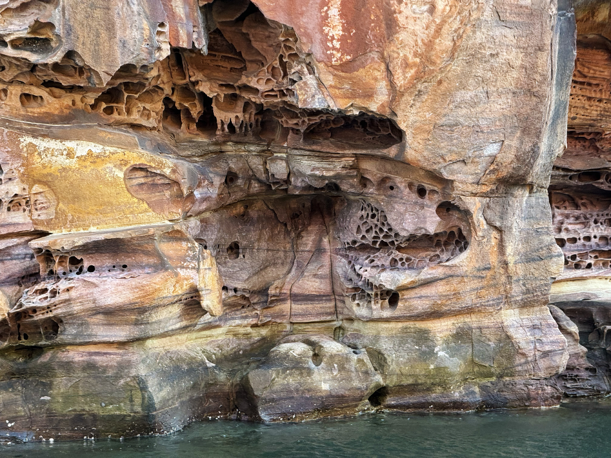
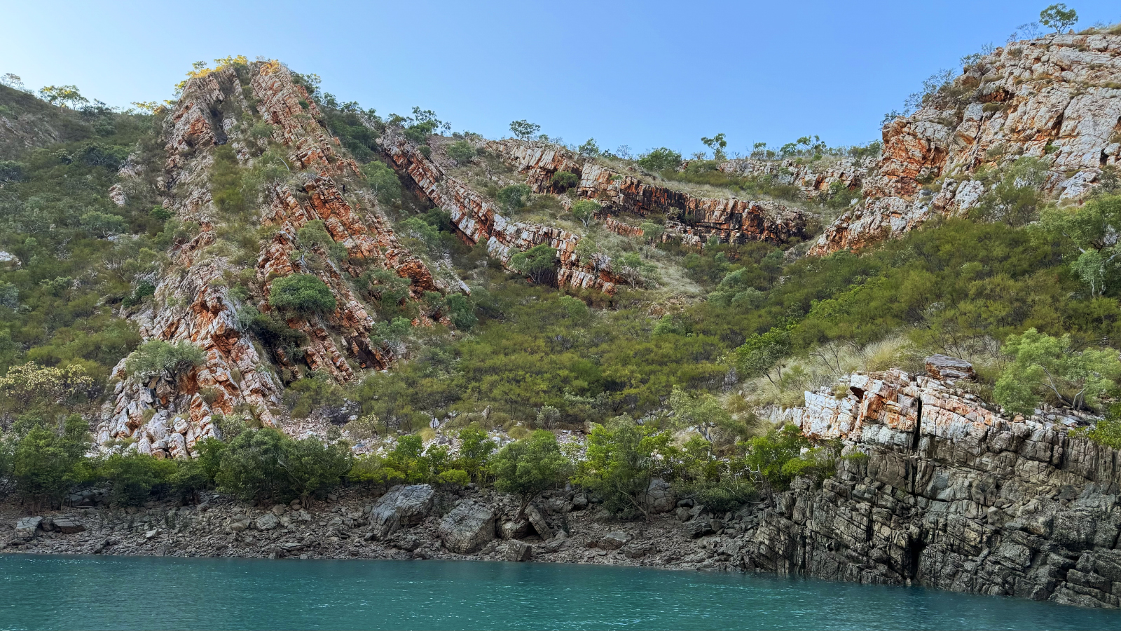
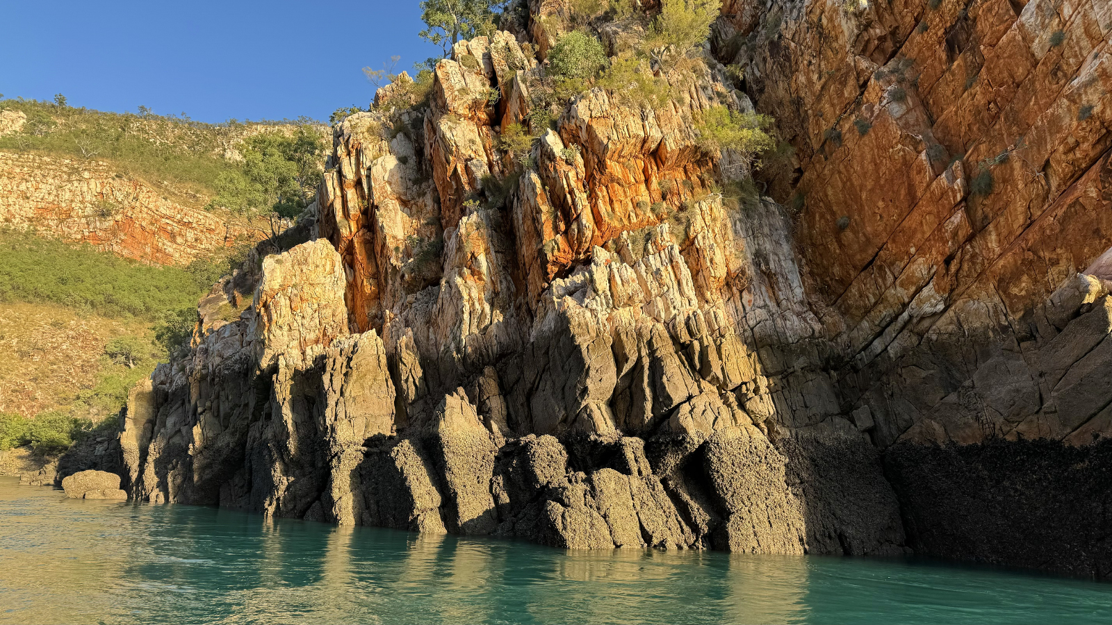
Cliffs near the entrance to King George River. The "Warten sandstone" rock layers are approximately 1.8 billion years old: younger layers atop them are eroded away. These layers encode -- and overwhelmingly emphasize -- many millions of years of the history of this ancient place. They are amazingly ornate: see pictures that follow.
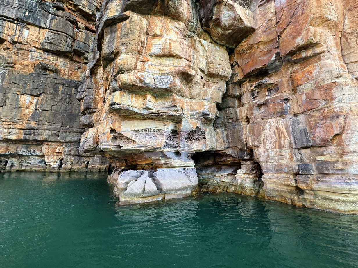
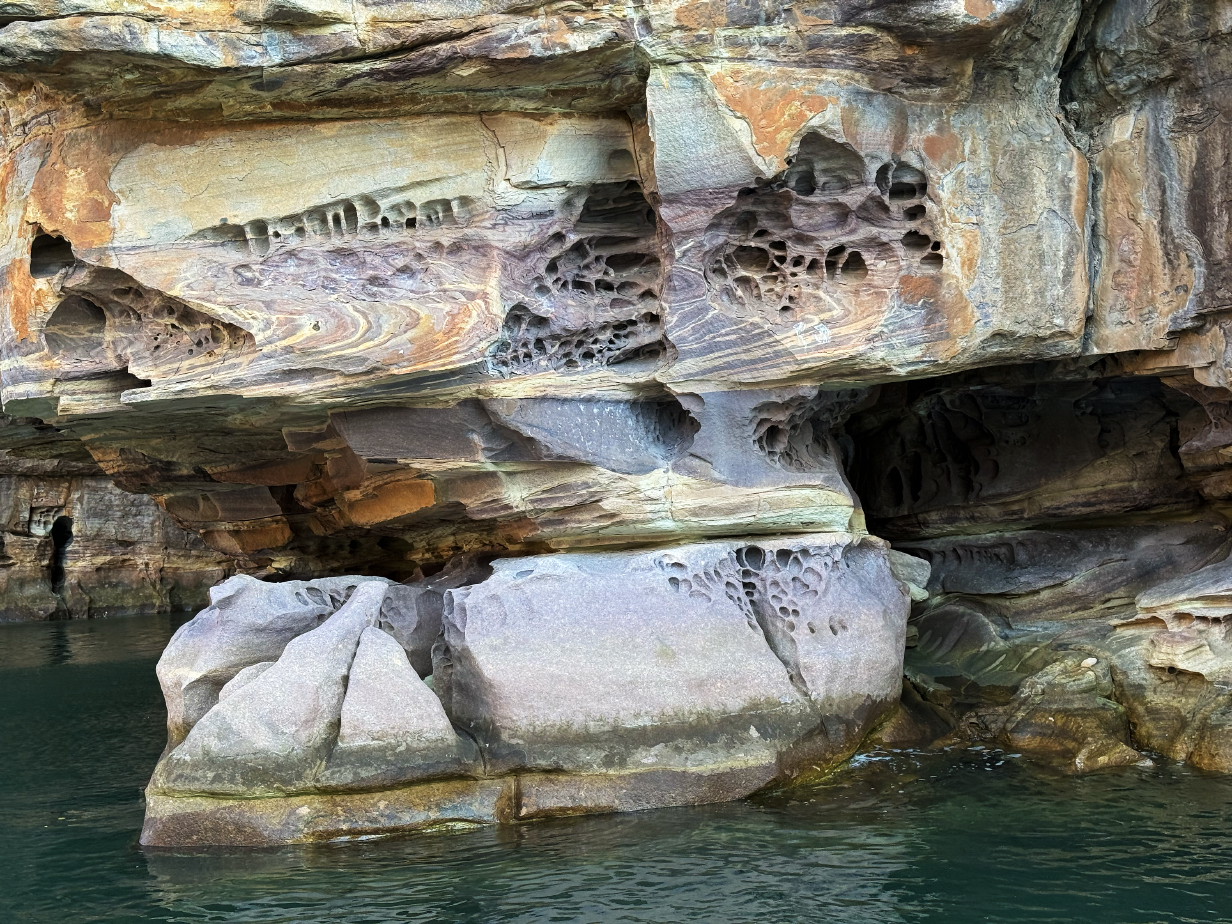
The complicated interaction of salt water spray, wind, and waves creates a marvellous 3-D tapestry of erosion -- captivating artistry everywhere you look, especially near water level. We were there at high tide, so there must have been much more of it under water.
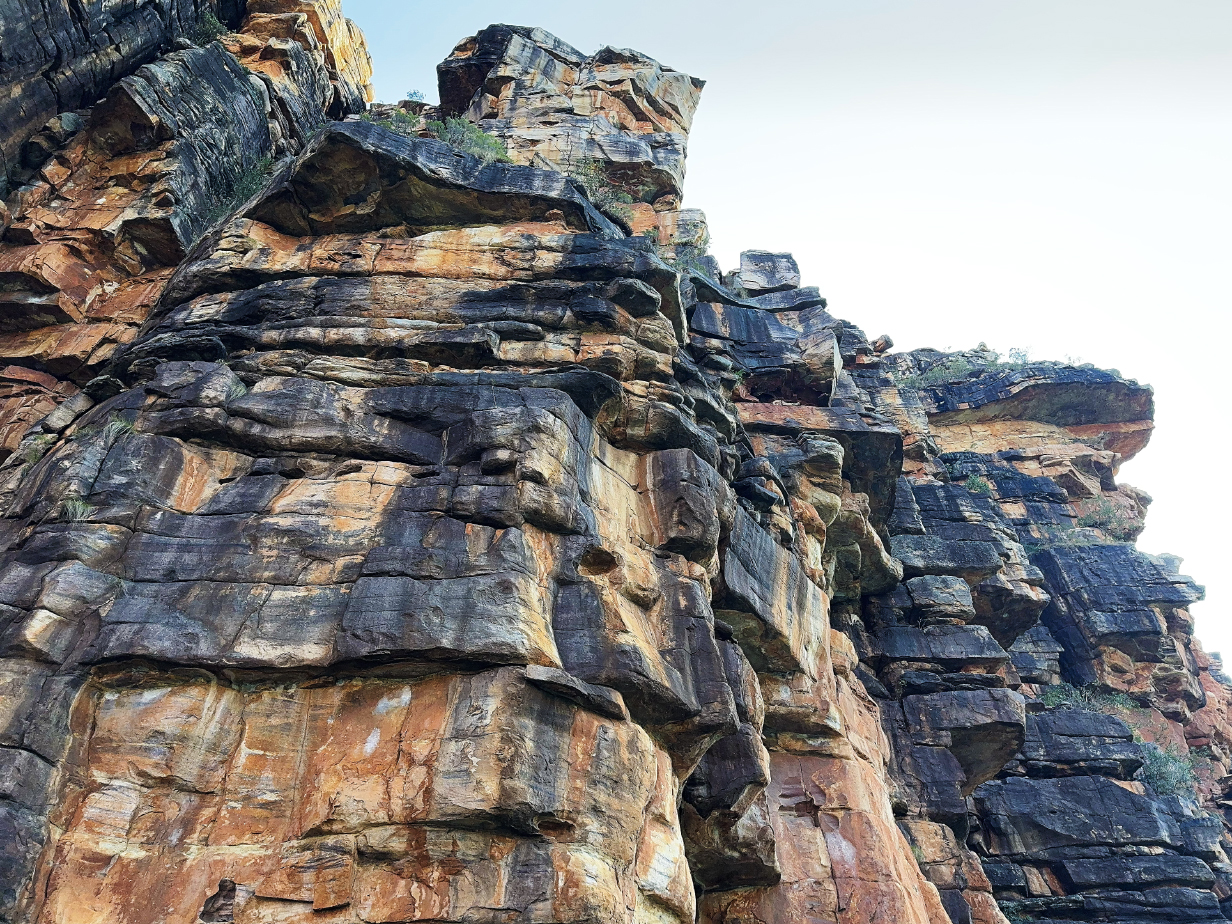
This is the cliff top that towers over the previous two pictures.
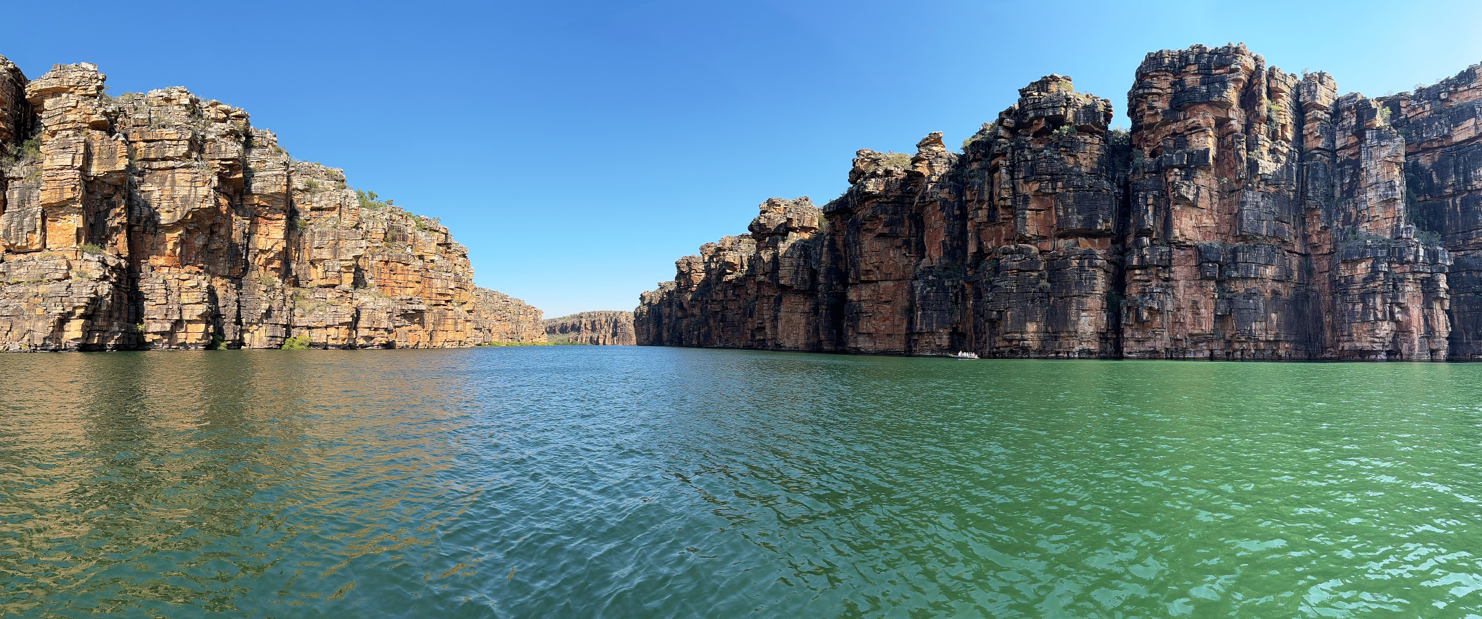
Entering the King Goerge River gorge from Koolama Bay (scroll right to see the full pano)
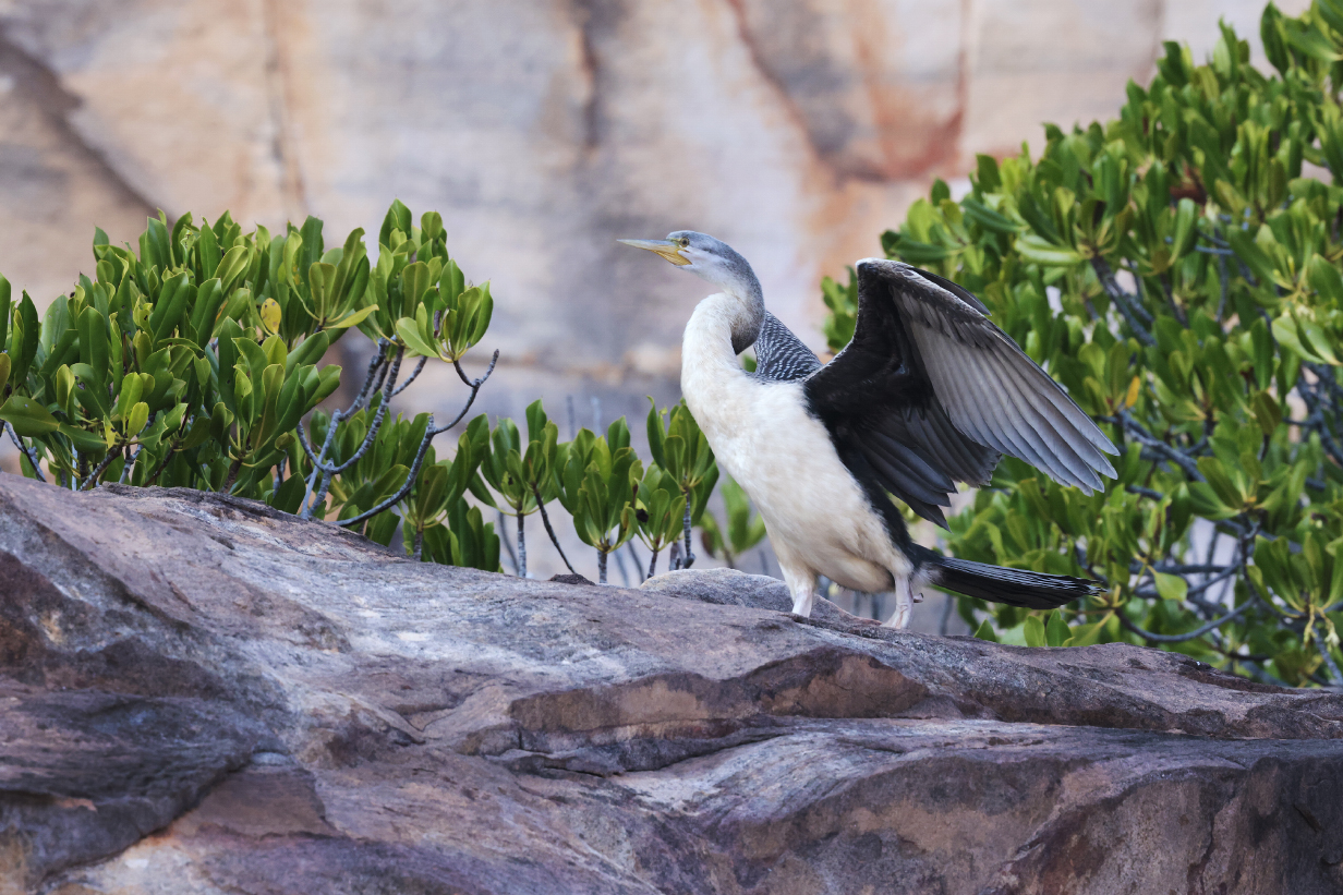
Australian darter drying its wings
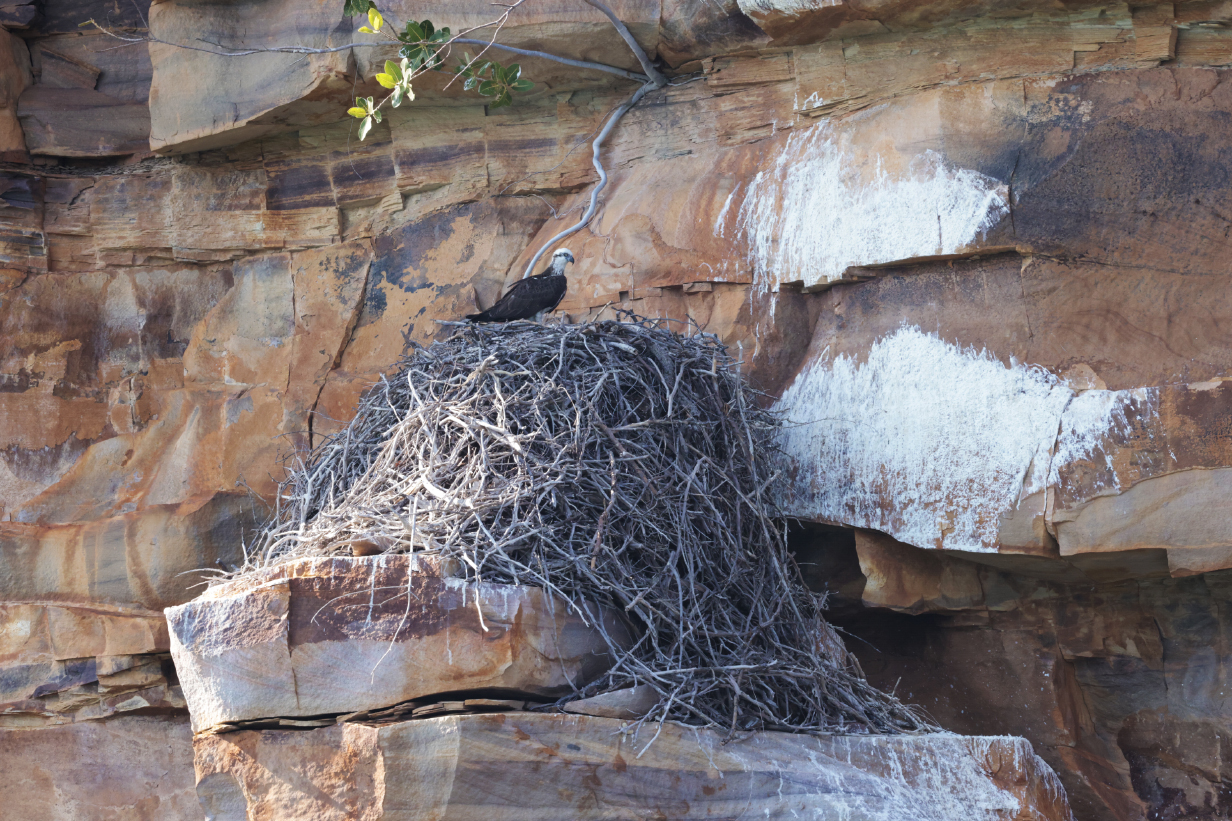
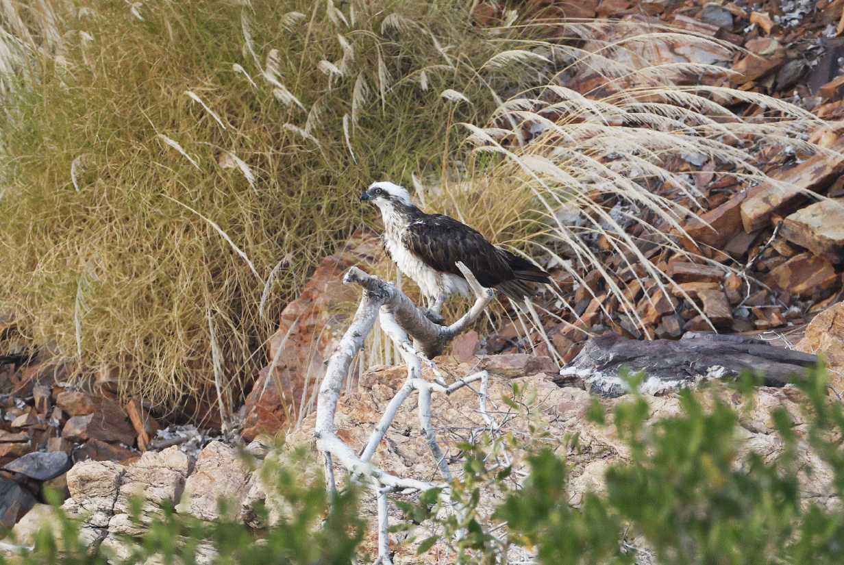
Osprey on a nest mid-way up the wall of the King George River gorge -- very safe and a very good place to make a living. We saw several Osprey and Peregrine falcons on nests, in the latter case (but not photographed) with 2 chicks.
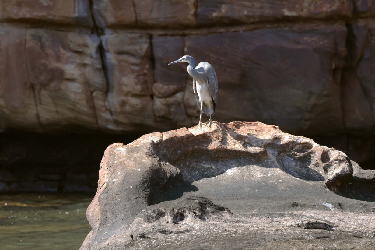
White-faced heron
More 3D art, farther upstream
Ship's photographer Harry Aslan Rogers taking pictures of a precariously positioned rock known as "the guillotine' ... again, amid marvels of 3D art

This shows the guillotine.

Tenderness of tree and rock
Sacred kingfisher
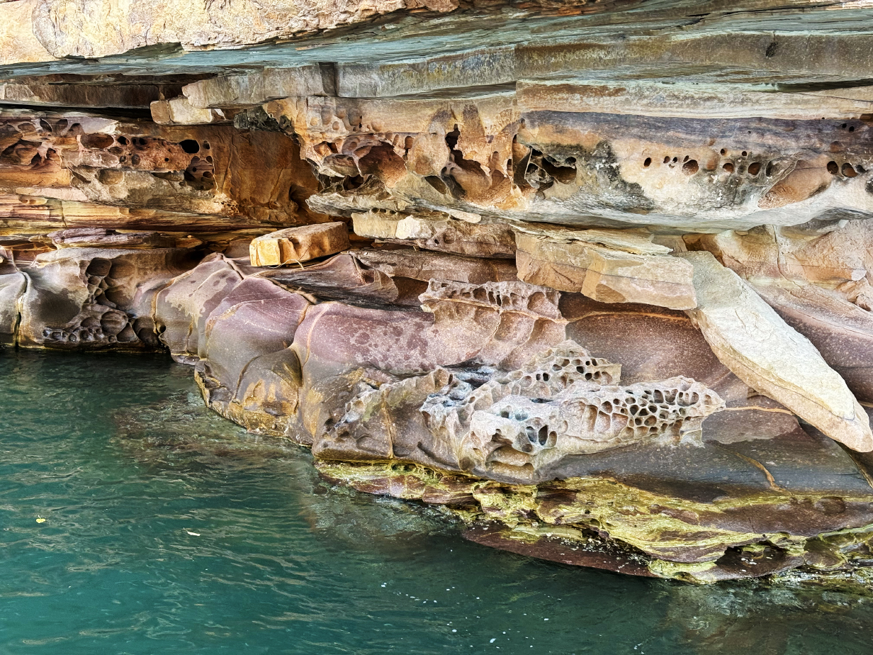
I found the artistry of the gorge walls irresistible.
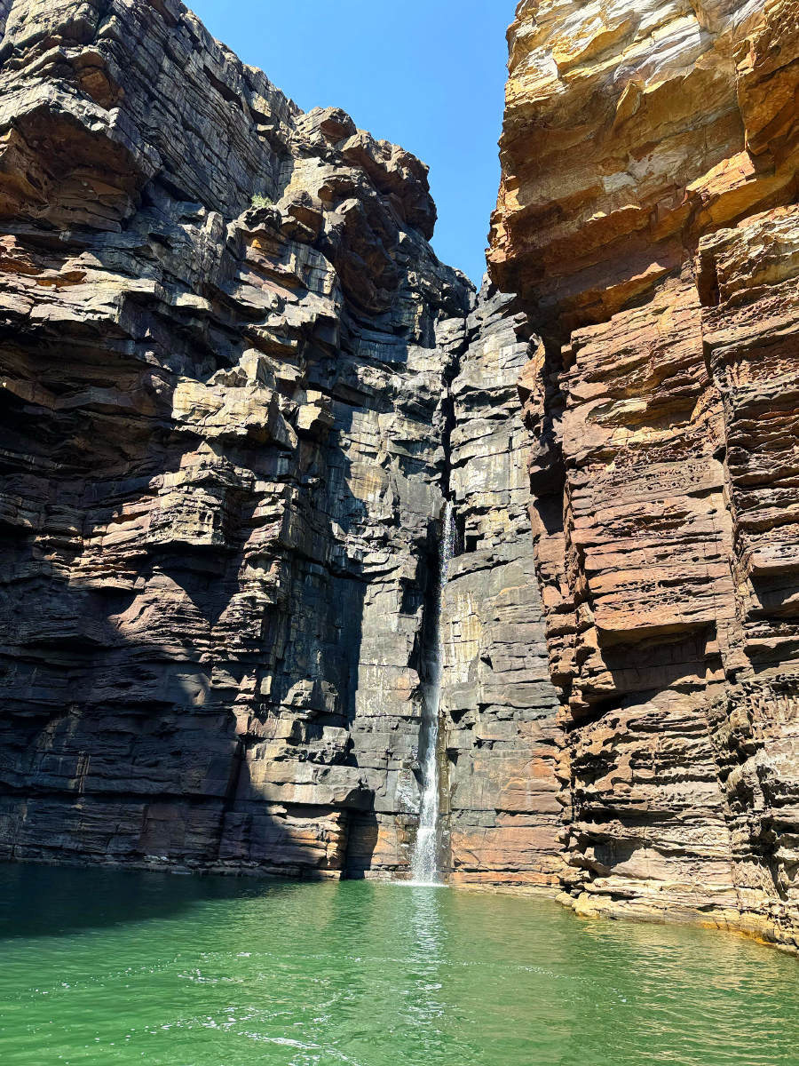
These are the twin falls of the King George River, almost dried up, now, during the height of Northern Australia's dry season. The height of the falls is variously quoted as 80 - 100 m or 262 - 328 feet, presumably because they fall into a tidal river. I think that these are overestimates, and lower values can be found on the web. We were there at high tide, when the falls are less high than at low tide. The black color of the walls is due to cyanobacteria, which thrive when the falls are most active and which hang on and survive during the dry season.
King George river dry waterfall and (in shadow to the right) a zodiac at the same distance, for scale
The trickle of water that still flows during the dry season has cut a narrow niche for itself in the wall of the main waterfall.
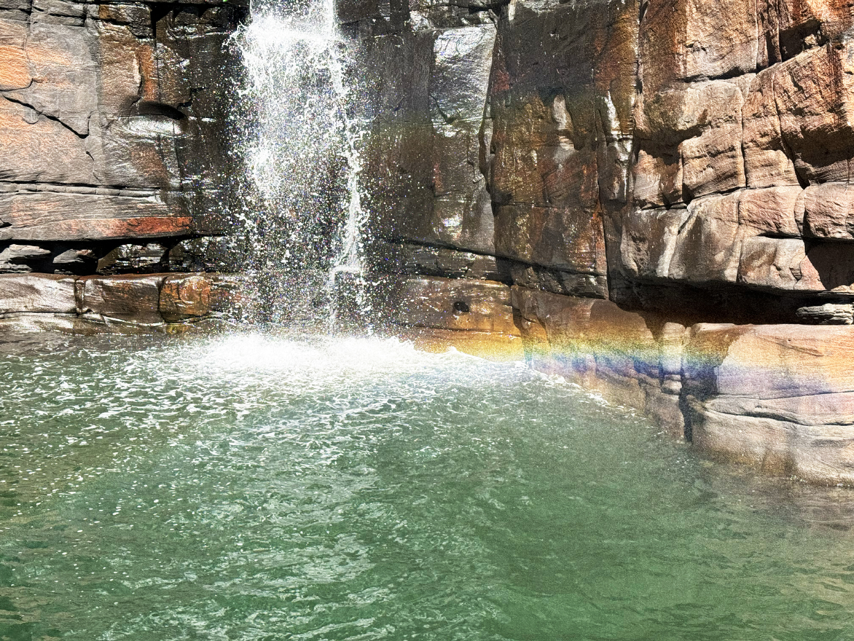
Rainbow ... if you catch the sunlight just right

View of the King George River gorge from the twin falls back out toward the mouth of the river
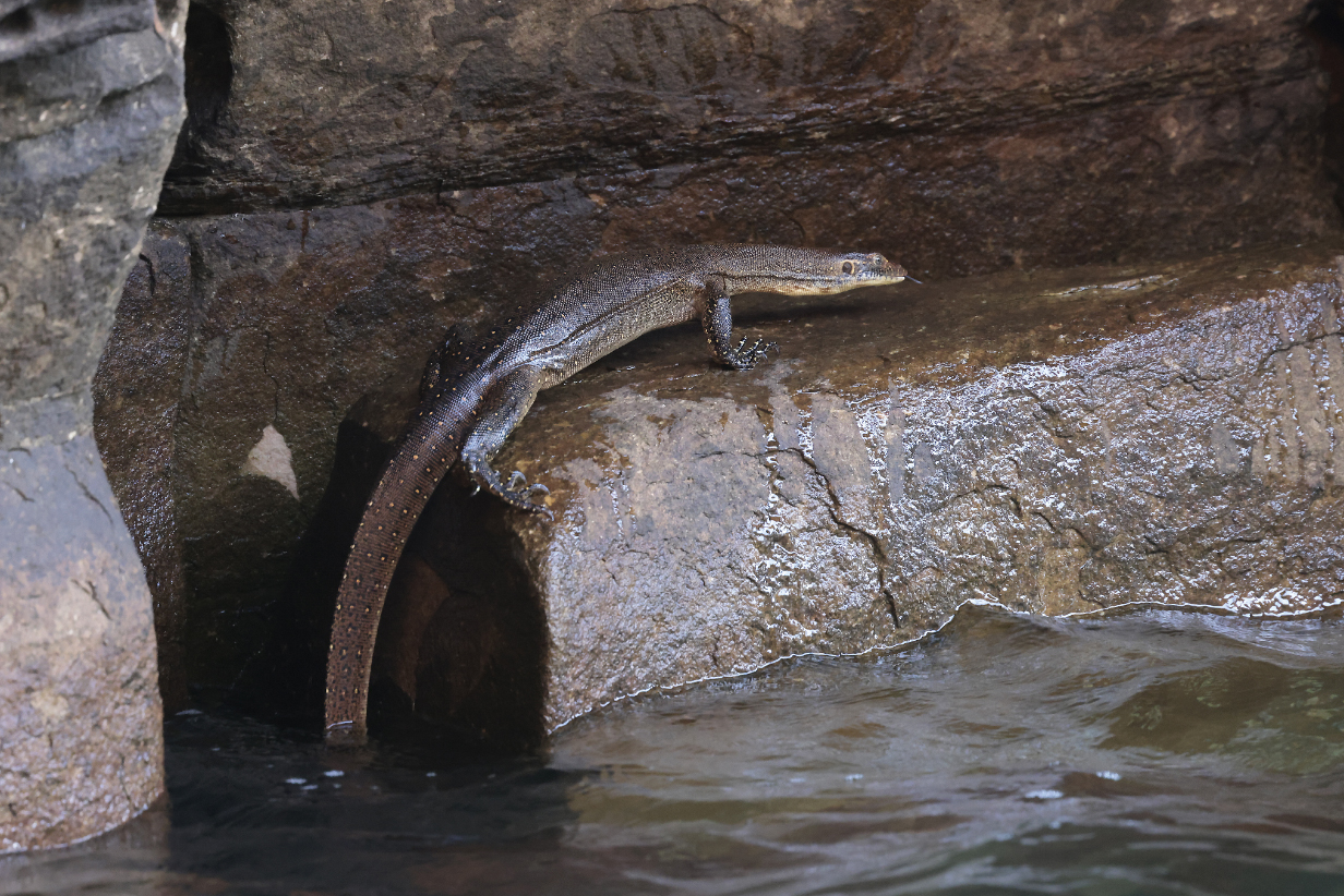
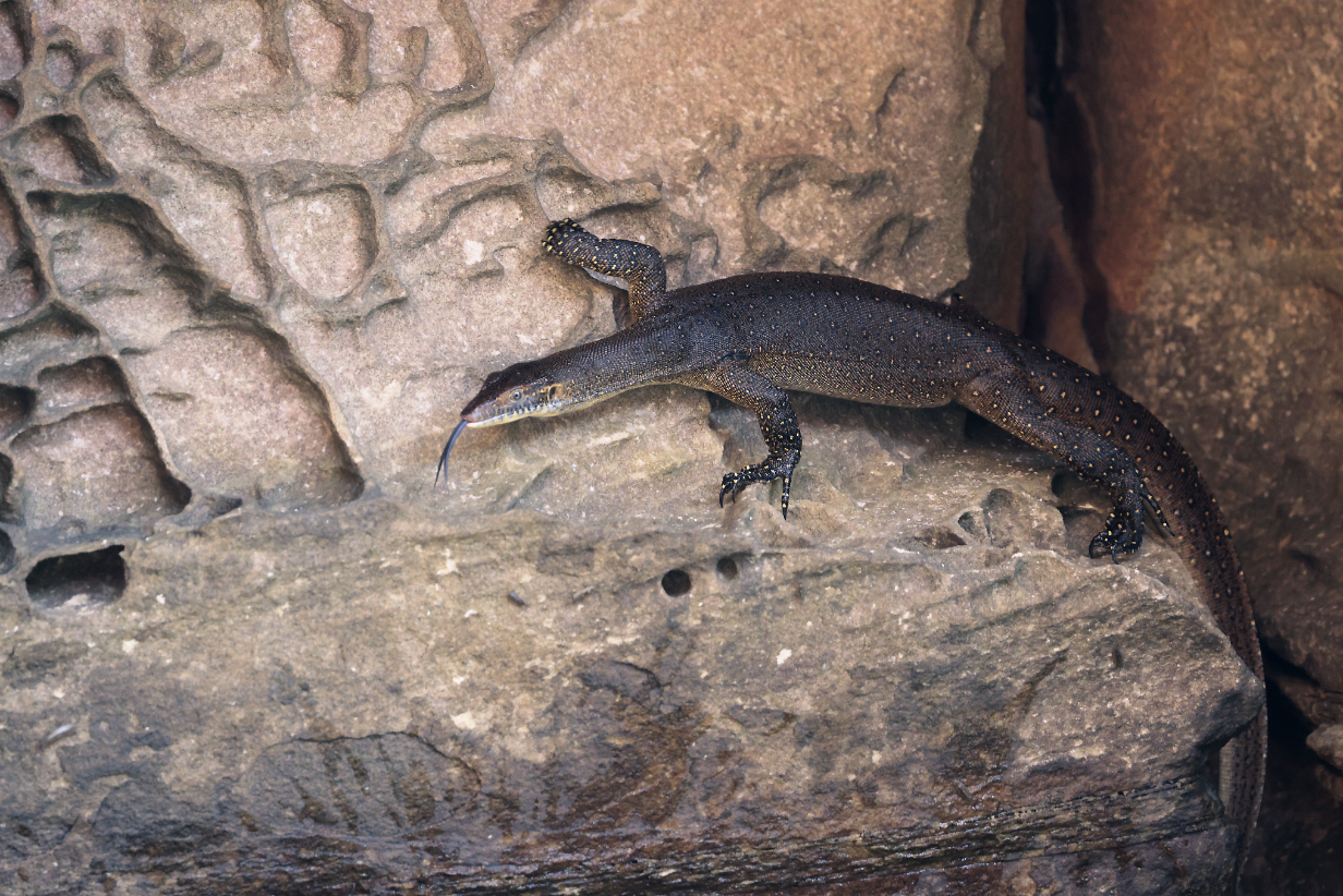
Mertens water monitor (Varanus mertensi) on the way back to the ship
August 16, 2025: Vansittart Bay landing
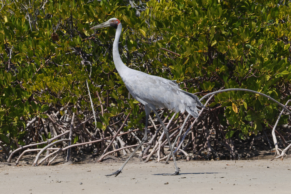
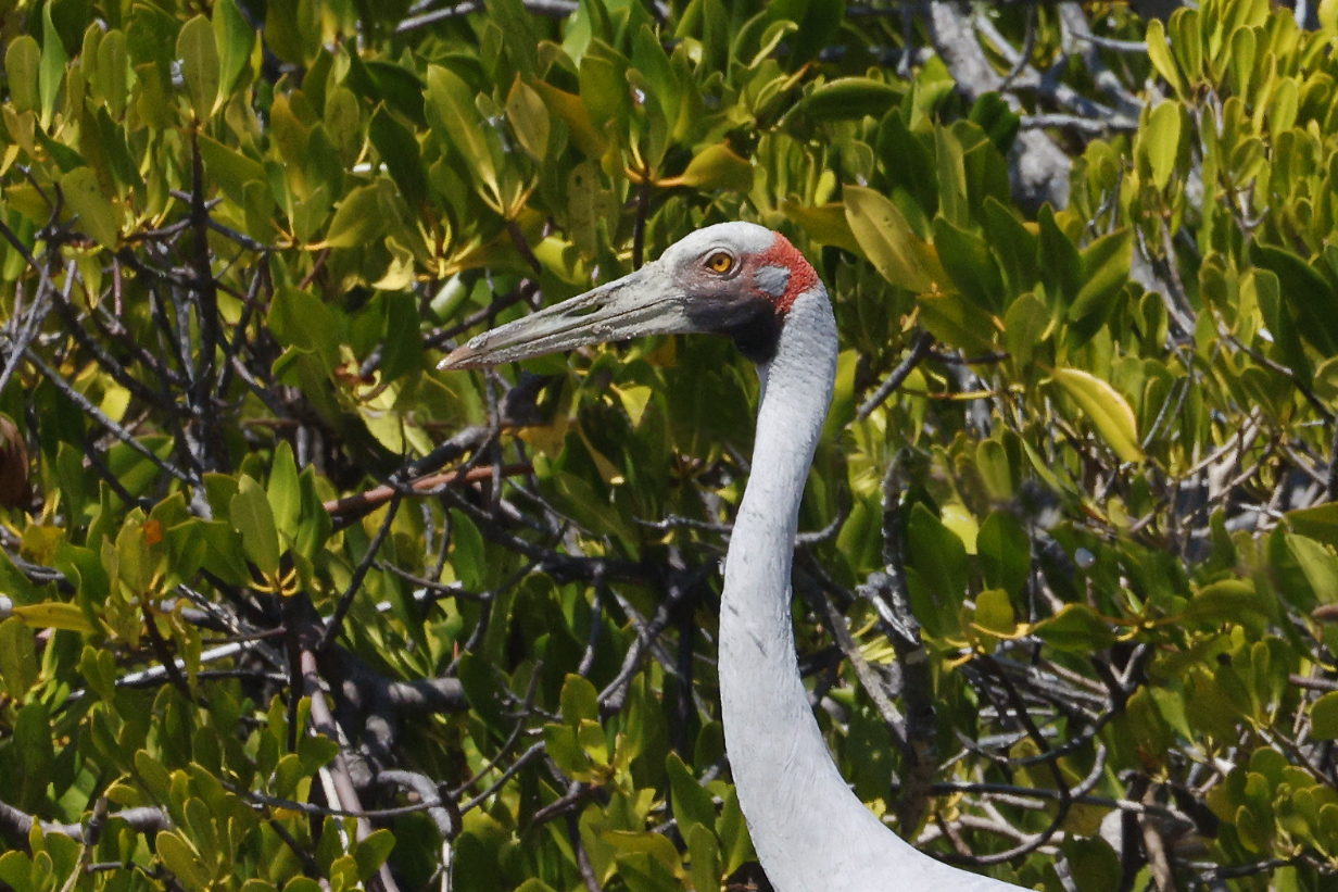
Brolga -- one of three on the sand flats at our Vansittart Bay landing
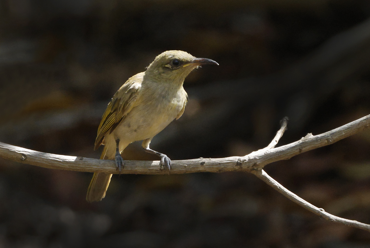
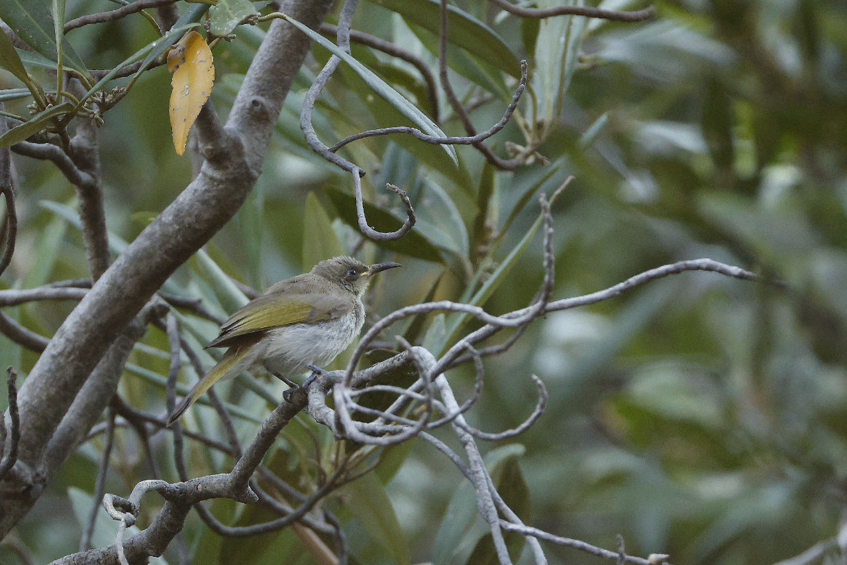
Brown honeyeater was the most common honeyeater throughout the Northern Territory and Australian cruise portions of our trip. This was at the water hole at Vansittart bay.
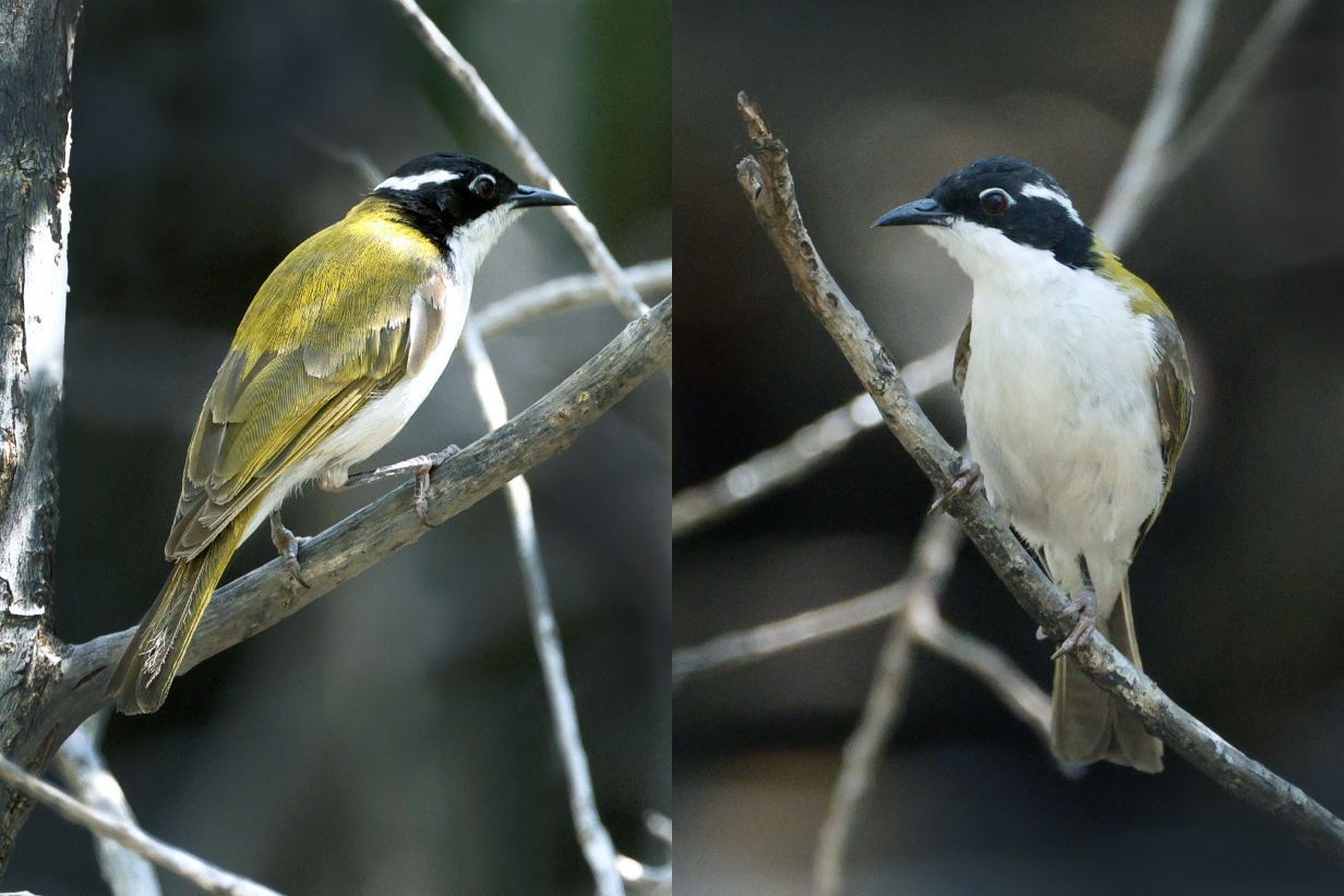
White-throated honeyeater at the water hole
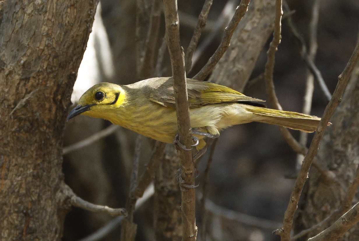
Yellow-tinted honeyeater (The yellow plume to the right of the black crescent at the ear is a bit too overexposed to be obvious.)
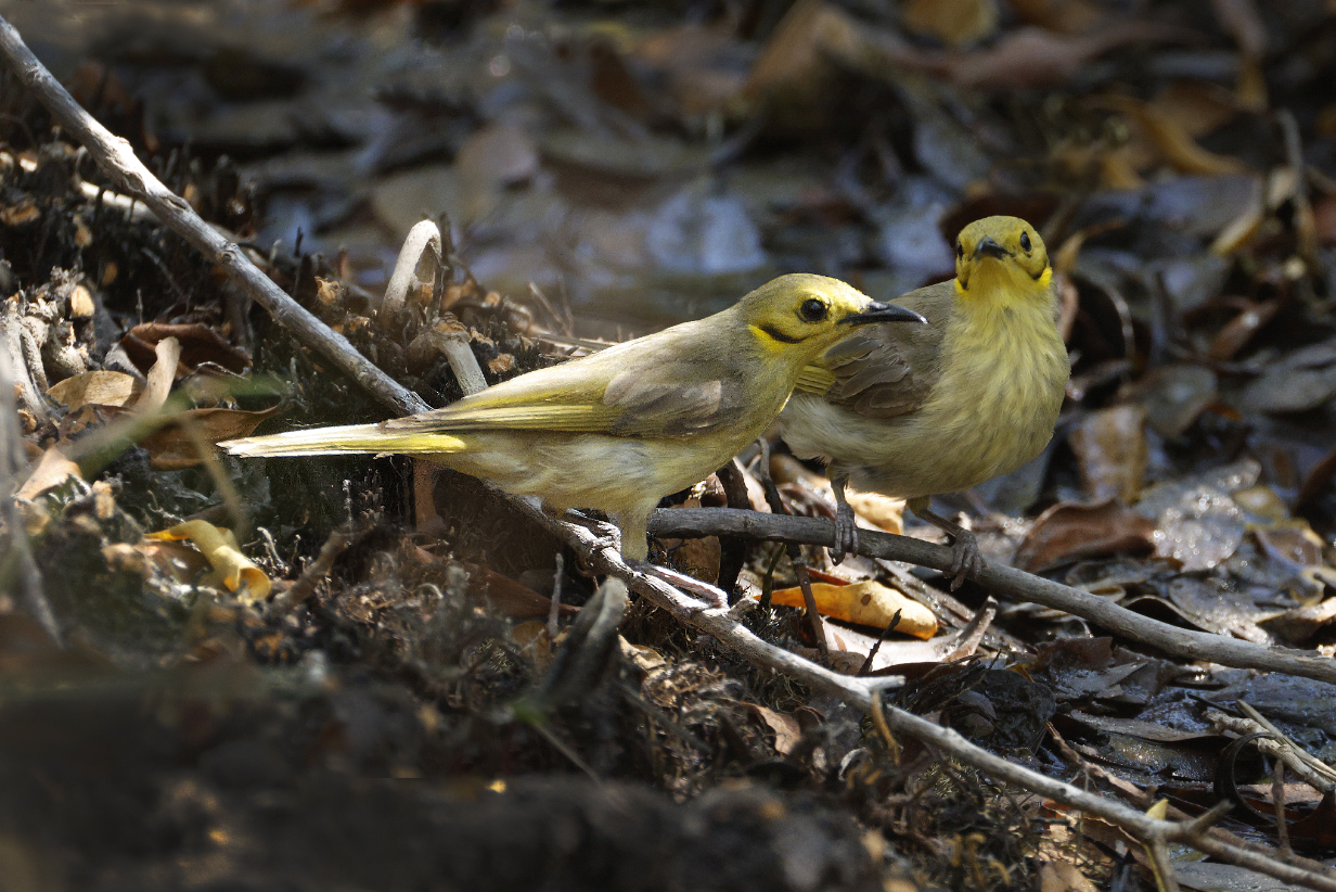
Yellow-tinted honeyeaters
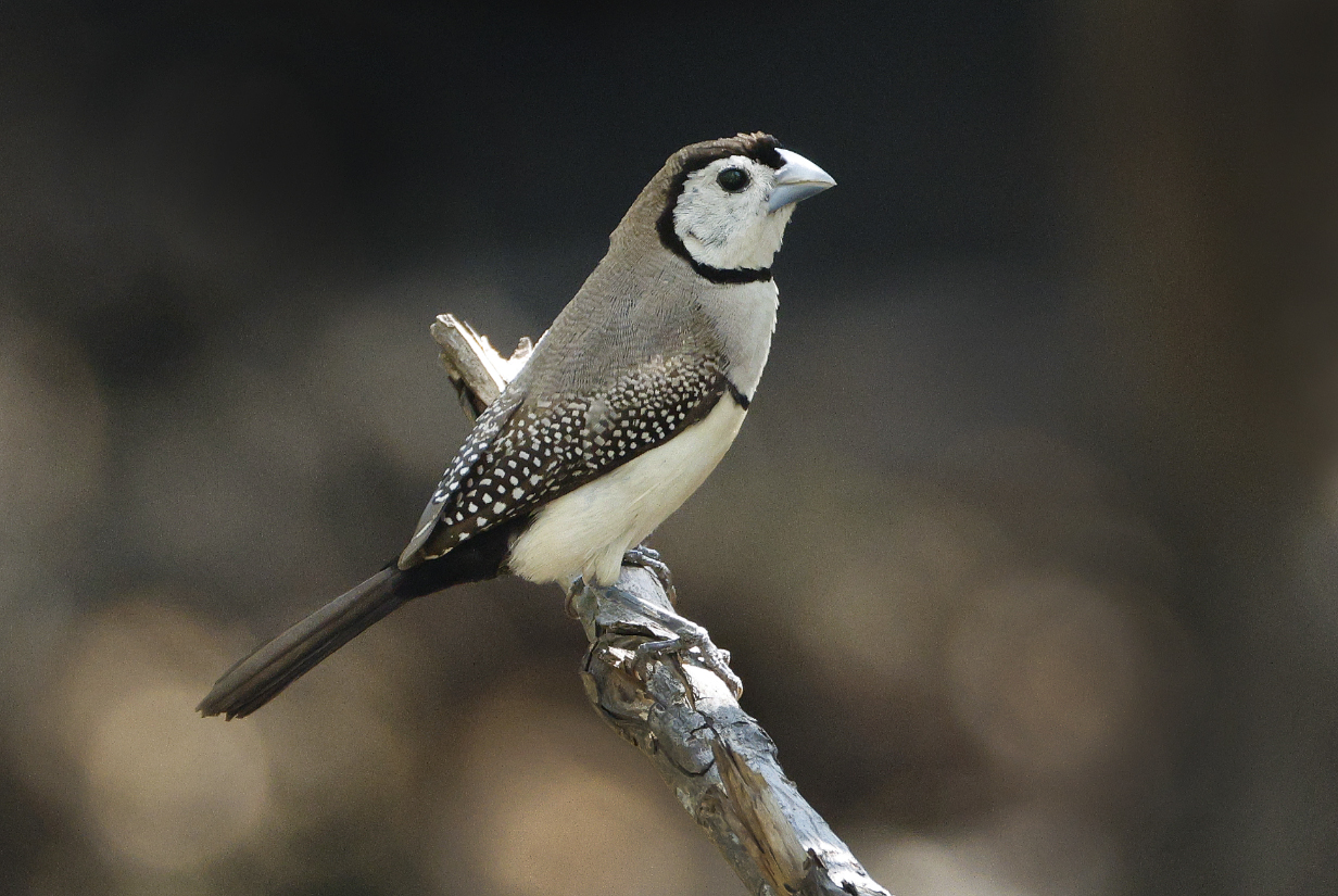
Double-barred finch was the most common bird at the water hole.
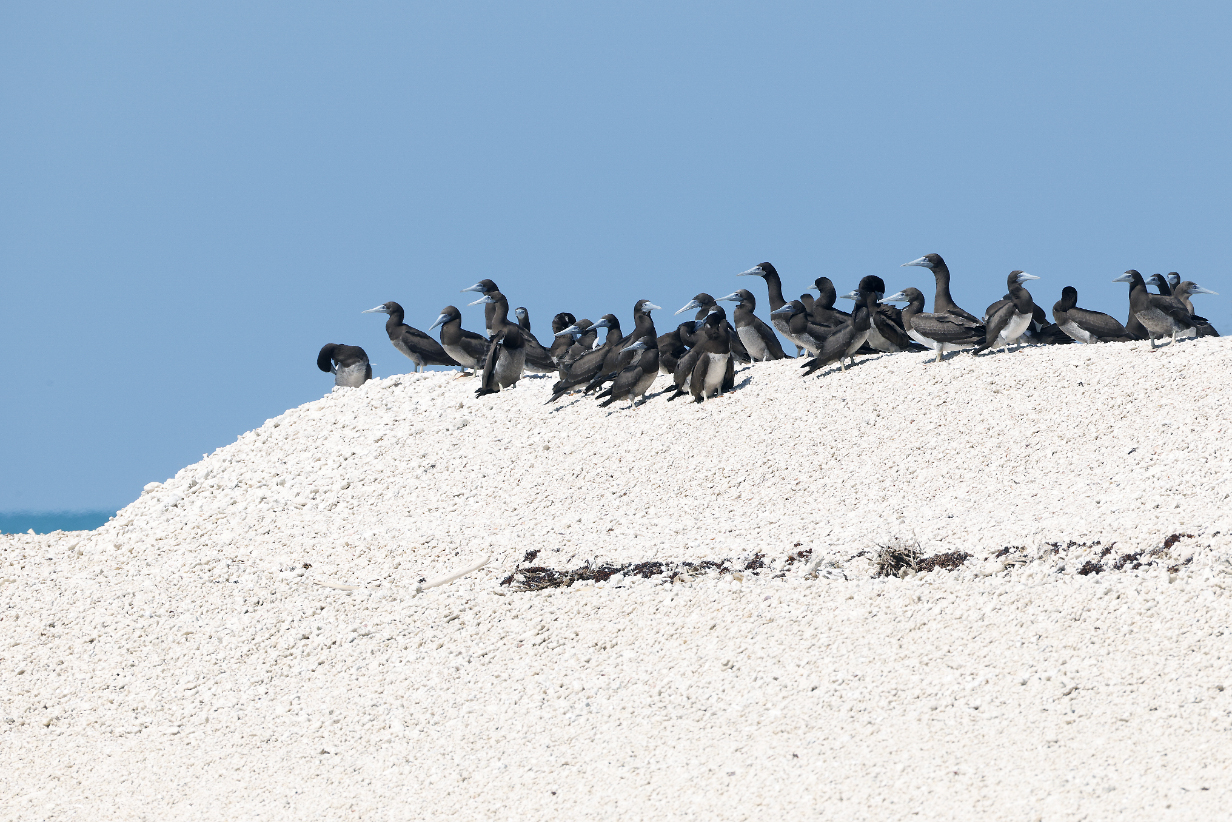
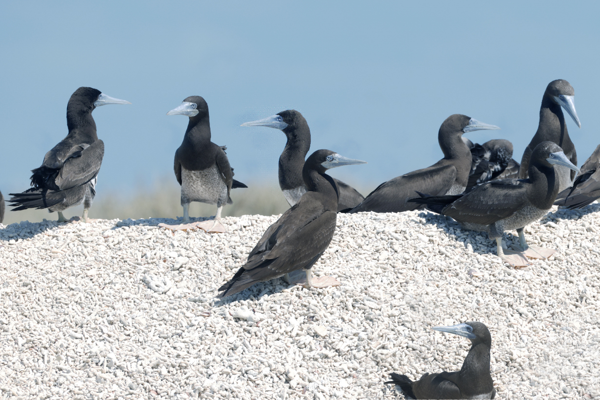
August 17, 2025: Ashmore Reef zodiac cruise
Ashmore Reef is a major nesting site for pelagic birds, a stopover for migrating birds, and a marine sanctuary. Unfortunately, no arrangement was made for me to take a zodiac with the ship's most experienced birder and photographer. This was disappointing. I could potentially have gotten 2 moderately easy and several harder new birds. On my own, with limited time and a non-birder (but otherwise helpful) zodiac driver, I saw only 3 bird species and got only one new bird, the easy and distinctive Bridled tern.
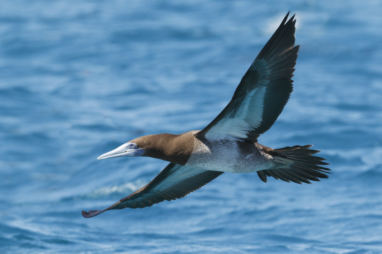
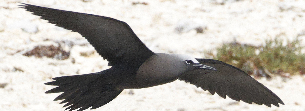
Brown booby was by far the most common bird around us in shallow water inside the reef and near the nesting island.
Common noddy also was easy. In fact, it was a life bird for both of us, despite the fact that we have been in the Common noddy's range many times. Also, I was hoping for Lesser noddy, but they are rarer and, among the relatively few birds that came close to our zodiac, I never saw one.
Bridled tern (This is my life bird. I saw several; they were clearly the most common tern -- at least just now -- at Ashmore Reef. The white eye stripe that extends well back behind the eye is characteristic.)
Ship's photographer Harry Rogers and our photo group zodiac driver
August 20 AM, 2025: Mitchell Falls helicopter tour from Hunter River
While I waited for the arrival of the helicopters that would take us to Mitchell Falls, this butterfly landed briefly on my face, presumably in search of salts. It looks most like a Dainty swallowtail (Papilo anactus). The range map for this species shows it only on the east coastal side of Australia "but with potential for vagrants in the Kimberley". If readers of this page can definitively ID it, please email me at kormendy at astro dot as dot utexas dot edu. Thanks!
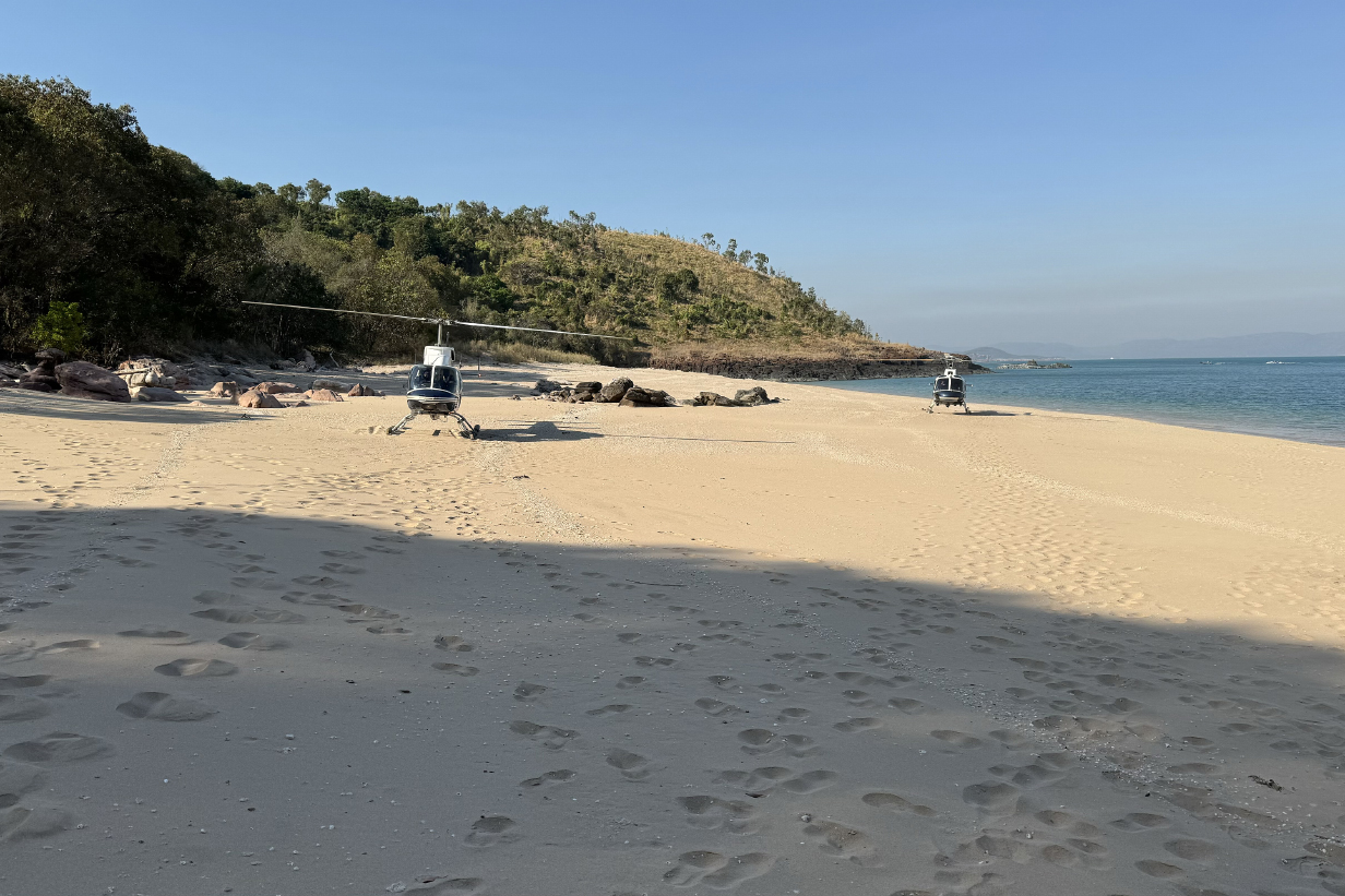
The left helicopter took me (John) to Mitchell Falls. Mary had a bad cold and skipped this outing, so only 4 of 5 seats were occupied. I was lucky to get the right-hand back window seat, with the result that I could get good pictures during the roughly 20-minute flight.

View of the cockpit from the right-hand back seat. The passenger is photographing Seabourn Pursuit, moments after takeoff.

Seabourn Pursuit from the helicopter ride. Our suite during the Darwin-to-Broome part of the cruise is at the front of the deck immediately above the deck that extends to the bow, slightly overhung by the bridge deck and on the far (i. e., port) side of the ship, facing forward. Wonderful suite with wonderful views. On the rest of the cruise, from Broome to Santiago, Chile, we will be one floor farther up, also on the port side, immediatly aft of the bridge and therefore on the back side that is hidden in this view. This gives us a side-facing balcony, which is actually better for pelagic birding.
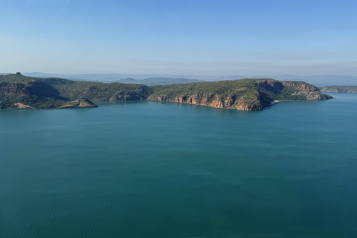
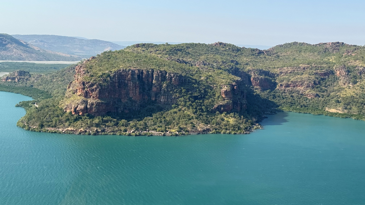
Kimberley coast from the helicopter
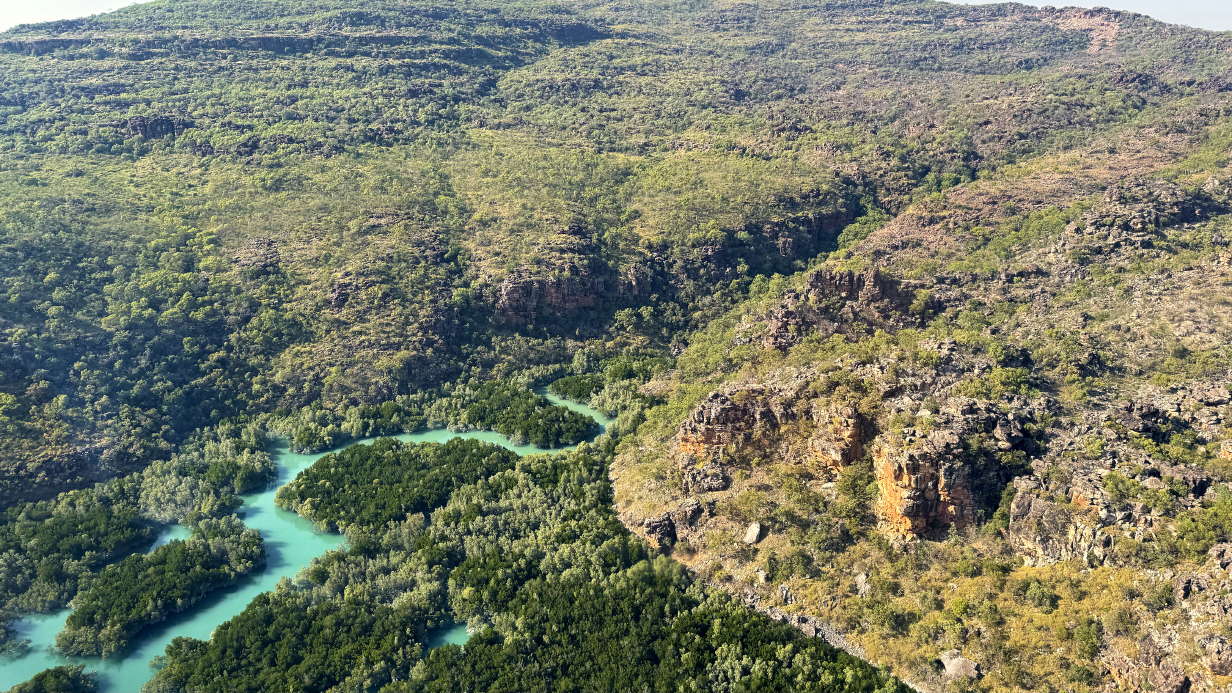
Rocky highland scrub forest gives way to mangroves in river valleys.
More views from the helicopter -- mangrove serpentines

Approaching Mitchell River and falls

Upper Mitchell River, which flows from right to left in this picture. The triple waterfall is at the head of the gorge at upper left.

Mitchell Falls from the helicopter

Now from our landing site, these are circular basins around 10 feet in diameter, upstream from the falls. They are produced during periods of flood flow by circular eddies that carry rocks which scour the basins. I have seen similar -- but less dramatic! -- basins more than 60 years ago along the Niagara River in eastern Canada.

Panoramas of the first view of Mitchell Falls from near the landing site. Scroll right to see the full pictures.

Mitchell falls -- simply gorgeous (movie)

Upper 3 Mitchell falls (Here is a movie that better captures the moment.)

Lower Mitchell falls

During the helicopter flight back to the ship, we were treated to a "bonus" view of 90 m Donkins Falls on the Hunter River.
August 20 PM, 2025: Hunter River -- Porosus Creek zodiac cruise
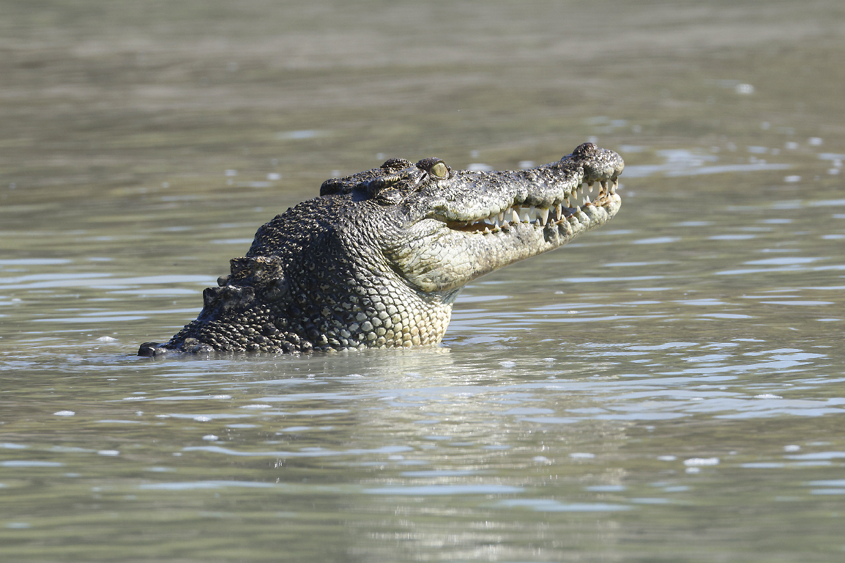
The afternoon, detailed "Image Masters" zodiac cruise was on Porosus creek. The Australian saltwater crocodile is Crocodylus porosus, so it is not hard to guess the main attraction.

Mudskippers were everywhere. We saw many confrontations over status, territory, and mating rights, no less ferocious for being between ~ 2-inch-long fish.
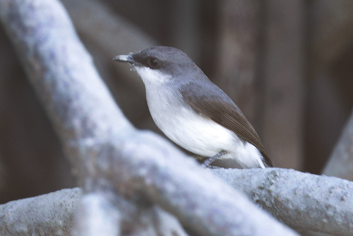
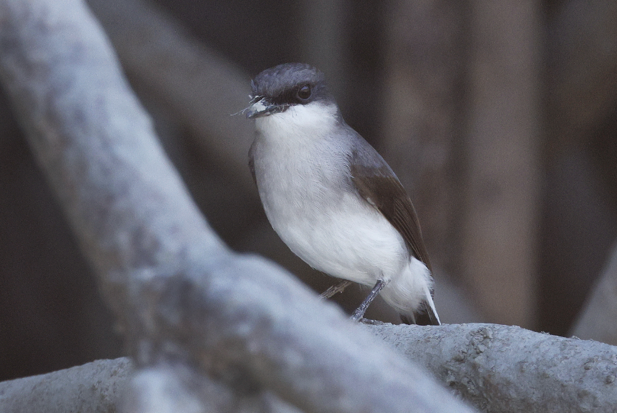
Mangrove robin -- good bird; well seen

Croc alert!
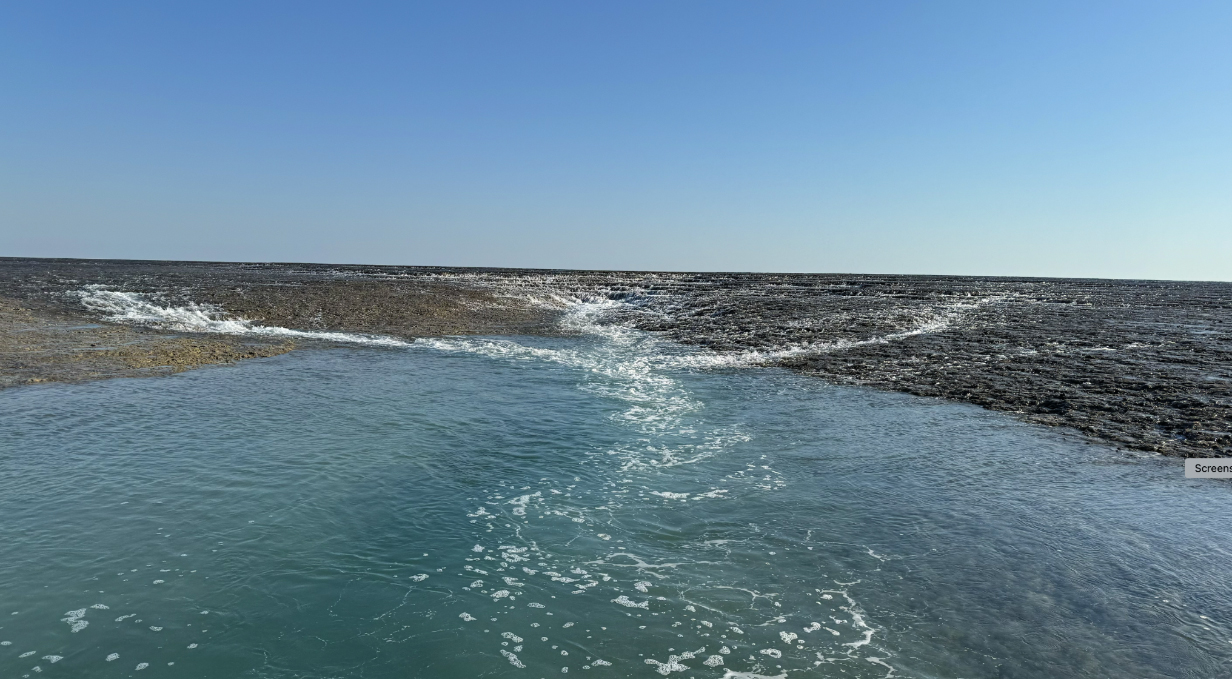
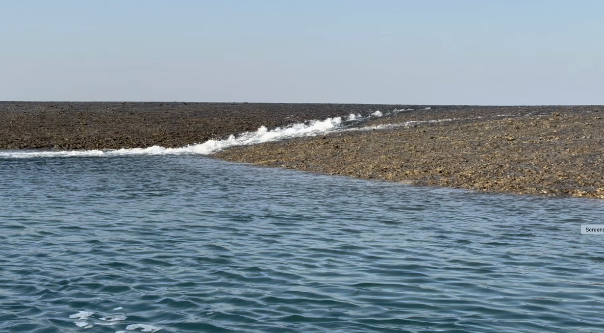
August 21 PM, 2025: Montgomery Reef zodiac cruise

At the beginning of our zodiac cruise, it felt like the top of the reef -- this part, anyway -- was just awash. But the tide fell quickly, and within an hour, about 4 m of the reef were exposed, and fast rivulets could not keep up in draining the reeftop. Some sea life gets stranded; other creatures try to escape, and predators such as birds and even reef sharks feast on the unlucky. Dominating the spectacle are torrents of shallow waterfalls as the reef continues to drain. As documented below:
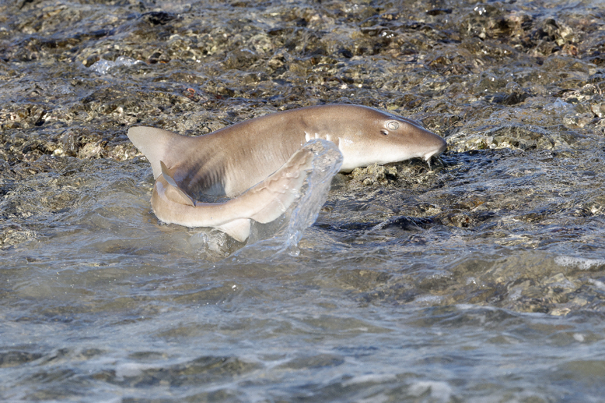
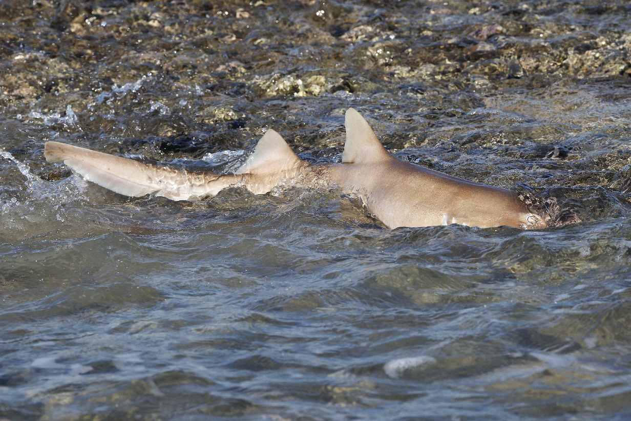
A reef shark was momentarily stranded as it lunged after prey. It quickly flapped its way back into deeper water ... and then continued to hunt as the tide continued to drop.
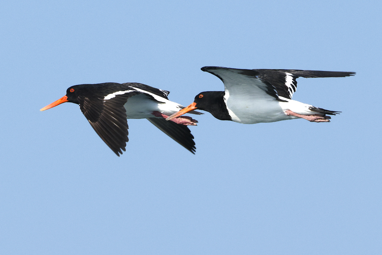
Pied oystercatchers
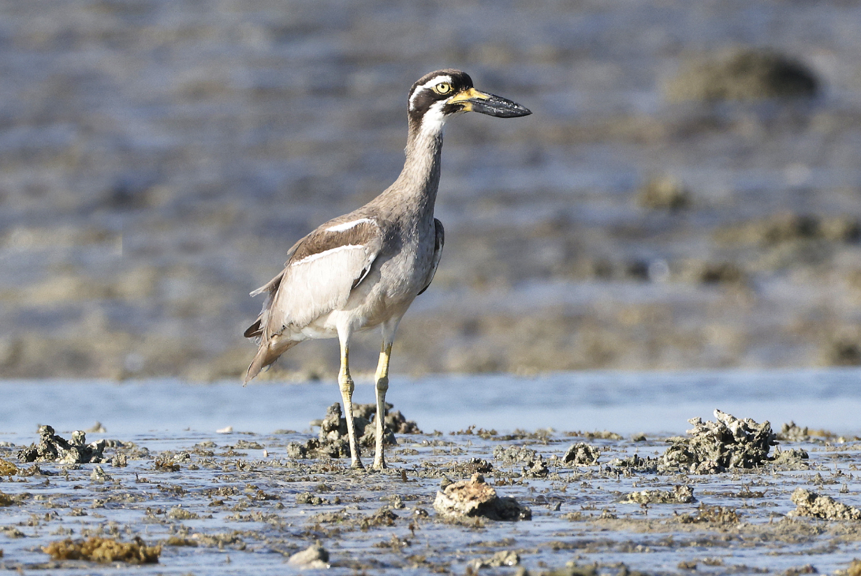
Beach thick-knee (or Stone-curlew)
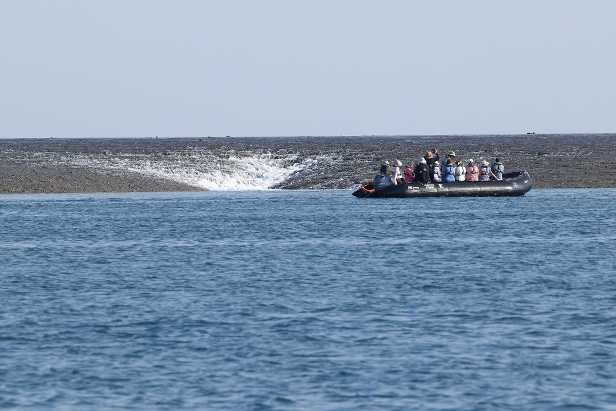
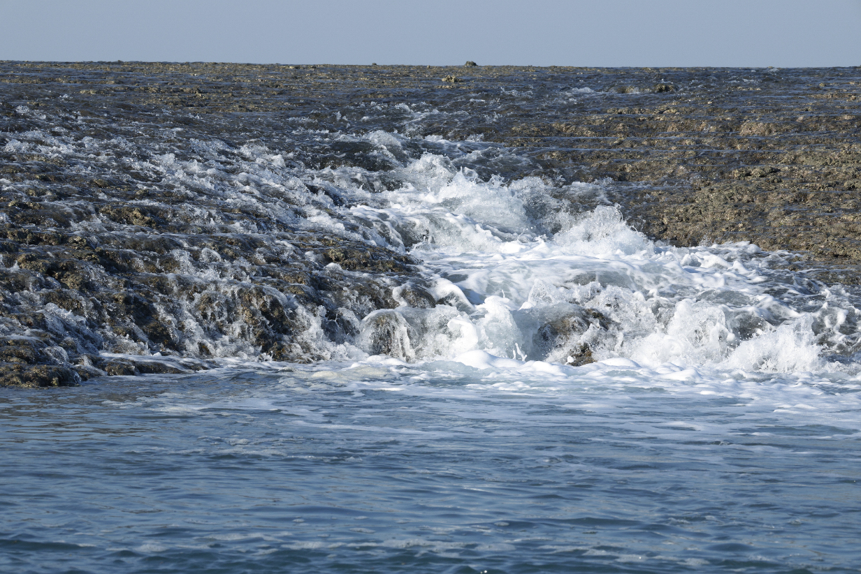
Gradually, dozens of waterfalls emerged as the tide continued to drain off the reef. The zodiac provides a sense of scale.
A movie provides a better sense of the feel of the tidal drainoff.
August 22 AM, 2025: Cyclone Creek zodiac cruise
Ship's photographer Harry Aslan Rogers (characteristically exuberant) and John (characteristically subdued) at the start of today's zodiac cruise to the spectacular rock formations around Cyclone Creek. Harry's Image Masters program gave five of us longer and more intimate excursions into nature plus excellent advice on photography and especially on finesse with the features of iphones and other cameras. Thanks also to Harry for tweaking the Image Masters' schedule to give me more chances to see new birds.
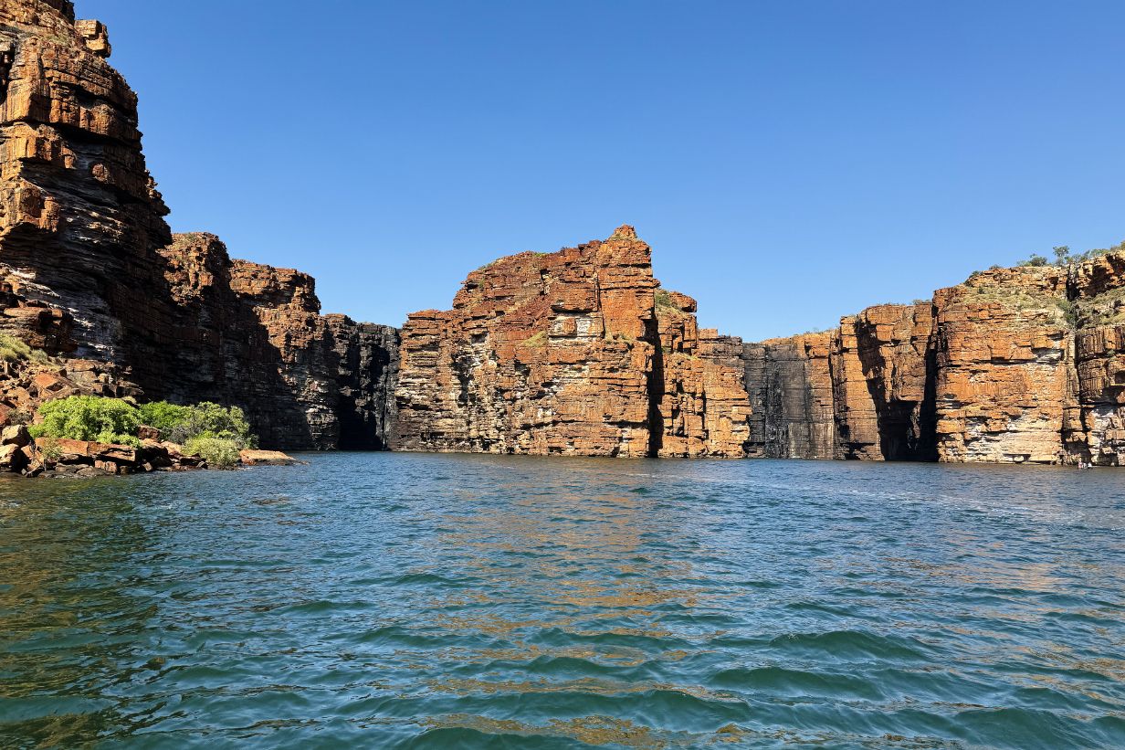
Cyclone Creek cliffs in early morning sunlight were a riot of color.

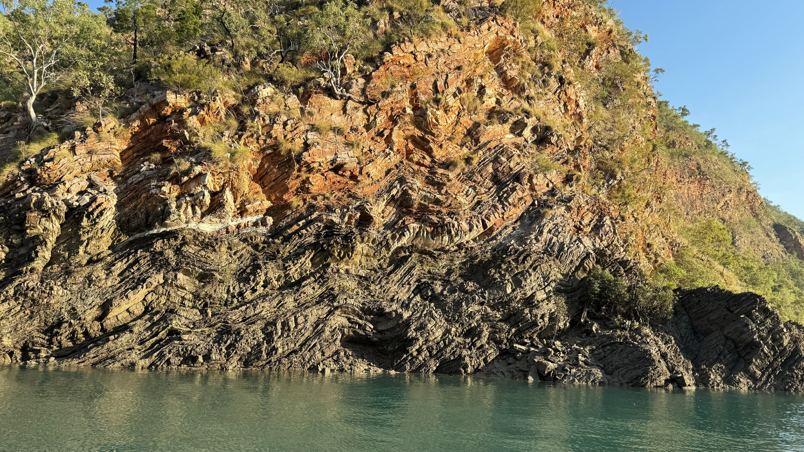
In the King George River valley, sedimentary strata were horizontal, but at Cyclone Creek, the layers that encode millions of years of sedimentation have been tilted -- here almost vertically -- or even crunched up into curves. Also, you can also see the consequence of arriving at low tide; many vertical meters of cliff are stained and covered with micro-organisms up to various high tide lines. Tidal ranges in the Kimberley are extraordinary, ~ 33 feet during spring tides and still ~ 12 feet during neap tides.
I hope that my photo co-conspirators -- including ship's photographer Harry -- don't mind if I post a picture of our group to record the feeling of tranquility inherent in the intimate connection with nature that was provided by the in-depth zodiac rides of our Image Masters Photography Masterclass.

Alcove in a cliff with trees makes for a charming moment in a memorable morning.


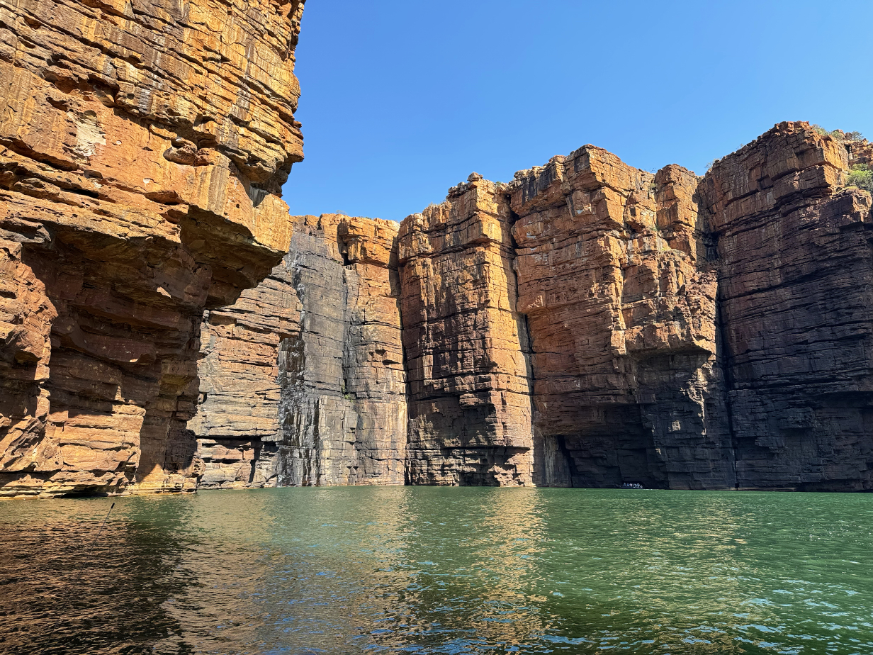
More tilted layers
Osprey ... far away
Spectacular rock formations ... including this movie.
More spectacular rocks and another movie to try to capture some of the feeling of sailing up Cyclone Creek .
Some layers are not just tilted -- they are squeezed up into rock waves.
The ubiquitous Brown honeyeater looks a bit different here ... or maybe this is just a juvenile.

Croc alert!
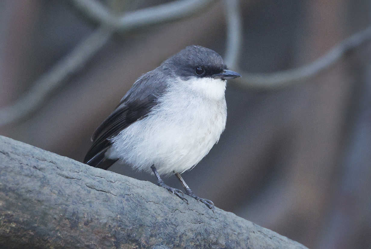
Mangrove robin
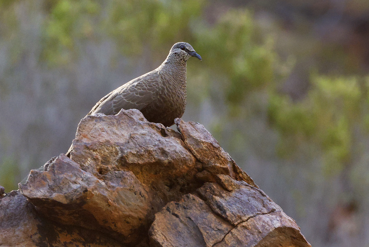
White-quilled rock-pigeon (I got my life bird just recently, during our Australian North End birding tour, on August 9th.)
August 23, 2025: Lacipede Island zodiac cruise
Today was promising: Lacipede Island just north of Broome is said to be a major nesting site for Roseate tern and could also have lesser Noddy, both of which I need. As it happens, I saw hundreds of Brown noddies and many hundreds of Brown boobies ... but no Lesser noddy and no Roseate tern. So today was a bit disappointing, despite the happy richness of more common birds. Still I got better pictures of Bridled tern than I did at Ashmore Reef.
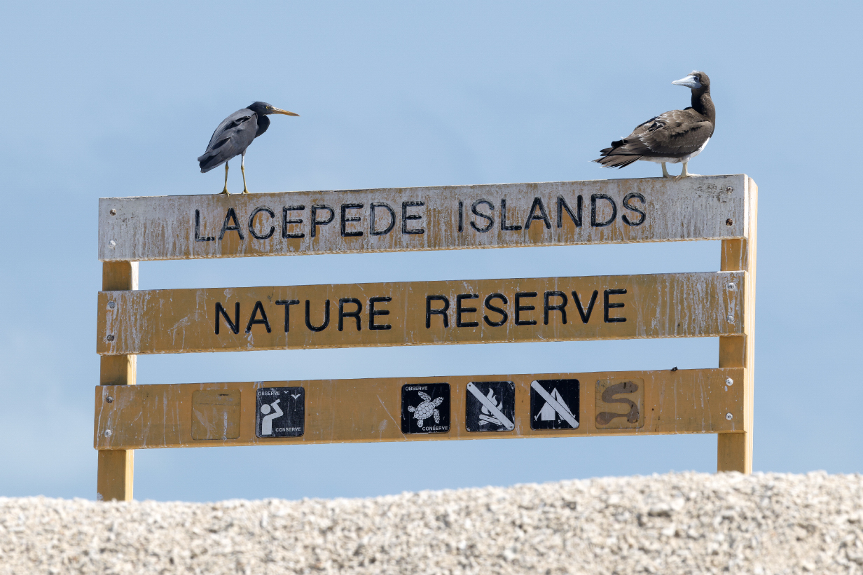
Lacipede Islands Nature Reserve (with dark-morph Eastern reef-heron and Brown booby)
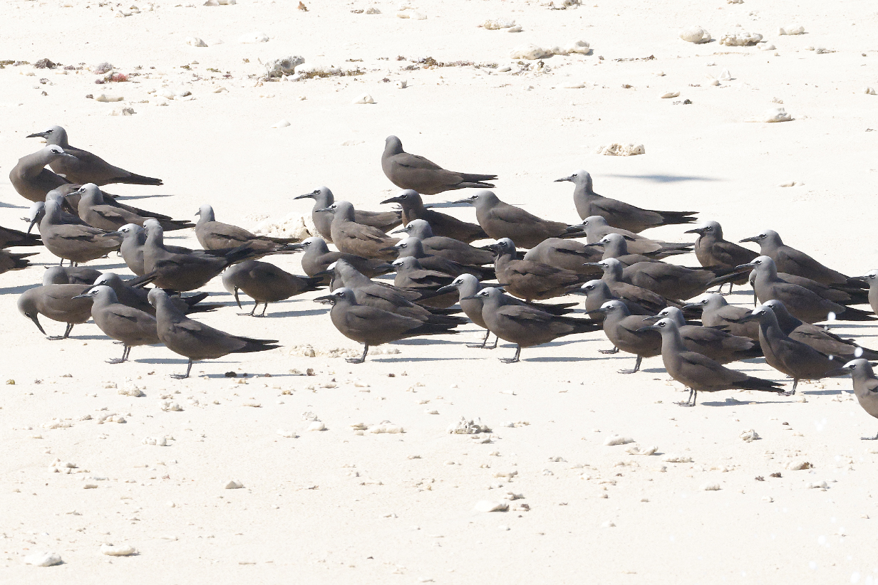
I tried to look at every one of the several hundred noddies that I photographed, but as near as I could tell, essentially all of them were resolutely Brown noddy. Note the sharp edge to the light gray cap at a line from the top of the bill to the eye. Below that line, the color is very dark. A few birds were brown all over. But none showed light gray between the bill and the eye, shading into brown only lower down on the chest. So I did not get Lesser noddy. And this was by far my best chance of the trip.
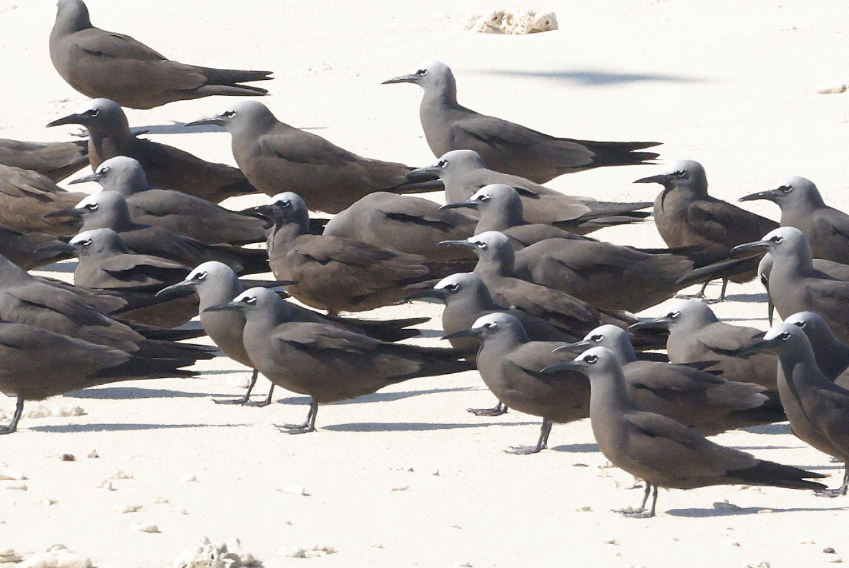
This cropped version of the above picture better shows the sharp line between bright above and dark brown below the line that connects the top of the bill with the eye. Hence: Brown noddy. Note how different birds have bills of different lengths and different amounts of decurvature. Hard to ID using bill length, as bird ID books suggest.
Brown noddy closeup to show colors between the bill and the eye
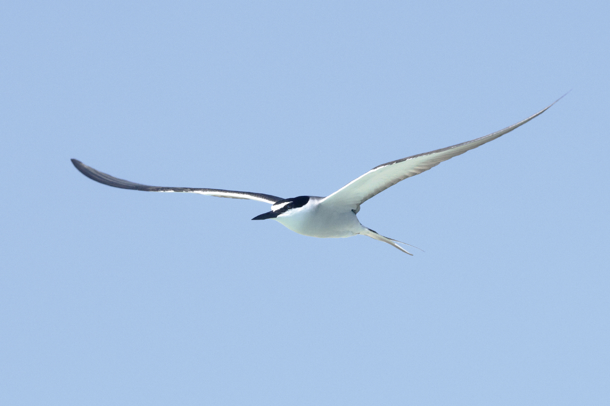
Bridled tern (The white eye stripe clearly extends back behind the eye.)
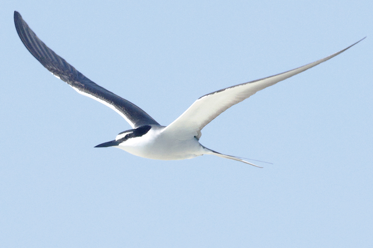
Caspian tern (non-breeding adult)
Brown boobies
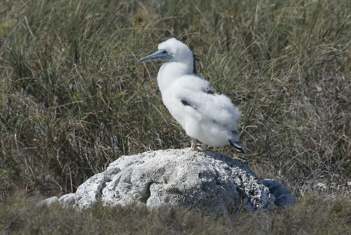
Brown booby chick

Lesser frigatebird
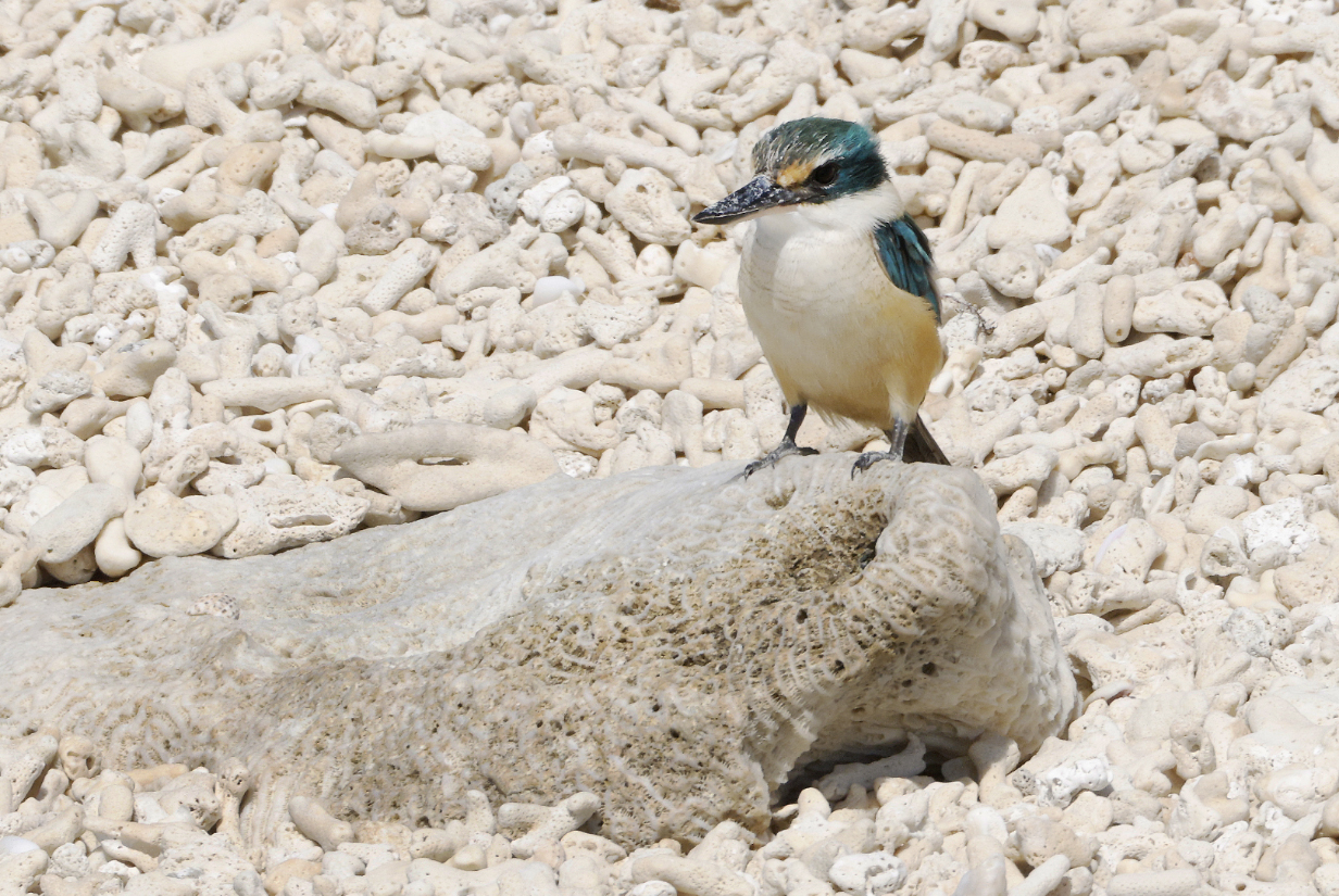
Sacred kingfisher ... is not exactly to be expected on Lacipede Island. It surely did not get here "on purpose". On the other hand, this IS a place where a kingfisher might make a reasonably good living. But not a place where one might one day find a mate.
August 24, 2025: Broome
Today, we docked in Broome and formally switched from our Darwin-to-Broome cruise to our
Broome-to-Darwin-to-Santiago, Chile cruise. With much appreciated help from VENT's bird guide
Scott Baker, I had arranged to bird with Karina Sorrell
Mangroves and ornate rock formations at Roebuck Bay near Broome Bird Observatory (Scroll right
to see the full panorama.)
Mangrove fantail at "One-Tree" in Roebuck Bay (This is my life bird.
We got there just in time to benefit from the end of the "morning rush" ... plus the tide was
rapidly rising and driving us farther away from the mangroves. The spring tidal range here is a
remarkable 10 m; we were here less than a week before spring tide. Every few minutes, we had to
take a step back, farther up the beach, as the tide advanced.)
Dusky gerygone at "One-Tree" in Roebuck Bay (This is my life bird. It is a classic example
of a "little brown job" that is very hard to find and still harder to identify without a
guide.)
Sacred kingfisher
Silver gulls on what's left of the ornate rocks at Roebuck Bay at high tide
White-bellied sea eagle during the drive back to Broome
Gray-headed honeyeater was surprisingly easy and clearcut at the busy parking lot of Entrance Point
in Broome. This is my life bird.
Singing honeyeater, also at Entrance Point. This is a bad picture, almost directly up-sun,
but I include it because I may never have photographed this species before, and besides ...
it seems to have its eye on the prize.
Dusky gerygone one more time, in the shadows at Streeter's Jetty in Broome. By this time, the
tide was well on the ebb, and then, in mid-afternoon, bird activity got very subdued.
Mangrove fantail also one more time ... in a not very sharp picture in the shadows during the
heat of the day.
Meanwhile, the tide had gone out enough to expose the mud flats at Streeter's Jetty, so the
Fiddler crabs were out in force, trolling for mates. At this point, we declared the end of an
enjoyable and successful day. Many thanks to Karina for getting me the two target species
and the important bonus of Gray-headed honeyeater.
Today, John took the Mitchell Falls helicopter tour again, in part because, well: it's worth it ...
and because we wanted Mary to experience it, too. The weather was again perfect; the zodiac ride
to the helicopter takeoff and landing site was short and easy; the helicopter ride itself was again
very nice (this time, the tide was low and mud flats were exposed everywhere along Hunter river),
and the walk from the landing site at Mitchell Falls to the first, main lookout was not too hard
for Mary.
Mary at Mitchell Falls lookout: Red Bull gives her wiings. (Maybe not "wiiings", but still helpful.
Unfortunately, two cans would not give her wiiiiiings.)
Mary at the lookout to Mitchell Falls (Scroll right to see the full 180-degree panorama.)
Mitchell Falls (except for the uppermost falls) movie.
Bits of riparian habitat upstream from the falls: I heard bird song on my previous visit here,
so I looked for birds this time (specifically: Kimberley honeyeater), but we were scheduled too
late in the day for birding, and in the noon heat, the area was silent.
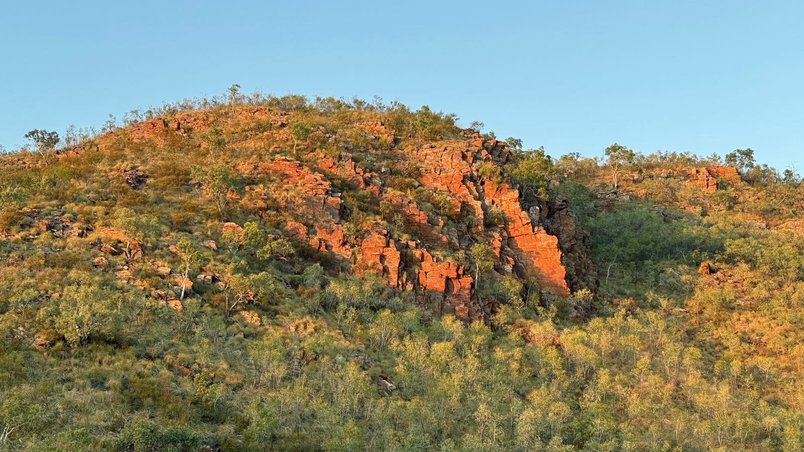
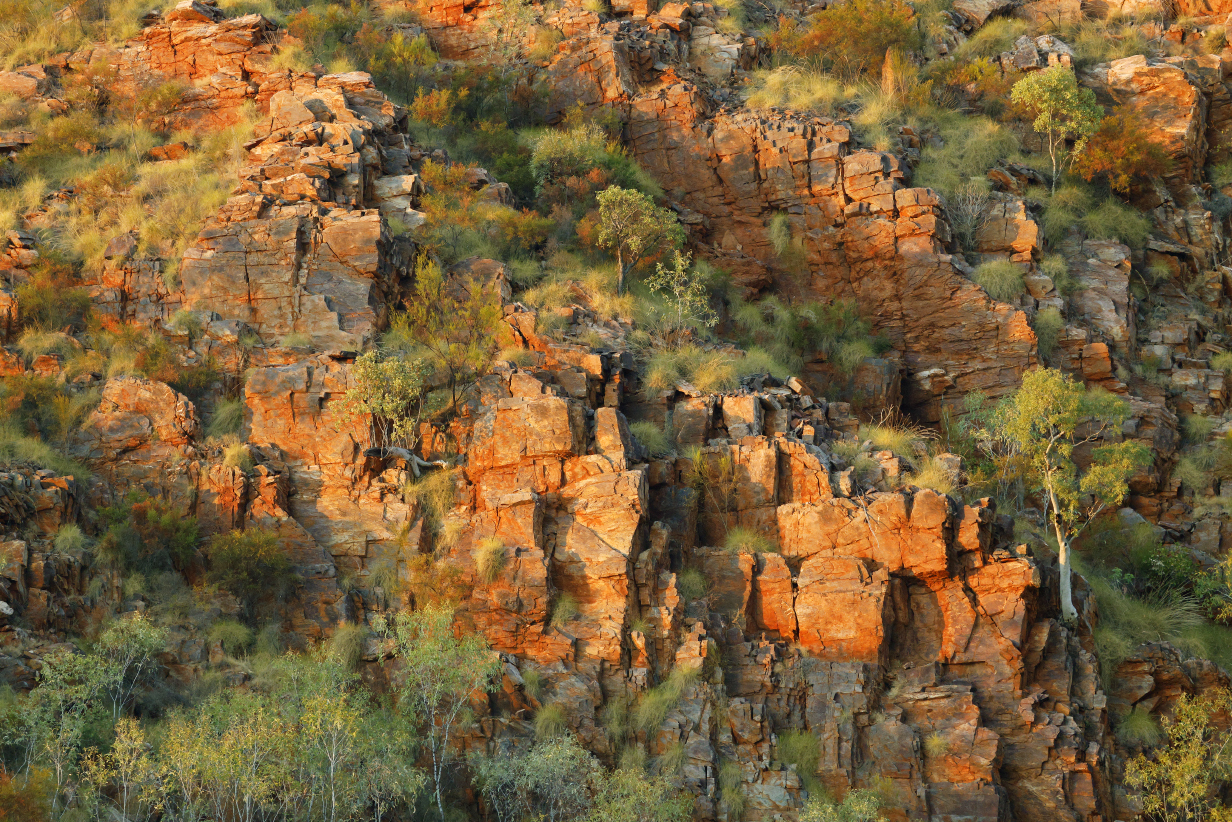
Red rock is characteristic of the Kimberley. This picture is exactly as taken with my iphone:
I have not changed the color balance, vibrance, or color saturation. The rock really is this
beautifully red.
Today, we stopped again at Ashmore Reef, on the way back from Broome to Darwin. I again took a
standard zodiac cruise with 11 other passengers. The zodiac driver was a good generalist but
had no special interest or expertise in birds. As expected, the result was a disappointing
ride. We were not allowed close to the islands where birds breed (this is, after all, a nature
reserve); we saw few birds, and only Brown boobies came close. I saw only a few, very distant terns,
mostly Common noddies and a few probable (but not confirmed) Bridled terns. No Roseate tern.
No Lesser noddy. Today was probably my last semi-realistic chance for Lesser noddy.
West Island at Ashmore Reef (This is the closest that we could get, photographed with an 800 mm
telephoto lens. The highest-flying bird is an adult Brown booby: adults were substantially
outnumbered by immatures.)
This was the only Common noddy that came close enough to be well photographed. Looks juvenile.
Immature Lesser frigatebirds were common during this zodiac cruise. I saw a few distant adults ...
but signs clearly were that we are here late in their breeding season. I suspect that the same is
true for other breeding sea birds. The end of August is not the best time to visit Ashmore reef.
Immature (probably Lesser) frigatebirds of various ages. The one with the white head is youngest.
Immature frigatebird (not sure whether this is Great or -- more probably -- Lesser) and
Brown booby (at least almost an adult)
Brown boobies were, like last time, by far the most common bird. They took an active interest in us,
and it was easy to get almost within arms length of birds sitting on buoys. Note again that all these
are immature birds.
Brown boobies (immature)
Today John again took the zodiac cruise up the King George River estuary to the twin falls.
This time, it was not an Image Masters cruise but just a normal (and therefore quicker) zodiac
excursion. I was again mesmerized by the 3-D artistry of erosion on the sandstone walls ...
but something went wrong with my iphone, and it erased all pictures taken before I arrived
at the falls. The following 3 pictures were taken with my birding camera. Pictures that follow
were taken with my iphone.
Artistry of erosion on the sandstone walls of the King George River gorge
The sea level estuary of the King George River ends about 7.5 miles upstream at the double falls.
Which are almost dry during the Northern Territory dry season. This shows the (black-walled) double
falls. Scroll right to see the full panorama.
King George River falls
Two views of the eastern wall of the river gorge near the falls
One more view of the western falls -- the one that was in sunlight -- before we headed back
to Seabourn Pursuit
And a last look at the east falls, now partly sunlit
This is the view back downstream away from (but still from near) King George River Falls.
More 3-D erosion art, this time on the east wall of the King George River gorge, on our way out
It is interesting how differently different rock faces are eroded. Presumably this results from
slight differences in composition and (e. g.) hardness ... because all this happened after the
various blocks were in place with respect to each other and all presumably had similar experiences
with eroding forces. It is also safe to assume that chunks sometimes break off the wall, taking
with them eroded faces and leaving behind a smooth surface. For all these reasons and maybe more,
results differ dramatically from block to block.
I can't resist adding one more ...
Everywhere we look, the walls of the gorge encode many millions of years of history.
From here, we zoomed back to the ship ... after a welcome second immersion in this wonderful experience.
This was the last stop in our return cruise from Broome to Darwin.
We docked in Darwin on September 3, stayed overnight, and sailed for West Papua Indonesia on
September 4. On September 3, we were offered a "birding tour" to Fogg Dam Conservation Reserve,
and I took it in the (admittedly faint) hope that I might see Pictorella manakin in the places where
we saw finches last time we were here, many years ago. This tour was not a success. The main visitor
center was closed; the backup viewing area was closed, and we got a chance to visit only one
~ 1 km walk to some wetlands plus a drive over the dam itself. I saw no finches.
Little bronze cuckoo was the best bird of the day, kindly pointed out by a birder from
the ship's crew.
Agile wallaby
Plumed whistling duck -- lots!
I think that this is a Whistling kite. Please email me if I am wrong. Thank you.
Today involved one the the hardest shore excursions of the trip and very likely the most
spectacular cultural experiece. It required an almost 13-mile zodiac ride, half of it from
the ship to the SE coast of mainland West Papua New Guinea and the rest up a river bordered
by rain forest to an Asmat village called -- we were told -- Uwus. The village is build on
stilts over a muddy swamp. About 1000 people from 4 villages combined to put on for us a
show of martial strength and tribal tradition, including about 100 war canoes, mostly manned
by 5 men each. Meanwhile and afterward, on shore, women danced for us. After the show,
we were free to roam the village and to see (e. g.) the "man house" where men gather to meditate
and to discuss. We were allowed to see a bit of their life style, although I entered no individual
house. And we could see and if interested buy some of the elaborate wood carvings for which
these people are famous. Having too much stuff already, I only looked and took pictures.
Before I include some of these, here is more information on the Asmat:
Paraphrasing Wikipedia: "The Asmat are an ethnic group of New Guinea, residing in the
province of South Papua, Indonesia. They live in a region on the island's southwestern coast
bordering the Arafura Sea, with lands totaling ~ 7336 square miles and consisting of mangroves,
tidal swamp, freshwater swamp, and lowland rainforest. The land of Asmat is located in and adjacent
to Lorentz National Park, the largest protected area in the Asia-Pacific region. The total Asmat
population is ~ 110,000 as of 2020. The Asmat have one of the most well-known woodcarving traditions
in the Pacific, and their art is sought by collectors worldwide.
The natural environment is the major factor that affects the Asmat: their culture and way of life
depend on the natural resources found in their forests, rivers, and seas. Their food consists mainly of
the sago palm (Metroxylon sagu) supplemented by beetles, crustaceans, fish, and forest game. Due to
frequent flooding, Asmat houses are built two or more meters above the ground on wooden posts.
The Asmat traditionally emphasize the veneration of ancestors, particularly those who were
accomplished warriors. Asmat shields are among their most famous products. Asmat art consists of
elaborate stylized wood carvings such as the bisj pole and is designed to honour ancestors. Many Asmat
artifacts have been collected by the world's museums.
The Asmat have traditionally been known for their warrior prowess and headhunting raids.
Every death of an adult was believed to be caused by an enemy, and relatives sought to take a head
in an endless cycle of revenge and propitiation of ancestors. Heads were part of the rituals by which
boys were initiated into manhood. Cannibalism was a feature of these rituals. All this is believed
to have been suppressed by missionaries.
In this context, there is a famous story of Michael Clark Rockefeller (born May 18, 1938),
who disappeared in 1961 while exploring this region. Again, paraphrasing Wikipedia: "He was a son of
New York Governor and later U. S. Vice President Nelson Rockefeller, a grandson of American financier
John D. Rockefeller Jr., and a great-grandson of Standard Oil co-founder John D. Rockefeller Sr.
On November 17, 1961, Rockefeller and his companions and local guides were in a 40-foot dugout canoe
about 3 miles from shore when their double pontoon boat was swamped and overturned. Their local guides
tried to swim for help. On November 19, Rockefeller tried to swim to shore and disappeared. No remains
of Rockefeller or physical proof of his death have been discovered, despite detailed investigation.
He may have drowned. He may have been killed by marine life. Or he may have been killed by the Asmat
in retaliation for killings by the local government." The myth persists that he was eaten by the Asmat,
and claims to that effect have been credited to some Asmat. Repression of the kill-for-a-kill culture
had been ongoing for years, and it is reasonable to expect that this was more successful near the coast
and in places where contact with non-Asmat culture was most common and that it may not have been
successful in places that were (and still are) more isolated. I include the myth because it is so
thoroughly a part of the story of the Asmat people. However:
I emphasize: Although the body decoration and ritual performances that we saw were impressively
martial, we were treated with consummate respect and kindness. This was especially relevant as we
struggled with the deep mud that surrounds the village. The atmosphere was wholly friendly, and
there was not the slightest hint of danger. What there was -- in abundance -- was respect for
tradition, and every effort was made to show us that tradition.
Continuing to paraphrase Wikipedia: "Even today, the Asmat are relatively isolated and
their cultural traditions are strong. Still, many Asmat have received higher education in other
parts of Indonesia in Europe. The Asmat find ways to incorporate new technology and beneficial
services such as health, communications, and education, while preserving their cultural traditions.
The biodiversity in this area has been under pressure from outside logging and fishing,
although this faces significant resistance. In 2000, the Asmat formed Lembaga Musyawarah Adat Asmat
(LMAA), an organization that represents and articulates their interests and aspirations. In 2004,
the Asmat region became a separate governmental administrative unit or Kabupaten, and elected
Mr. Yufen Biakai, Chairman of LMAA, as its Bupati (head of local government). In 2022, following
the formation of South Papua province which includes Asmat Regency, Apolo Safanpo, a native Asmat,
was appointed as the first governor of South Papua."
With this context, pictures follow:
This was the longest and most cumbersome zodiac excursion of the trip. Part of the reason
was that the expedition crew decided to use all zodiacs in convoy, and to not start the run to
Uwus until all zodiacs were loaded. Since our Photo Masters zodiac was loaded first and sailed
first after the lead, scout boat, we had to wait a long time at the ship while all the rest of the
zodics were loaded. In glowering weather and intermittent light rain, we had to sail about 6 miles
from Seabourn Pursuit to shore and then a similar distance upriver to Uwus. Part of the reason to
convoy was that, as we approached the village, more than 100 war canoes started to pass us,
beginning a loud, complicated, and well choreographed martial display:
This is the first war canoe that I photographed.
More war canoes passed, with warriors shouting and banging oars against their canoes in shows of ferocity.
Warrior decorations became ever more elaborate ...
But apparent strength of character does not require elaborate decoration.
After some confusion during which canoes and zodiacs mixed freely ... but with no personal
interaction between Asmat people and people in canoes ... the canoes started to line up in
formation between us and the village.
So with a lot of not-at-all obvious but clearly choreographed maneuvering, we ended up with the
zodiacs on the side of the river opposite to the village, facing groups of warriors in canoes ...
... and facing groups of mostly women in the village at river's edge. Scroll right to see this
complete panorama.
The warriors in the canoes then gave us a complicated show of martial strength, accompanied by
shouting and banging of oars against the canoes, as in this
movie.
Meanwhile, women, children, and older men waited on shore.
And we, too, got ourselves onshore ... with a lot of scrambling to cope with deep mud.
Women and children also danced for us, as in this movie.
I emphasize: Casual nudity and even -- among the men -- occasional nudity to emphasize prowess --
was common and had no lascivious intent. It would waste a lot of the emphasis of the cultural
traditions on display to us if I had edited out all such nudity. No inappropriate connotation
should be ascribed to any level of nudity that the Asmat displayed.
At this point, there was a break in our zodiac landings as the war canoes came in to land.
The great effort that the Asmat put into showing us their cultural traditions and the
complication of all these ceremonies is nowhere better demonstrated than in
this movie of the canoe landings.
Whatever we might have been told about our destination today ... "Kampung" means "village" in
Indonesian, so I assume that this place was Bou Village. We were told that at least 4 villages
of people joined up in putting on today's show of Asmat culture.
At this point, all organization evaporated and we were free to wander the village. This is one
of the raised walkways that led from the river shore into the heart of the village.
Village scene -- At this point, the weather got much friendlier ... which also means that it got hot.
This is the eastern, upriver edge of the village. Beyond lies jungle.
Another village scene
Some of the raised walkways were a bit ... adventurous.
This one was a little too adventurous for my taste. Normally, I'd manage the balancing act,
but I was too hot and too tired to risk the consequences of screwing up. So I "chickened out".
At about this time, I started to look for the way back to the zodiacs. But I had not seen the
"men's house" -- in the chaos on shore, nobody pointed it out. Luckily, I found it by accident:
Men's house of the Agats
We -- including women -- were freely allowed in the Asmat men's house. Here and along the
raised walkways, their remarkable woodcarvings were on display and on sale. The atmosphere
toward us was unfailingly friendly.
After visiting the men's house, I got into a long line in deep and slippery mud to get onto
a zodiac for the long ride back to the ship. This will almost certainly remain the most
memorable day of the trip.
I have wanted for many years to visit the fabled islands of Raja Ampat. The name means "Four Kings"
in Indonesian, referring to the islands of Misool (where we went on Sept. 10),
Salawati,
Batanta, and
Waigeo (where I went on Sept. 11).
Wikipedia gives more detail.
Raja Ampat's beauty is most obvious in an aerial photo such as the above (credit:
Jeremy Bishop on Unsplash, curated by Simon Spring).
Map of Raja Ampat
in the context of our trip.
To put the area in context, I include the above map with areas identified that were visited by
the cruise (e. g., Darwin to Broome, Agats to Raja Ampat to Cenderawasih Bay and on to Papua
New Guinea) as well as Singapore, which we visited before the cruise. Also marked is Waisai on
the island of Waigeo, which I visited in the minimally successful attempt to see Wilson's
Bird of Paradise on September 11.
We spent September 9 and 10 visiting two island groups in Raja Ampat via Photo Masters zodiac rides,
documented here.
Day 1 = September 9 started out spectacularly and stayed wonderful all day.
This panorama (scroll right to see it all) begins to give the feel of many karst islands,
each topped with forest.
Once we were out on our zodiac cruise, we were treated to an ever-changing kaleidoscope of
wonderful karst scenery.
The weathered and lichen-overgrown karst walls of the hills often was magically artful, much
like the erosion on the walls of the King George River gorge was 3-D art. In addition, an
early target of our cruise was ancient handprints outlined in red pigment, safely placed on
protective overhangs. We were told little about the artists, but a web search provides
this paraphrased comment: Rock art is part of the Austronesian Painting Tradition, a form of
visual expression that probably began ~ 4000 years ago with the spread of Austronesian speakers.
It is interesting to view this -- like some (not all!) similar Aboriginal art in Australia --
as a manifestation of the very human impulse to leave behind concrete signs that "I was here!"
There are similarities in these handprints with carvings of "Kilroy was here" in some western-culture
tree trunk or, indeed, in graffiti on walls of modern US and European cities. When it may be
4000 years old, it is regarded as art. When it is well enough executed, it can be regarded as
modern-day art in graffiti form, too ... or else, it is just a nuisance that damages the
beauty of some Renaissance building in Europe or some cleancut (if not artistic) subway wall
in New York City. People don't change much. But early development of the homo sapiens
impulse to record abstract ideas (even "I was here") in pictures that were hoped to last for
a long time -- that development is of great interest in the context of our understanding of how
civilization developed.
And, of course, the next step of recording the history of battle (versus nature or versus other
humans) and the still more abstract idea of embodying strength or wisdom in pictures, including
religious art, speaks more profoundly to our understanding of the development of intelligence.
So handprints as rock art are important parts of the history of the development of human culture.
Rock art detail
It is not clear whether the figure to the right of center depicts a human, and animal, an insect ...
or an extraterrestrial alien! But it looks more abstract than "I was here." If it is human, then
it does not have correct proportions. On the other hand ... it could be interpreted
as a (not-well-shaped) human who is being attacked by a crocodile. Or maybe I am 100 % wrong.
We will never know.
Overhang with rock art. Note the peculiar formation at bottom left, shown below:
Peculiar hanging formations that look a little like boot-shaped "stalagtites".
Brahminy kite
Karst islands with trees thriving in the most unlikely-looking ledges
Here, too, effects such as erosion and lichen produce a distinctive sort of -- perhaps macabre -- art.
Walls and zodiacs for scale
Wall art with more abstractions but also with more erosion, hence hard to interpret
Raja Ampat islands with Zodiac and Seabourn Pursuit
Island undercut by waves in a roughly 6-foot tidal range
Islands wonderfully characteristic of Raja Ampat (scroll right to see this panorama)
Varied landscape of karst walls, tiny sand beaches, and forest-covered islands -- remnants of what
must once have been a rugged mountain chain
Today's last closeup look at the islands of Raja Ampat
Sunset on a very satisfying day, from the balcony of our Suite 800 on Seabourn Pursuit
Still in the heart of Raja Ampat, we had another spectacular (if rainy) zodiac cruise. This picture
from our suite's balcony shows part of the island chain extending ESE from Misool that we explored
today. It is already raining, so you see signs of how it will go: We had cloudy but good enough
weather early on, and then it started to rain harder during the last 1/2 hour out. This was a
Photo Masters zodiac cruise, so the good news is that we explored in satisfying depth ... and the
slightly less good news is that participants were willing to endure quite a lot of rain before we quit.
Still, it was an eminently satisfying day: The weather could have treated us a lot worse (see my
account of September 12) than it did. Scroll right to see this 180-degree panorama.
Islands in the chain, still as seen from our balcony: The mist and rain provide some sense of depth
to this image.
Islands of the Raja Ampat archipelago, with zodiac for scale
These islands are clearly the remnant of a rugged mountain chain: It is interesting how many
vertical cliffs there are even after so much erosion. And it is starkly clear that A LOT of
erosion has occurred, as is most dramatically shown by the otherwise subtle observation that the
water is rarely deep between islands (see, e. g., the aerial picture at the start of yesterday's
account). Mountains don't form in nearly vertical summits above flat plains. No, they form rugged
peaks with deep, jagged valleys between them, as in the Himalayas. Here, the deep valleys have been
filled in by erosion. But here, erosion nevertheless leaves behind many vertical walls. (Contrast old
mountain ranges such as the Appalachians in the USA, in which mainly rounded mountains are separated
by gentle valleys.) Another reason to expect massive erosion here is that much of the rock is limestone,
which dissolves easily in only mildly acidic rain. Evidence for that kind of erosion -- which creates
multiply connected cave systems -- comes below in the next pictures from today. And of course, meanwhile,
we are in the wet tropics, so even the tiniest amount of soil that is produced and left behind by
erosion gets covered with forest, except on the most vertical -- and plausibly: the most recently
exposed -- walls.
I was not sure of it at the time, but this looks like part of a cave that has been opened to the
outside world via erosion of overlying rock. It already looks dramatic ... but check out the
more convincing pictures that follow:
These flowstone features must have been laid down over thousands of years, deep inside a cave
in a mountain that is ..... gone. It is open now to the elements, and starting to be overgrown
with vegetation. The karst mountain tips that we saw all around us -- essentially all covered
now with forest -- are largely made of limestone and must be riddled with caves. We saw only
a few hints, like this one.
Vertical panorama from underwater coral through the flowstone features to the upper part of
what remain of the mountain
On the dramatic cliffs, even the tiniest amount of soil that's produced by erosion and fed by
early growth gets used by trees.
Trees eking out an existence on what here looks like lava
More of the endless array of islands. It is instructive to notice how they are undercut by the
sea. These cuts are consistent with the typical tidal range of ~ 6 feet. But we never saw similar
cuts at higher levels on the hills. So ocean levels have never been much higher than they are now,
at least not in the lifetime of island features as we see then, which can be tens of thousands of
years. Of course, there could be and probably are such cuts tens and even hundreds of feet under
water, given that ocean levels were much lower during Earth's glacial maxima.
You get the best feeling for the Raja Ampat experience from movies such as
this one (even if the zodiac driver is in a hurry
to have you sit down so he can start moving)
and
this one
and
this one.
We were captivated by dramatic headlands ... and the seemingly endless variety of islets.
Meanwhile, the swirling weather is bringing rain closer and closer.
This is an interesting headland -- the only one I saw that appears to have, cut into it, the sort
of shelf that is cut under an island via erosion by sea waves. If that's what this really is, then
it is evidence that the cut was once at water level. And if all that is true, then I suspect that
we see evidence of uplifting rather than evidence that ocean levels were once different. Trouble is:
there were no other features nearby that might give further evidence about the cause of what we see here.
It is possible that there was just an unusually fragile rock layer along the line that is now cut away.
What remains clear -- and in no sense surprising -- is that this area has a long and complicated
history.
Raja Ampat certainly lived up to its promise of beauty and drama.
And you continue to get a feel for the 3-D geography -- e. g., for the different distances to different
islands -- from this movie. Note that by now, it is raining.
By the time I got back to the ship, I was pretty well soaked. But happy!
Today was a complicated failure:
I worked for months to arrange a private excursion to see Wilson's Bird
of Paradise (my "most wanted bird"), Red Bird of Paradise, and hopefully other new species in
the (for birding) virgin territory of West Papua. The ship scheduled a landing at Gam Island,
starting with an 04:30 hike to get Red Bird of Paradise. That hike sounded intimidatingly difficult,
and its success record was not great. In the afternoon, the ship was scheduled to have a landing
at Mansuar Island, south of Waigeo. I knew that Wilson's Bird of Paradise could be seen on Waigeo,
and I was put in contact with an excellent bird guide to help me to get it. I do not mention his
name here -- he honorably did his best, and I do not want his name to be associated with a failed
day. Anyway, I arranged to be picked up at the village of Sawinggrai, taken by speedboat in ~ 45
minutes to Waisai on Waigeo, taken to a hide for Wilson's and later to a different hide for Red
Bird of Paradise, and then delivered, again in a ~ 45 minute speedboat ride, to Swandarek village,
where Seabourn was by then to have arrived. This required Seabourn to sail from Gam to Mansuar with
a passenger missing. That's not allowed. I had get special permission to carry out my plan. It
was duly (if not entirely cheerfully) granted.
In the event, this complicated choreography went fine. The speedboat rides were unpleasantly
rough. The > 1 mile hike to the Wilson's hide was not easy, although it was not intrinsically
hard -- 2/3 level and then 1/3 gently rising, but in very warm, very humid weather. We got to the
the hide just before 7 AM, when BoP displays were expected to start. The guide and his assistants
were wonderfully helpful with my difficulties with the trail and especially by carrying my gear.
And that's the end of the good news. We waited > 3 hours, until the day got too hot for bird activity.
Wilson's Bird of Paradise sang repeatedly from high above the hide. It hissed its threat call.
But it came ........ for perhaps 0.2 seconds, landing ~ 25 feet away from me. I got only a fast,
indirect look which showed roughly this:
This is the ebird picture of Wilson's Bird of Paradise, reduced in size to roughly what I saw for
much less than 1 second and only with the naked eye. The red and blue patches were striking. I
did not see the curled tail. For sure, I got no picture. The bird immediately flew into a tree
for a few seconds and then flew away.
It did not return. In fact, I saw exactly zero other birds during the whole excursion. No other
birds came to the hide. We got no birds -- new or otherwise -- during the hike back. Which
was unspeakably hot. So, other than the 0.2-second look, the day was a failure.
One thing that I did not like: Neither the hide owners nor my guides were willing to look for
the bird in the trees. I could perhaps have gotten a takable look.
But they are so used to depending on the success of the hide that they refused to try anything
else. So the whole complicated excursion was a frustrating waste. I fear that there was
too much commotion in the hide, with (as it turns out) 2 birders and at least 4 helpers.
Or maybe this was just a day when the bird was uninclined to appear. That happens.
Ironically, some people who took the Seabourn hike saw Red Bird of Paradise very well.
Pulau ("Island") Matas is an island in Cenderawasih Bay, the tiny tip of an atoll that
measures about 1 x 1.5 miles. The island is about 100 feet wide and less than a mile long --
a thin strip of sand with a few trees. We were scheduled in the AM to land there for a
beach swim and snorkel. This was to be my first snorkel in about a decade. It was also
my first snorkel with new diving gear bought for this trip way back when I still thought that
it would offer scuba diving, including a shorty wet suit, prescription goggles, diving boots
and fins, and underwater camera. As a snorkeling trial, it was successful. As a snorkeling
experience, it was not:
Pulau Matas beach, in the first official picture taken with my new OM System TG-7 underwater
camera. The narrowness of the island is clear. So is the threat of heavy rain coming in
from the left. The people in the distance are snorkeling; those on shore include Seabourn's
snorkeling managers.
It was already raining during my zodiac ride to the island. During the ~ 1/4 mile walk to
the snorkel site, above, the rain got harder. As I struggled -- more or less succesfully --
to get used to my new equipment, the rain turned torrential. I as just getting comfortable
enough to go to look for coral when I got a tap on the shoulder: "We are aborting the snorkel."
Which required an unpleasant walk back to the shivering crowd that was waiting for zodiacs
back to the ship. And a cold wait, partly under an awning and partly in the rain. I am glad
that I wore a wet suit! I "got away with" the experience without catching a bad cold.
I skipped the PM landing at Yende village -- a social occasion: not my forte.
Their welcome is shown above, as seen from our balcony.
Vanimo is on the north shore of Papua New Guinea, so there was, in principle, good potential
for new birds. Also, today was the 50th anniversary of the independence of PNG. So our ship's
crew decided that we would not land at Vanimo, a substantial and probably raucous port city.
Instead, we would land across the bay from Vanimo and visit Vanimo Surf Lodge. This sounded
like good news: perhaps a walk along the forested beach might yield new birds. Didn't happen.
The beach was idyllic and inviting. But you have to decide whether to swim or to take a camera.
It is not safe to do both. I brought my camera and tried to walk along the beach's forested edge
to see birds. I heard a few chirps but got only 2-second views of 2 flying birds -- not photographable.
The problem proved to be exactly what I feared,
(1) birds near town have mostly been eaten or gone far inland, and
(2) local people -- probably well intentioned, but you can never be sure -- kept following me.
I had to give up and go back to the ship, having seen nothing.
It's too bad: The forest was inviting, and serious birding with a good guide would be productive
in this part of PNG. But that's not something that Seabourn would arrange.
Today, we were scheduled to have our first submarine dive, to about 100-150 m depth off the
outer slopes of Garove Island, Papua New Guinea. Waves were too choppy by the time we got
to the dive site, and the dive was aborted. But not before Mary got seriously seasick.
Which is remarkable, considering that she never got seasick even with 25-foot waves in
Antartic and Arctic waters.
This Google Maps aerial picture shows how Garove Island -- in the middle of the concave-northward
crescent of West New Britain, itself volcanic in origin -- is the caldera of a volcano. The ship
was taken into the caldera for a landing at a local village. There was even some birding scheduled.
But we were scheduled for a submarine dive on the outer slopes of the volcano, at roughly the place
shown in the above photo. According to the people who made the dive before us, this turned out to
be a disappointing sand and silt slope to a plain mud bottom, with not much to see.
Entrance to the caldera as seen from Seabourn Pursuit in the morning. The weather was slightly
blustery ... and got worse as our 11:30 AM dive departure approached. In the event, the zodiac
ride was rough enough so that Mary got seriously seasick. And, when we approaced the sub, bobbing
on the surface, it turned out that several people on it also got seasick. The dive was aborted and
we all headed back to the ship together. On an expedition cruise, such events have to be expected.
This morning featured a strenuous drift snorkel at Duke of York Island. I prudently skipped it.
The ship then moved to Rabaul, the capital of PNG's West New Britain island and province until
1994, when an eruption of the volcanoes Tarvurvur and Vulcan destroyed enough of the city so that
a new capital, Kokopo, was build 20 km away. Rabaul remains an active port city, even though
its outer bay is the caldera of Vulcan. We have been (more or less) here as part of our
Victor Emanuel Nature Tours birding
tour of PNG. We did not tour the city then, and we didn't tour it now, except for the important
ceremony of the fire dance, below.
Mt. Tavurvur erupted again in 2014. We were here in 2022.
Mt. Tavurvur from the balcony of our suite on Seabourn Pursuit, while we were docked at Rabaul on Sept. 19.
Note: the smoke has nothing to do with the volcano.
In the evening, most people on the ship were taken ~ 1 hour from Rabaul into the mountains to the south
to see the famous fire dance of the Baining people. A description and explanation is posted on youtube
here. However, we are told that much of the
meaning and importance of the dance are secrets shared by only a few men among the Baining. The aspect
of the dance that was most obvious to us is that young men from the village are dressed to represent
spirits who dance in part to appease the volcanoes Tarvurvur and Vulcan. In doing so, they supposedly
become those spirits and hence withstand the flames of the bonfire. We watched the dance for about
an hour, but it typically lasts all night, "fueled" in part by the stimulant of betel nuts.
I photographed it and made videos only with my iphone. I am just getting used to it, and the quality
is not superb. But the experience was every bit as impressive and unique as promised.
Note: Since my attempts to edit movies result in loss of quality, I post the movies as taken,
even when there are distracting bits that would better be edited away.
Before I start, a personal quirk:
At times in the movies that follow, ghost images of the bonfire look like phantom spirits at play
within the story, as in this movie. Here, the spirit
hovers back and forth over the fire. In the following movies, I sometimes try to make these "spirits"
be part of the story. No disrespect to the Baining ceremony is implied.
The dance gets started. Eventually, with breaks for other figures to appear, at least 16 spirits
like this one had appeared, dancing between us and the fire and then gathering to its right, as seen
from where we sat. This one is called an "anguangi" and represents an animal.
This figure -- one of several "avriski" -- appeared next and,
danced his way to the first spirit,
now at right.
Soon there were 8 spirits around the fire ... with more on the way.
By the time of this movie, more than a dozen
volcano spirits had appeared.
As the dance progressed, spirits flirted closer and closer to the fire.
Now, in this longest (10 min 23 sec = 3.76 Gb) movie,
near the middle, the dance gets more free-form, as all the dancers start to circle the fire. Some,
like the two in the above pictures from near the end, get intimate enough with the fire to kick it.
This movie best captures the feel of the fire dance. (Although I should have known better than to
zoom in to 5 X near the beginning.)
Scenes from the melee
Late in this movie, spirit warriors begin to dare to
jump right onto the fire. Meanwhile, I get the impression that the drummers are getting tired:
they are not always in synch, as they were early in the dance.
Eventually ... even though the dance probably went on ... we and
the figurative fire ghost departed, , in our case,
back to the ship for a late supper.
It was a spectacular performance.
Today, we arrived at the Solomon Islands, which are John's 56th country visited. The tour
itinerary said that we'd be at Ghizo Island, but in fact we went to tiny (500 m long)
Njari Island to snorkel and have a beach day. This was my first chance to really try out
my new snorkel gear, including my underwater camera. I was noticeably clumsy, having not
snorkeled in several decades, but settled in reasonably well after 1/2 hour of practice.
The camera was new to me, and I did not know its controls at all well. Ship's photographer
Harry Asland set it up for me, and it worked fairly well. It tended to overexpose pictures;
I still need to solve that. I never snorkeled into significantly deep waters, so the coral
and fish that I saw are not the best. Still, here's what I got, in chronological order:
My first underwater picture that is (barely) worth keeping
This is a tiny giant clam, about 6 inches long. It quivered its shell open and closed as I watched.
The dark blue spot at the bottom of the frame is shown in the next picture:
This is a still younger giant clam -- barely 2 inches long and only a few inches away
from its (still tiny but bigger) neighbor, above.
The coral was patchy and not very healthy so close to shore.
Most of the fish that I saw were electric blue and tiny ... cleaner fish?
Blue starfish
I don't know these waters -- I don't even know the names of the fish and corals that I saw.
Snorkeling here is a very new experience for me.
Corals were healthier farther from shore. I think that the tiny striped fish at top-left is a cleaner.
Hiding ...
Remarkable little school of bright blue fish. Again, I wonder if these are cleaners ... or just
juveniles that use the reef as a "nursery".
On this first serious snorkel in decades, I did not go very far out or see very remarkable reef life.
But I got somewhat more comfortable with my new snorkeling and diving gear. I hope to do better
next time, if I can better understand how to use my OM System GT-7 camera. It works fine but is
complicated, as all serious cameras are, nowadays. I have a lot to learn to optimize it for whatever
conditions I encounter. Still: today was in essence a success. And the venue -- a sand and palm tree
haven in the tropical Pacific -- was a delight.
Today, we docked at Honiara on Guadalcanal at ~ 8 AM and stayed until 6 PM, so it was possible to
get ashore easily and bird this very substantial island in more detail than has been possible at most
landings. I had arranged a private birding tour with the shore excursions group of Vacations to Go
(cedwards@vacationstogo.com, kallen@travelps.com). My overall tour guide was Bernard Rizu
(bernard.rizu@gmail.com) and my driver was Starling Andrew. Samson Hoasi was my bird guide on
Maunt Austen. We spent most of our time and had the best success there. All three gentlemen worked
hard to be helpful. Birding was somewhat hampered by the late hour -- we got to Mt. Austen only at
~ 9 AM, when it was already getting hot -- and by housing development reaching up to our high point
on the road. But from that high point on down the mountain away from Honiara, the forest was
still pristine and productive. I managed to get 7 life birds. Not bad, for a hot day.
Here as in so many places (e. g., Hawaii and Australia), Common myna are taking over in the city.
I saw this bird while waiting at the dock for my guides.
I spotted my first life bird almost immediately on Mt. Austen, and it was glorious --
Yellow-bibbed Lory.
Solomons corella (This is my life bird.)
Claret-breasted fruit dove (This is my life bird. It is not ideal when the defining feature of
the bird shows barely a hint. It was also -- as almost all life birds were, today -- far away.)
Sacred kingfisher (This bird was instantly "called" Ultramarine, which would have been new.
But it is obviously the ubiquitous Sacred kingfisher.)
Buff-headed coucal (This is my life bird. The red eye is obvious in the original image.)
Red-knobbed imperial pigeon (We had seen it
in West New Britain, but never this well.)
The next life bird was Woodford's rail, well seen in the road at the summit. But it hid in tall
grass before I could get a picture.
Blyth's hornbill (Gigantic bird, far away: It's a good thing that we have seen it better along
the Fly River in Papua New Guinea -- see link above.)
Pied goshawk (This is my life bird, spectacularly close!)
Long-tailed mynas ... very far away, but cute
Brown-winged starling (I missed it earlier on Mt. Austen but got it at the Honiara Botanical
Garden. This is not a flattering picture ... but it is my life bird, the 7th and last of the day.)
The crew of thre ship decided not to land us at Vanikoro Island as listed in the voyage itinerary
but instead to take is to a small island -- Nanunga Island -- off the north coast of Vanikoro.
They originally claimed that no cruise ship had ever visited here. That turned out not to be true.
The island has a style liked by the crew -- 1/2 km long with sand beaches, some snorkeling possibilities,
some forest cover, and local people who would welcome us with a formal ceremony. Also listed was
the possibility of a "nature walk" or (possibly) a bird walk, led by our birding expert JJ Apestegui.
I went for the bird walk ... which turned out to be only a nature walk. JJ did mention, though,
that he had seen Cardinal myzomela, which would be new for me. At the end of the walk, he told
me where he saw the birds. I spent 1-2 hours there looking, even though I was by this time tired.
JJ joined me to help, for which I am grateful. In the end, several adults flew by too quickly for
me to see them. And then, a juvenile perched long enough for pictures.
Nanunga Island from Seabourn Pursuit with Vanikoro in the distance. I got Cardinal myzomela
from the beach that you see here, roughly in the middle of the island.
This was the idyllic setting where I got the bird ... with Seabourn Pursuit in the distance.
Cardinal myzomela juvenile, with already red back but, so far, only reddish throat and otherwise
still black. This is my life bird.
Seabourn Pursuit's stop today was at the island country of Vanuatu, John's 57th country. (The count
for Mary is trickier, because she has not been getting off the ship at recent stops in Indonesia and
the Solomon Islands.) Vanuatu has been an independent republic since 1980 and consists of ~ 83
volcanic islands.
We landed on the Ambrym Island, which is dominated by the active volcanoes Mt. Benbow (3806 feet
high above sea level) and Mt. Marum (4167 feet high above sea level). Wikipedia says that both
are almost continuously active, often (although not right now) with molten lava lakes in their caldera.
This is exceedingly interesting, but it played no part in our day. We were here only for cultural
reasons, to see the famous "Rom Dance" that is documented here.
As is almost universally the case, the people were very friendly. I spoke a little with a few
school children; they seemed comfortable with English. Here, as elsewhere, there is a widespread
tradition of elaborate woodcarving. It would have been a pleasure to partake ... but we already
have too much "stuff" and (on this trip) too much baggage. Still, it felt like a golden opportunity
missed.
A lot of cultural significance was hinted at but lost to us, as in this wood carving that is being
engulfed by a strangler fig tree.
The Rom Dance was performed in a field surrounded by most of the passengers of our ship. This
gave it rather too much the flavor of a performance rather than a mystical ritual. Still, it was
an impressive pageant. This is a panorama: scroll right to see it all. In the distance at right,
the dance is just getting started.
Short movie near the start of the Rom Dance
Paraphrasing Wikipedia: "The Rom dance is a sacred, traditional ritual performed by men on
Ambrym Island, Vanuatu. It is known for its complex masks, elaborate costumes made of dried
banana leaves, deep connection to spiritual beliefs, magic, and ancestor veneration. The ritual
includes hypnotic costumed dances, haunting bamboo flute music, and chants from associated
"nambas" (warriors) who provide protection. The costumes and masks are often destroyed after the
ceremony to prevent spirits from haunting the dancers." Explanations given on our ship emphasized
that a primary role of the dance is to enhance the social stature of the dancers. That is, it is
less about rites of passage, e. g. from boy to man, and more about the standing of the dancers in
the community. As is normally the case, much nuance is withheld from outsiders and, indeed, even
from non-participants such as women. The dance that was performed for us lasted about an hour.
The authentic ritual, properly performed, lasts much longer.
Dancer (detail)
Our expedition leader told us that this is a (or THE) chief of the tribe, now 82 years old and in
fine health. He looks essentially identical to a picture of him 10 years ago that we we were shown
in our end-of-day expedition briefing. Vanuatu is widely described as a happy place to live.
The curved tusks are from a pig. These are raised and allowed to grow the longest possible tusks
as part of the ritual of the Rom dance. The length of the tusks is a sign of the status of the
person who wears it. Used to be (but not today) that a pig was slaughtered and enjoyed in a feast
associated with the dance.
Judging from the impressive tusks and from his actions, this is another leader of the dance.
Here is a short movie near the end of the Rom Dance.
We docked at Lautoka on the north-western, dry side of Viti Levu, the main island of Fiji.
Fortunately, a last-minute change in the schedule of the ship had us staying overnight. I was
therefore able to arrange a full day of birding with an excellent local guide, Pastor Vilikesa
Masibalavu ( vmasibalavu@gmail.com ). He took me to the Nausari Highlands of Western Fiji, the
nearest area with pristine native mountain forest. Unfortunately, even here, development --
especially logging -- is rapidly encroaching, and the wondeful birds of Fiji that used to be easy
are getting harder. Today happened to be a particularly quiet day, and heavy rain started soon
after noon. Mr. Masibalavu worked hard to get me new birds, and in the end, I got 8 species.
His recommendation is that birding is much more productive on the south-east side of the island
via arrival at the capital city of Suva.
Fiji woodswallow (This Fiji endemic was my first life bird of the day, gotten easily while driving
still about half way up into the mountains.)
Vanikoro flycatcher (This female was my second life bird of the day, now in the pristine mountain forest.
I got a much better look and picture of another female and a male at Dravuni village tomorrow.)
Barking pigeon (This endemic life bird landed just for the moment that gave me this poor picture.
We heard it "bark" several times but never got another look.)
This female Sulphur-breasted myzomela is definitively my life bird, but I got a better look at a
better looking male tomorrow.
The Fiji endemic Chestnut-throated flycatcher was my prize life bird of the day -- simply gorgeous.
Slaty monarch -- not a good picture of this slate-gray bird with prominent white spectacles ...
but it is a Fiji endemic and it was the 6th and last life bird that I got before the skies opened
and rain inundated the mountains. We waited a little while, but this rain clearly was serious,
so we drove back to the vicinity of Lautoka. There, it was merely cloudy, and we were able to
get a few lowland species. One that we saw briefily but not well enough to take was the endemic
Fiji goshawk. Two of them swooped by the car after prey, but I did not get a good enough look.
Polynesiqan triller (Lalage maculosa pumila on Viti Levu) is my 7th life bird of the day.
We glimpsed it in many places, but this was taken in the outskirts of Lautoka, very near where
the Fiji parrotfinch was seen, below.
Fiji parrotfinch -- this beautiful male -- was my last life bird of the day. We had looked for
it and gotten glimpses briefly both in the mountains and near Lautoka. It kept eluding us. Also,
most birds that I glimpsed were all-green females. This male showed up and perched conveniently
on a wire just as we were about to give up for the day. It is a Fiji endemic.
I managed to arrange what I thought was a private bird guide at Kadavu Village, and a husband-and-wife
team were there on schedule at my zodiac landing. But they came over to Dravuni from the main island,
Kadavu, and they knew essentially nothing about birds. They were visibly pessimistic that I could see
the local endemic parrot, and indeed, there was no sign of any interesting birds in the surrounding
forest. The pair was helpful in making me feel safe to carry the expensive camera into the wild, and
they helped to carry my gear. But they were essentially unhelpful in finding birds. I managed to get
better views than on Viti Levu of the following two birds. But they were new already on Sept. 27, so
I got no new birds today.
Male sulphur-breasted myzomela in gardens in Dravuni village. This is a not-very-sharp picture that
has been rescued as much as possible from motion blur. The bird -- of course -- flitted constantly.
Vanikoro flycatcher (On September 27, I only saw a female and I did not see her well. This is a male.
You can also see why it used to be called Vanikoro broadbill.)
Vanikoro flycatcher (much better views of a female)
Approaching sunset on a nice day in Fiji. At least I got better views of two good birds.
And as always: We had a very comfortable day on Seabourn Pursuit, relaxing for both Mary and me.
Today, we took our first submarine dive of the trip (a previous attempt was aborted because of
rough weather). We dove to about 40 m depth, limited by the depth to which rescue scuba divers could
easily go in the exceedingly unlikely event of trouble. The sub model has been in use by many ships
for many years and has a perfect safety record. But an electrical glitch on the second ship's sub kept
the crew conservative for dives during this cruise. It was not really a problem, because most of the
best scenery is within about 40 m of the surface, where at least some sunlight makes photosynthesis
possible. The water today was unusually clear, and the scenery was among the best that the experienced
sub drivers have seen. Mary was not feeling well before the dive and got sick in the sub while we
bobbed at the surface, but she kept this from being a problem for the rest of us, and she enjoyed the
dive immensely. We immediately signed up for one more dive during this part of the cruise, on Oct. 8.
Windy.com map of Vulaga atoll, showing where our ship was positioned and where our dive took place
down the outer wall of the atoll. Seas were slightly rough: the zodiac that took as to and from the
sub bobbed up and down with respect to the sub by about +- 1 foot. Getting on and off the sub was
easy. Being inside while we bobbed was not fun. For "calibration", note that American astronauts
who waited after mission splashdown on the ocean to be picked up by rescue divers often said that
the hardest part of a space flight is the wait in the bobbing space capsule on the ocean. We empathize.
I was OK but worried about Mary. She felt bad but survived well enough to want to try it again.
The dive was spectacular. First, the setting:
This shows the atoll of Vulaga in the direction of the island (at right) in front of which we dove.
The zodiac that is going toward the right has the 6 passengers who took the dive before ours. The
zodiac that is heading mostly upward toward the deep channel into the lagoon is taking passengers to
a landing at a village on the far side of the lagoon.
This picture better sets the scene -- it shows the islands just left of the deep-water channel into
the lagoon in the previous picture.
Here the sub is loaded with the passengers for the dive before ours and is ready to submerge.
Conditions look rather calmer than they were for us.
Starting to dive: The zodiac that brought the passengers -- at left -- now has only its driver,
and the zodiac that oversees the dive operation is stationed at right. The sub is at all times in
contact with the surface and reports conditions (e. g., oxygen level 20.9 % and 1-atmosphere pressure)
to the surface periodically throughout the dive. At all times, all conditions felt safe and completely
under control. The only discomfort -- for us, though apparently not so much for people before us --
was bobbing on the surface at the beginning and end of our dive. This was in no sense dangerous; it
was just not fun. Notice that the current has been carrying the sub toward the right. I think that
they moved back toward the left for our dive.
This is a front view of the "Cruise Sub 7-300" model submarine that Seabourn uses. They are made
by U-Boat Worx. The the "300" means that the sub is rated to dive to 300 m ~ 1000 feet depth.
In operation, two sets of 3 seats each are rotated as shown above so that passengers look out
through a 20-cm-thick (7.8 inches thick) acrylic window that has the same index of refraction as
water. Under water, the window seems to disappear. During loading and unloading, the seat sections
are rotated to face the central column though which you enter and leave. This is also where the
sub pilot sits. The environment feels cramped during entry and exit but is entirely adequate.
Once you dive, there is no sense of claustrophobia.
This is Seabourn's video
on submarine operations. They are exactly right: The experience is magical. The acrylic window
vanishes completely, and one feels comfortably immersed in the expansive environment. Mary and I are
experienced scuba divers -- this is different in a wonderfully complementary way: When scuba diving,
you feel intimately close to the environment; whereas when diving in the sub, you feel the panorama of
(in our case) the wall of ornate corals and fish. This expansive, wide-field view is enchanting.
In the pictures that follow, I try to capture some of the views. The problem is that underwater picture
colors are much too blue. For many pictures, I provide both the raw, blue view that was captured by
my iphone and my attempt to partly compensate toward more realistic colors using
Photoshop to improve the color balance. This was guided in part by correcting colors so that objects
(mostly fish) whose color I more or less know come out more or less correctly. Other pictures are
then "corrected" using the same procedure and parameters. Corrections are far from perfect.
The actual experience is intermediate between the too-blue raw colors and the corrected versions.
The reason is that the human eye somewhat compensates for the too-blue illumination ...
but not perfectly. Submarine lights help a little, mostly near the bottoms of some pictures.
In those cases, the bottom of the picture may be over-corrected, whereas the top is certain to be
under-corrected. Anyway, I try with uncorrected and partly corrected picturs and with (always)
uncorrected videos to capture the feeling of the moments.
Atoll wall at 40 m depth, looking downward
We started the dive by going down to about 40 m depth and then working our way slowly upward.
At our deepest point, life on the atoll wall was noticeably less ornate. Soon, though, we started
to see more, including this fan-shaped coral. I believe that it is predominantly brown, but at this
depth, I cannot make useful color correction.
Here is an 18-second movie that gives a better 3-D sense of
the atoll wall.
Scissortail fusilier fish (Caesio caerulaurea) near the start of the dive, when we
were pretty deep (35 +- 5 m) and colors are uncorrectably blue. In reality, the bodies of the fish
are light blue-green and the almost-dorsal stripe is green. So this is the color that an iphone sees.
Plate coral before and after color tweaking
Without and with color improvement, this shows a fish that I believe should be predominantly brown.
The bright coral fans are clearly undercorrected; they, too, should be more or less brown, and I can
not make that happen.
Anemone, fish, and coral at about 25 m depth. The first picture shows the scene as photographed
without color correction by my iphone. Note that the sub's (very bright and very white) light
partly illuminates the bottom of the scene more than the top. The second, bottom picture is my
best attempt to color-correct the scene, mostly using the fish's colors as a guide. It may overdo
the correction at the bottom, although many corals are quite red. It certainly underdoes the correction
at the top of the scene. This was my first attempt at color correction.
This is a larger-field view of the environs of the above anemone. You can better see how the sub's
illumination reddens the lower part of the field of view and how I here undercorrected the top of the
image to keep the bottom from getting too red.
In this case, we know that this "Yellow longnose butterflyfish (Forcipiger flavissimus) is
predominantly a bright, warm yellow, as the Latin name implies. I tweaked the color balance
accordingly while trying not to "overdo it". Bright coral is still too blue.
Selfie taken during the later part of the dive. We are still at 20-25 m depth, and I know exactly
what our colors are ... but the illumination remains weird -- yellow from sunlight above, but blue
from the windows in front of us. This is the best corrected version that I could manage. You can
guess correctly that our outside pictures are less than perfect. WE, however, are having a great time!
This was one of the last pictures taken before we started seriously to surface. We're at about
15-20 m depth and color correction is a little easier than it was deeper down. The sub driver
pointed out a "yellow leather coral", which I know is bright yellow. I was able to make the brighter
parts at least have roughly the correct color. Of course, especially at darker light levels, color
correction is still far from perfect. But the general splendor of color in a coral reef is real.
Evening panorama of our dive site at Vulaga in front of the biggest island just to the right of
center. A zodiac is heading into the deeper-water entrance to the lagoon, heading for the the
village at the far side where ship's passengers made their landing of the day. After our dive,
we rested. If you look carefully, you can see that the submarine has continued to drift further
to the right. To see this, scroll right to see the full panorama.
We made a zodiac landing on the sand-plus-brush-forest, 6-acre island of Nukupule for people who wanted
a sand beach plus snorkeling. I got a phone call to tell me that "There are lots of birds here!"
So I quickly went ashore. Turns out that the obvious birds were Common (Brown) or Black noddy --
I am not sure which. They were nesting in palm trees on the beach and were not happy to see us.
There were also fruit bats chittering in the trees. An uncomfortable scramble into the brush tangles
showed that there were a few smaller birds, too. My suspicion is that
they were Eastern wattled honeyeater -- which would have been new -- because I saw a lot of yellow
on the face of one bird. But I never got a takeable look.
Noddy nests on Nukupule Island
Brown or Black noddy
Fruit bat (hard to photograph, because they flew rarely and not far, in daylight)
Today, on our second day in Tonga, my shore landing was scheduled for a walking tour of the Vava'u
botanical garden and then a cultural presentation and (very good) fruit salad lunch at a beach resort.
We saw no birds in the botanical garden -- the tradeoff between "this is a protected forest" and
"this is a forest of introduced species that are not interesting to endemic birds" apparently
favored the latter outcome. But I got my 23rd life bird of the Seabourn cruise at the beach:
Pacific kingfisher was gorgeous and easy and John's life bird.
October 3rd was a sea day and a chance to catch up on this web site. October 4 at Samoa was wasted:
I was unable to connect up with my guide, even though we waited for each other for almost 1.5 hrs.
Plenty of blame to go around, but it does not help that Seabourn IT is messed up enough so that I can
not send and can barely receive email. Contact with the outside world is cumbersome and, as it
happens, was not possible during the Samoa incident. We then crossed the International Date Line
and lived October 4 again. That was then followed by a (somewhat adventurous) day at sea, which
brought us to:
The Cook Islands were John's 60th and last new country of the trip. On Monday, October 6, we
made a dry zodiac landing on Aitutaki, the second-most-populated island (after Rarotonga) in the
country. It is also a prime site for Blue lorikeet, a bird introduced from French Polynesia
but very well establised, common, and countable here. I decided to forego a complicated and possibly
rough (given 8-foot seas in the open ocean) snorkel in the lagoon of this "almost atoll" to try to
see the bird. Shore excursions and local leaders put me in contact with Ms. Maria Henry, who runs
Kutekute Tours and Transfers. She and her assistant Miriama Rapana were very helpful, first in taking
me to suitable habitat (that turned out to be banana plantations) and then in finding the bird. They
found a small flock twice via its high-pitched call, and the second time, I got the bird. Many thanks
to Maria and Mariama for their persistence.
Panorama of Aitutaki and a small part of its surrounding reef from the balcony of our suite. Pan right
to see it all. The landing site is near the end of the deep-water passage with two zodiacs in it.
Blue lorikeet (This is my life bird, the 24th of the cruise.)
Blue lorikeet (This is one of several less good pictures. The bird is tiny -- not much bigger than a
sparrow -- and its call is high-pitched and very recognizable.)
As I got back to the ship, two Humpback whales were breaching gently in the not-very-deep waters just
outside the reef. Then, after a day at sea:
On October 8, we docked at Ra'iatea, our first stop in French Polynesia. Here, Claudio Schulze had
arranged for me to have a driver and guide, Ms. Tauhere Guy. She had never guided a bird tour before,
but luckily, she had seen one of the two new birds that I had a chance to see here on Ra'iatea.
And -- many thanks! -- she was persistent enough to help me to get both birds. After a promising
stop that, for now, was unsuccessful (but see below), we drove down the east side of the island
to here:
This was one of several high points on the road from which there were wonderful views of tropical
island forests (and sometimes eroded volcanic mountains). Here, I scanned the trees
far away and spotted a minute but obvious bird in the dead trees at left. It proved to be a
Chattering kingfisher, one of the two birds that I was looking for. It then flew to the biggest
tree just to the right of the leafless trees, and that's where it was when I got the following picture.
Note: This is a panorama -- scroll right to see it all.
Chattering kingfisher (This is my life bird. It was far away, but I was lucky to get this view.)
Map of Ra'iatea posted at the high point in the road that is labeled in red as
Belvedere -- vous etes ici.
We drove up here in the hope of seeing Ra'iatea fruit dove, and I missed one close by because
I was concentrating on the tropicbird, below. Fortunately, I had one more chance to see the fruit dove,
and that was a lucky success ... although I would probably have gotten a better picture from the present
high point.
Some points of interest: The ship was docked roughly where the ship is sketched at top-left. Both
sightings -- Chattering kingfisher and Ra'iatea fruit dove -- were in the SE part of the island,
south of the botanical garden, where we did not go. The north-south size of the island is 12.4 miles.
Panorama at the vous etes ici high point, above. Under the black cloud
at left is the highest point on the island, Te Fatua Iti, 1024 m high. The high point to its right --
almost covered by cloud -- is 758 m high, The high point just on the other side of the valley,
farther right, is Mau Fenua 361 m high.
White-tailed tropicbird soaring over the valley below the above high point in the road.
Raiatea fruit-dove (This is my life bird.
I managed only to take 2 almost almost simultaneous pictures through the window of my guide's van.
This is the sum of the 2 pictures, which reduces pixel noise by about 40 %. Not superb but the best that
I could do.)
We had gone to this spot earlier, because my guide had seen the bird here three days before. We did not
see it that time, but this time, miraculously, the bird flew right in front of our vehicle just as
we were about to give up. Persistence pays!)
On October 9/10, we docked at Pape'ete, the capital city of French Polynesia. We were scheduled to be
here for 3 days while Seabourn Pursuit underwent maintenance. It was an opportunity to bird this island --
big by mid-Pacific standards -- over several days. The island of Tahiti is made up of an almost-circular
eroded volcano 28 miles in diameter at sea level touching an almost-circular eroded volcano 9 miles in
diameter. Paraphrasing Wikipedia, "Construction of the larger volcano, Tahiti Nui, occurred from ~ 1.37 to
0.87 million years ago, while the smaller volcano, Tahiti Iti, formed between ~ 0.9 and 0.3 million years ago.
Over time, rain and landslides have eroded both structures, creating the present-day rugged landscape" that is
much like Oahu and Kauai in Hawai'i. Pape'ete is on the NW coast of Tahiti Nui. My first day of birding was
October 10: a local guide took me via 4-wheel-drive truck (much needed on the potholed roads into the interior),
mainly to Papano'o Valley. It extends south into the interior from almost the north point of Tahiti Nui and
is part of the collapsed caldera of the volcano. Here, thanks to my guide's persistent scanning of the trees
around the road, we got the most important life bird of the day, the Gray-green fruit dove.
The sides of Papano'o Valley mostly are steep walls with many waterfalls such as Topatari Waterfall,
80 m ~ 262 feet high, here seen far away.
The introduced but exceedingly well established Silvereye was a frequent "decoy" all day, even though
I knew that a small bird with its behavior was unlikely to be new in Tahiti. Still, I was happy to
get a good picture.
Gray-green fruit dove (This is my life bird, one of several birds that were feeding and traveling together
through the trees at the side of the road up Papano'o valley. Note the slight difference from
Ra'iatea fruit-dove -- the yellow color of the lower breast of Ra'iatea fruit-dove is confined to
the lowest part of the belly here. Otherwise, the birds look essentially identical. The two species
were split in 2021.)
Vaimahuta Waterfall -- also 80 m ~ 262 feet high -- is in Fa'arumai Valley, which we checked out
unsuccessfully for birds. The big rock conveniently placed was used by a lot of people
for pictures ... but that puts the person very much closer than the waterfall, which makes the
waterfall look small. Even here, I am much closer to the camera than is the waterfall.
From here, we tried a valley farther west and closer to Pape'ete. My guide had previously noticed
birds flying around the valley's stream and far-side cliffs. Yes, they were here. And when they
started to land conveniently for photos, it turned out that they were Tahiti swallow, split in 2024
from Pacific swallow, which I have also seen. The amount of brown in the face and throat is smaller
here, as is the beak. Happy to have a second life bird, today -- second of roughly 7 new birds that
I might get on Tahiti.
Tahiti swallow (This is my life bird.)
Common = brown noddy tern in a small flock, seashore, in Pape'ete
We then tried to drive up the hills inland of Pape'ete in the hopes of seeing swallows or swifts.
This gave us very nice views of the city and surrounding valley ... but no birds.
Panorama of lookout above Pape'ete (scroll right to see it all). The Seabourn Pursuit is at a
dock just above where the obvious valley merges with the city. It is marked in the next picture,
below.
Pape'ete with docked Seabourn Pursuit identified with the red arrow.
Docked Seabourn Pursuit here is seen, miles away, from the Belvedere high above Pape'ete
(Canon 5R Mark II camera with 200-800 mm telephoto lens at 800 m focal length).
Deck 8 is the highest deck that runs the full length of the ship. The ship's bridge is
at its bow end. Our cabin since our second stop at Darwin is immediately behind the bridge,
here facing away from the camera.
Dramatic views of the ridge looking west and inland from the belvedere above Pape'ete -- the
end of a very satisfying day.
Today, I had an appointment with two guides to be taken into the Tahiti Monarch Preserve,
Captage Papahue, to get Tahiti monarch. This exceedingly rare and endangered flycatcher is
a victim, as so many species are, of multiple threats, including native forest habitat loss, the
many exotic imported plants, rats, and, lately, the exploding population of Common myna and
Red-vented bulbul, both of which prey on monarch nests and young birds. Quoting
Wikipedia, "this bird was previously found in only four out of 39 valleys of Tahiti between
1986 and 1991. A shift was observed in 1998 when the Tahiti monarch vanished from two of these
previously recorded valleys only to emerge in two new valleys. This established their residency
in Papehua, Orofero, Tiapa, and Maruapo valleys. By 2010, the Orofero valley population was reported
to have vanished. As of 2019, the Birdlife International Data Zone factsheet records an estimate
of 25–100 adult individuals. Another study done that same year estimated a total of 91 adults.
The lowest recorded population for the Tahiti monarch is 21 individuals in 1997." There were
probably a few more in valleys that are so isolated that people cannot realistically research
them. But the population was clearly on the brink of extinction.
Aggressive protection including habitat restoration -- some of it carried out by my guides --
appears to be working. The population is on the rise. My guides estimated that the total population
is now between 100 and 200 birds, taking isolated valleys into account. Captage Papahue was said
to have about 60 breeding pairs. I saw and photographed 4 birds, two very well and 2 at greater
distance. Most likely, this is the 2nd-rarest bird that I have seen, after Hawaiian crow (I saw 3
of the last 4 Hawaiian crows; they are now extinct in the wild). Also in contention are Maui parrotbill
(probably < 200 left; there were slightly more when I saw them) and Bugun liocichla (estimated at
14 -- 250 birds; some may lurk undiscovered in hard-to-enter Himalayan valleys).
My guides were wonderfully dedicated and extremely helpful to me. I warmly thank
Mattia Bolognesi from Cesena, Italy and
Carlos Hernandez from Salamanca, Spain,
who volunteer here, who care deeply about the health of the monarch population and its habitat,
and who work hard to improve both.
Tahiti monarch (This adult -- far away -- is my life bird.)
Tahiti monarch (This bird posed best for me ... but against a very bright sky.)
Tahiti monarch (The fourth of the 4 birds that I saw came closest. This is from the place
where I got Tahiti swiftlet, below.)
Tahiti swiftlet was my second life bird of the day. My guides were familiar with a nesting
cliff a few hundred meters upstream from the farthest that I could get on the increasinly difficult
(you should forgive the expression:) trail. I could see a bend in the valley wall in front of me,
just beyond where I could go. Birds were flying around in good numbers above me, and I got a few
very bad pictures that are minimally good enough for me to take the bird. In the above, best
picture, I compare what I could see with a picture taken in Captage Papahue and posted on
ebird.
Four more Tahiti swiftlets overflying me against an almost-white overcast sky. Of course, the camera
does not know how to focus on them; they are too small and too fast -- mostly -- to be
captured by "eye-control autofocus". I think that the best one or two are in focus; the
problem then is that they are high up and I had to shoot at high ISO to get even grainy silhouettes.
It would have been nice to get to the nesting wall, but that was beyond my 77-year-old capabilities.
After dinner, tonight, we had reluctantly to say goodbuy to our principal restaurant steward,
Jonnatas Ribero, who finished his tour and was heading home to Brazil tomorrow. Jonnatas took
wonderful care of us, learning and coping admirably with our wishes and quirks at our favorite dinner
table. He also helped me to learn to sing "The Girl from Ipanema" = "Garota de Ipanema": I knew the
lyrics in Brazilian Portuguese but wanted to learn the proper Rio de Janeiro accent. I can't be sure
that I succeeded, but any shortcoming is not due to Jonnatas, who was a giant help. I am most grateful.
We were privileged to have his enthusiastic service and friendship for many weeks. We wish all
the best for him and his family.
Today, we were scheduled for a submarine dive down the outer wall of Ana'a Atoll in French Polynesia.
We were especially looking forward to this, because it was probably our last chance to dive in waters
that support healthy coral. We were part of the 3rd dive of the day. It was cancelled at the last
minute, because (they said) conditions had deteriorated too much. The dive site was conveniently close
to the ship. That helps Mary a lot. I could not understand. I could see the subs, and conditions were
significantly better than they were during our wonderful dive on Vulaga on September 30th.
Sub 1 on its way back to the ship after our dive was cancelled on October 13th.
Sub 2 on its way back to the ship after our dive was cancelled on October 13th.
Previously, we were also cancelled on the 3rd dive of an earlier day. Too many of the things that interest
us on this Seabourn cruise are being cancelled. In this case, we found out only later that a sub had had
a technical problem (not an immediate threat, apparently, to the dive before ours) that could not be fixed
during the cruise. So, to protect our safety, all further sub dives were cancelled.
But what hurts most is that Seabourn's policies have persuaded me to abandon snorkeling.
That has for decades been one of our great pleasures in life, and it always was one of the main
attractions of these tropical South Pacific waters. The cruise is much diminished because I feel
I cannot snorkel.
However, I am exceedingly grateful that I am getting effective help for birding from a few people on the
ship. Expedition Coordinator Claudio Schulze has been superb in arranging (e. g.) my birding in Tahiti and
elsewhere. That is even more important to me than snorkeling and diving.
After 3 sea days covering more than 1400 miles, we arrived today at Pitcairn Island. Pitcairn is a
British overseas territory with a current population of ~ 37 people descended mainly from 9 British
HMS Bounty mutineers and 12 Tahitian women. It is ruggedly scenic, but ocean conditions were marginal
for a landing, and the hikes on offer were too difficult for their modest profit. I did not go ashore
but instead finished the processing of bird pictures from Singapore. Still, it is worth while to have
been here, and I post some pictures to give an impression of what the scenery is like.
Plus: I got my 31st life bird of the trip, Gray noddy!
Pitcairn island panorama as seen from our suite's balcony. Scroll right to see it all. The zodiac
landing was to the dark brown jetty just to the right of the diagonal roof, roughtly in the center,
in a bay behind the jetty. One zodiac can be seen heading for that bay.
Here, the landing zone is at lower right. Above and to the left is a remarkably eroded cliff. Once
again, like at King George River in Australia, erosion has created a 3-D tapestry of abstract art --
not quite up to the standard of King George River, but still enjoyable:
Eroded cliff: detail below
Eroded cliff -- 3D art
This islet near the east end of Pitcairn, besides being scenic, shows signs that it is often
visited by birds. In fact, tiny almost-white terns swirled regularly above the waters between our
ship and the shore. At first, I thought that they were White tern (gygis alba), which we
know well from Hawaii. But pictures showed that they were a new bird, Gray noddy.
Gray noddy (Anous albivitta skottsbergii in the Pitcairn Islands) is clearly identified by
gray in the wings and tail. These are life birds for both Mary and me -- she noticed the gray even
before I did.
For comparison, here is a picture of Gray noddy from ebird.
Ducie is one of 4 islands in the Pitcairn group and one of the most important stops of the cruise.
As a very isolated, uninhabited, and relatively predator-free atoll, it is a major nesting site for pelagic
birds. I spent about 3.5 hours out on our suite's deck, photographing as many birds as I could. I also did
a 75-minute zodiac ride. That put me even more in the midst of flying birds. But it was essentially useless;
even our bird specialist and zodiac driver JJ Apestegui made virtually no attempt to identify birds,
beyond calling every dark petrel "Murphy's". Conditions were marginal; the ride was splashy, and I did not
unpack my camera. It was hard enough to focus on swooping birds from the solidity of a deck; it would
have been hopeless from a zodiac. I took about 260 pictures which -- I thought in real time -- probably
got about 3 new species. The following summary comes after a lot of mulling and culling.
And, eventually, with corrections following advice from pelagic specialists. Thanks especially to
Victor Emanuel Nature Tours guide Scott Baker.
Panorama of Ducie Island from our suite's balcony
Six of the last zodiac rides of the day, seen from our balcony, emphasizing the vastness of the ocean.
Best to observe from the stability of the ship.
I took as many good pictures as I could, because I hoped to chance upon a different petrel species.
Didn't work. But the pictures are worth keeping, as a study of a very localized and hence rarely seen bird.
Some hints of my ID struggles are preserved in the figure captions.
Murphy's petrel with "frosty" gray-brown back. The first picture is processed as little
as possible and taken appropriately with "sunshine" white balance. In the second picture,
I have lightened the face with respect to the rest of the body.
Despite the white flashes in the outer parts of the upper wings, these appear also to be Murphy's petrel.
Note the chunky front body with high "forehead". Again,
the first picture is processed as little as possible; the face is lightened in the second picture.
Two pictures of another Murphy's petrel, both processed as little as possible. That is,
I did not change the color balance (full sunlight: there was patchy thin cirrus). Some white in
the outer wings maybe suggests Kermadec, but the generally "frosty" look identifies this as Murphy's.
More Murphy's petrels. As nearly as I can tell, every dark petrel that I saw today was Murphy's.
JJ Apestegui was right: it is hard to find a "dark-phase" petrel here that is not Murphy's (and hence dark).
That's also the verdict of all the pelagic birding experts who I consulted.
Especially nice Murphy's petrel, based again on the stocky body and gray haze on the wings.
Thus petrel has me "stumped". I can't find a good match among the species
that are likely at Ducie Island. Would be nice if this were a new species, but I suspect that
it is an aberrant Murphy's. It does not help that the pictures
(plus worse ones that I don't include here) are not sharp.
This is one of only 2 light-morph petrels that I saw and the only one that I photographed (I saw the
other one during the AM zodiac ride, which was not suitable for photography). Most likely, this is a
Herald petrel, not the likely alternative, which is Kermadec petrel. Either would be new. The ID of
Herald depends most on the white underside of the tail, which Kermadec petrels never have. Other
features of this bird are less definitive than those of the light-morph petrel that I saw on October 21
at Rapa Nui. There, those other features favor Herald petrel, even though the underside of that bird's
tail is dark. In the end, I take both of these birds -- the one shown above and the similar-looking bird
at Rapa Nui -- as my Herald petrel life birds. See the caption of the Rapa Nui bird's picture for more
discussion.
Great frigatebird
Red-footed booby was among other birds seen.
Unfortunately, I caught this tern only far away, flying away, and not very sharp. It looks like a Sooty tern
(which is not new); even the white outer edging to the black tail is correct. But there is no black line
from the black cap to the bill. So maybe this is a juvenile Sooty tern?
White tern with fish
After two days at sea, October 21st was our first of two days at Easter Island. Scenically, the island
was spectacular. "Birdishly", it was a disappointment.
I had arranged 2 days of private touring, mostly for birding but with a major focus also on archeology.
This went well, with Sr. Sebastián
Yancovic Pakarati ( sebastian.yancovic@gmail.com ) as solicitous, congenial, and eminently knowledgeable
guide. Ship's personnel -- especially Expedition Coordinator Claudio Schulze -- made it possible for me
to get to shore early on each day, to get to archeologicl sites congenially early and to focus on birding
early enough to give us some (albeit modest) chance to see new birds. One verdict is still pending, but
it looks like I got only 1 new bird, Christmas shearwater, on October 22nd.
Easter island (Spanish: Isla de Pascua; Polynesian: Rapa Nui) has a special mystique, summarized
briefly here, parphrasing Wikipedia. Rapa Nui is an island and special territory of Chile, the
southeasternmost point of the Polynesian Triangle. The island is famous for nearly 1,000 monumental statues
("moai") created by the Rapa Nui people -- it is thought -- as deified ancestors, especially chiefs or
important warriors. (With no written and little oral history, it is impossible to be sure, although local
tradition supports this story.) "It was believed that the living had a symbiotic relationship with the dead
in which the dead provided everything that the living needed (health, fertility of land and animals, and
fortune) and the living, through offerings, provided the dead with a better place in the spirit world. Most
settlements were located on the coast, and most moai were erected along the coastline, watching over their
descendants in the settlements in front of them, with their backs toward the spirit world in the sea."
Enormous energy was invested by competing clans in creating the statues, and conflict
often included destruction of enemies' moai. Modern archaological study focuses on conflicting
views about whether overpopulation and exhaustion of resources led to a catastrophic breakdown of the cultures
(e. g., Jared Diamond's book Collapse) or whether destruction was dominated by exploitation (slave trade)
and the importation of diseases such as smallpox. Polynesians evidently arrived in the north-west -- where
Seabourn Pursuit landed us -- some time between AD 800 and 1200. At first, the inhabitants created a thriving
and industrious culture. I remain frankly shocked by how much energy was put into the building of the moai
given the need first to provide food and housing. Strife between clans seems always to have been a driving force.
Anyway, land clearing for cultivation wiped out the most impressive palm forests in Polynesia; this and
the introduction of the Polynesian rat led to gradual deforestation. By the time of European arrival in 1722,
the island's population was estimated to be 2,000 to 3,000 people. European diseases, Peruvian slave raiding
in the 1860s, and emigration to other islands depleted the population, reducing it to a low of 111 native
inhabitants in 1877. So resource depletion, internal strife, and external exploitation all contributed.
In any case, the emphasis now is in rehabilitating the natural environment and the Polynesian culture. Moai
sites are being reconstructed. In 1995, UNESCO named Easter Island a World Heritage Site, with much of the
island protected within Rapa Nui National Park. Chile annexed Easter Island in 1888. In 1966, the Rapa Nui
were granted Chilean citizenship. Wikipedia says that "the 2017 Chilean census registered 7,750 people on the
island, of which 3,512 (45%) identified as Rapa Nui."
Wikipedia continues that "Easter Island is one of the world's most remote inhabited islands. The nearest
inhabited land (around 50 residents in 2013) is Pitcairn Island, 2,075 kilometres (1,289 mi) away; the
nearest town with a population over 500 is Rikitea, on the island of Mangareva, 2,606 km (1,619 mi) away;
the nearest continental point lies in central Chile, 3,512 km (2,182 mi) away. As I write this, we are
early in 4 days at sea, on our way eastward to the Juan Fernández Islands, which are themselves 1 sea day
away from San Antonio (Santiago), Chile. There, this long and memorable cruise will end.
Here are my pictures, documenting archaeological remains, spectacular scenery, and birding:
Map of Rapa Nui showing (1) our ship's position at Anakena in the north and,
sequentially numbered 1 -- 9 in red, many of the places that I visited.
I saw Chimango caracara within a few minutes of the start of my tour and again, many times, over
the rest of today and tomorrow.
Diuca finch -- also introduced from mainland Chile -- was the most common
bird throughout my 2 days in Rapa Nui. I was glad to see no Common mynas here. They are a hardy and
likeable bird, but they are introduced, thriving, and out-competing native birds in too many places.
Sadly, there are no native land birds with which to compete in Rapa Nui. This is an obvious but
not generally mentioned aspect of the destruction of the native ecosystem by the Polynesian immigrants.
2 -- Ahu Tongariki, with 15 moai, is the biggest Ahu (stone platform with
moai) that has been restored. This distant view puts it into the larger context of the somewhat desolate
landscape. Opposite the road from which this picture was taken is the volcanic mountain from which
the moai were carved (see 3), farther below.
More detailed views of Ahu Tongariki and its 15 moai.
This view again emphasizes the desolate surroundings. In particular, on May 22, 1960, the 9.5 Richter
Valdivia earthquake in Chile created a tsunami that here was 6 to 8 meters high. It scattered the already
toppled moai statues up to 600 meters inland and further destroyed their platform. This site was then
restored between 1992 and 1996 and the 15 moai were returned to their original positions.
And again: closeup view of the biggest Ahu.
Petroglyphs in the Ahu Tongariki field: Much is made of petroglyphs essentially everywhere (including
Aboriginal Australia, earlier in this trip), but their significance usually remains obscure.
In particular, the local population had what looks like a complicated writing system. But the last
people who could read it were casualties of the slave raids of the mid-1800s, so nobody knows how to
read them now. The fact that writing was invented, probably in many independent "events" world-wide,
is well known but not now by itself of fundamental use. Clearly the culture here developed
substantial sophistication. Still, it remained grounded in the mysteries of human nature's tendency to
invent "spirits" that are responsible for ... almost everything, good and bad.
One more view of Ahu Tongariki and its 15 moai.
The next set of my pictures shows my views of Volcano Rano Raraku and the quarry at which moai were made.
Above is an aerial view from a
CNN Science description of a study of moai culture by
Lipo et al. (2025) "Megalithic statue (moai) production on Rapa Nui (Easter Island, Chile)",
PLoS One 20(11): e0336251, available here."
The above picture shows the SE face of the volcano and its "holes", illustrated first, below. Then,
below that, I show the SW face identified above. This is the quarry. The ridge that separates them
features 4 unfinished supine moai also identified below. The helter skelter of semi-finished statues
abandoned during transportation is identified above and pictured below.
Lipo et a. (2025) took more than 11,000 drone images to 3-D map the parts of Rano Raraku that are shown
in high resolution in the above image. They identify 426 moai variously unfinished and still attached
to the mountain and 133 "roughly rectangular voids ... resulting from the removal of moai". There are
more than 1000 moai in total. The biggest one is unfinished -- it would have been ~ 69 feet tall and
would have weighed ~ 270 tons. Lipo et al. (2025) conclude that "30 distinct quarrying foci [are]
distributed across the crater, each ... employing varied carving techniques. This spatial organization,
combined with evidence for multiple simultaneous workshops ... indicates that moai production followed
the same decentralized, clan-based pattern documented for other aspects of Rapa Nui society." They
do not explicitly mention the ongoing controversy about whether or how moai production may have
contributed to a (perhaps catastrophic or perhaps gradual) exhaustion of natural resources, especially
trees. Nevertheless, my archaeologically inexpert mind boggles at the amount of work and resources
invested in moai culture. Everything seems to me to invite the conclusion that clans competed to make
the most impressive expressions of that culture. The infrastructure needed to make this happen --
e. g., felled trees to support moai transportation -- could well have contributed to the deforestation
of the island. Maybe this, together with (1) diseases imported by European sailors and (2) depopulation
via the slave trade, "centimated" a once-thriving culture from a population of several thousand to --
quoting Wikipedia -- "111 native inhapitants in 1877".
Since then, there has been a remarkably successful recovery to ~ 8000 people, with major
focus on reconstruction and preserving Rapa Nui's endemic culture. Interest in and respect for that
culture was resoundingly emphasized by everything that I saw and everything that I heard from my
Rapa Nui guide, Sebastián Yancovic Pakarati.
3 --Volcano Rano Raraku, immediately across the road from Ahu Tongariki.
This is the SE-facing side shown in the aerial image, above. Around the corner to the left and shown
below is the SW side of the volcano: this is the tuff quarry at which most moai were made. Even from
there to Ahu Tongariki, where I stood when I took this picture, is a remarkable distance to move moai
that weigh many tens of tons. But the map shown earlier in this web site shows how much farther many
moai were transported.
The holes in the wall of the cliff on the right side are intriguing:
Holes in the SE-facing wall of the outer cliff of volcano Rano Raraku: The mountain is made of tuff,
which is "rotten rock" that can break and crumble easily ... though not so much so that
it is easy to sculpt moai! It is possible that these holes formed naturally through weathering.
4 --
Moai quarry on the SW side of volcano Rano Raraku. Many moai abandoned during transportation
are scattered on the hillside. Others are in various states of sculpture out of the cliff face.
Four unfinished and supine moai lie, one above the other, at the bottom of the dark brown rocky
ridge corner that separates the SE and SW sides of the mountain. You can identify them -- and see
their impressive sizes -- via the parallel lines of grass at right, vertically in the middle of the
picture immediately above. Unfinished statues are still being discovered (Lipo et al. 2025).
Once again: my mind boggles at the realization of what enormous labor went into this pure fantasy
that dominated Rapa Nui ancient society.
All of which makes moai as iconic an aspect of Rapa Nui -- and of developing civilization --
as, e. g., the pyramids are of ancient Egypt or the Eiffel Tower is of modern Paris. In other words:
experiencing the Maoi culture of Rapa Nui is as essential to the human experience as are the above icons
and many more -- the Taj Mahal, the Great Wall of China, Notre Dame cathedral, St. Peter's basilica,
Chichen Itza, Machu Picchu, et mult. al. I am glad I had this experience.
A helter skelter of moai in the quarry grounds
5 --Ahu Akivi on the southern slopes of Terevaka volcano, which, at 1670 feet
above sea level, has the highest point on the island. This Ahu is 460 feet above sea level and is unique
in that the statues do not face away from the sea and toward the village that the moai are supposed
to protect. Instead, they face toward the sea. A legend guesses that people did this to propitiate the
sea to help navigators ... but in truth -- as is the case for much of the archaeology of Rapa Nui --
no one is sure. What's clear is that the statues are aligned east-west, so they face sunset during the
Spring Equinox. This is the only place on the island where an Ahu has astronomical precision.
6 --
Ahu Vai Uri is at the outskirts of the main city on Rapa Nui, Hanga Roa, with a population of
about 7300 people according to Wikipedia. Just to the north is this:
Ahu Ko Te Riku is the only moai that has its eyes restored. The iris is made of white coral
and the pupil is obsidian. When the eyes were installed in a ritual ceremony, the statue was
considered to come alive and could then project its mana or spiritual power to protect
its tribe. Therefore, moai look toward the interior of the island -- that is, toward the villages
that they protected -- and not (except for Ahu Akivi) toward the ocean.
Eyes give moai a startling "presence". It is easy to imagine that villagers had a very different
view of their local Ahu than the stark archaeological presence that we now get, more then 500 years
and a lot of strife and "wear and tear" later.
Ko Te Riku also carries, on its head, a pukao, that is, a cylindrical piece of red scoria
from the Puna Pau volcano. It represents a hat or a hair bun -- people are not sure which or
even whether either is correct. It was placed in the last phase of construction of the Ahu.
A few restored moai have a pukao. Most do not. At Ahu Tongariki, pukao are
lined up on the ground near the concession stand.
3 --
After the morning archaeology and an ice cream, we headed out in a roughly 20-foot-long open
motorboat to the two islands (7 on the map) Moto Iti (presumably
the tall frozen-lava core of a volcanic vent) and Moto Nui (a phantasmagorically twisty island
of tortured frozen lava). These are prime roosting and nesting sites for pelagic birds.
I hoped to get new petrels and shearwaters here, but this turned out to be harder than expected.
Gray noddy nested on Moto Nui. Just a few days ago, they were new birds ... but now, although
it was nice to see them again, they were not new. That was the story of our visit to the two
Motus -- fantastic scenery but only birds that I already know well. With one possible exception
at the end.
Common or Brown Noddy was the most common bird at eye level, near the water. But if the bird
population was a little undewhelming, the scenery of the twisted mass of Motu Nui lava was fantastic.
Lots of Brown noddy loitered near the surf ... which tossed me around violently as I tried -- with only
modest success -- to compose pictures. And this was the downwind, sheltered corner of waters around
Motu Nui. On the windward side, waves were bigger and I took no pictures. But that's also not where the
birds were.
Meanwhile, Red-tailed tropicbird circled overhead. Also Masked booby, Great frigatebird, and others
that I didn't really notice. With one important exception:
Late during our time at Motu nui, one petrel flew by, high up and far away. I got two pictures, but
unfortunately, they do not show the top of the wings. Like the light-phase petrel at Ducie Island,
this one likely is Kermadec or Herald petrel. Scott Baker of Victor Emanuel Nature Tours notes that
"the longer, more attenuated rear end and narrower wings support [the] identification as Herald Petrel."
I am grateful to Scott and to Simon Gorta of the Centre for Ecosystem Science at the University of
New South Wales, Australia, for this ID.
However, the underside of the tail is definitively dark. This is characteristic of Kermadec petrel,
whose tail underside is always dark. However, some Herald petrels share this feature. The light-phase
petrel that I saw at Ducie Island definitively has a tail with light underside ... but the viewing angle
is such that other parts of the bird -- especially the tail -- are less clearcut. Expert opinions
nevertheless are that both birds are Herald. I therefore adopt the unprecedented step of taking
both birds together as my "life birds" Herald petrel.
Sometimes pelagic birding can be complicated.
Returning to scenery for the rest of this account of today: Here again are Moto Iti and Moto Nui.
We spent most of our time sailing around Moto Nui. Seas were rough enough so that we rounded the
left = SE side of Moto Nui rather quickly, being careful about the substantial surf that pounded
the island. We then lingered on the more sheltered (but still wave-tossed) NW side where most of the
birds and certainly the most dramatic scenery were concentrated.
Motu Iti was, at least while we were there, the favorite perch for Masked booby.
North side of Motu Nui -- the side that faces Motu Iti (scroll right to see the full panorama)
This is part of the same more-or-less NE side of Motu Nui as we come around the eastern, windswept side.
Seriously tortured lava ...
This movie tries to capture the drama of surf pounding the island's
windward side rather less than 100 feet from where we were sailing ... but it looks much calmer than I
remember it. I hd a lot of trouble, as the boat "rocked and rolled" in holding my iphone steady for this
movie. We did not stay long on this side of the island, and in fact, this is not where the birds were.
Tortured lava as we came around the SW corner of Motu Nui toward the more sheltered west side. This
feature looks like an ancient, craggy facial profile from farther along (see next picture).
I do not normally indulge in fantasies wherein I see people or animals in clouds ... but I could not
help but notice that this rock sky line looks rather like an ancient curmudgeon's head, grumpily
guarding Motu Nui. Given the waves' wild ride, that seemed entirely appropriate.
More tortured lava just to the left of the craggy face. This is now the sheltered side of the island,
and we stayed here for some time in the hope that petrels would fly by. In the end, only the
light-phase petrel shown above came close enough to be recognized.
This was the most impressive feature on the west side of Motu Nui -- a hollow dome of rock that
looked a bit like a giant elephant head frozen in tortured lava. The "trunk" faces us. On either
side, the dark openings connect up to a giant cathedral open also on the here-invisible far side.
Waves entered from all directions, making a violent and captivating spectacle. It is hard to
judge from the picture and from memory, but I think that the openings were about 50 feet high. The
line of rock that extends from the "elephant head" toward the bottom-right is where the Noddy terns
were perched in the earlier pictures, above. This was one of the most spectacular lava structures
that I have ever seen.
This is a closer view of the right-hand opening into the above "elephant cathedral".
Opening toward the eastern, windward side of the island, immediately to the left of the "elephant head"
structure. Its left-side black opening is at the right edge of this picture.
Combination of the previous two pictures
On day 2 at Eaaster Island, we started at Motu Nui and Motu Iti, hoping to be early enough to see
petrels and shearwaters before they headed out to sea for a day of fishing. Didn't work: accumulation
of minor delays got us to the islands only slightly before 10 AM, and that was already too late. In truth,
we are bot sure that earlier arrival would have worked, either. At these islands, I saw only birds that
I knew well. Happily, on the way back to Hanga Roa, we detoured out to a small flotilla of fishing boats,
and there, I got my only new bird of Easter Island, Christmas shearwater.
Back to the gentle slopes of Motu Nui on the morning of October 22, 2025. Lovely weather. Lots of birds.
None new.
Masked booby
Great frigatebird (immature)
Great frigatebirds in mating display. Was hard to point camera high up while being tossed by the waves.
This is a Masked booby atop Motu Iti. At this time, we gave up on the Motus and decided to look for birds
that might be following 8:the fishing vessels offshore from Hanga Roa.
We succeeded:
Christmas shearwater flew by about 3 times and tended to stay in the vicinity of the fishing boats.
Sebastián Pakarati fully expected to see it and IDd it definitively. The photos agree on the ID:
This is the only shearwater here that is all dark. Also, it is relatively small and short-tailed.
So this was my only life bird of the Easter Island stop.
9 -- Our last stop was the most spectacular view on Rapa Nui -- the
caldera of Rano Kau volcano, overlooking the city of Hanga Roa.
My first moments of viewing Rano Kau were very special -- acutely conscious that this is one of the most
wonderful views that I will ever see.
Rano Kau panorama (scroll right to see it all)
More-than-180-degree panorama showing the main city of Rapa Nui, Hanga Roa, on the left and the rim of
the caldera of Rano Kau on the right. Also with my guide, Sebastian Yancovic Pakarati. Scroll right
to see the full image and to get a feeling for this airy view.
Hanga Roa from the Rano Kau caldera lookout. The runway for the international airport runs left to right
through the nearest part of the city.
After 4 sea days, we arrived on October 27th at the Juan Fernández Archipelago (also) of Chile,
specifically, Alexander Selkirk Island, ~ 830 km = 530 miles westward of our eventual destination
at the end of the cruise, San Antonio, Chile. Slightly paraphrasing Wikipedia, "they are composed
of three main volcanic islands: Robinson Crusoe, Alejandro Selkirk, and Santa Clara. The islands
are primarily known for having been home to the marooned sailor Alexander Selkirk for > 4 yr
from 1704, this may have inspired English writer Daniel Defoe's Robinson Crusoe. Most of the
archipelago's present-day inhabitants reside on Robinson Crusoe Island, [our destination tomorrow.]
The islands are named after Juan Fernández, the explorer who discovered them in the 1570s."
Alexander Selkirk Island from our cruise ship "anchor". Actually, we almost never used an anchor;
rather, the ships engines and multiple thrusters and stabilizers kept us positioned as well as possible,
so that zodiacs could be used with minimum danger. Weather here was marginal; zodiacs jumped
up and down by +- 1 to 2 feet with respect to the entry deck. That's adventurous.
The size of the island is ~ 11 km north to south and ~ 6 km east to west. We anchored on the north
side, protected as well as possible from swells coming from the south. The island is the top of a
volcano; the above-sea-level part is 1-2 million years old and starting to erode heavily.
One exceptionally rare bird, the Masafuera rayadito, is endemic to pristine forest at high elevations.
We did not land; anyway, I could never have climbed to where the bird lives. It is a bird
that I would have loved to see: the world population was estimated in 2002 at ~ 140 birds.
This shows intruded lava dikes, testifying to a long, complicated, and characteristically violent
formation. I saw them close up from my zodiac ride. This was taken from the ship as we sailed away.
Lava dikes photographed from up close with telephoto lens, earlier in the day, from our zodiac cruise.
Impressive formations!
We were now well into the Pacific Ocean's cold Humboldt current: with subantarctic rich food available,
there were now enough birds to make it practical and profitable to spend a lot of time in pelagic birding.
At Selkirk Island, I spent about 4 hours mostly on the deck of our suite and, for about 75 minutes, in a
zodiac ride nearer to the island. The zodiac ride took me well into bird flocks; sometimes there were
birds sitting in the water only a few 10s of feet away from me. This feels intimate ... but it is not
always useful. E. g., I cannot reliably identify petrels, even if I get pictures. There are half-a-dozen
petrel species possible here, and most of them would be new. But I need to see the back, the tail, and
especially upper and lower surfaces of the wings when they are open. That's not possible when a bird is
sitting in the water. Moreover, the zodiacs are unstable enough and the presence of 11 other people
plus driver are in the way by enough so that I cannot easily get useful pictures. Most of what follows
therefore is based on pictures taken from our suite's balcony.
But not all: It turns out that the most common bird to which we got close during the zodiac ride was
Pink-footed shearwater. And that also appears to be the most common bird near the island. And when they
take off -- which they did whenever we got too close -- you can get pictures of the underwing and you can
see the pink color of the feet. So this was the new bird that I got during the zodiac ride. See below.
I did also have another problem: Somehow, my Canon R5 Mark II camera settings got screwed up early in the
zodiac ride, so the camera only stored raw images for the rest of the day. Professional photographers
love raw images, which contain more information than in-camera-processed and stored jpegs. But Canon's
proprietary in-camera cleanup software works better than my knowledge of how to process raw pictures,
learned as I write this and reduce pictures from that day. So the quality of what follows will be slightly
weird. I try to be careful not to overdo noise cancellation and image sharpening. But the pictures feel
different than my processed versions of camera jpegs. Sometimes they feel better; sometimes worse.
I do my best. Here are the results:
Pink-footed shearwater (These are my life birds: The morphology -- e. g., mostly dark underwings with
whitish centers; pink legs; shearwater bill -- is clearest during takeoff.)
Then it is clear that the many birds that we saw swimming around the zodiac were mostly Pink-footed
shearwater. (The rest were almost all Black-browed albatross -- easy to identify.)
And it becomes clear that the many birds that I saw from the suite balcony that had dark wings with
whitish centers and thin, shearwater bills were also Pink-footed shearwater.
Now from the suite balcony: Jackpot -- This petrel is bomb-proof new. From the underwing pattern,
it could be Masatierra petrel or Stejneger's petrel. Both are common here.
Fortunately, I have an unusually long series of 63 pictures of this bird. So I capture
essentially all relevant angles and wing positions. This picture of the top of the wings identifies
this petrel as Masatierra: the tip of the tail is not dark. Other subtleties also favor Masatierra;
e. g., the beak is relatively robust. Taken together, the above two and following 2 pictures are
convincing enough so that I take this as my life bird Masatierra petrel. I am sure that I saw it earlier,
too, including (I thought at the time) from the zodiac. But these pictures are detailed enough to
eliminate Stejneger's as ID.
One thing makes me slightly uncomfortable: The dark M on the upper surface
of the wings is less pronounced than it is in most pictures posted on ebird. However:
This picture shows a more obvious M. It also shows how much the appearance can change with even smallish
changes in illumination. Again, the tip of the tail is as light gray as the rest of the tail.
Hence: Masatierra.
Finally, this picture shows the upper surface of the far wing and the underside of the near wing.
And it is an unusually clear picture of the face. It provides further confirmation. This bird was
unusually cooperative, swooping back and forth in front of me several times. So I was able to get many
more pictures than I normally have. That helps.
Finally: a juvenile Black-browed albatross, earlier in the day, during the zodiac ride.
On our second day at the Juan Fernández Archipelago, we were able to land via zodiac at Robinson
Crusoe Island. About 180 km = 112 miles farther eastward and closer to mainland Chile than Alexander
Selkirk Island, it is the main island of the Archipelago. From 1704 to 1709, the island was home to
the marooned Scottish sailor Alexander Selkirk. Most of the islands ~ 10**3 people live in the
capital city of San Juan Bautista where we landed. I was very fortunate that our ship's Expedition
Coordinator Claudio Schulze togther with my guide on Rapa Nui arranged private birding for me up
in the mountains above the city, where there live -- and I successfully saw and photographed --
two endemic birds, the Juan Fernandez firecrown and the Juan Fernandez tit-tyrant, plus the parent
species from which the endemic firecrown evolved, Chile mainland's Green-backed firecrown. All three
were new. And the site was remarkably beautiful and intimate. As follows:
Two panoramas of Robinson Crusoe Island from our ship. The first is sized so that the width more or less
fits on a computer screen. The second is sized so that the height more or less fits on the screen. Scroll
right to see the whole of the second picture. It's a beautiful island, with our destination, San Juan
Bautista is slighty to the right of the center of the picture. The birding site was a forest directly
above the city.
Zooming in on San Juan Bautista, still as seen from the ship: The dock were we landed via zodiac
is just to the right of center in the second picture.
Mary enjoyed the views of Robinson Crusoe Island -- as she did almost all destinations -- from the ship.
From the shore, I was driven with my guide to El Bosque de Plazoleta el Yunque, which stretches
from 220 to 410 m above sea level directly above the town. Here a boardwalk stretches through ...
100 % primeval endemic forest ...
amid a wonderful carpet of blue flowers to the "hot spot" for Juan Fernandez firecrown,
Juan Fernandez tit-tyrant, and Green-backed firecrown. It was truly special to be alone here,
surrounded by the relentless buzzing of busy hummingbirds.
Juan Fernandez firecrown (This male is my life bird. Males constantly chased each other in a continual
buzzing all around me. Females, below, were not aggressive but also buzzed all around me. Both were
completely unafraid and often came within arms length, obviously checking me out. I passed inspection.
Unlike other hummingbirds, I was no threat. These were totally magical moments.)
Sometimes a single feather that is out of place gives a hint of how different irridescence looks
from different angles.
Sometimes I get SO MAD!
OK: Calm down.
These are rare looks at Chilean mainland's Green-backed firecrown from which the local, mostly red version
evolved. This is my life bird. Green-backed firecrown is strongly dominated by Juan Fernandez: It is
constantly chased and very difficult to see or to photograph. Juan Fernandez males certainly chase each
other ... but a bigger reason for their restless aggression is their competition with their ancestral
species. As usual, justification is slender: There are lots of flowers in the trees and hence no real
shortage of food. That has never stopped hummingbirds from chasing each other, not even at feeders.
In fact, it looks like these pictures, taken about 15 minutes apart and from different places along
the boardwalk, show the same bird. And that it has lost feathers on its back, very likely, I suspect,
because of pecking attacks by Juan Fernandez firecrowns. Life is hard here for Green-backed firecrown.
The Juan Fernandez firecrown feeds especially on the nectar of the purple flowers of
Rhaphithamnus venustus in the trees all around where we saw the birds.
Juan Fernandez firecrown female. Several birds hovered just a few feet in front of my face, taking
a close look. Unperturbed, they flew off, back to business. We were there in the middle of the
breeding season.
Juan Fernandez tit-tyrant, Anairetes fernandezianus, presumably evolved from the mainland's
Tufted tit-tyrant, Anairetes parulus,
which we have seen most recently in Argentina. I got just two fleeting looks at this rare endemic,
my third life bird of the day. That's 100 % success.
Meanwhile, disputes between male Juan Fernandez firecrowns continued.
Having gotten all the possible new birds, I took my last zodiac ride of this trip back to the ship.
On the way back, we stopped to see seals on the beach. Most cruise passengers love mammals,
both whales and seals. Like the hummingbirds, the seals dispute territorial and mating rites, avidly
watched by some and apparently (but probably not!) ignored by other seals.
Selfie taken after dinner on October 28, our second-last dinner of the cruise: Happy after one of the
most important days of the trip
While sailing from the Juan Fernández Archipelago eastward to the Chilean mainland, we were well into
the Humboldt ocean current. Birds flew by often enough and in enough variety to make it profitable
to try pelagic birding ... at which I am not very good. Also, most birds did not come close to
the ship. Altogether, I spent 3-4 hours on the balcony of our suite, up on deck 8 and far enough
above the sea so that it was hard to get pictures of the undersides of wings. Given all this, the
pictures below are poor in quality. But the potential to get new birds was good. I did my best
but got no new birds.
Painful lesson in pelagic birding:
In the 2 days at the Juan Fernández Archipelago, I did not manage to see the local "specialty",
Juan Fernandez petrel. Now, I briefly thought that the following 5 pictures of a single bird finally
caught a San Fernandez Petrel. Like all good birds that I saw today, it was far away. But it looks like
there is just a fine black "comma" at the "wrist" -- at the bend in the front-middle of the wing.
The dark cap and upper neck look about right. The pictures are not good enough to tell much about the
upper wing and -- importantly -- the top of the tail: I was trying to time pictures to get underwings.
If I were correct, this would be my life bird.
But there is a problem illustrated by comparing to the Ebird picture that follows, below:
The front of the wing from the body to the wrist is white, as it should be, but the rest of the
front of the wing from wrist to the tip is, in most pictures, clearly black. This is unlike
San Fernandez Petrel and instead identifies this as one of the analogous petrels, Masatierra
or Stejneger's. Lacking a picture of the top side of the tail, I cannot tell which species this is.
Five pictures of the same Masatierra or Stejneger's petrel -- I cannot tell which.
Masatierra would not be new. It is the more likely ID: a very similar bird seen a few minutes earlier
had an all-gray (not black-tipped) tail. I can't be sure that this is the same bird. The alternative,
Stejneger's petrel, would be new. But I cannot tell which one this is.
Such is the challenge of pelagic birding.
For comparison, this is a picture of the
Juan Fernandez Petrel posted at Ebird. Note that the front of the underwing is white from
the black comma at the "wrist" half way to the wing tip.
OK, later in the day: This is a bona fide Masatierra petrel, with correct underwing pattern and
all-gray (not black-tipped) tail. And a prominent dark M on the top side of the wings.
I think that this is a Northern Royal albatross, based on the dark "lips" that separate the upper and
lower mandibles of the bill and on the combination of all-white body (including tail) and all-dark
upper wings. Not quite impossible that this is Southern Royal albatross. Photographing almost
exactly "up-sun" is not ideal. Anyway, neither species is new.
Takeoff from a sea of diamonds
Pink-footed shearwater (New at Alexander Selkirk Island the day before yesterday, this is one of the
few birds that came fairly close today.)
Black-browed albatross was, as it so often is, the easiest bird of the day.
That was the end of the birding on this trip. During the cruise, I got 40 life birds and Mary -- who
was not actively birding, just watching the scene mostly fron the ship -- got 3 life birds. Also,
I got 18 and Mary got 13 life birds during the NW Australia birding that preceded the cruise. And
I got 35 life birds in Singapore before we got to Australia. So the total life birds that we got
during this 3.5-month trip number 93 for John and 16 for Mary. I was hoping for about 100 but knew
that this would be difficult. So the trip was a good success from a birding point of view
That evening, we had our last dinner of the cruise.
After dinner, we most warmly thanked Expedition Coordinator Claudio Schulze for his crucially important
help throughout the cruise. More than anybody else aboard ship, he helped John's birding. He arranged
private birding in Aitutaki (Cook Islands), in Ra'iatea (French Polynesia), in Tahiti, and on Robinson
Crusoe Island. He repeatedly facilitated birding; e. g., by arranging it so that I could get ashore as
early in the day as possible and that I could take zodiac rides with ship's birding expert JJ Apestegui.
He helped with other excursions, too; e. g., submarine dives. Much of the success of this cruise happened
thanks to Claudio -- cheerful, energetic, efficient, and truly remarkable. We hope we get to sail
with him again.
Last cruise dinner on October 29. In the background is the tug that is bringing Seabourn Pursuit
into the dock at San Antonio, near Santiago, Chile.
Today, we checked out of our suite by 7:30 AM, comfortably before the 8 AM crush, and were taken
efficiently and comfortably to the Santiago Airport Holiday Inn for a 1-day rest before our long
flights home to Austin, TX. It was a well handled end to a truly epic cruise. And the end
of an enormously varied and enjoyable 3.5-month trip from Austin to Paris, Singapore, NW Australia,
and the Seabourn cruise.
This web site is finished. It is possible that a small number of additional pictures will get added.
But there will be few changes, because we will be preoccupied with our next trips.
Our bird pictures from around the world follow standard ecozones approximately but not exactly:
Birds from the USA and Canada: our house,
Hornsby Bend and greater Austin,
Texas,
California,
Hawaii,
Canada,
Neotropic birds from Central America and the Caribbean: Honduras,
Costa Rica,
Panama,
Trinidad and Tobago
Neotropic birds from South America: Ecuador,
Ecuador 2017,
Brazil.
Western palearctic birds: Europe: Germany, Finland, Norway,
Europe: United Kingdom,
Europe: Spain,
the Canary Islands,
Europe: Lesbos, Greece,
Israel
Eastern palearctic birds: China
Birds from Africa: The Gambia,
South Africa
Indo-Malayan birds from India: North-west (Delhi, Uttar Pradesh, Uttarakhand)
India: North-east (Assam, Arunachal Pradesh, Meghalaya)
India: Central (Maharashtra, Madhya Pradesh)
Birds from Australia,
New Zealand.
For our 2014 December trip to India, see this travelog.
For our 2016 May-June trip to India, see this travelog.
For our 2017 April trip to High Island, Texas, see this web site.
For our 2018 March trip to India, see this travelog.
For our 2018 May trip to China, see this travelog.
For our 2018 October trip from Munich to Budapest, Hungary see this travelog.
For our 2018 November trip to China, see this travelog.
For our 2019 April trip to High Island, Texas, see this web site.
For our 2019 July trip to China, see this travelog.
For our 2021 April trip to High Island, Texas, see this web site.
For the 2021 August 3 & 4 migration of Purple martins through Austin, see this web site.
For our 2021 December trip to Ecuador, see this web site.
For our 2022 January-February trip to Peru, see this web site.
For our 2022 July/August trip to Australia and Papua New Guinea, see this web site.
For our 2022 September trip to Bolivia, see this web site.
For our 2022 November-December pre-trip to Argentina (before our Antarctic cruise),
see this web site.
For our 2022 November-December cruise to Antarctica,
see this web site.
For our 2023 January birding in Chile,
see this web site.
For our 2023 January-March cruise from Chile to Antarctica and around South America to Miami, FL,
see this web site.
For our 2023 March-April birding in south Florida (after the Seabourn cruise), see
this web site.
For our 2023 November-December birding to Sri Lanka, the Andaman Islands, and South India, see
this web site.
For John's 2024 February-March birding in Colombia, see
this web site.
For our 2024 May-June cruise from Iceland to Jan Mayen Island to and around the Svalbard Archipelago, see
this web site.
For our 2024 June 25-30 stay in Paris, see this web site.
For our 2025 April 21 - May 3 trip to High Island, Texas, see this web site.
For our 2025 July 16-22 stay in Paris, see this web site.
For our 2025 July vacation and birding in Singapore, see this web site.
For our 2025 August birding in north-west Australia, see this web site.
For our 2025 August-October Seabourn cruise from Australia to Chile, see this web site.
For our 2026 January-February trip to New Zealand and 3rd cruise to Antarctica, see this web site.
For my 2026 March-April trip to Borneo and Singapore, see this web site.
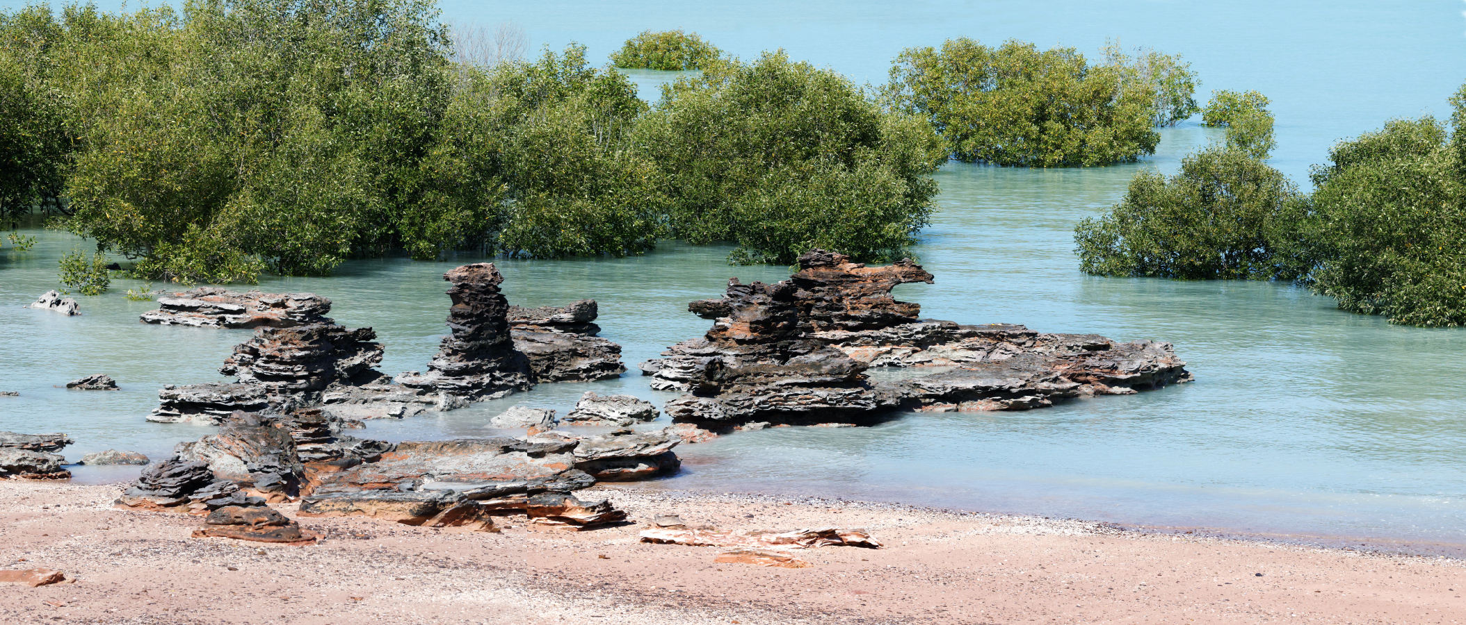
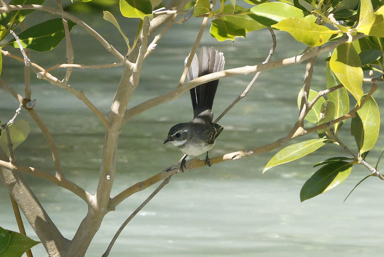
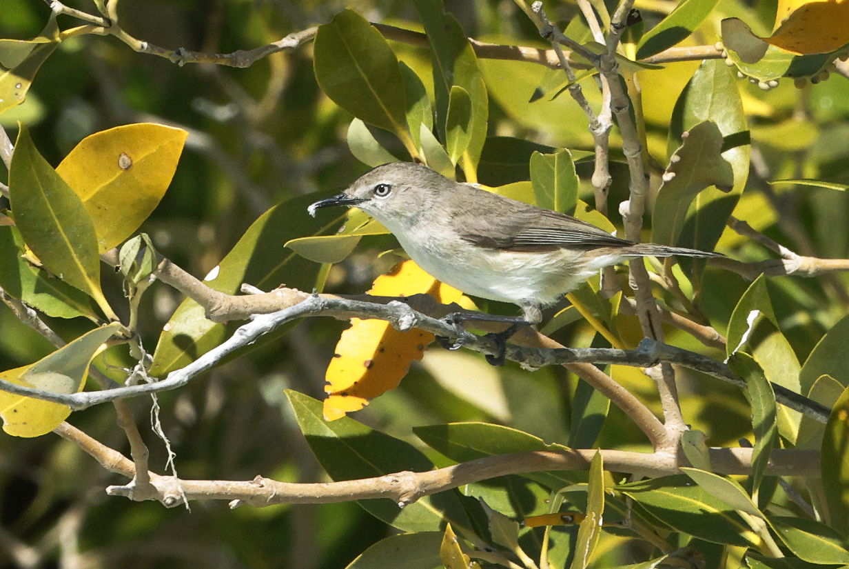
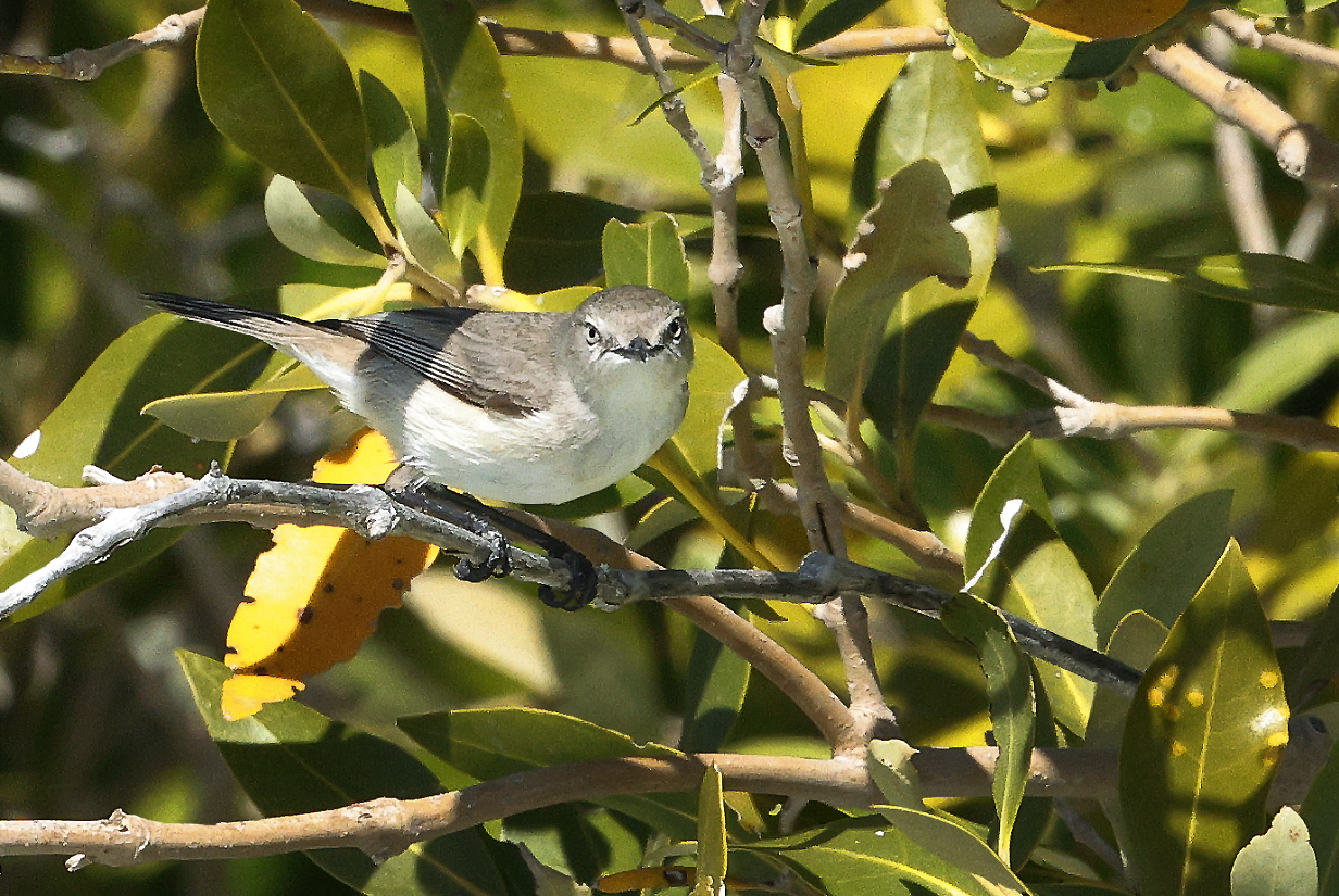
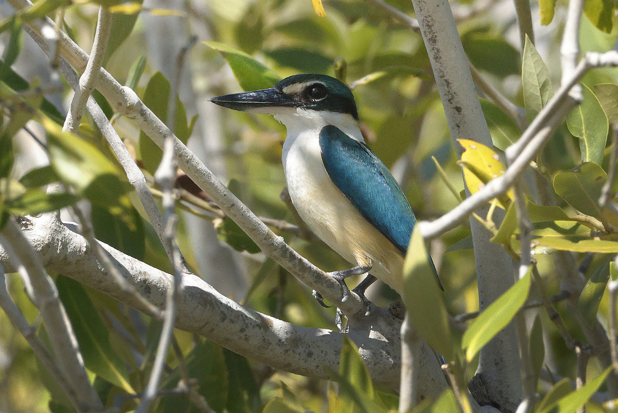
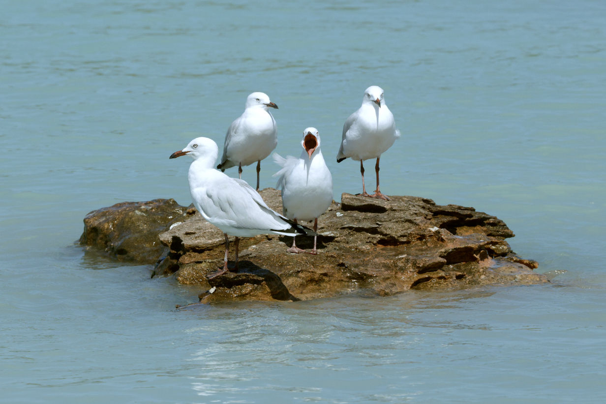
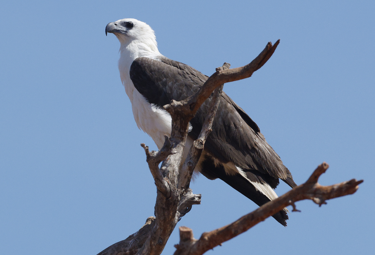
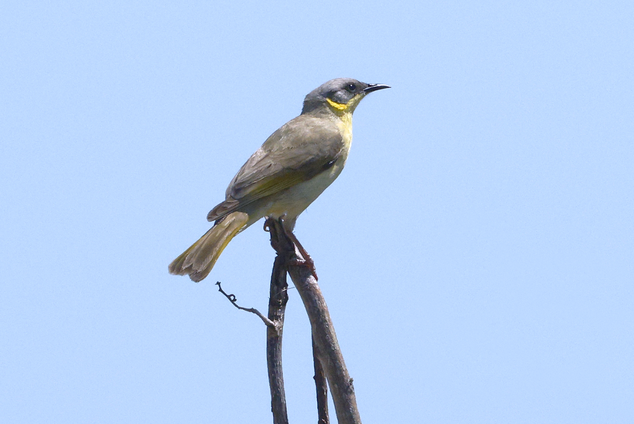
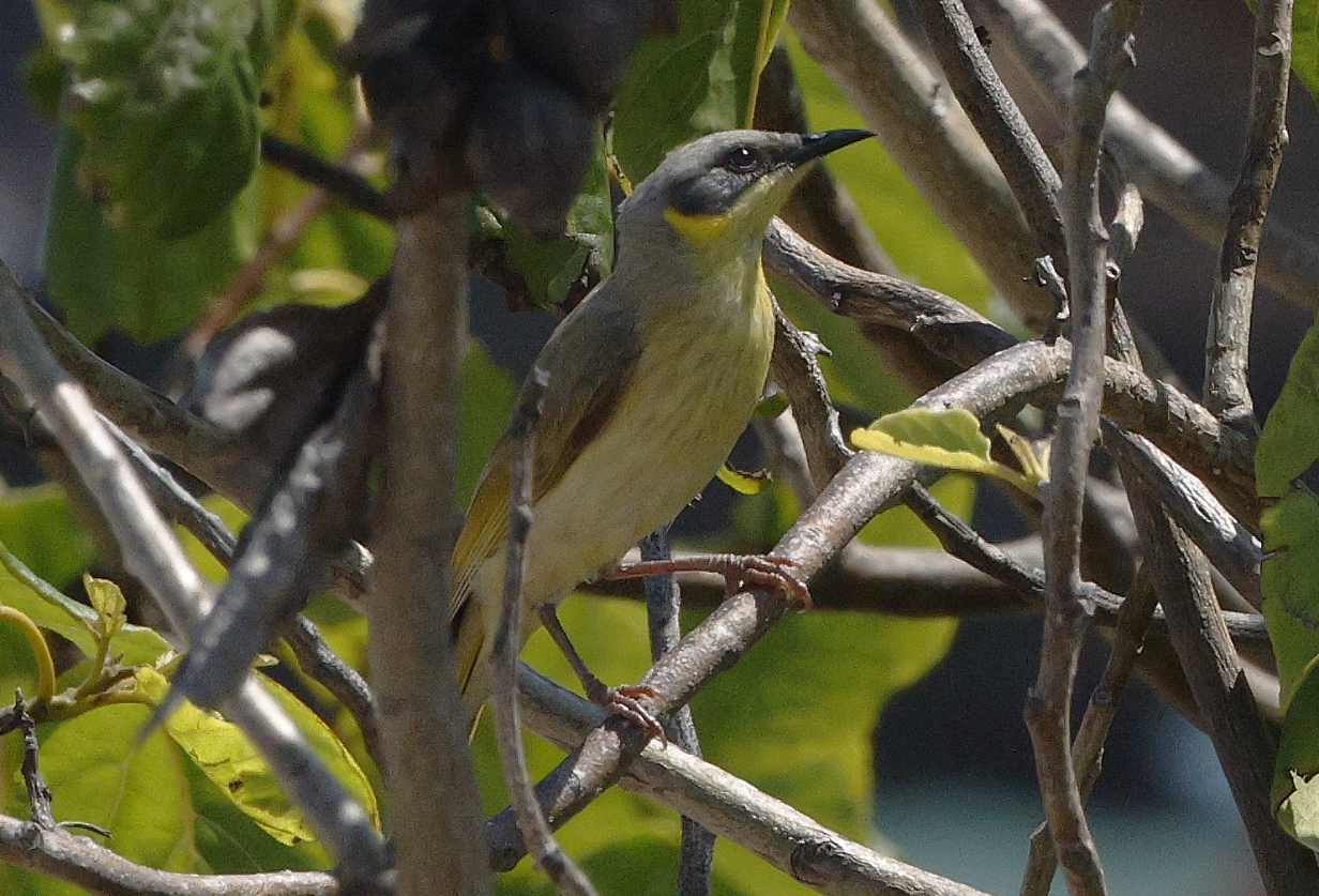
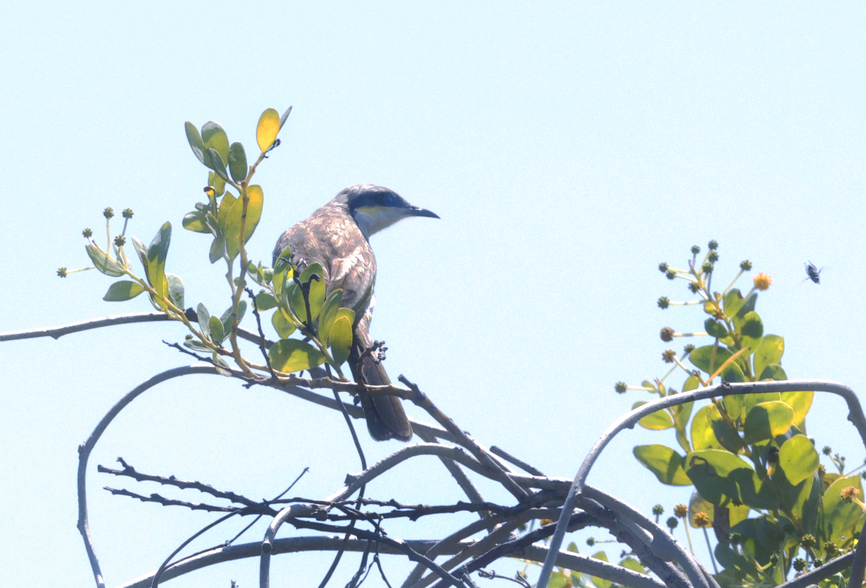
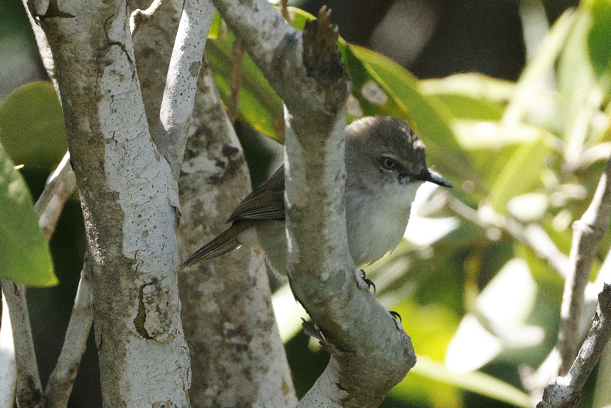
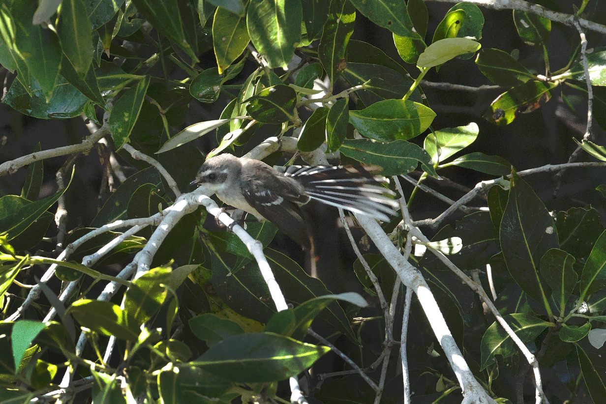
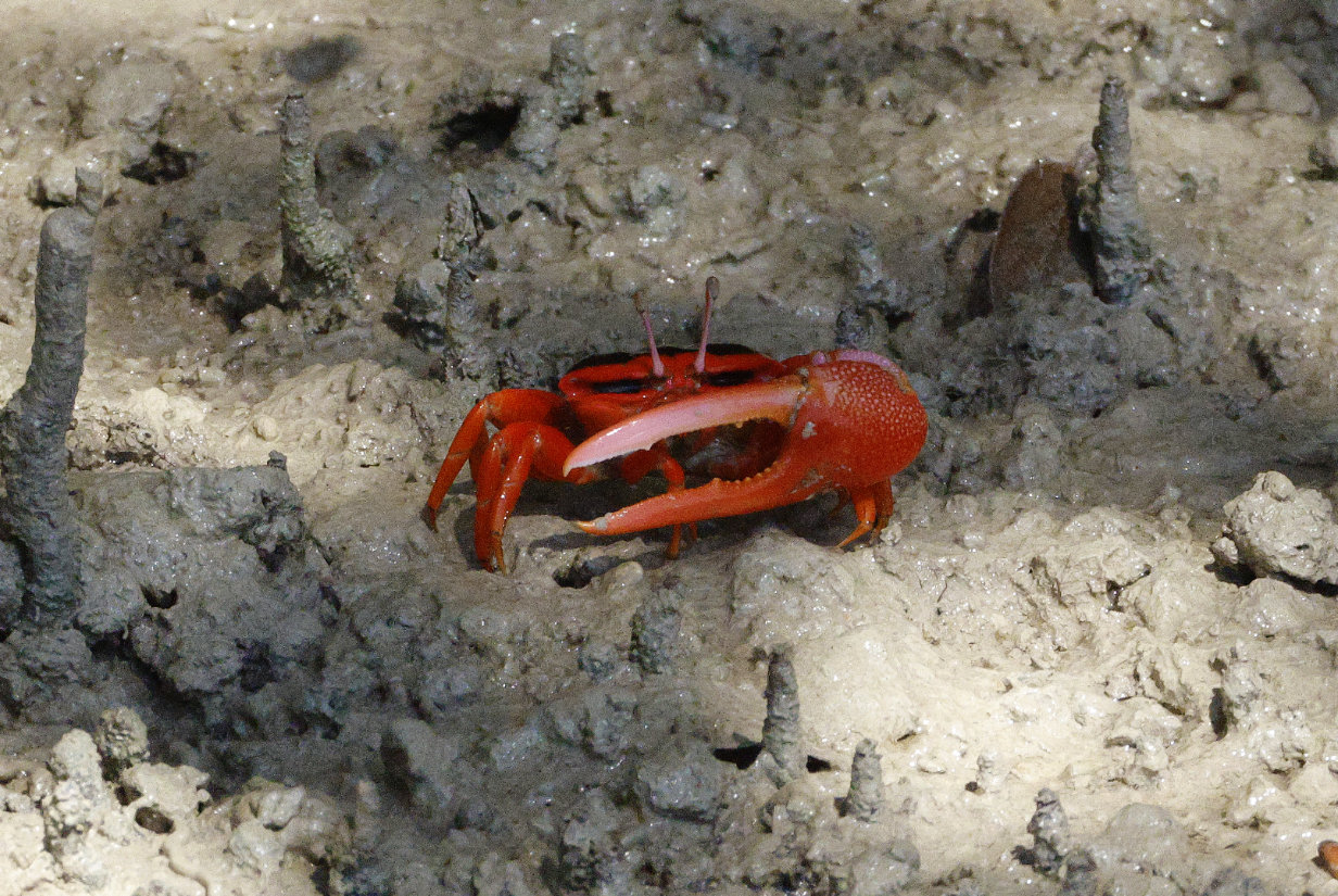
August 29, 2025: Second Mitchell Falls helicopter tour from Hunter River
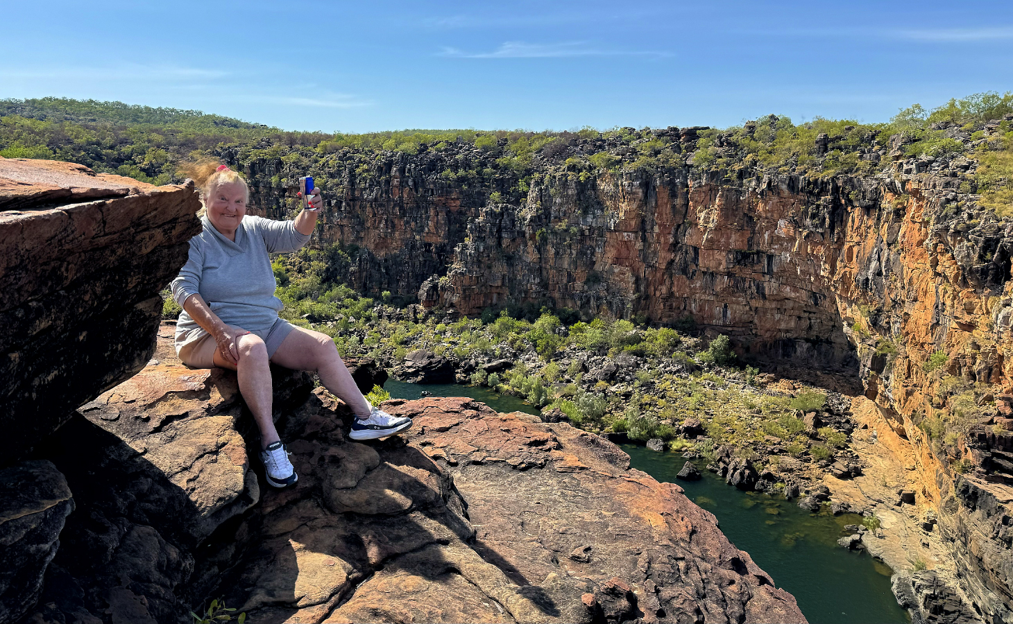
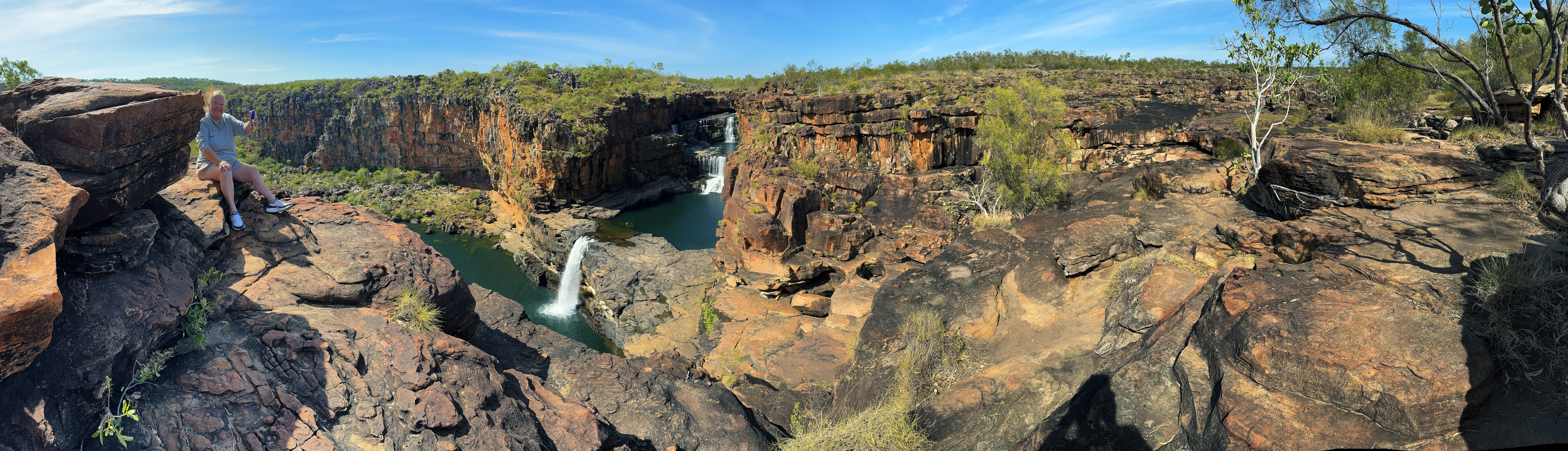


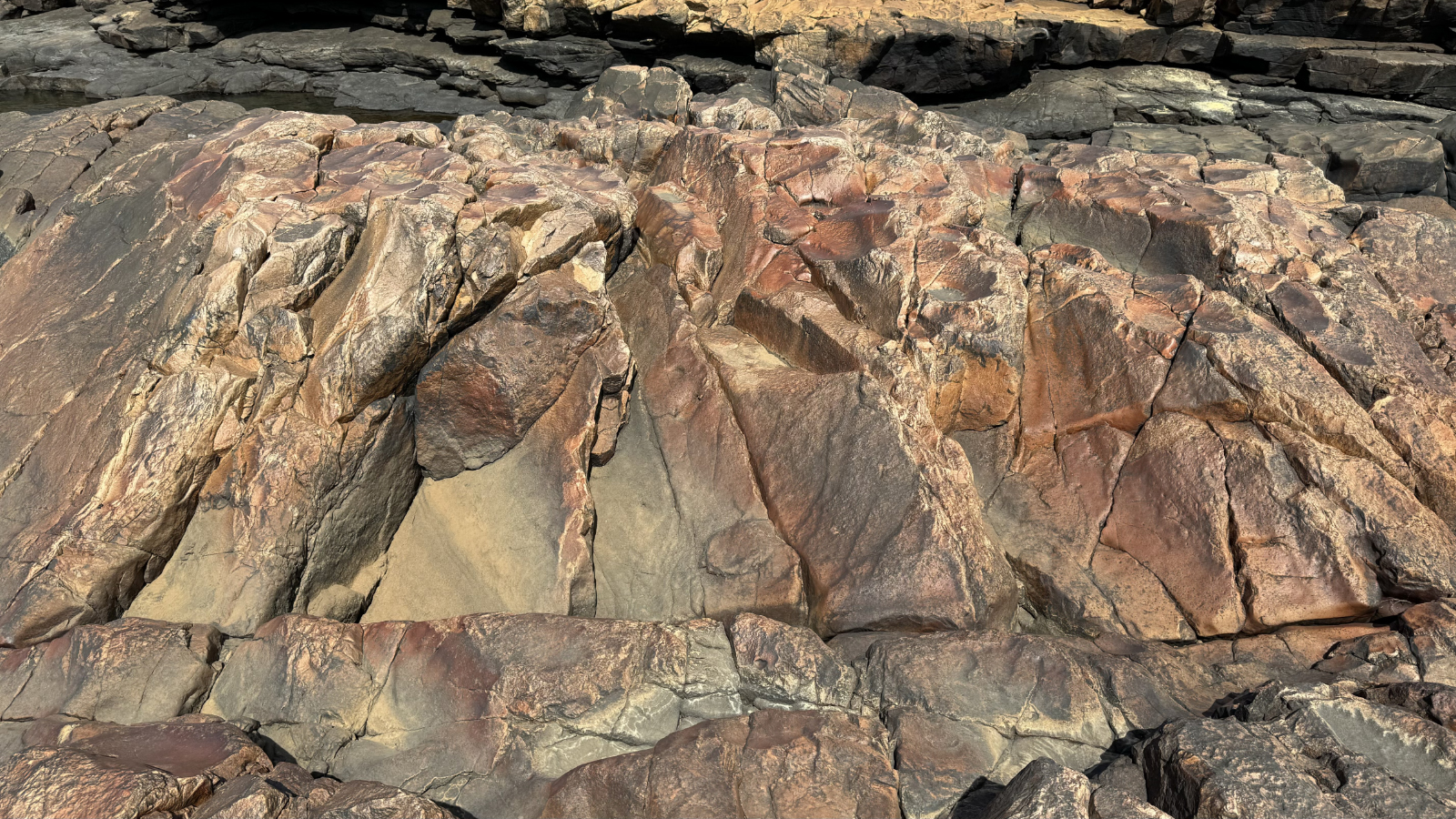
August 31, 2025: Ashmore Reef Zodiac Cruise Redux
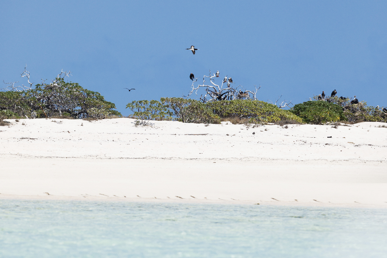

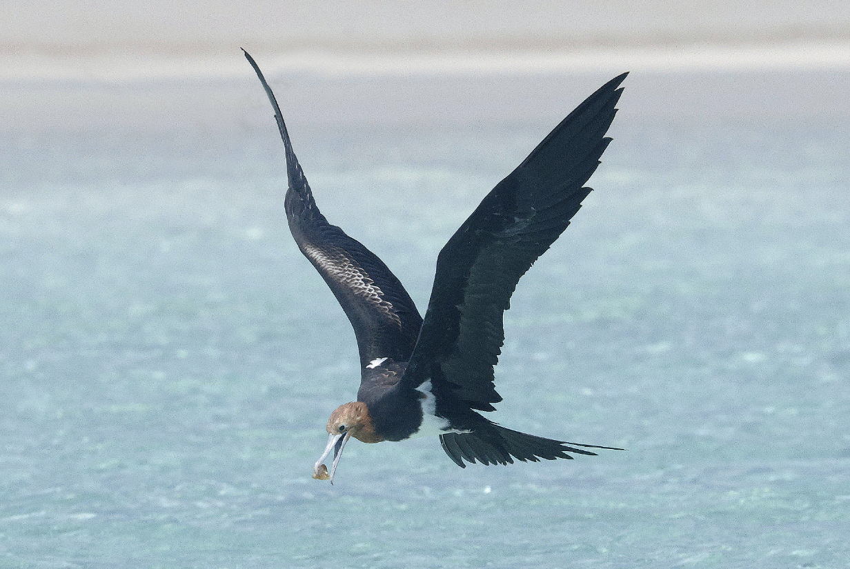
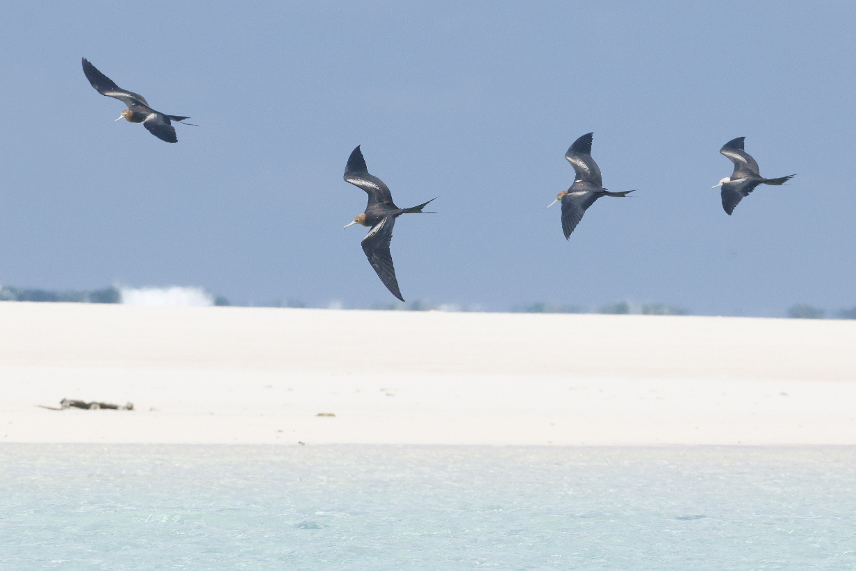
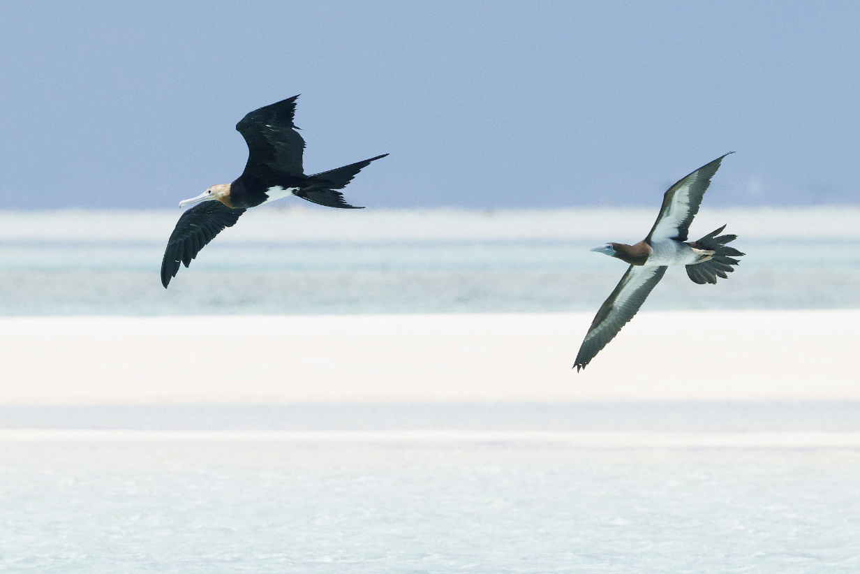
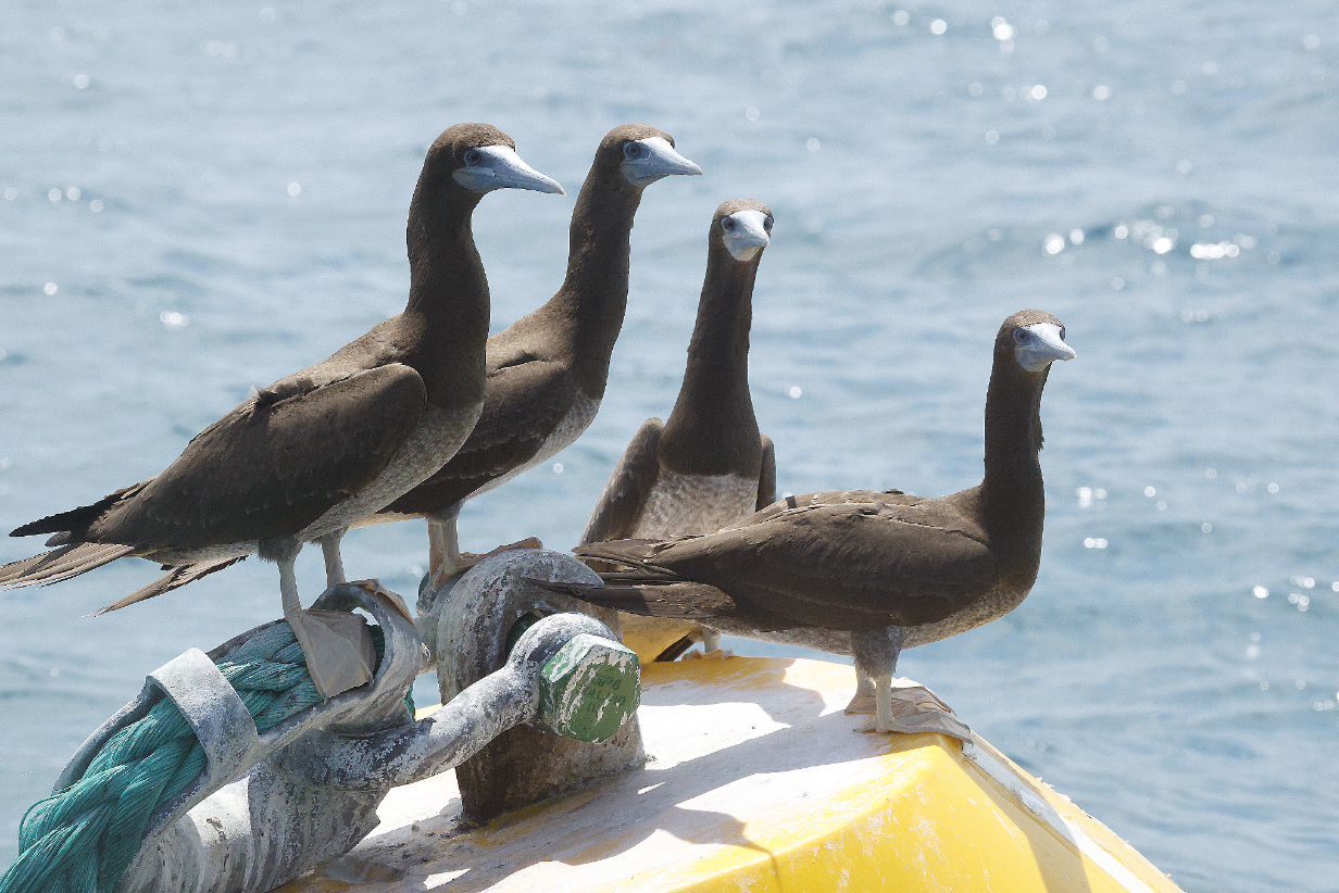
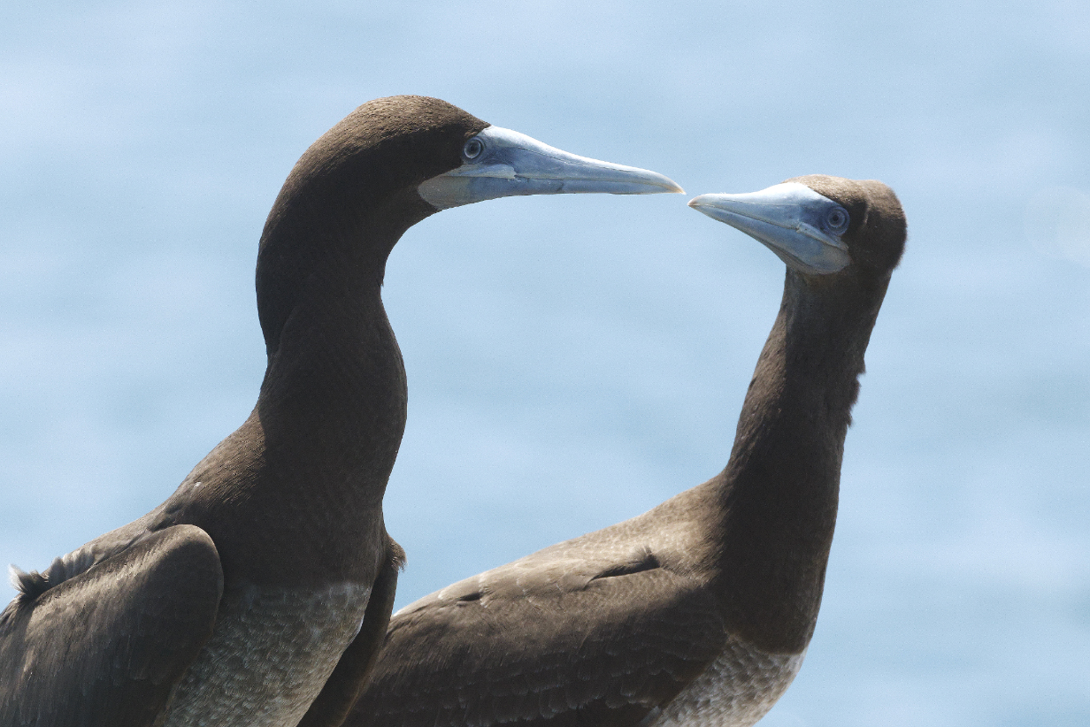
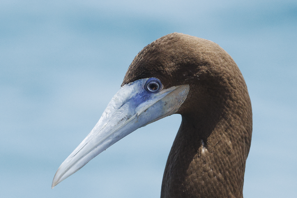
September 2, 2025: King George River Zodiac Cruise Redux
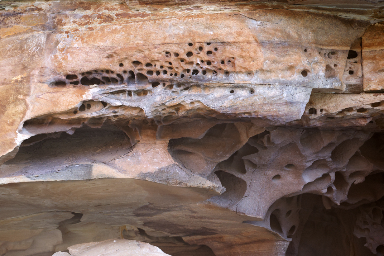
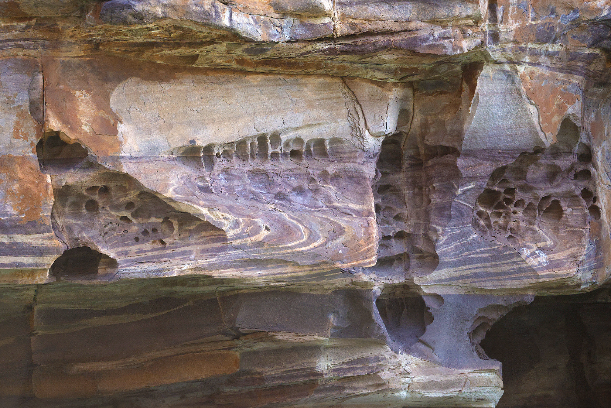
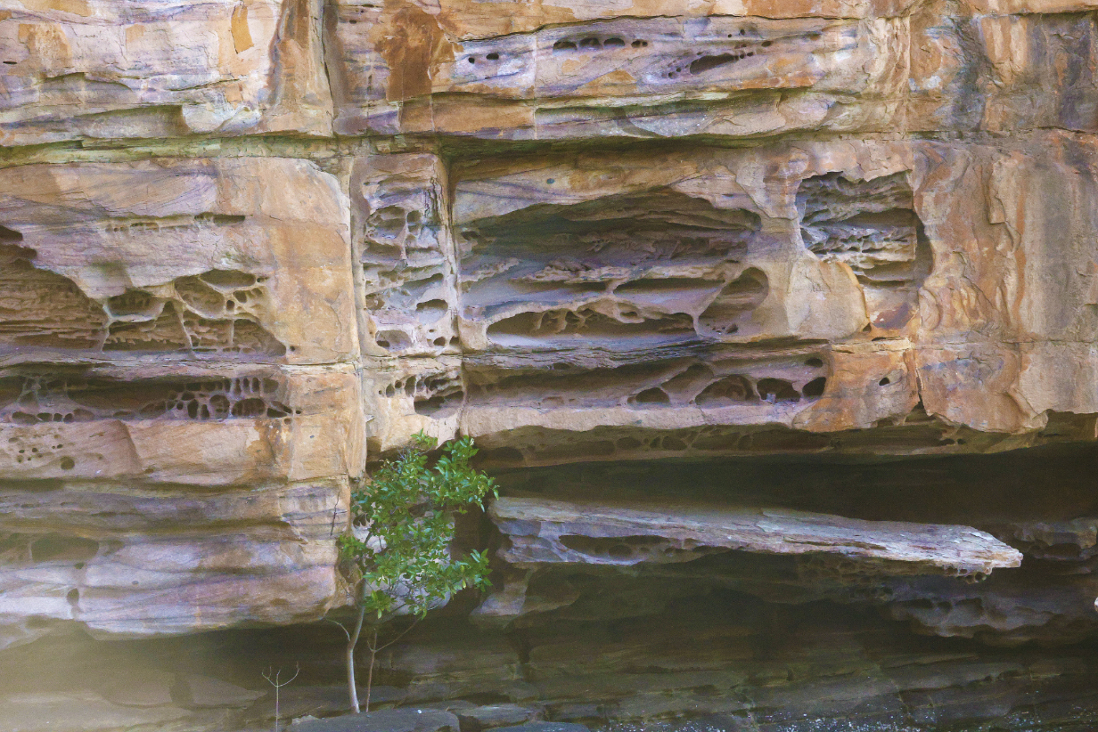
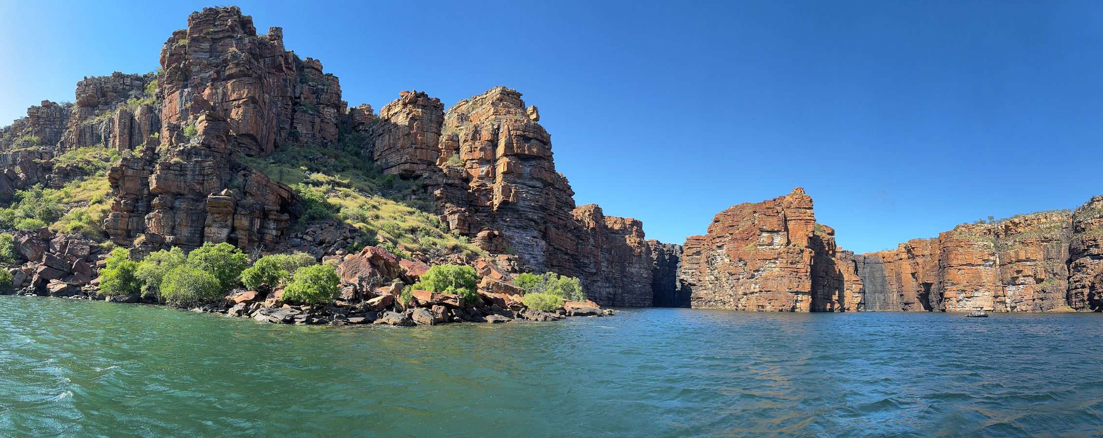
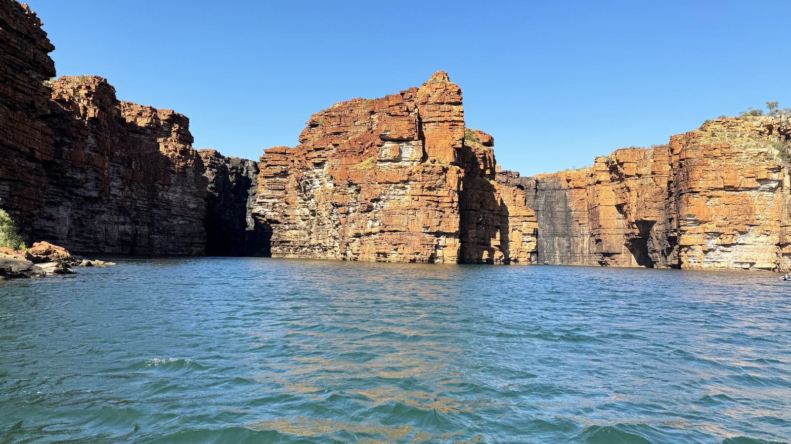
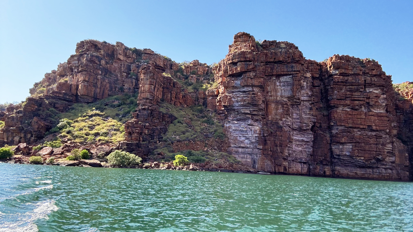
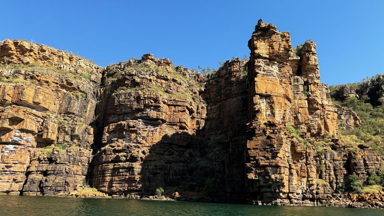
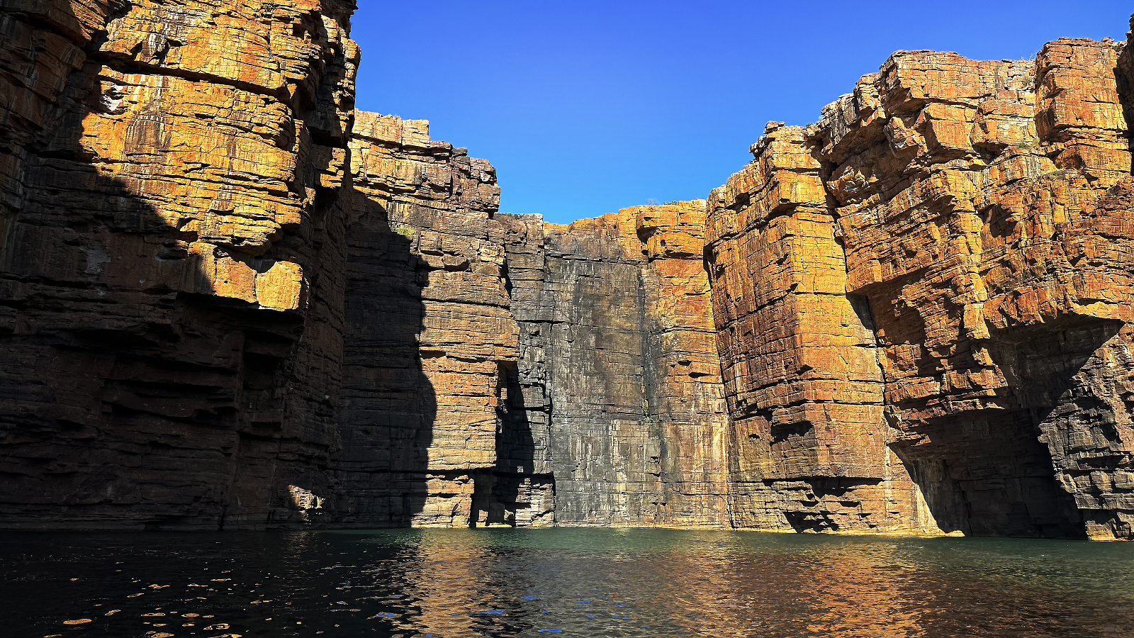
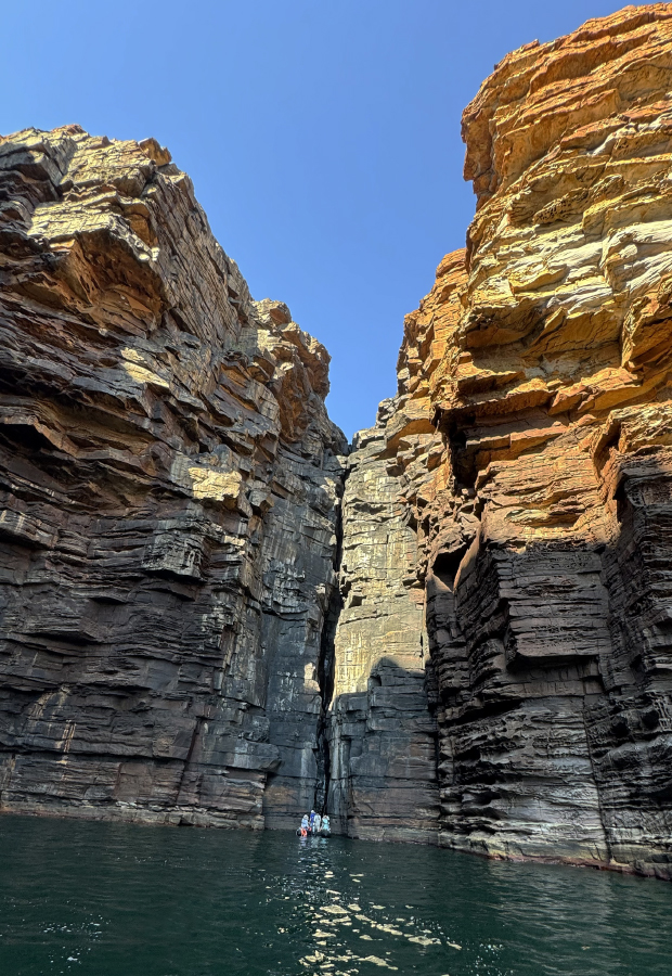

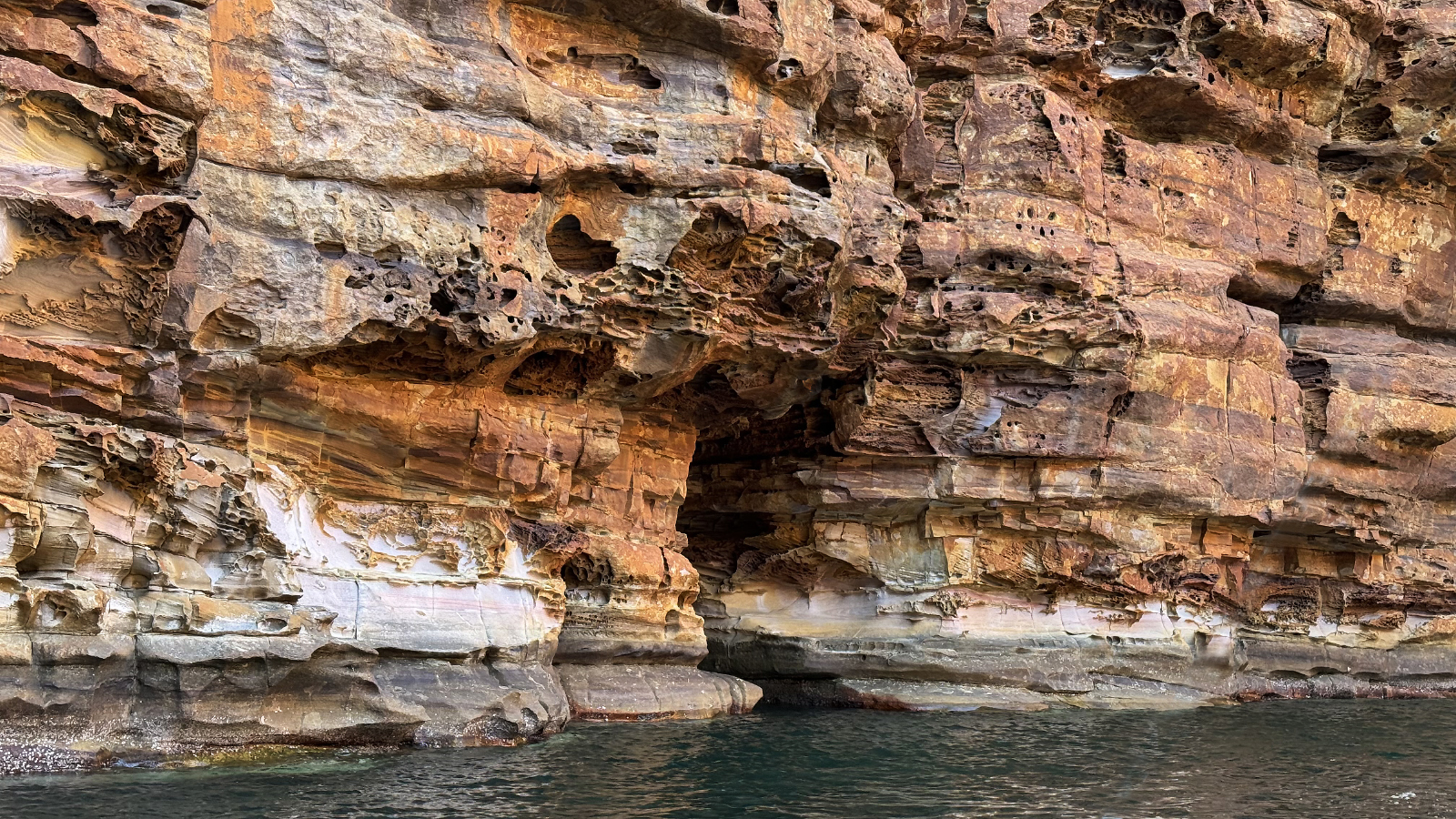
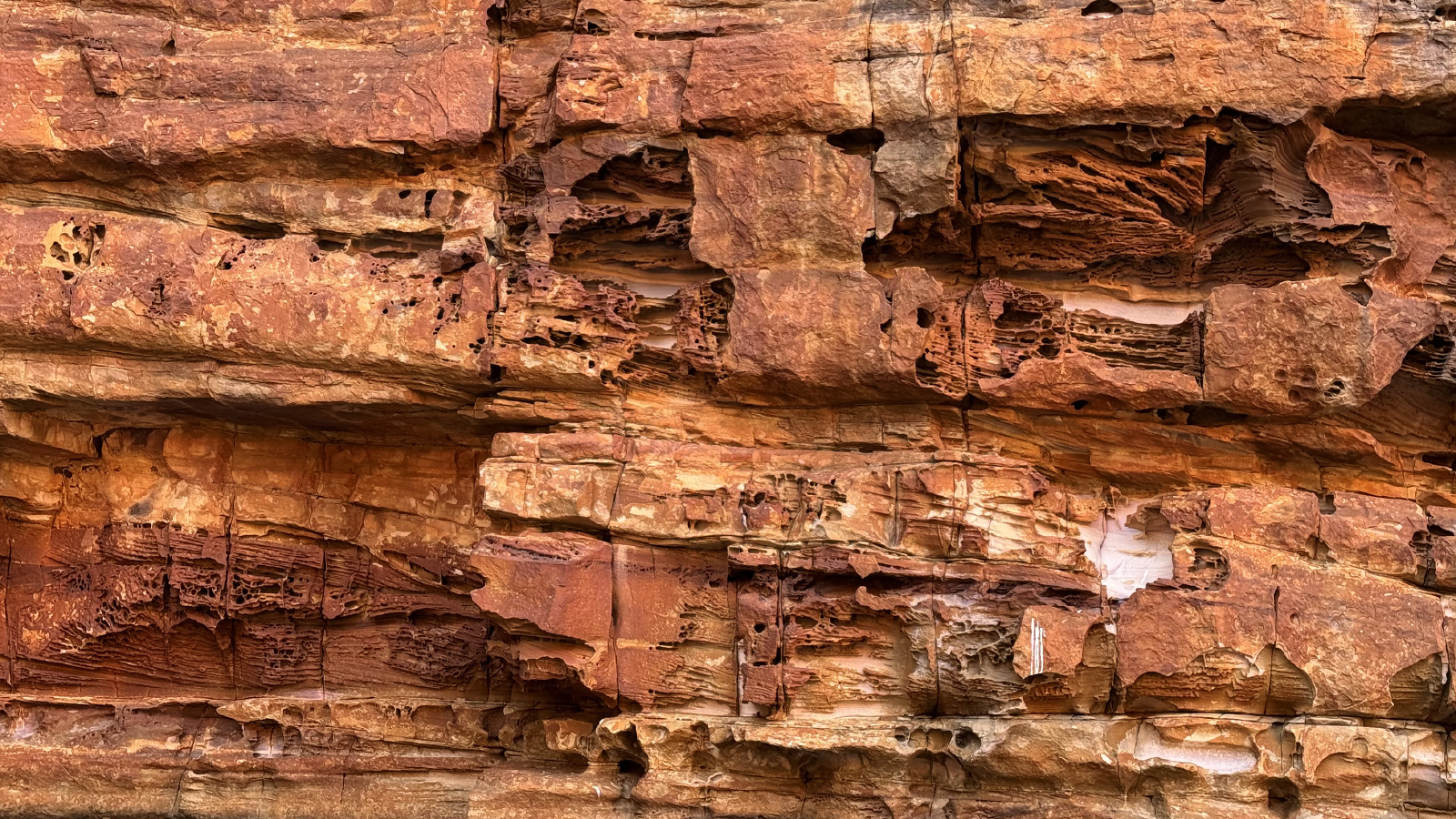
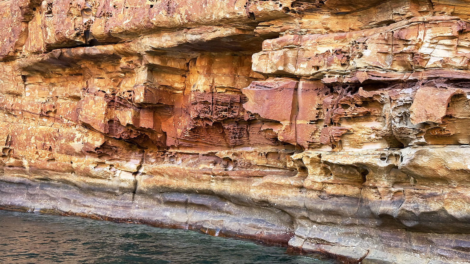
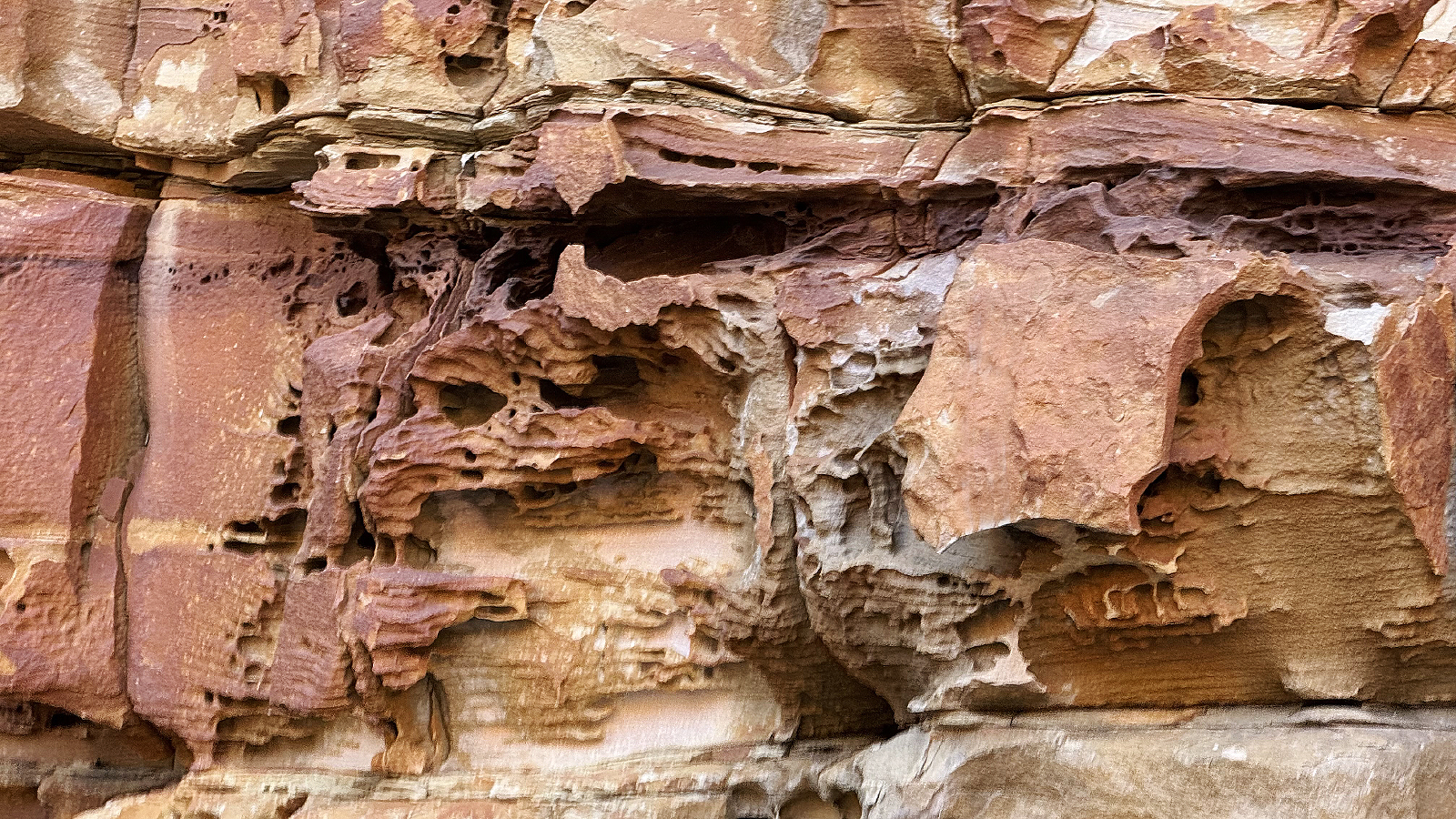
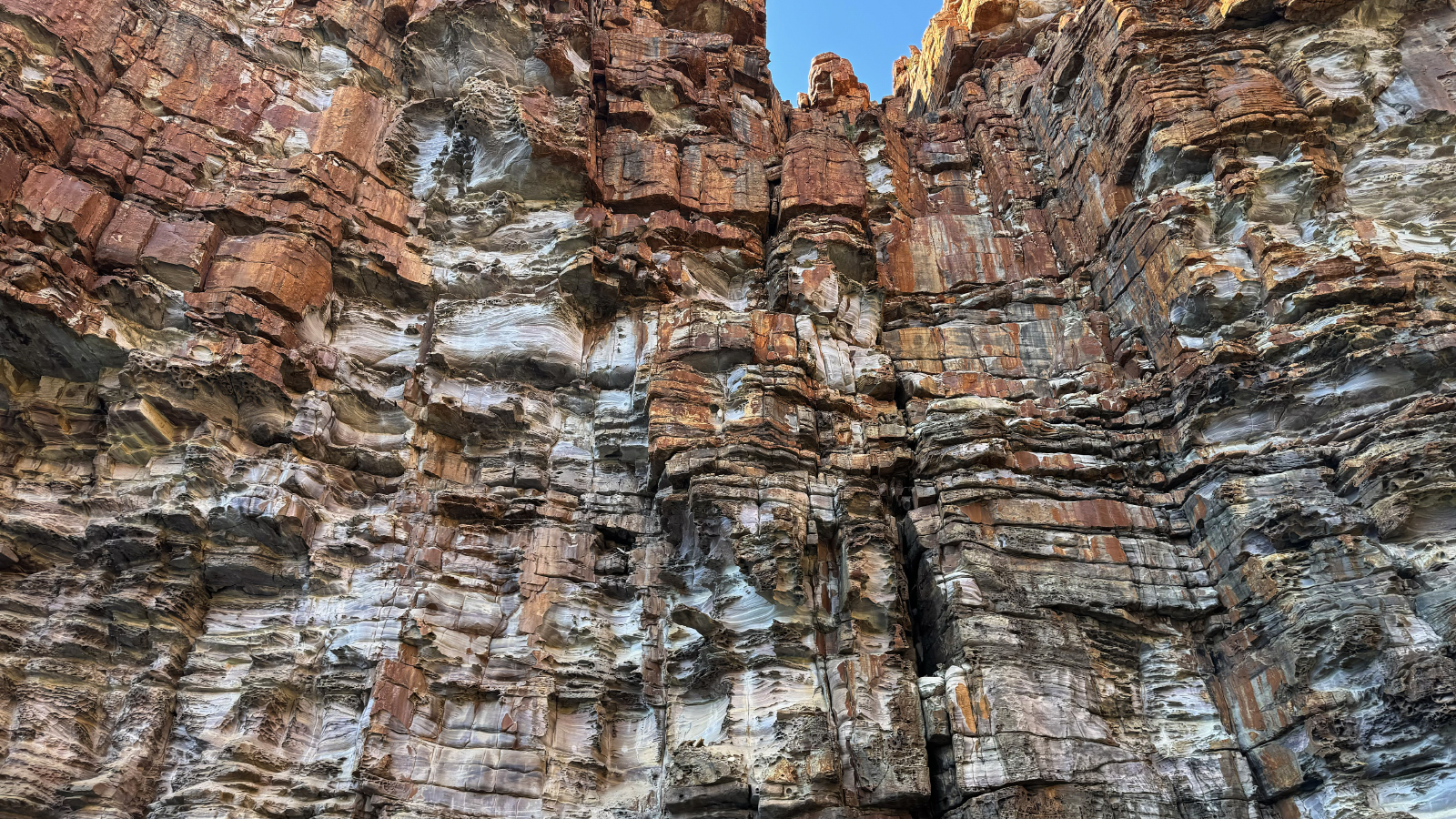
September 3, 2025: Darwin
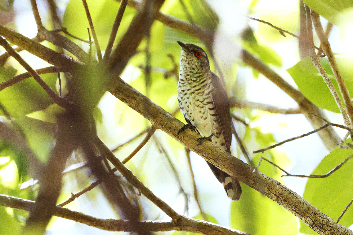
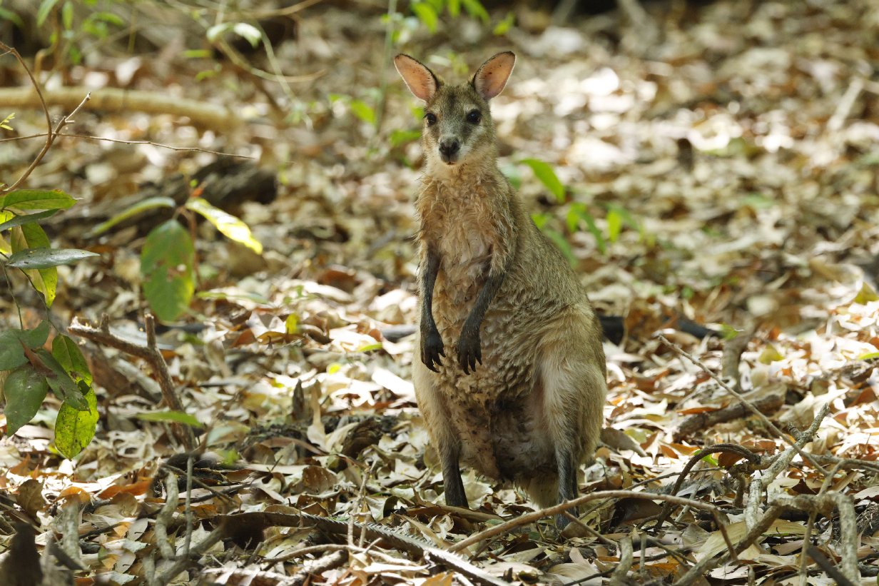
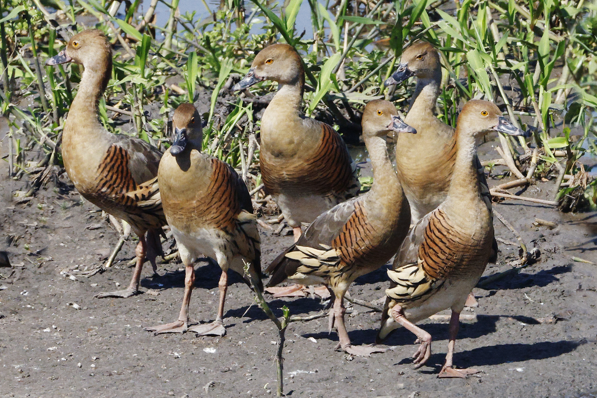
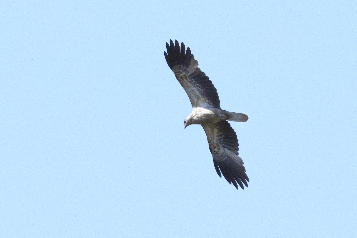
September 7, 2025: Agats, West Papua: Visit to an Asmat village
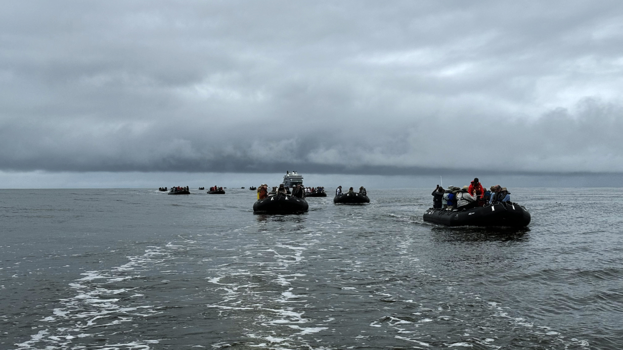
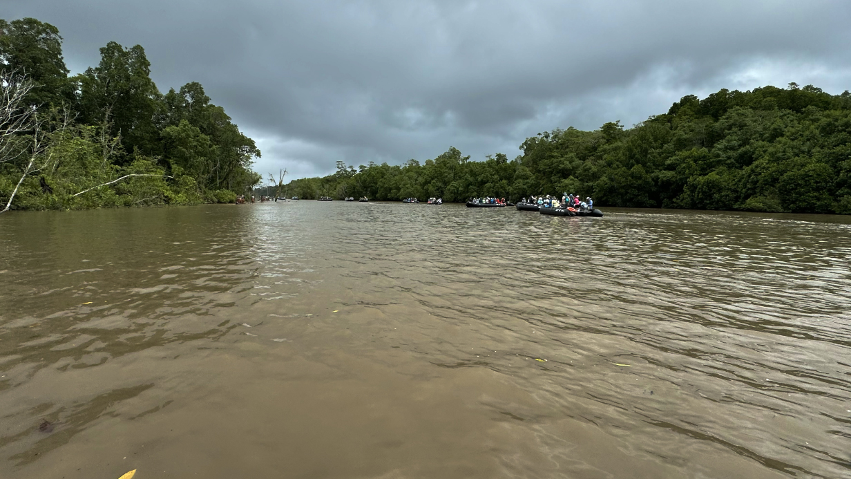
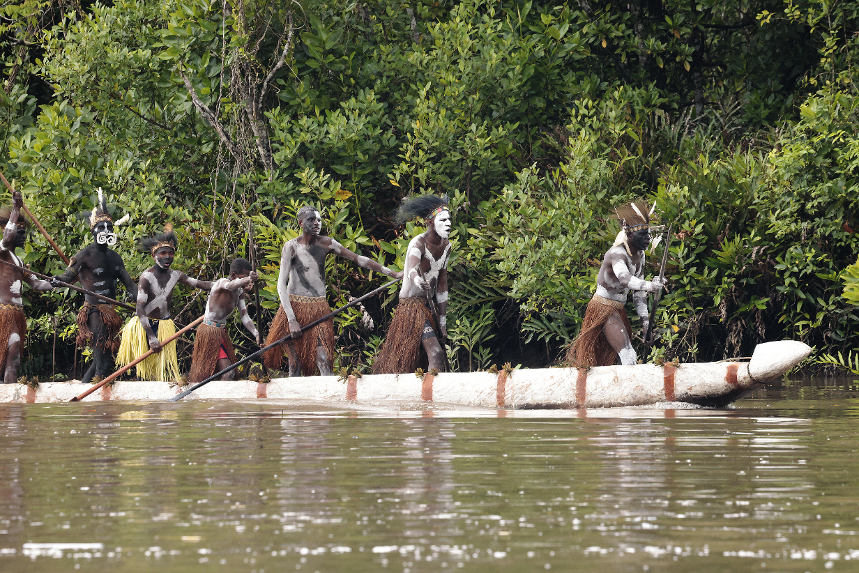
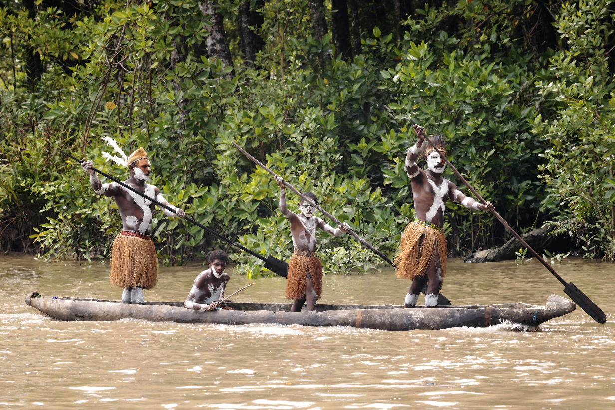
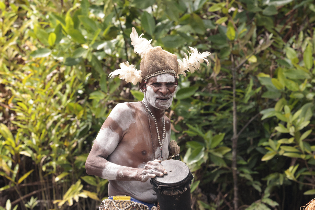
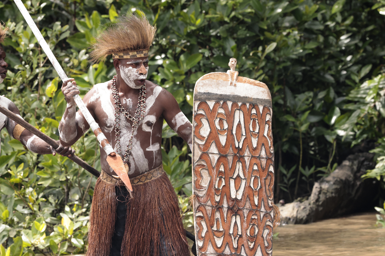
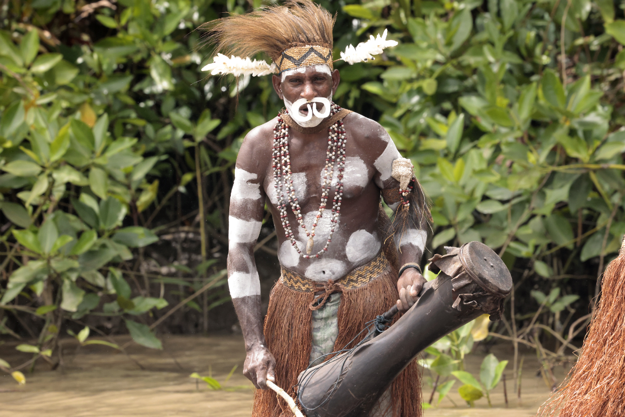
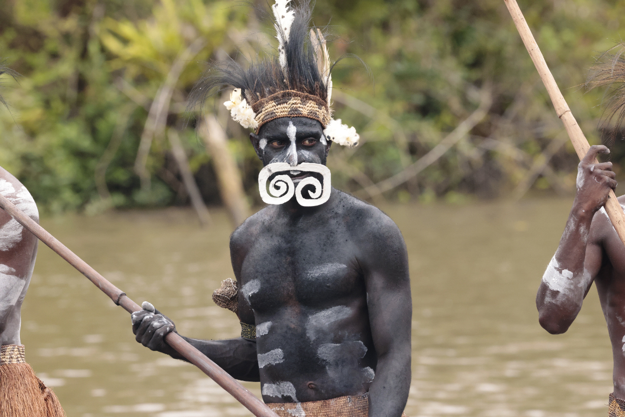
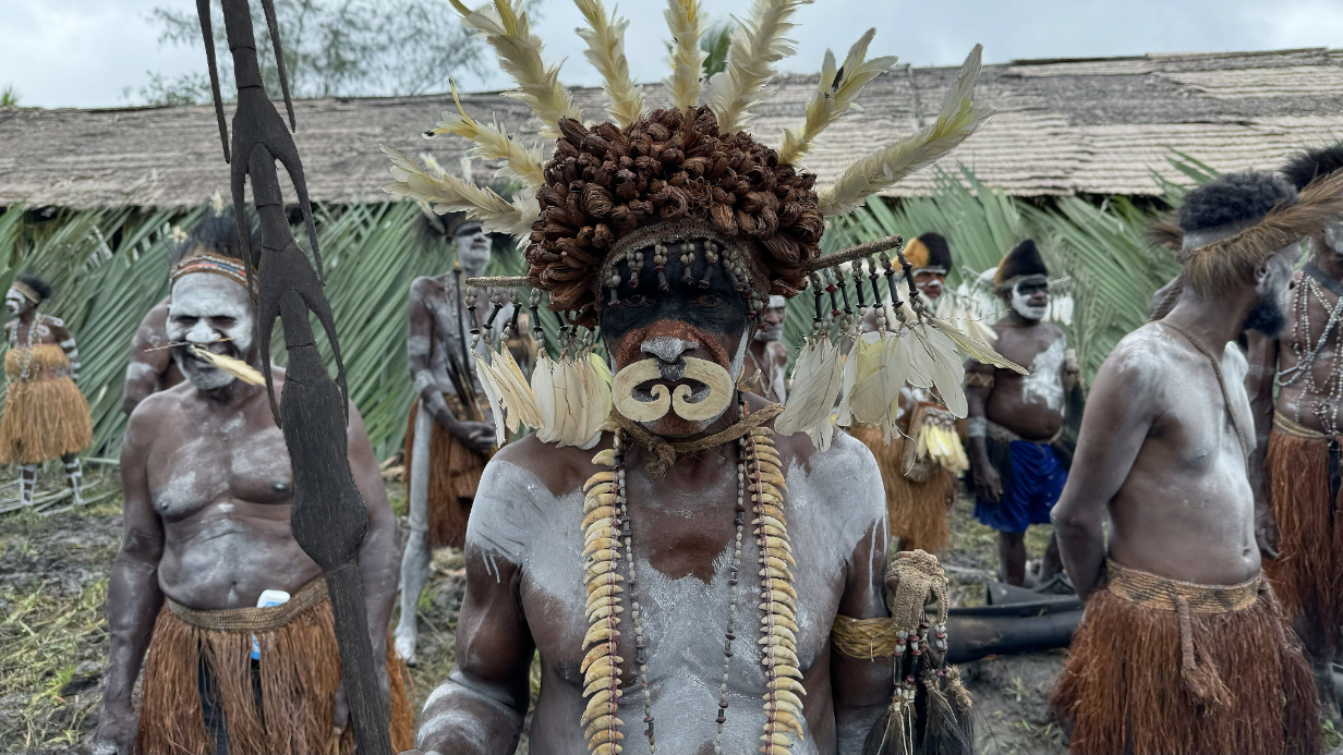
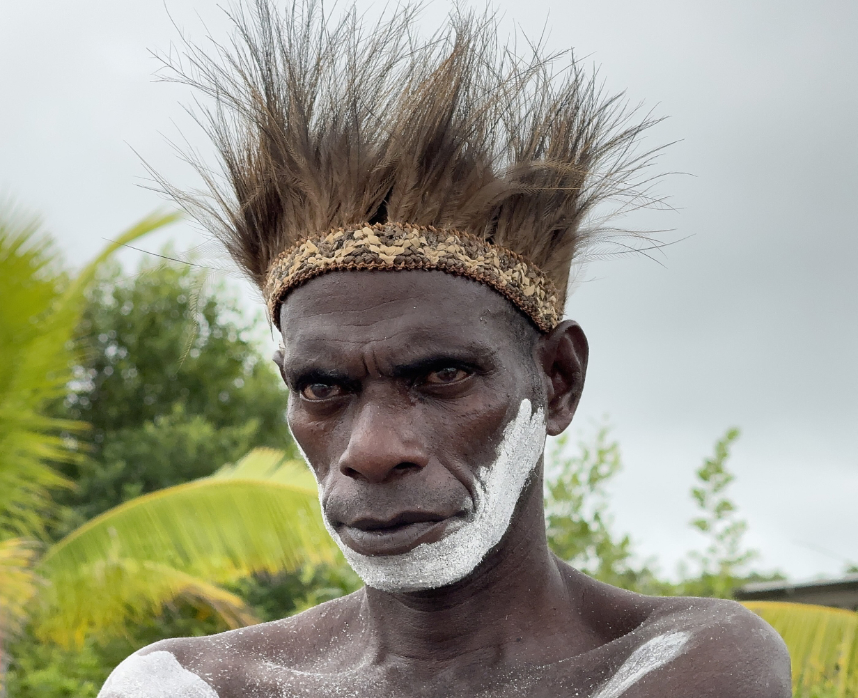
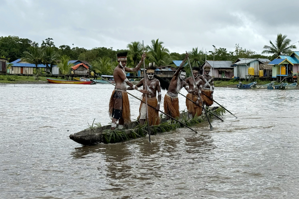
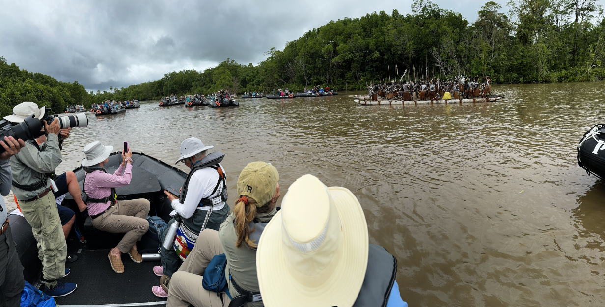
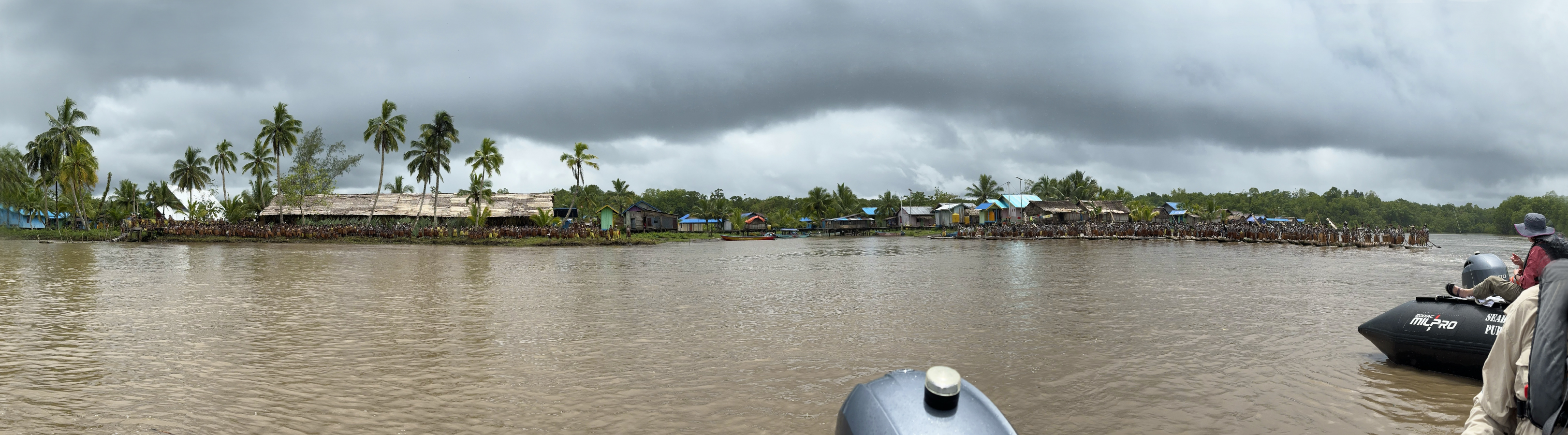
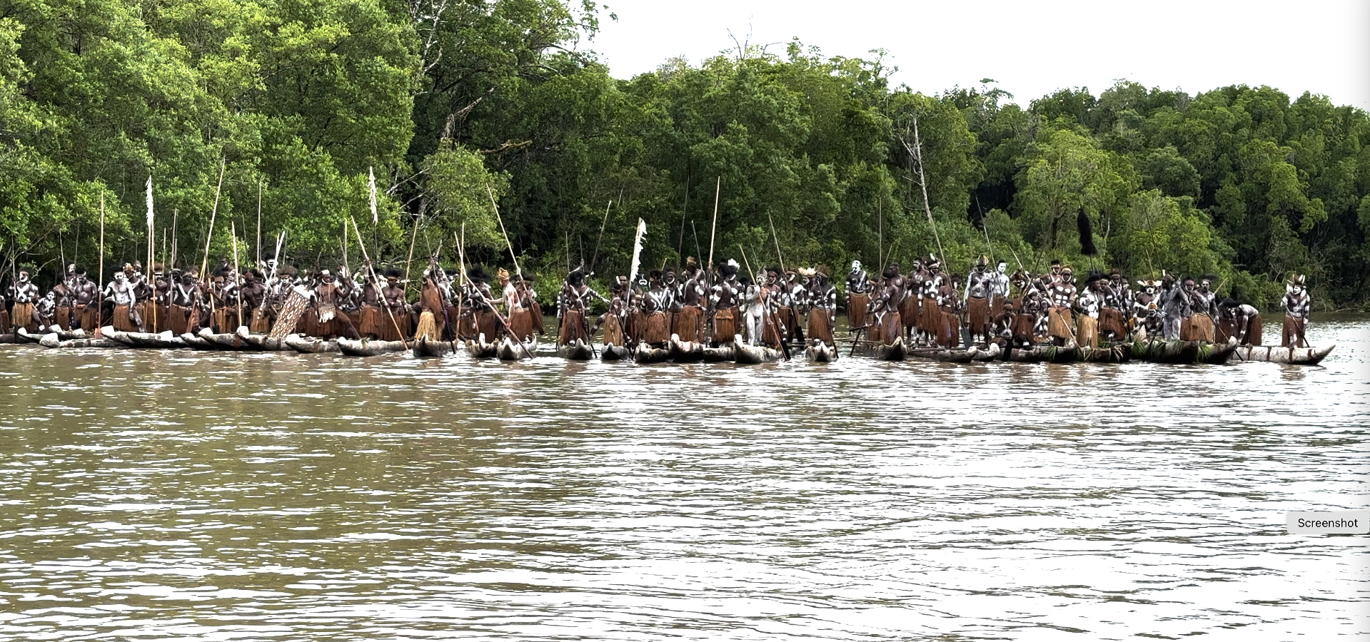
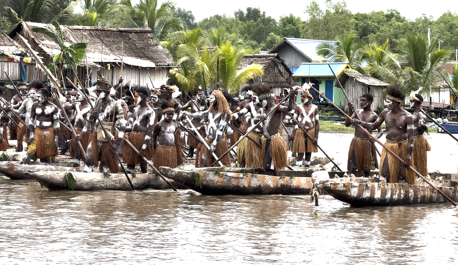
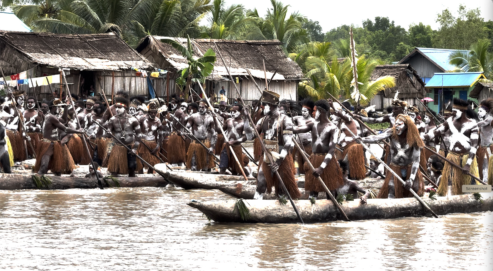
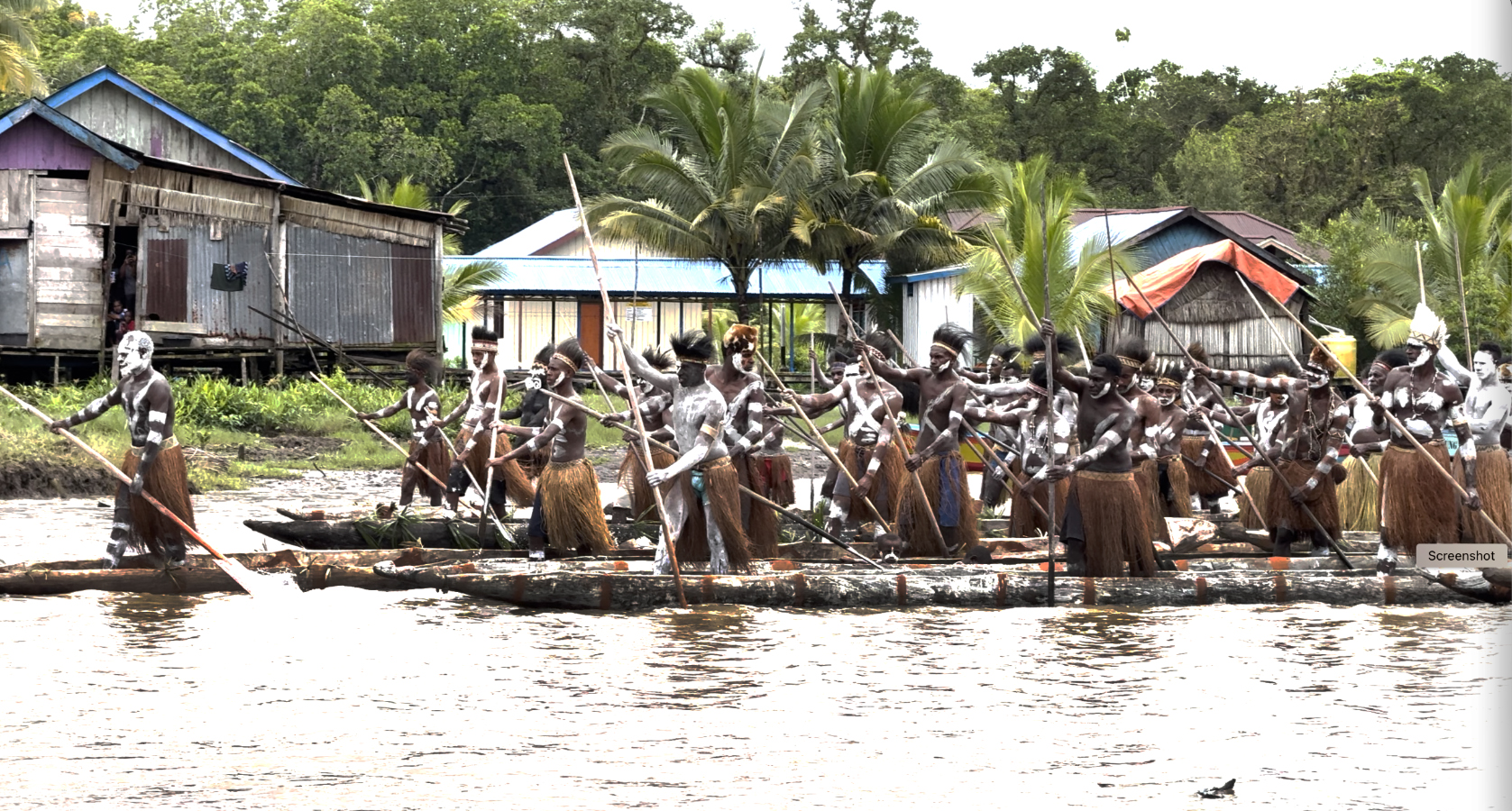
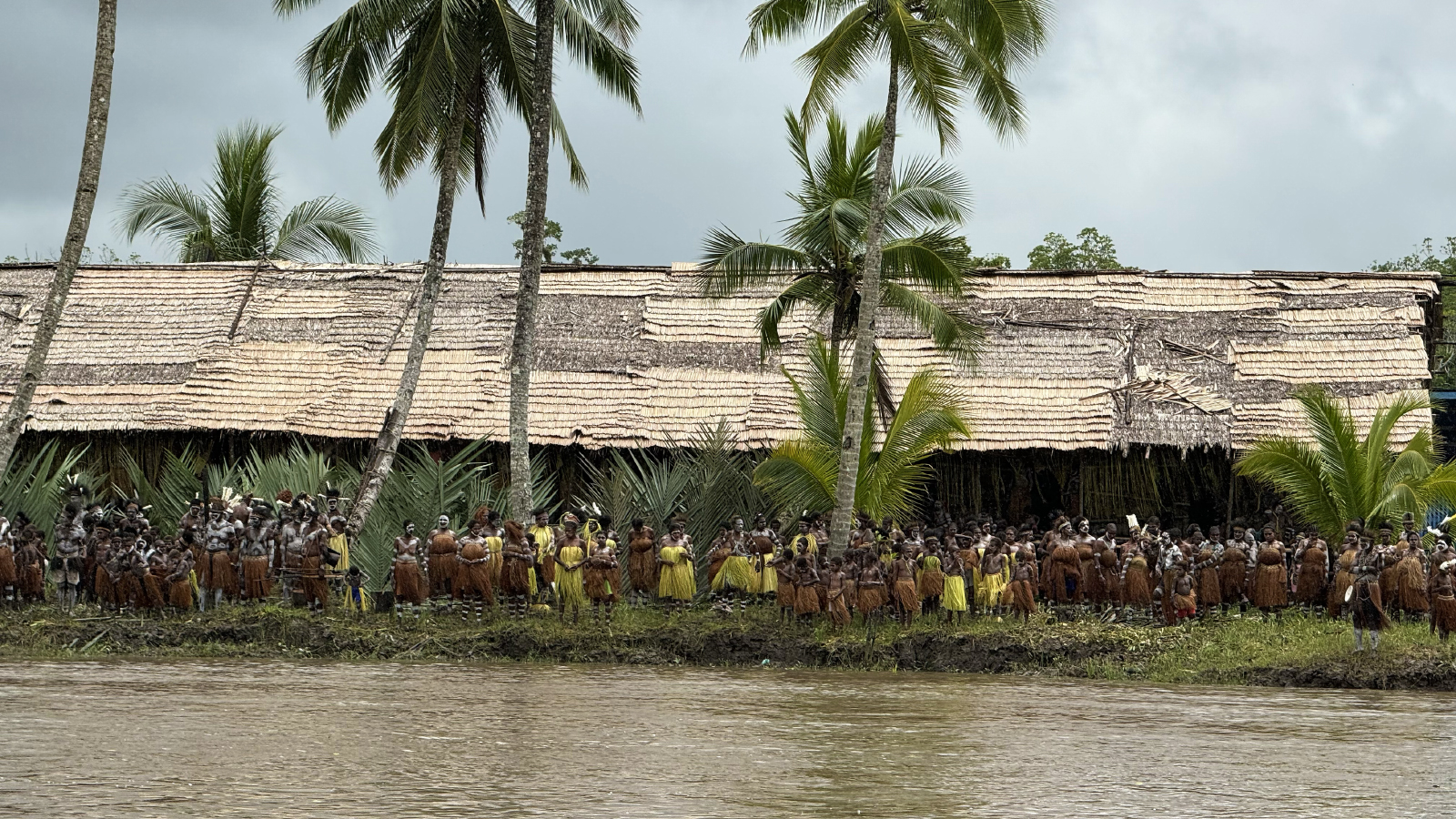
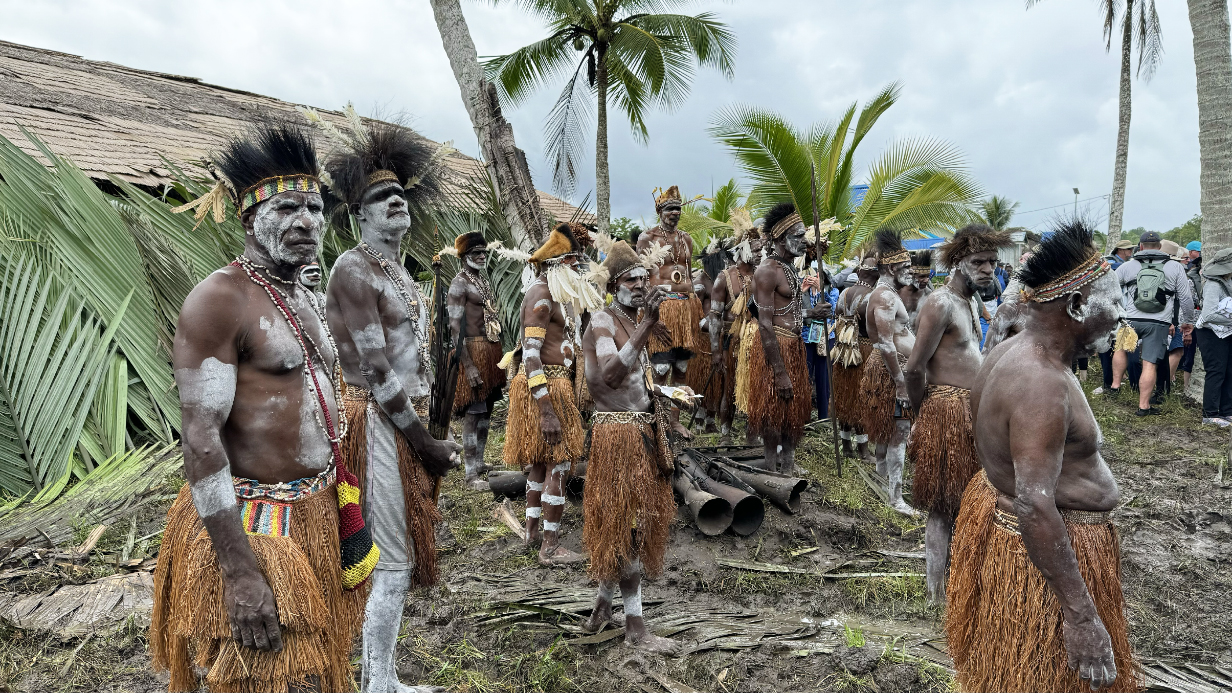
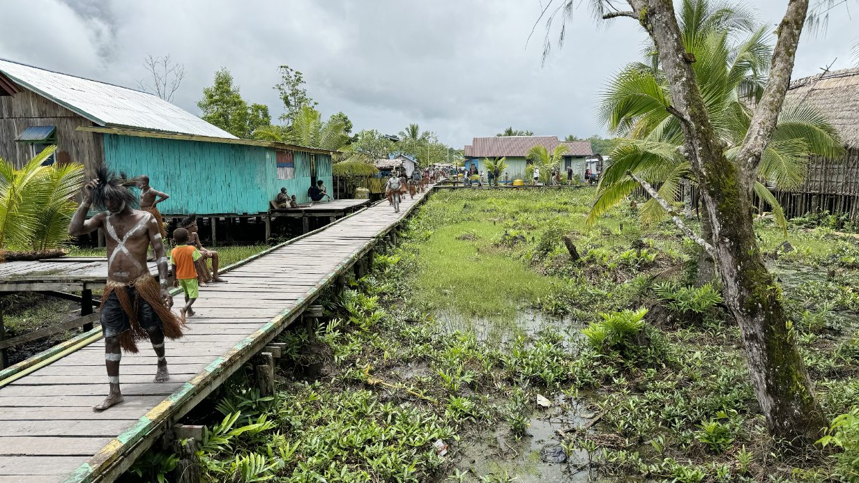
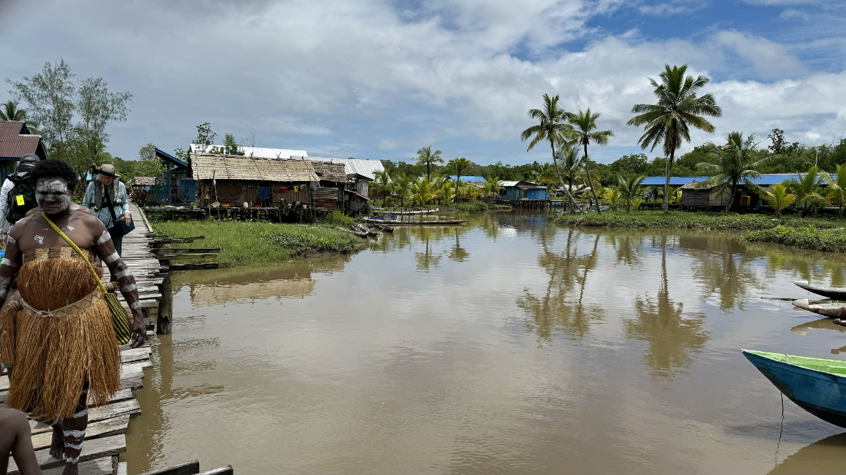
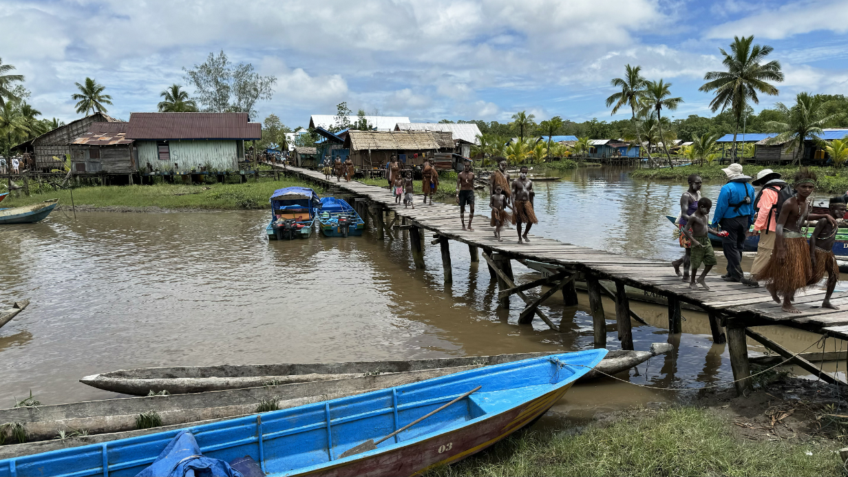
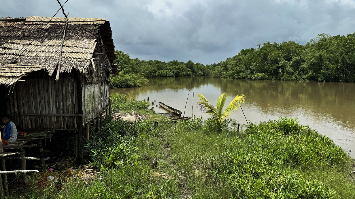
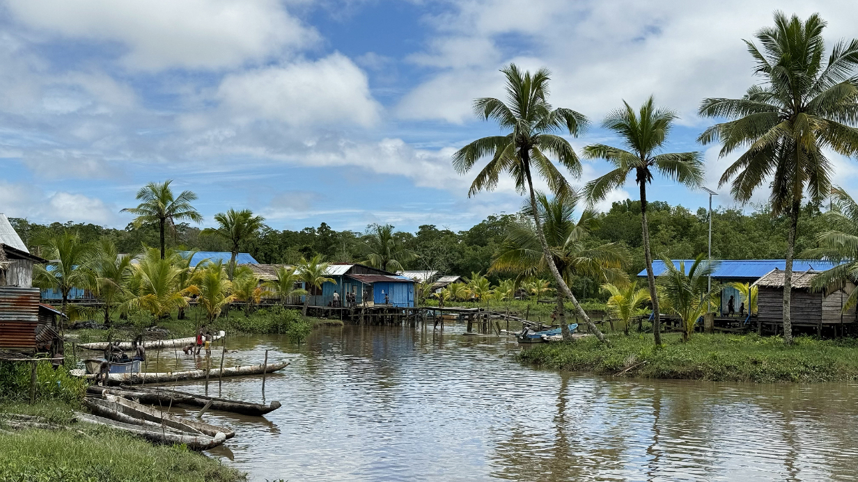
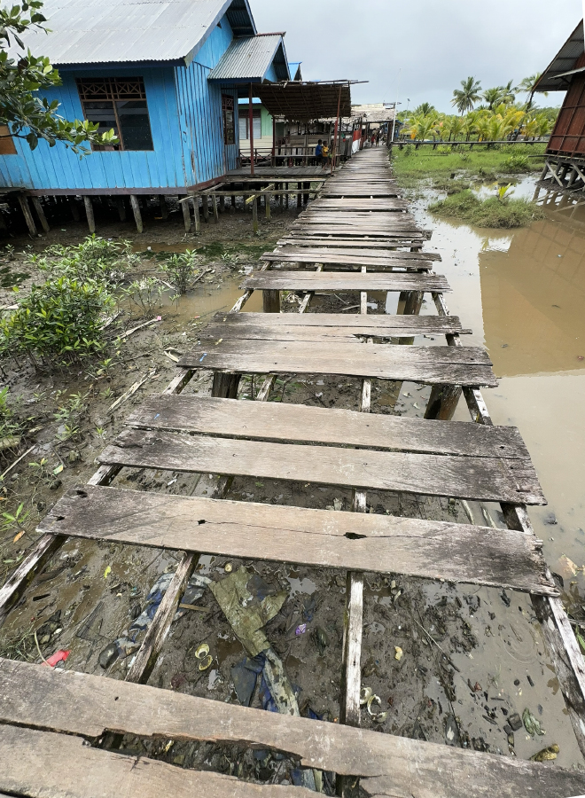
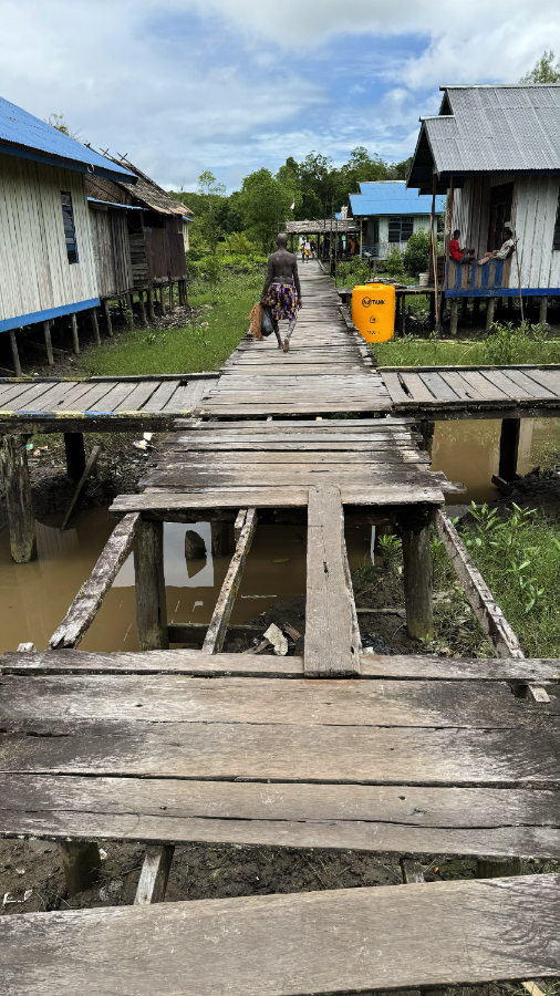
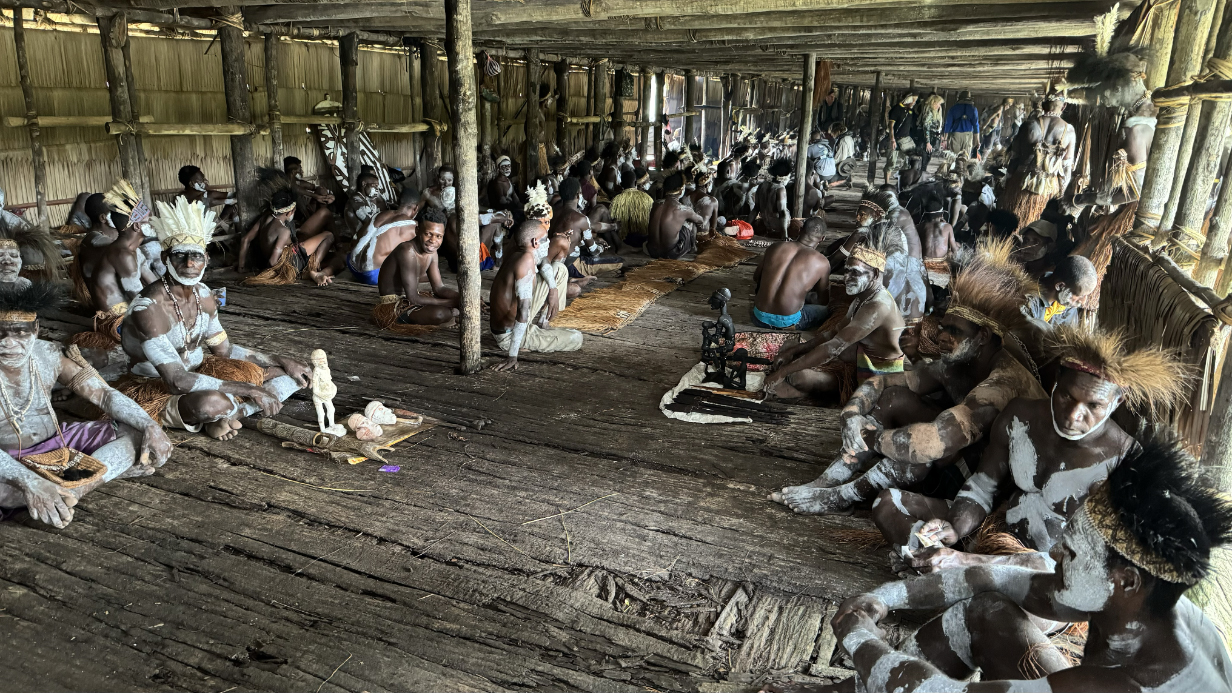
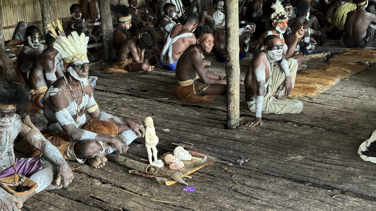
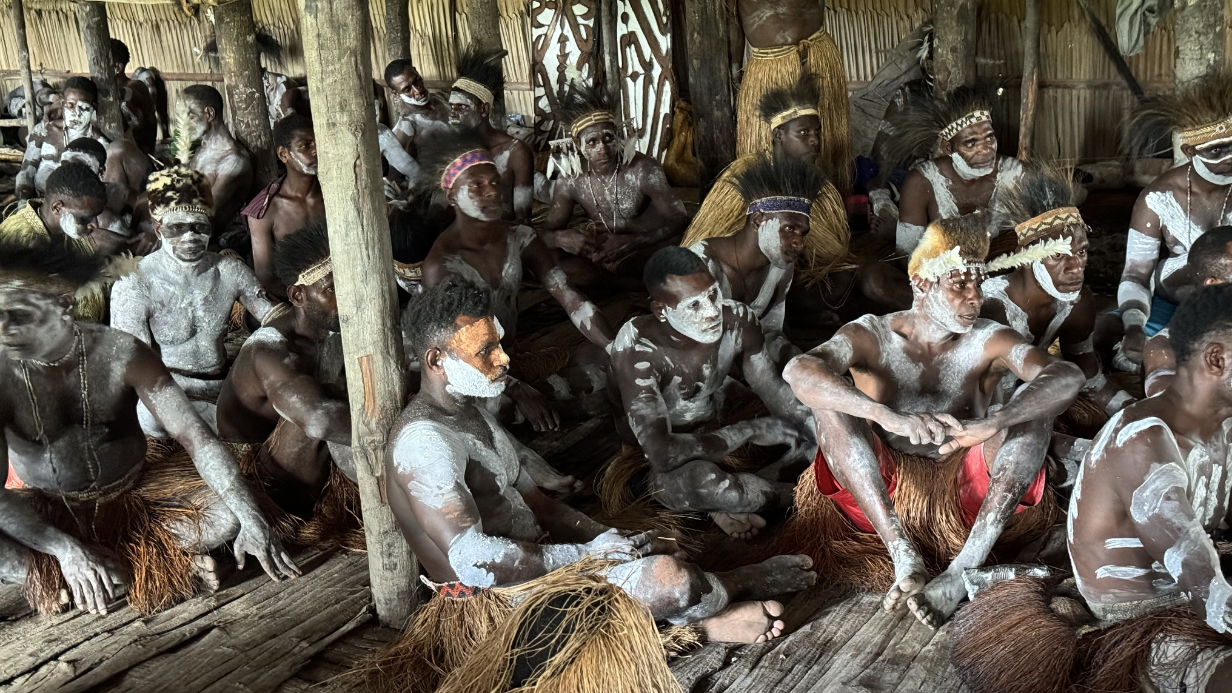
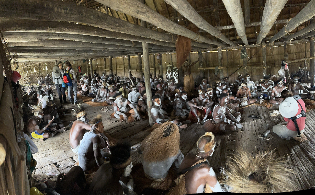
September 9, 2025: Zodiac Cruise in Raja Ampat Archipelago near Kokas, Indonesia
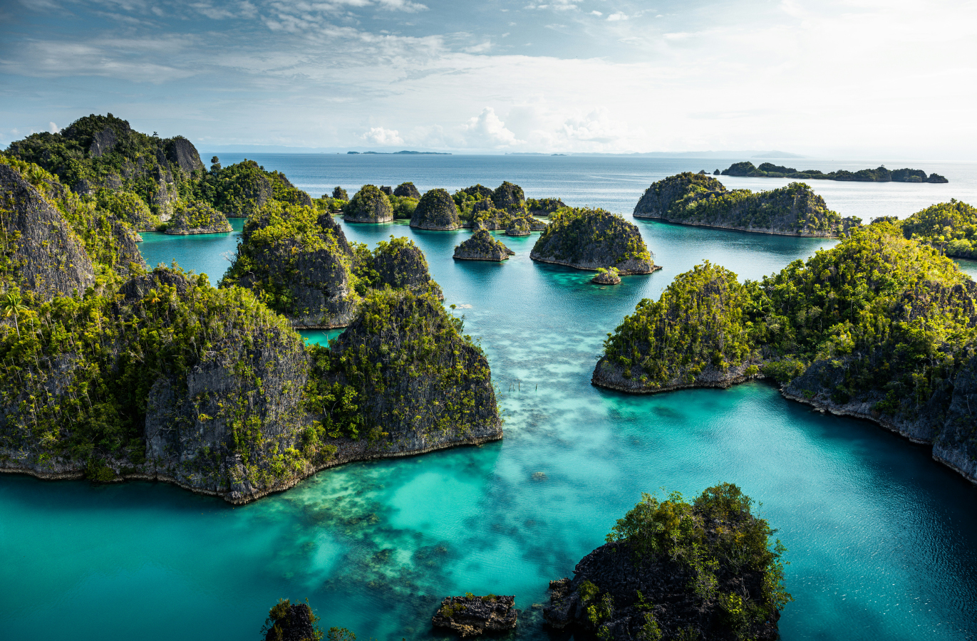
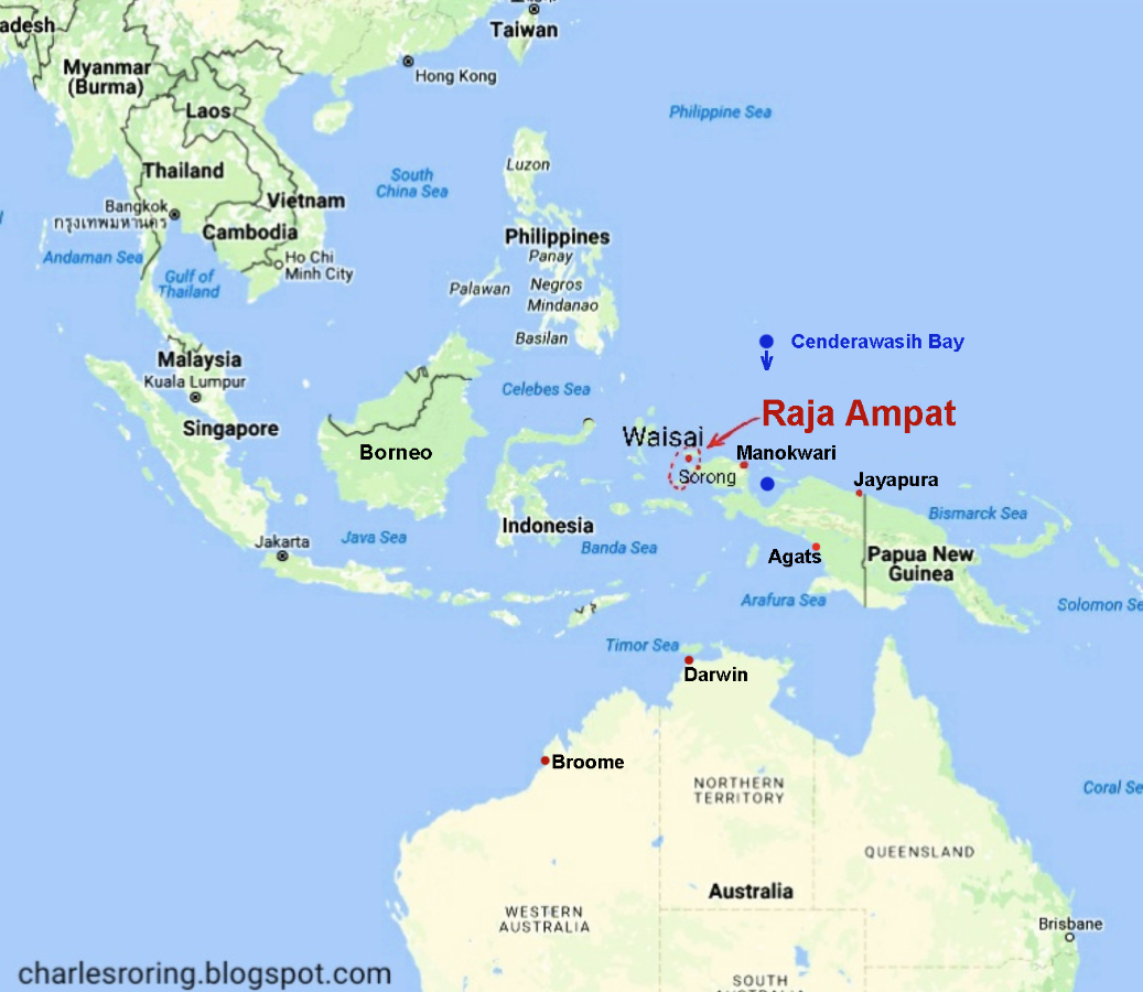
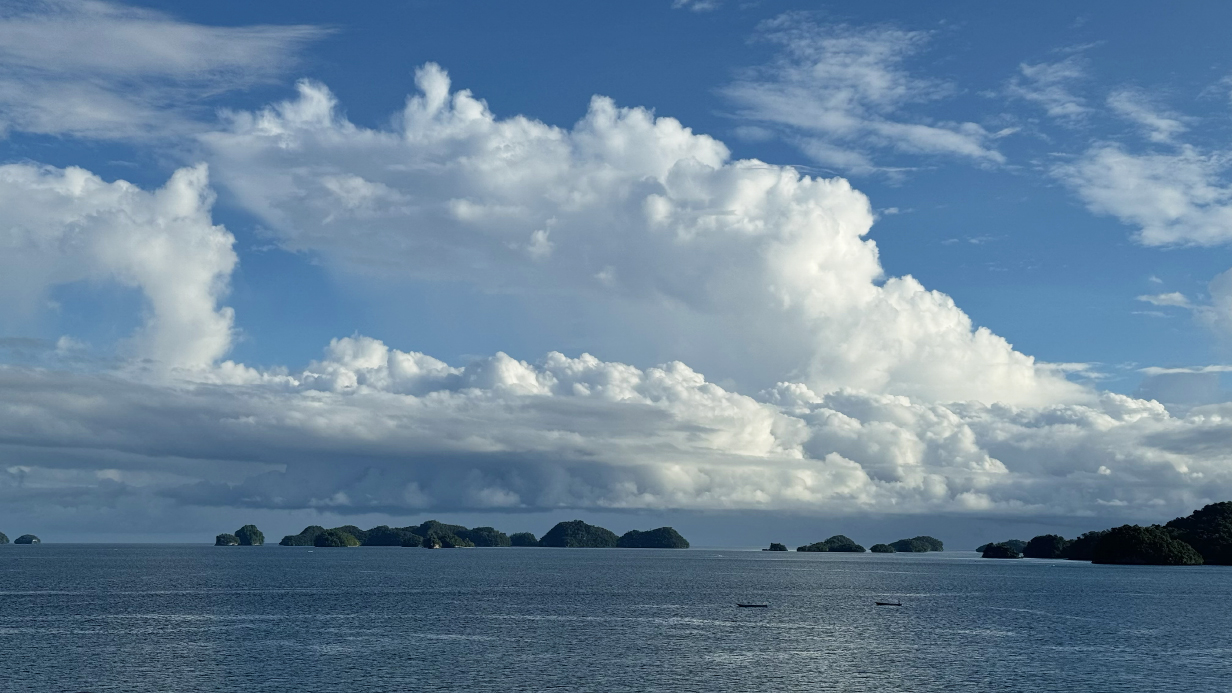
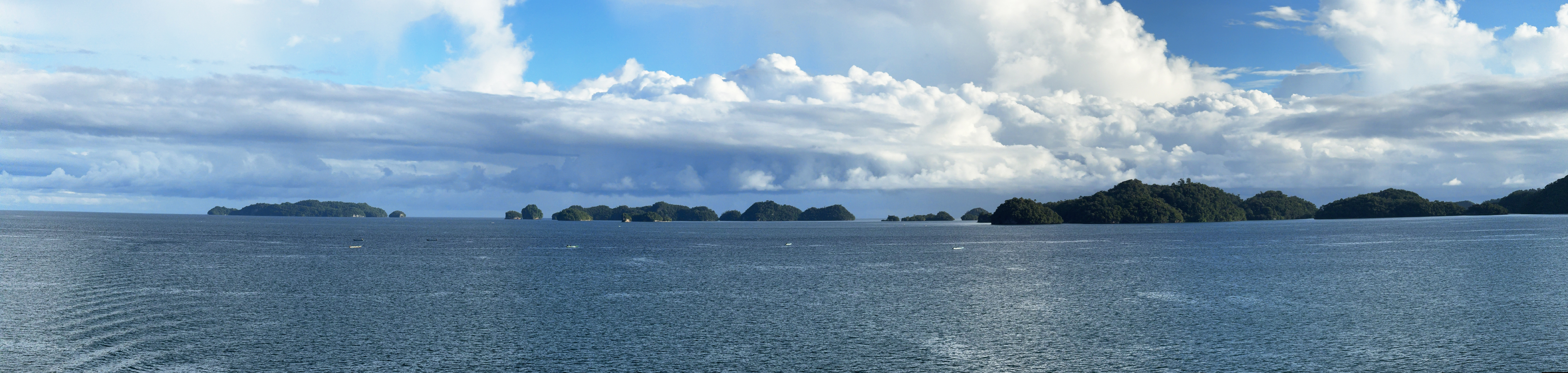
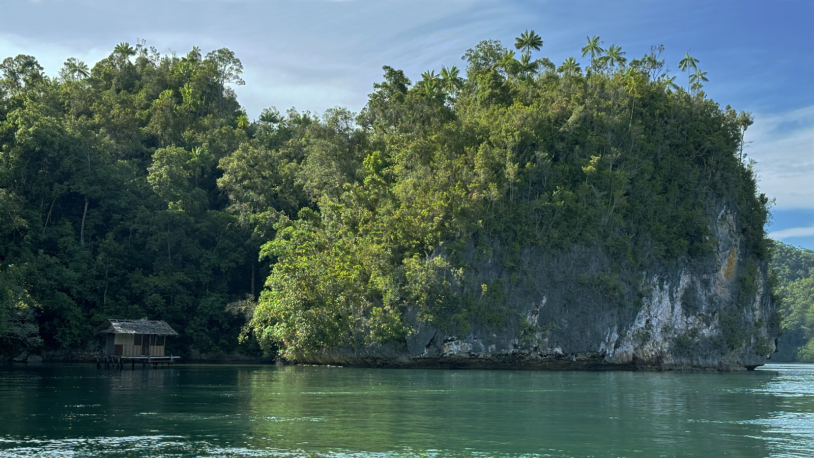
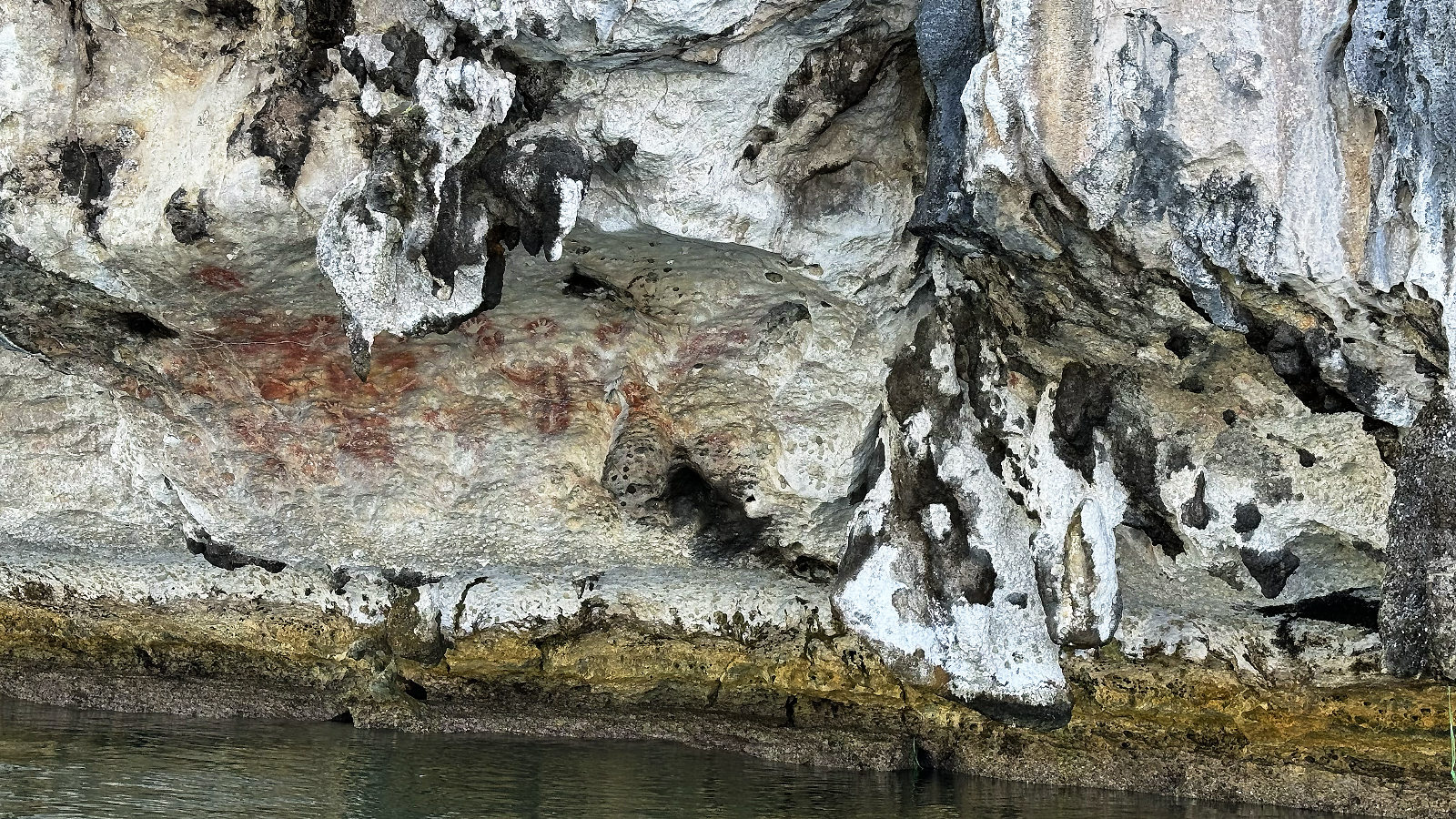
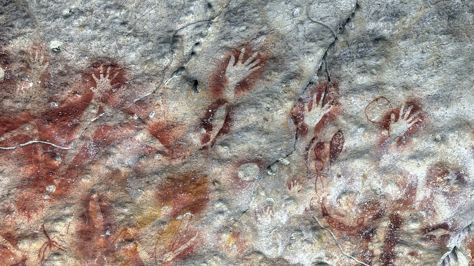
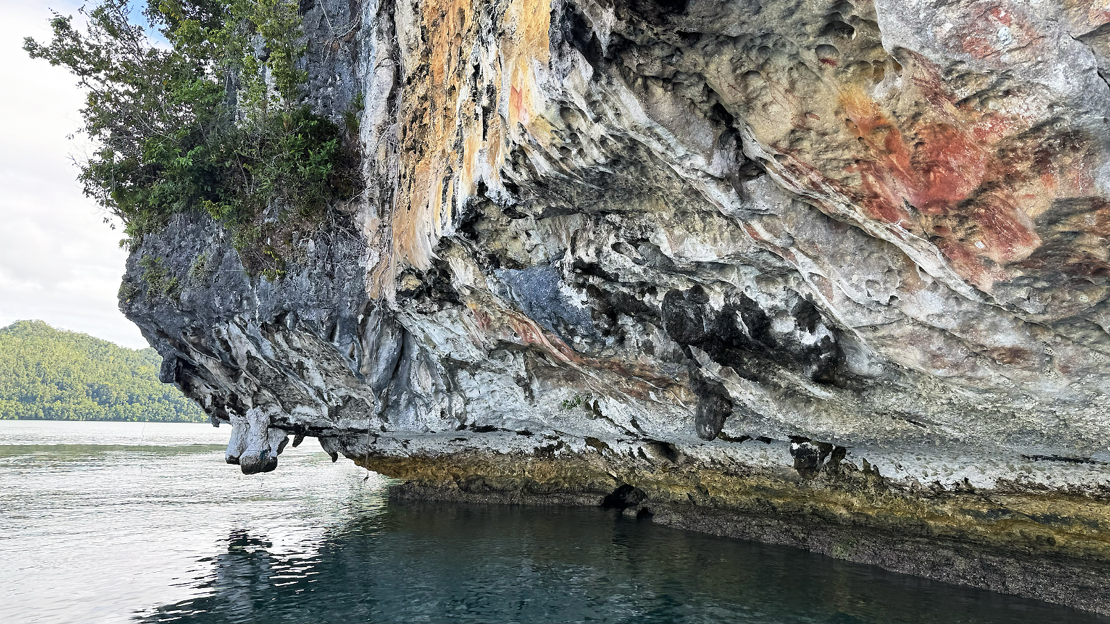
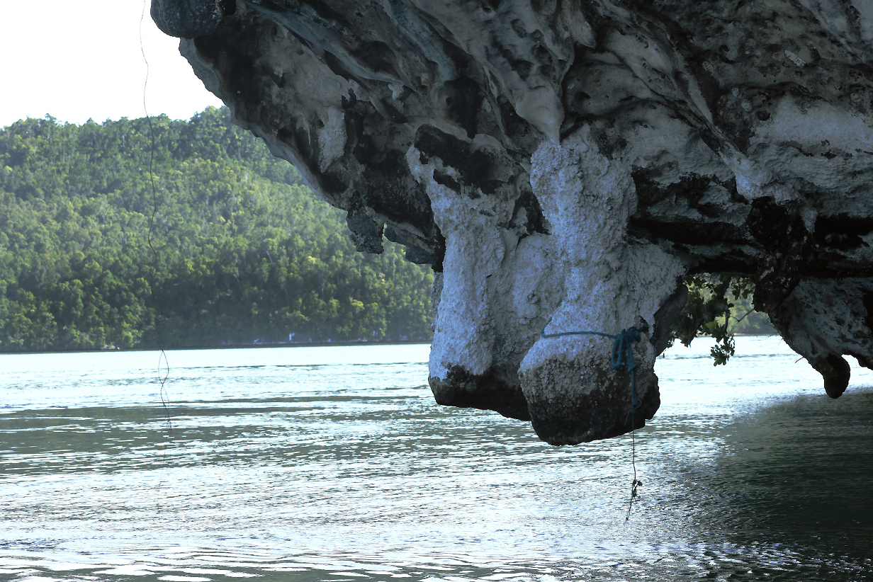
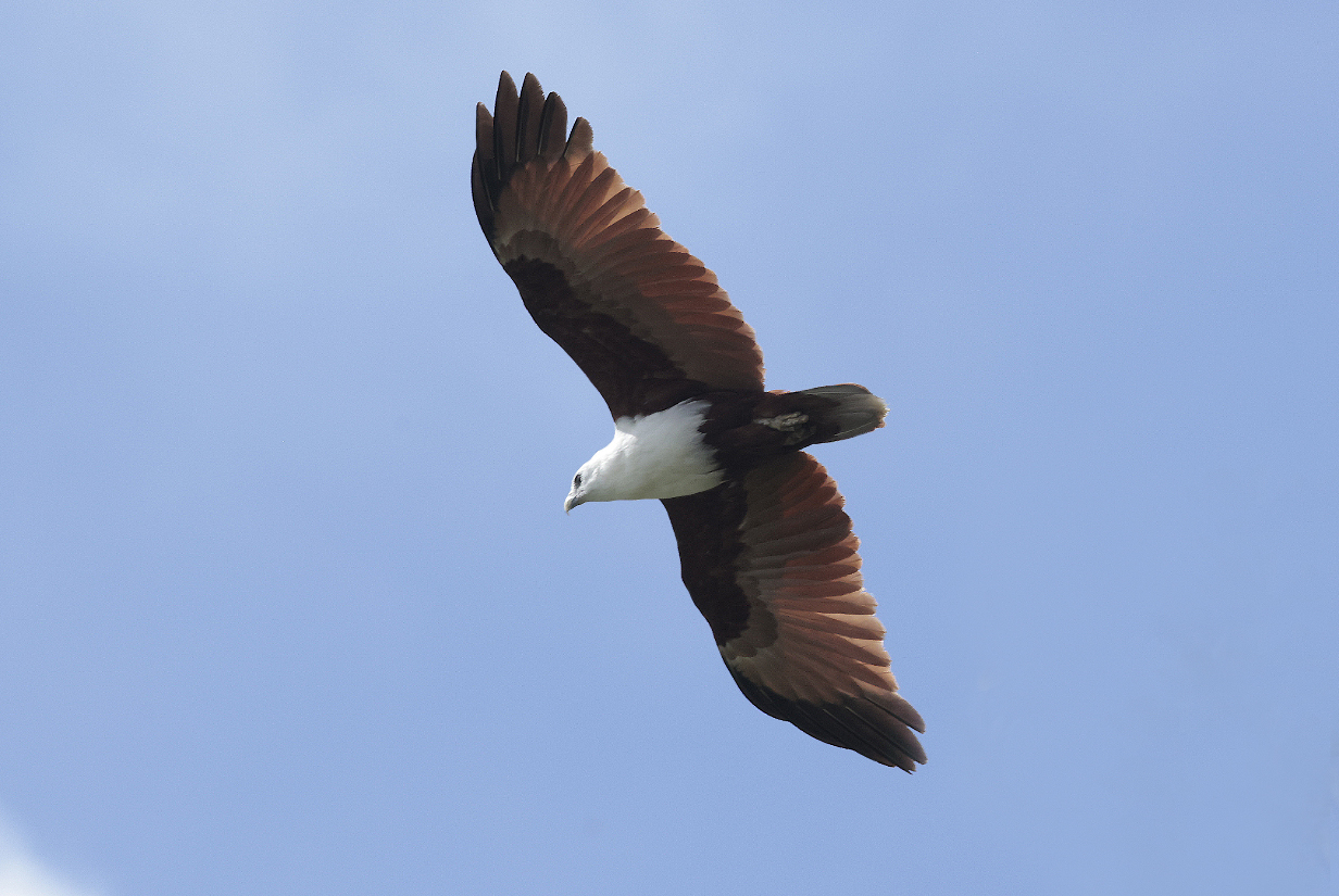
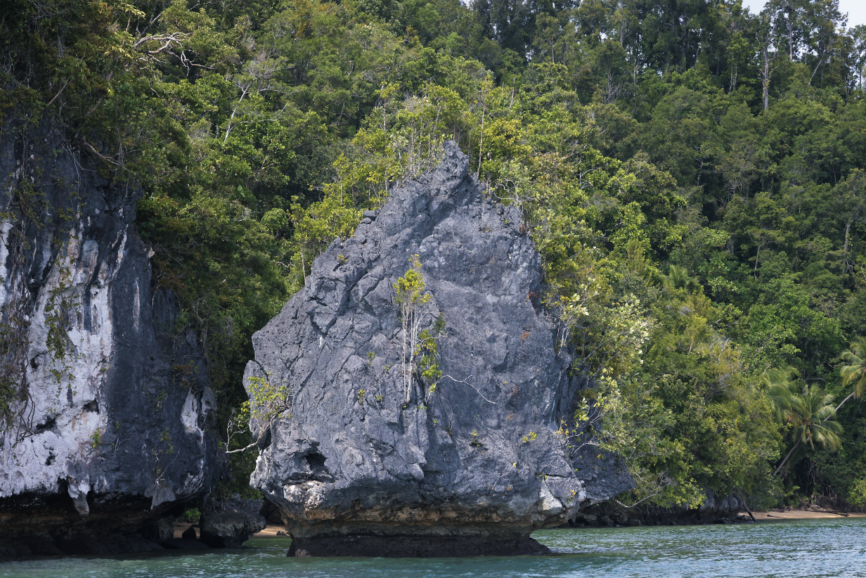
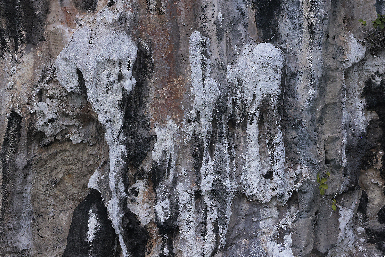
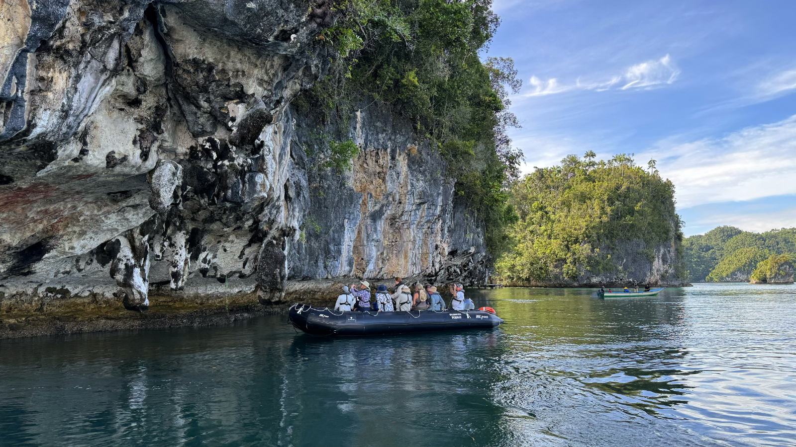
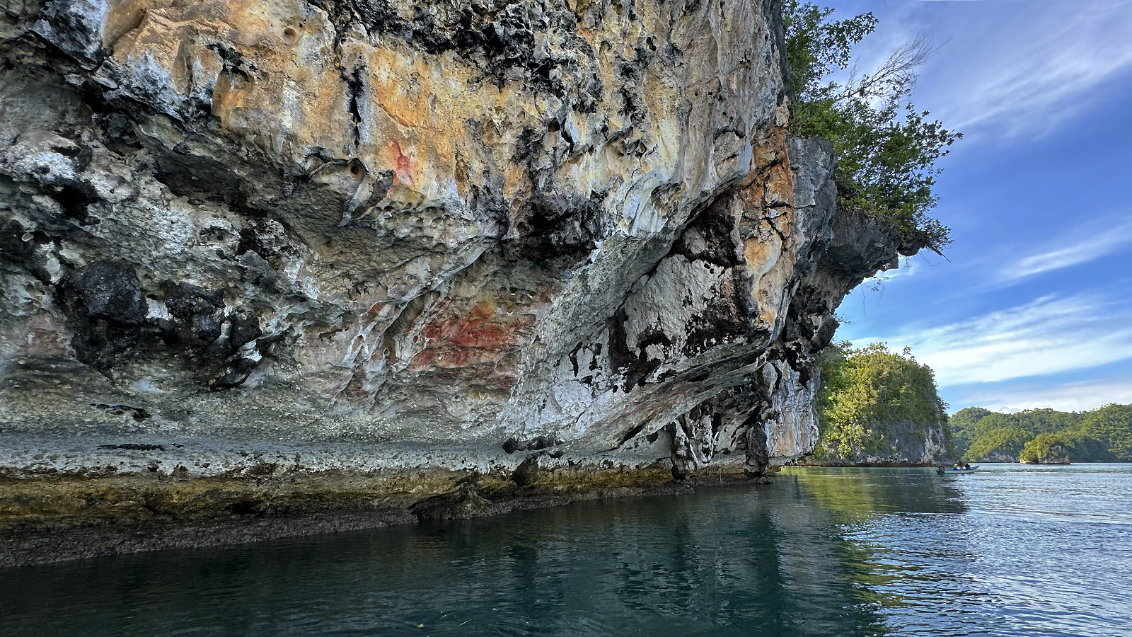
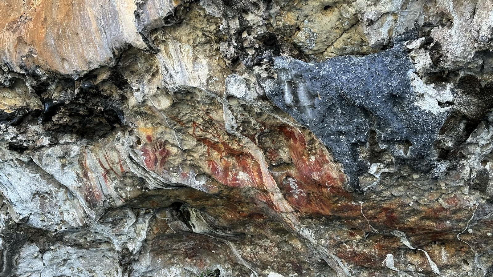
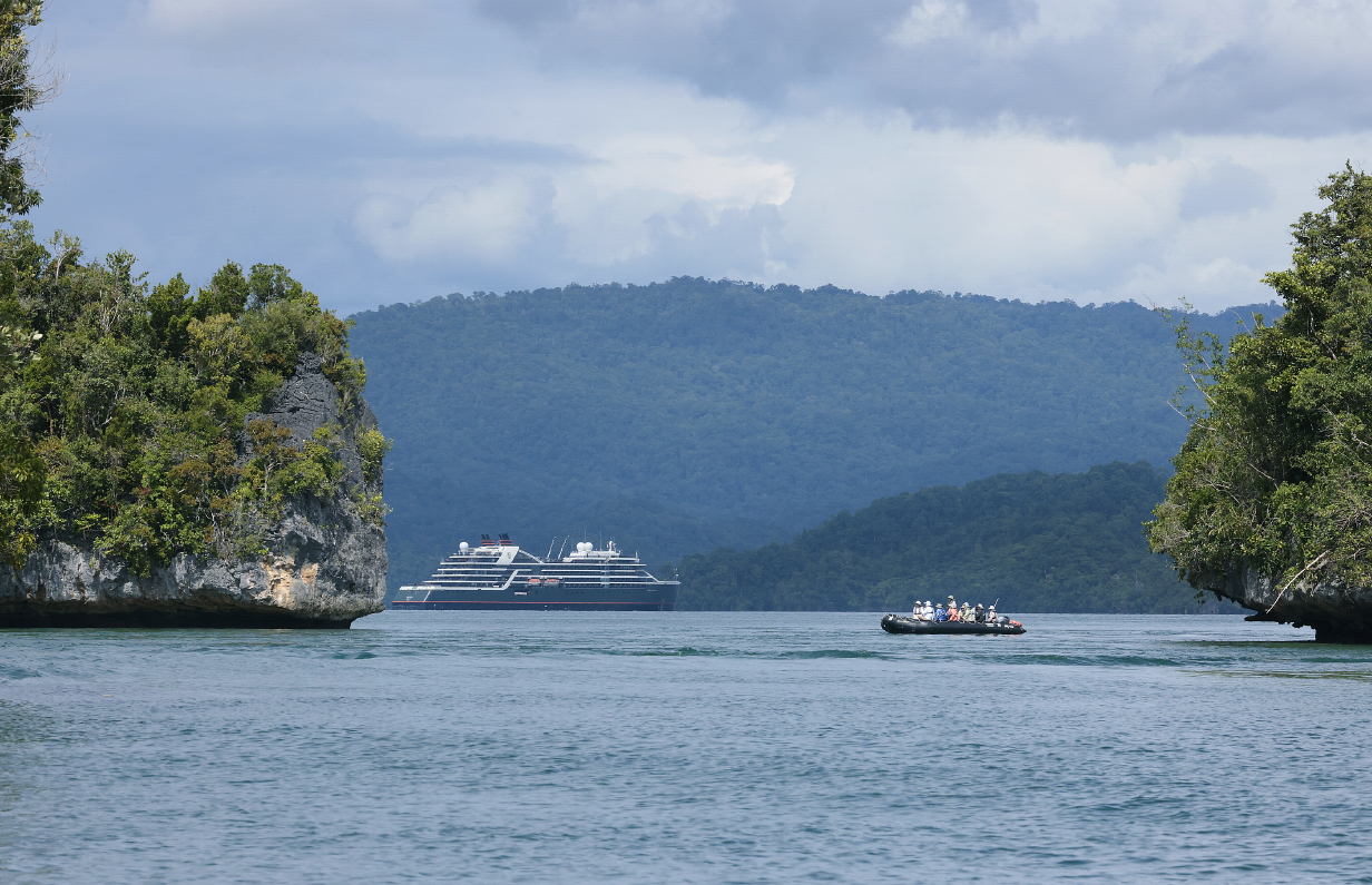
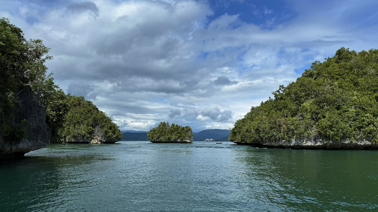
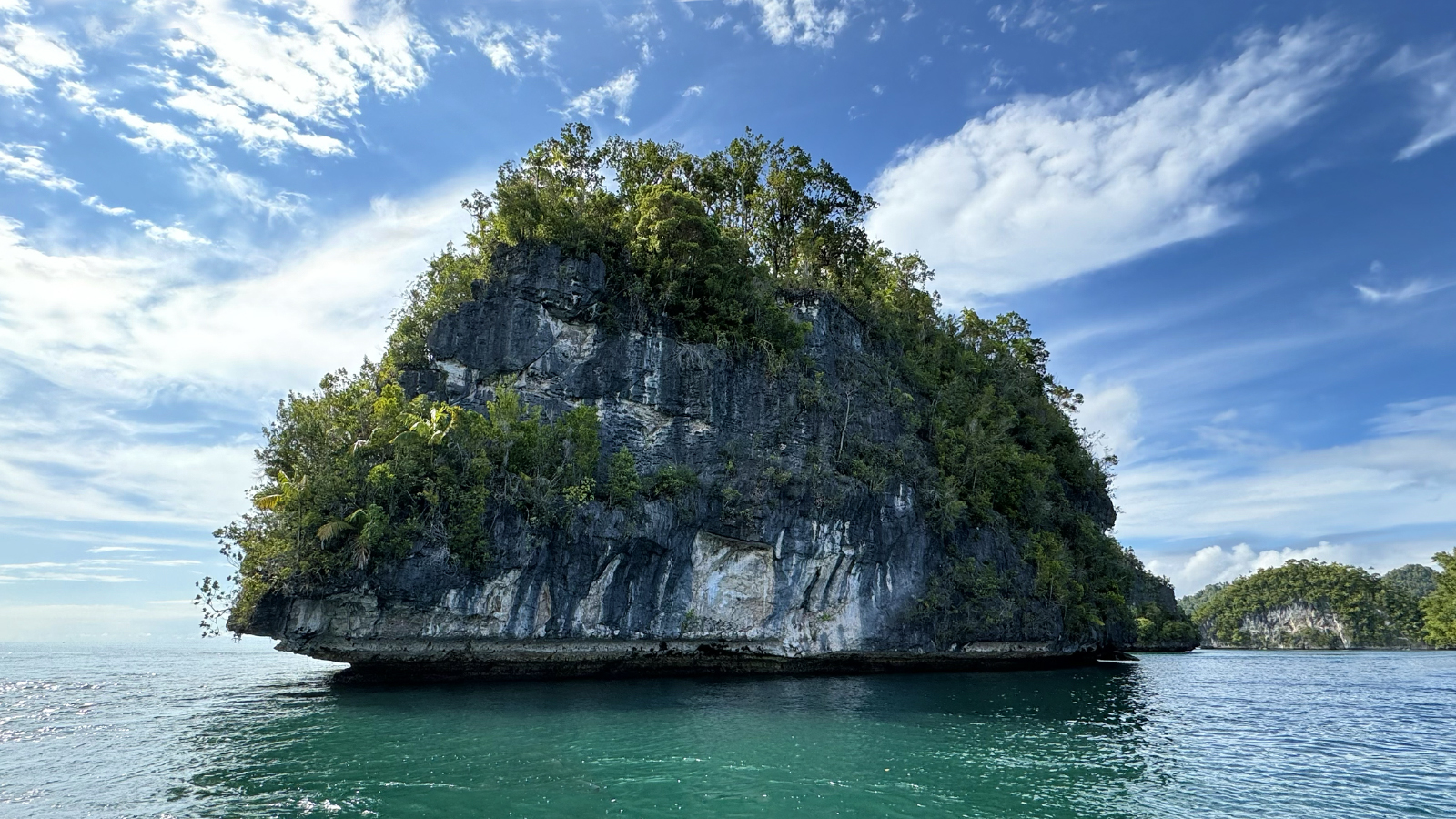
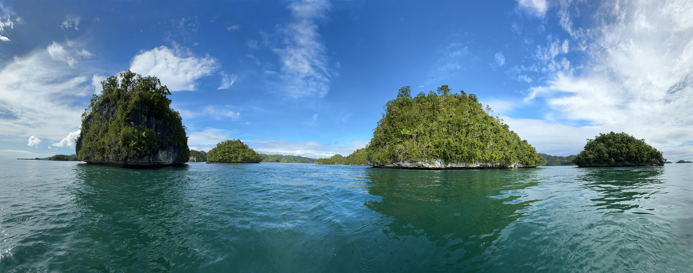
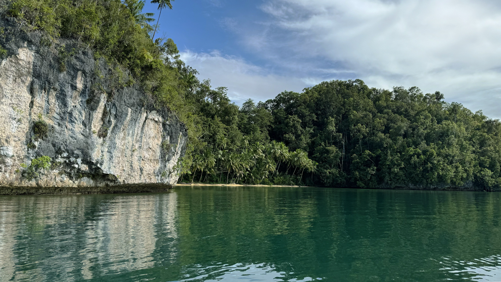
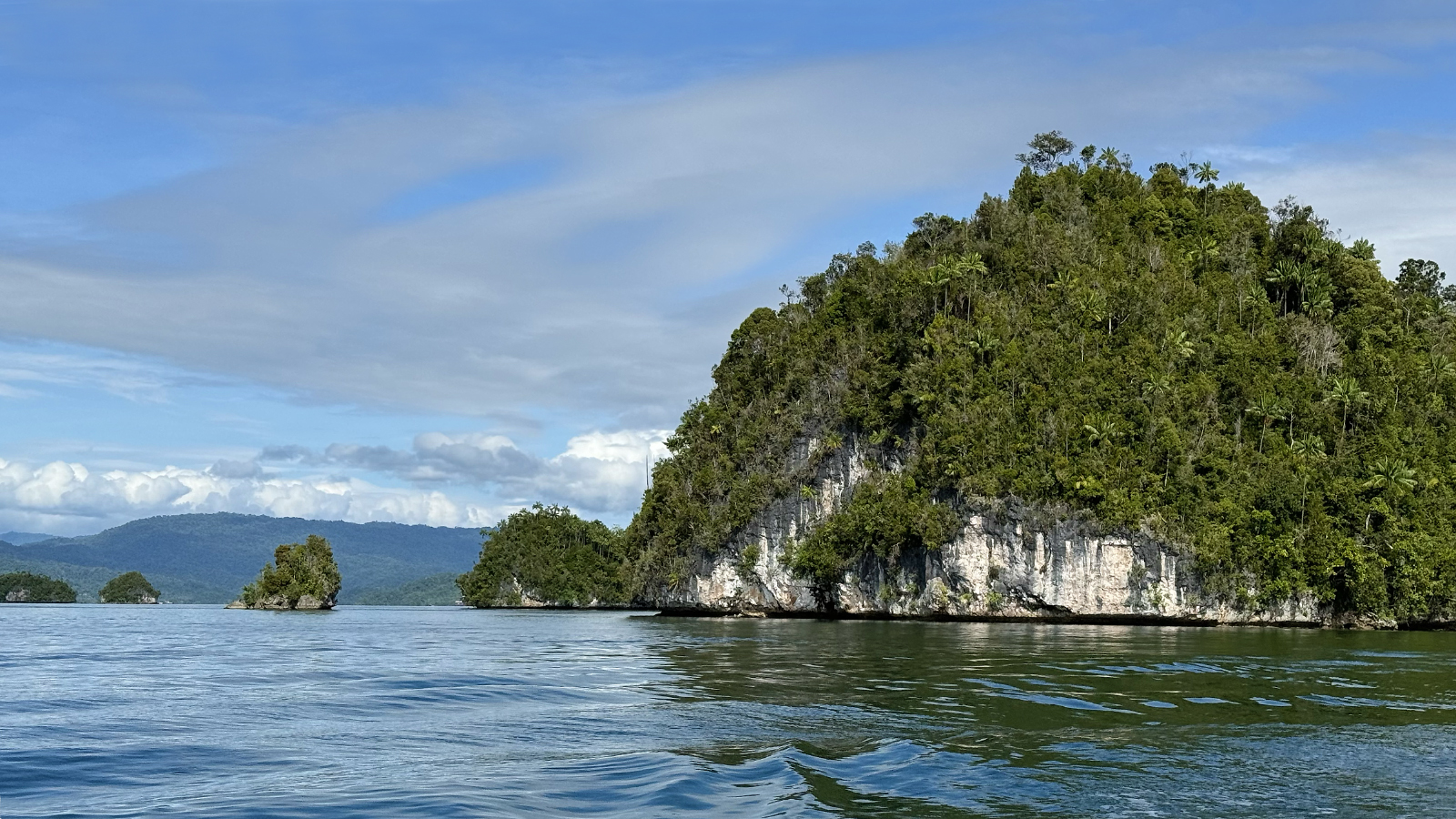
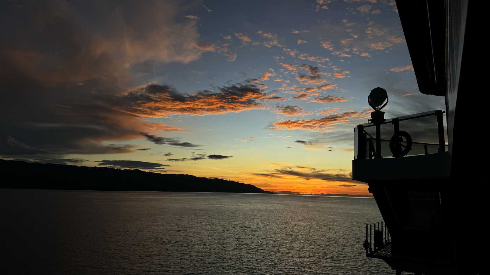
September 10, 2025: Zodiac Cruise in Raja Ampat's Misool Yapap Lagoon
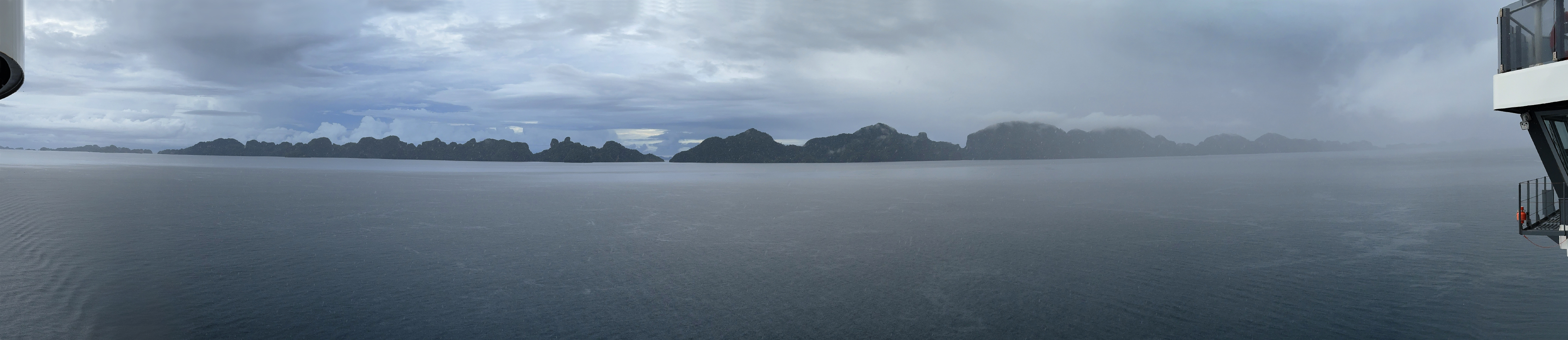
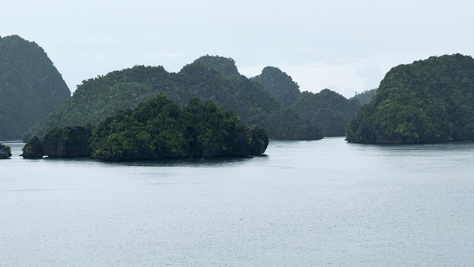
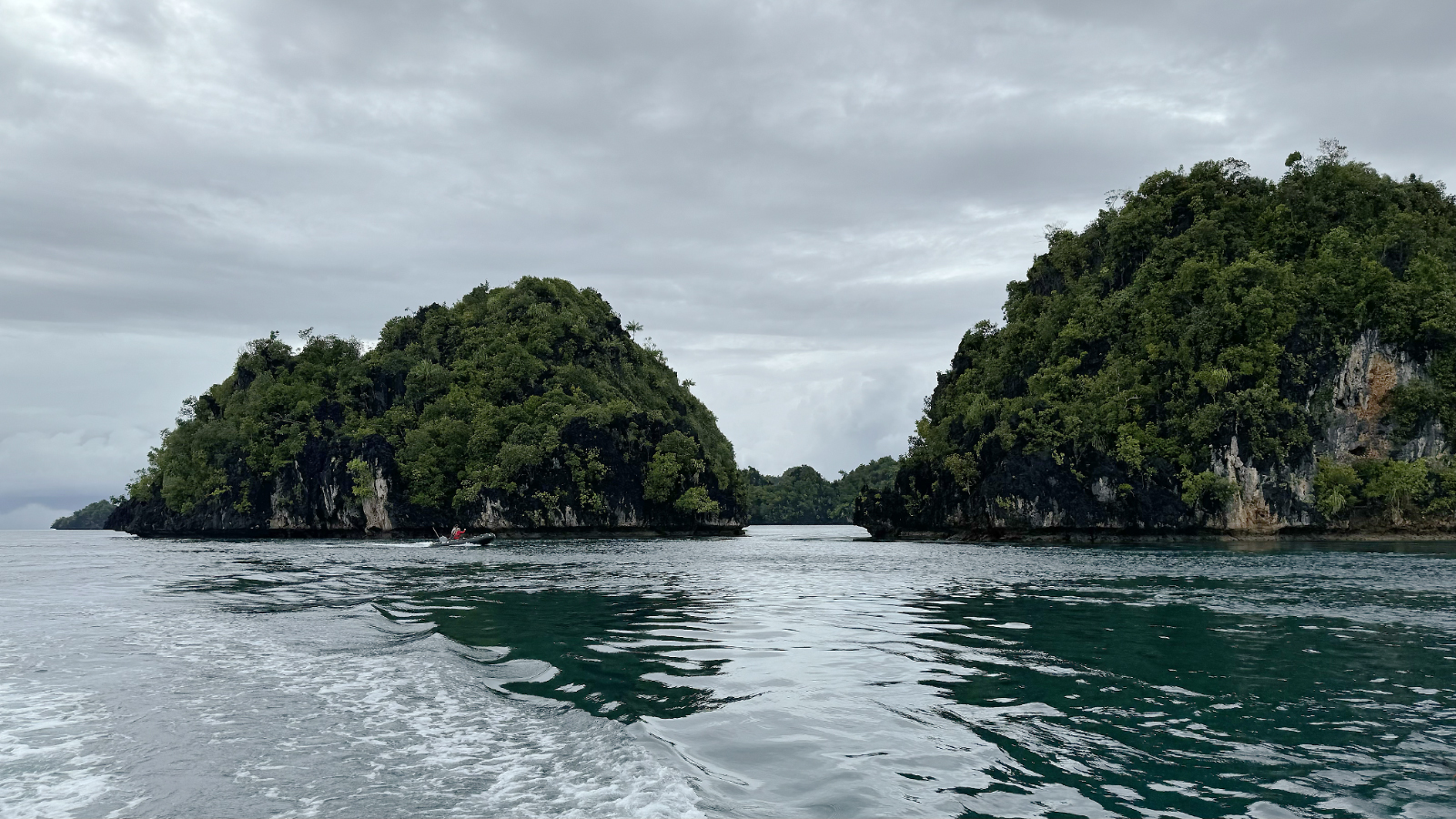
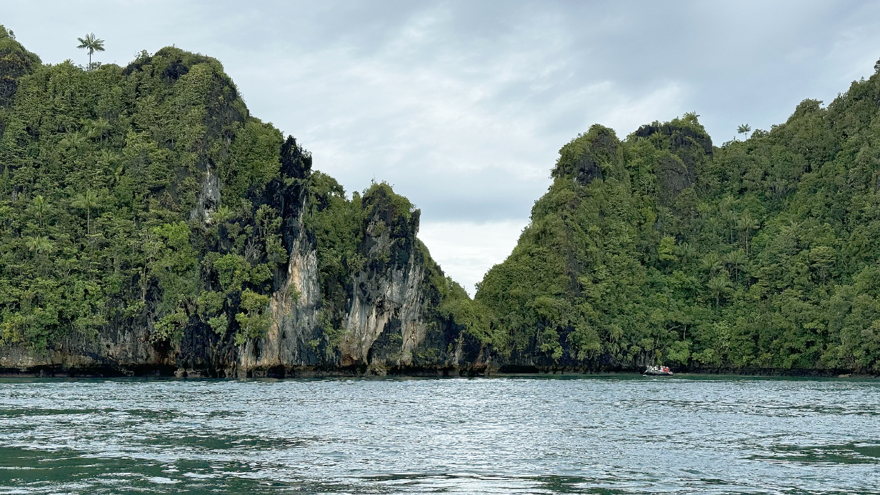
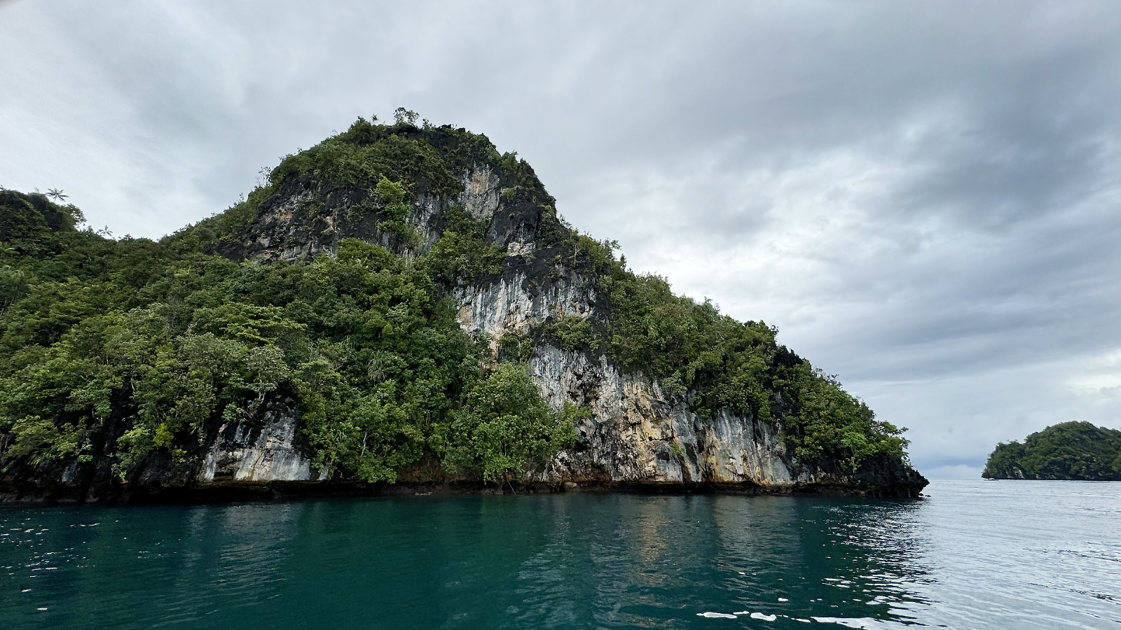
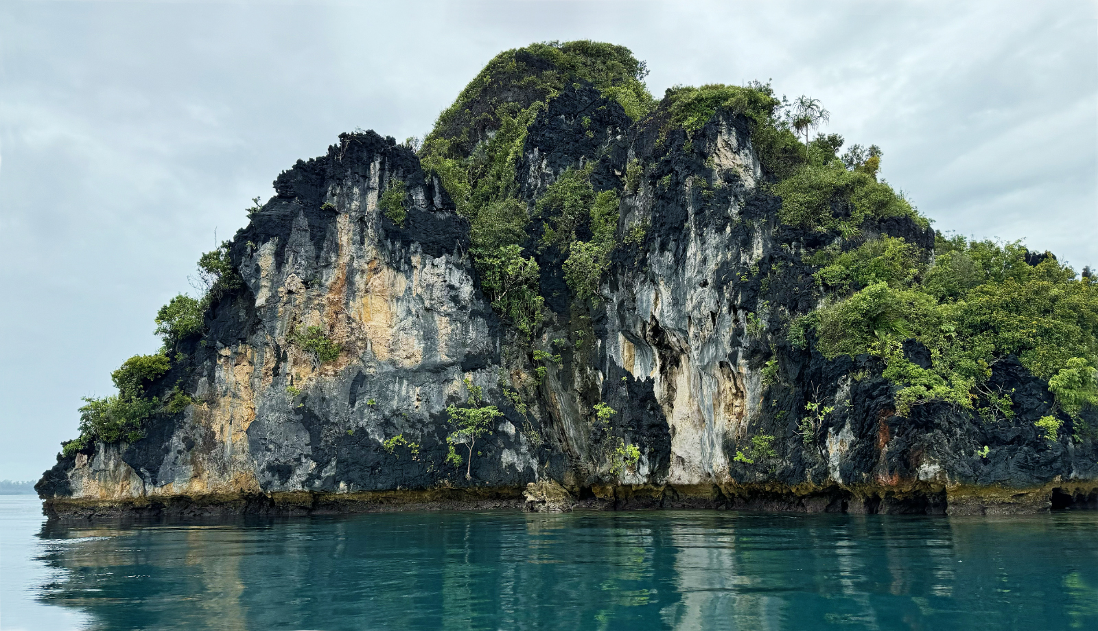
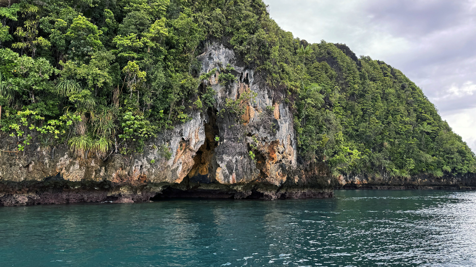
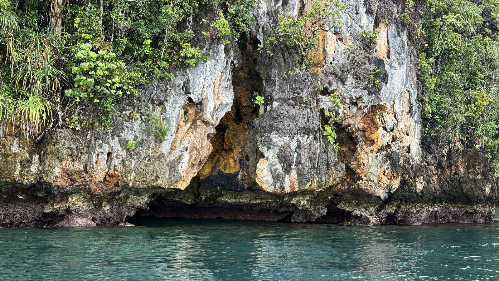
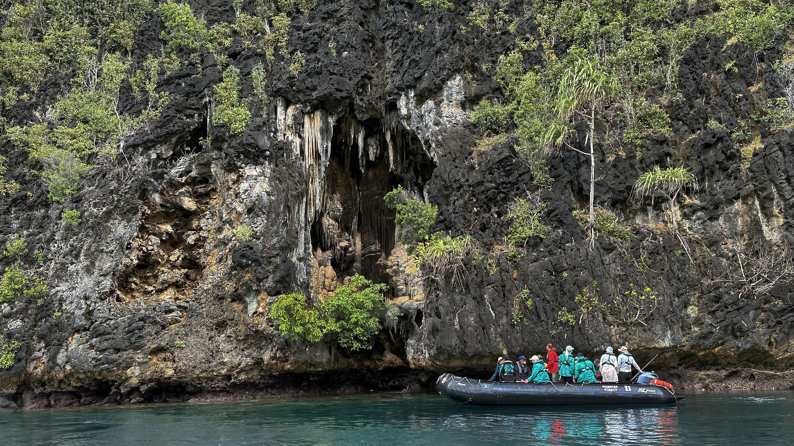
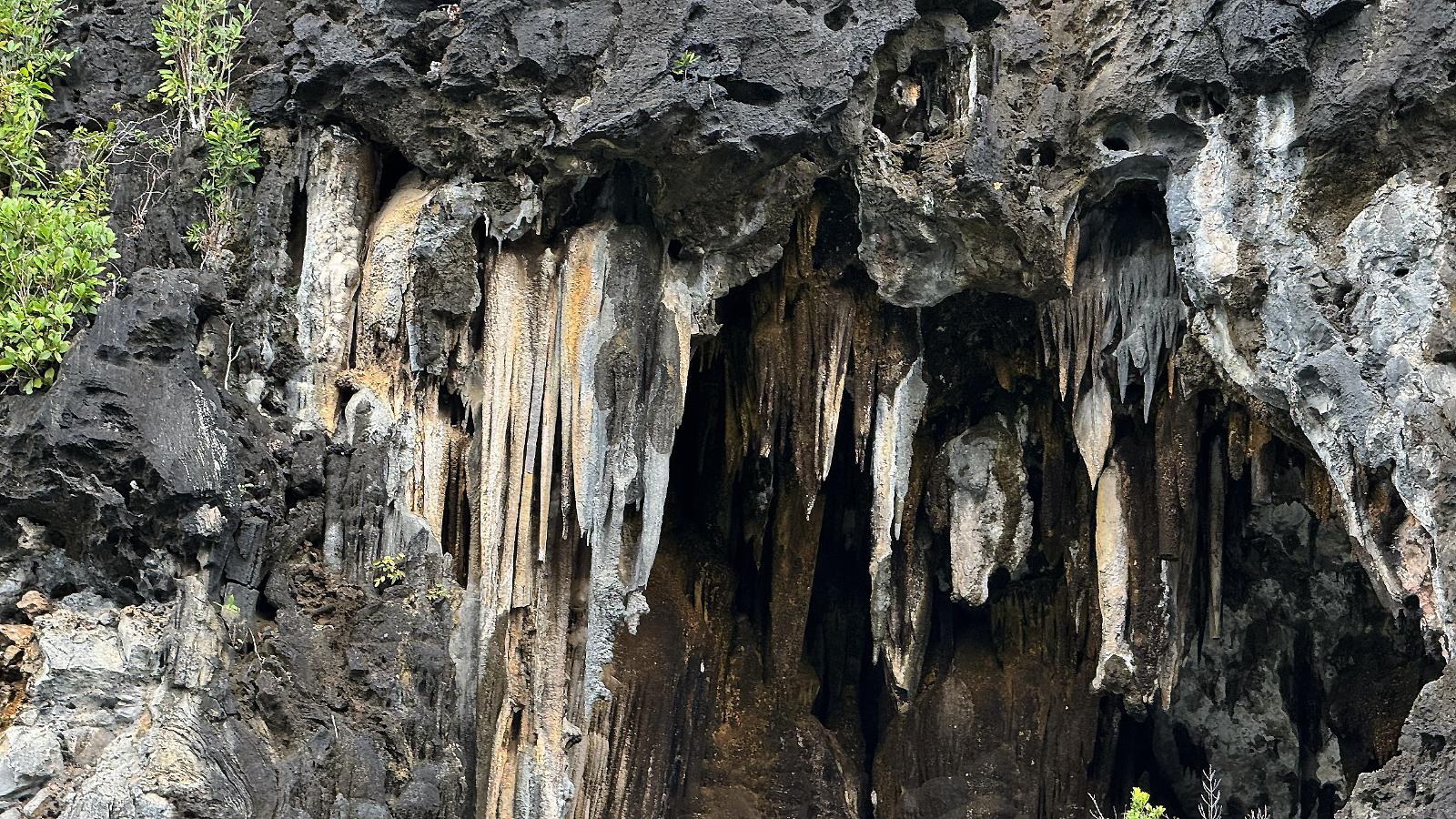
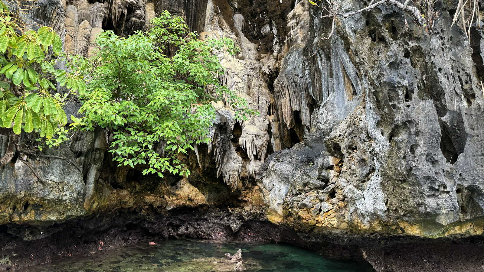
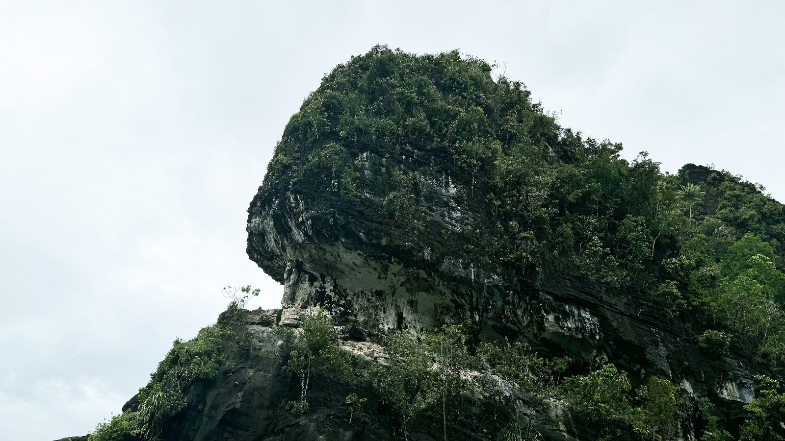
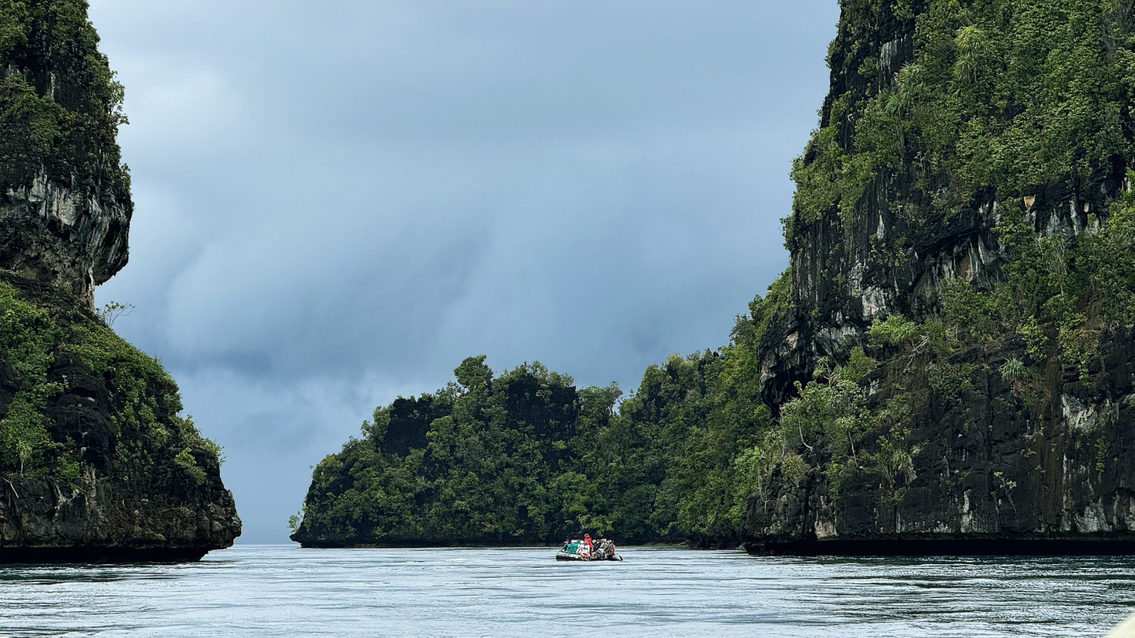
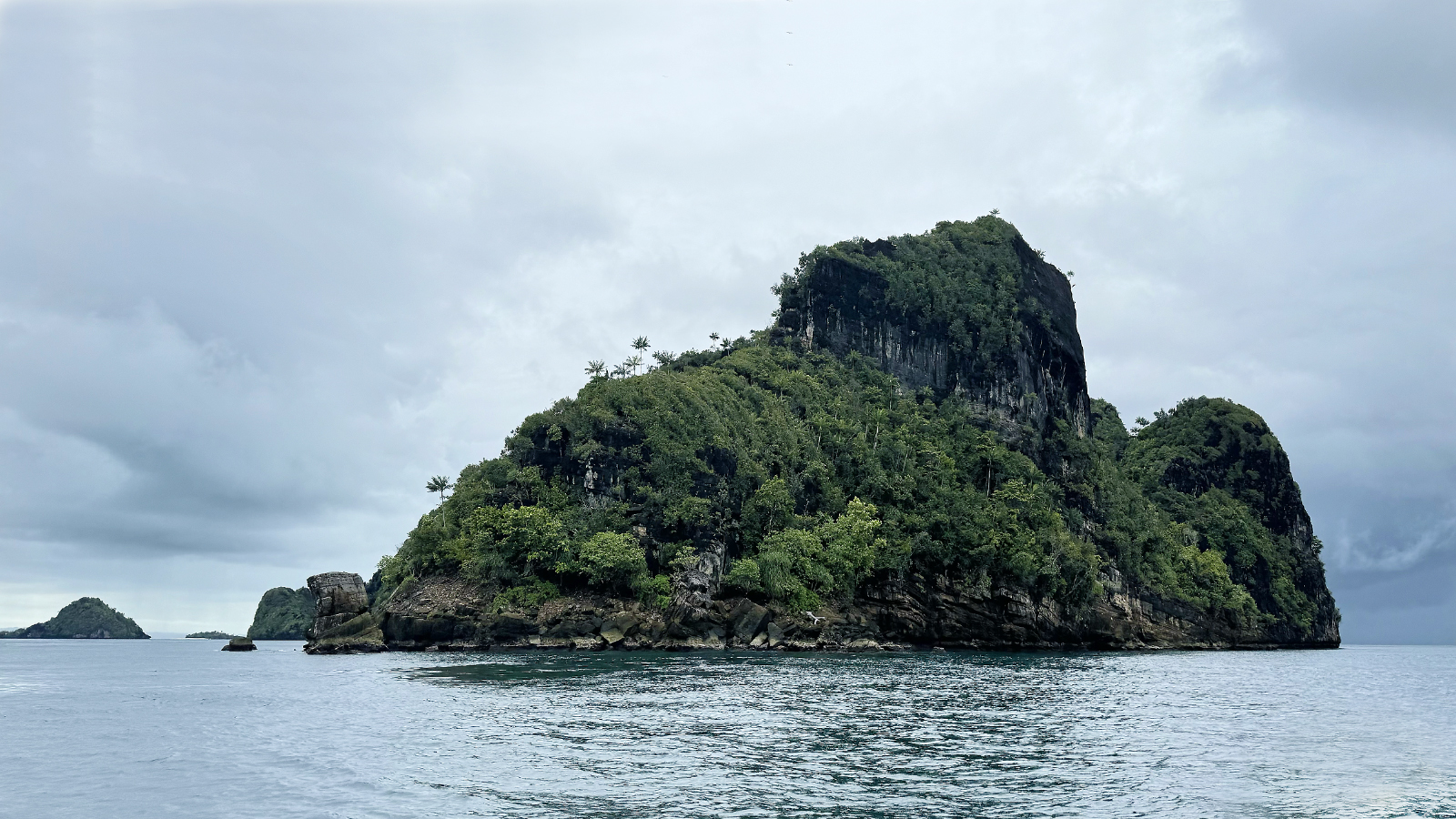
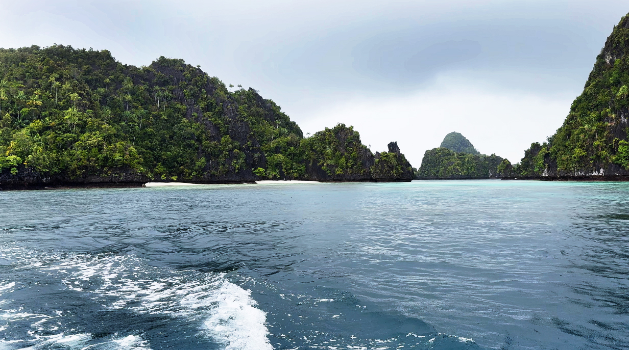
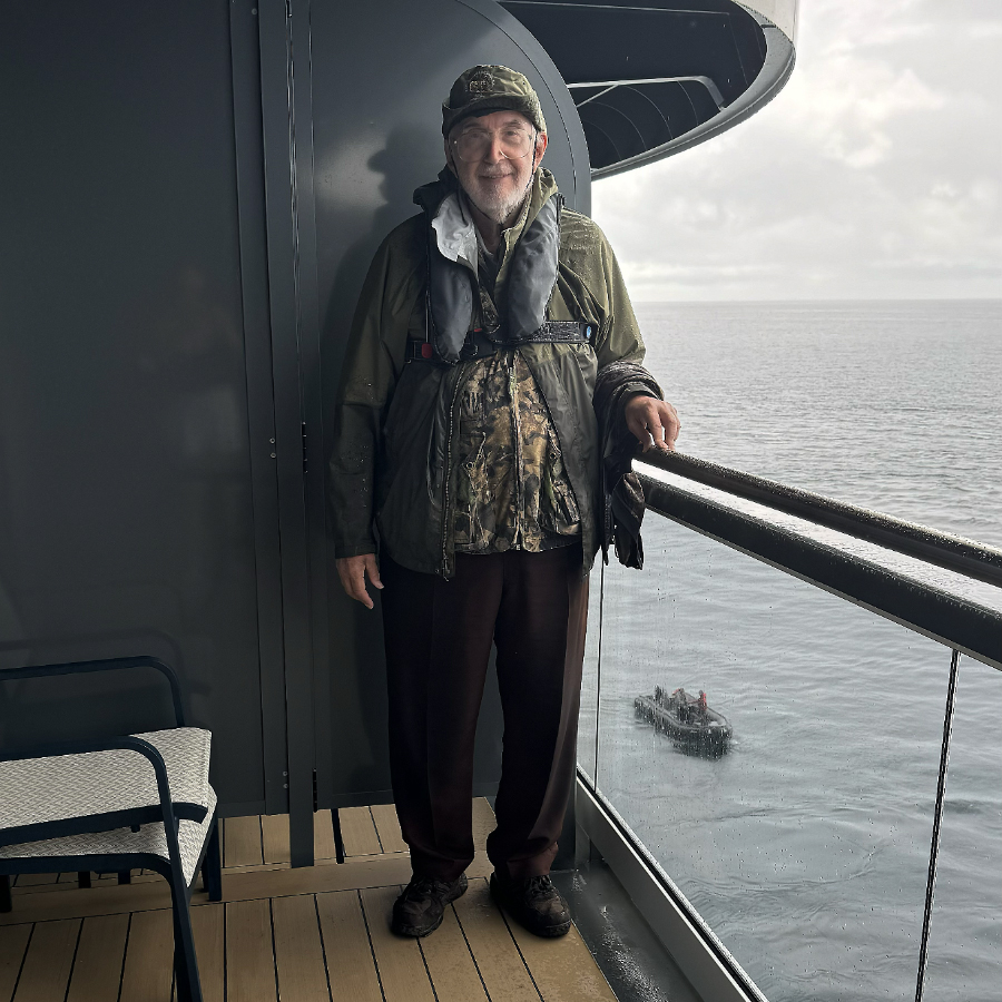
September 11, 2025: Private Birding Excursion to Waigeo
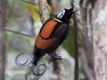
September 12, 2025 AM: Snorkeling at Pulau Matas in Cenderawasih Bay
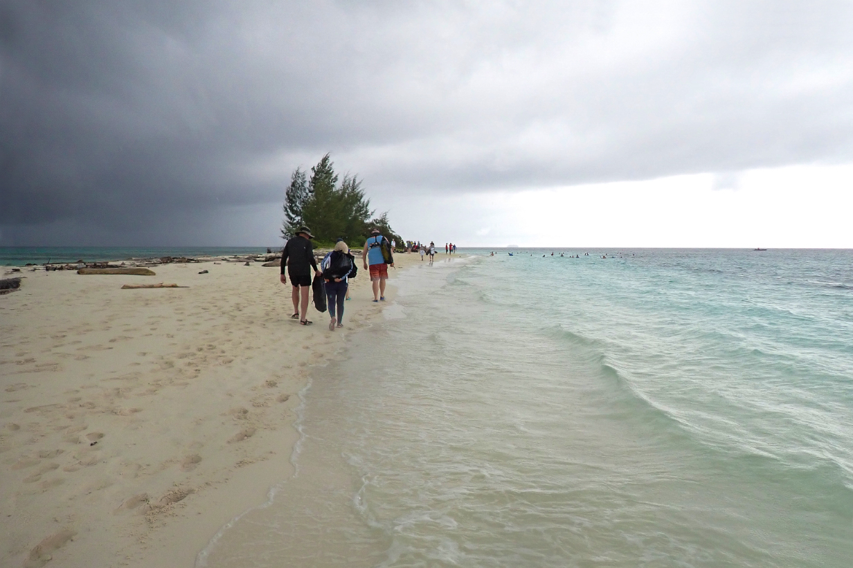
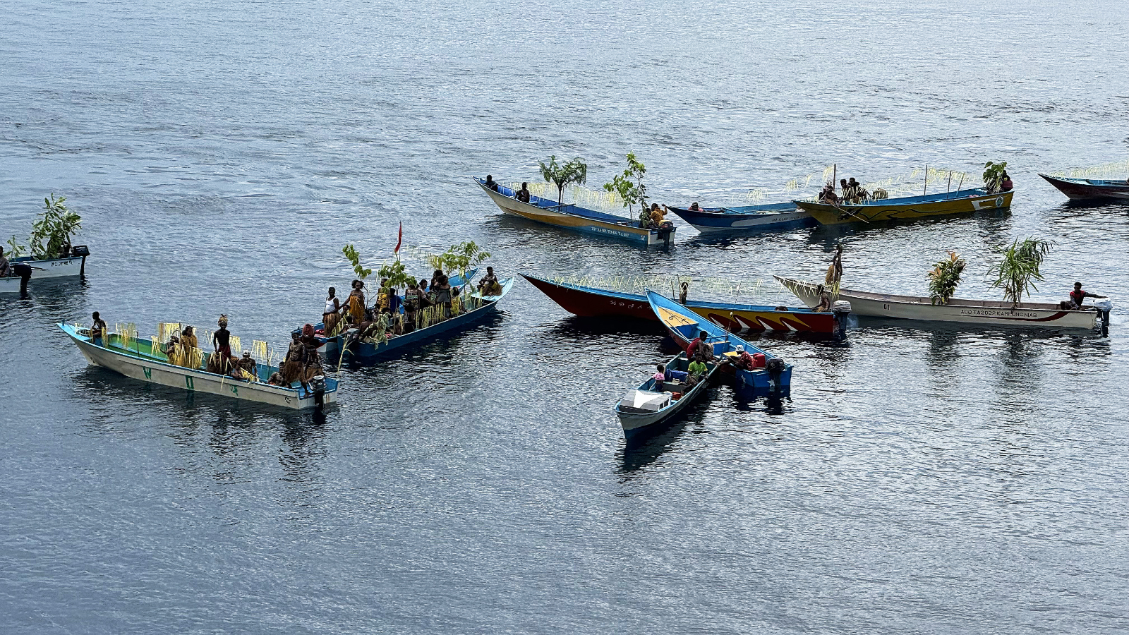
September 15, 2025 AM: Beach Landing at Vanimo Surf Lodge, Papua New Guinea
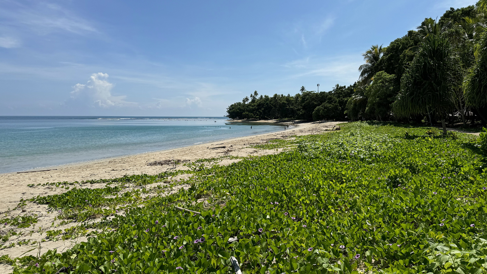

September 18, 2025 AM: Aborted Submarine Dive at Garove Island, Papua New Guinea
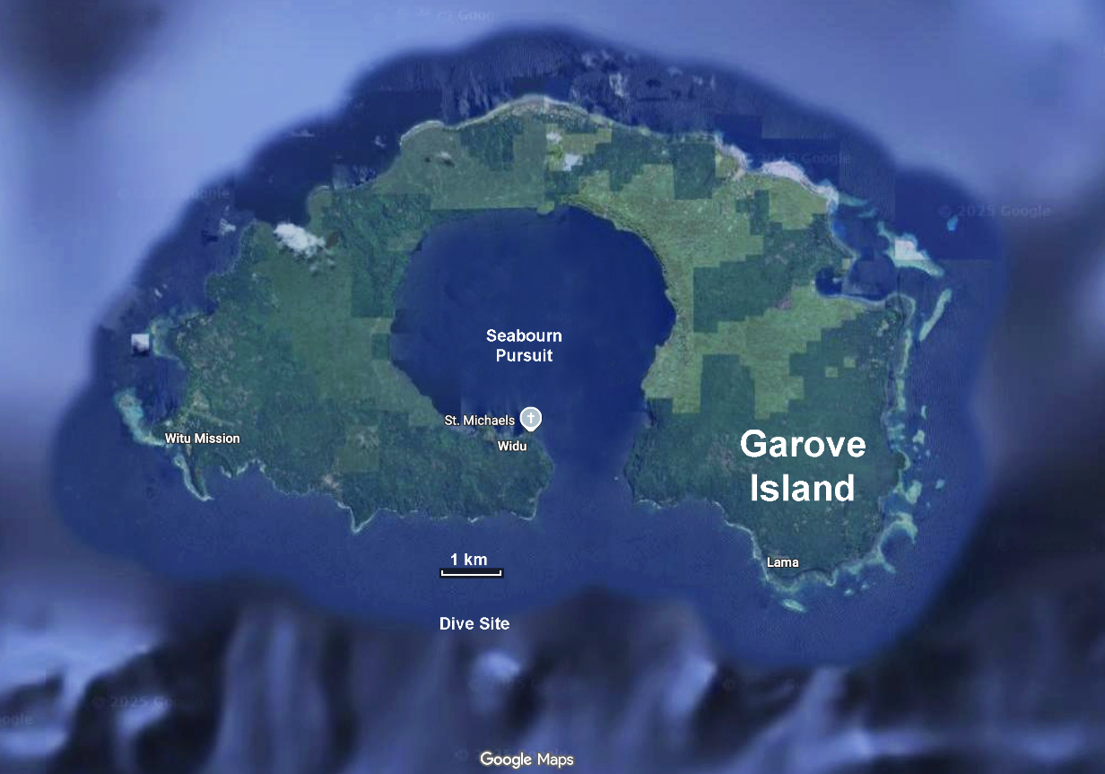
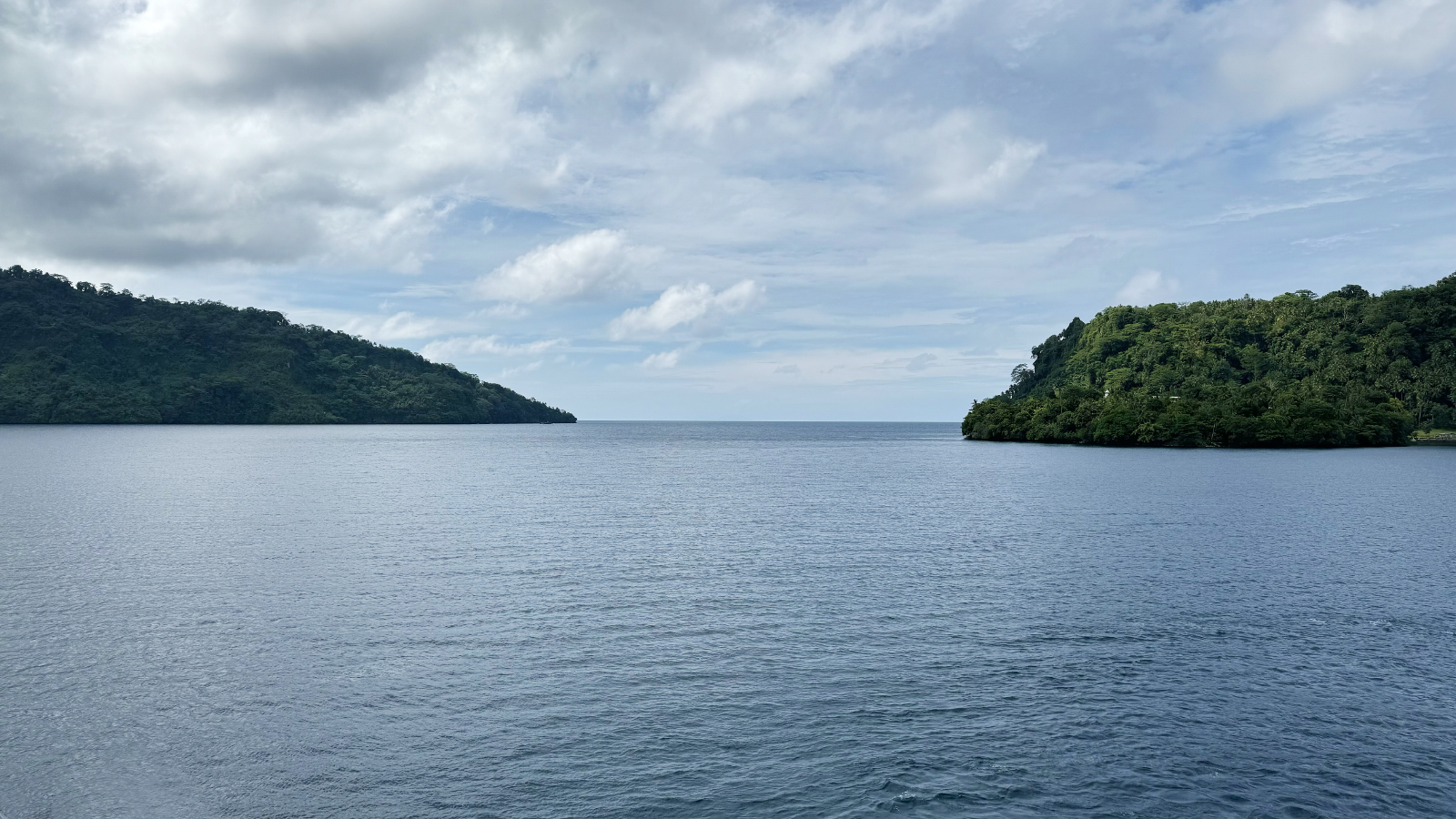
September 19, 2025 PM: Baining Fire Dance at Rabaul, Papua New Guinea
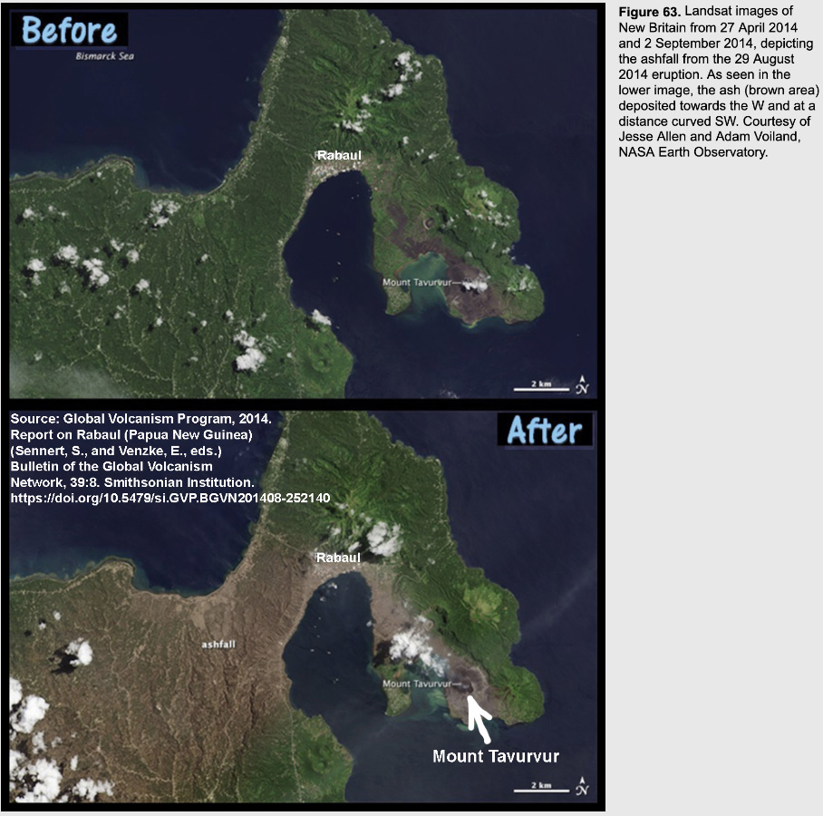
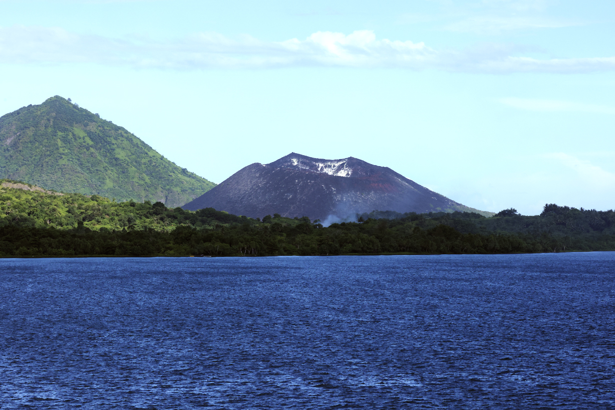
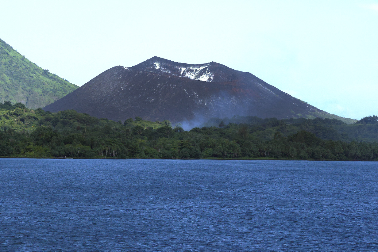
Baining Fire Dance
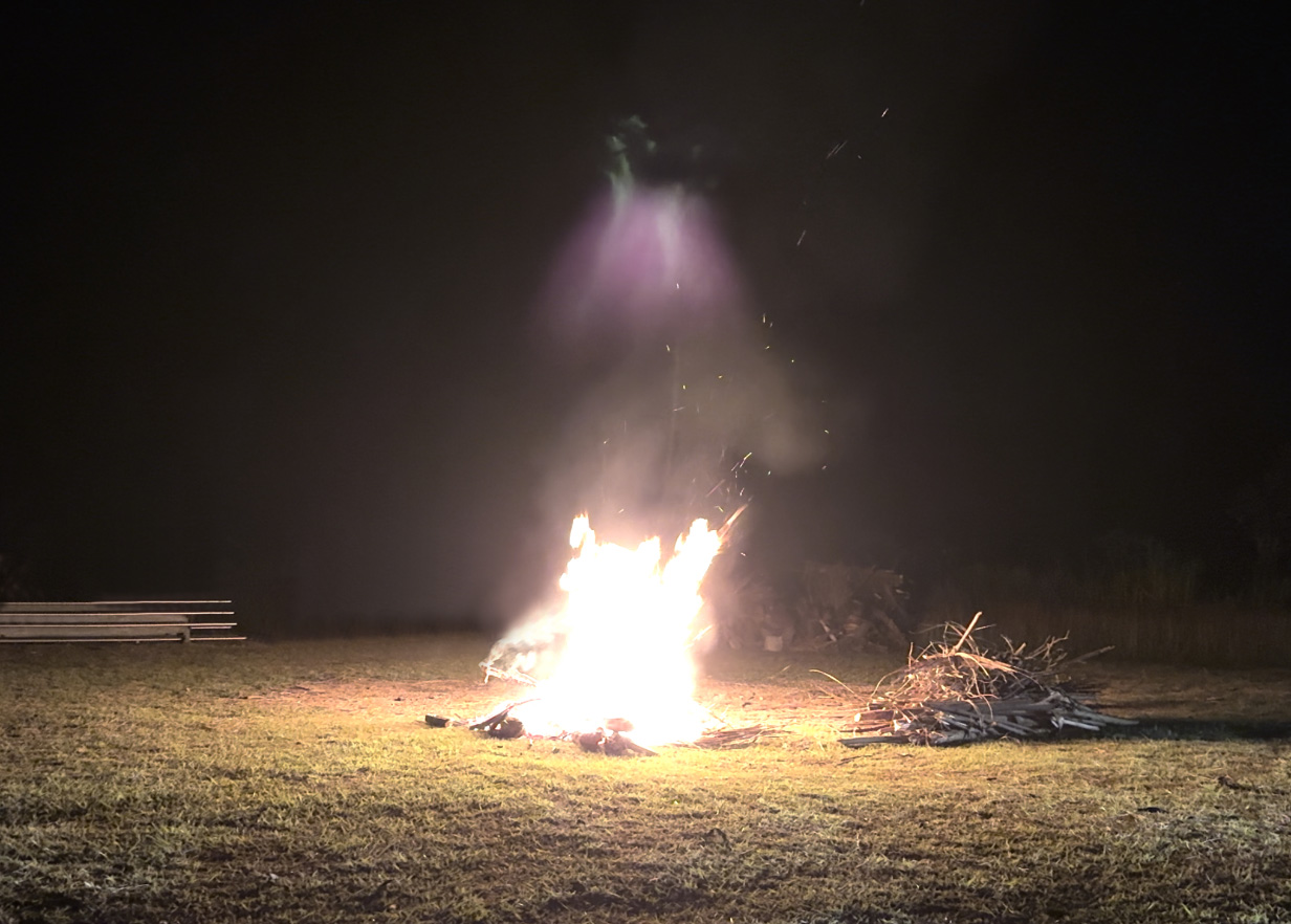
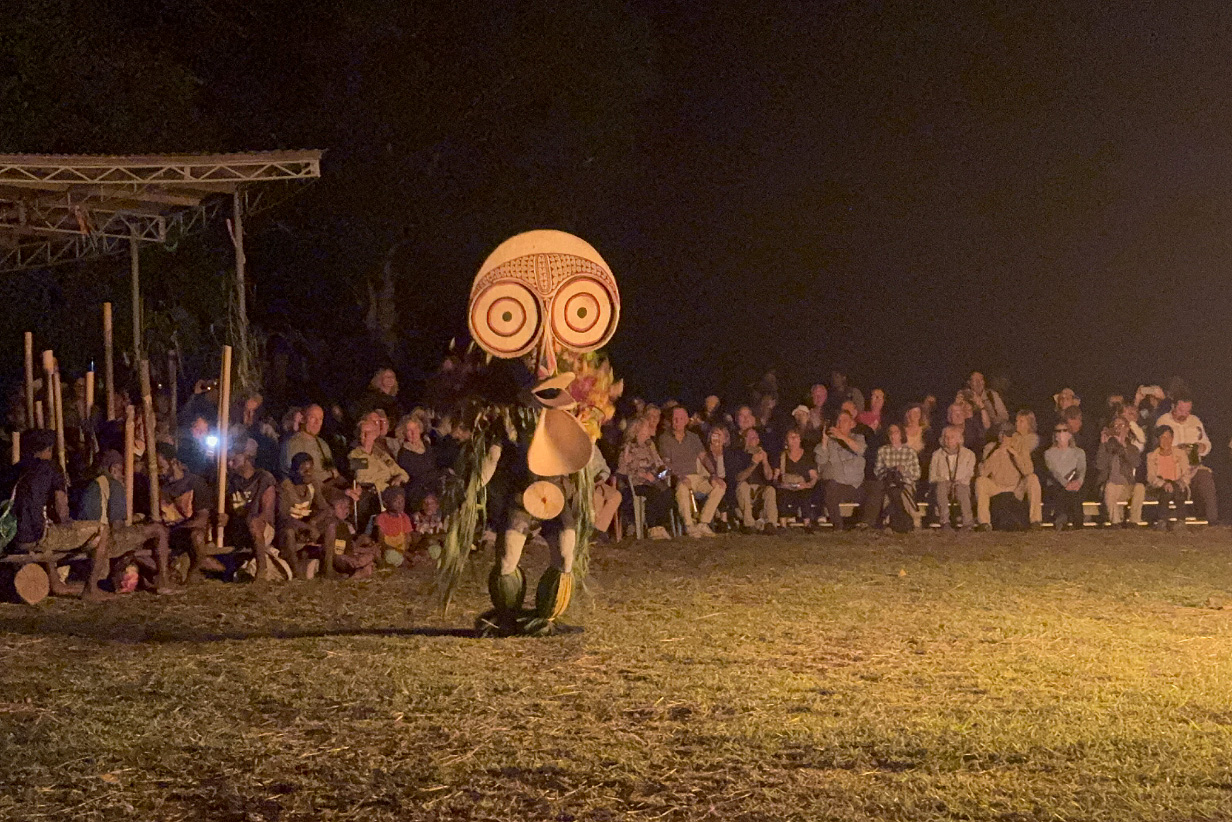
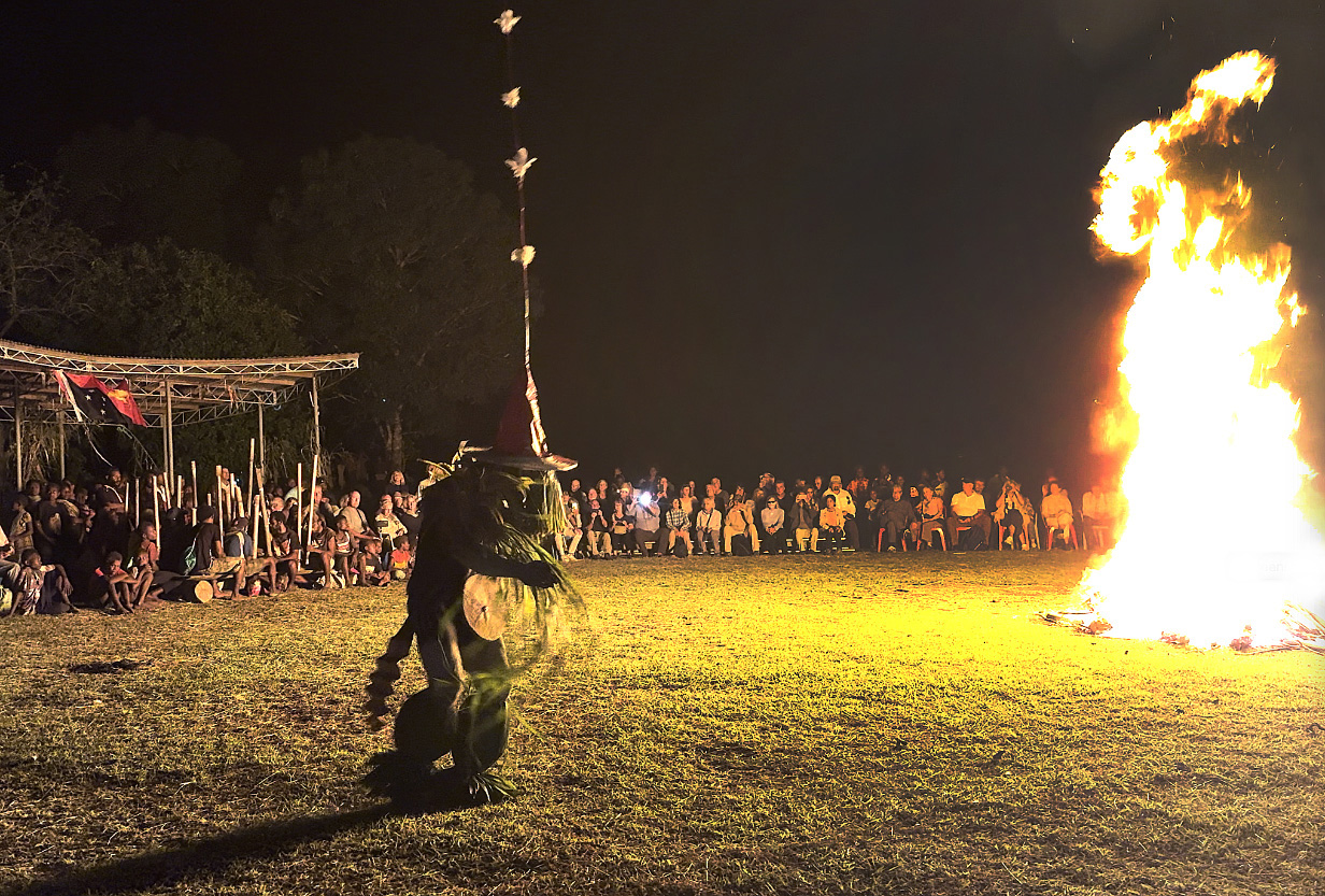
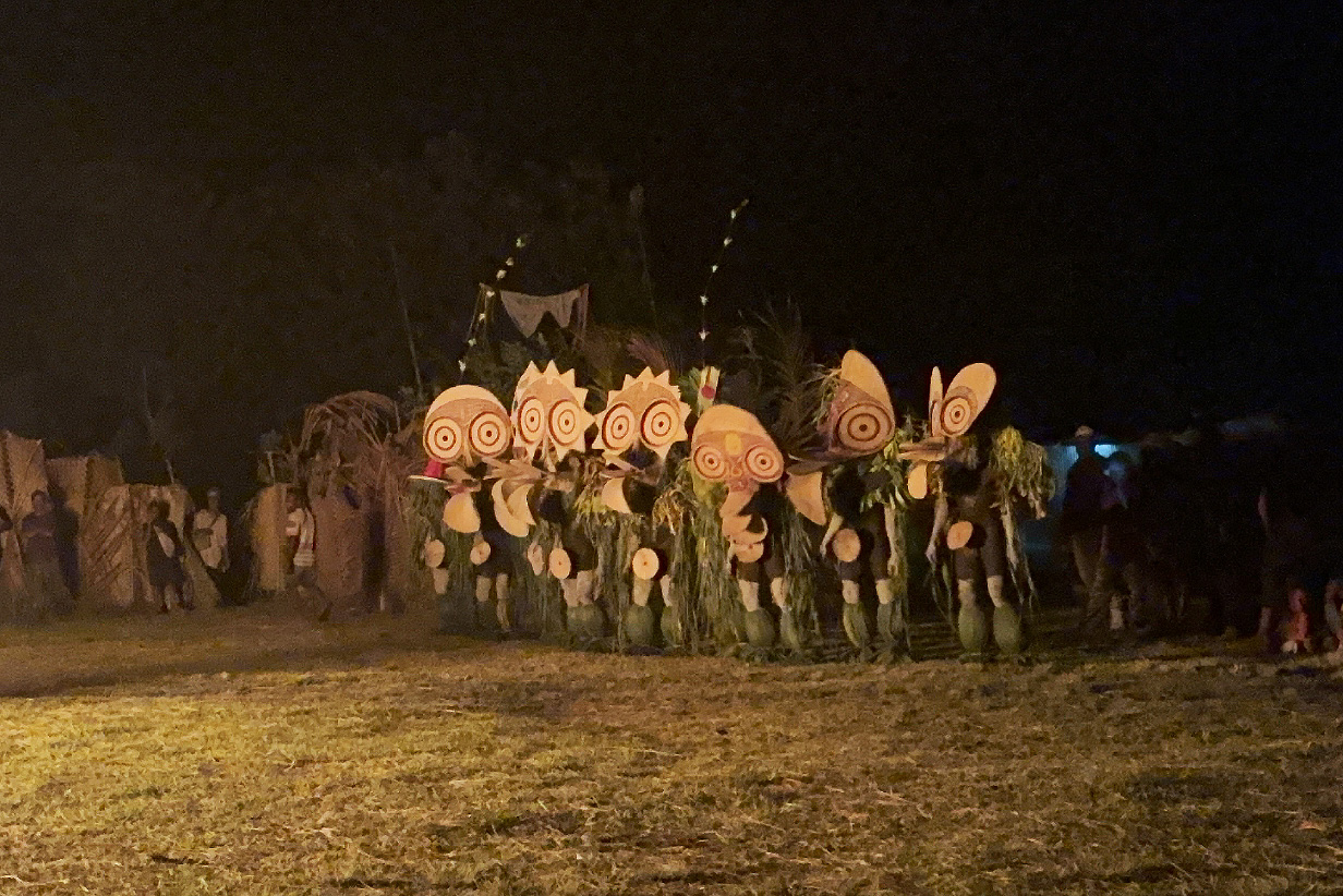
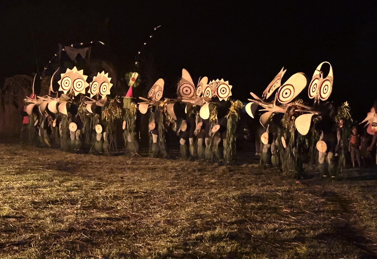
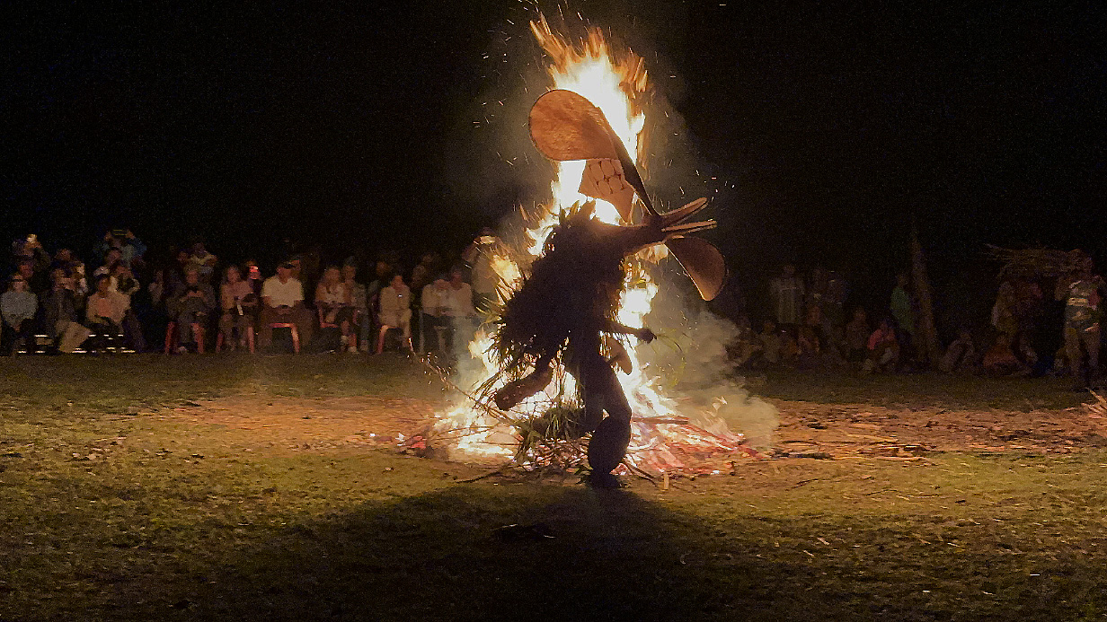
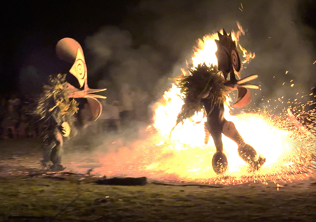
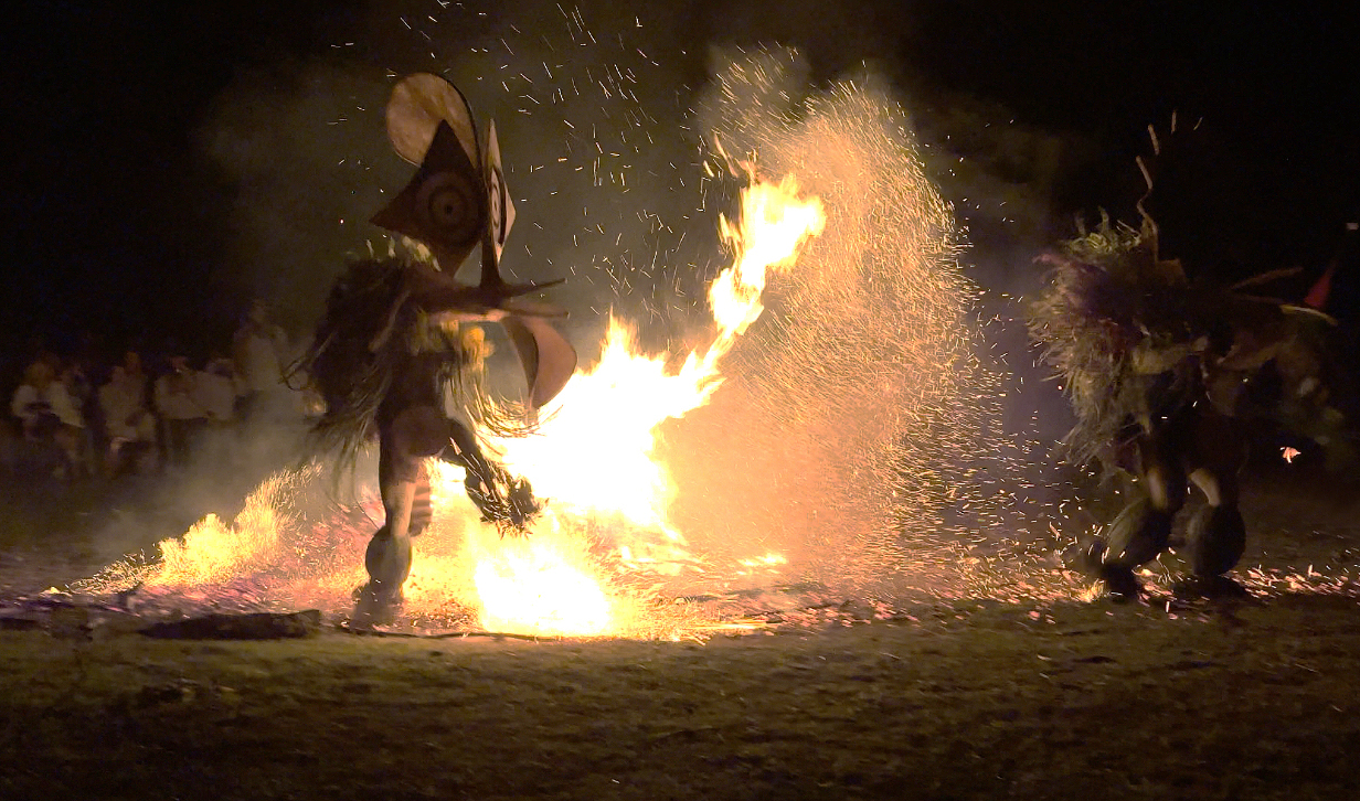
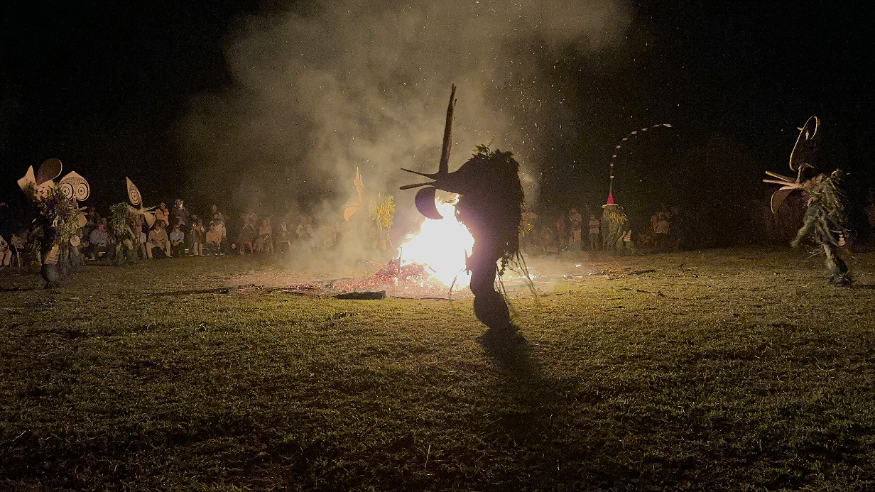
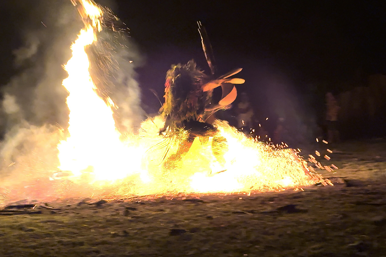
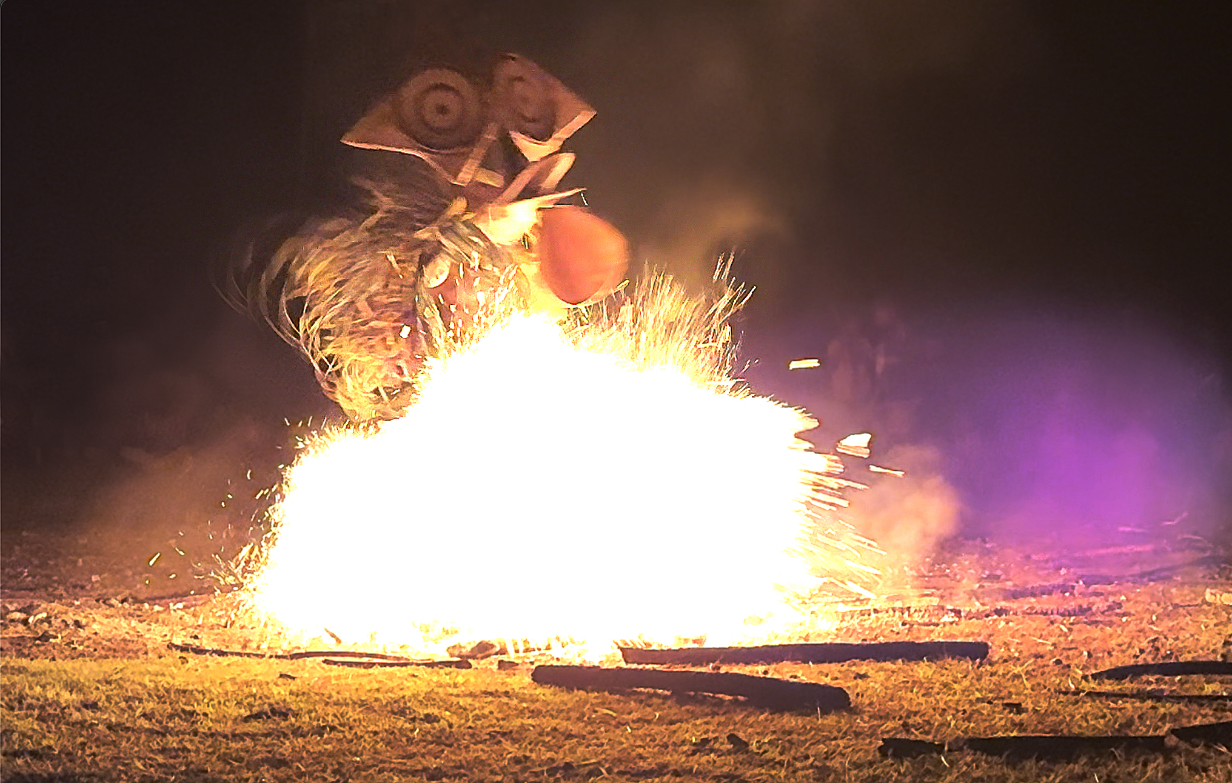
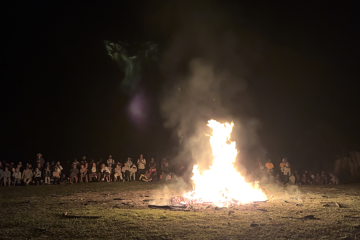
September 21, 2025 AM: Snorkeling at Njari Island, Solomon Islands
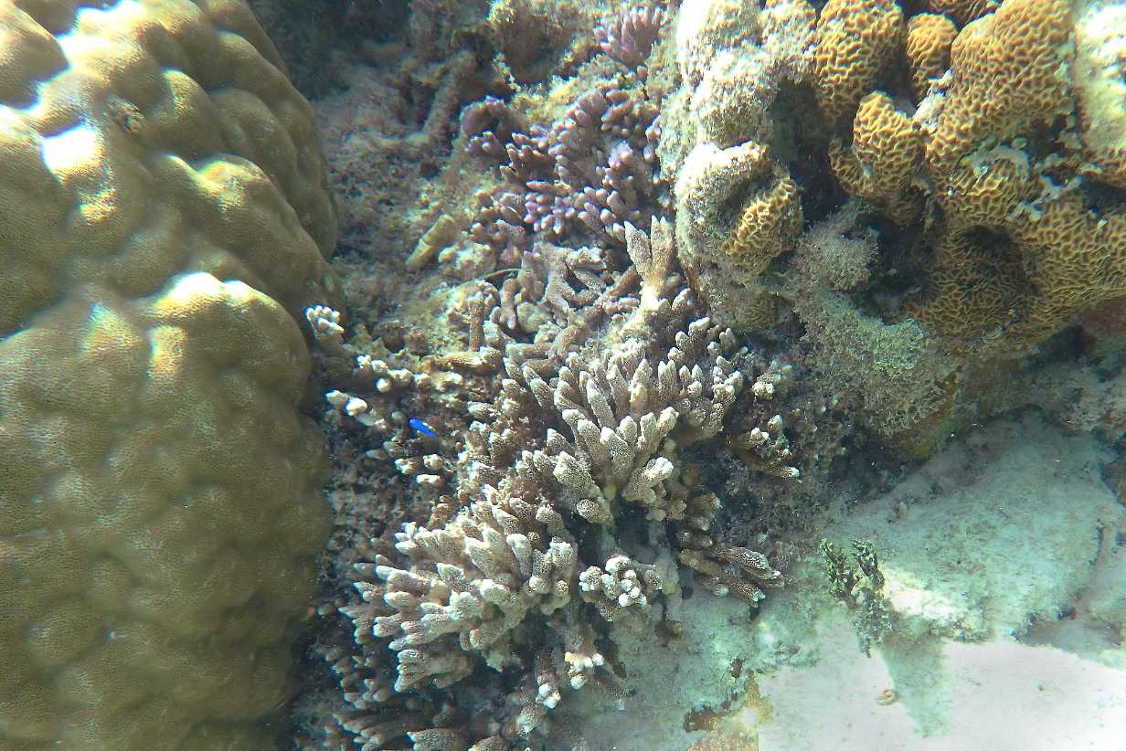
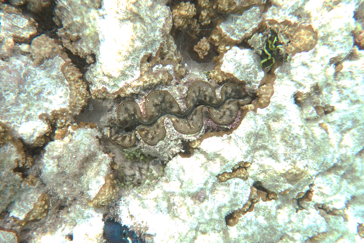
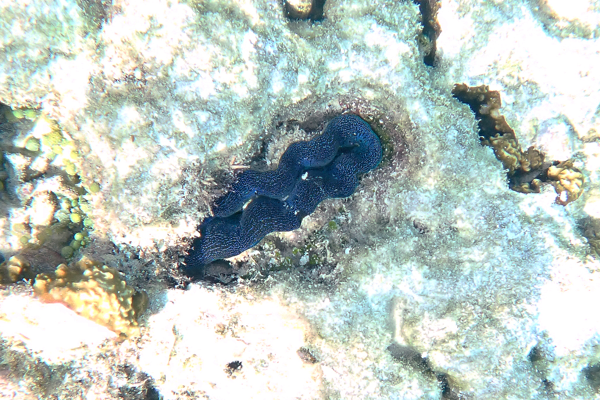
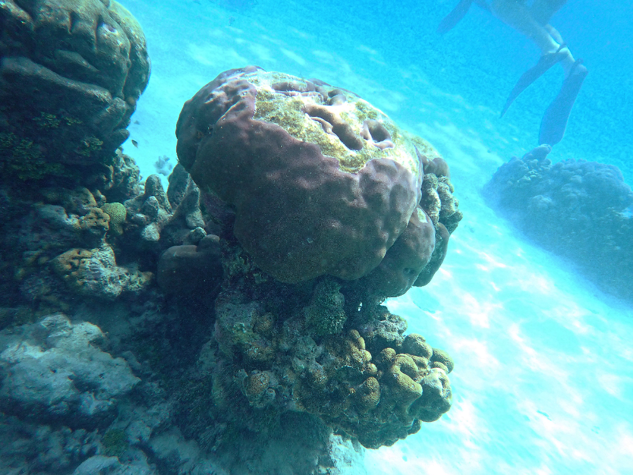
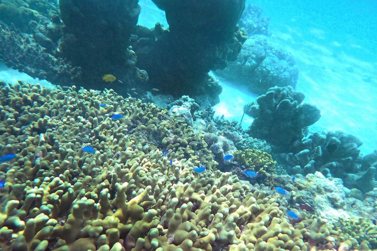
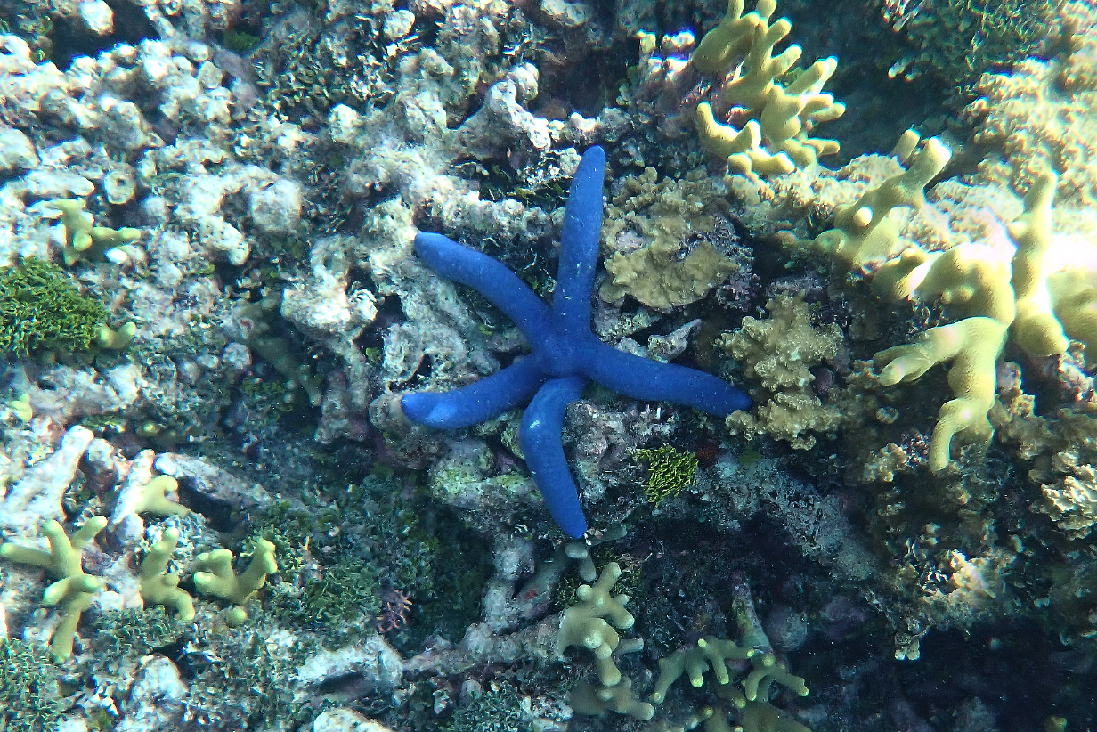
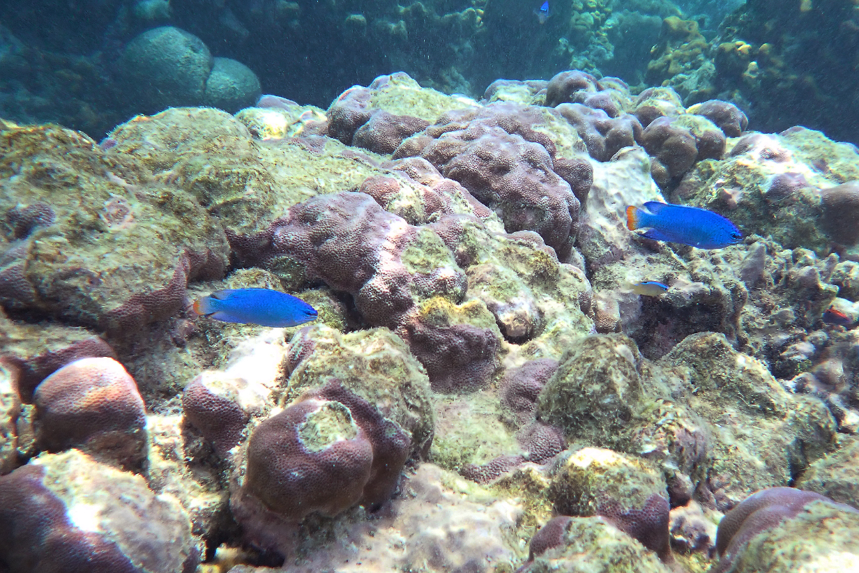
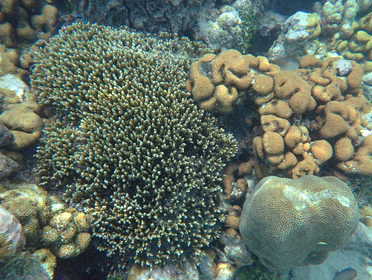
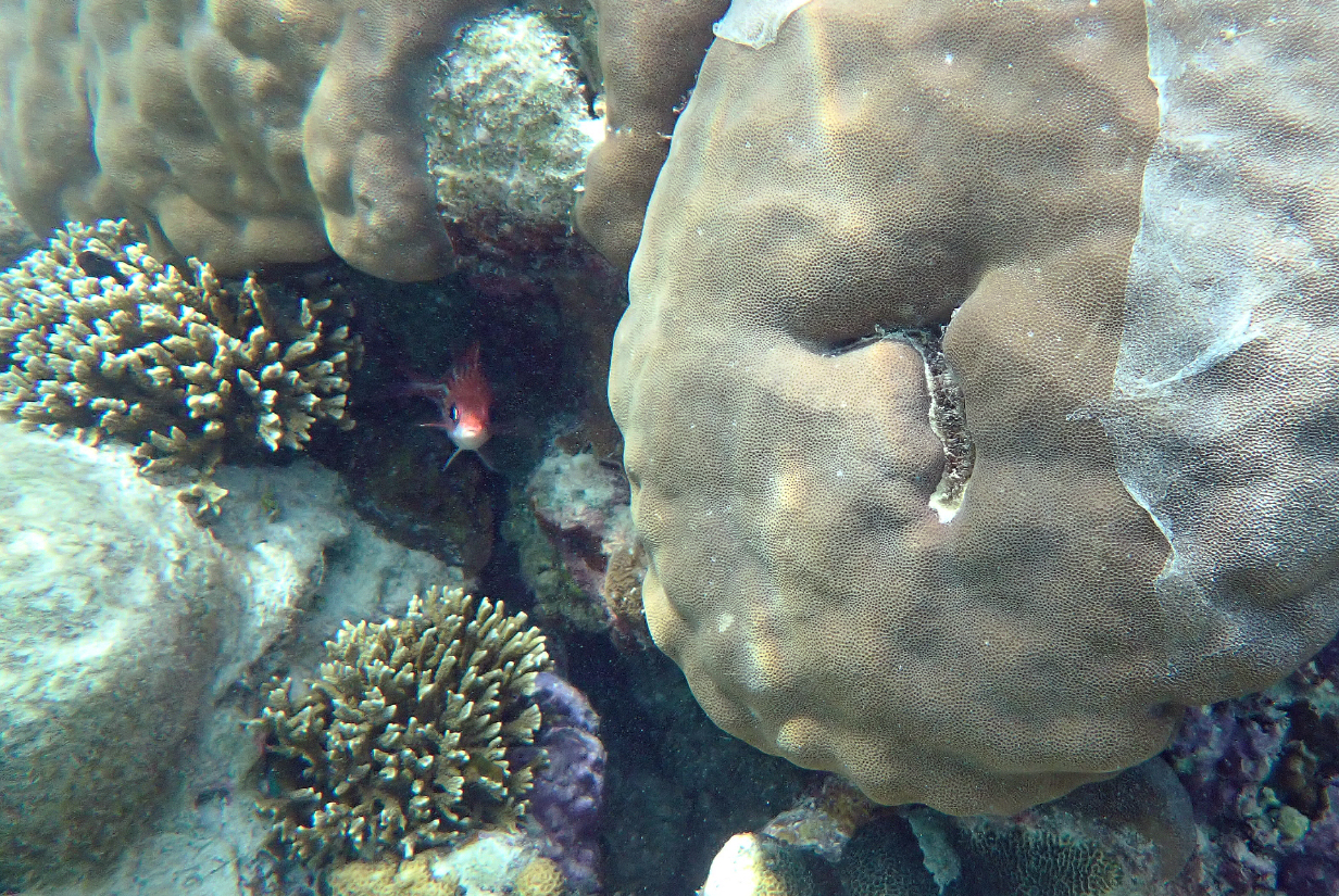
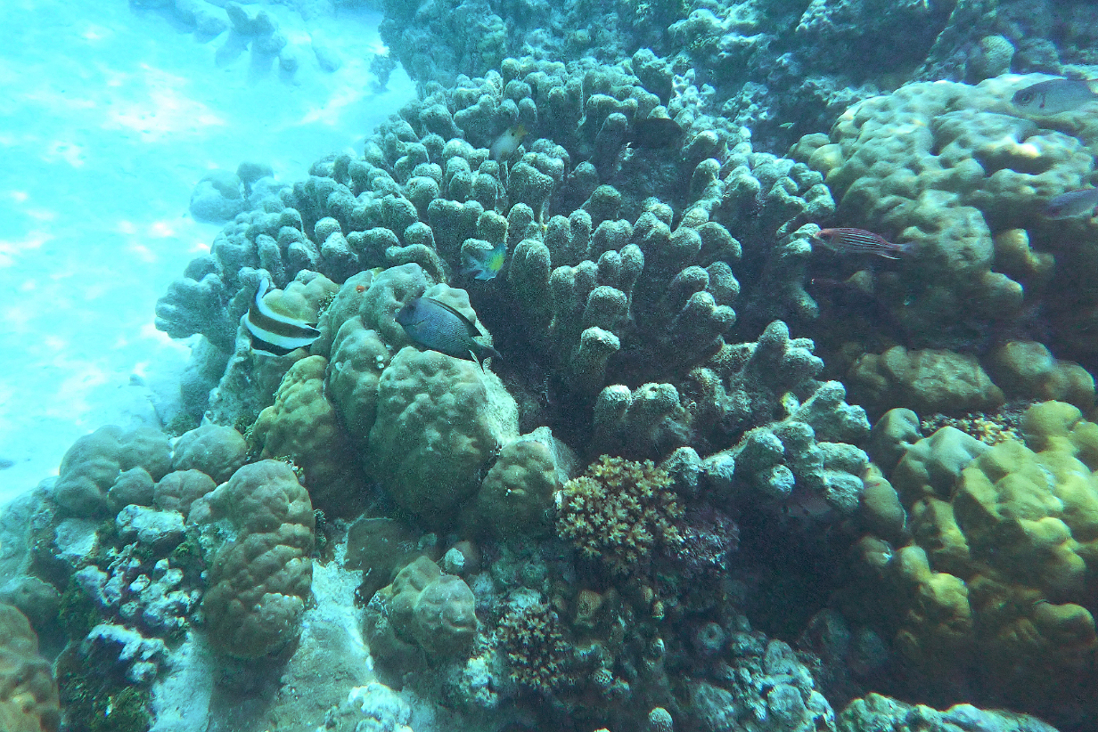
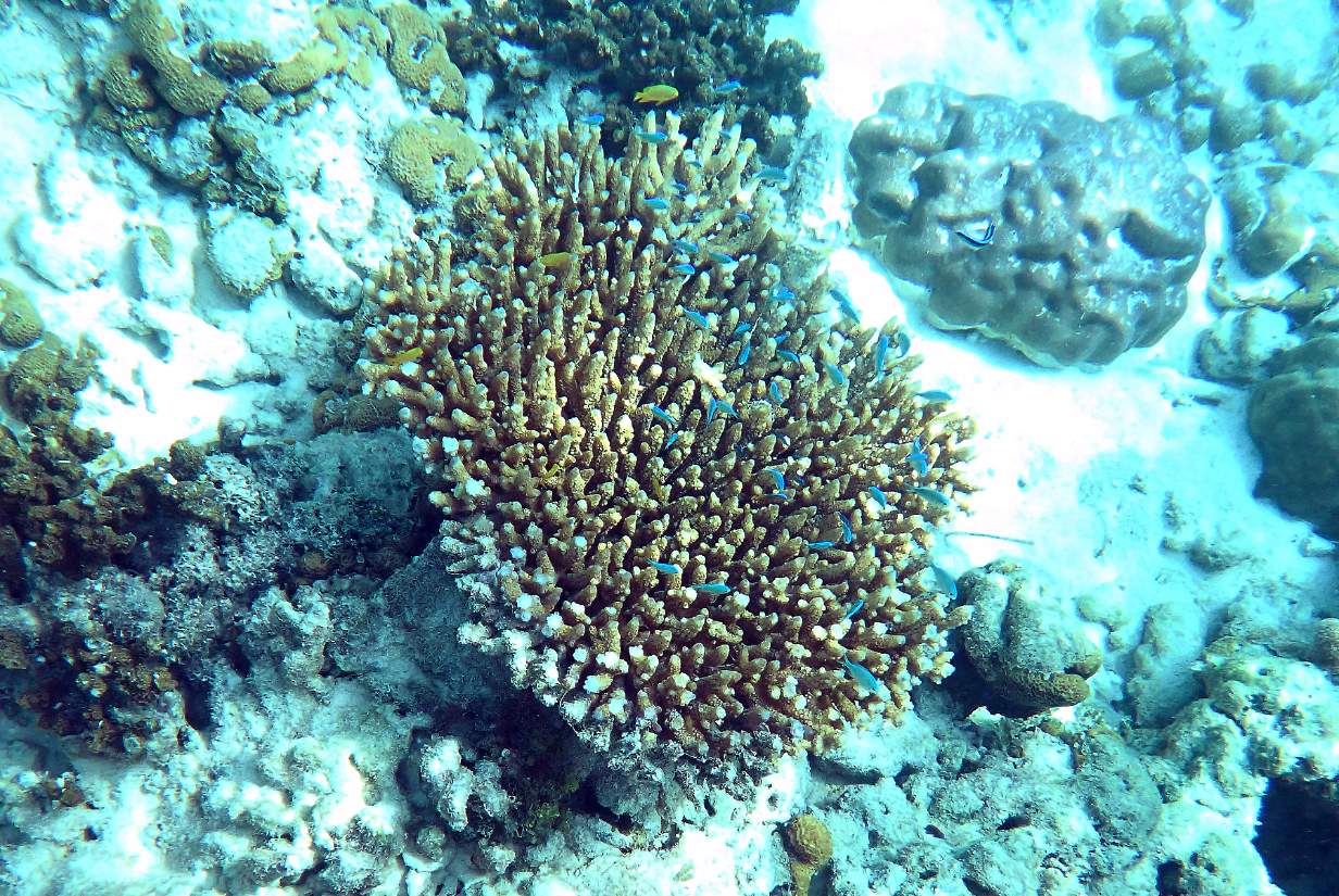
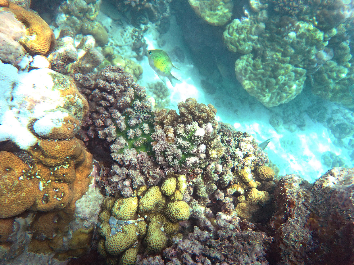
September 22, 2025; Private Birding Tour at Honiara, Guadalcanal Island, Solomon Islands
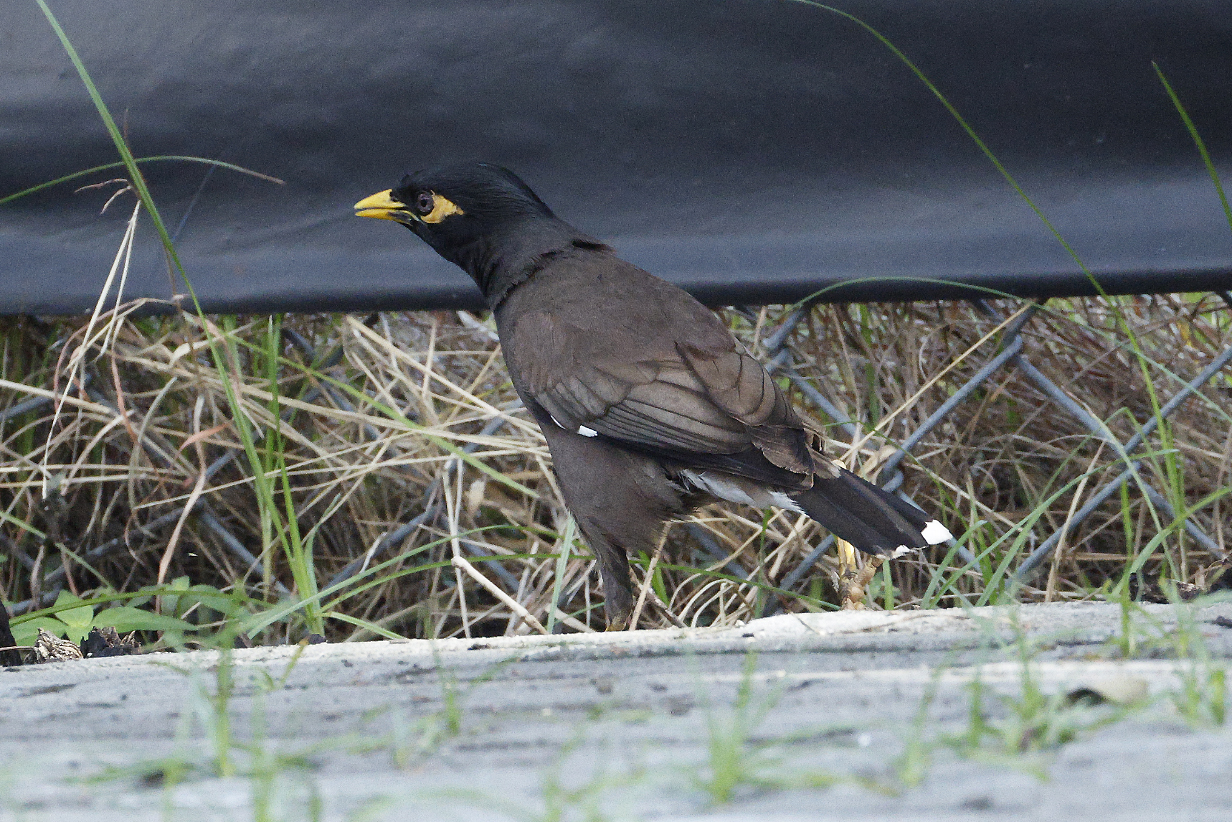
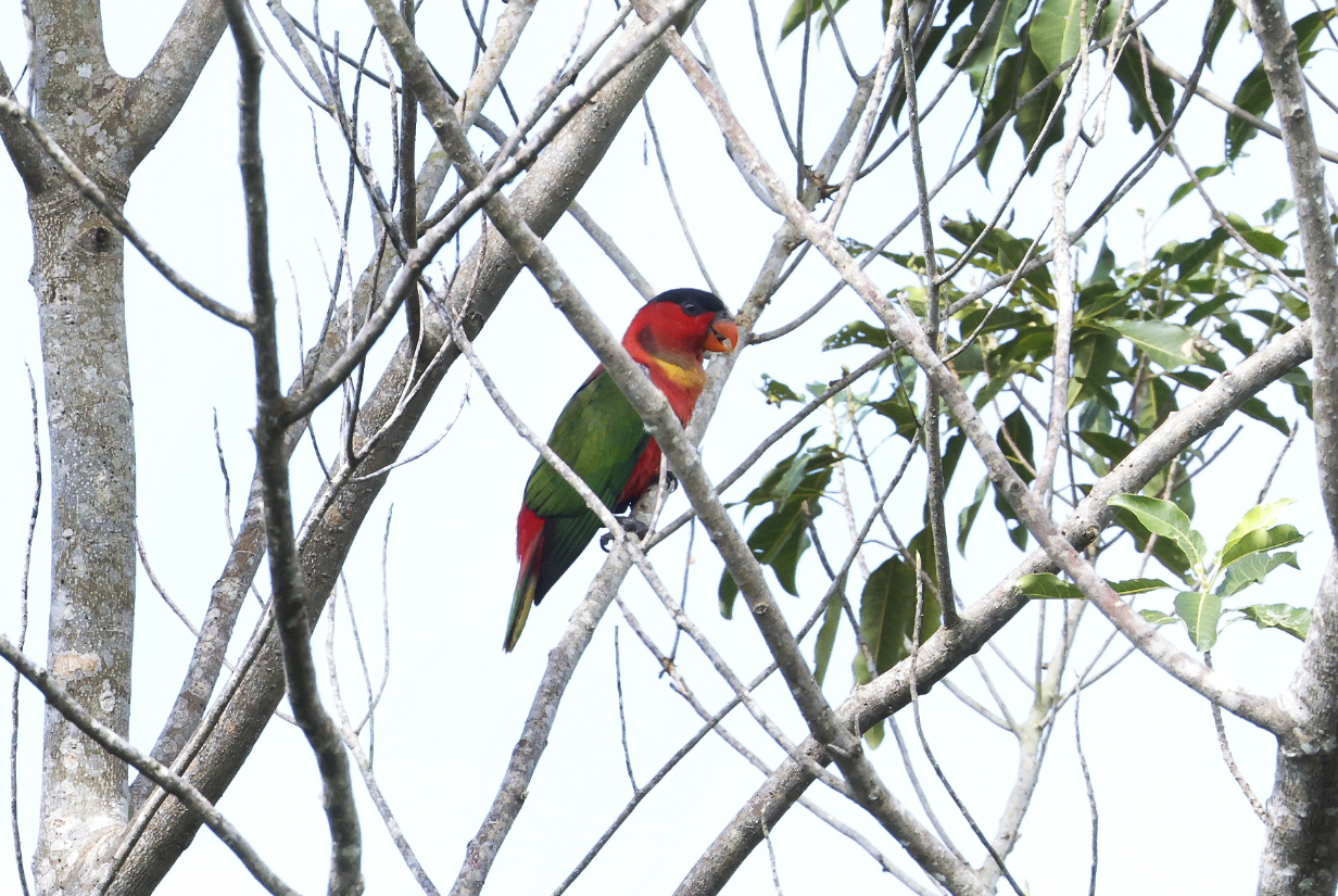
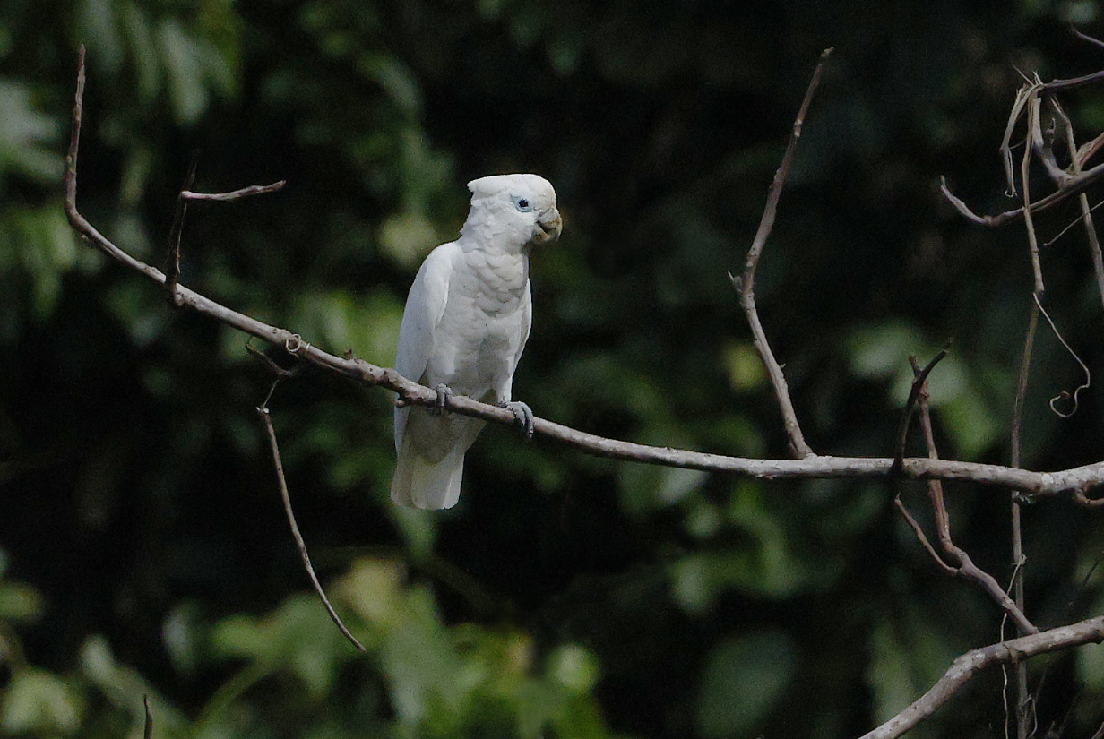
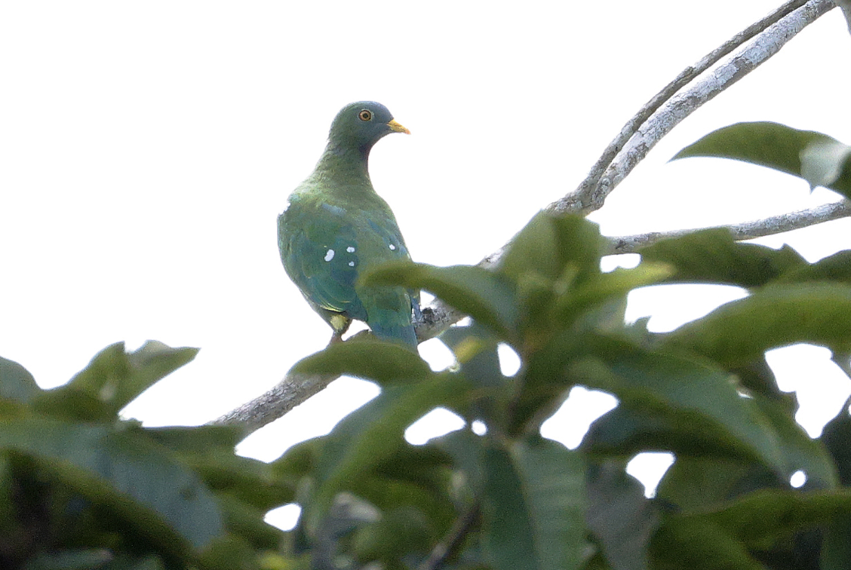
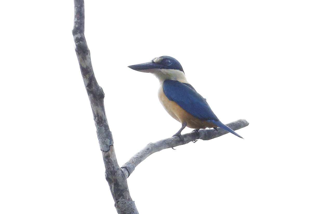
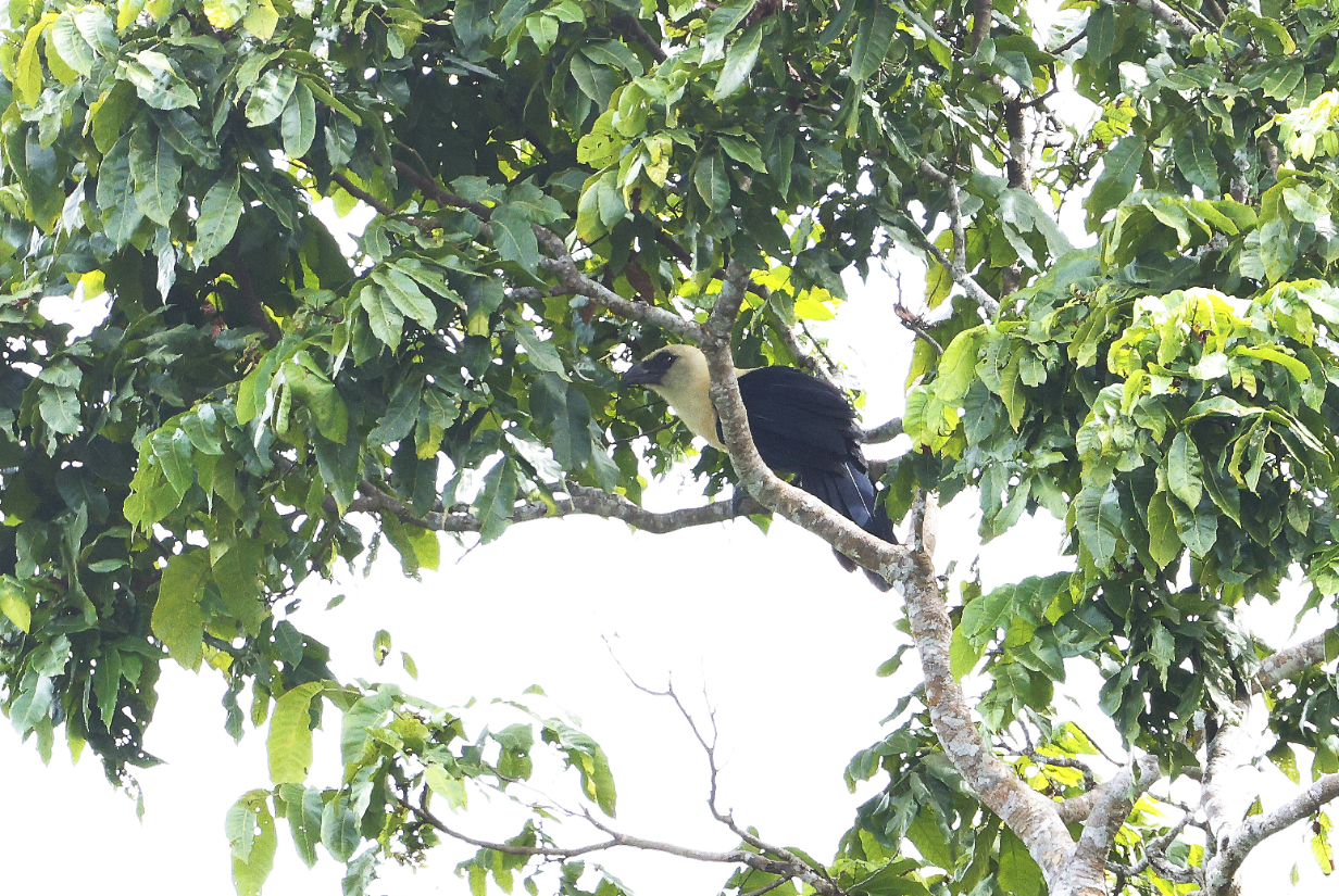
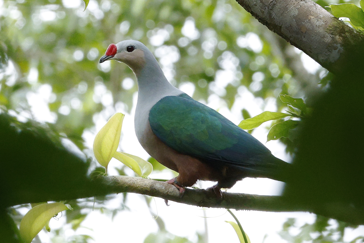
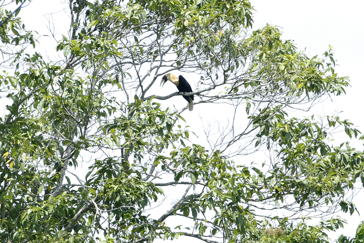
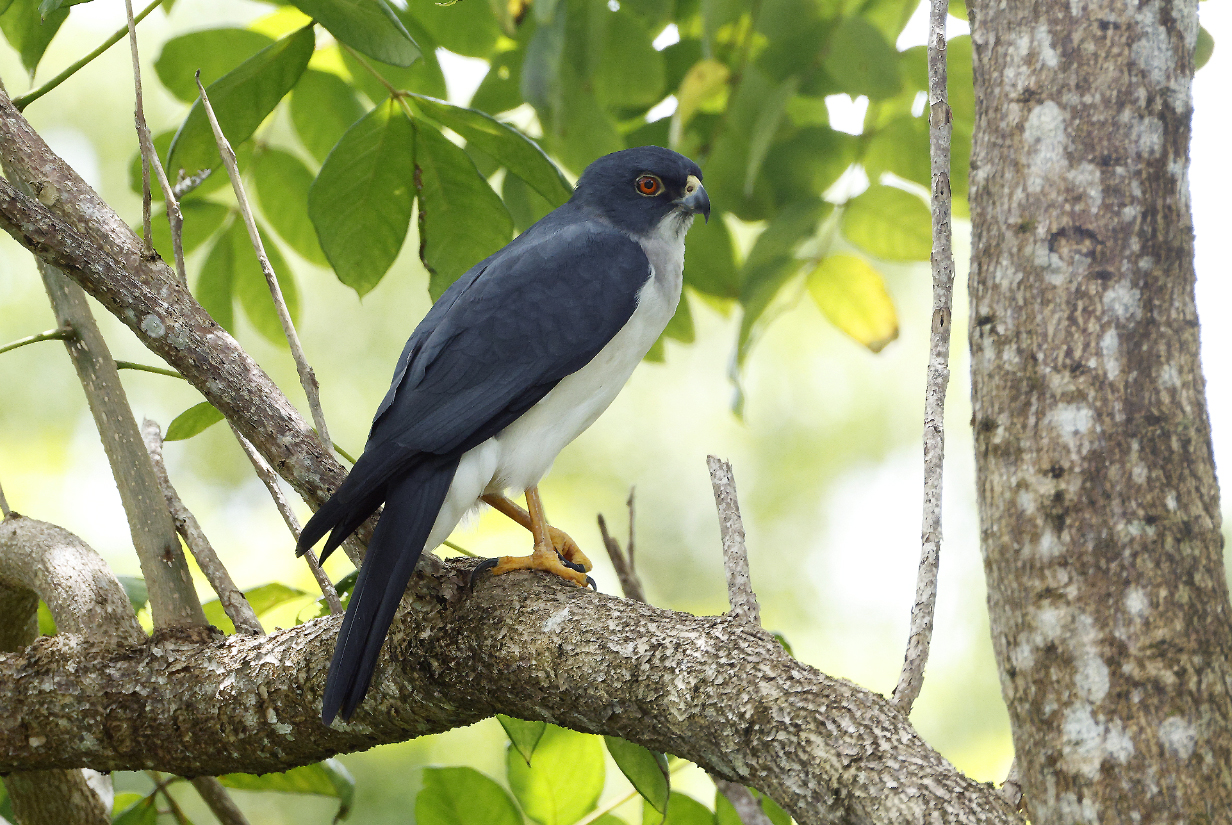
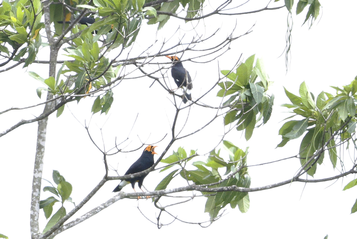
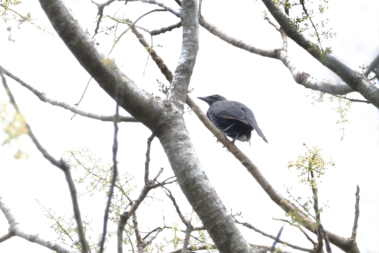
September 24, 2025; Nanunga Island, near Vanikoro, Solomon Islands
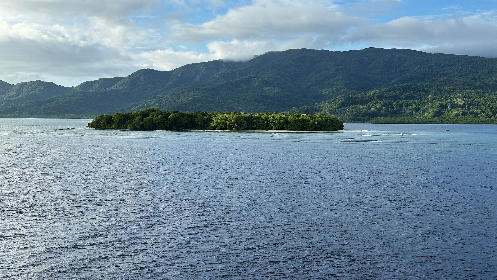
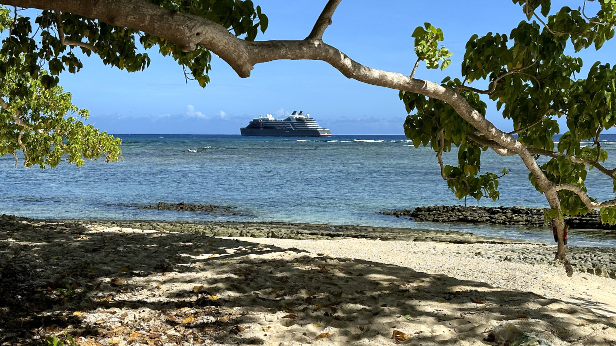
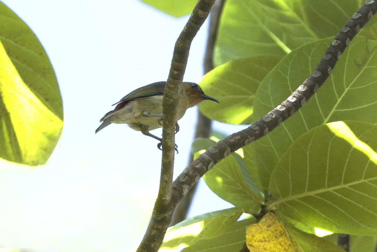
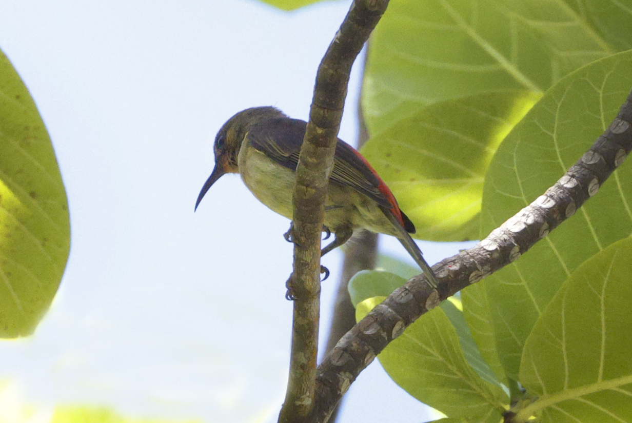
September 25, 2025: Rom Dance, Ambrym Island, Vanuatu
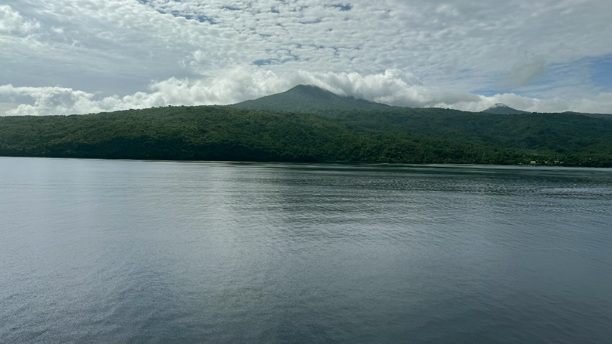
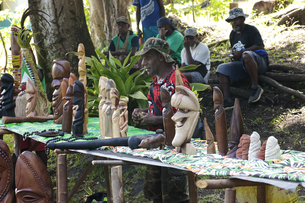
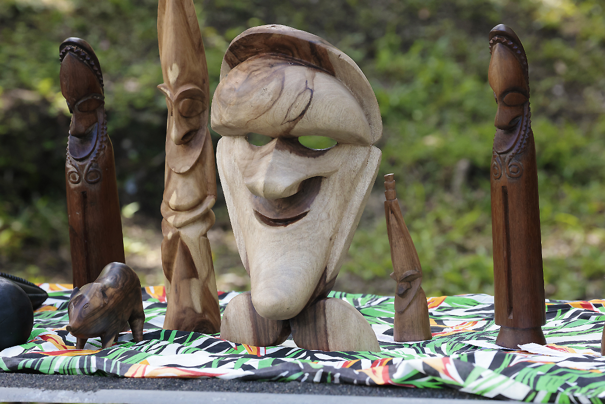
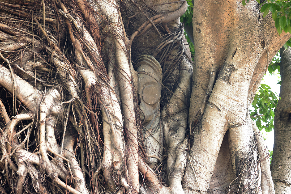
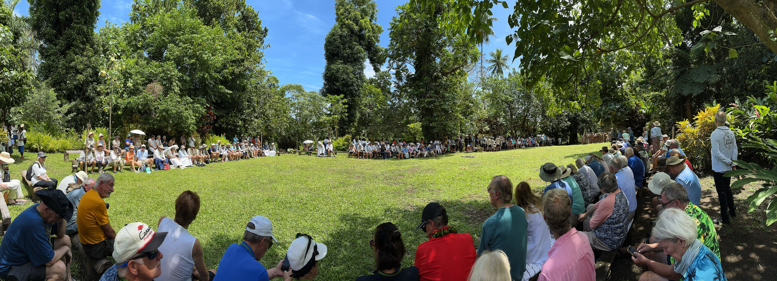
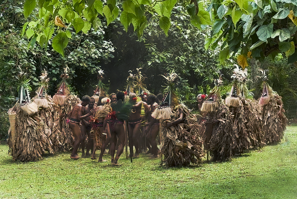
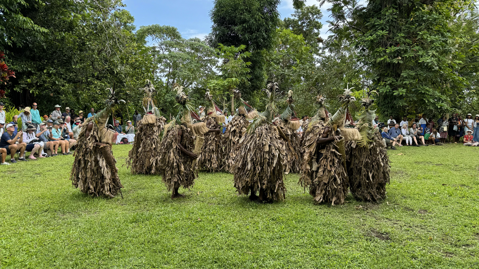
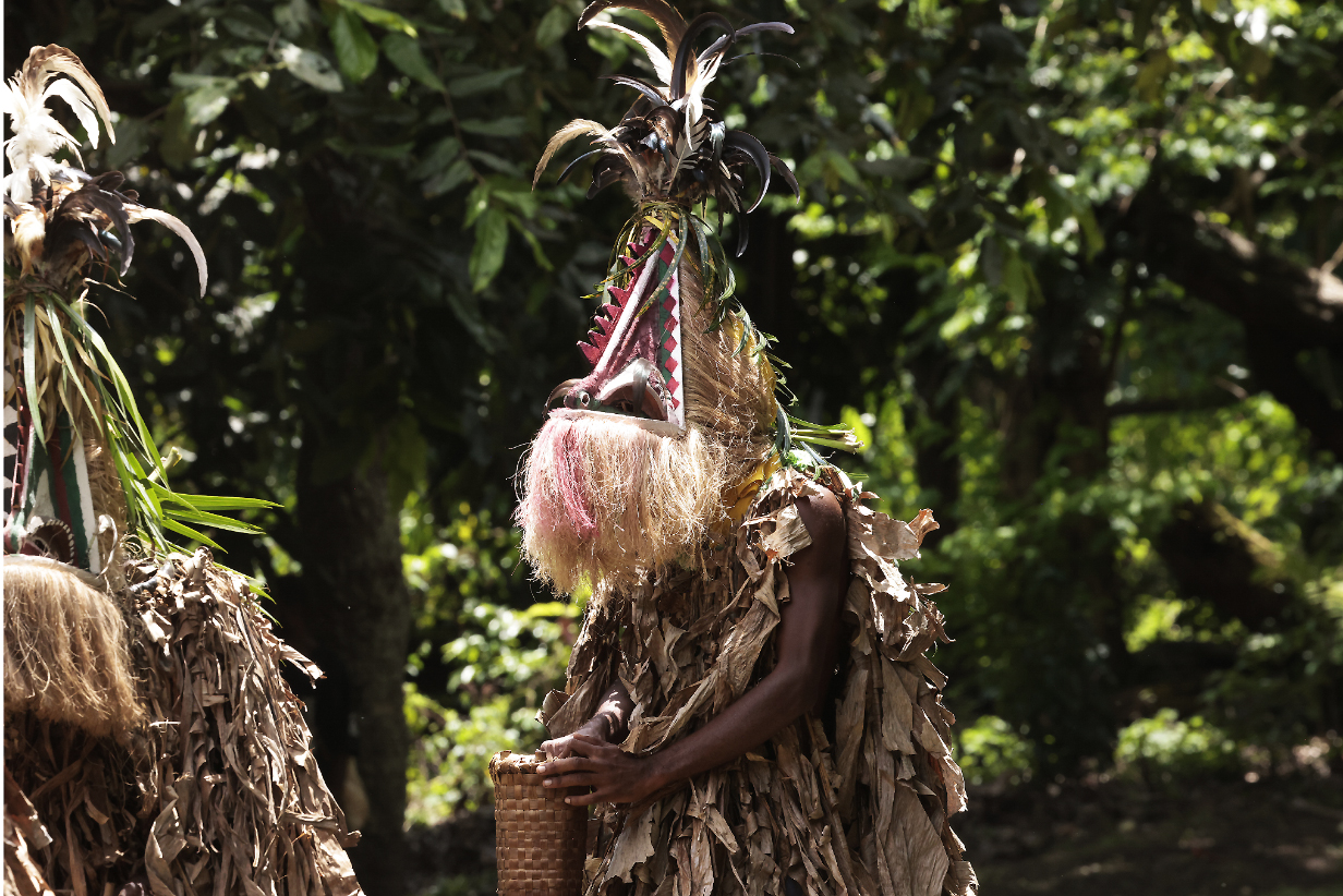
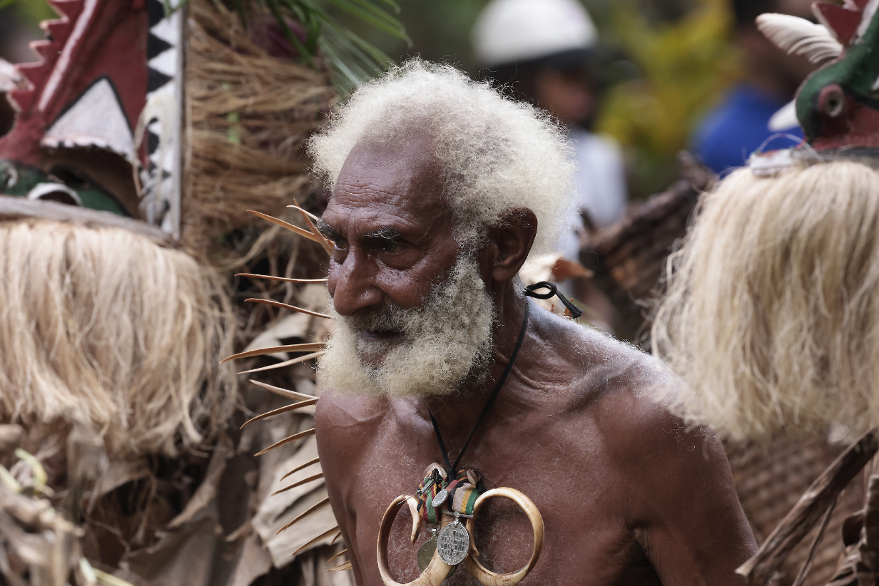
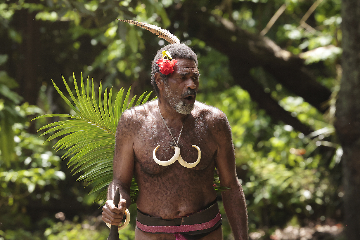
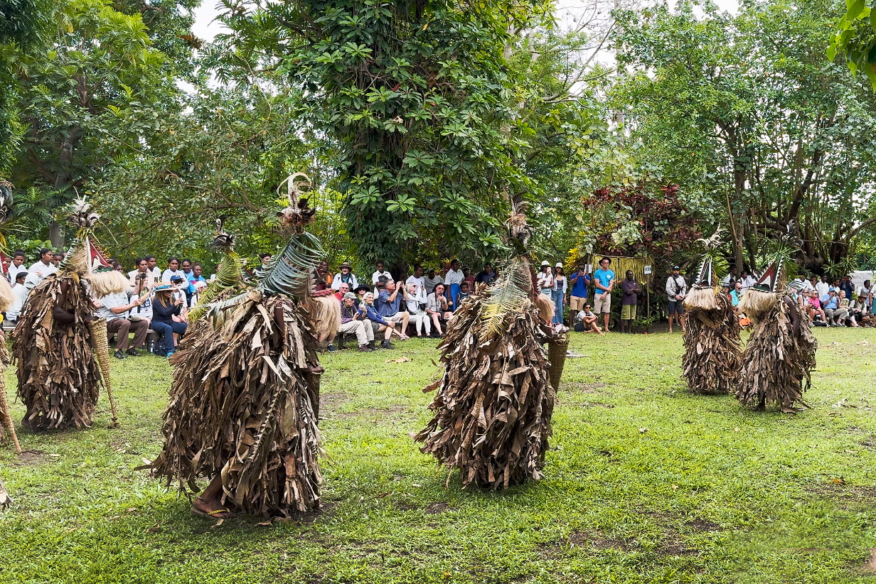
September 27, 2025: Private Birding Tour out of Lautoka, Fiji
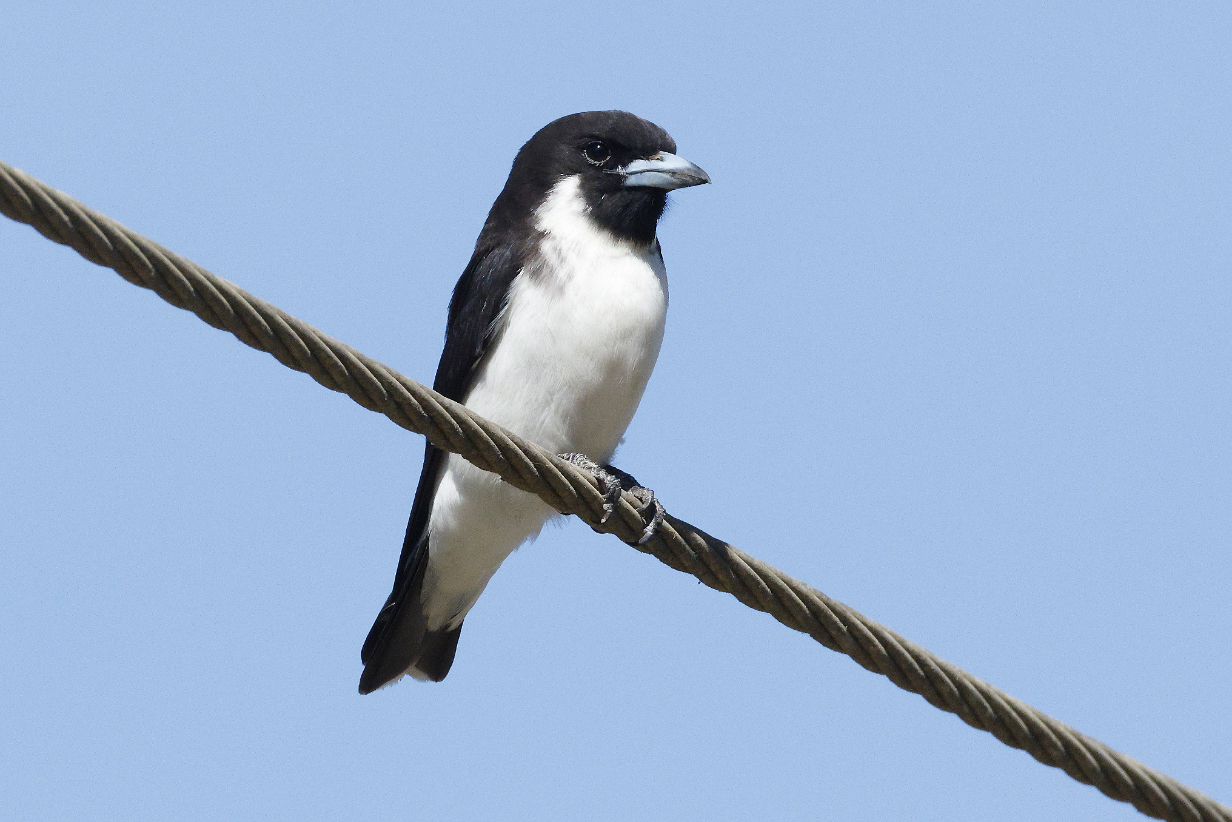
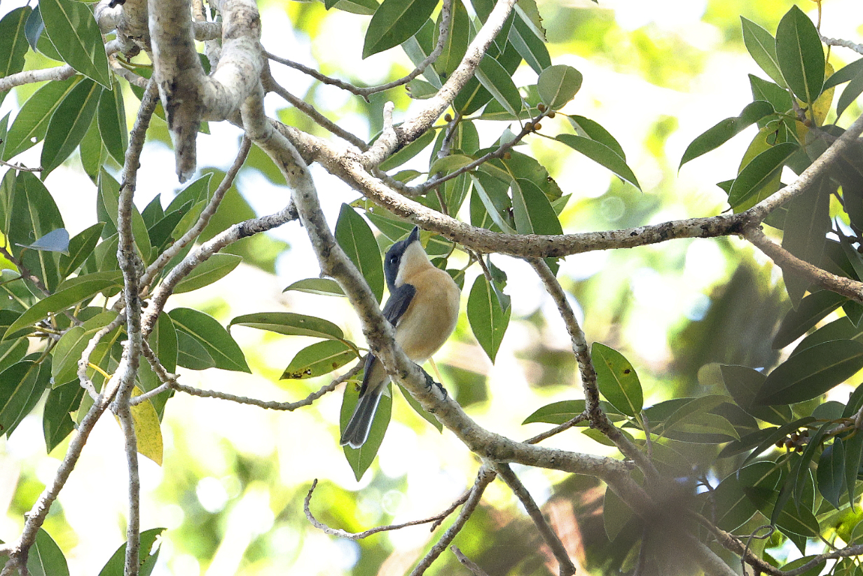
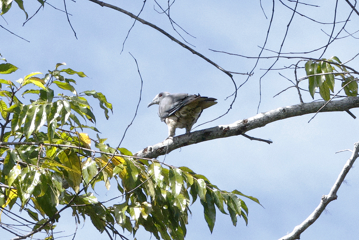
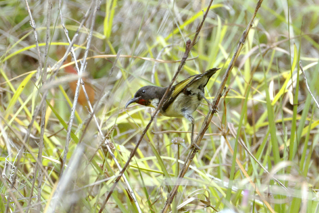
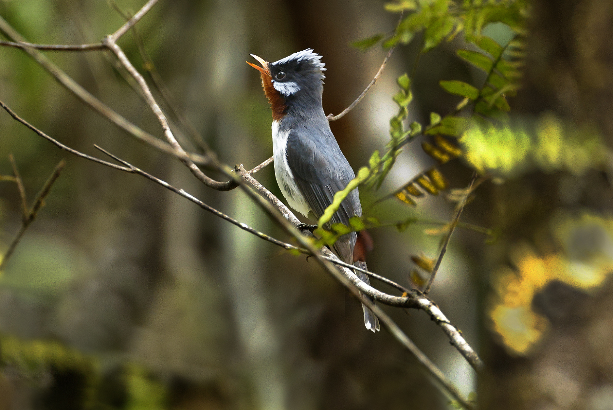
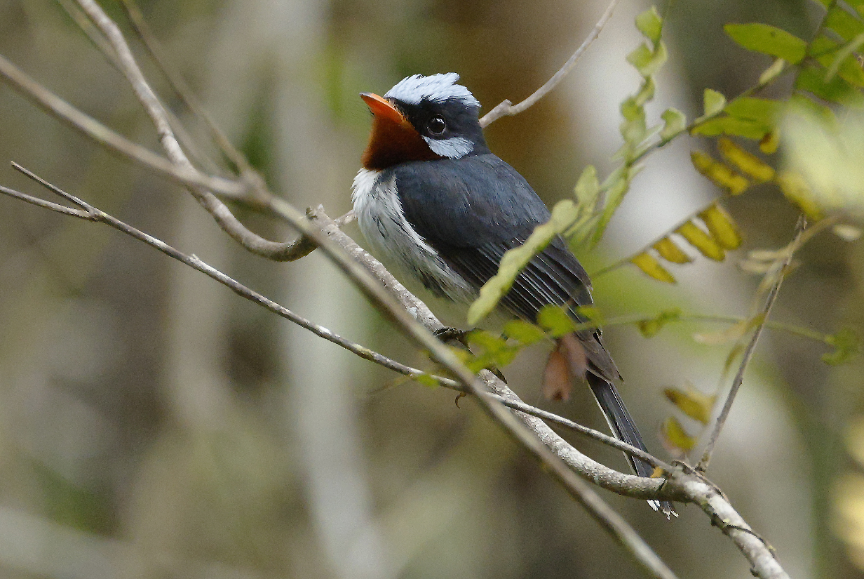
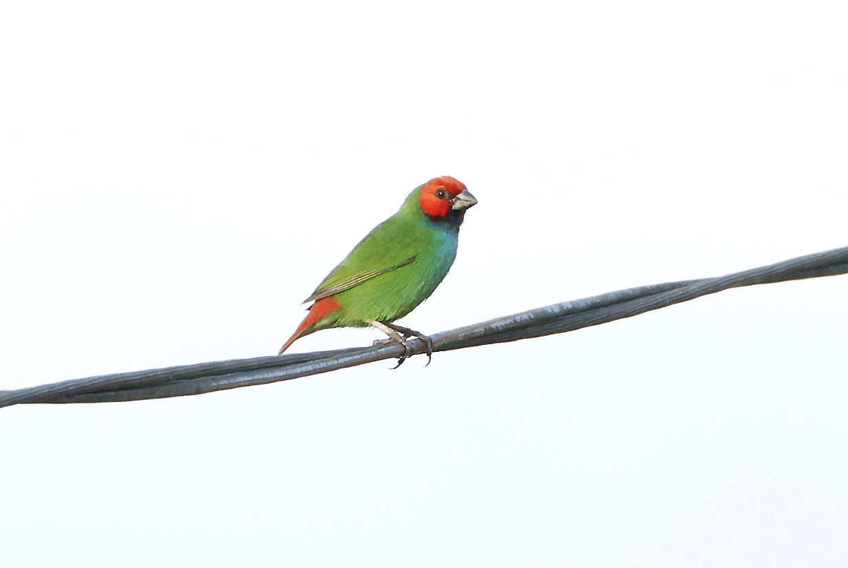
September 29, 2025: Dravuni Island and Village, Kadavu Lagoon, Fiji
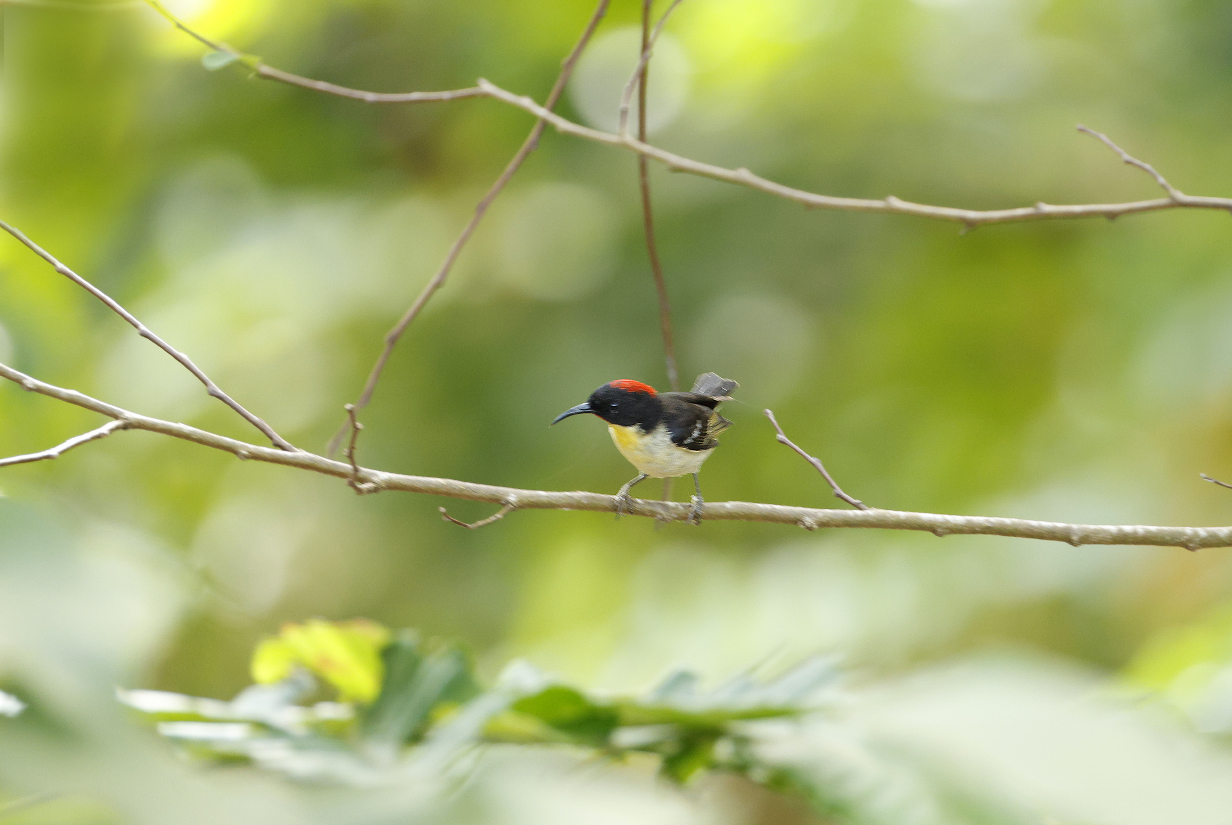
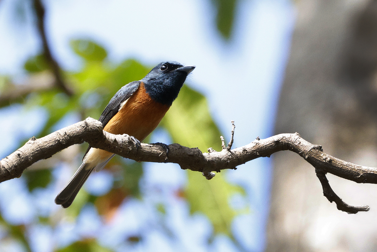
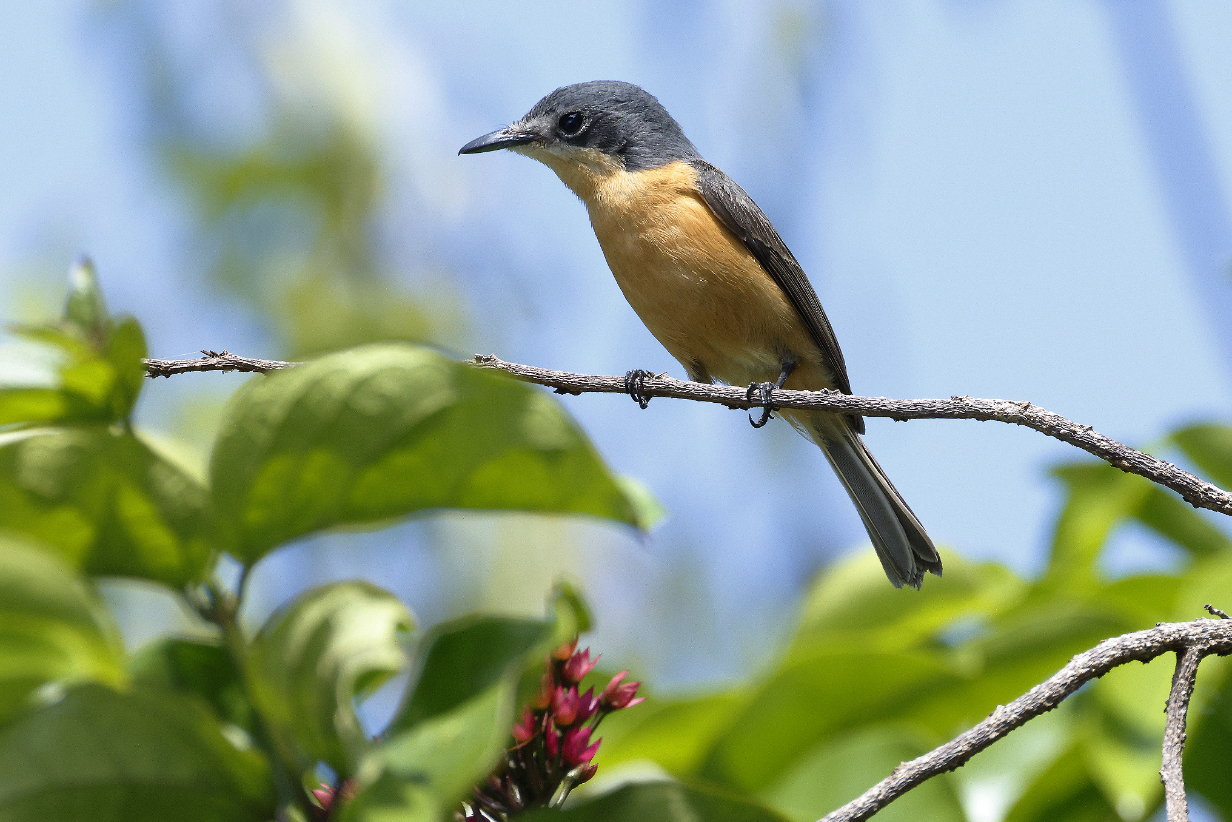
September 30, 2025: Submarine Dive to 40 m Depth, Vulaga, Fiji
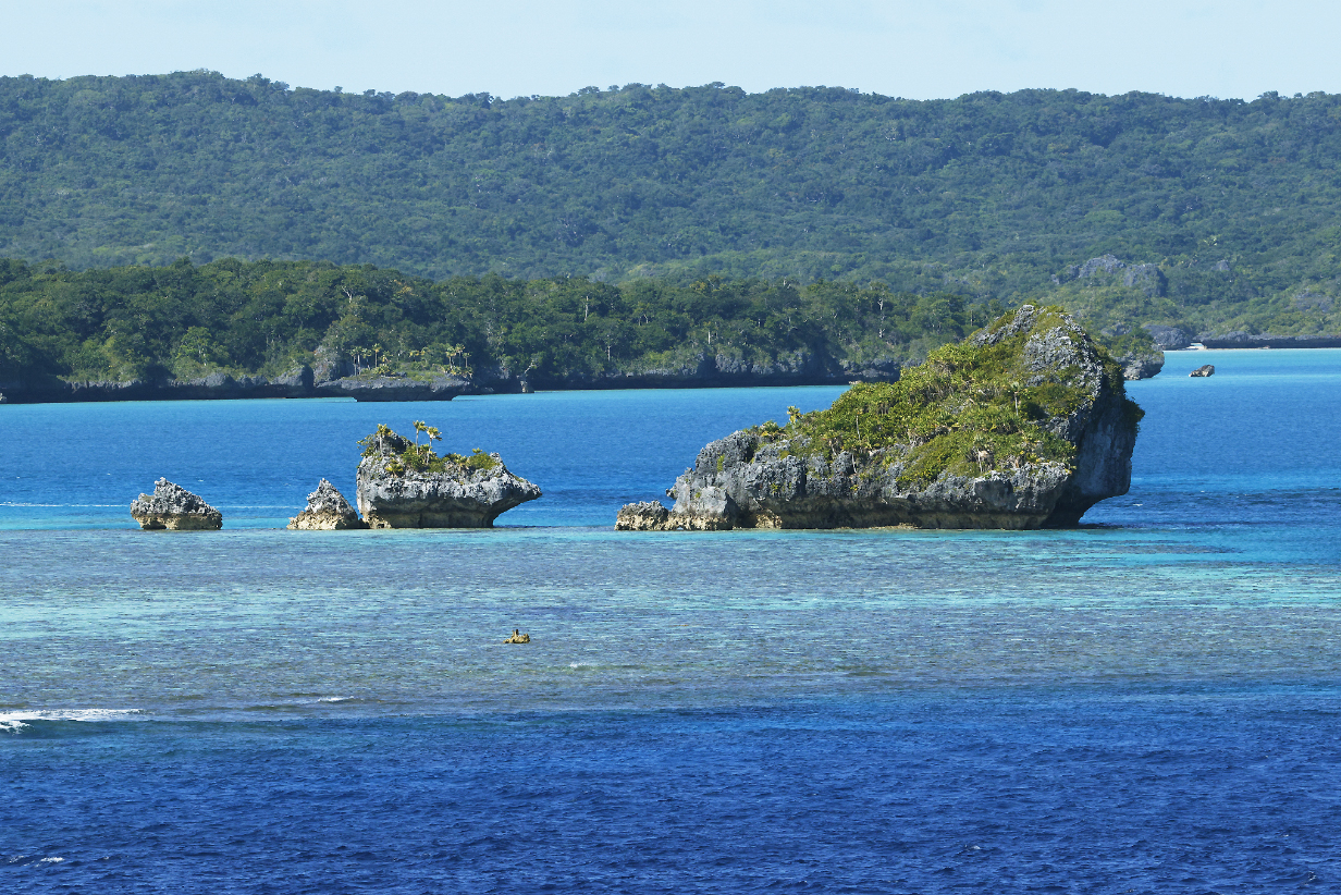
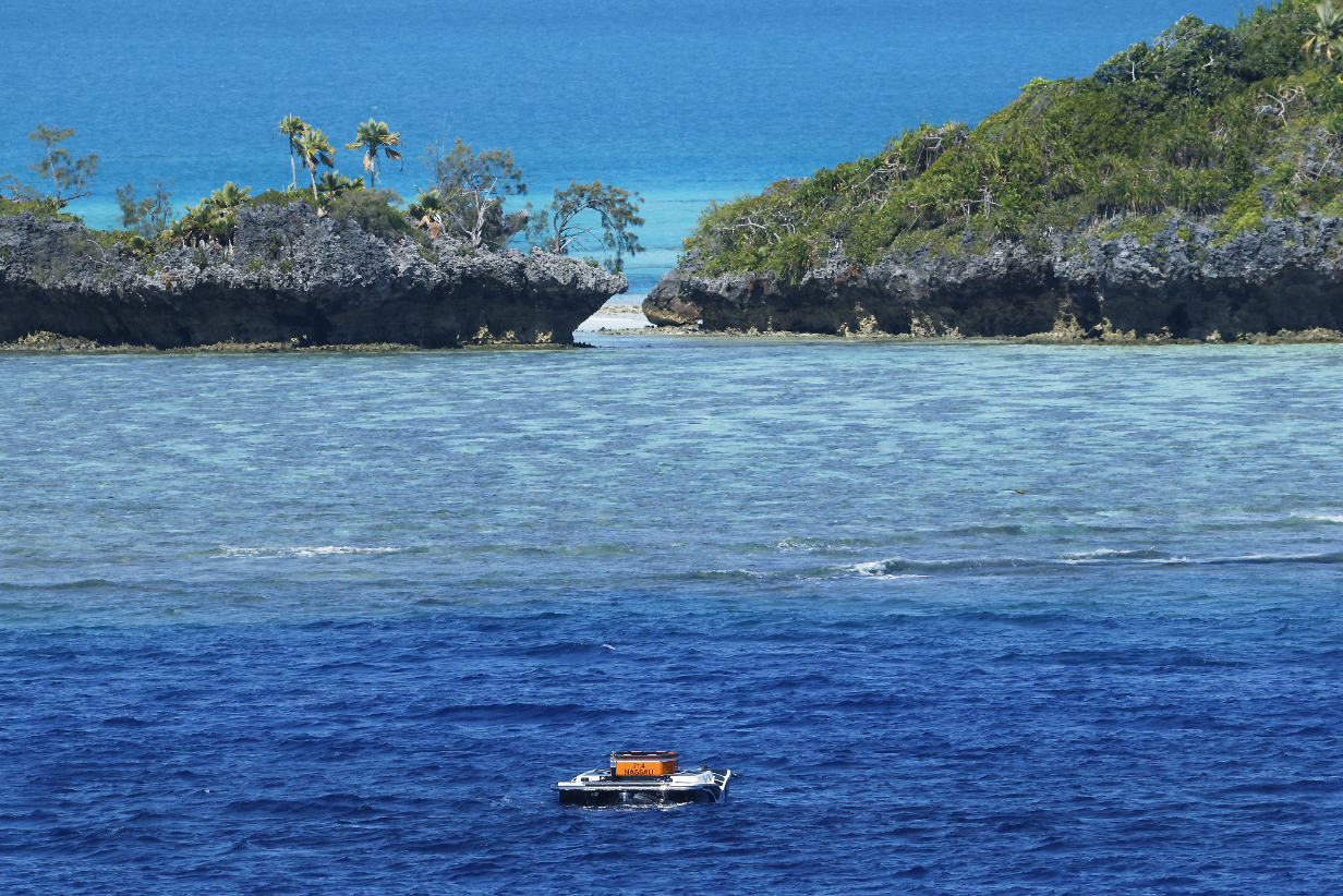
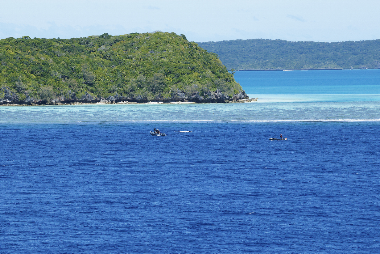
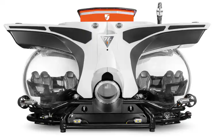
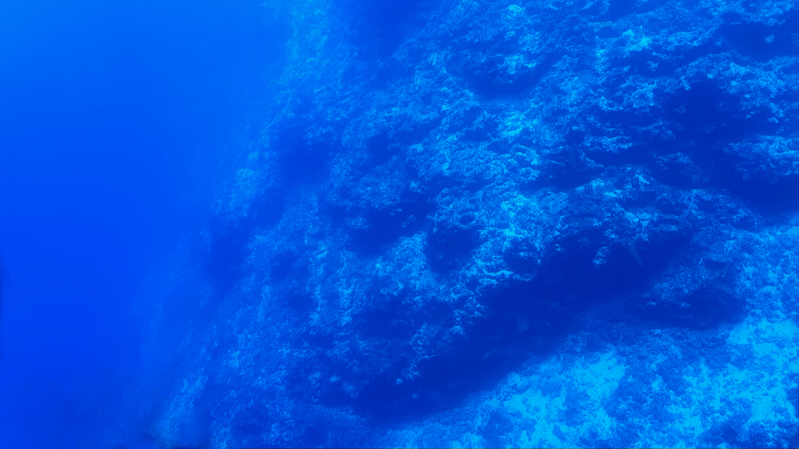
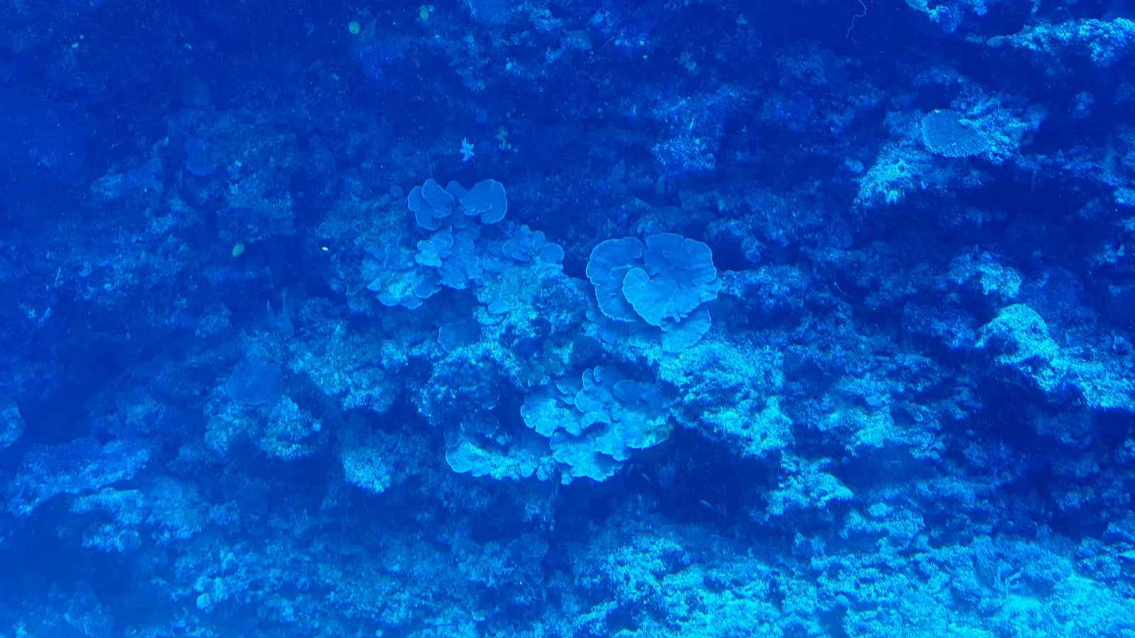
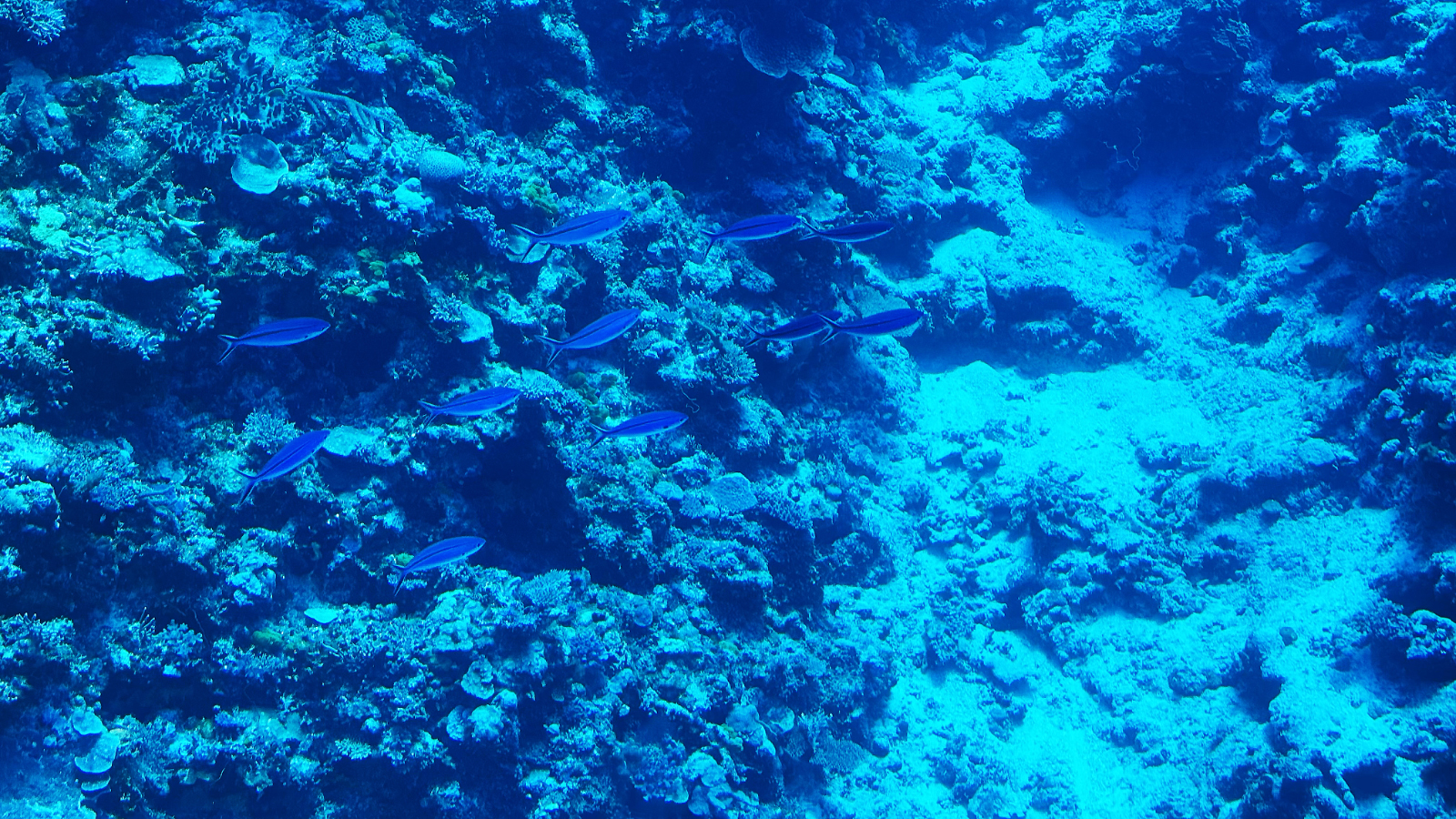
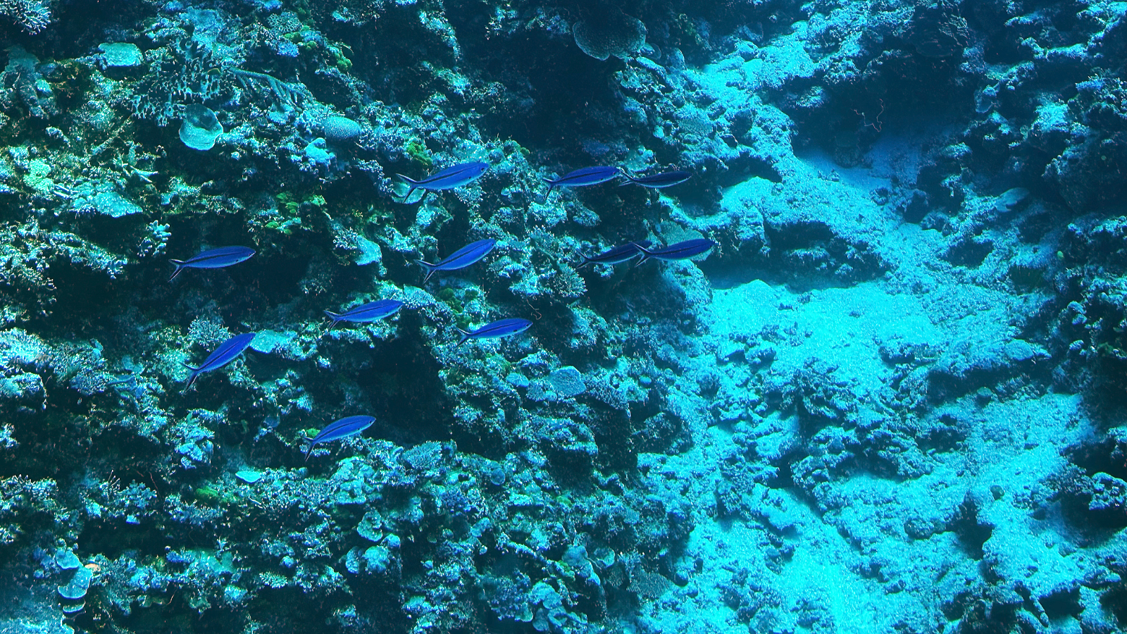
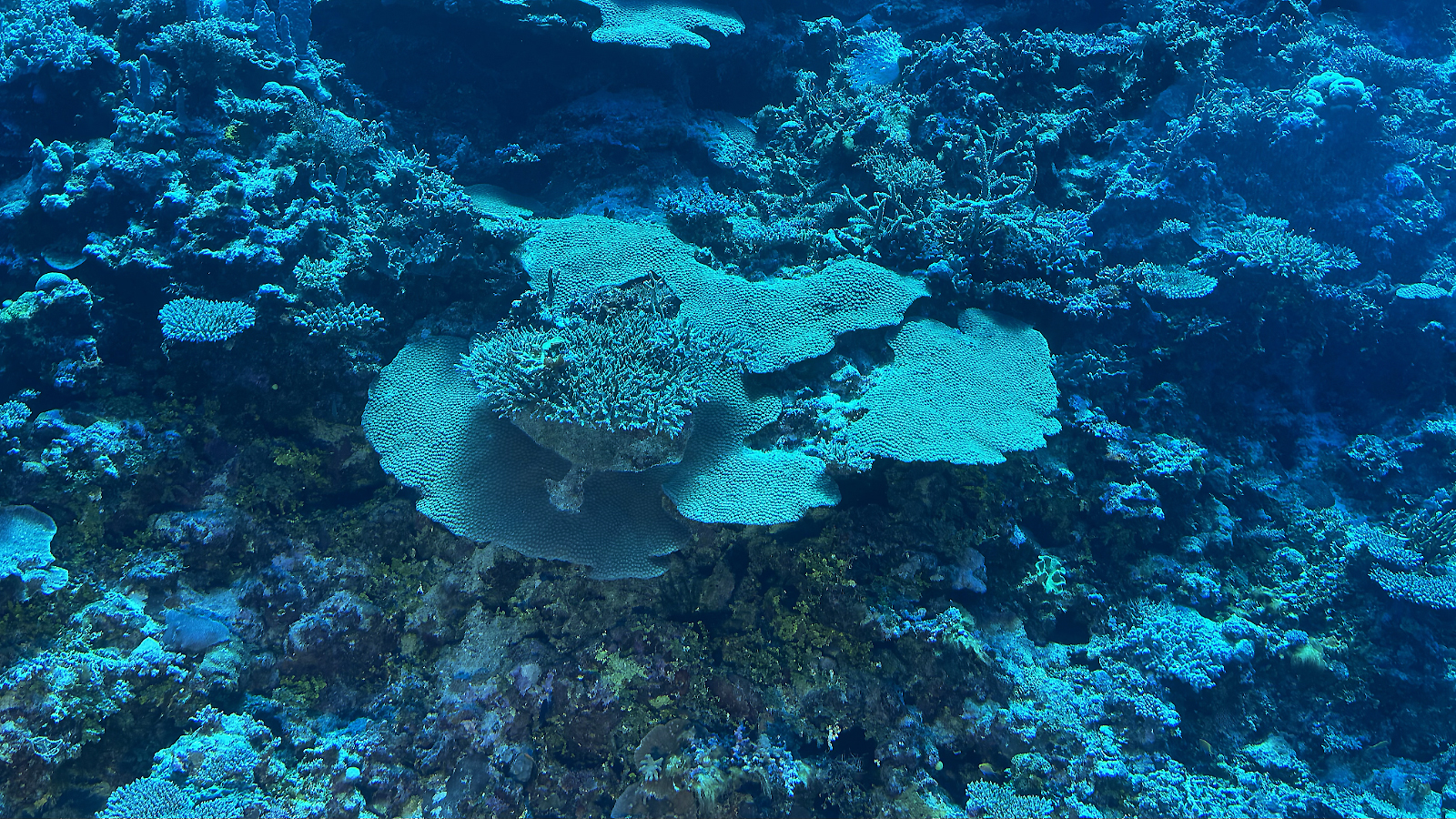
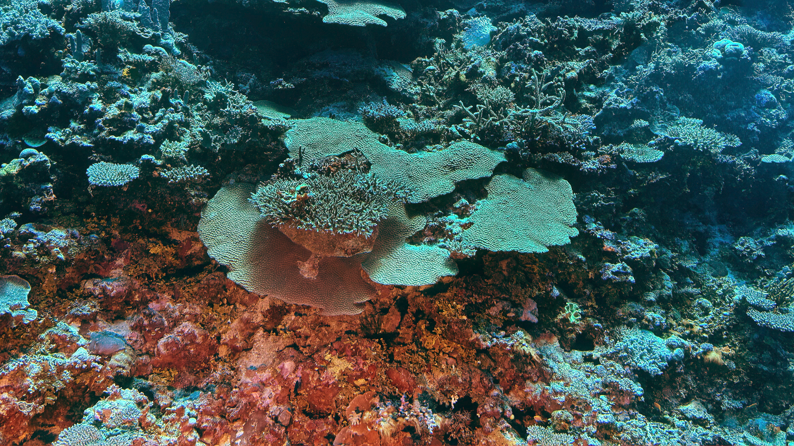
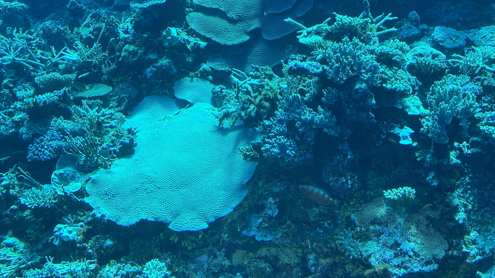
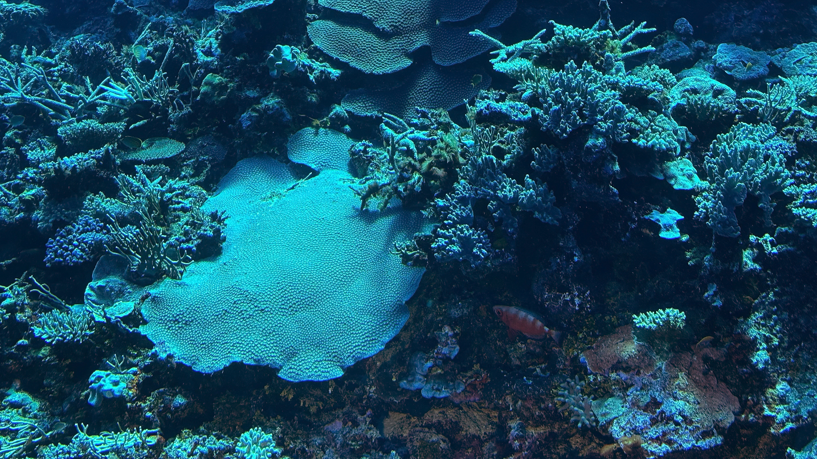
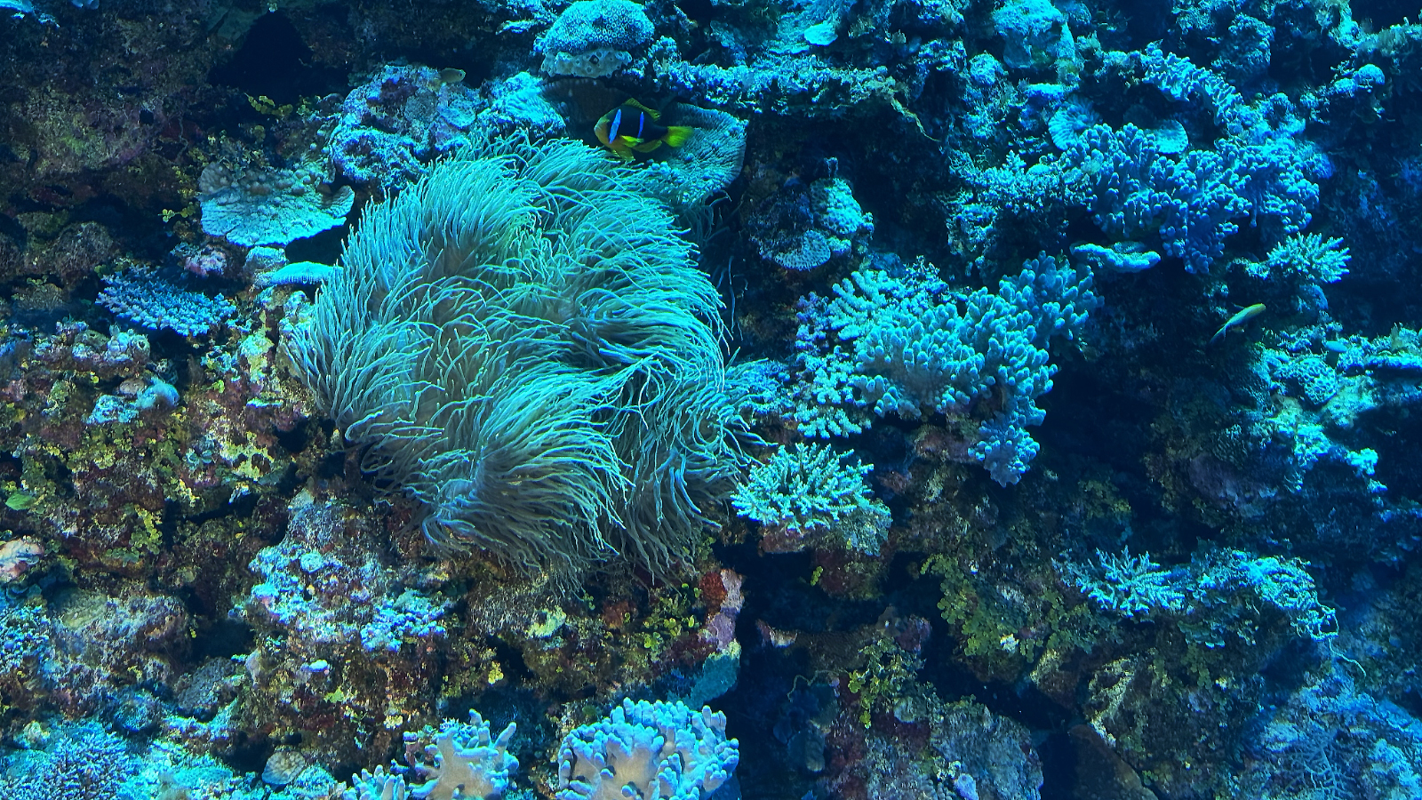
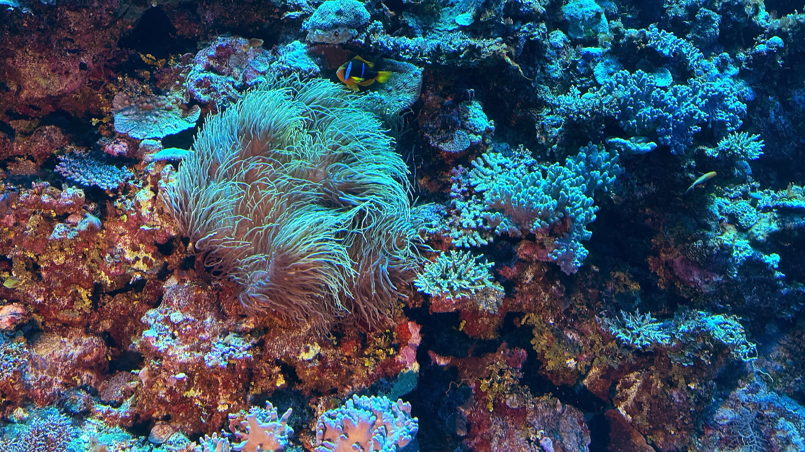
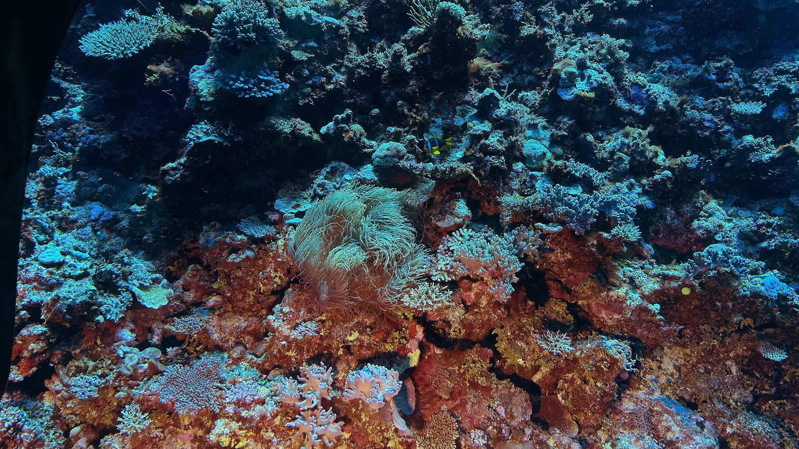
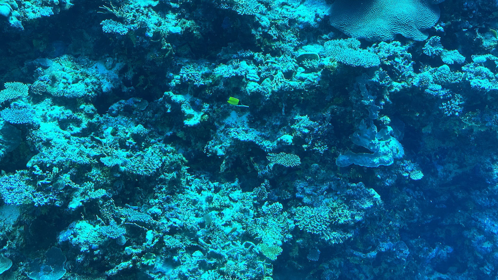
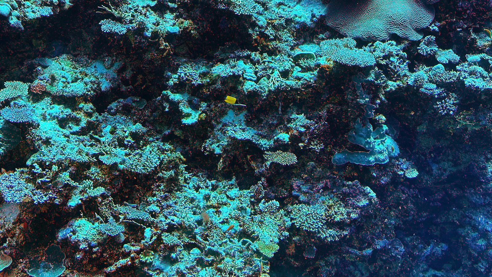
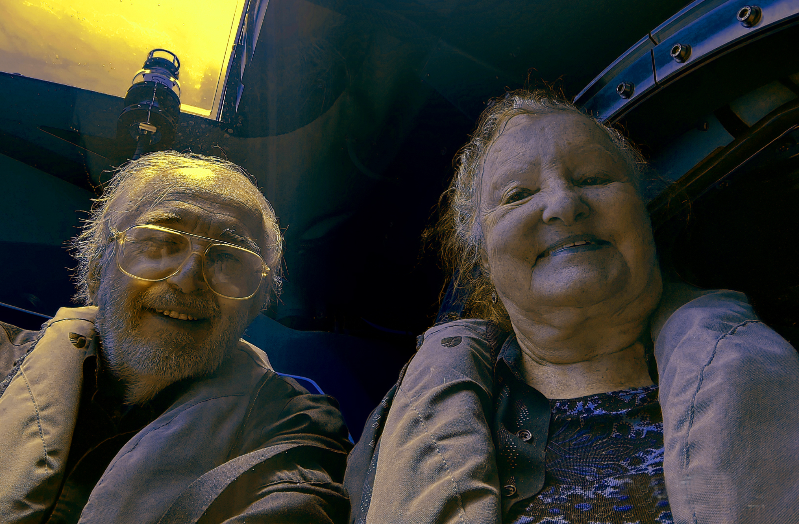
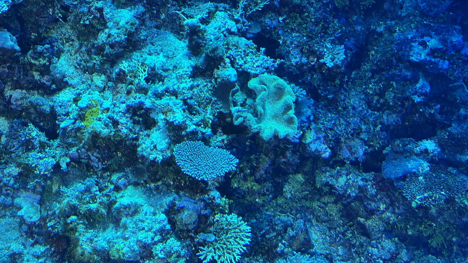
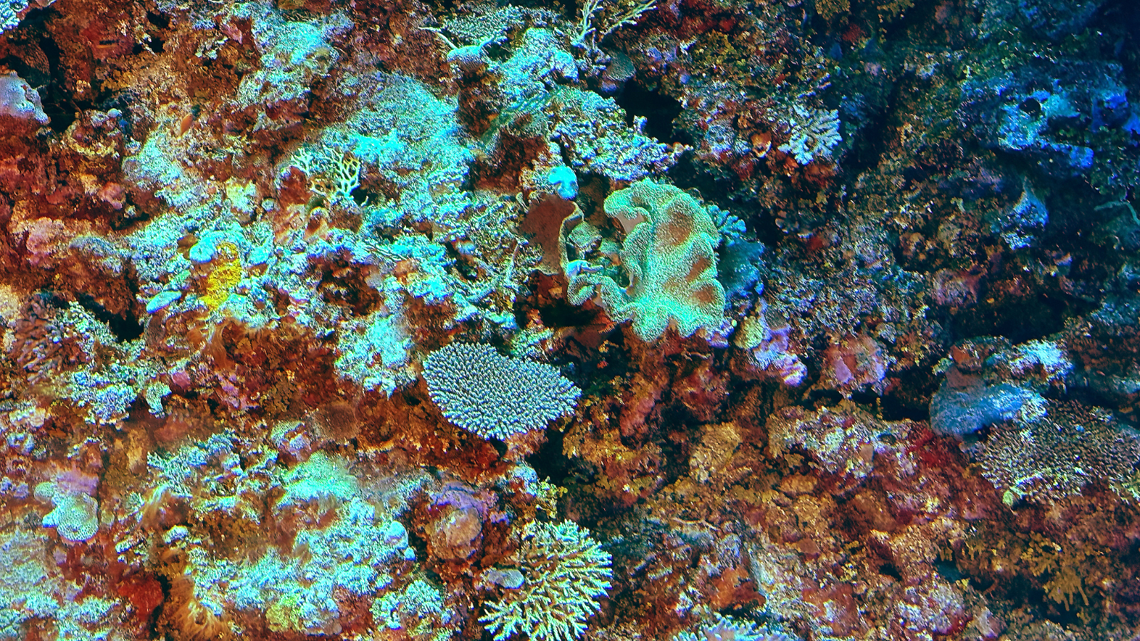
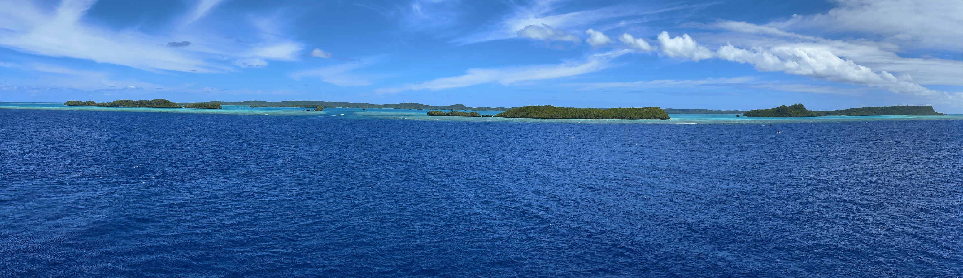
October 1, 2025: Nukupule Island, Ha'apai Group, Tonga
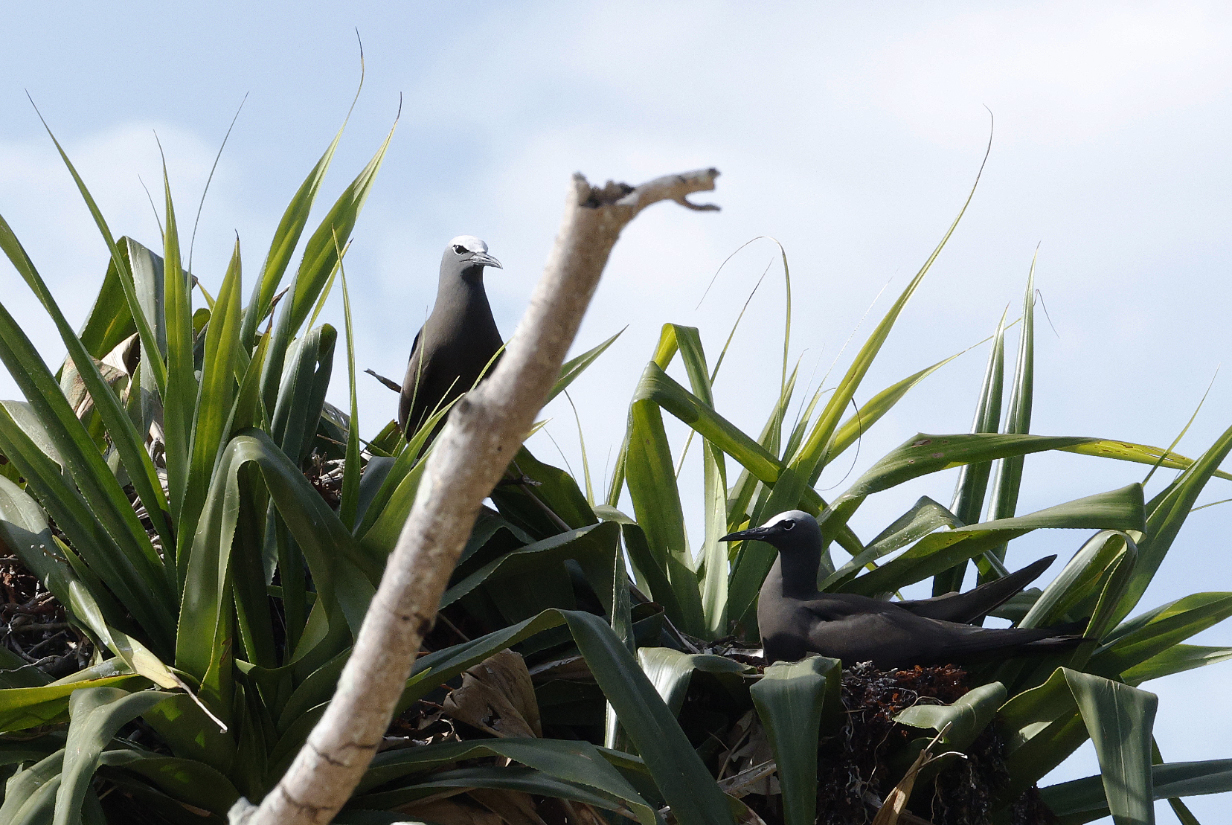
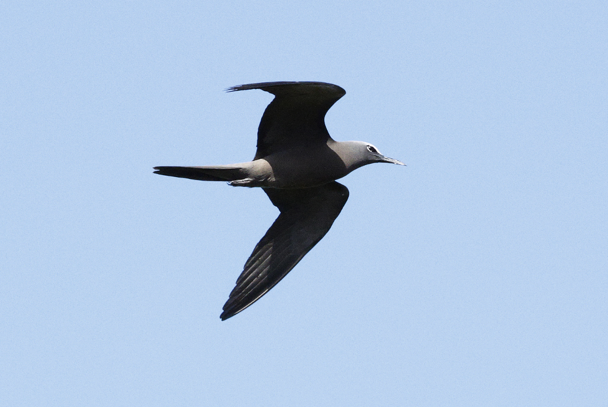
October 2, 2025: Vava'u, Tonga
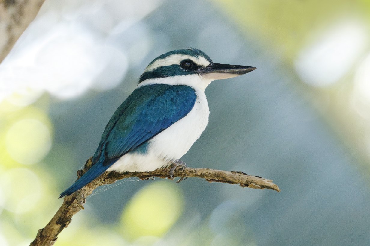
October 6, 2025: Aitutaki, Cook Islands
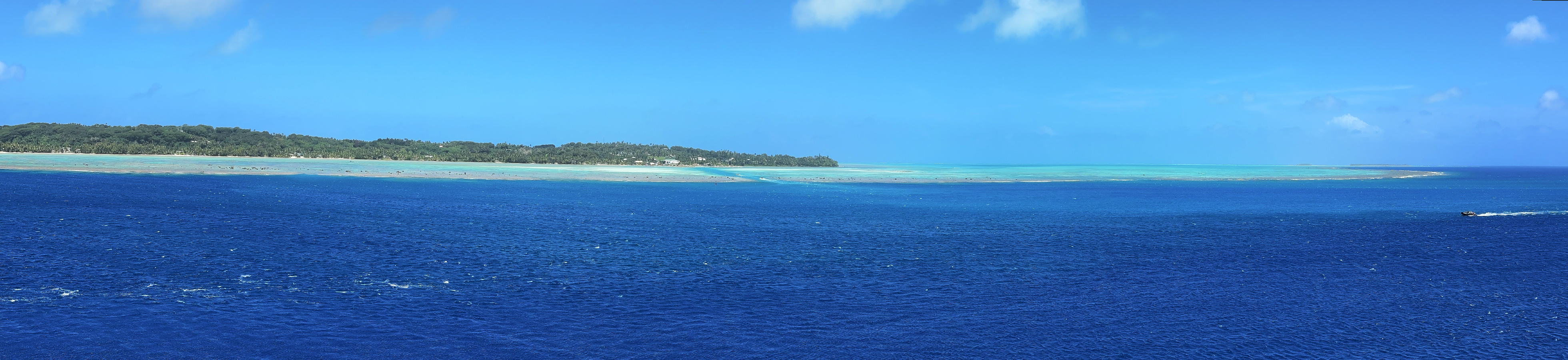
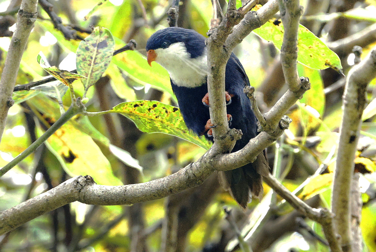

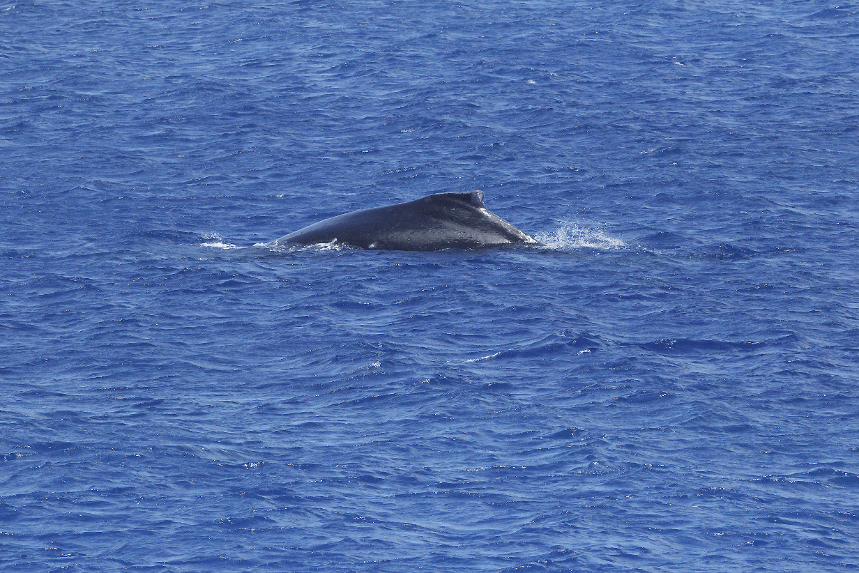
October 8, 2025: Ra'iatea, Society Islands, French Polynesia
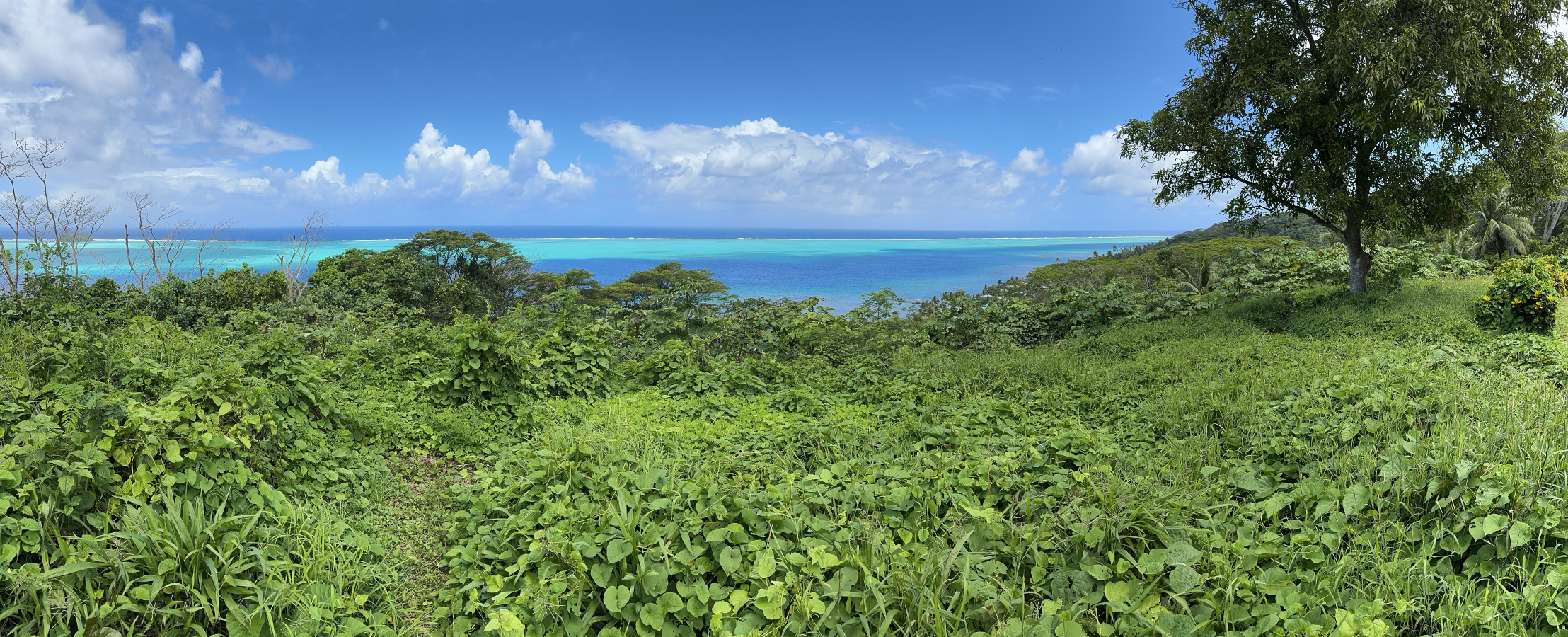
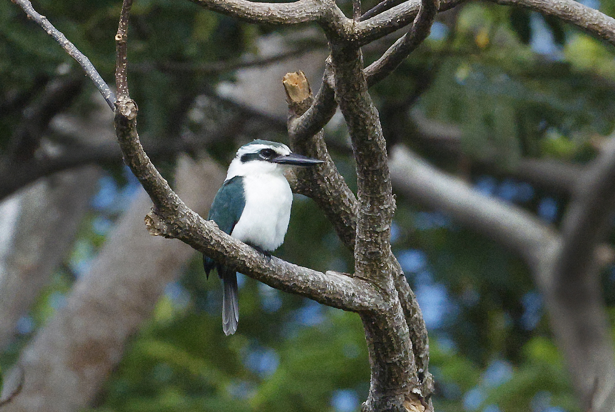
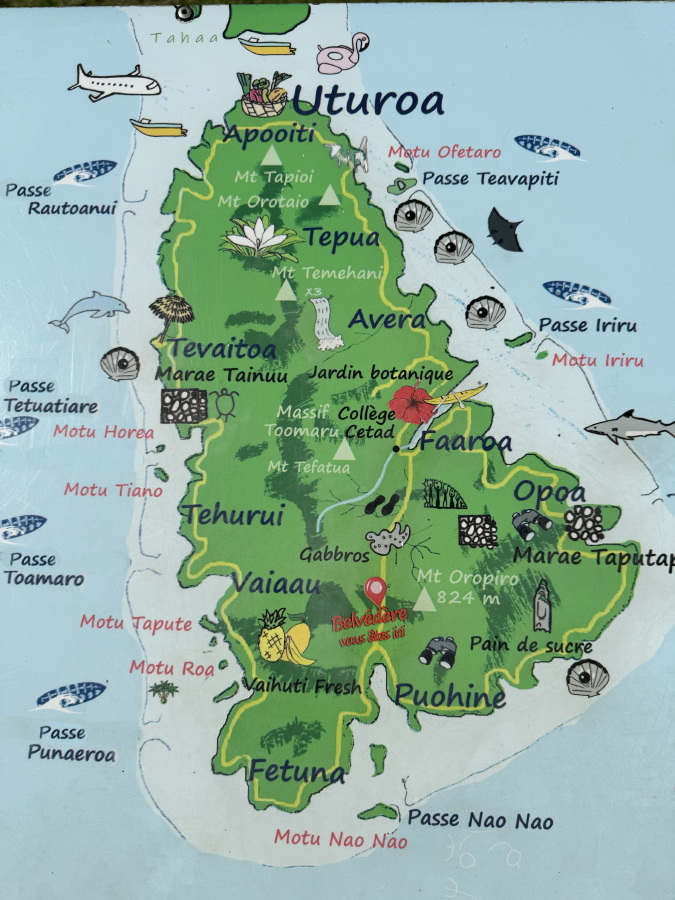
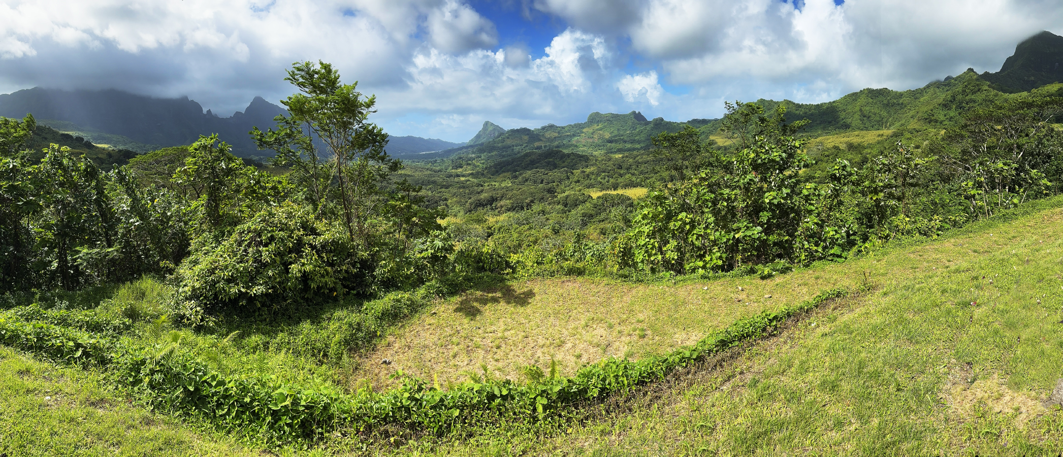
October 10, 2025: Pape'ete, Tahiti, French Polynesia
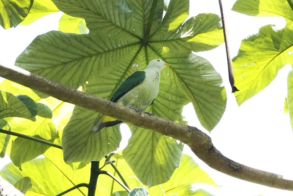
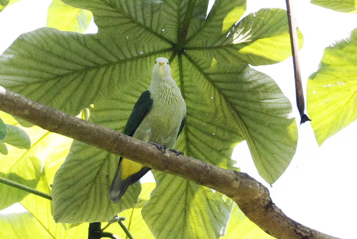
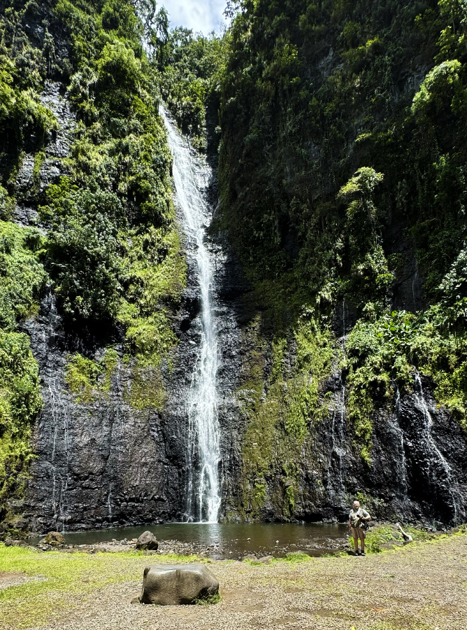
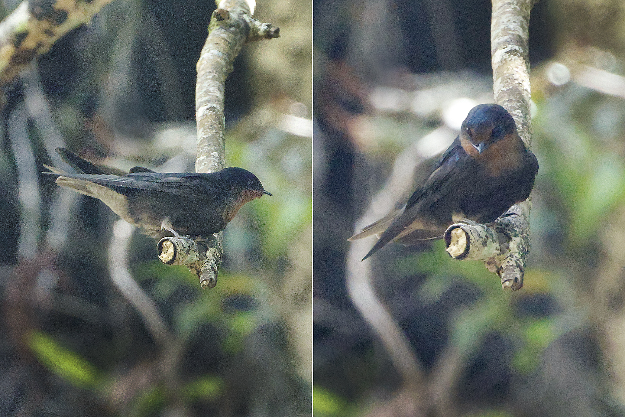
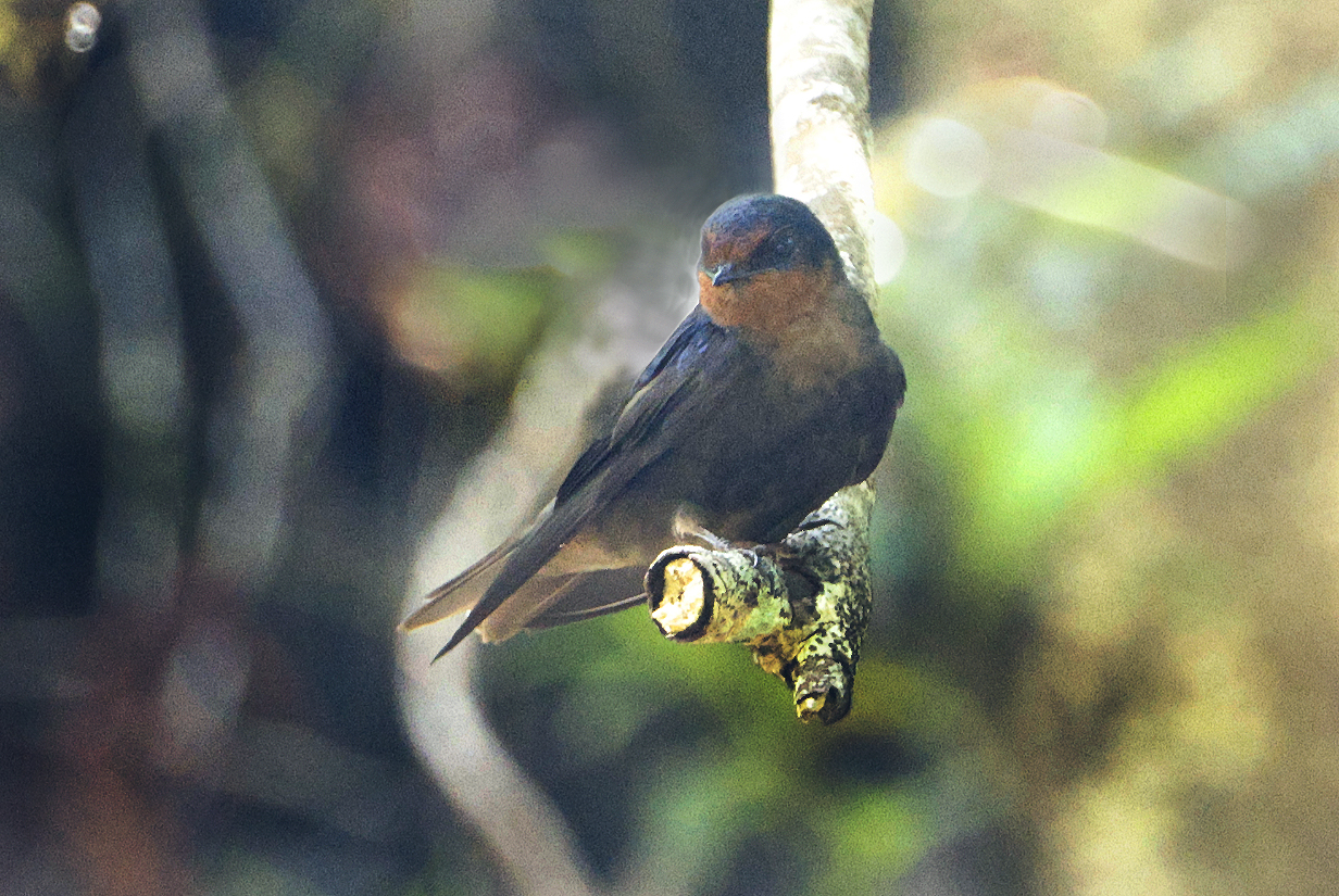
October 12, 2025: Pape'ete, Tahiti, French Polynesia
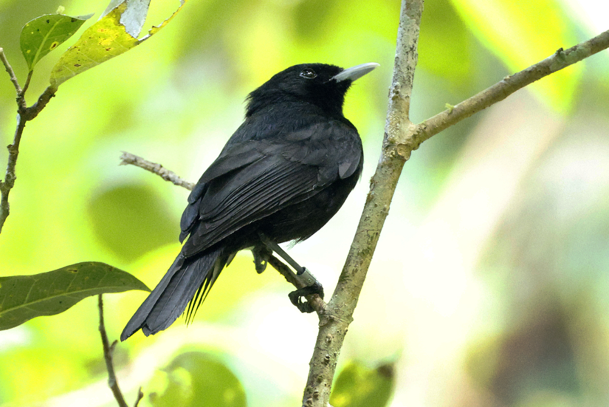
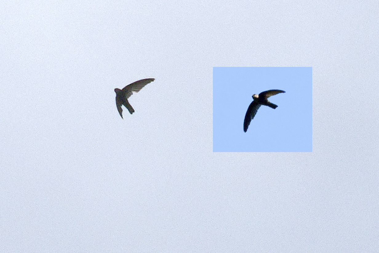
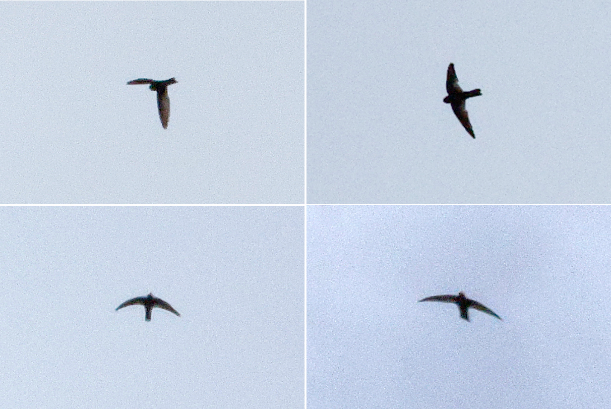
October 13, 2025: Cancelled Submarine Dive, Ana'a Atoll, French Polynesia
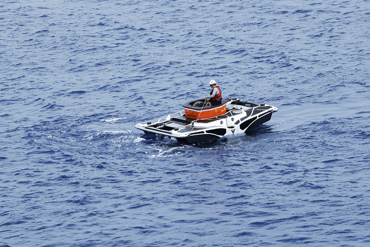
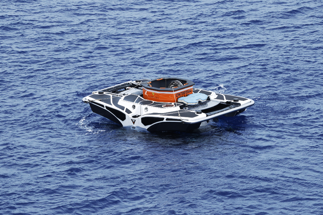
October 17, 2025: Pitcairn Island
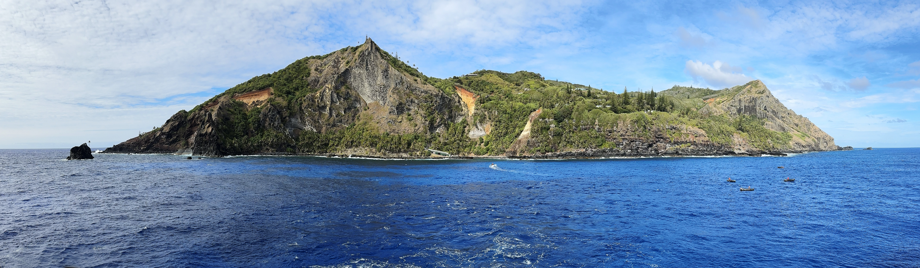
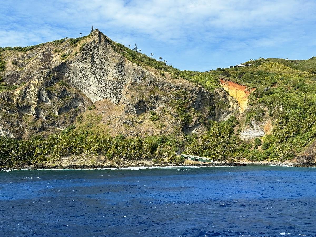
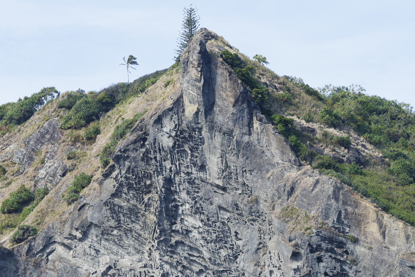
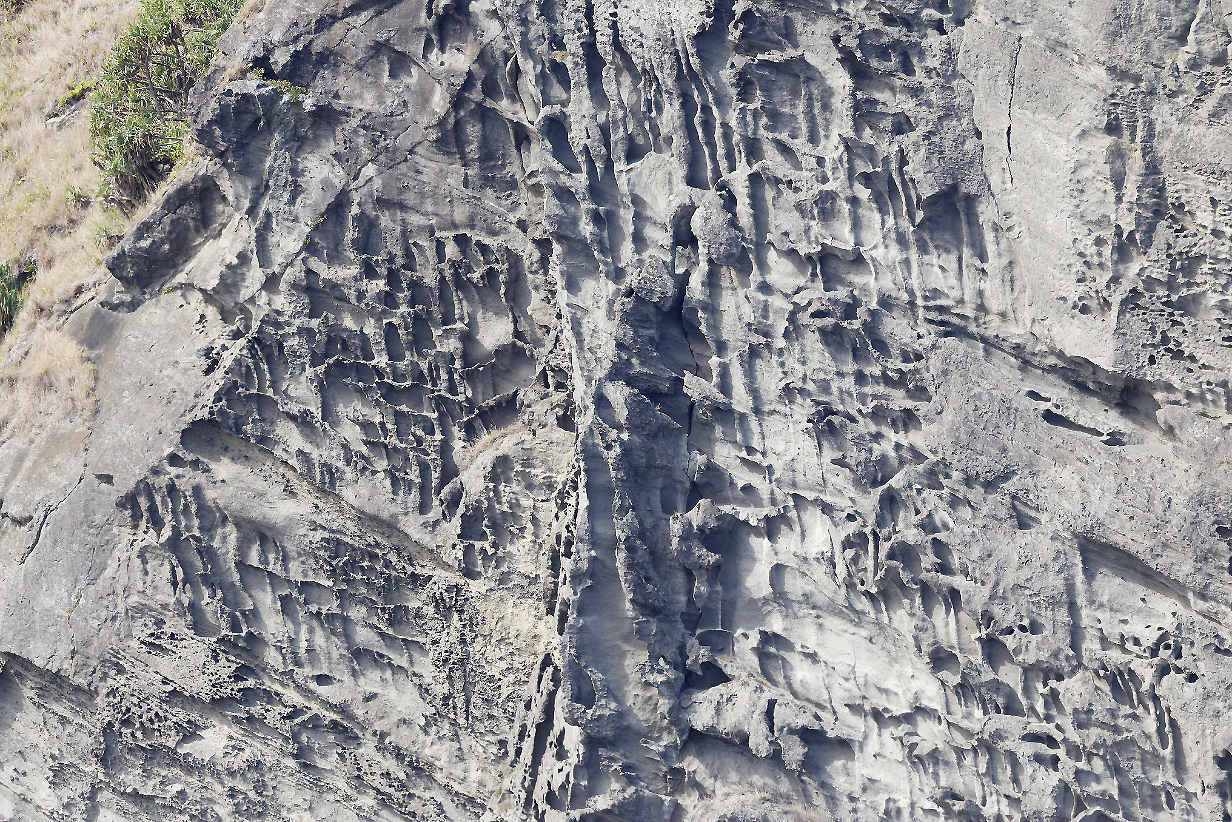
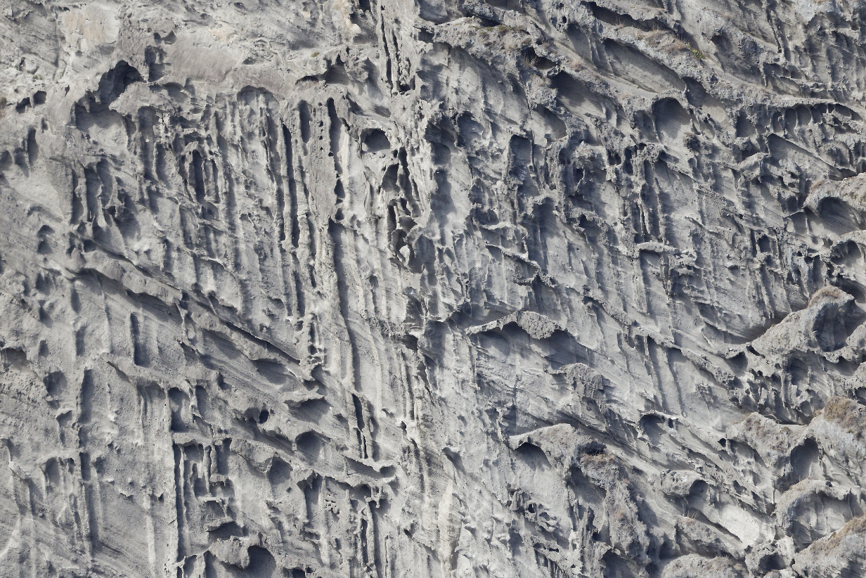
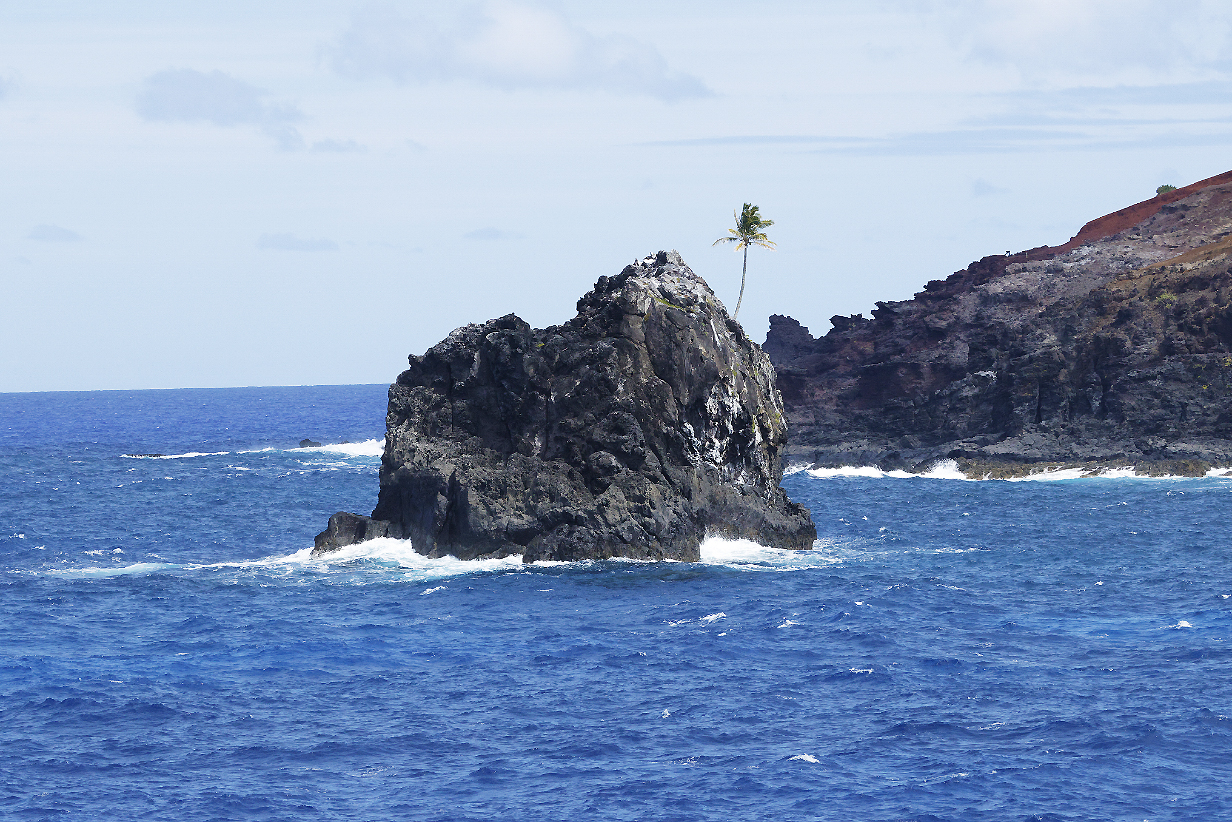
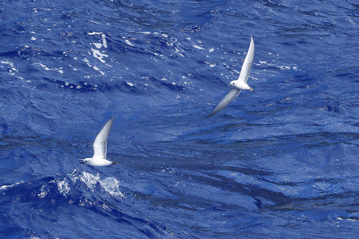
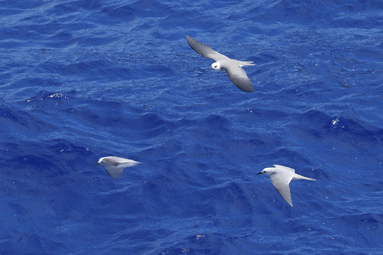
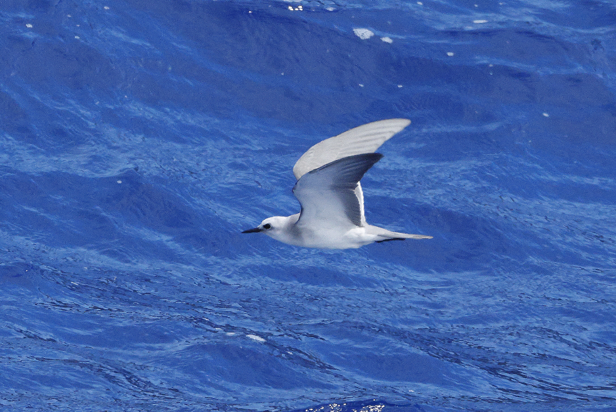
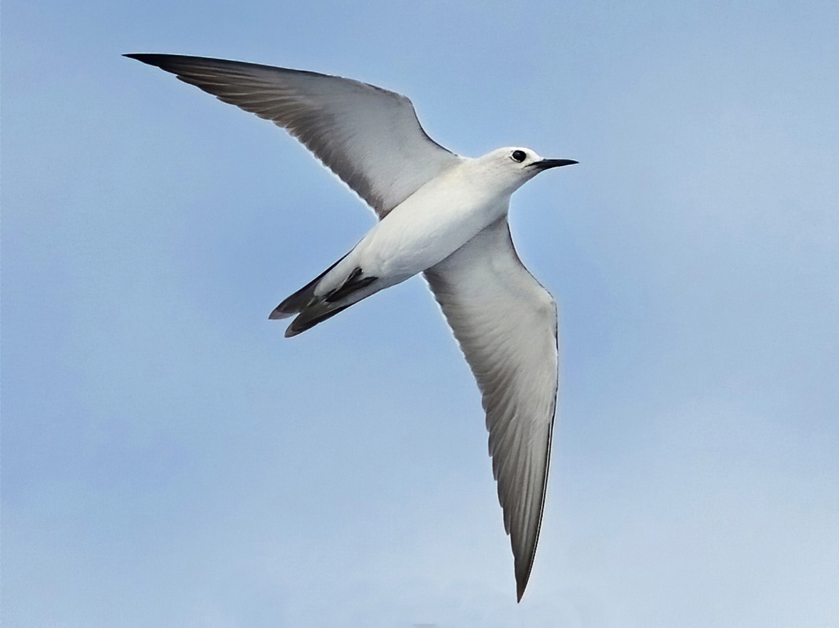
October 18, 2025: Ducie Island
Here follows an "overload" of pictures of Murphy's petrel
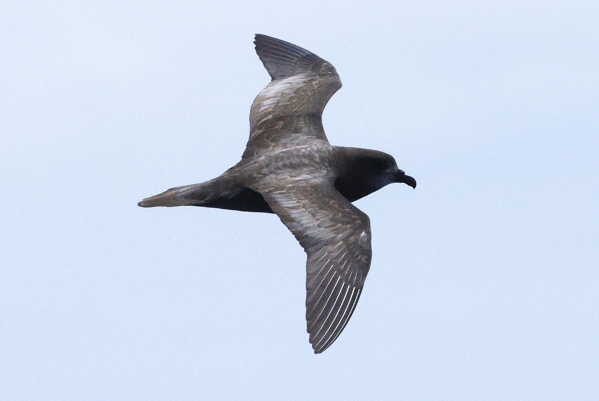
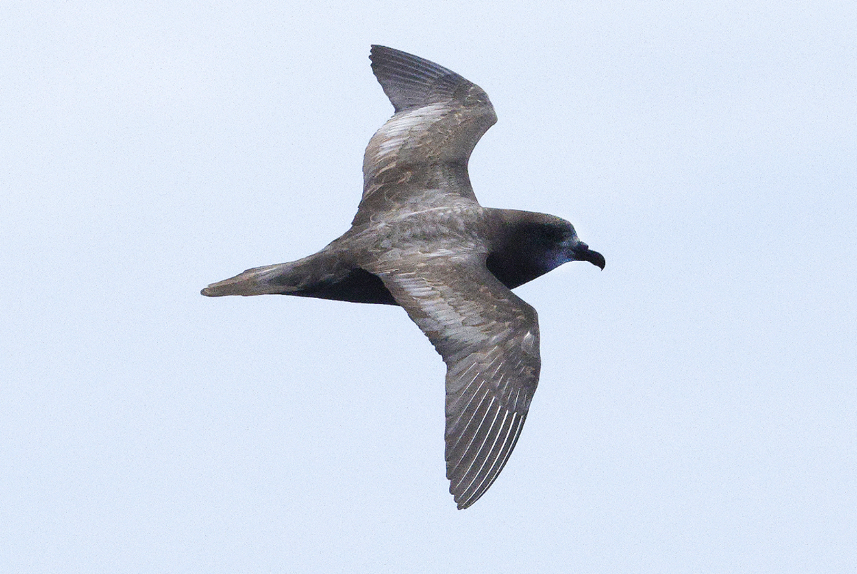
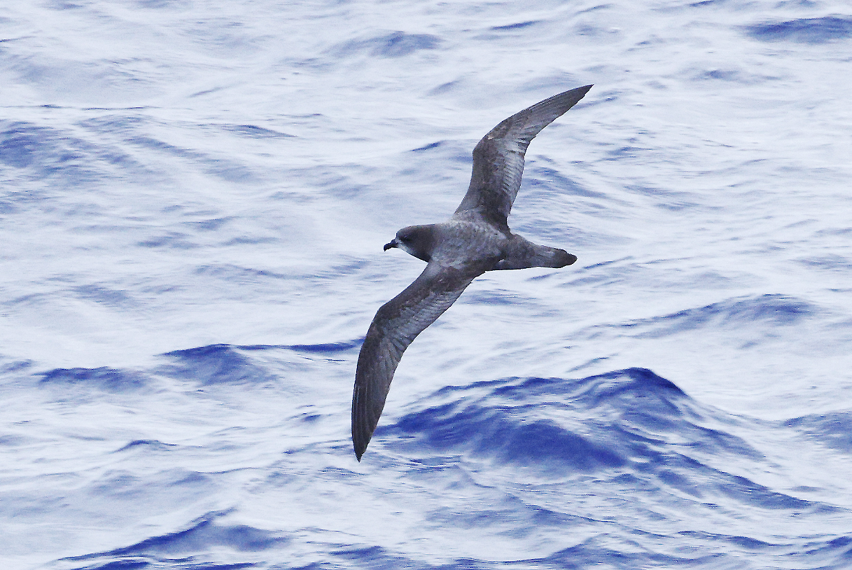
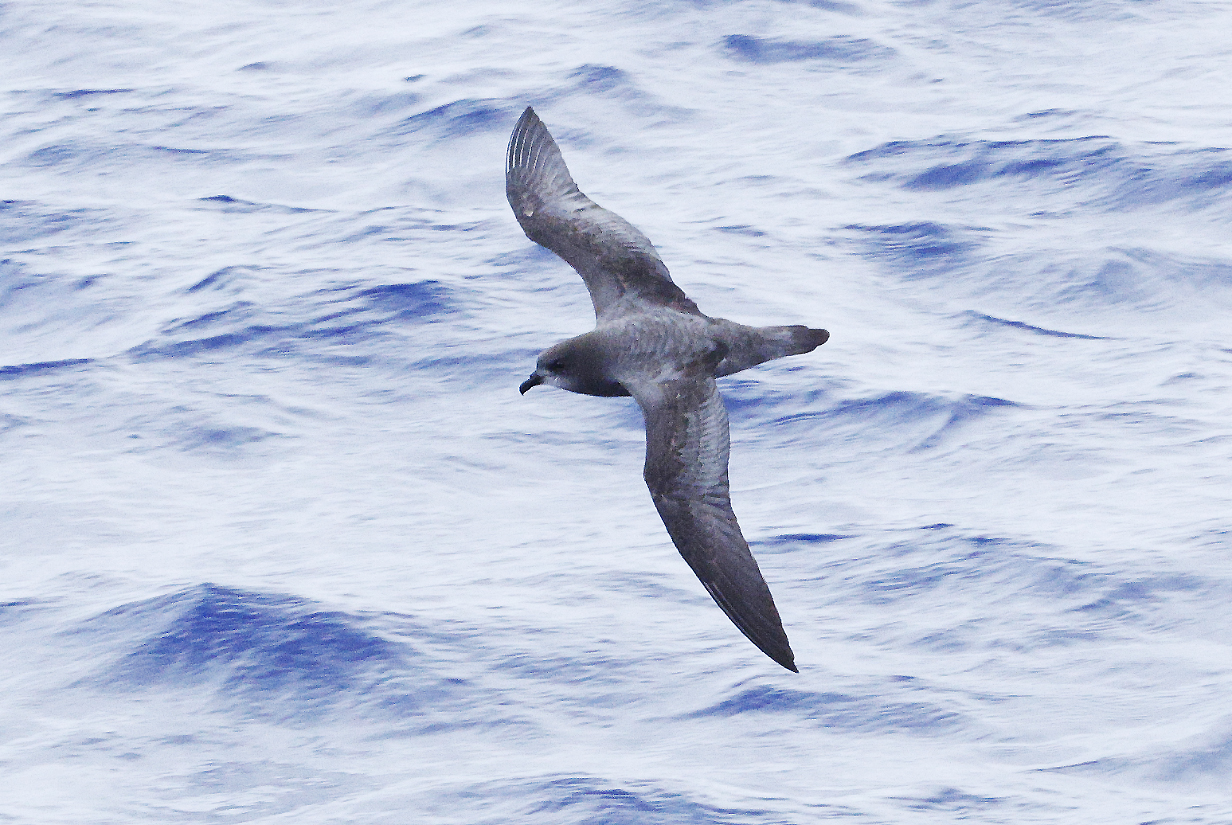
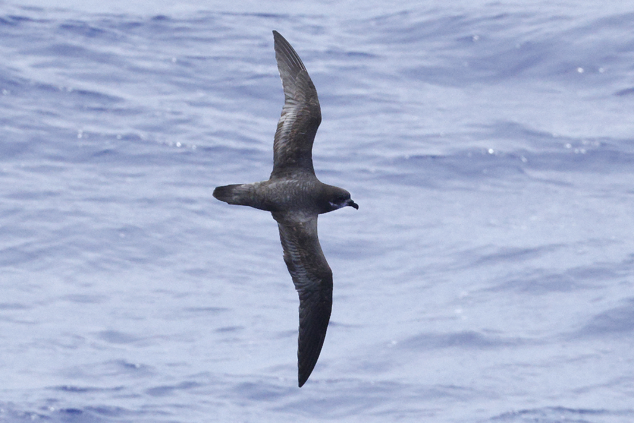
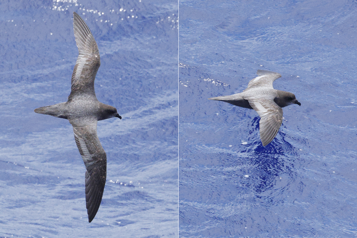
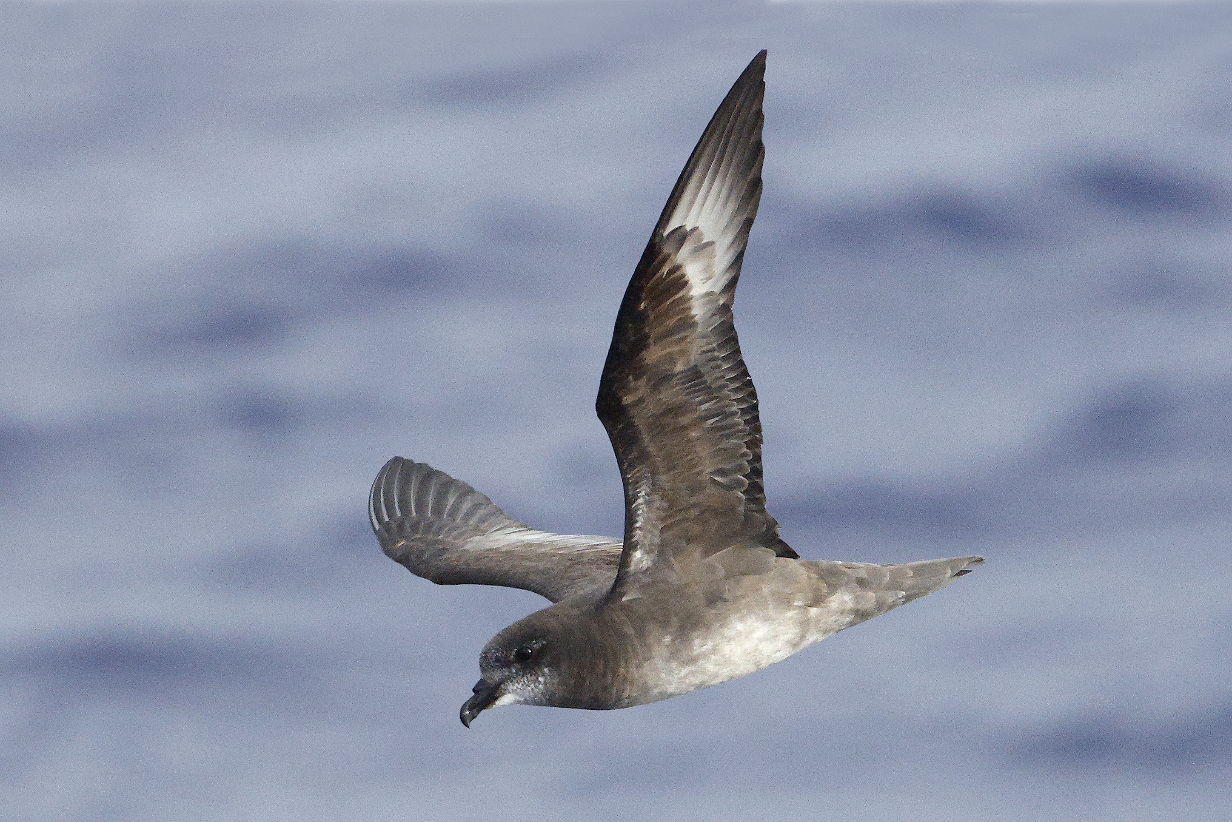
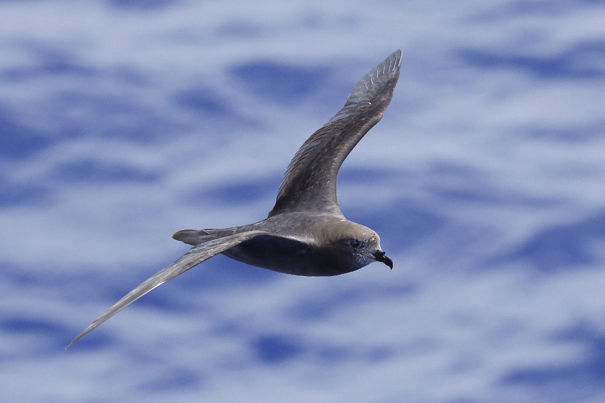
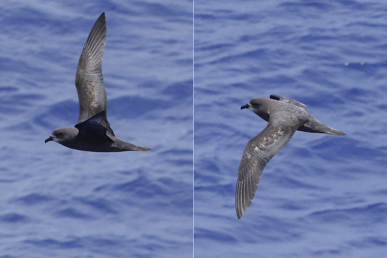
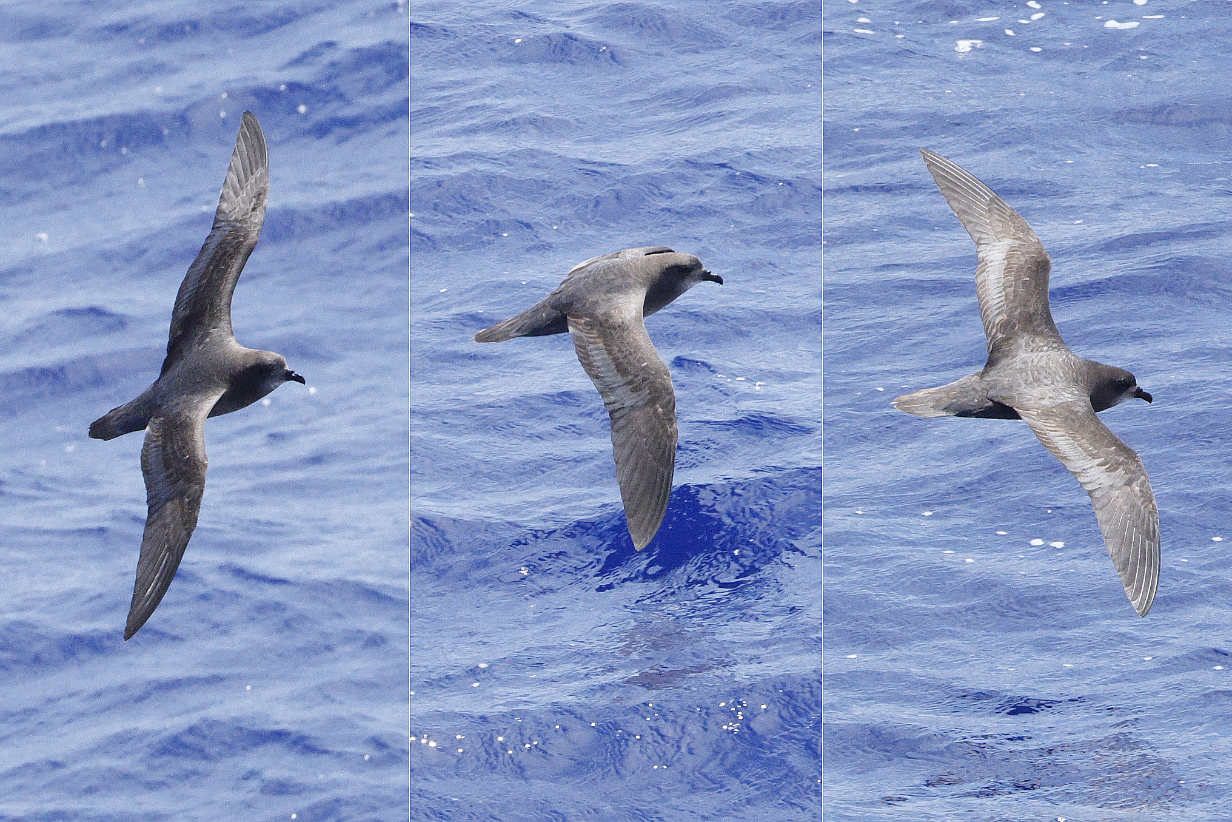
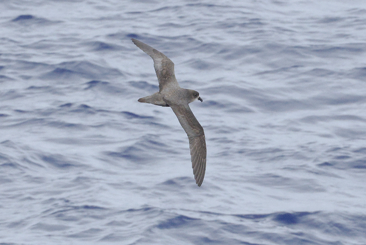
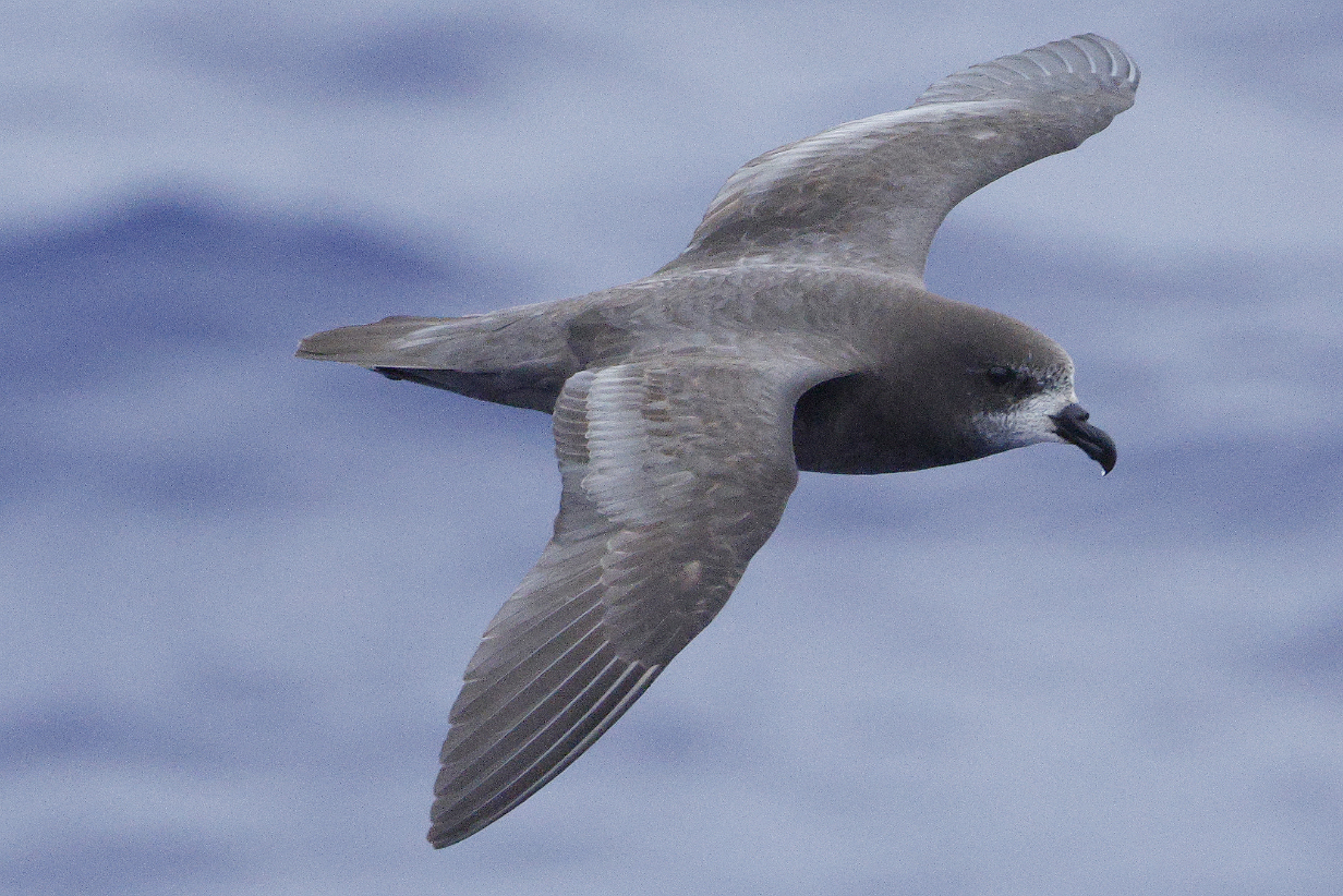
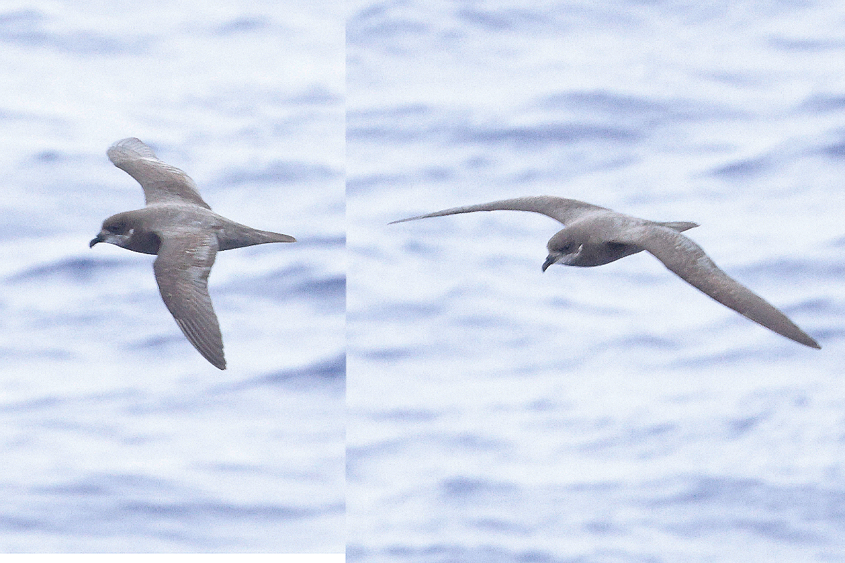
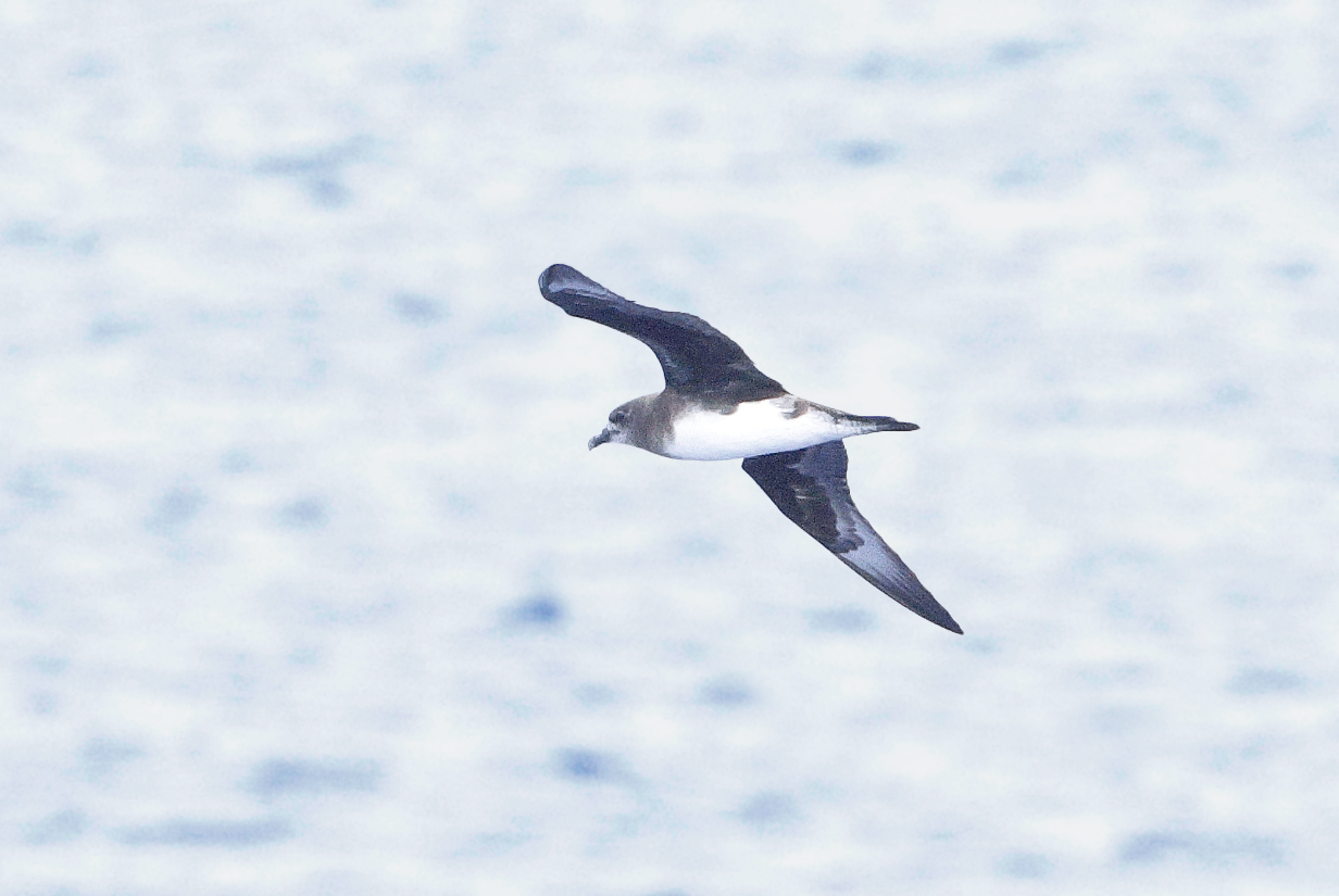
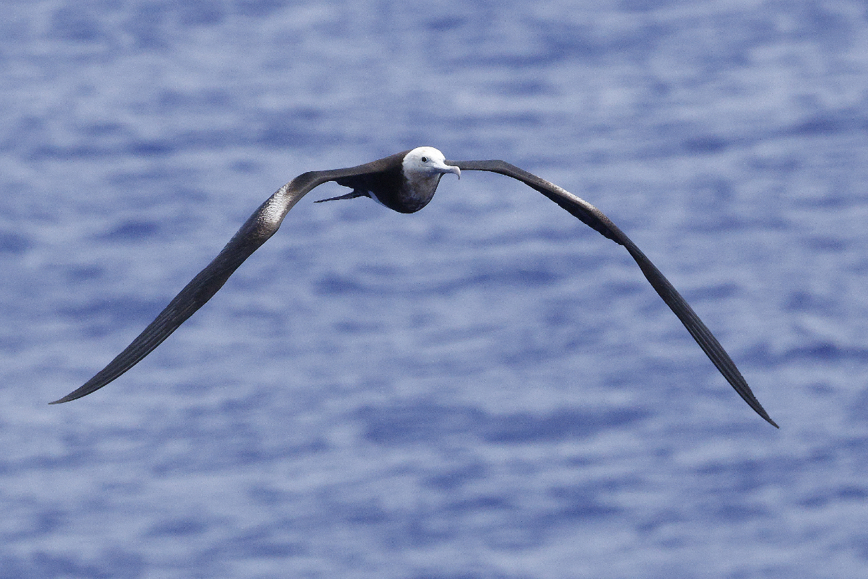
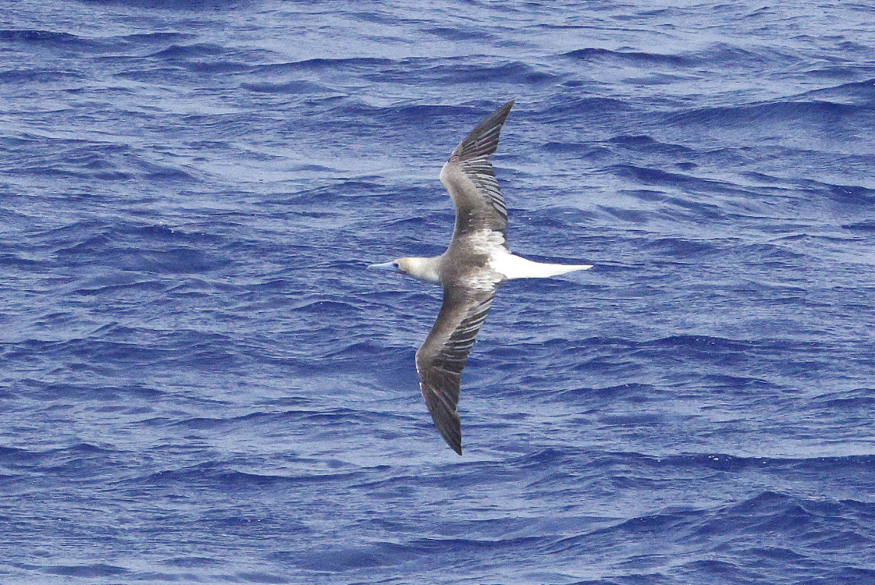
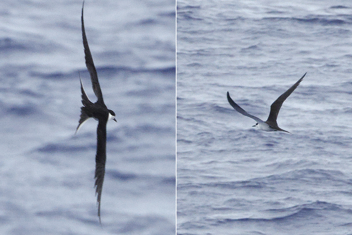
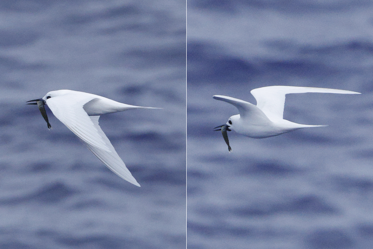
October 21, 2025: Rapa Nui = Easter Island
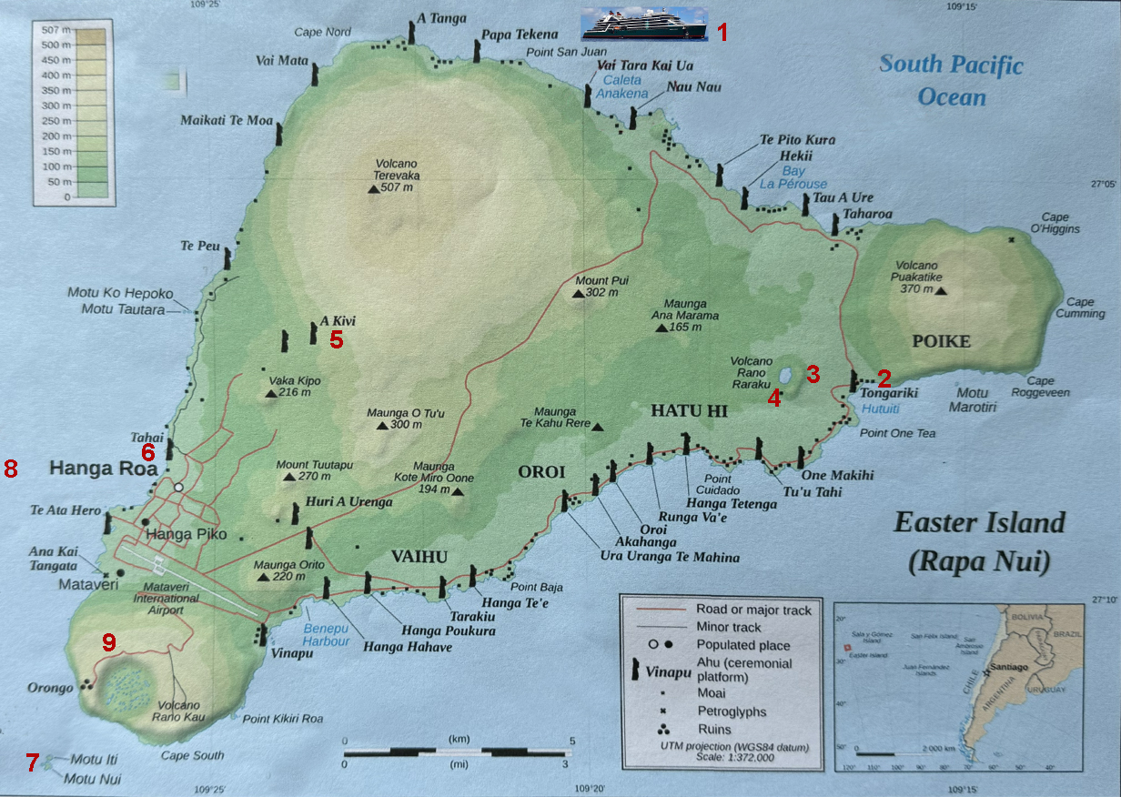
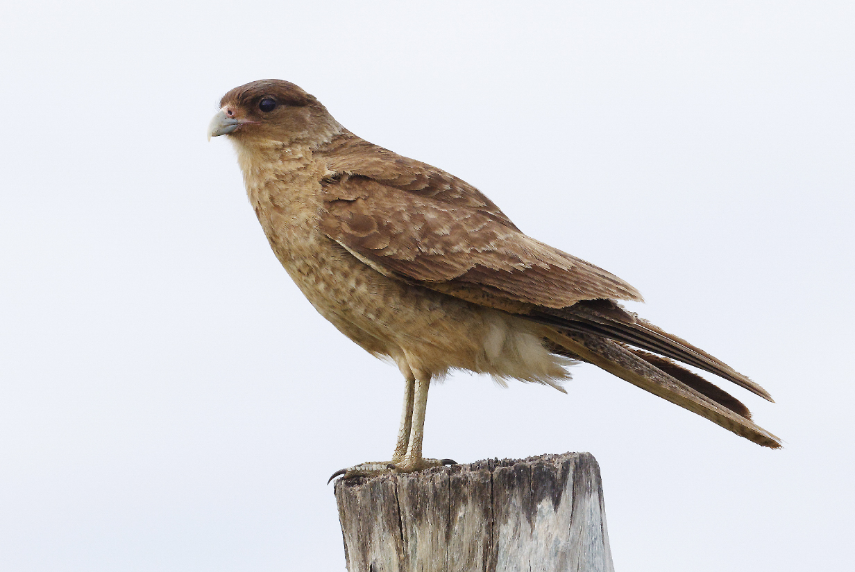
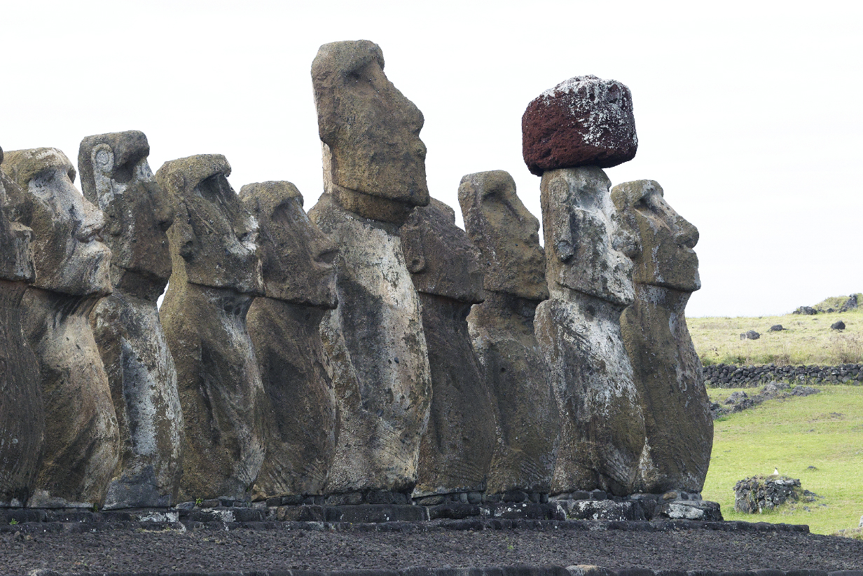
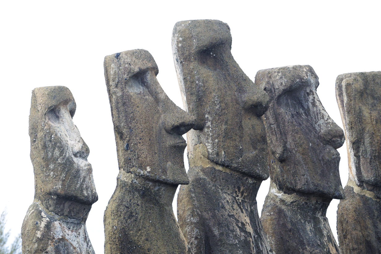
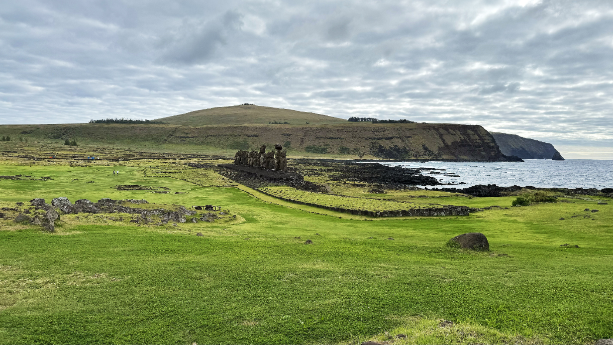
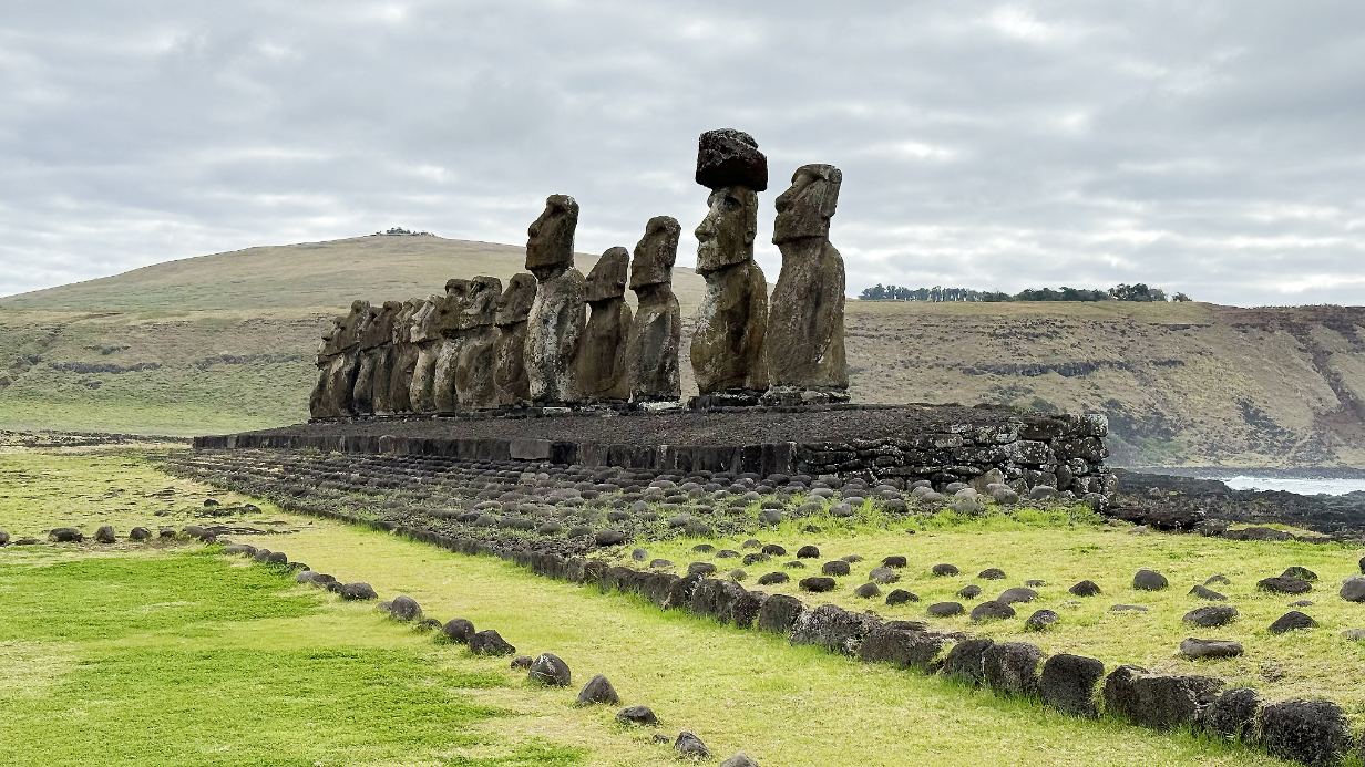
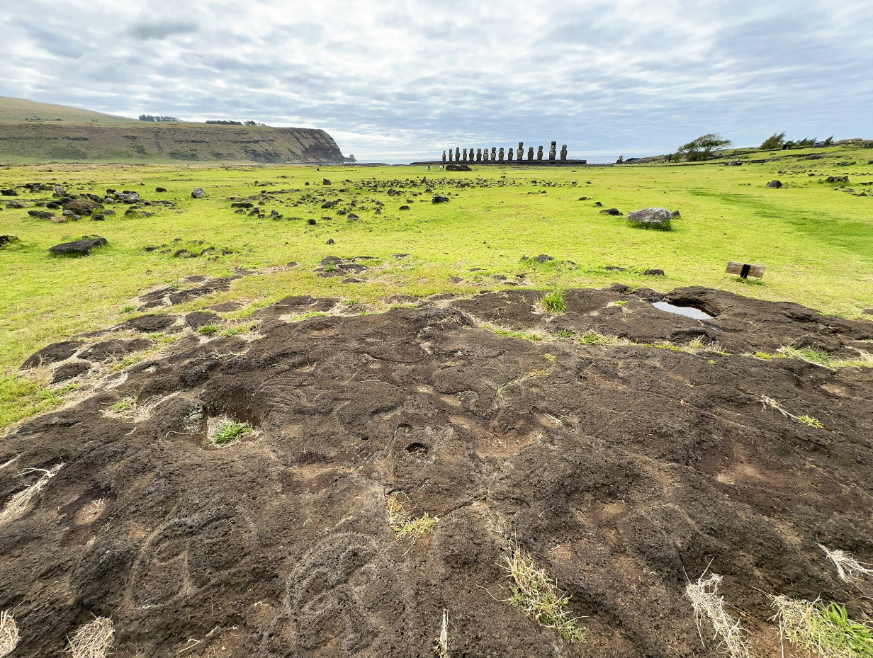
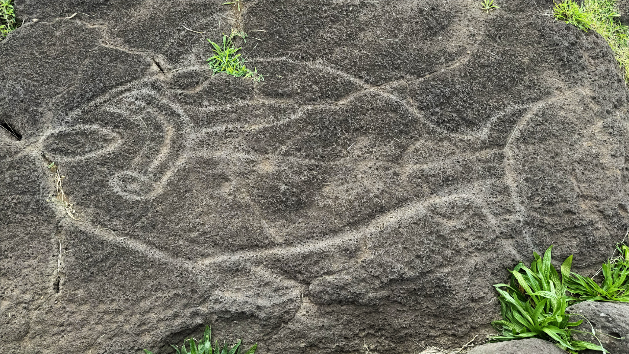
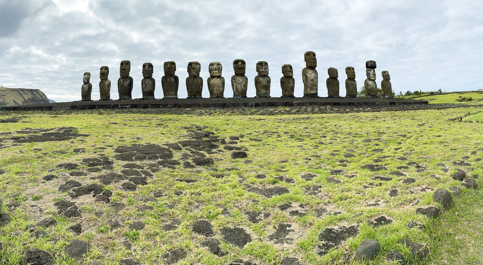
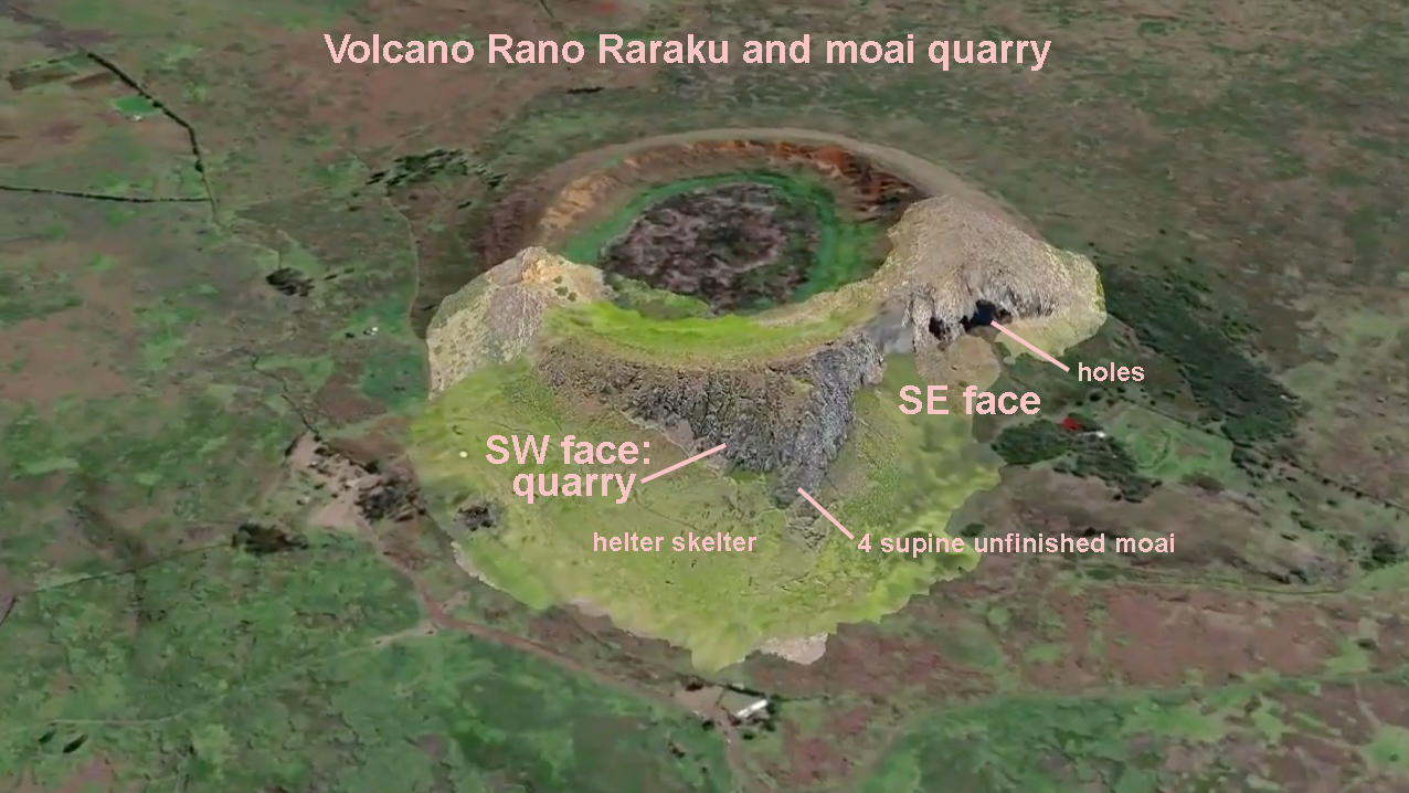
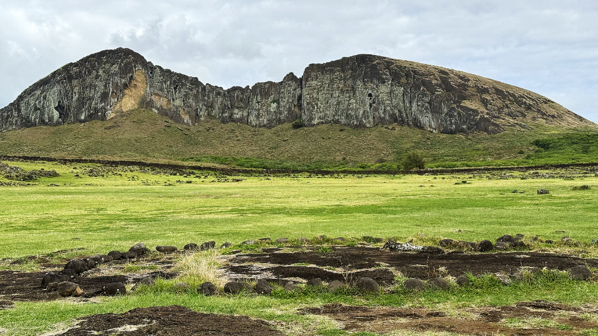
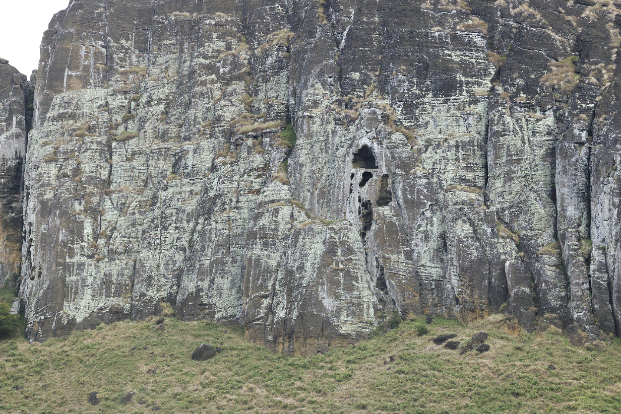
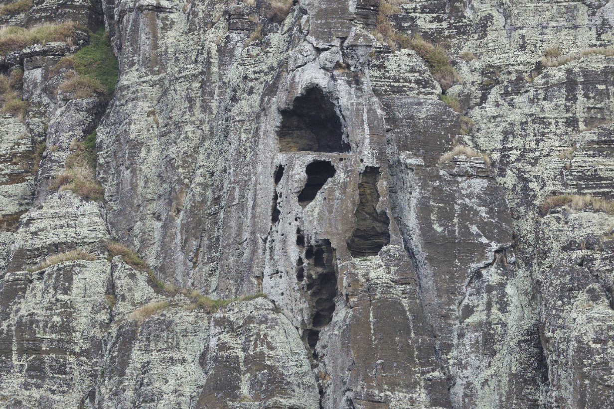
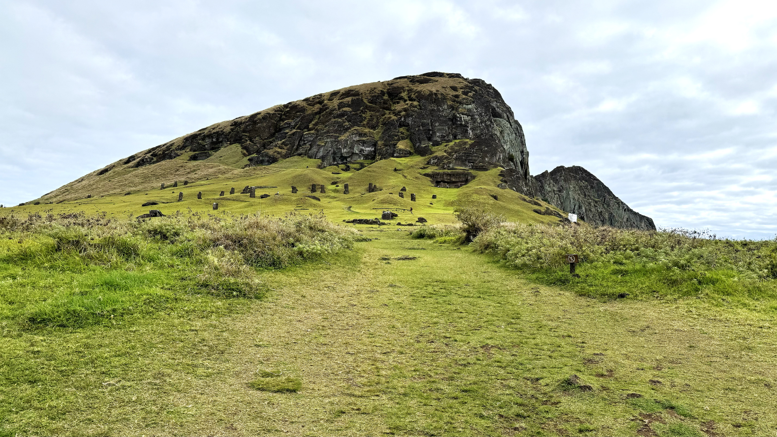
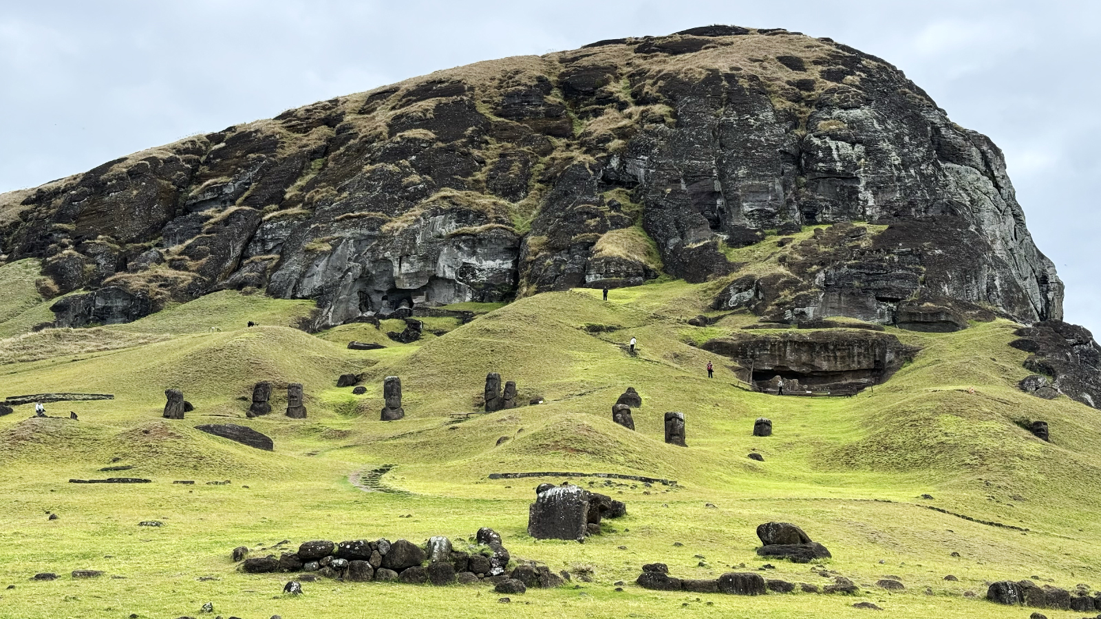
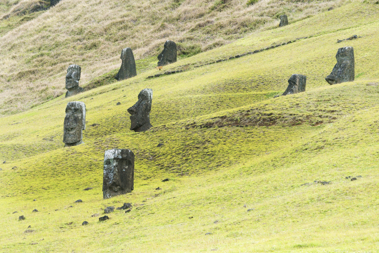
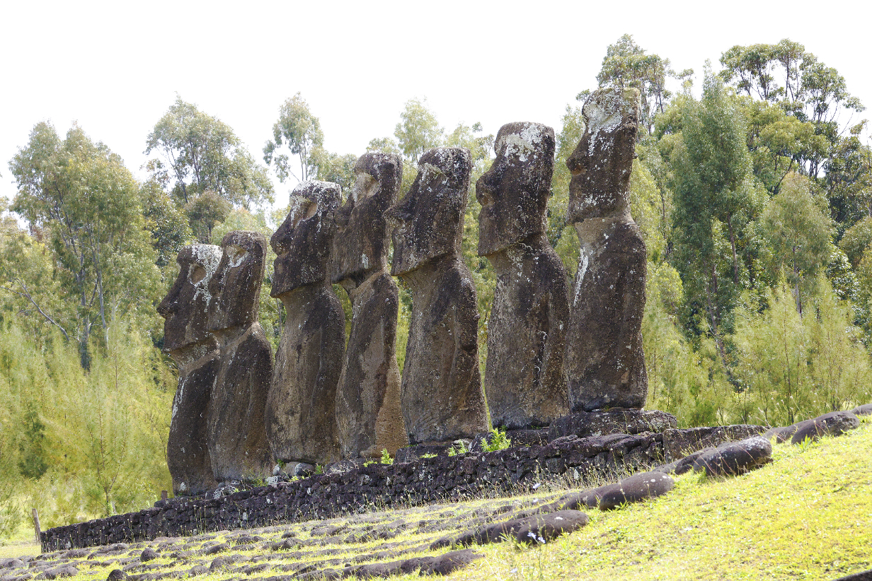
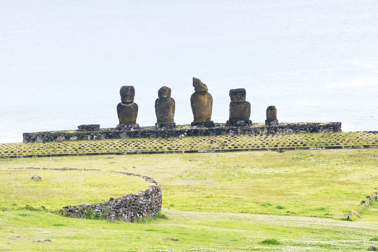
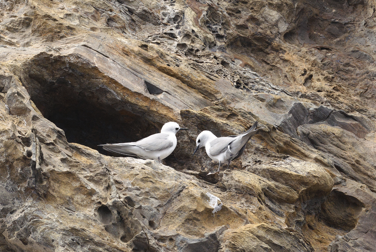
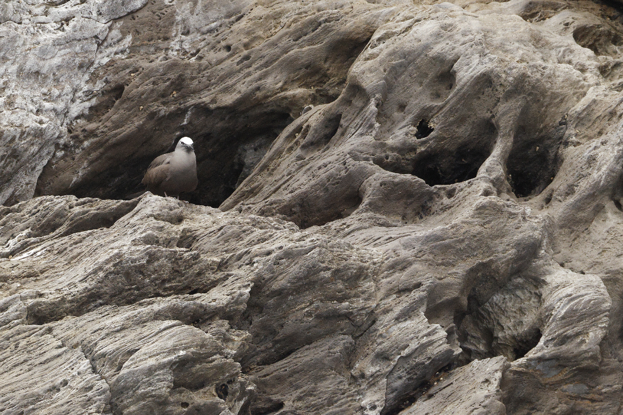
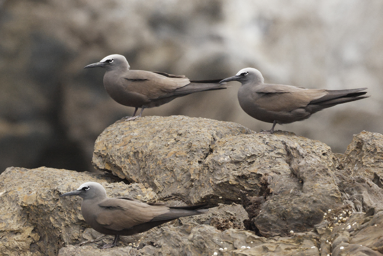
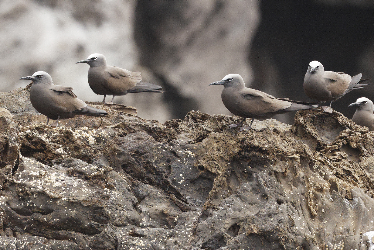
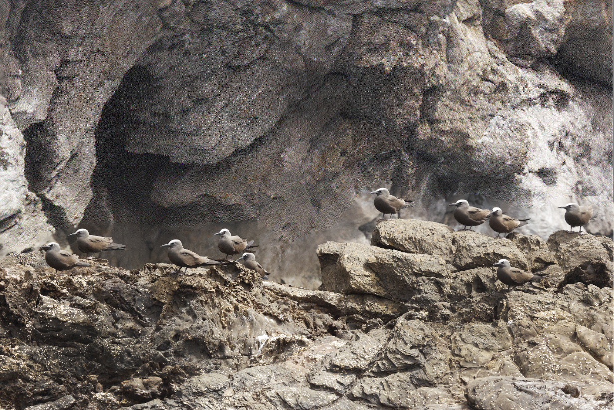
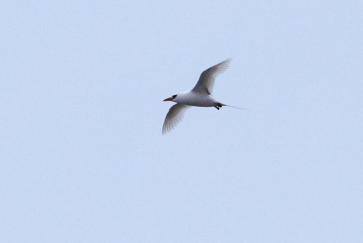
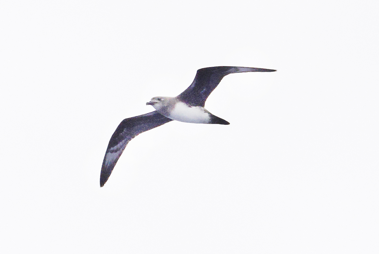
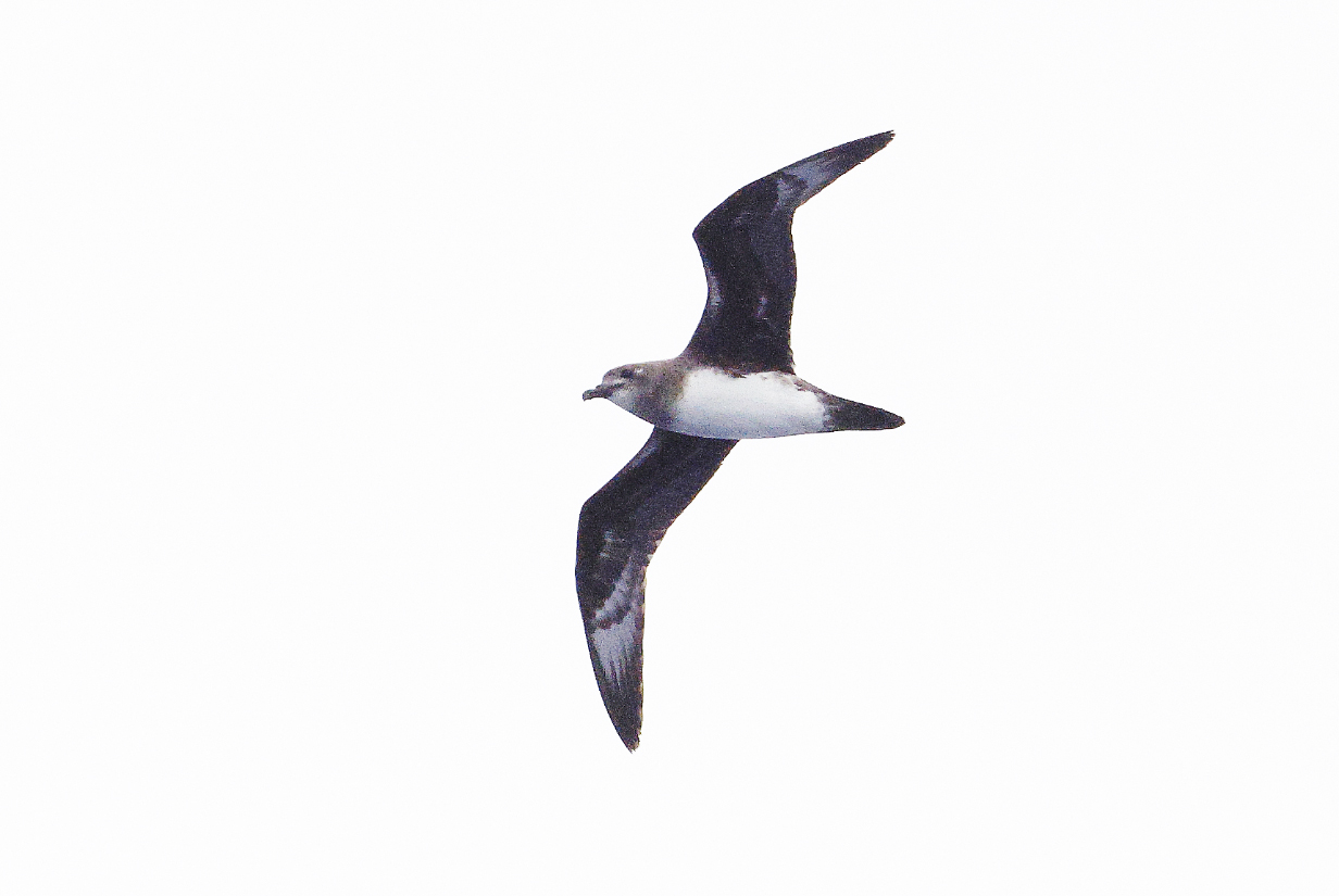
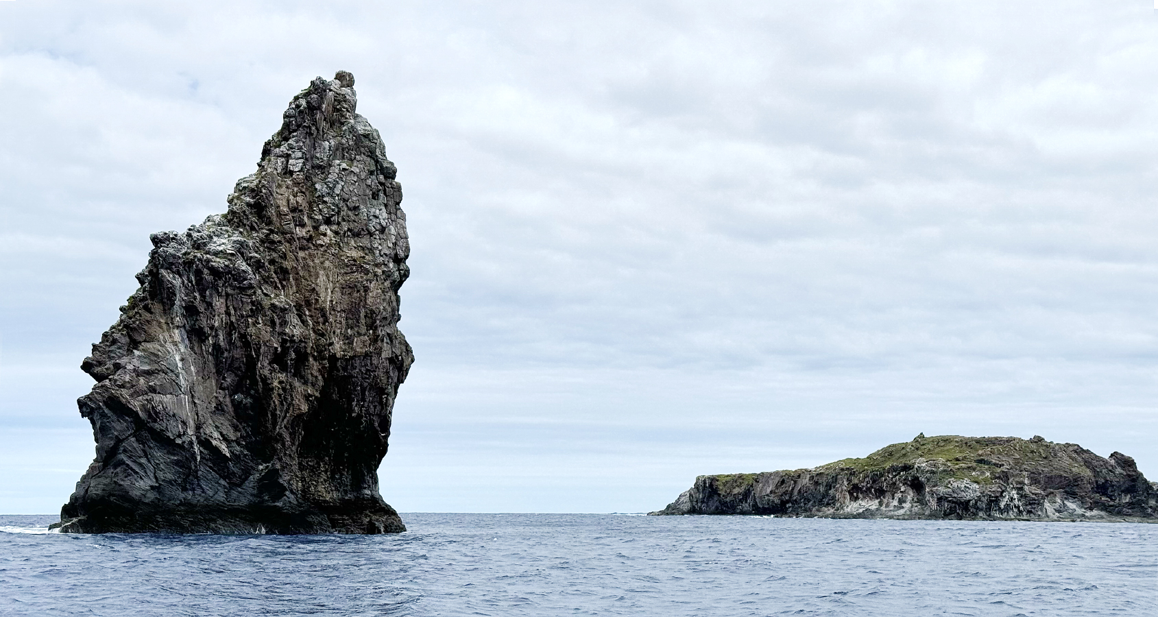
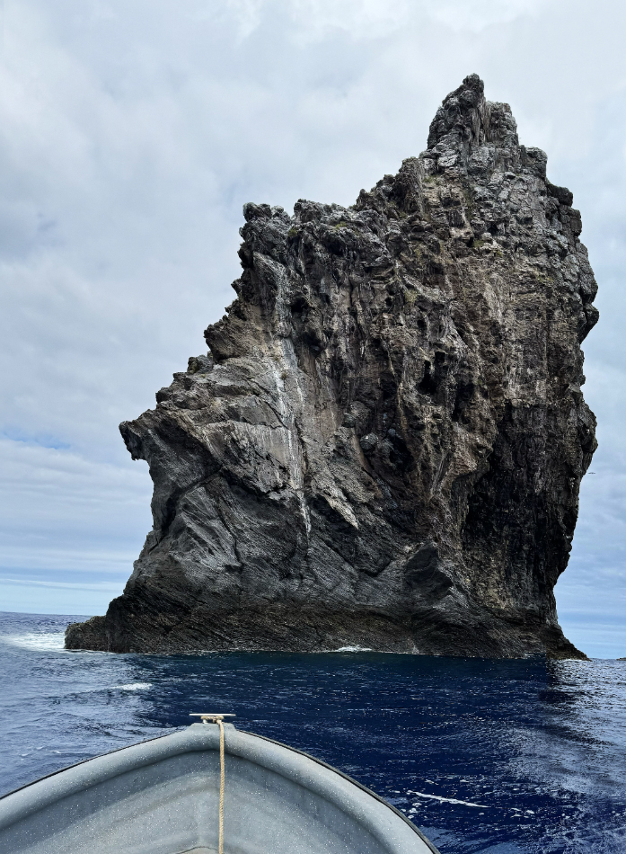
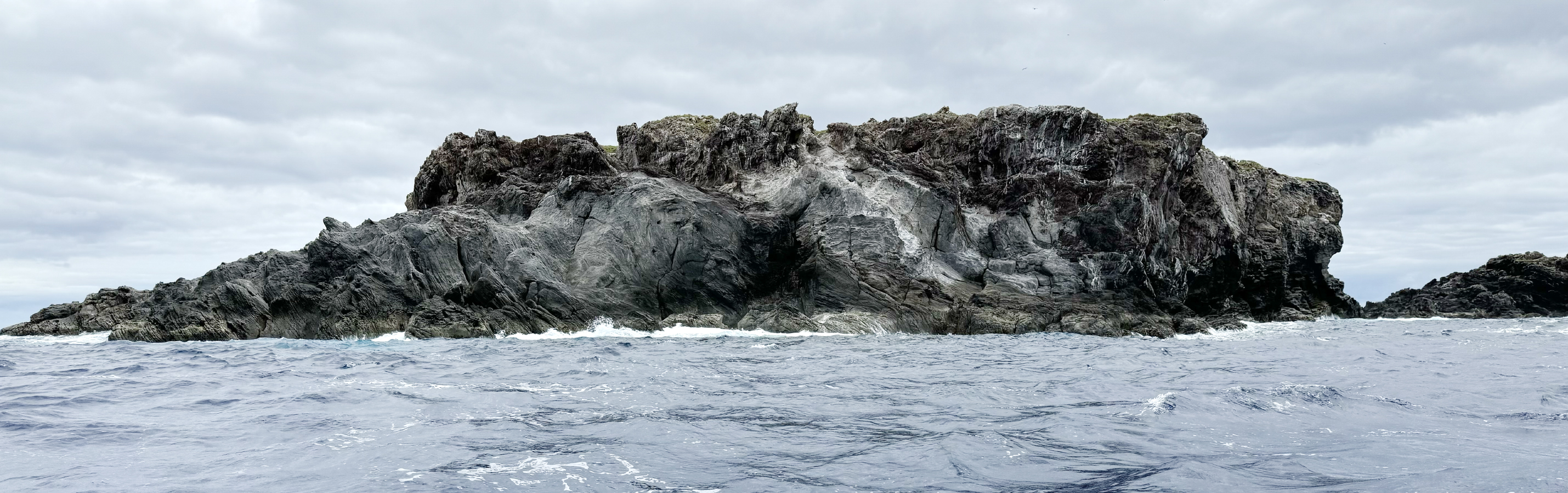
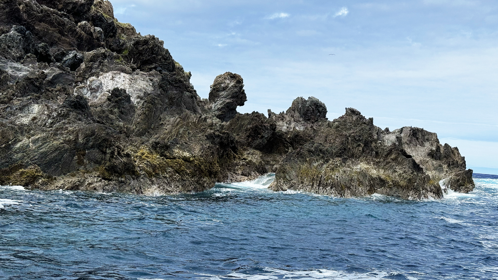
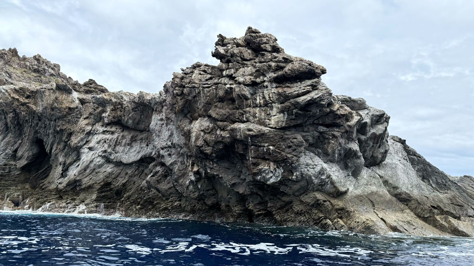
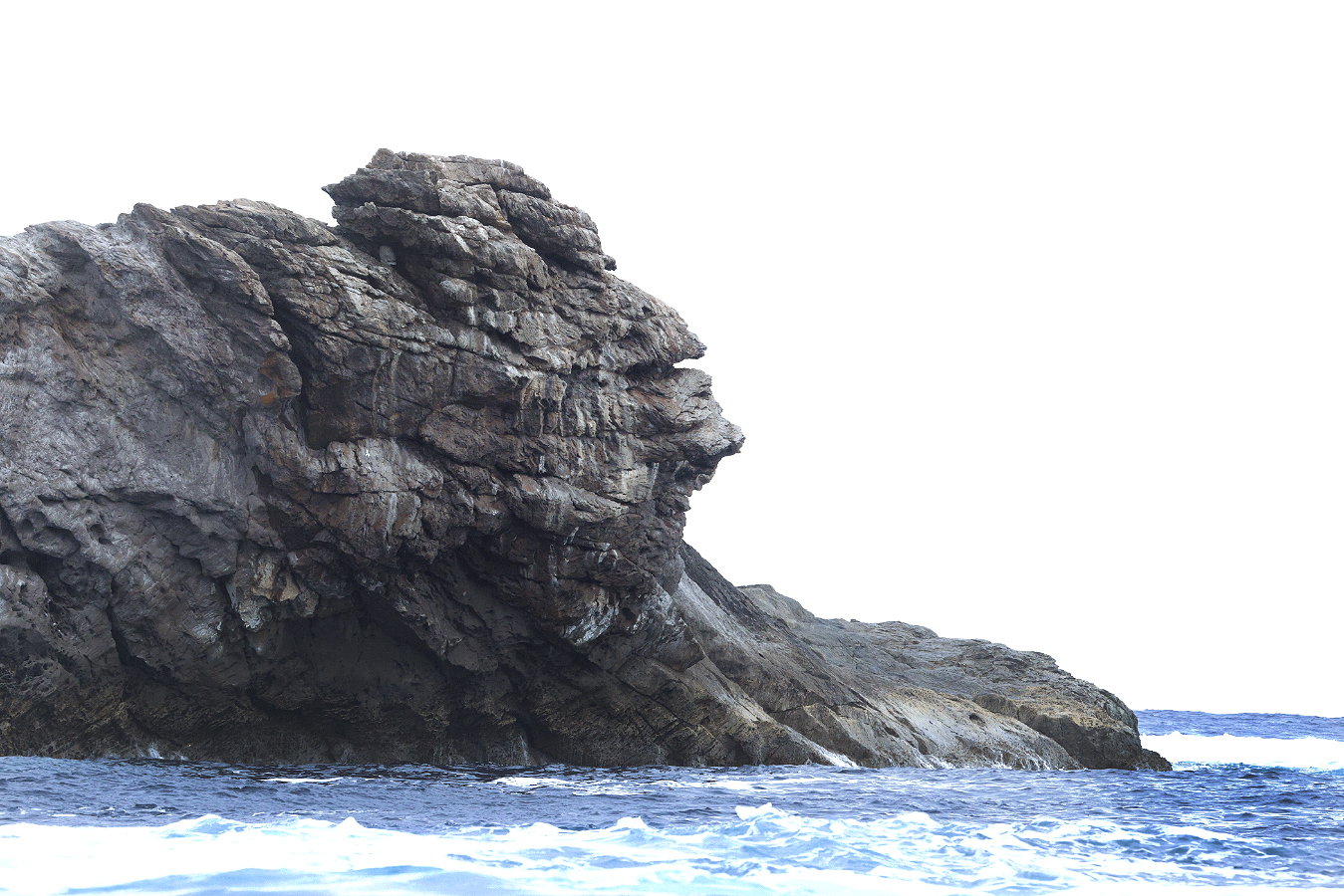
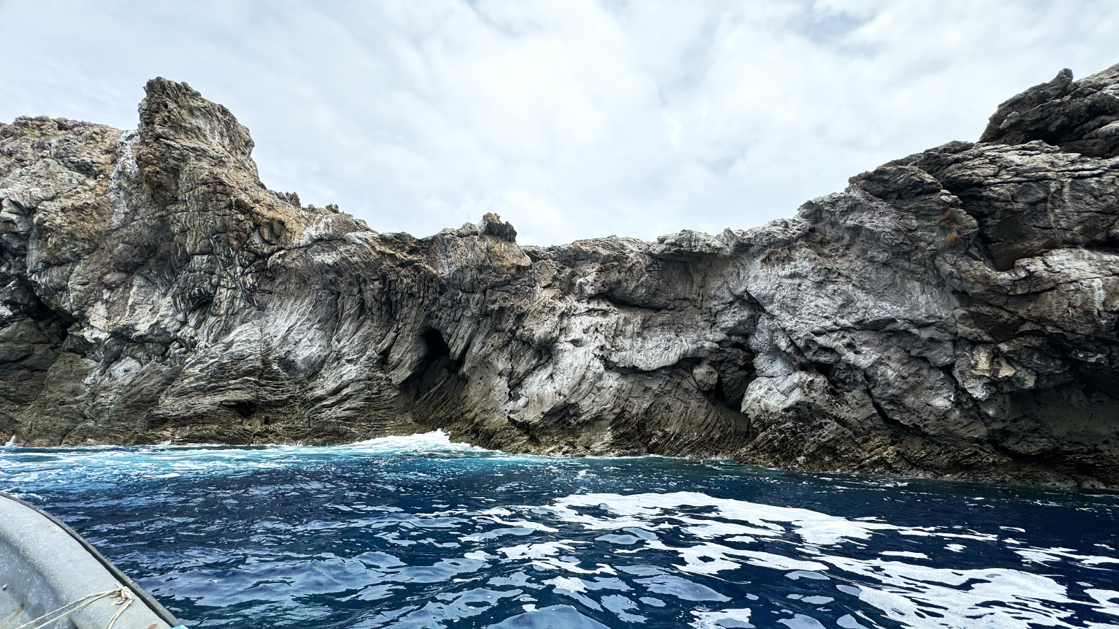
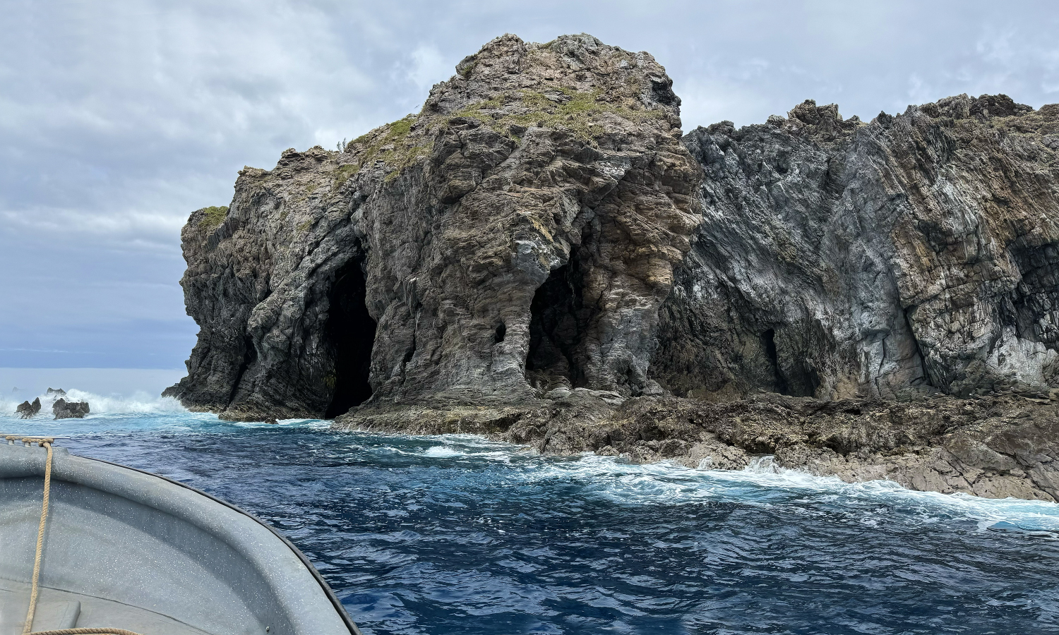
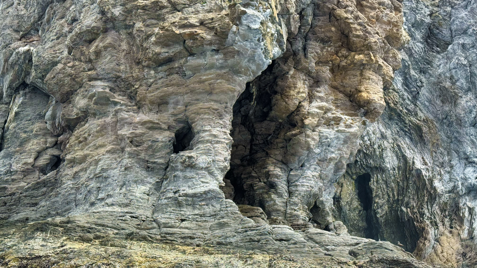
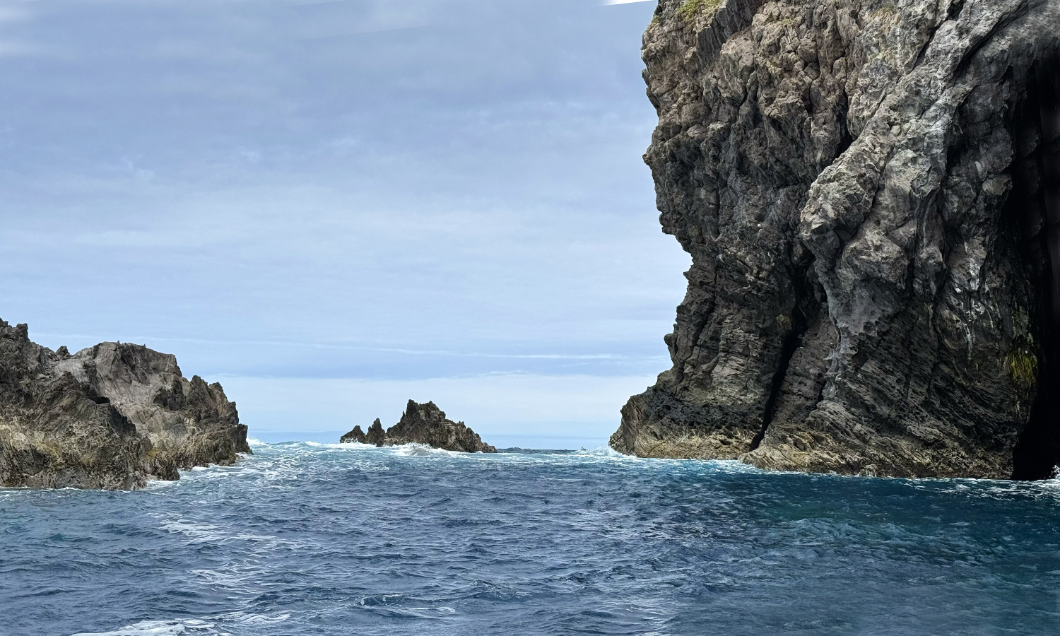
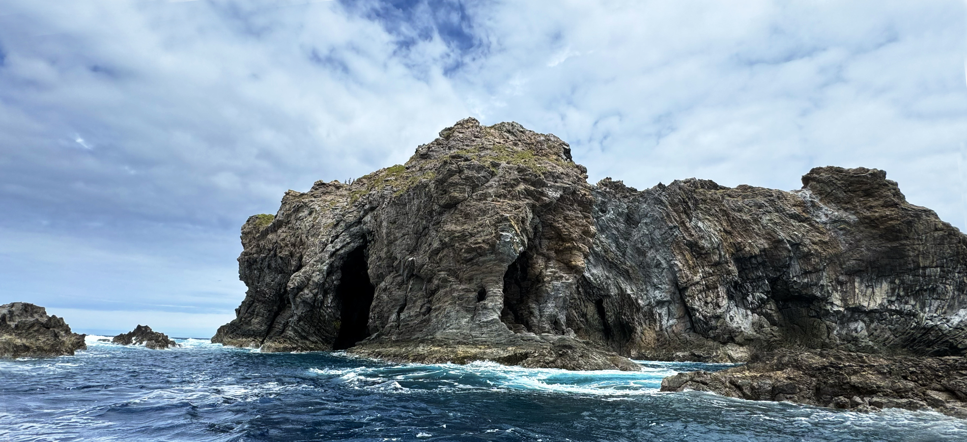
October 22, 2025: Rapa Nui = Easter Island
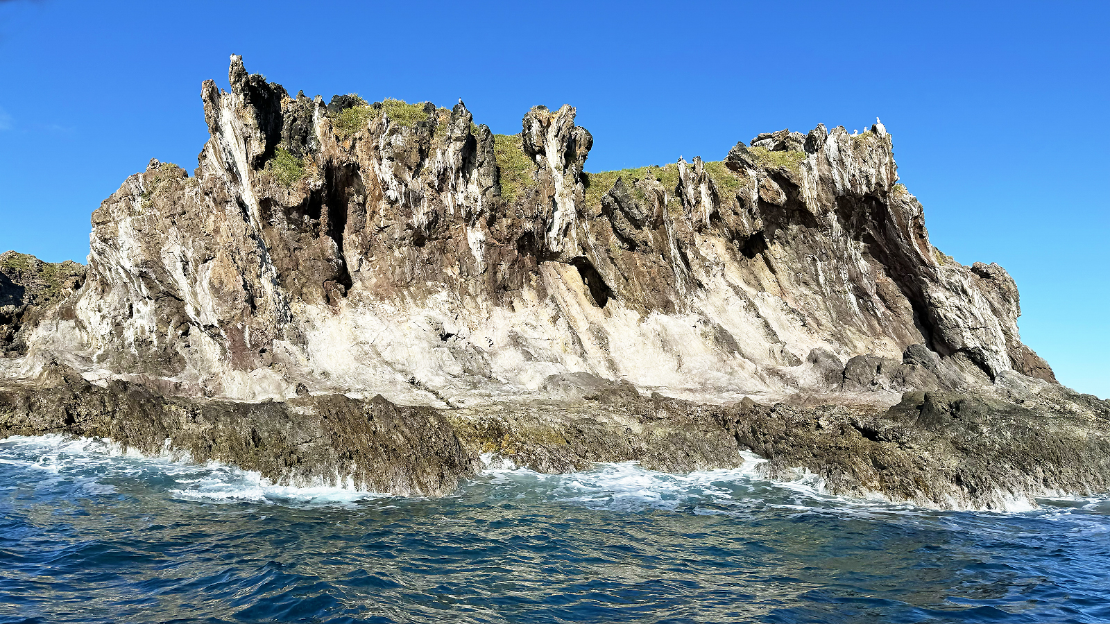
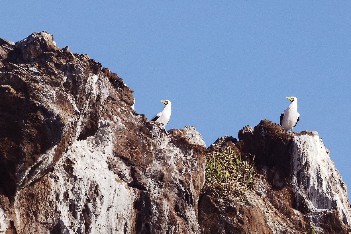
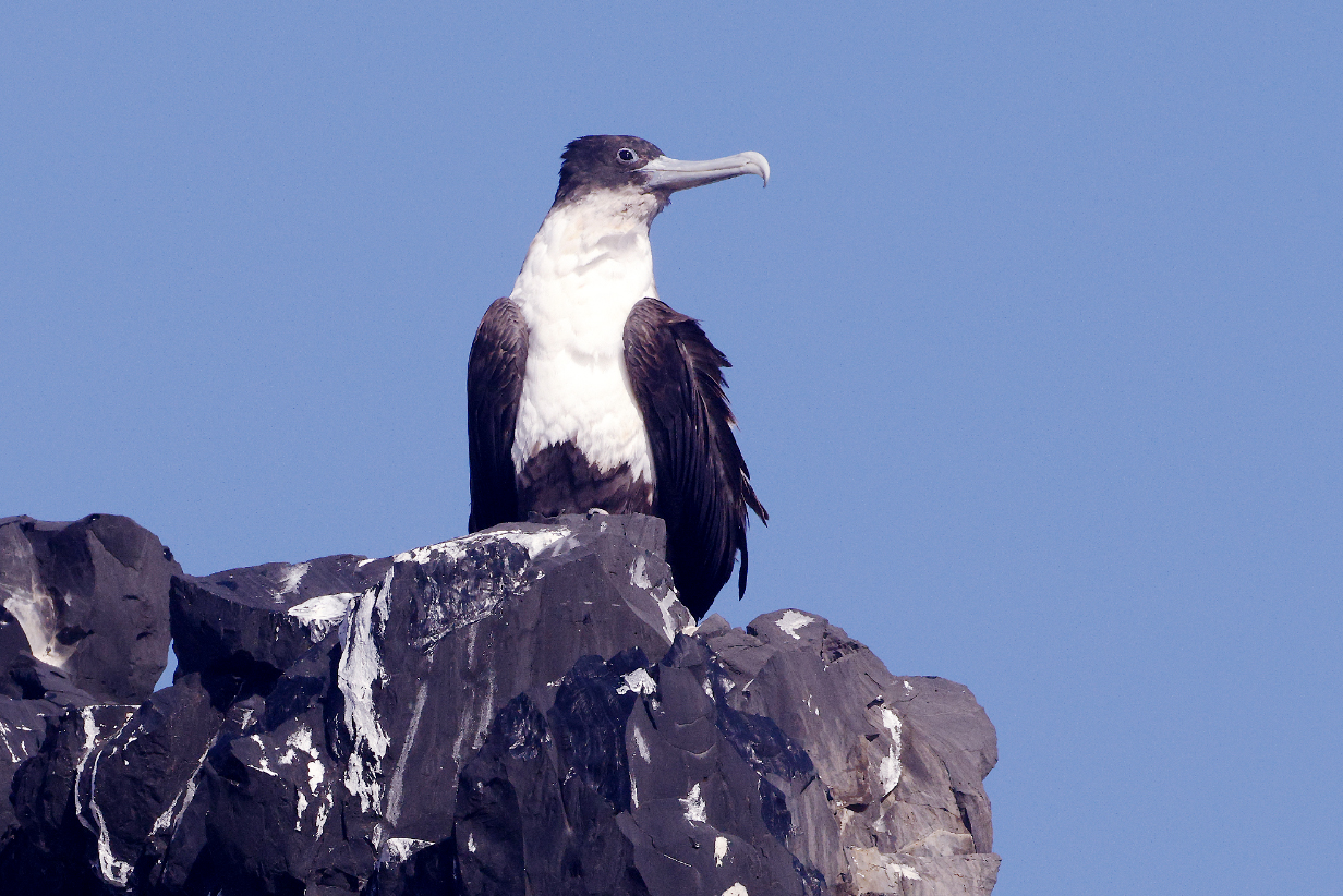
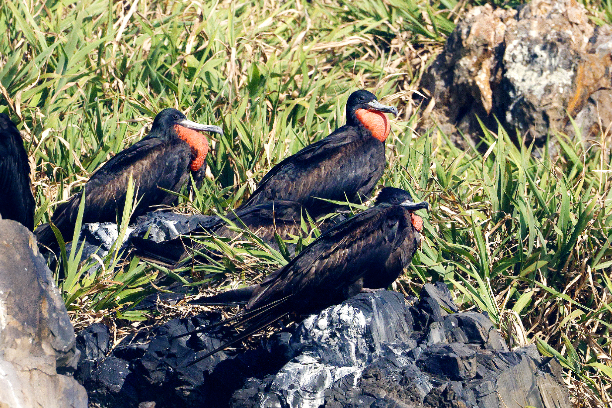
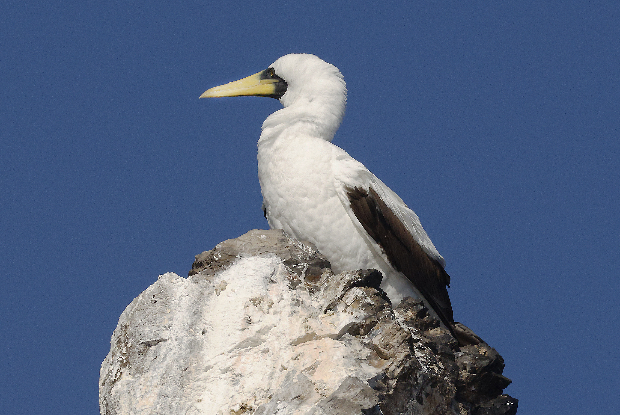
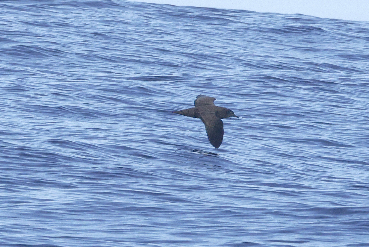
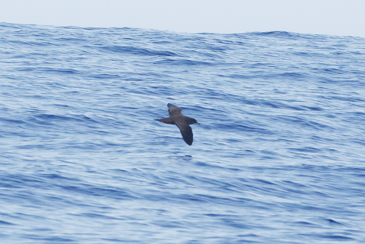
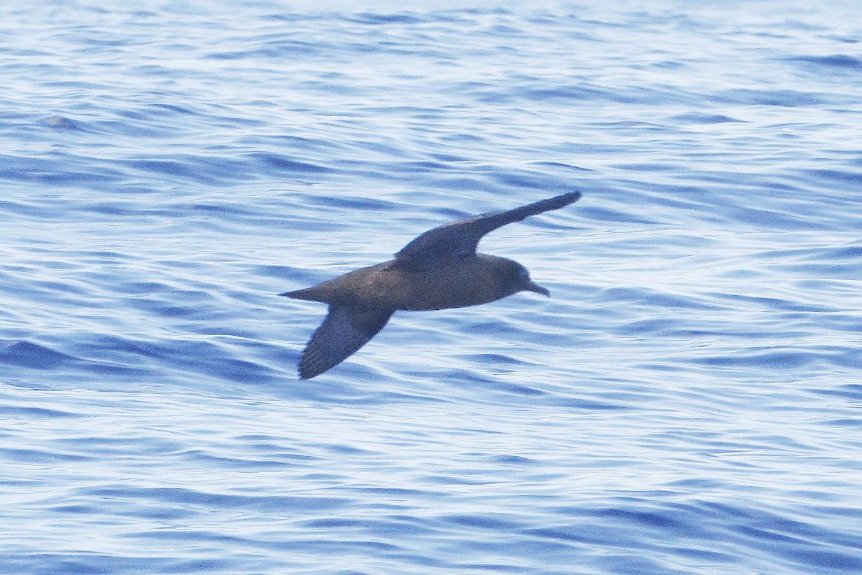
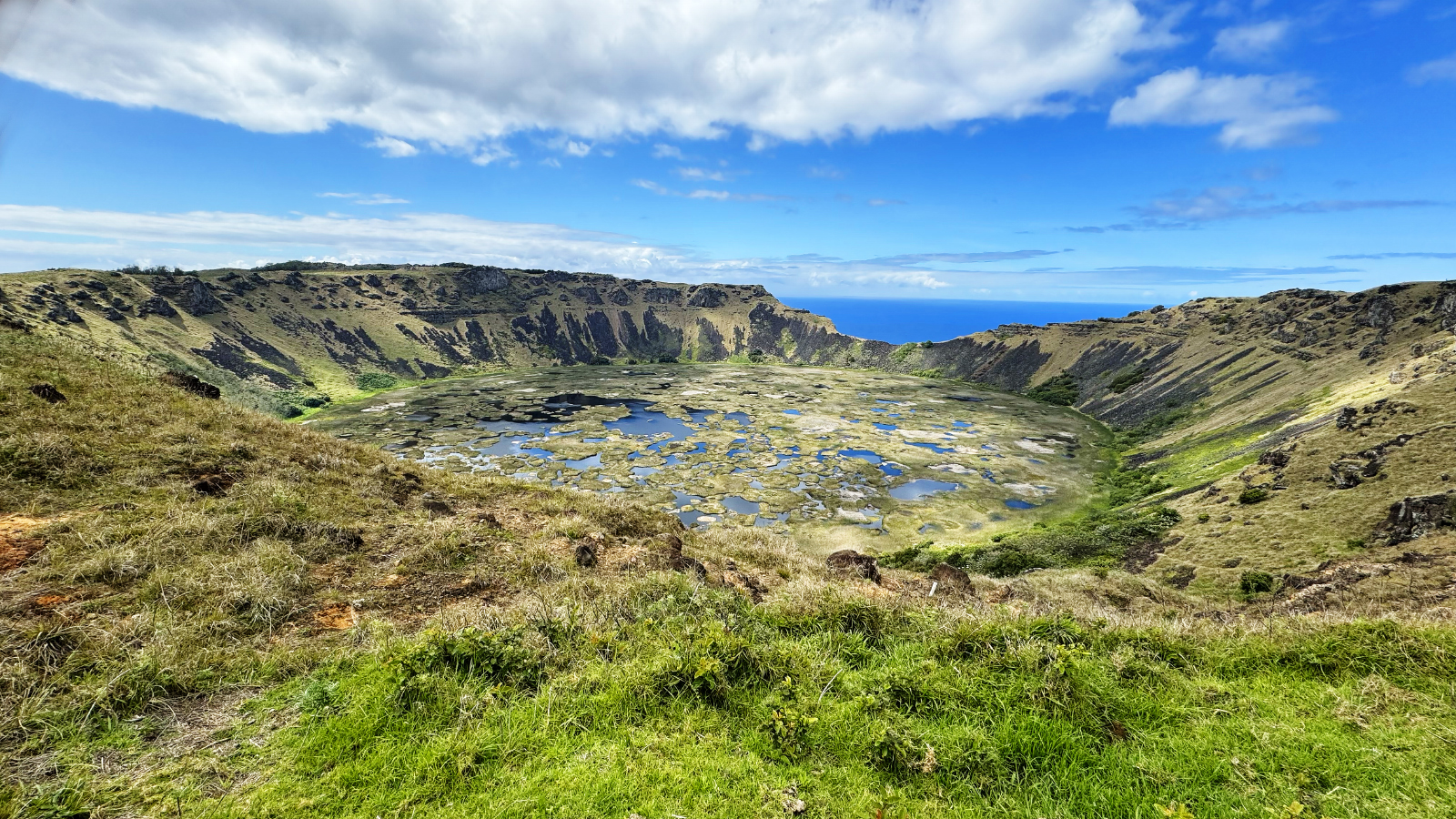
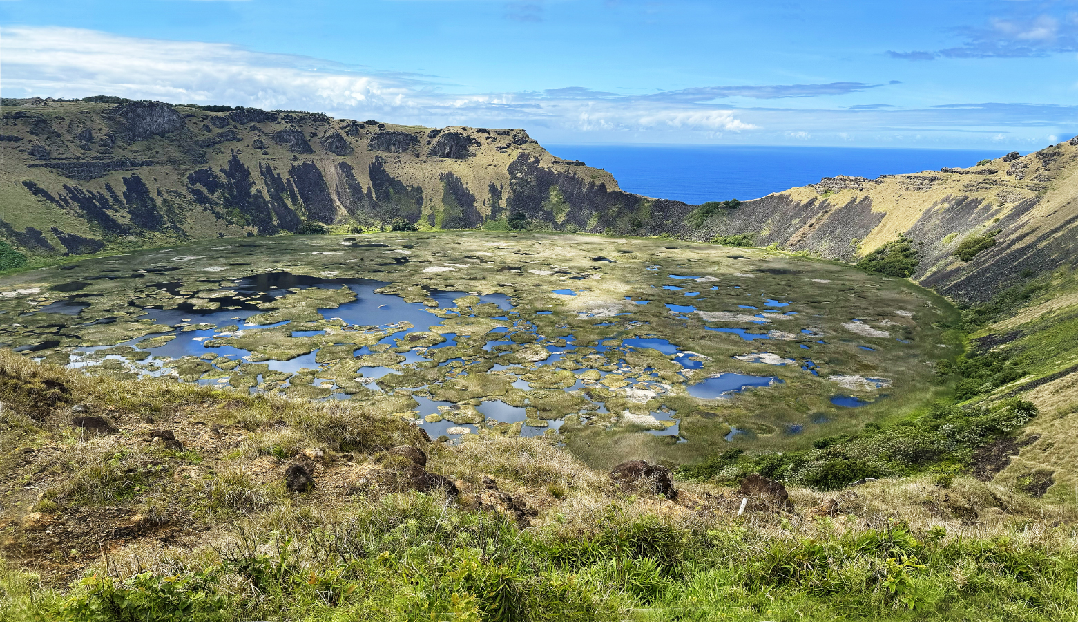
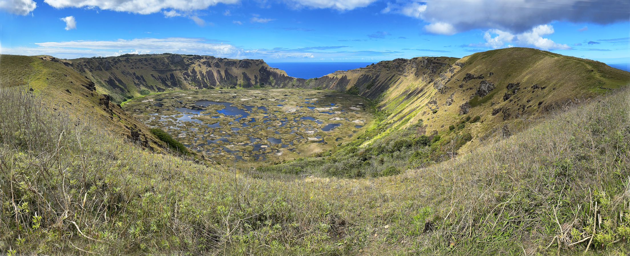
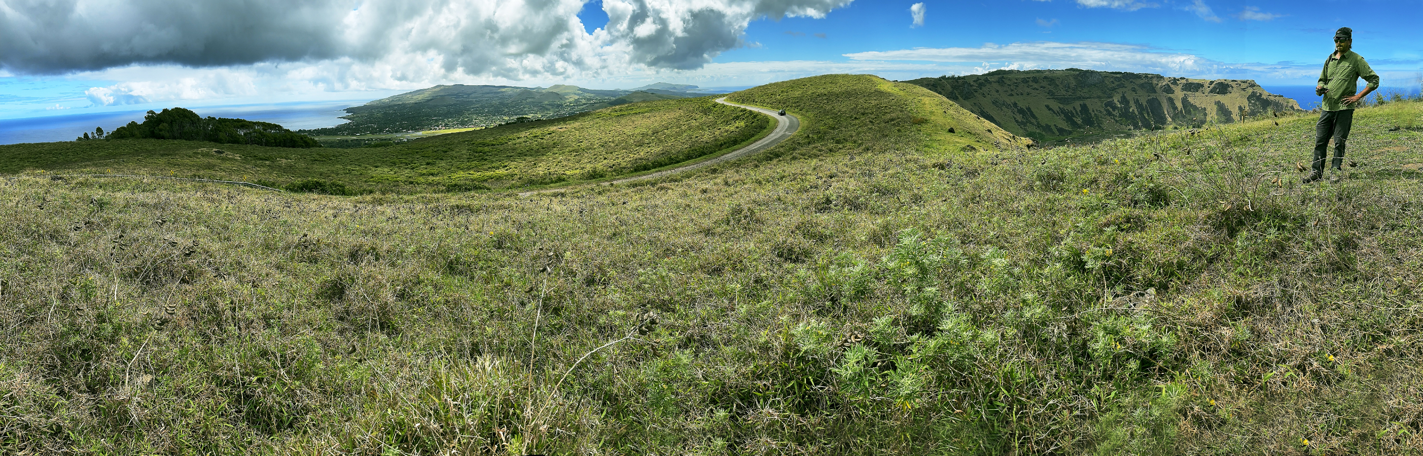
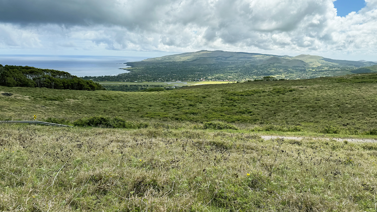
October 27, 2025: Alexander Selkirk Island, Chile
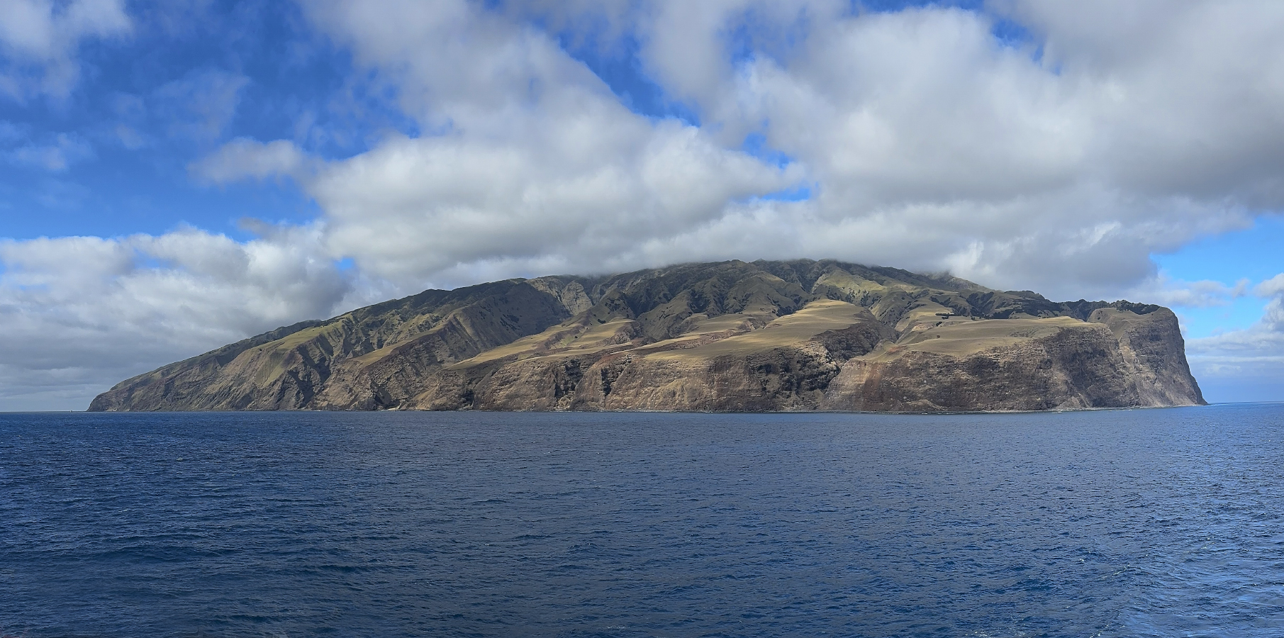
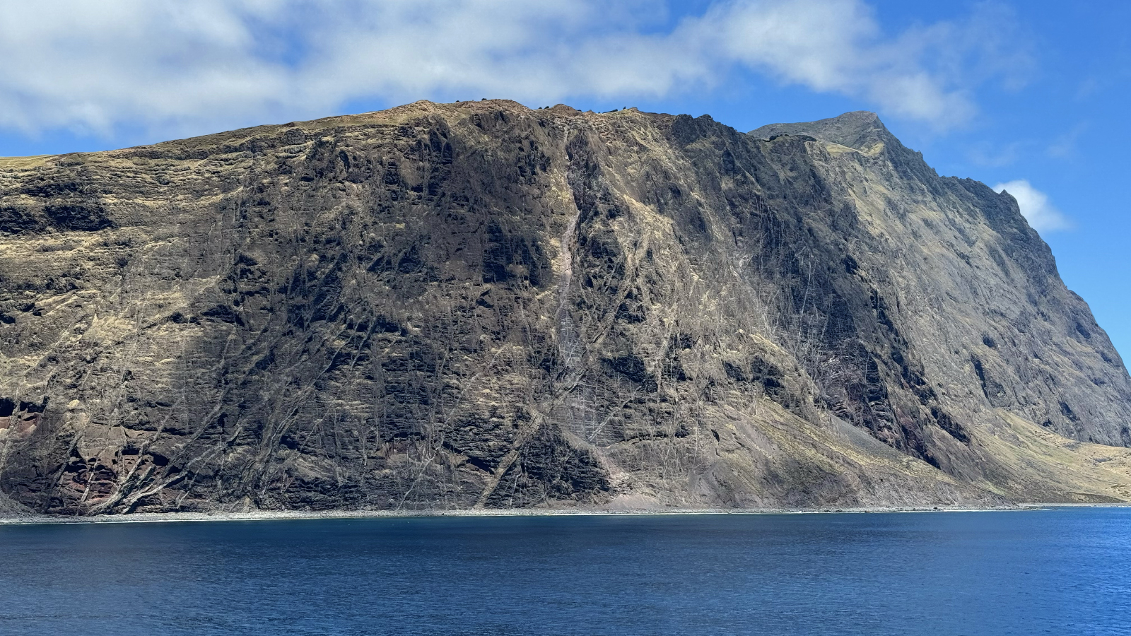
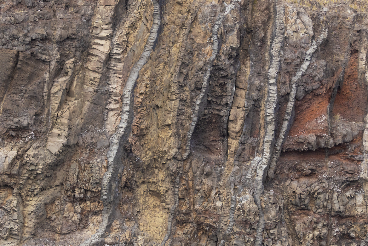
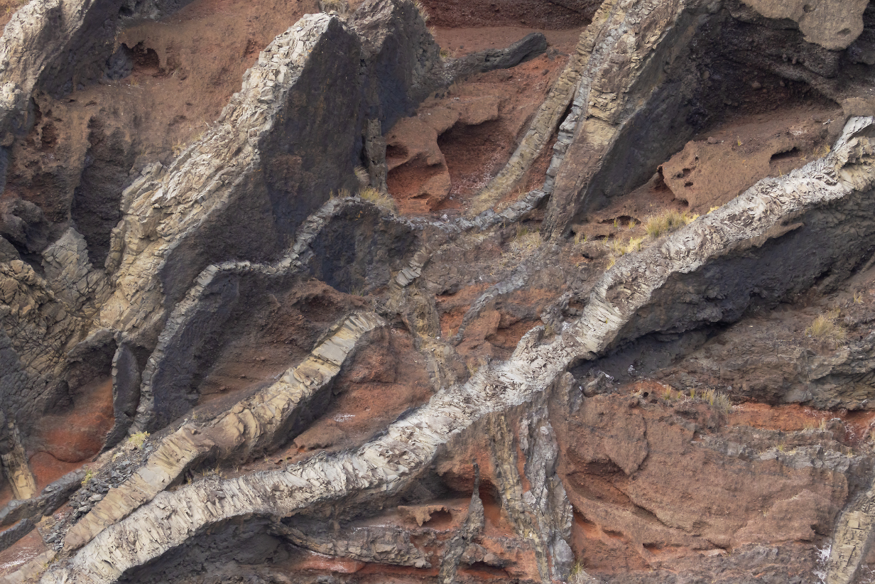
Pelagic Birding at Alexander Selkirk Island
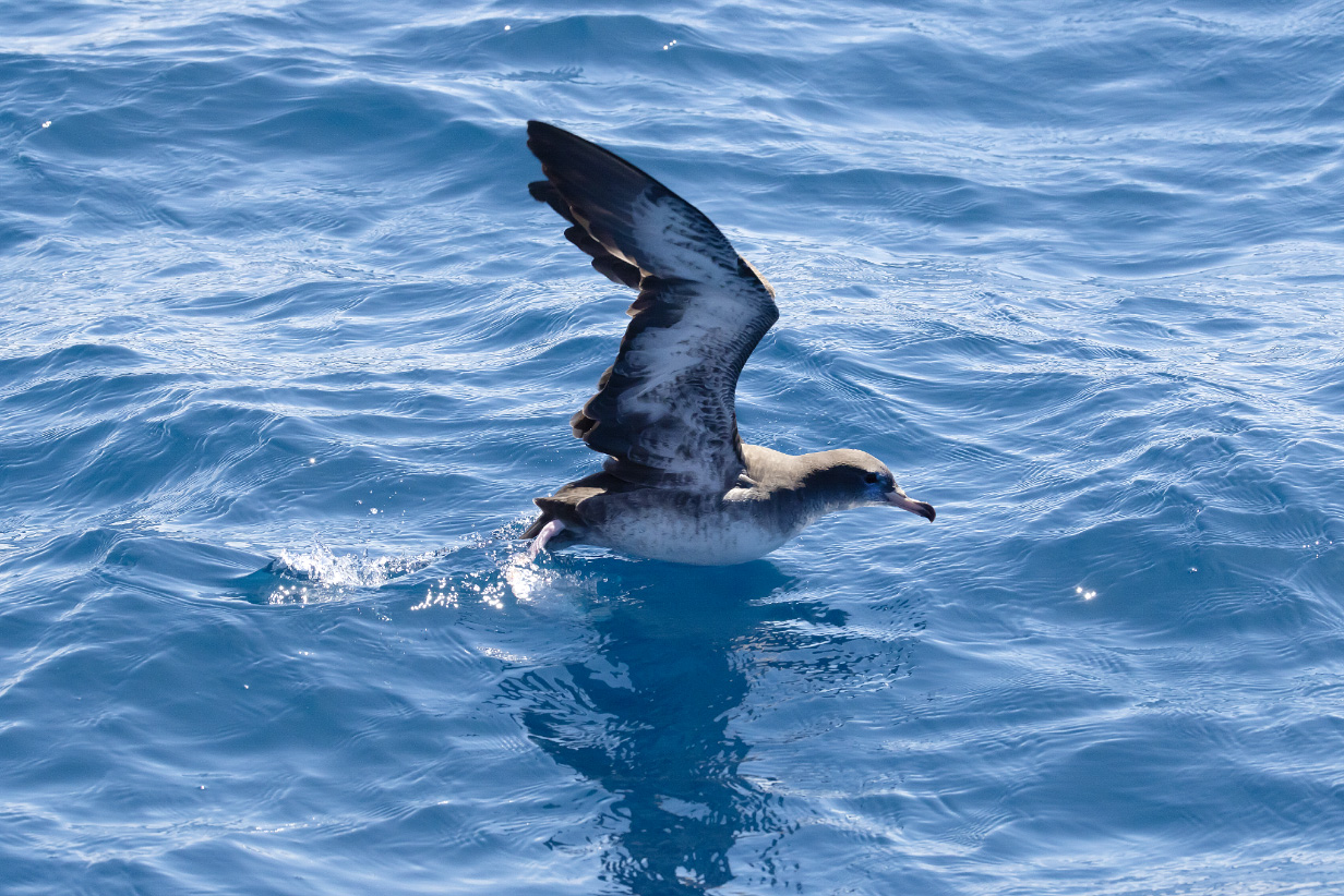
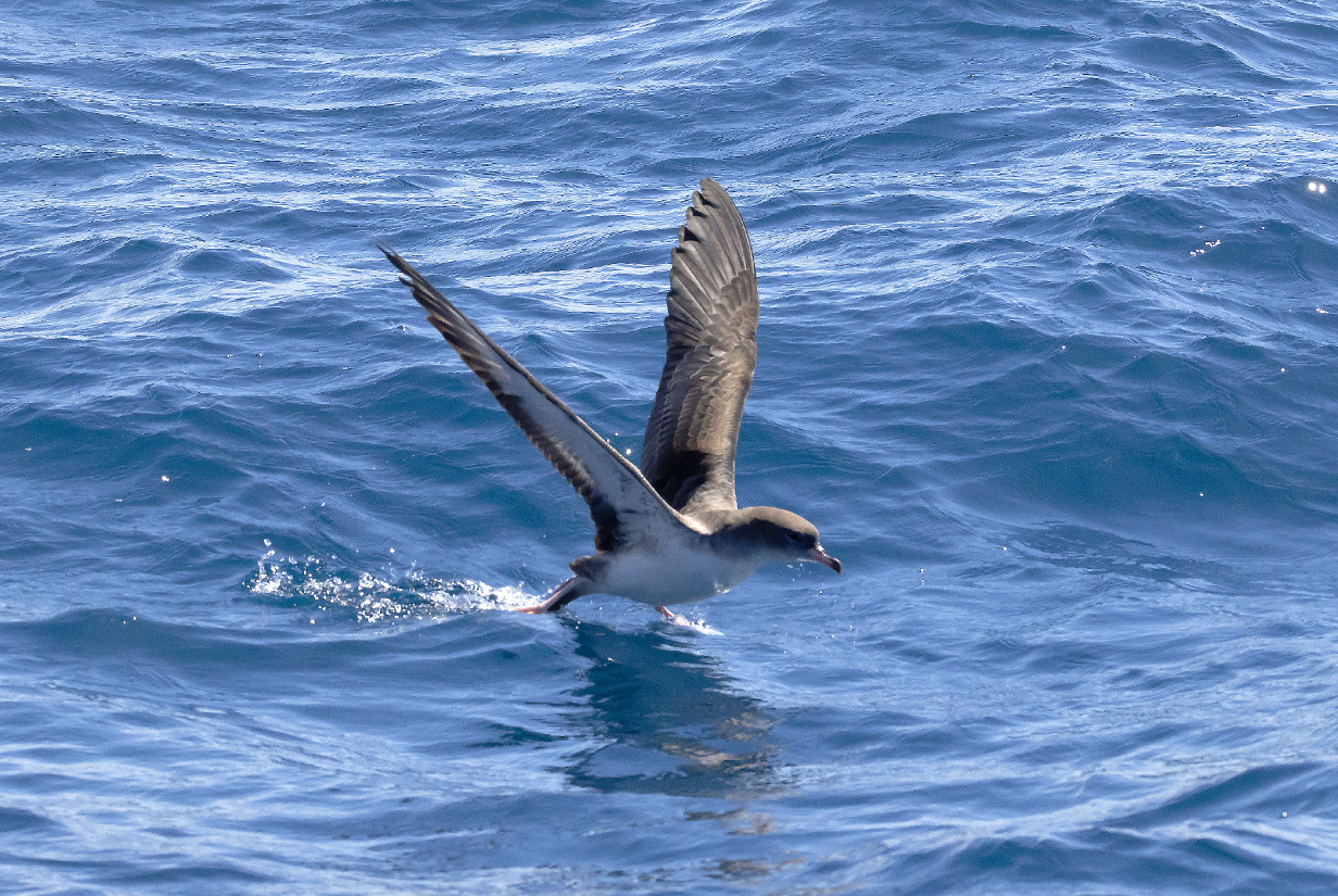
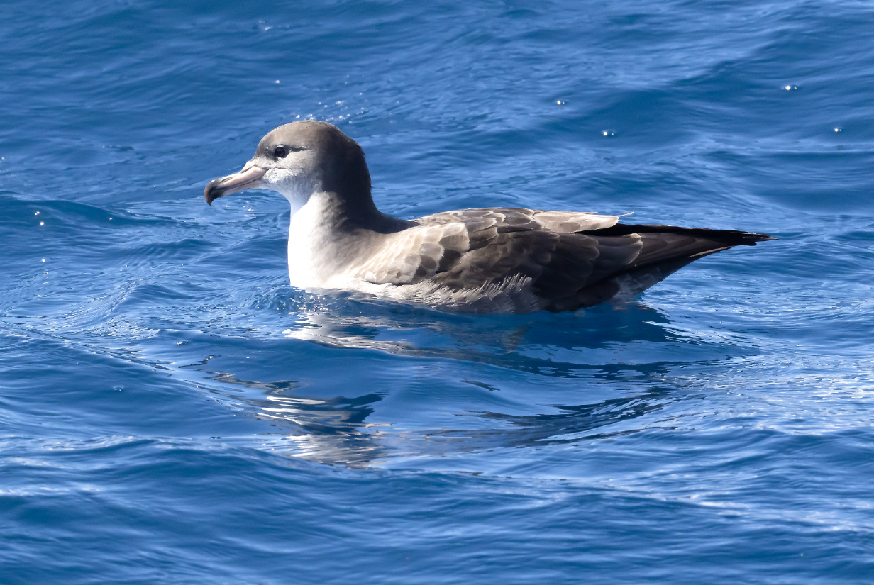
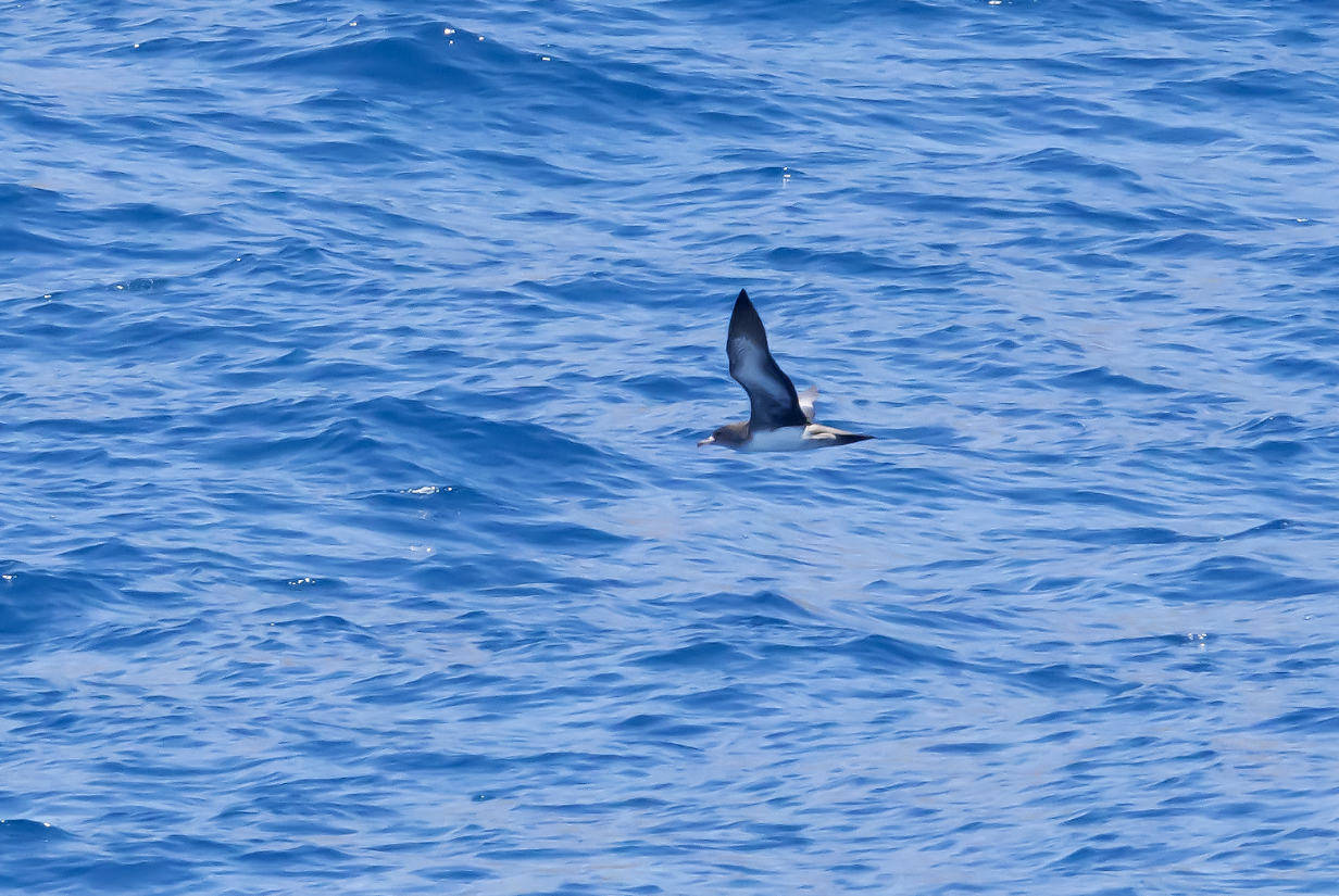
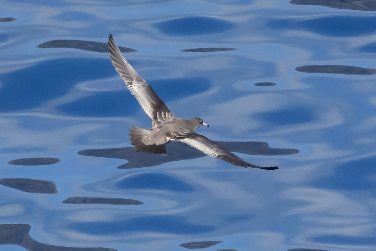
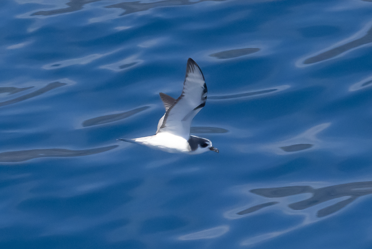
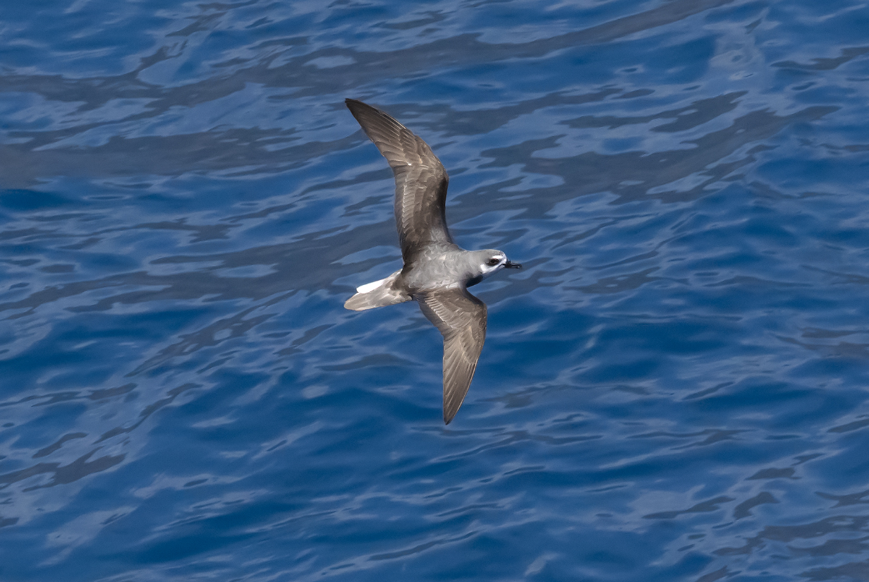
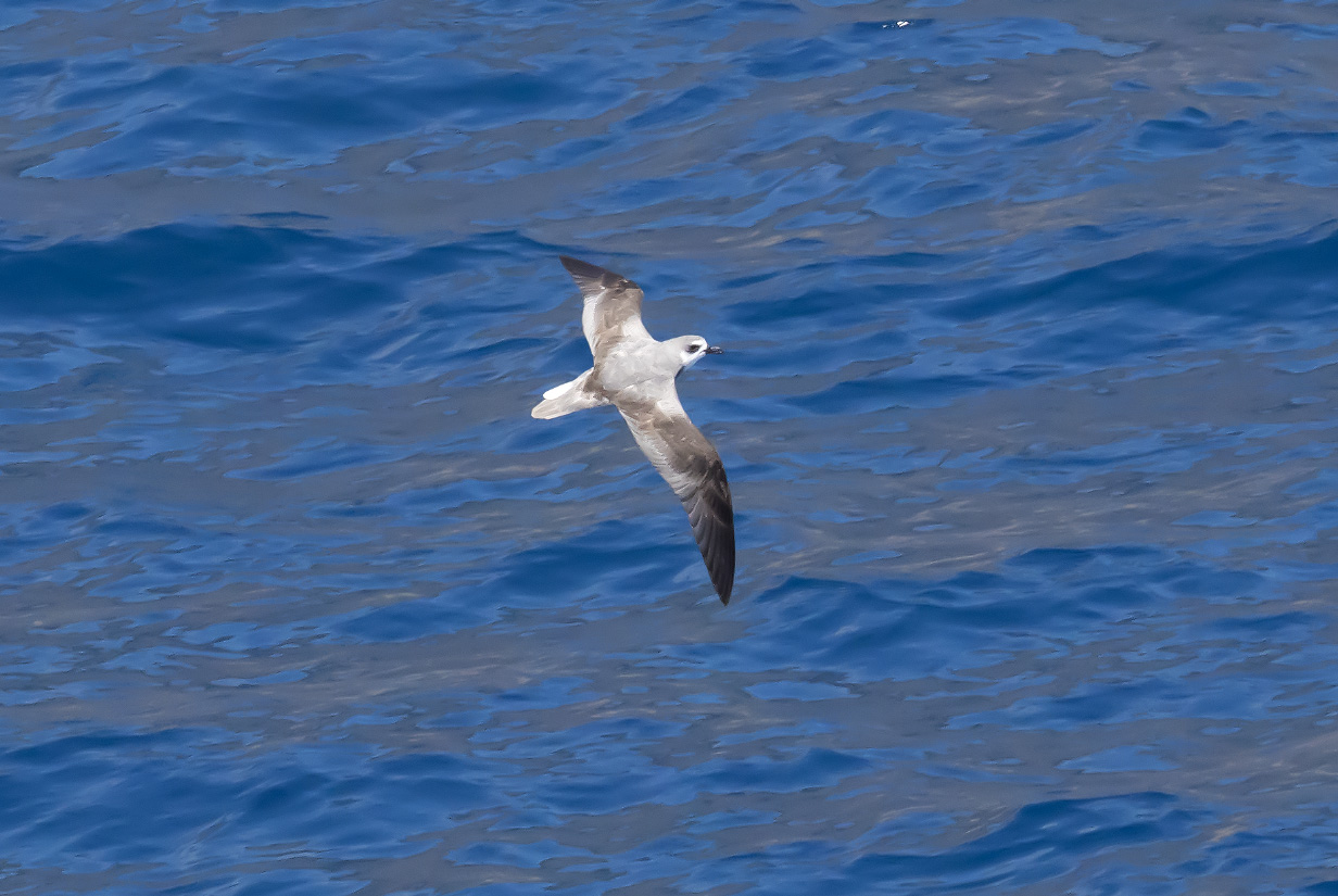
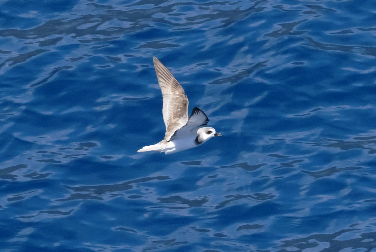
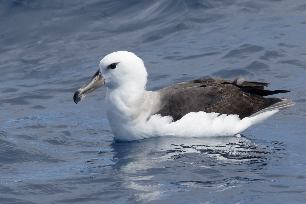
October 28, 2025: Robinson Crusoe Island, Chile
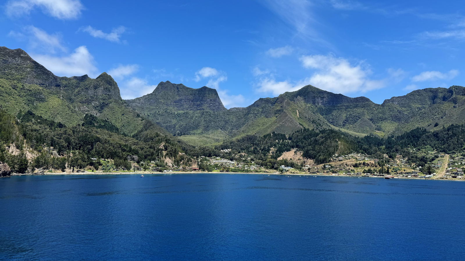
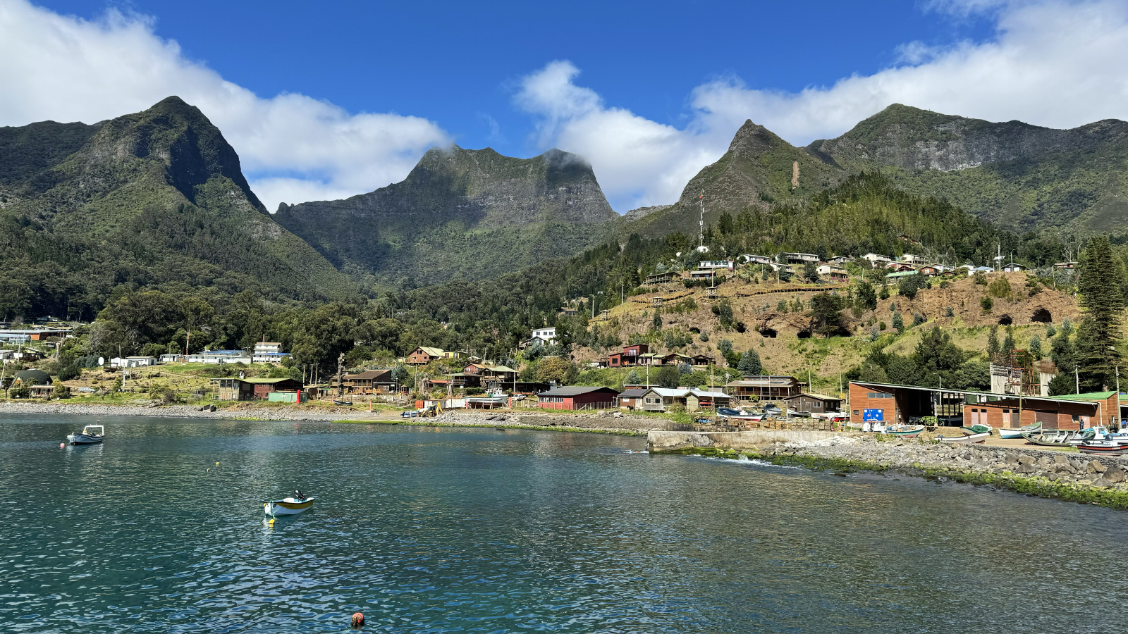
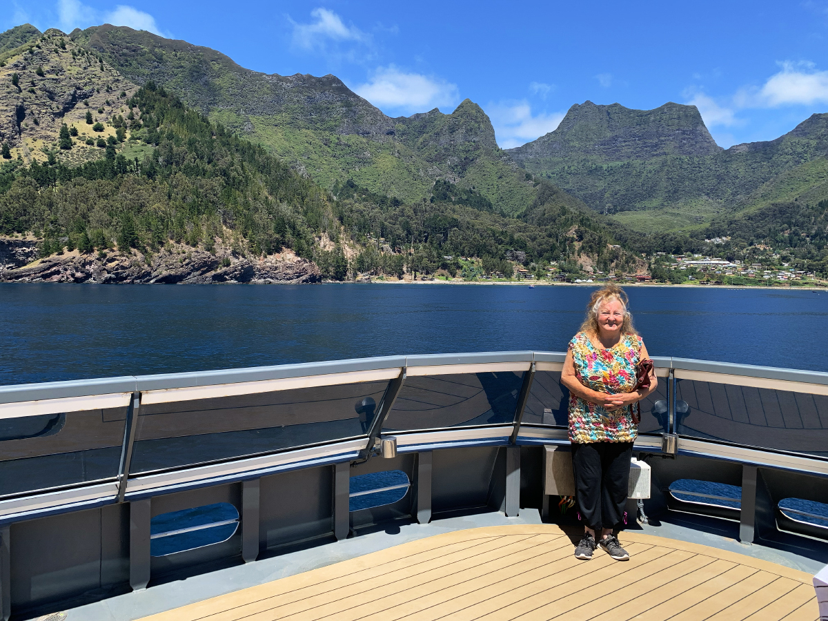
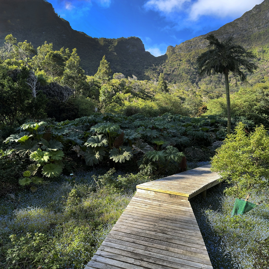
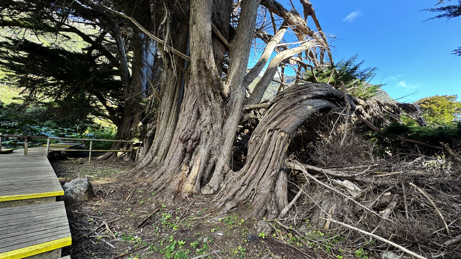
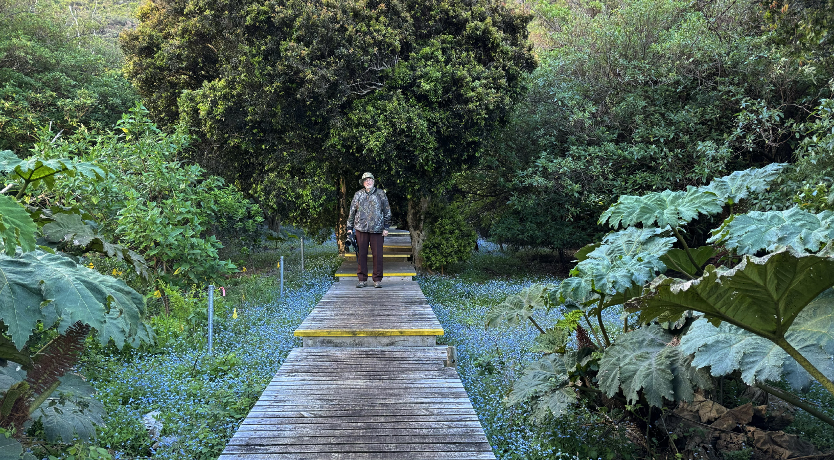
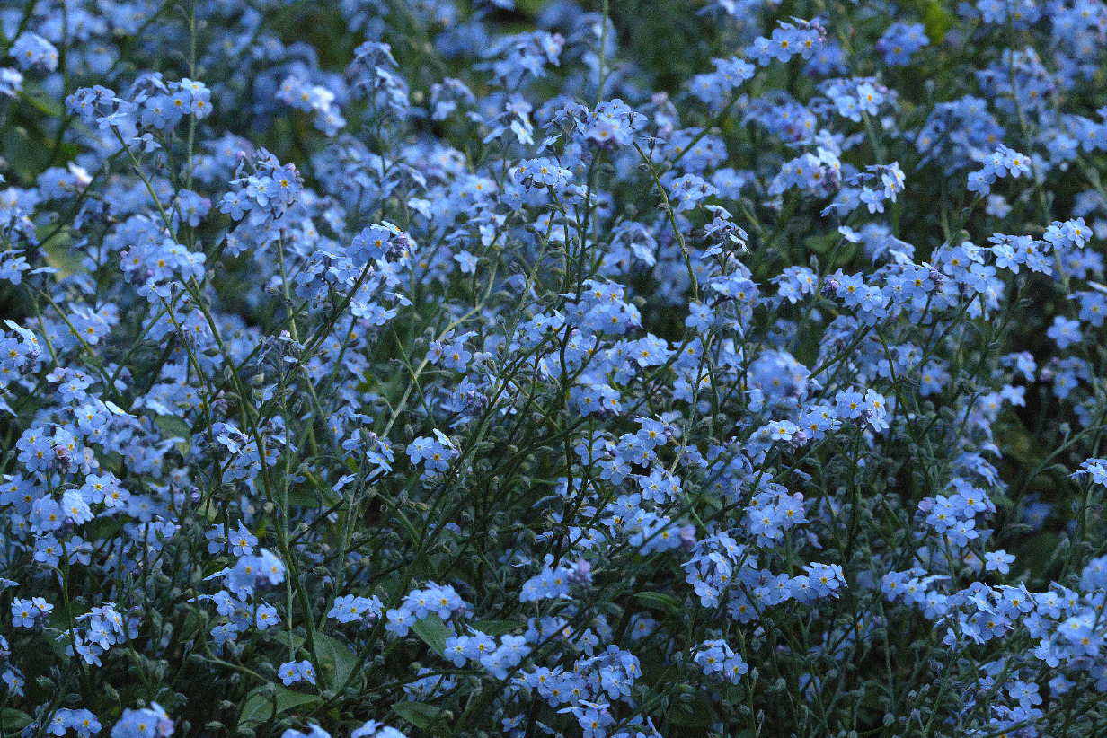
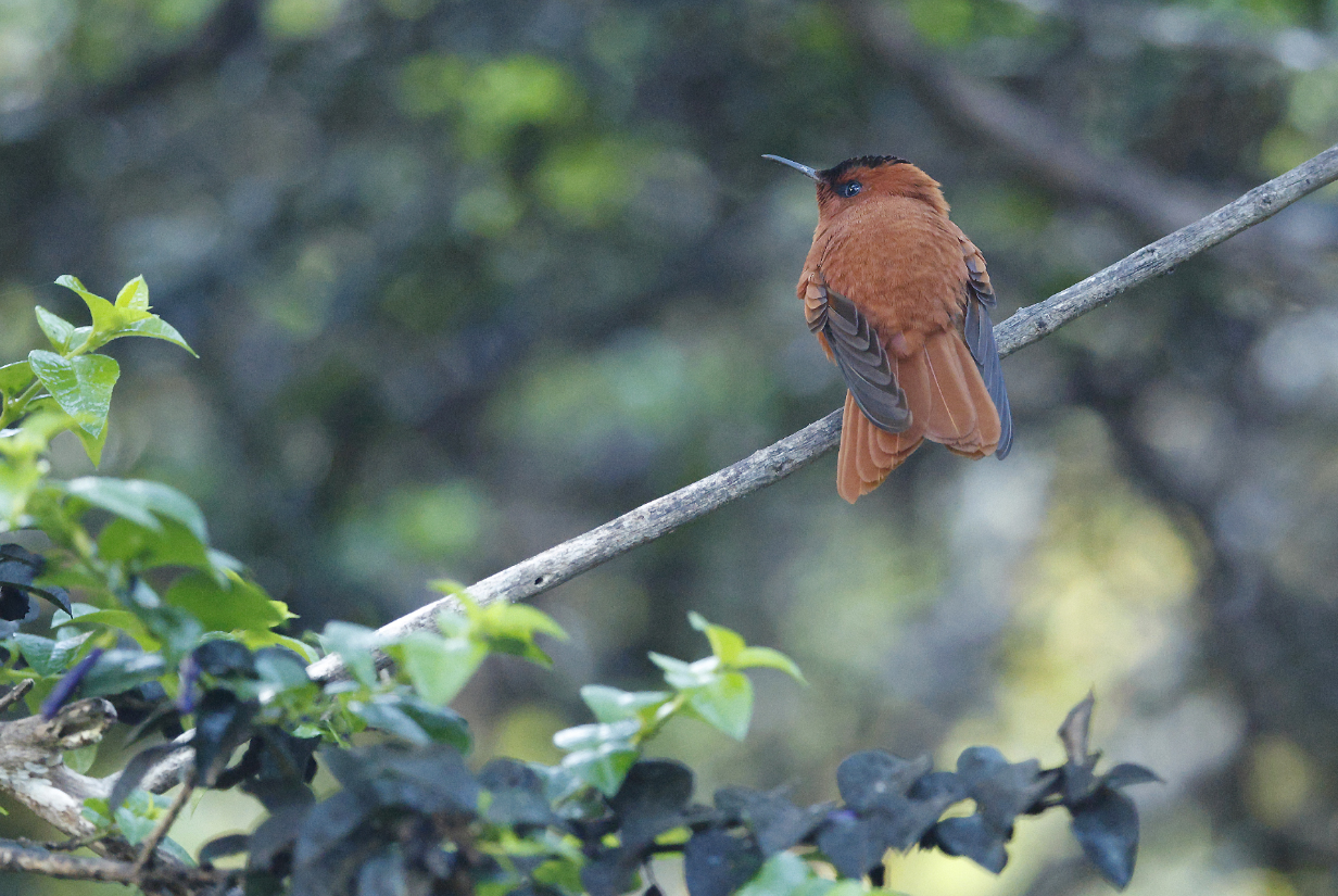
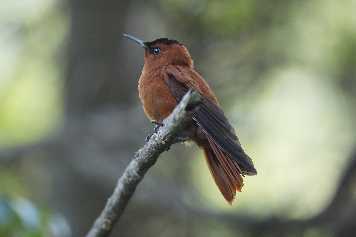
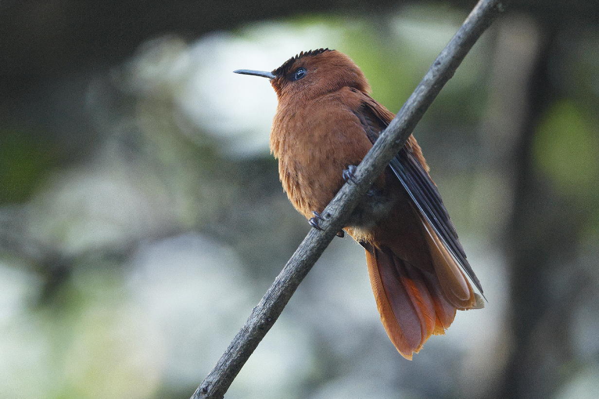
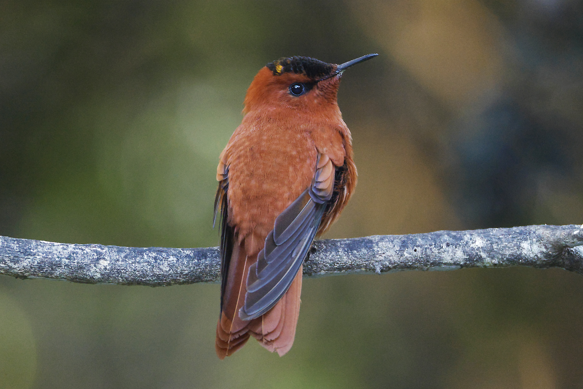
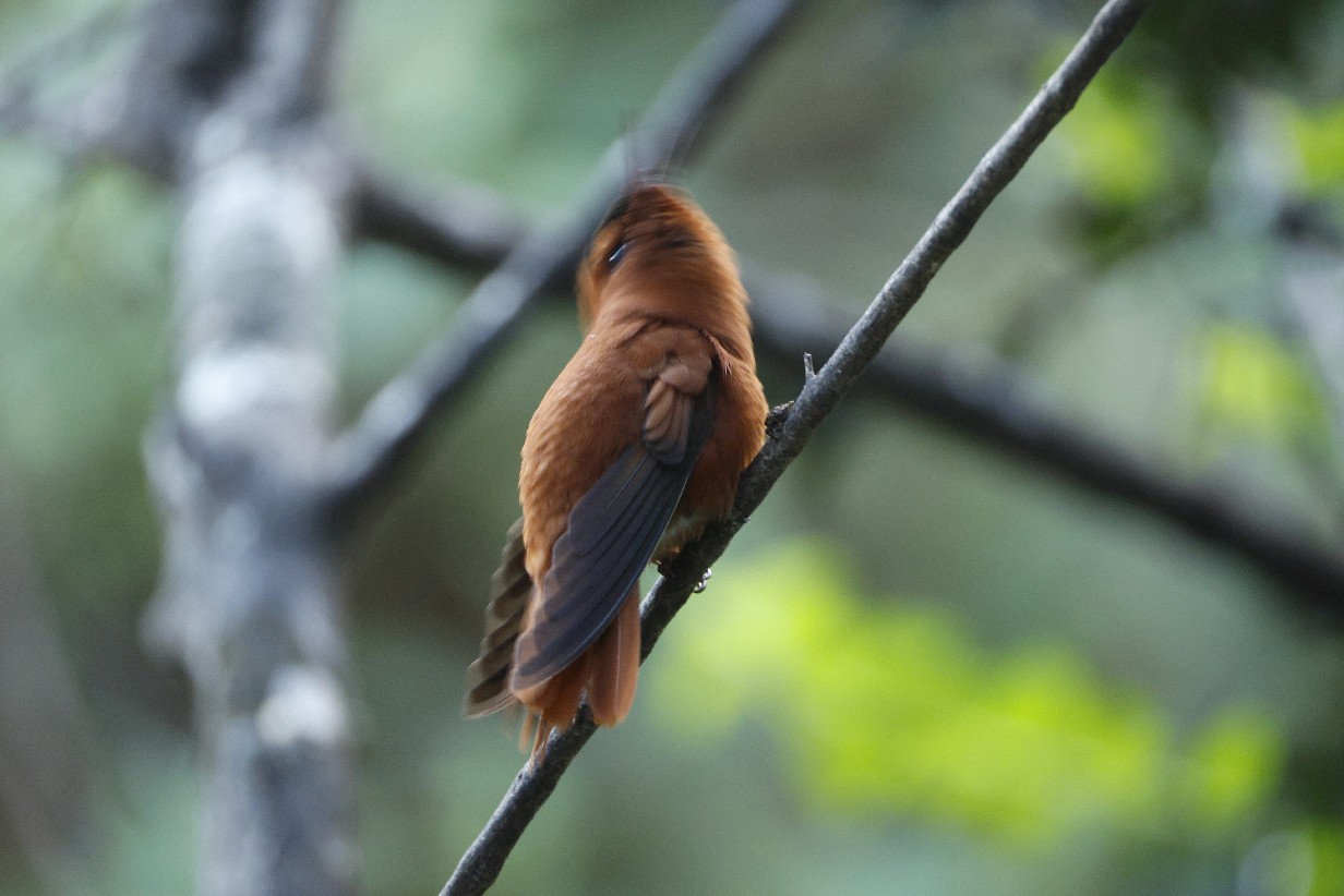
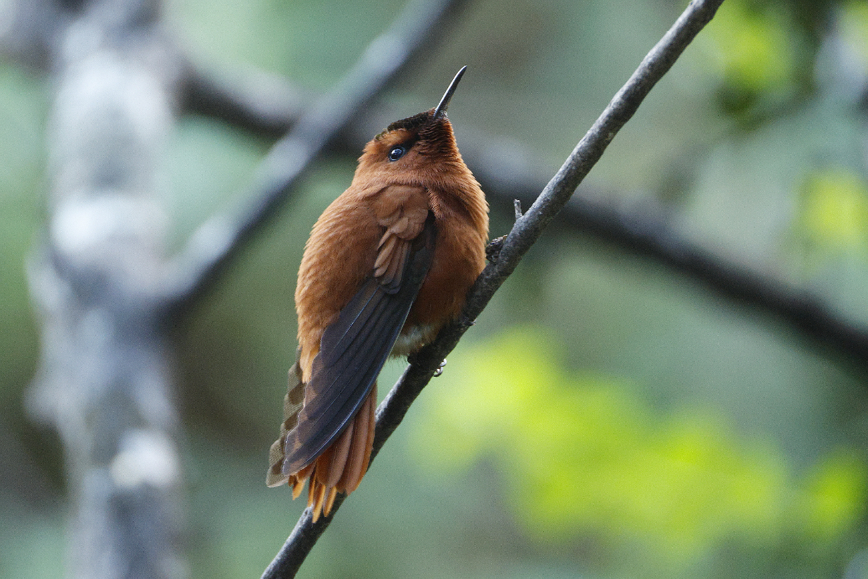
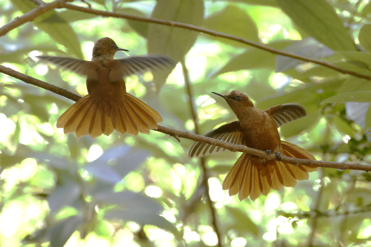
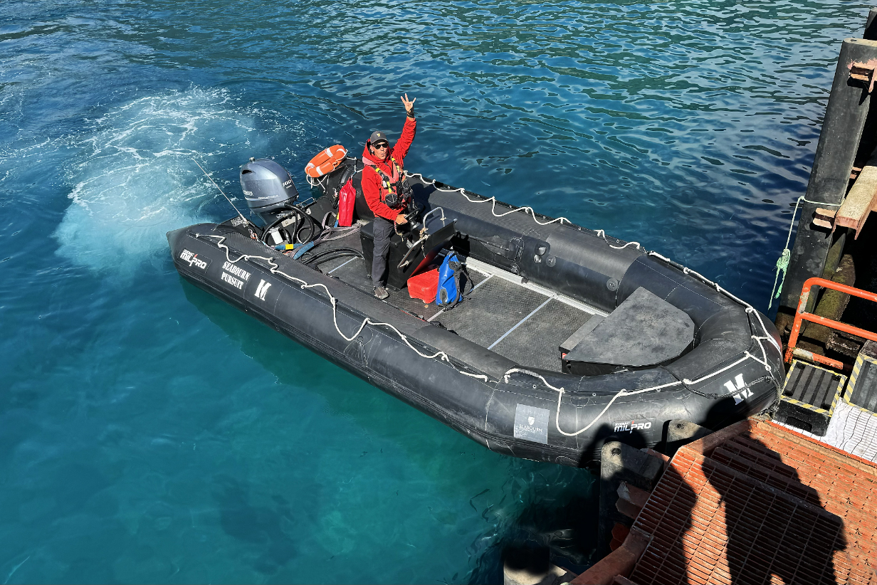
October 29, 2025: Pelagic Birding from Seabourn Pursuit in transit to San Antonio, Chile
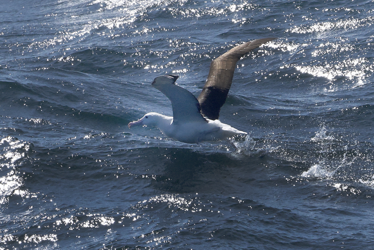
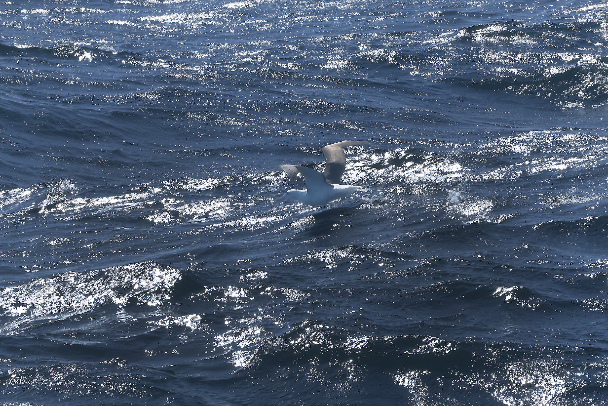

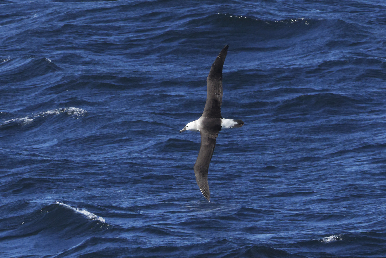
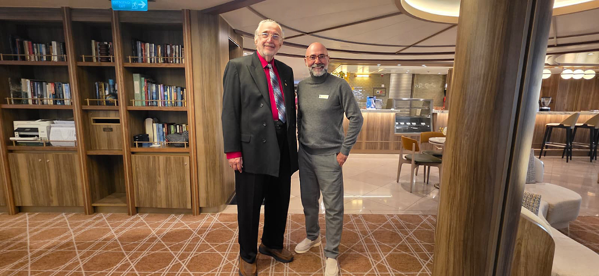

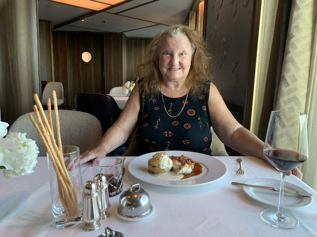
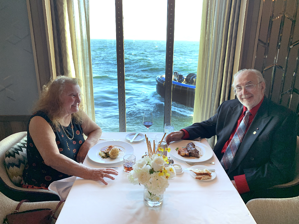
October 30, 2025: San Antonio, Chile: End of 80-Day Cruise on Seabourn Pursuit