John and Mary Kormendy: Antarctica 2026
This web site contains the pictures from our 2026 January/February trip to New Zealand and our Aurora cruise, the "Ross Sea Odyssey" to Antarctica. This will be our 3rd cruise to Antarctica; the first 2 were via Aurora and Seabourn, respectively -- see links here.
This web site is finished.
The purpose of this web site is to catalog our memories, not to showcase the trip for public readers. So I include pictures that are not very good when they document sightings that are important to us.
Calendar
Trip Birds
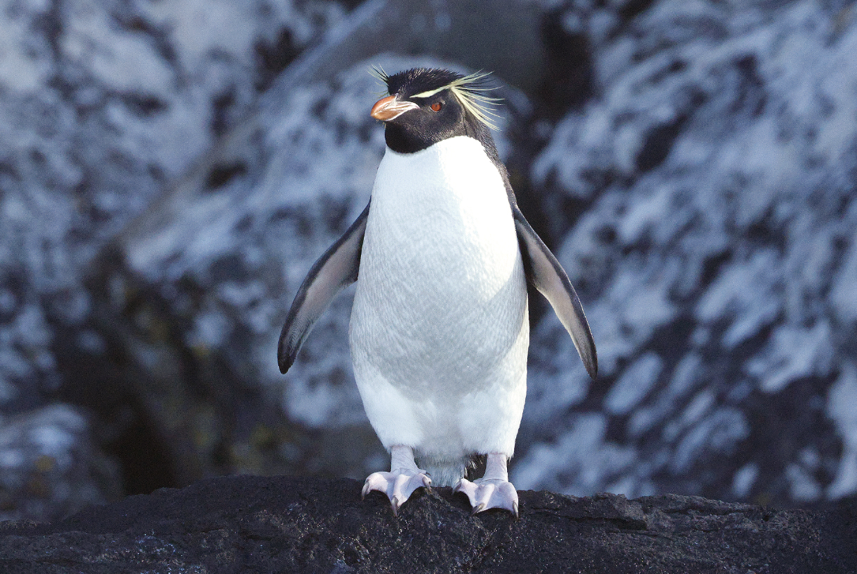
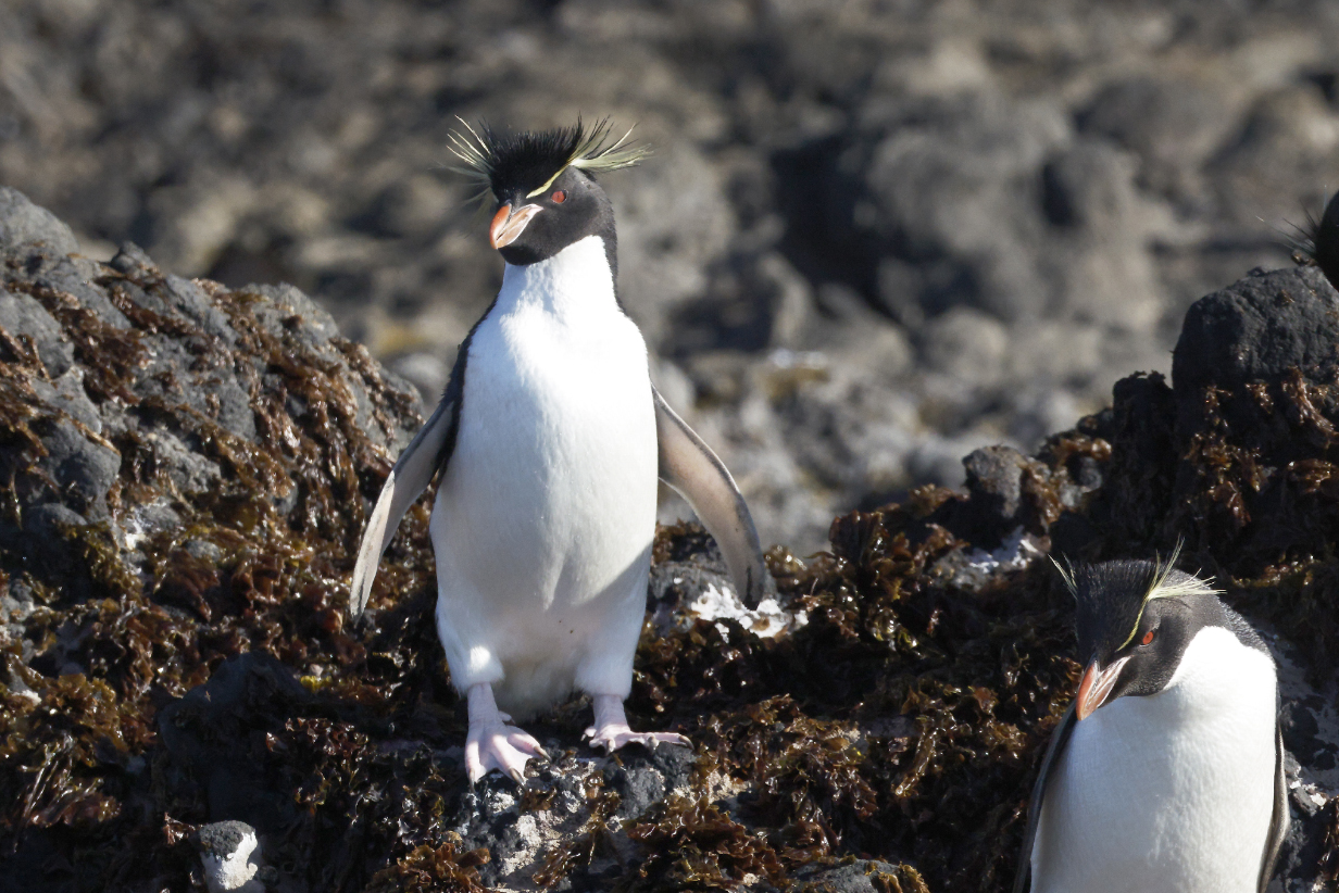
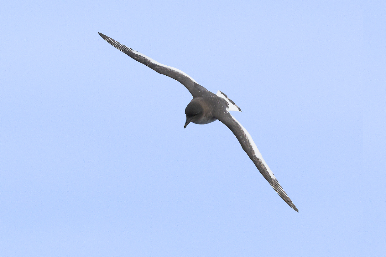
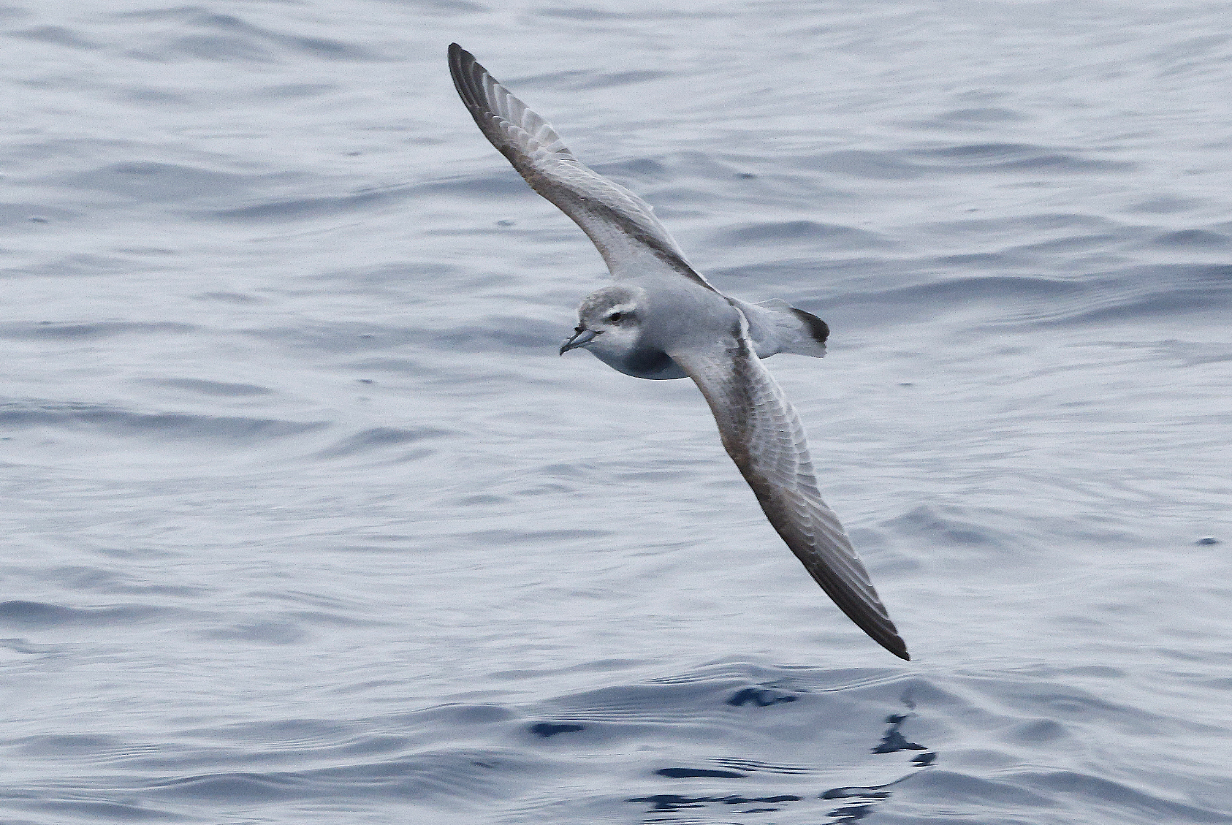
Eastern Rockhopper penguin on Auckland Island
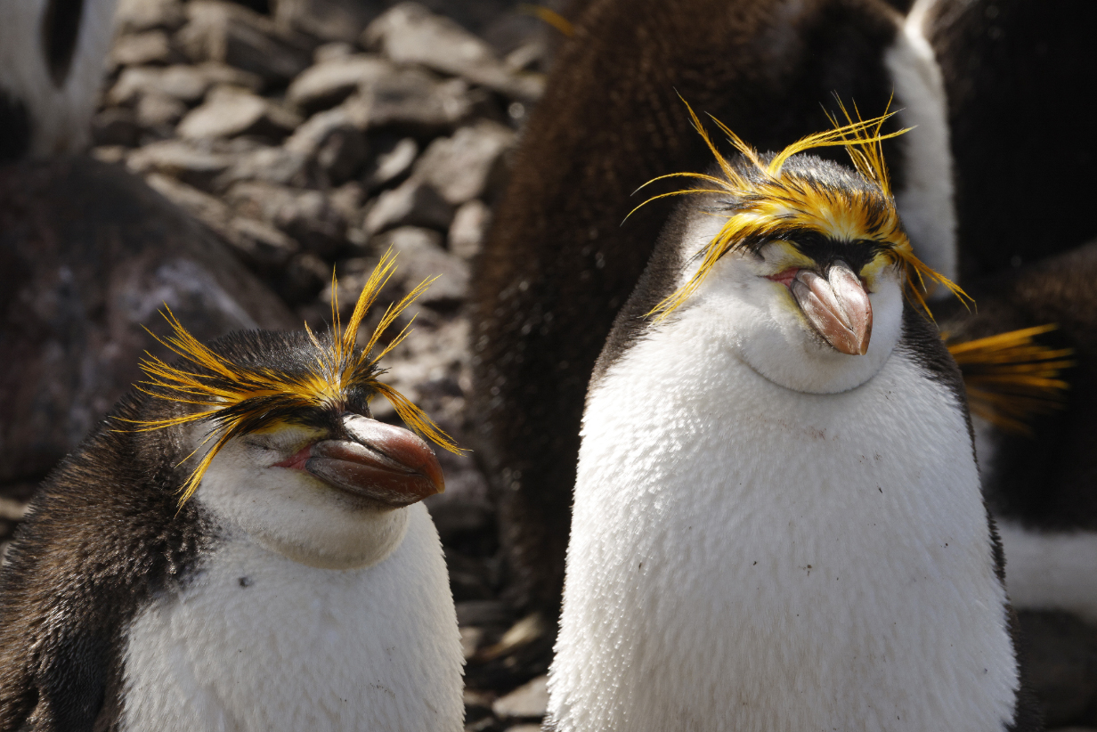
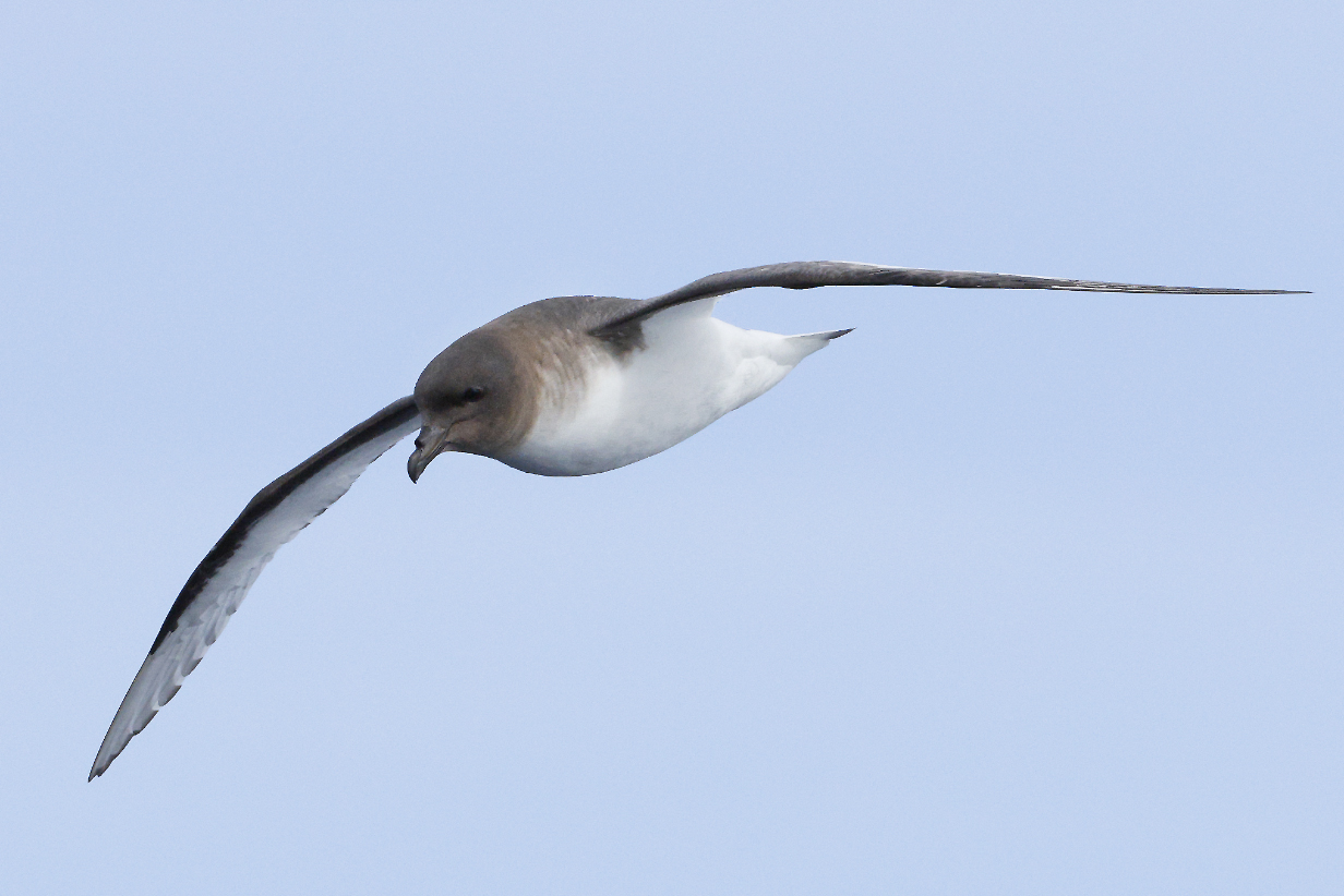
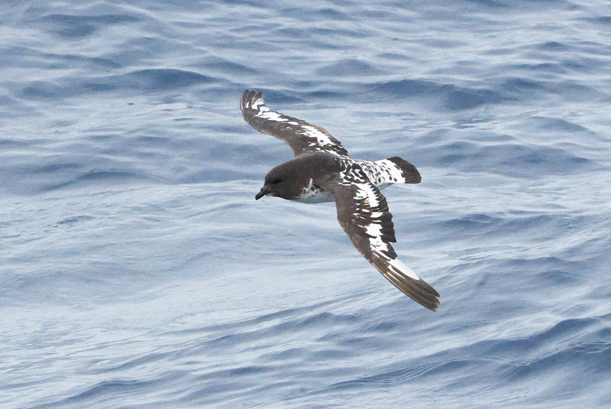
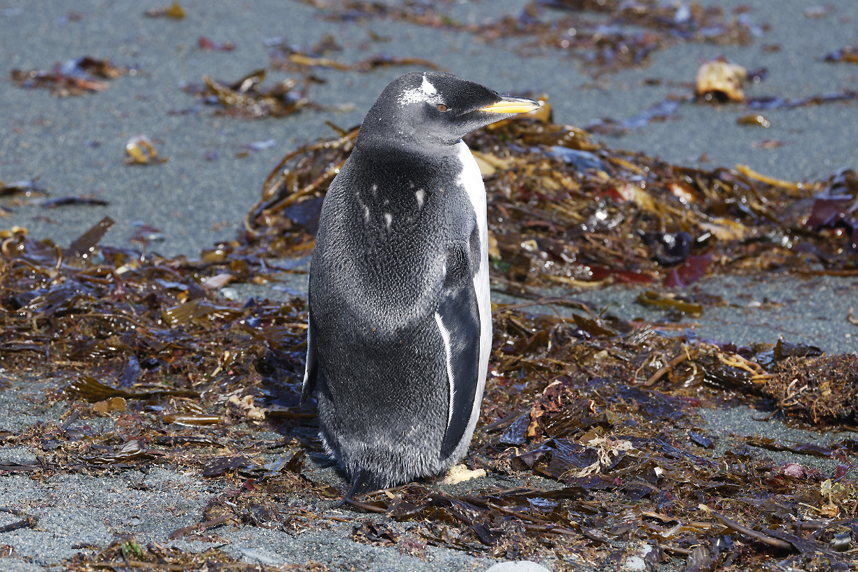
Royal penguins on Macquarie Island
Travelog and Bird Pictures
January 15 and 16, 2026: Orokonui Ecosanctuary, near Dunedin, New Zealand
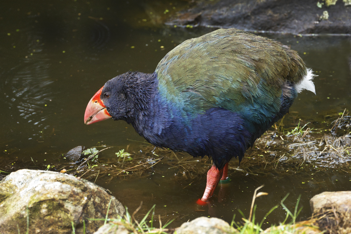
South Island Takahe -- closely related to Australasian swamphen and the world's biggest rail. Originally discovered in 1847-1848 based on fossilized bones, it was thought to be extinct, like the much larger Moa. A tiny population of about 100 birds was discovered in Fjordland on the South Island, but early encounters -- always of just one or two birds -- were exploitative. The minimum world population is estimated to have been roughly 100 birds. Since then, aggressive protection and relocation to predator-free islands and sanctuaries has increased the population to ~ 600 birds now, increasing (according to Wikipedia) by about 8 % per year. We first saw Takahe at the protected island of Tiritiri Matangi during our 2011 birding tour to New Zealand. Now they thrive in many sanctuaries, including Orokonui. New Zealand's focus on saving endangered bird species is impressively dedicated and successful.
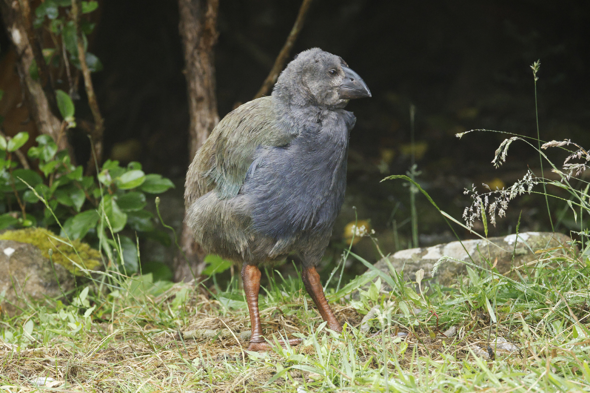
Takahe chick (Last year's now-almost-adult chicks are -- I was told -- helping to take care of this year's chicks, like this one. The recovery program is doing well.)
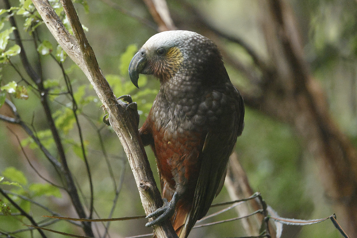
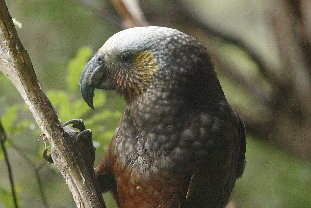
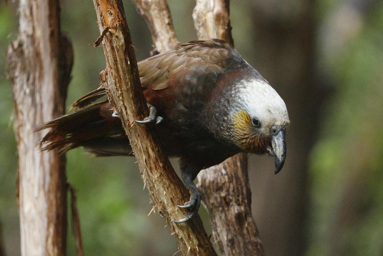
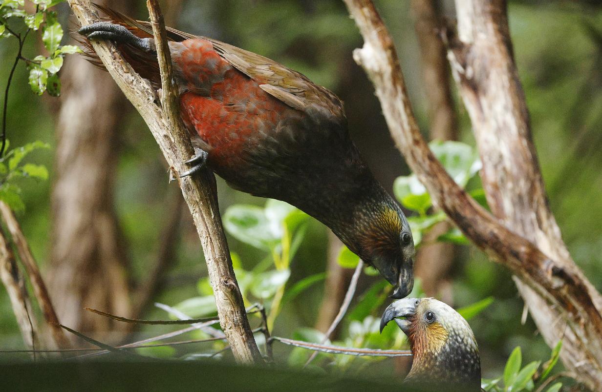
Kaka -- very charismatic, like virtually all New Zealand parrots.
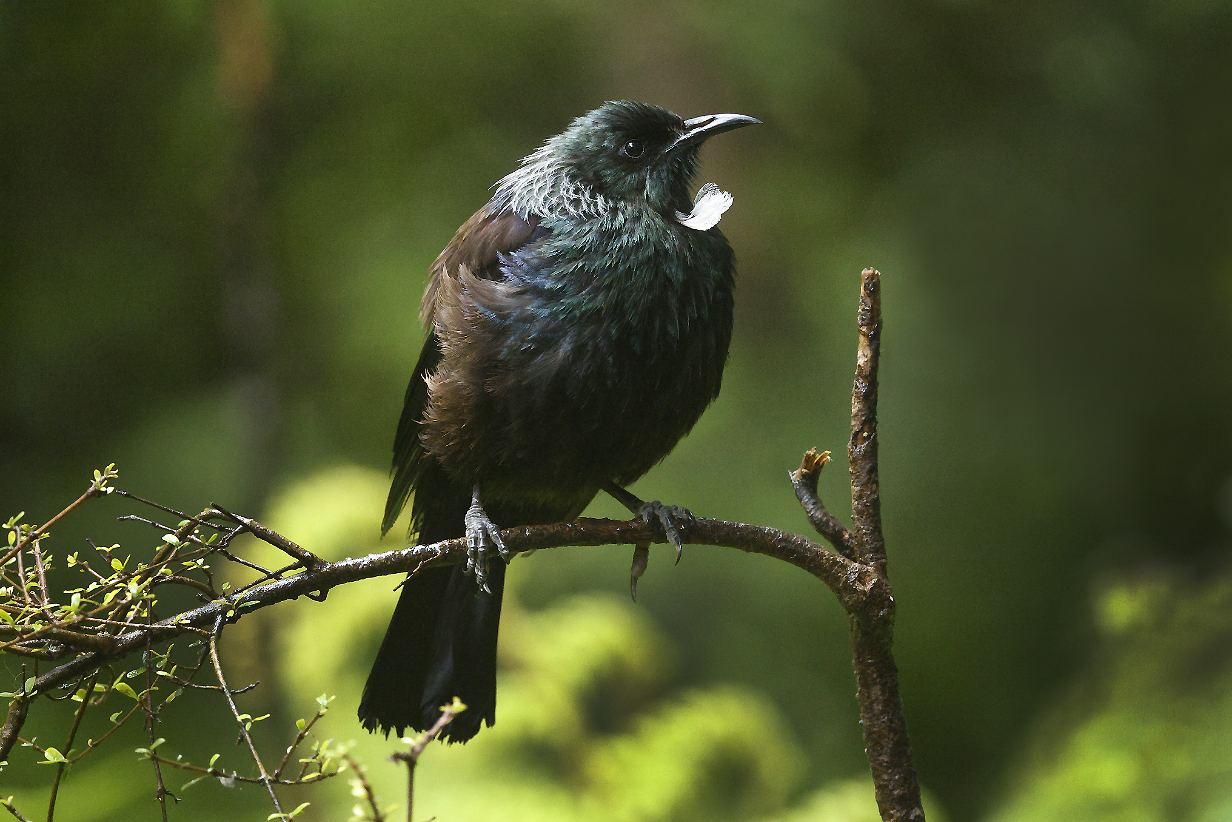
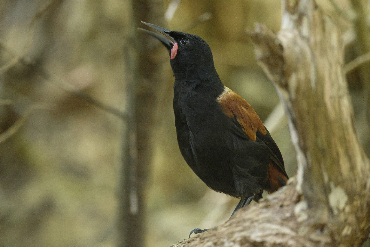
Tui -- another famous New Zealand endemic
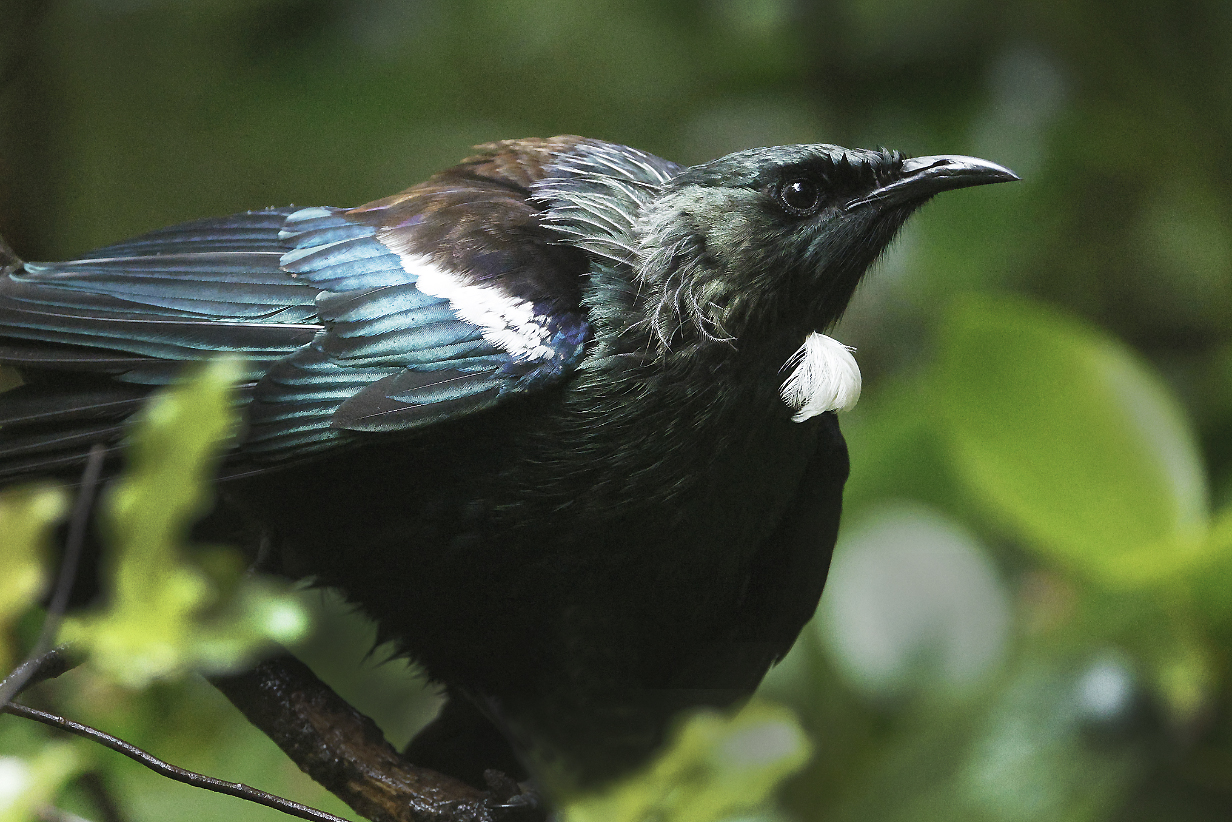
Tui threat display
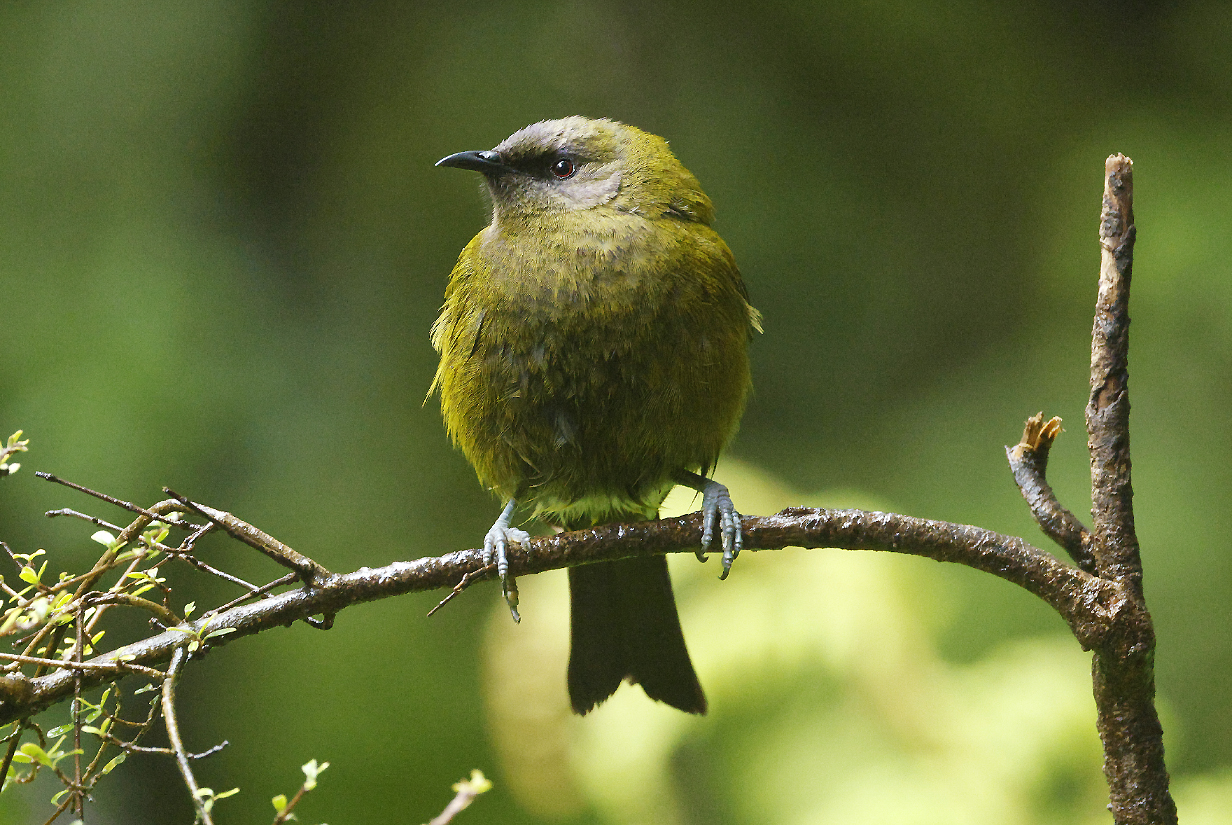
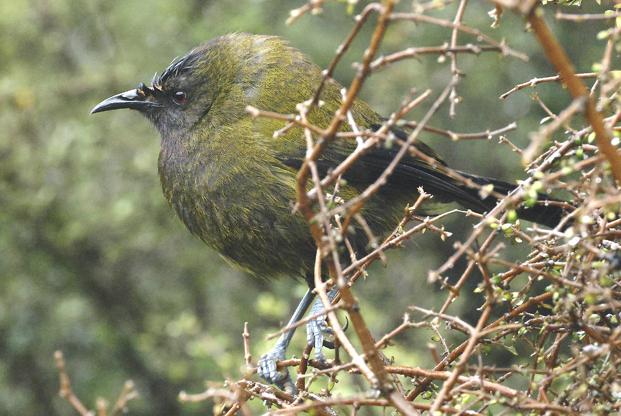
New Zealand Bellbird
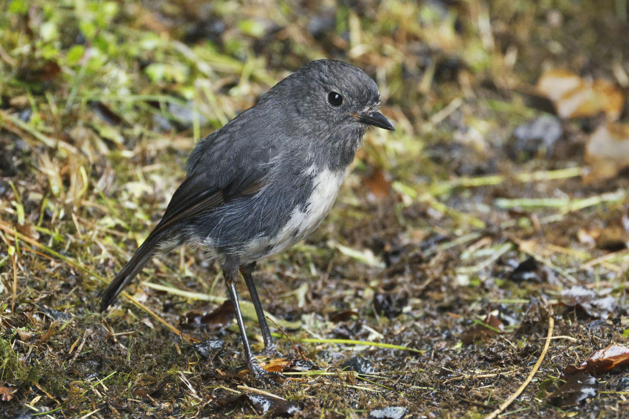
South Island robin (This male was very confiding, foraging almost underfoot. That's always very likeable.)
January 17, 2026: Today, we boarded our Aurora ship and set sail southward.
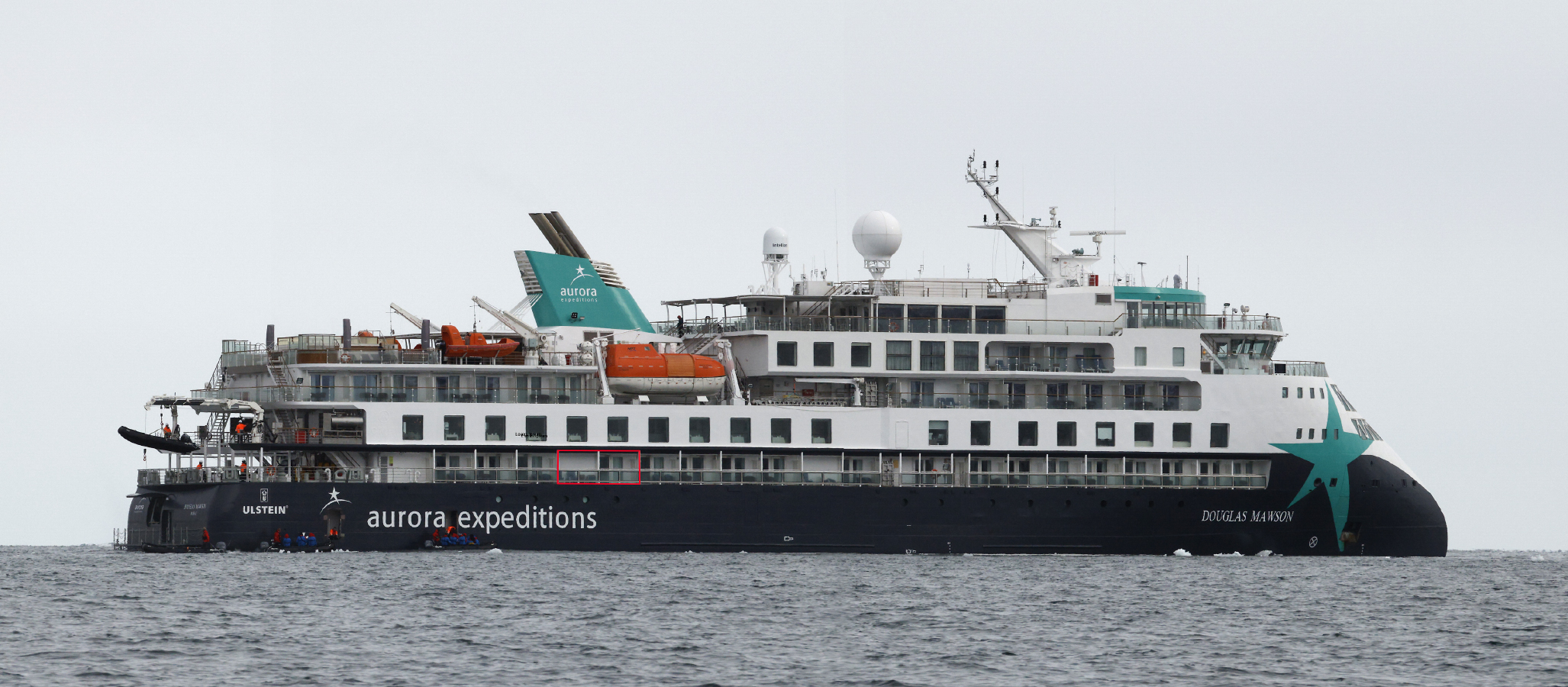
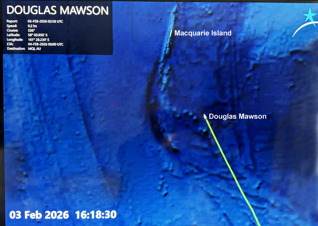
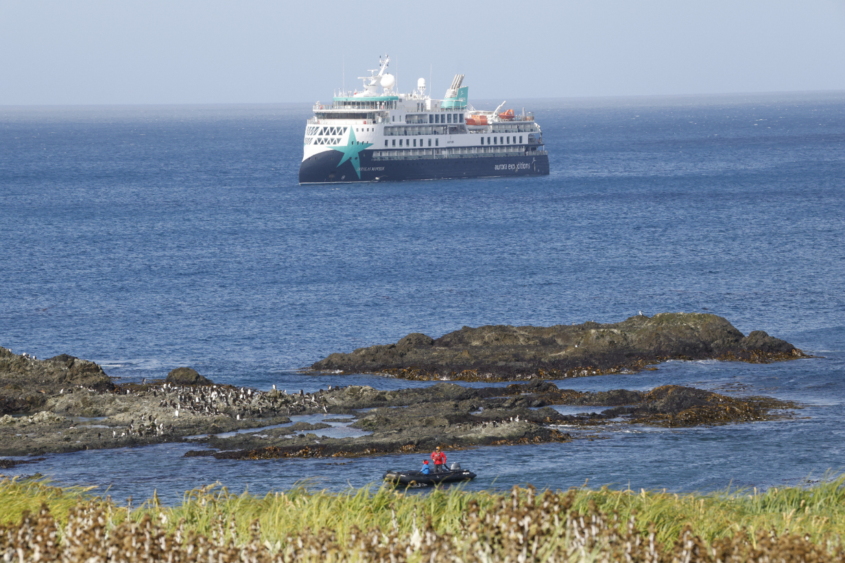
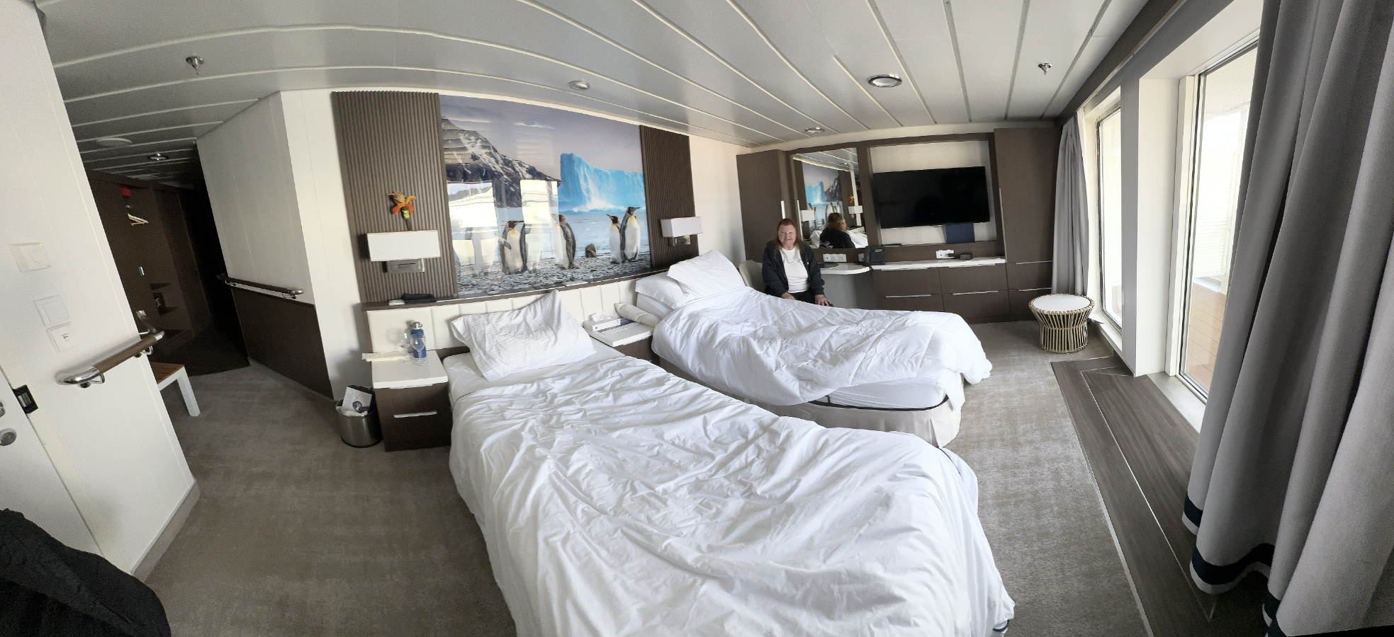
This is our Aurora ship, the Douglas Mawson, photographed off Ross Island in the Ross Sea of Antarctica on Thursday, January 29, 2026. The ship is named after Sir Douglas Mawson, an Australian member of Robert Shackleton's 1907-1909 British Antarctic "Nimrod" Expedition (see the account of January 28). Our cabin is outlined by the red rectangle: it is conveniently on Deck 4, close to the water, where many birds fly. It is only 4 doors away from the entrance to the "mud room", where one prepares for zodiac rides and shore landings. Aurora's ships the Douglas Mawson, the Sylvia Earle, and the Greg Mortimer -- on which we sailed, respectively, now, to Iceland/Svalbard in 2024, and to Antarctica for the first time in 2022 -- have essentially identical deck plans. We stayed in cabin 429 during all three trips and feel very comfortable and very much at home there.
January 18, 2026: Pelagic Birding on the Way from Dunedin to the Auckland Islands
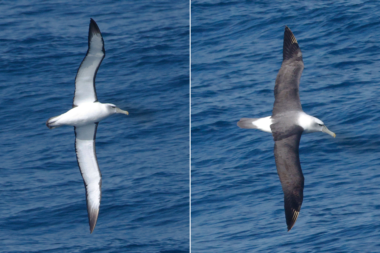
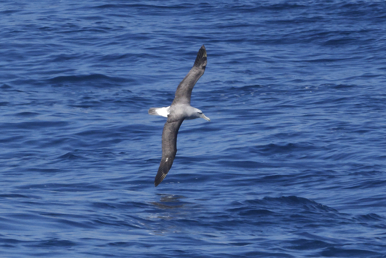
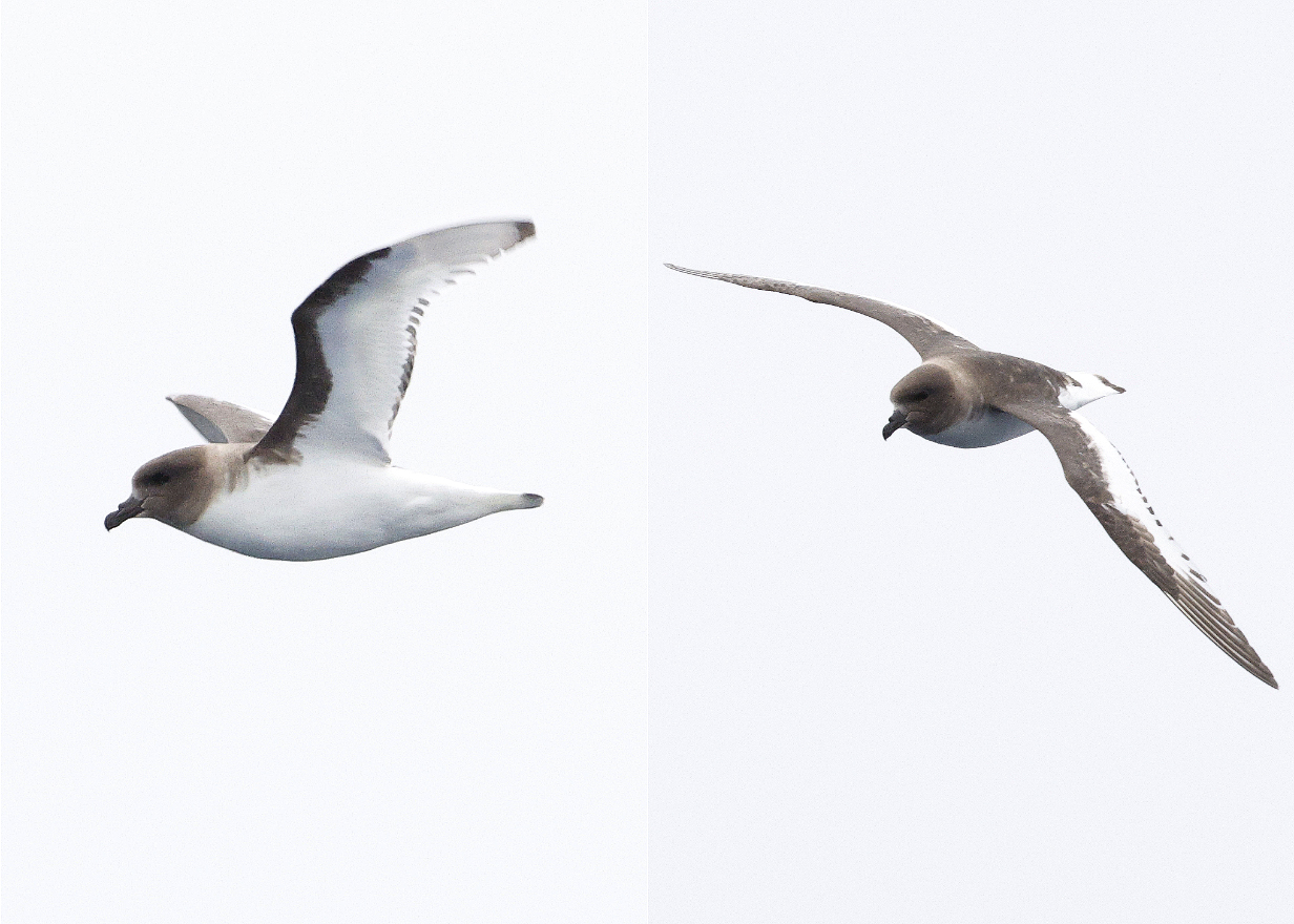
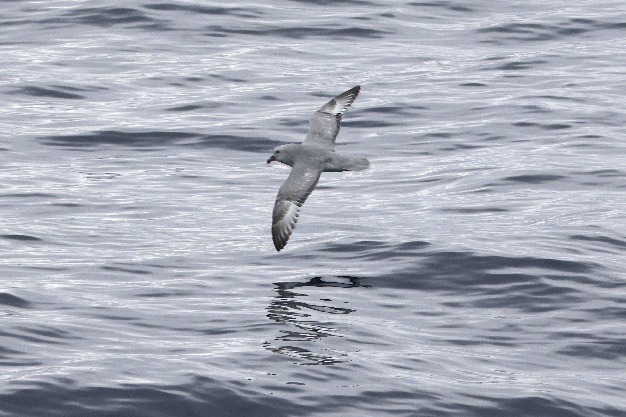
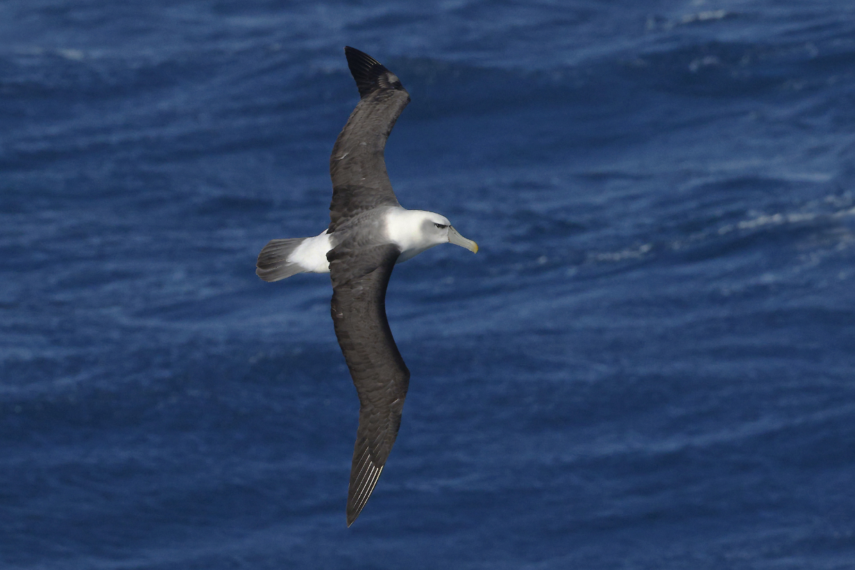
White-capped (formerly "Shy") albatross
Salvin's albatross (We saw in much better during our 2011 birding tour to New Zealand.)
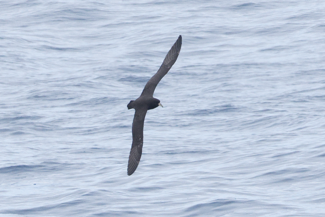
White-chinned petrel (not a very good picture of a bird we first saw long ago on a Cape of Good Hope pelagic)
January 19, 2026: Enderby Island at Auckland Islands
These maps put into perspective our first 2 destinations -- New Zealand subantarctic islands:
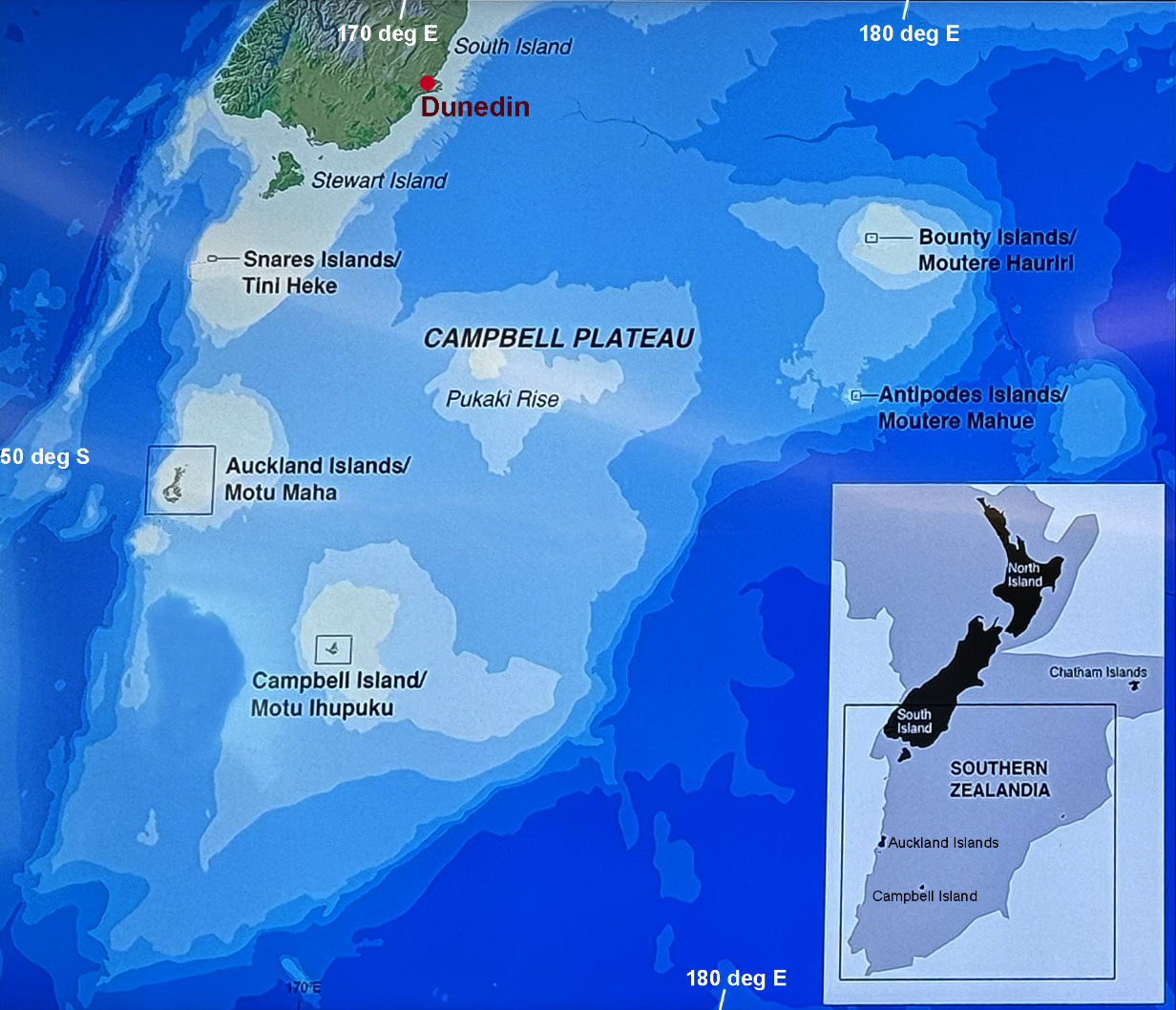
Ocean depth countours show that there is an undersea "subcontinent", South Zealandia; its plateau is typically 1 - 2 km below sea level. The surrounding abyssal plain is 4 - 5 km below sea level. Besides islands, the Pukaki Rise reaches up to about 0.5 km below sea level. So this "subcontinent" is not "in the same league" as true continents, the nearest of which is Australia. On the otherhand, Zealandia includes the North and South Islands of New Zealand and, among others, the Auckland Islands and Campbell Island. The latter were our first destinations.
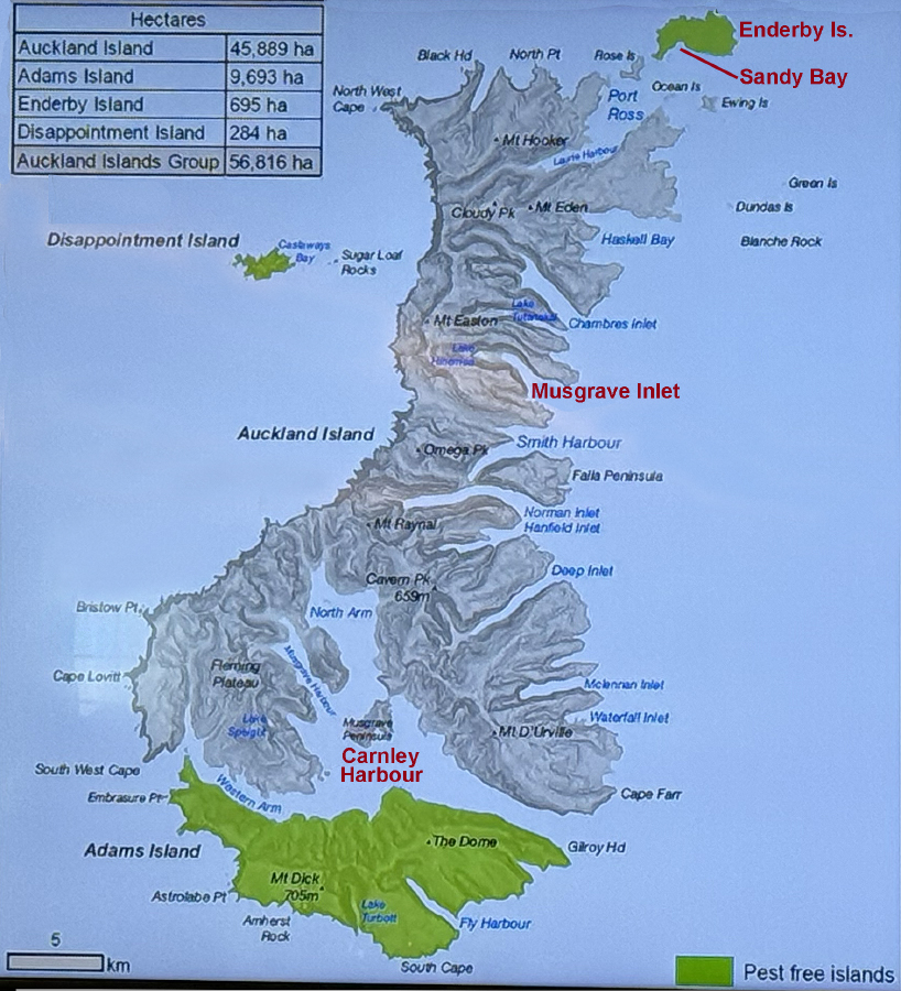
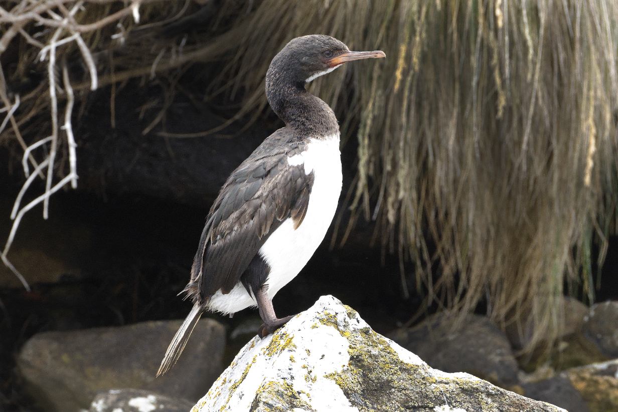
The Auckland Islands are remnants of 2 Miocene basaltic volcanoes formed 12-23 million years ago. They have since been heavily eroded by glaciers into a series of fjords. The islands include several that have always been predator-free or that have had predators such as rats and mice, feral cats, stoats, et various c. eradicated. Very strict security protocols are necessary for visitors to be able to get to these islands without importing either new predators or alien plants and diseases. Our first stop on January 19 was Enderby Island, with a landing at Sandy Bay, a hike north across the island, and later a zodiac ride. I (John) was temporarily ill and could not participate. I therefore missed Auckland Islands teal, although Mary and I both easily got Auckland Islands Shag from our ship's balcony.
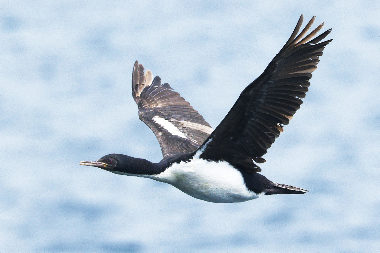
Auckland Island shag -- John's second new bird of the trip -- at Sandy Bay, Enderby Island
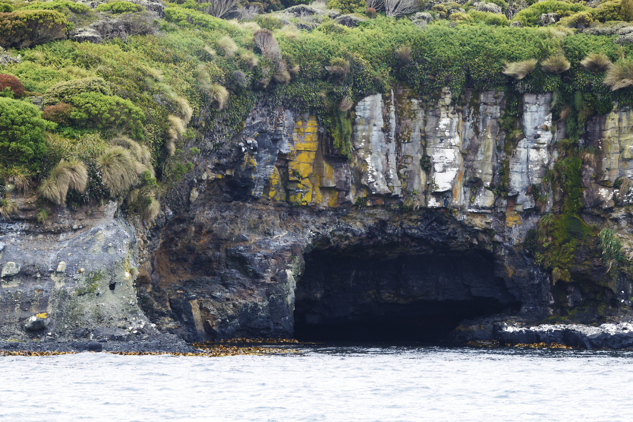
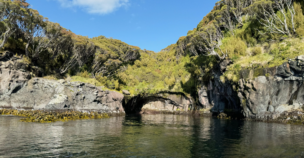
Sea cave and cliff around the outside of Sandy Bay. Auckland Is. teal turned out to have been feeding in small numbers in the kelp ... but I was not lucky enough to spot one from the ship.
January 20, 2026: Auckland Islands:
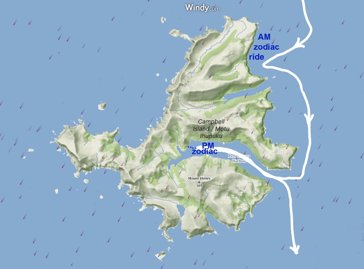
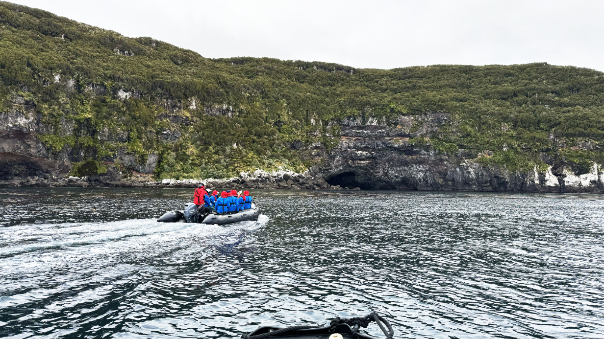
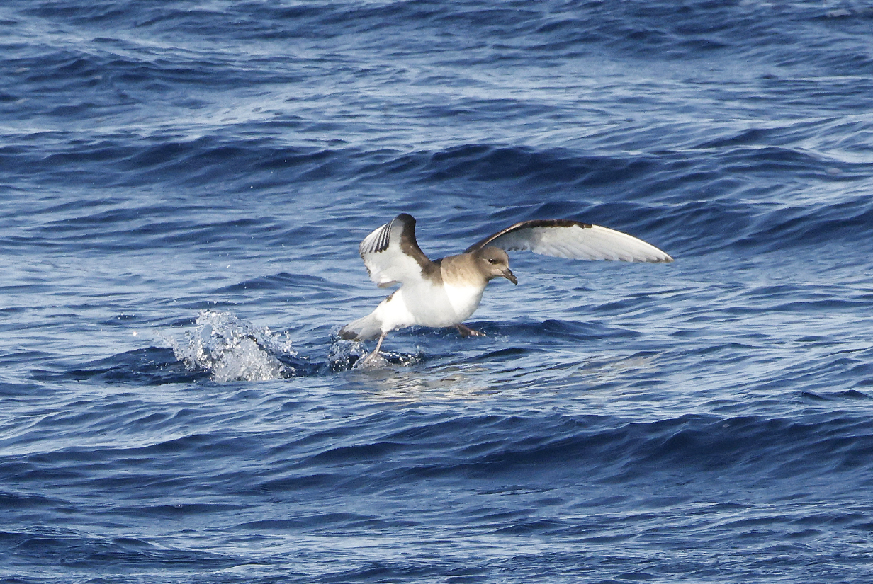
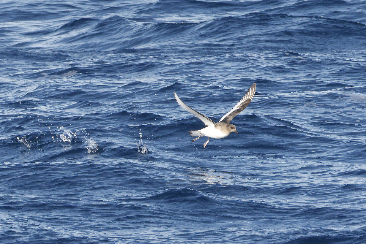
This morning began with a wonderful zodiac cruise at Musgrave inlet (see the above map). Our zodiac driver was expedition leader Roger Kirkwood, who is calm and experienced and who runs an exceedingly enjoyable ride. The weather could not have been more perfect, with calm seas and bright sunlight. We began with a tour around cliffs with penguins:
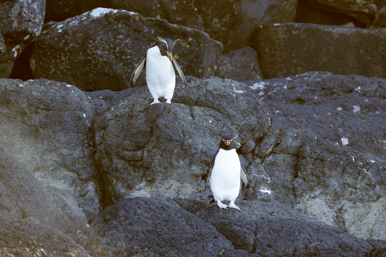
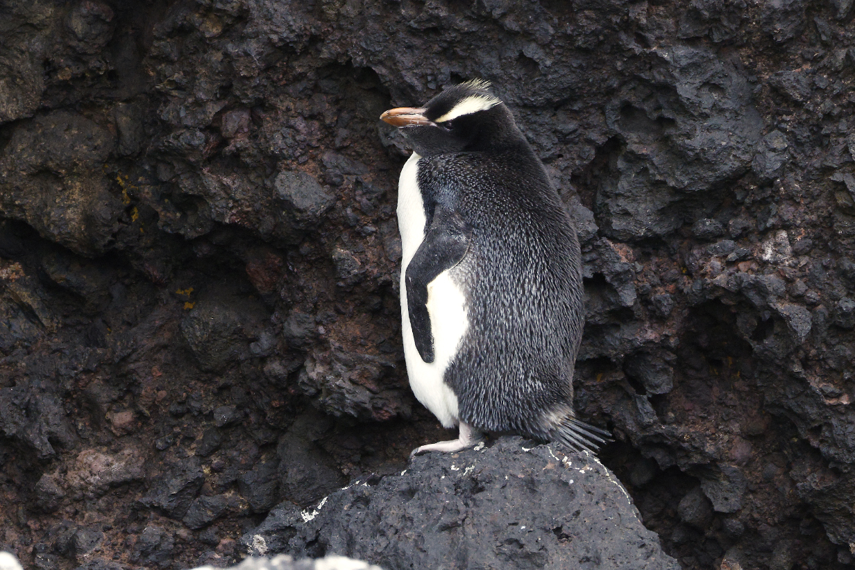
Eastern Rockhopper penguins at the start of the AM zodiac ride. We saw penguin shapes from the ship, but this was my first good look. So these are my life birds, the 3rd of the trip.
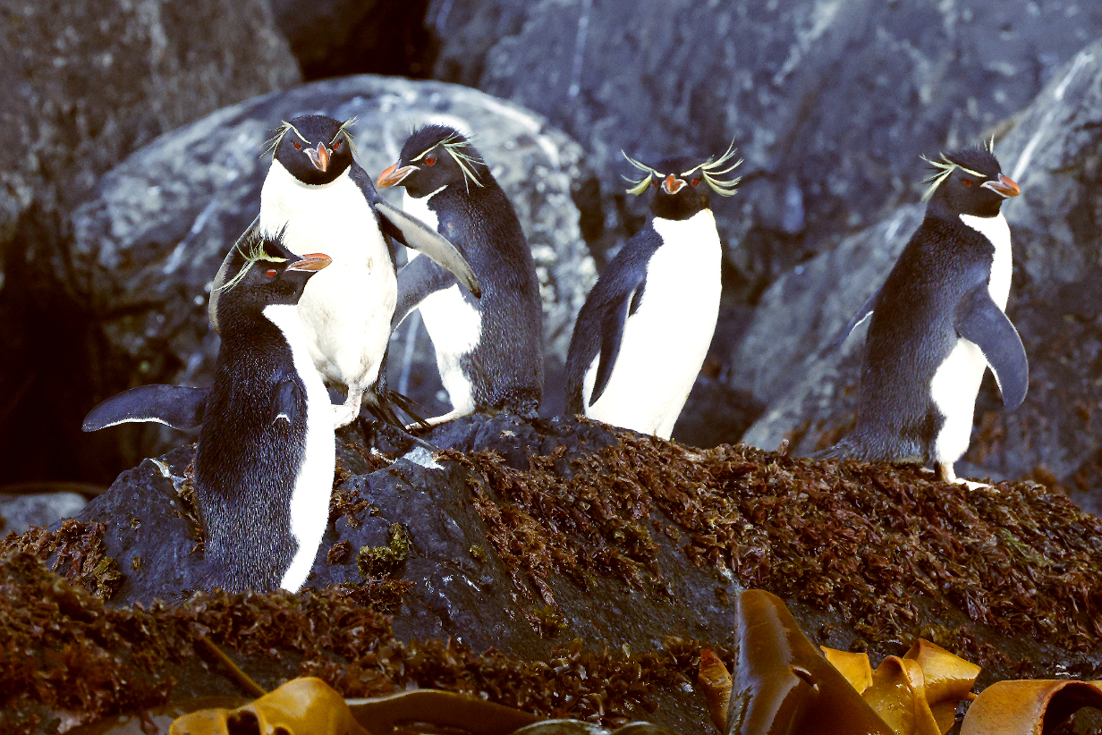
There were many Eastern Rockhopper penguins all along the cliffs.
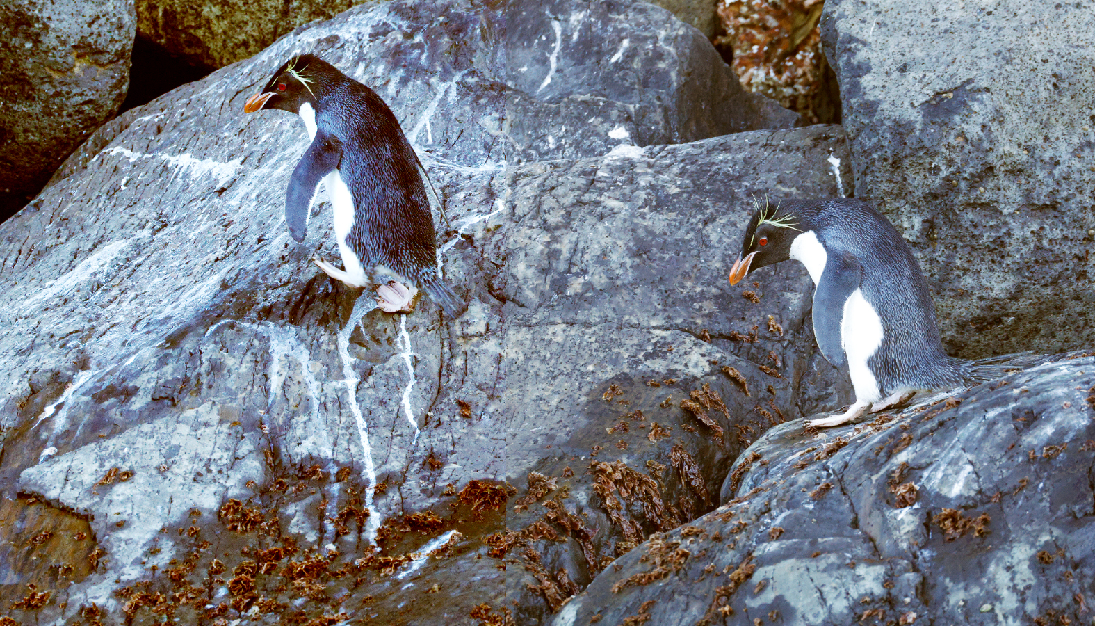
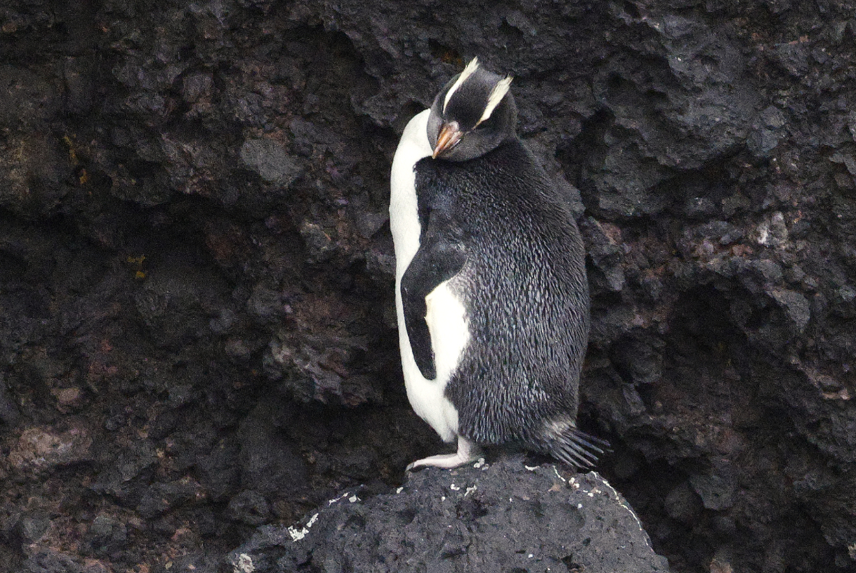
Not for nothing are they called "Rockhoppers": This is the same bird, photographed twice just a few seconds apart. They are astonishingly good at rock climbing, even without arms and hands.
Eastern Rockhopper penguin. It is always a delight to see a new penguin.
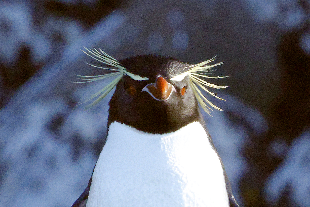
In your face!
I can't resist -- one more picture
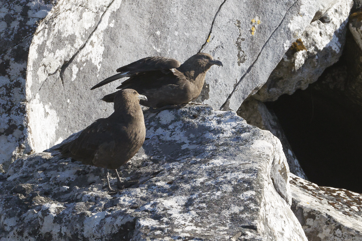
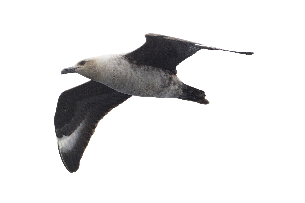
Brown skua on the cliff face, not far from some-time prey
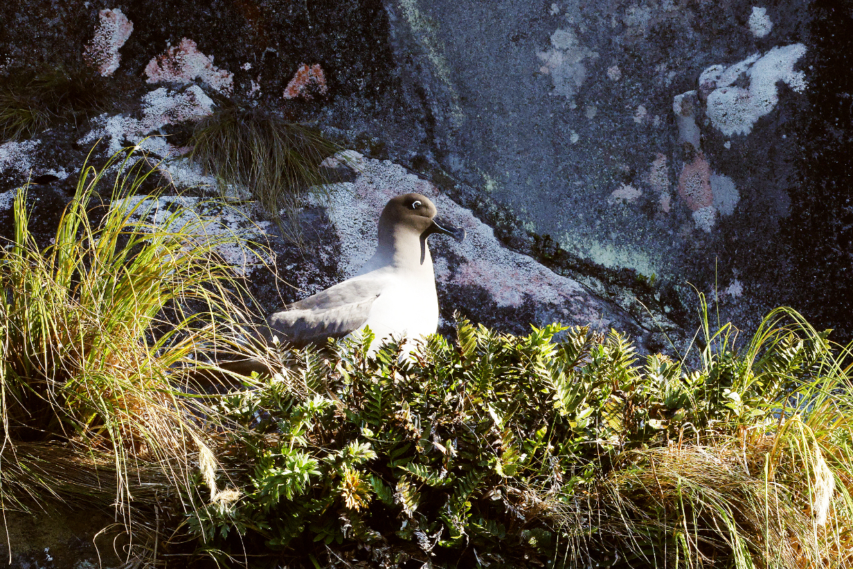
Light-mantled albatross on nest, high on the cliff
Auckland Island shag, now very well seen in bright sunlight during the second part of our AM zodiac cruise on the other side of Musgrave inlet
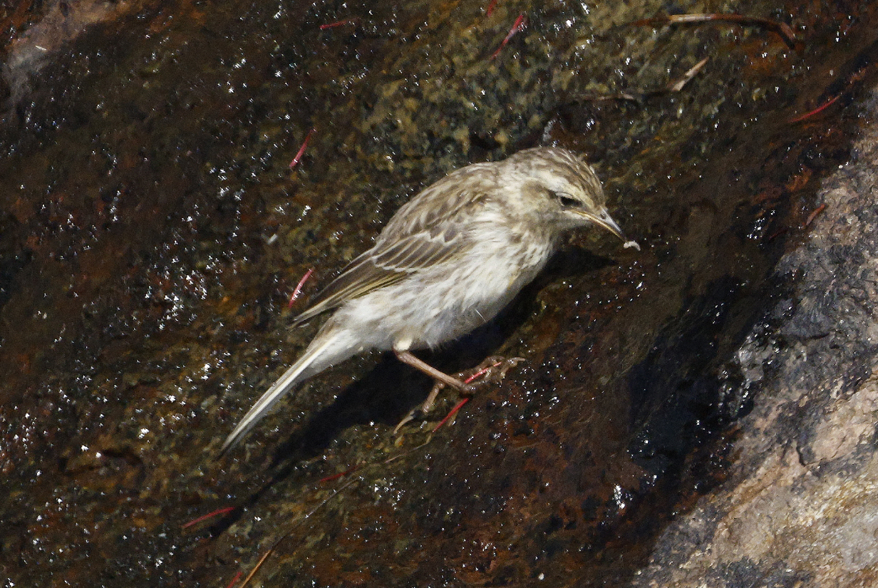
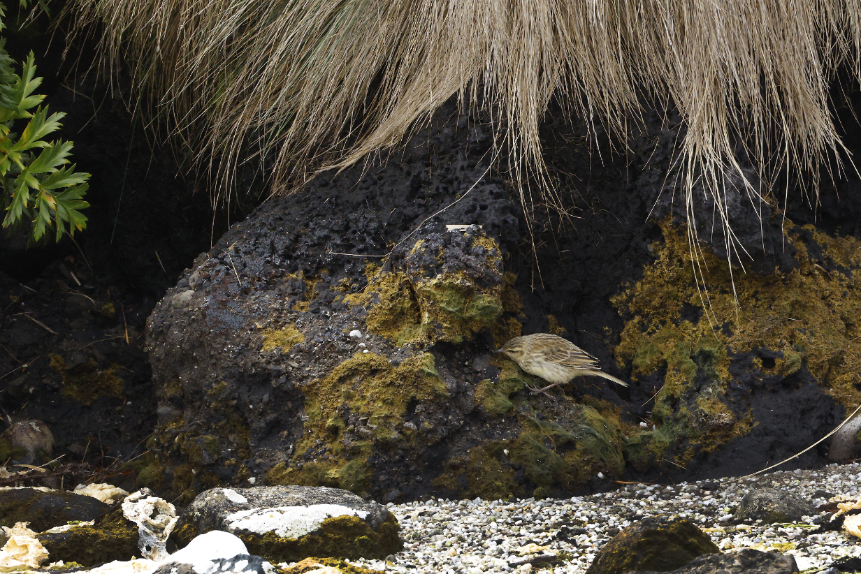
New Zealand pipit, my 4th life bird of the trip. It is surprising that we did not see it during our 2011 birding tour of New Zealand, because it is very wide-spread. But I saw it twice in the subantarctic islands, once here and again tomorrow at Campbell Island.
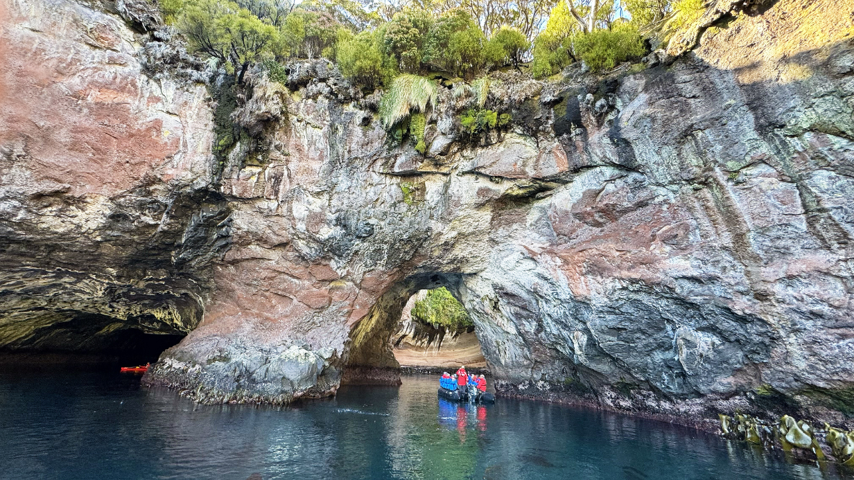
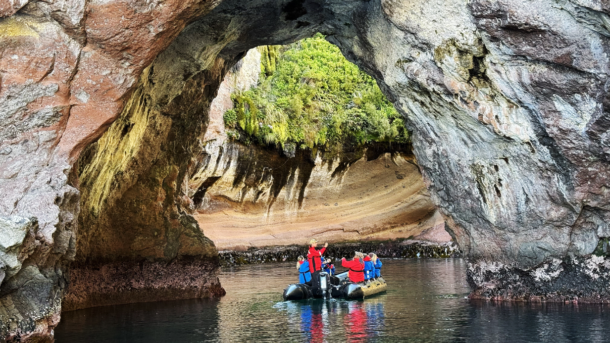
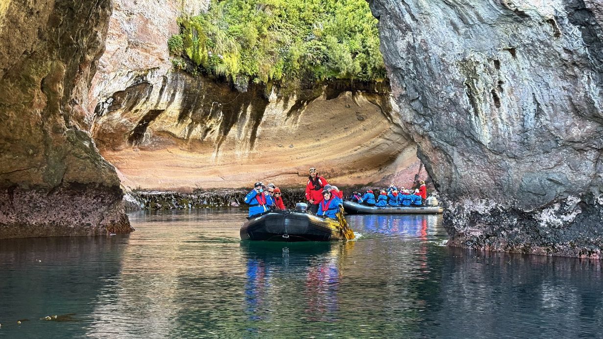
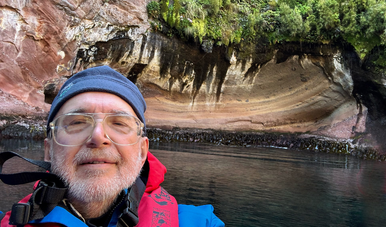
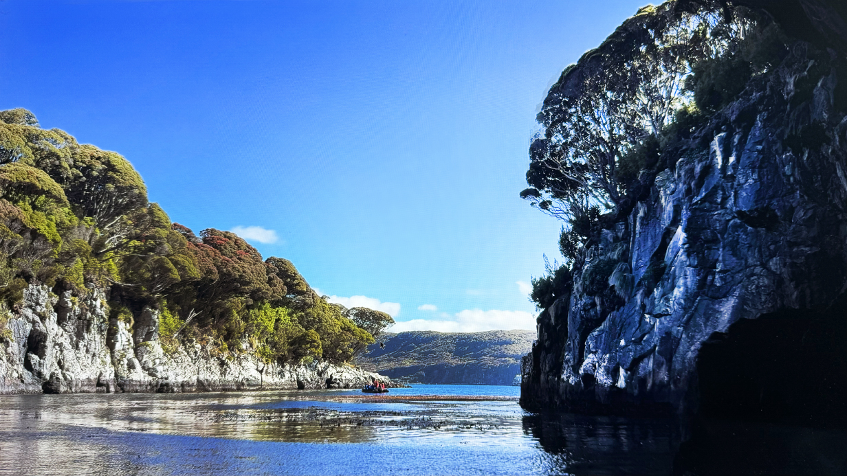
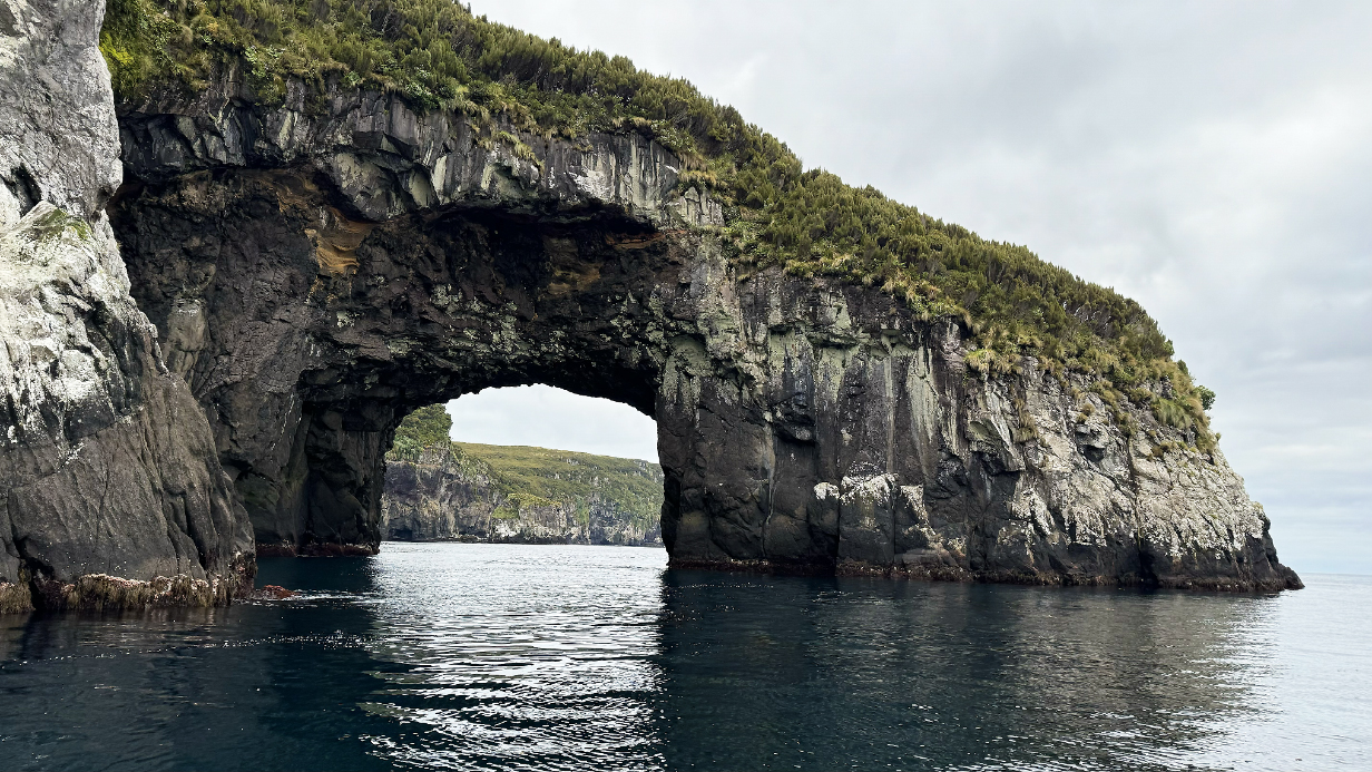
Later, we here approach an archway opening to an open-roofed "cave", one of two. (The other was closed and dark inside, possibly a lava tube; I do not include pix.)
Open-roofed cave interior
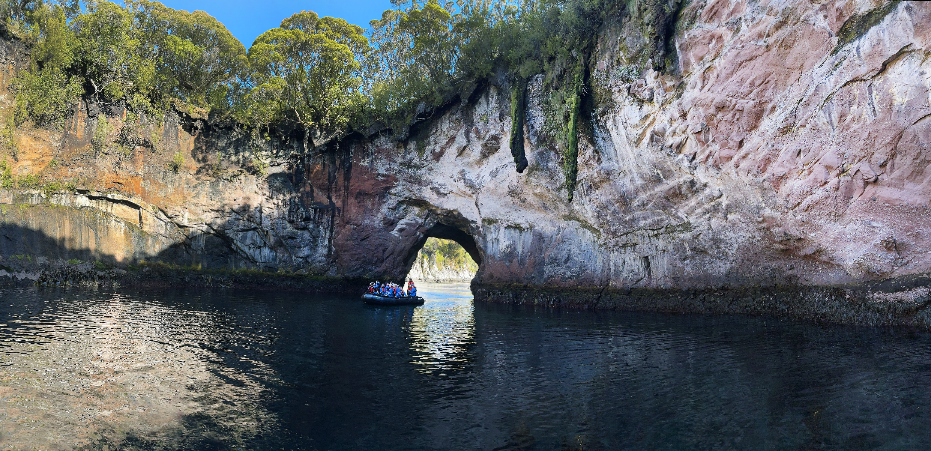
Open-roofed cave interior panorama (scroll right to see it all)
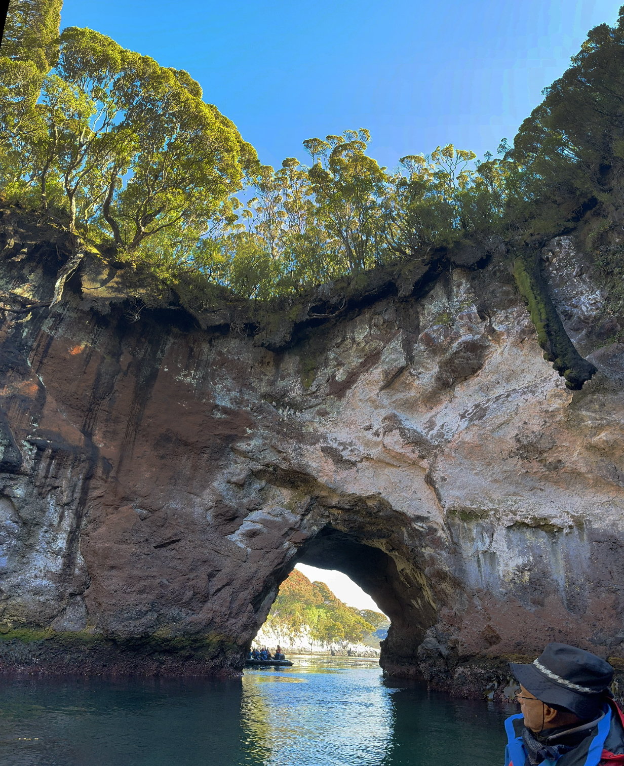
Vertical panorama from inside the open-roofed cave looking out the entrance
Here is a brief movie as we emerge from the above open-roofed cave.
This afternoon, I had the mixed experience of my hardest zodiac cruise ever, at Carnley Harbour (see the above map). The zodiac captain was a "cowboy" who thrived on adventurous driving. In the "Western Arm" of the bay as shown on the map, the ride got very rough and very fast. I did not know that this was coming. A disadvantage of some Aurora excursions is that we are not told what to expect. so wondrous surprises await us ... or unpleasant challenges. I took only the birding camera, which was a mistake. There were essentially no birds -- in particular: no chance for Auckland Islands teal -- and I had to protect the camera from splashing water throughout the ride. And I made the mistake of forgetting to bring my iphone. So the good aspect of the trip could not be photographed. Once we got near the west corner of the "Western Arm", there were deep tunnels though the headland of sea cliffs and out to the open ocean. We cruised part way into these, and they were spectacularly worth seeing. But I could not photograph them. Had I known how demanding the ride would be, I would have taken only my iphone. My back felt wrecked and my arm strength was challenged. The young and robust passengers typical of Australia and New Zealand had an exhilarating time.
January 21, 2026: Campbell Island
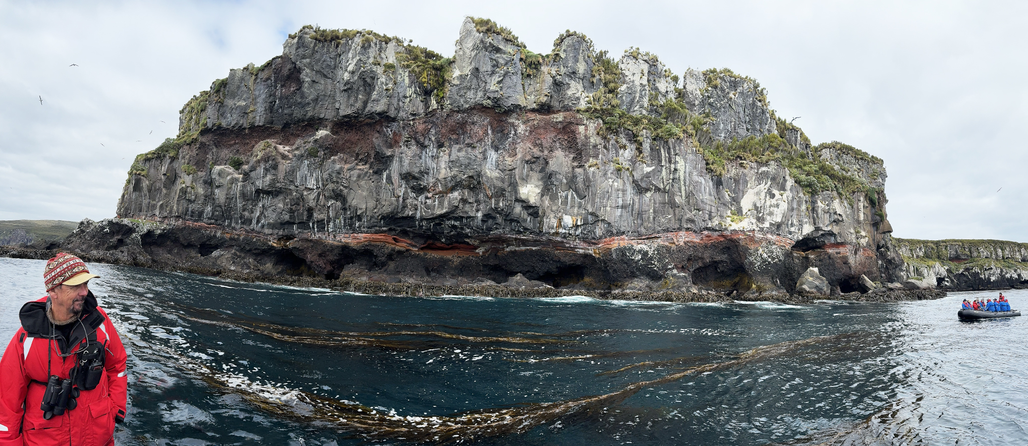
We spent today at Campbell Island, in relatively calm seas and temperatures of ~ 50 degrees F. The wind was almost calm in the morning but brisk and increasingly cold in the afternoon. The morning zodiac ride was along dramatic cliffs to from our "anchorage" to the north end of the island, concentrating on sea caves, remarkably beautiful and artistic rock layers, birds -- including two life birds -- and the nesting colony of almost all of the world's Campbell Island subspecies of Black-browed albatross. Our zodiac driver was Howard Whelan, who is one of the most experienced crew members -- he was Expedition Leader on our Iceland/Svalbard cruise. He provided a sensitive and nuanced cruise experience.
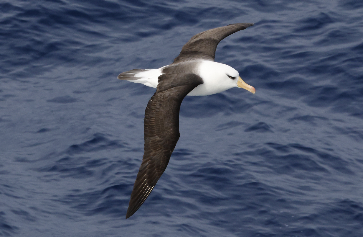
The AM cruise traced to cliffs along the NE corner of Campbell Island to North Cape. Campbell Black-browed Albatross (Thalassarche melanophris impavida) -- a subspecies of the Black-browed Albatross breeding solely on Campbell Island, New Zealand. It is easily recognized by its pale yellow eyes (versus dark eyes in other populations), as shown later in these web pages. The picture above was taken near the start of the cruise and shows one of the many sea "cave" holes or arches. We did not approach this one.
A sea arch a little farther along the cruise
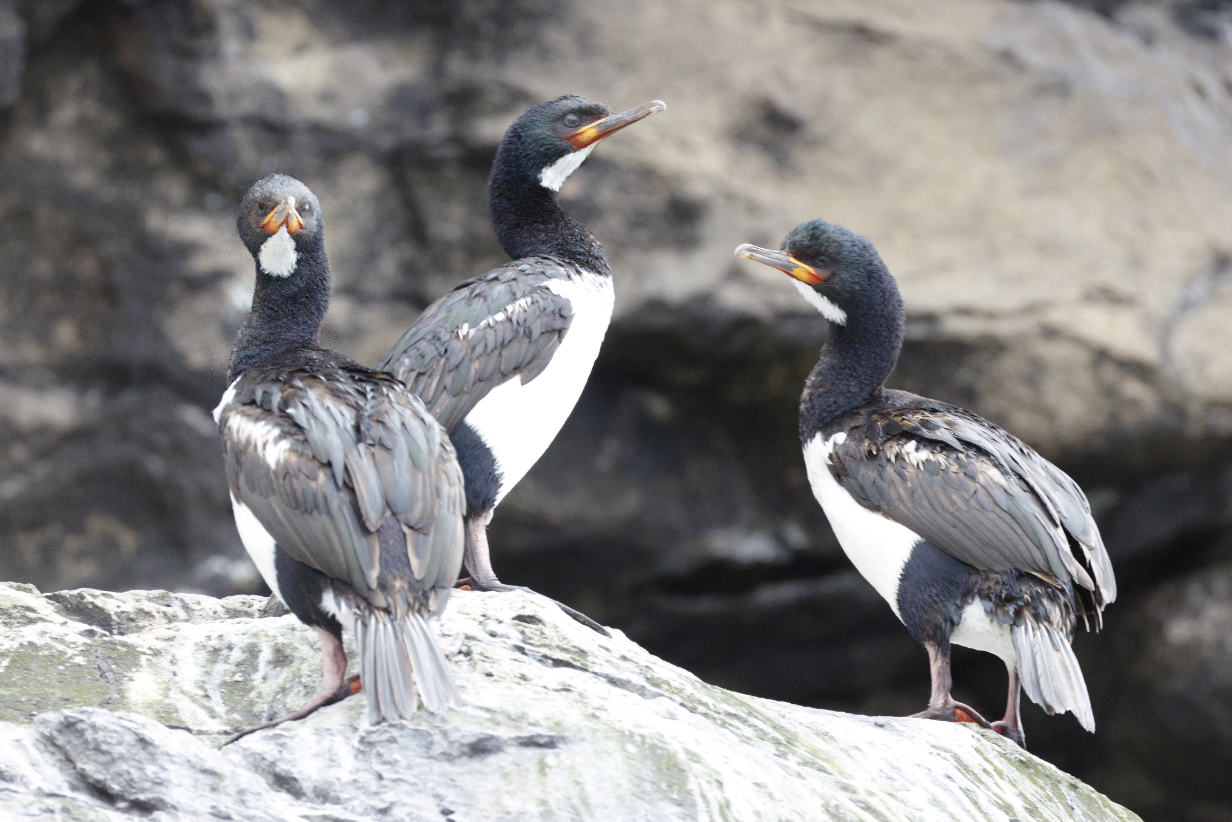
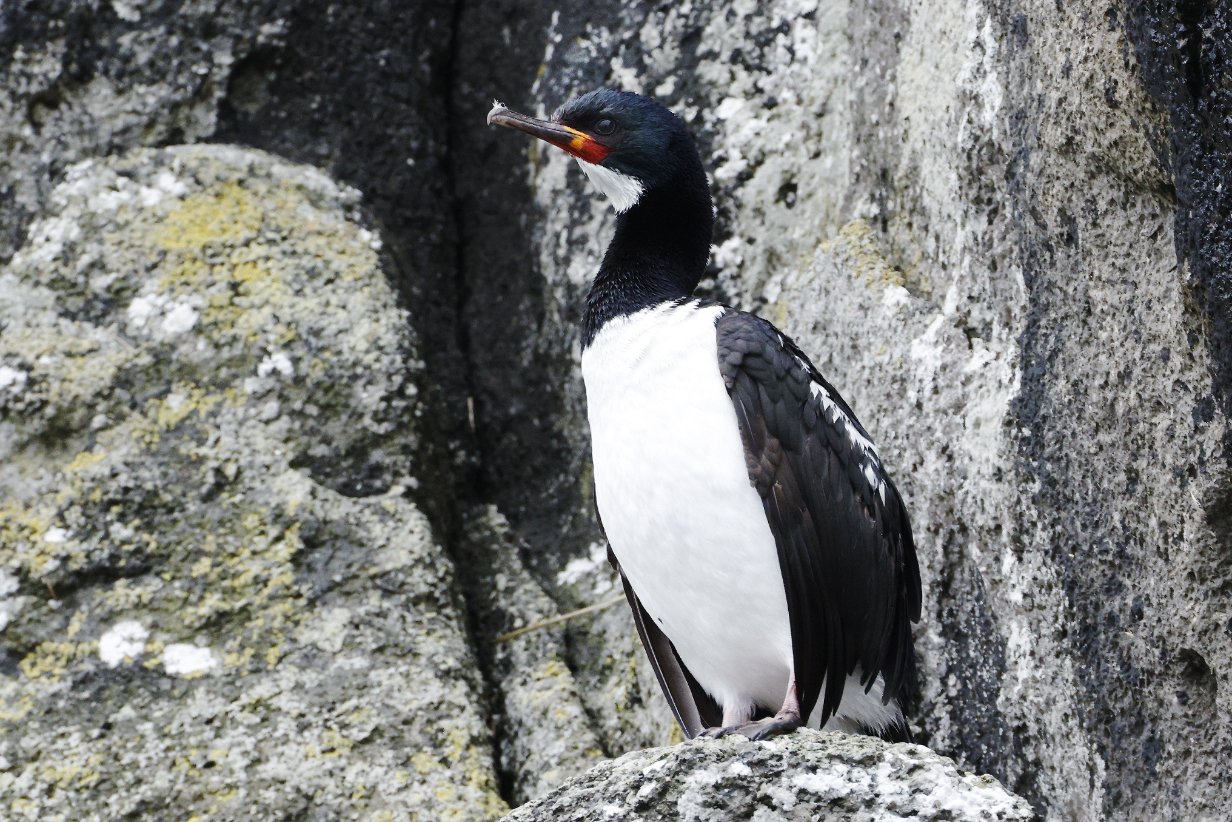
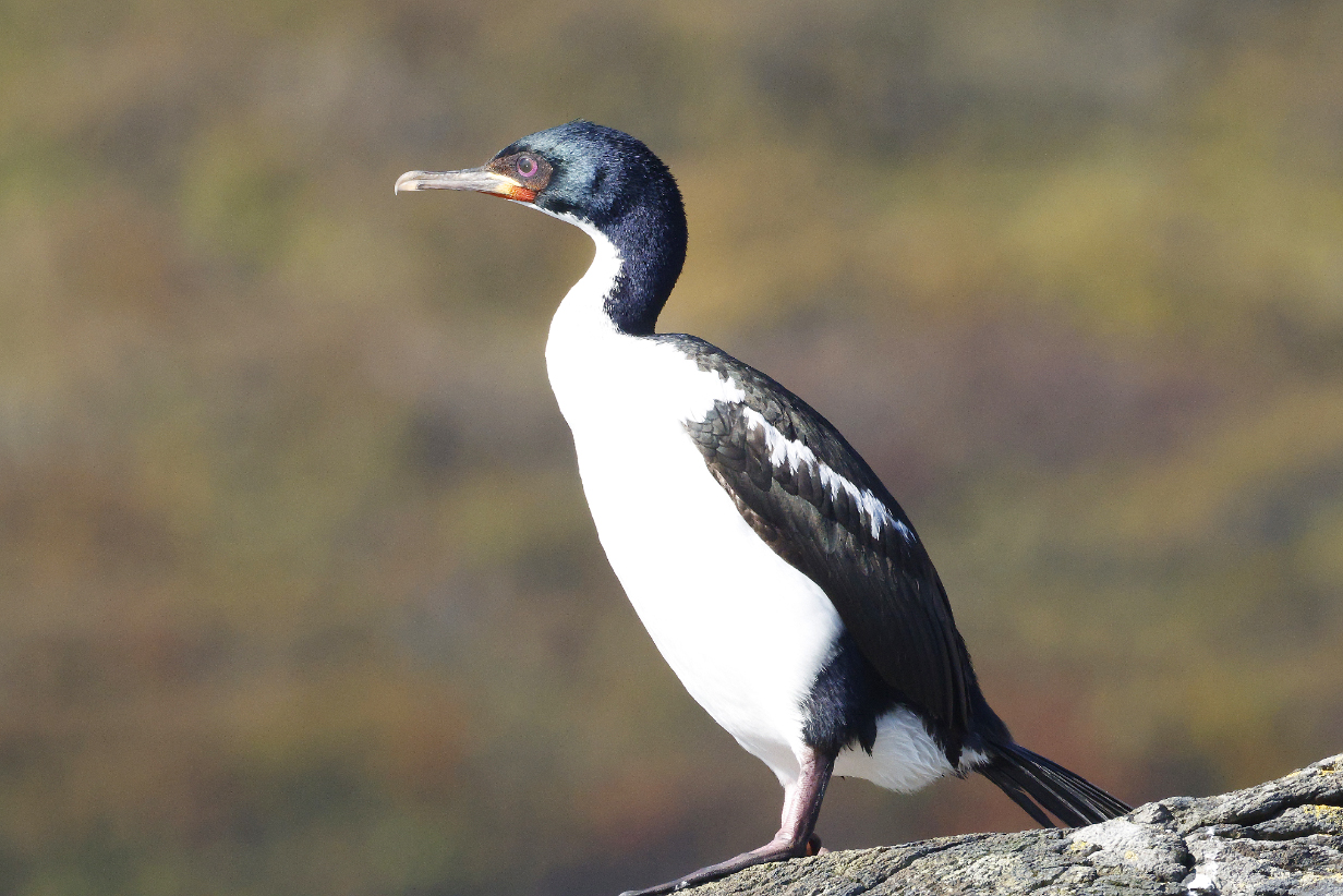
Campbell Island shag was the ubiquitous and easy new bird today. Like Auckland Island shag, it has a white stripe along the upper wing. It has only a white throat patch separated from the white belly by black, unlike Auckland Island shag, which is white from throat to belly. The face is also more brightly colored. It is shown better in PM zodiac ride pictures, below.
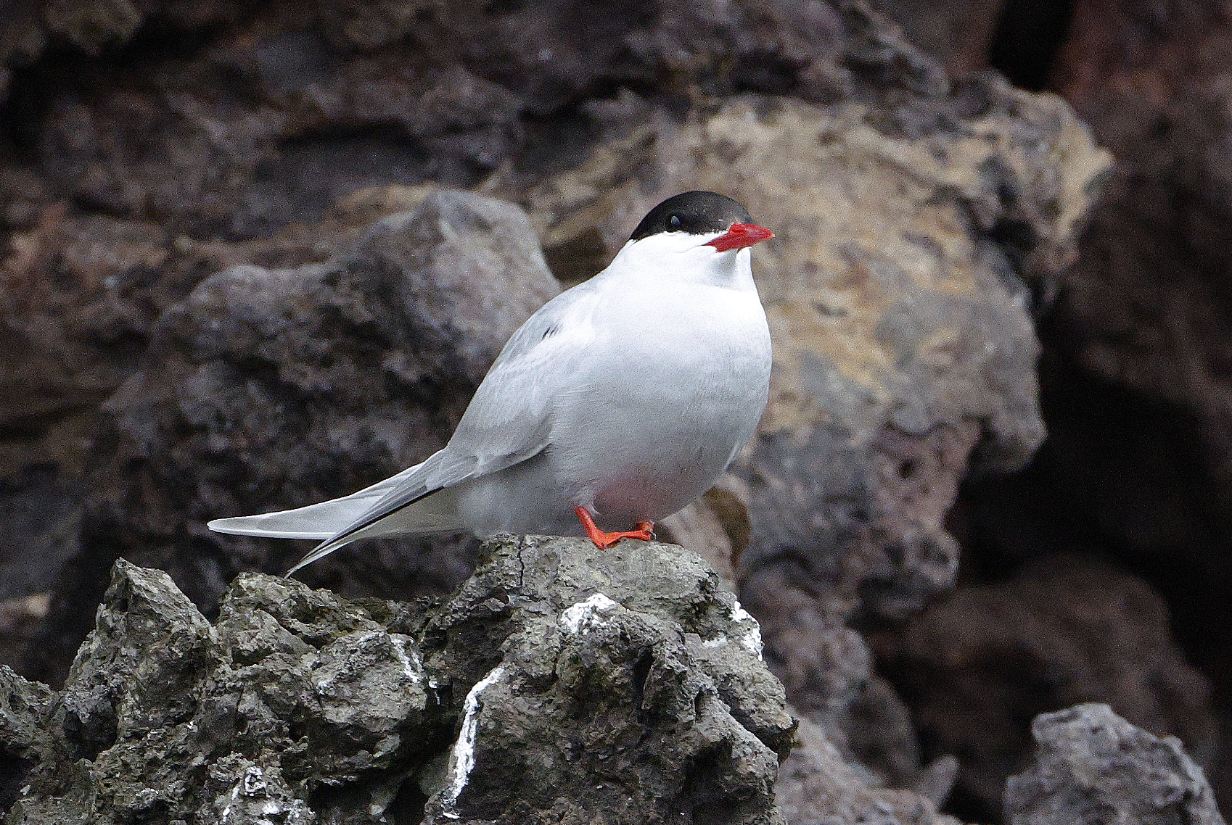
Antarctic tern in breeding plumage
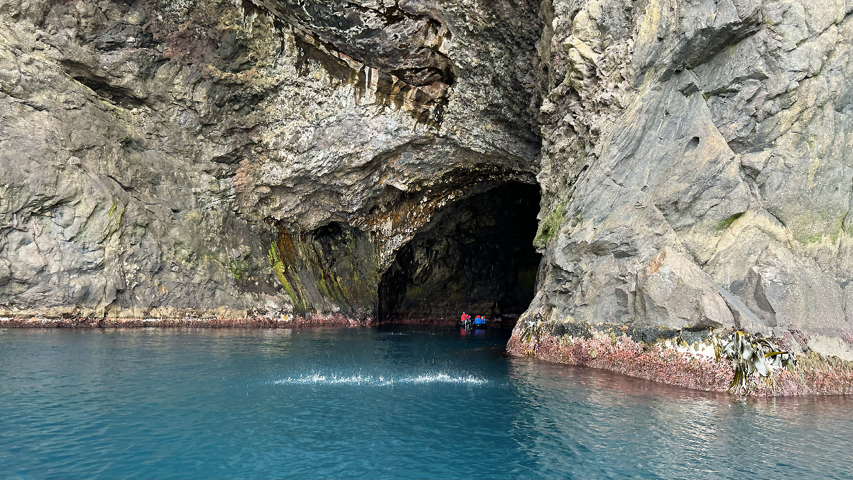
This sea cave is somewhat more than 100 feet deep before it dead ends. It was easy and interesting to enter ... and to contemplate the violent storms that must sometimes happen for waves to have dug this feature. Today, in calm seas, there was only a thin splash line of drops from the cliff above.
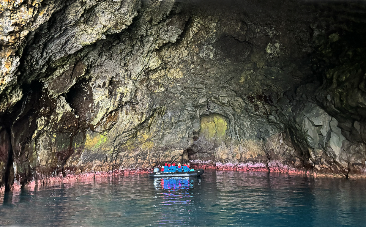
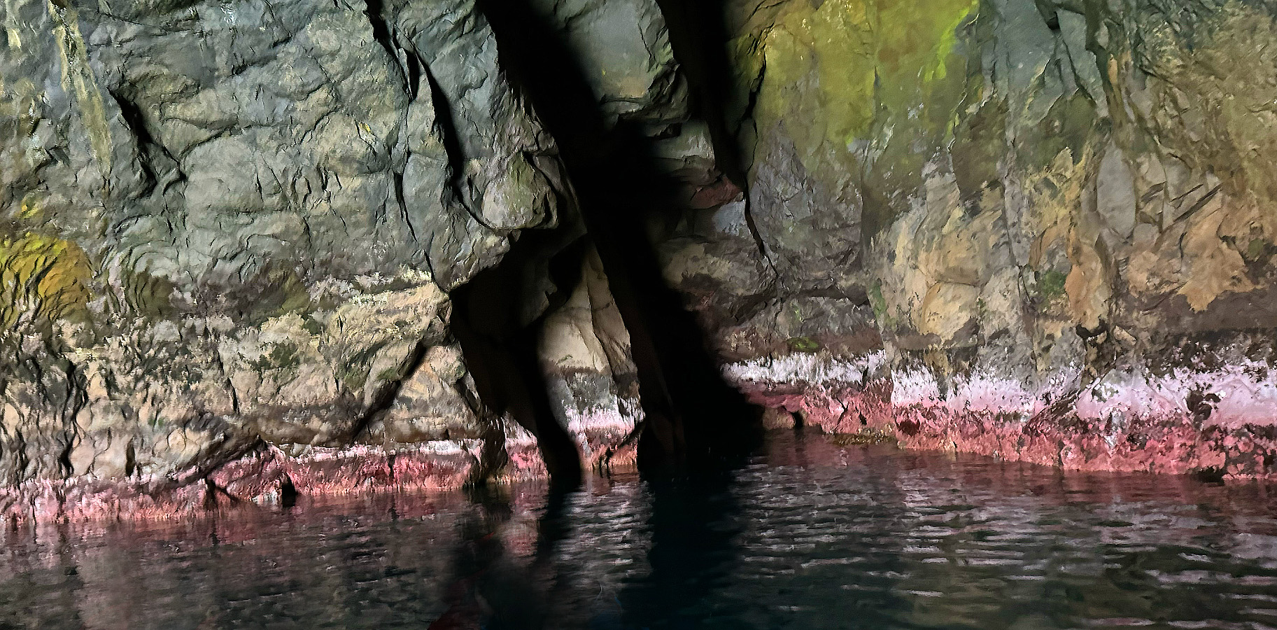
Interior end of the sea cave: The red algae on the walls indicates that we are near low tide. Scroll right to see the complete panorama.
Campbell Island albatross nesting groups started to get more numerous as we sailed farther north along the cliffs.
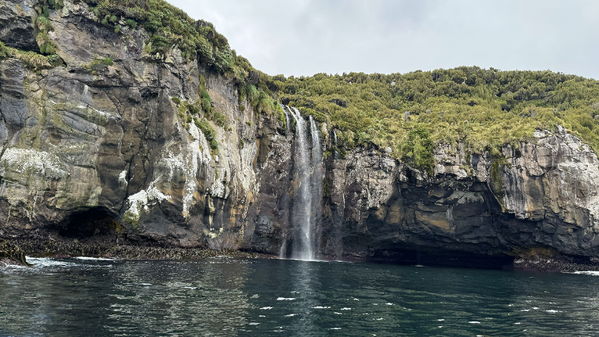
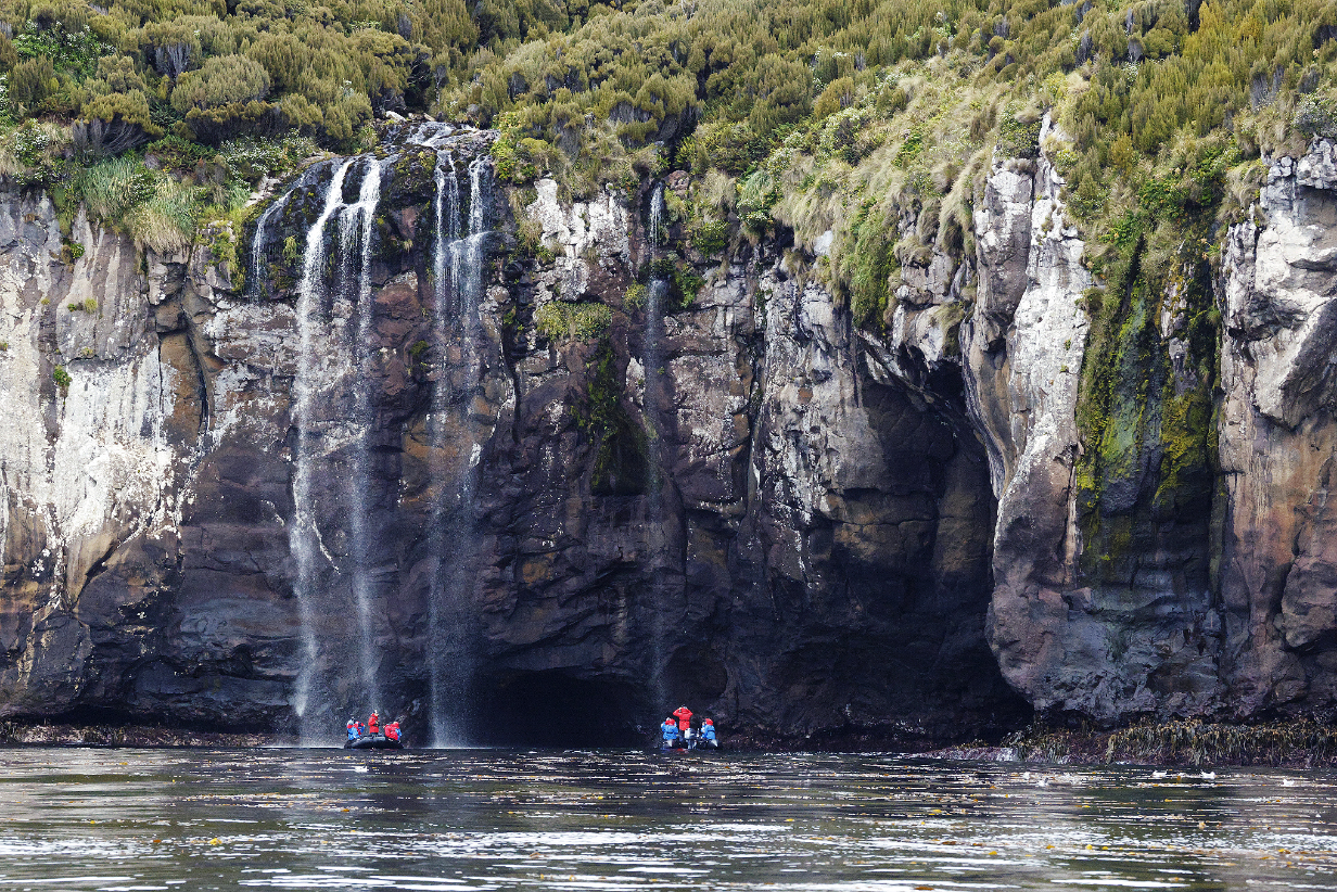
Waterfall
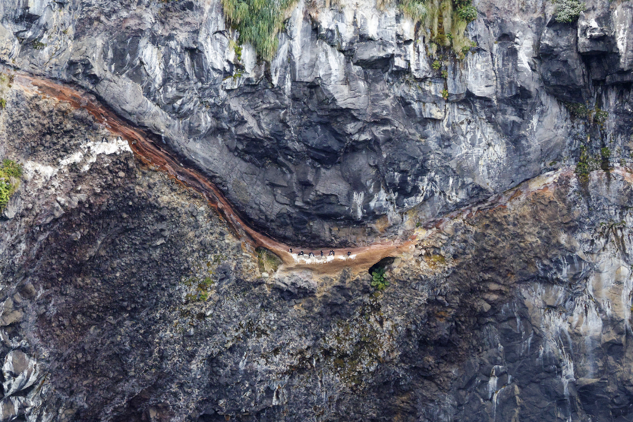
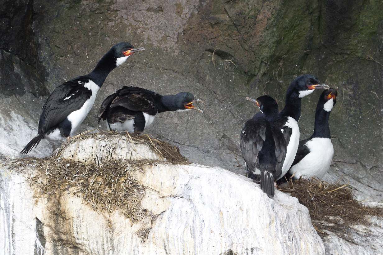
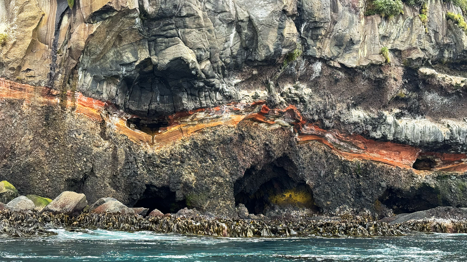
Campbell Island shags in a prominent layer of red rock that ran from here all the way to the north end of the island. Its many twists created another 3-D art display that captured me in the same way as eroded rocks captured me artistically in the Kimberley region of Australia during our July-November 2025 Seabourn cruise from Darwin, Australia to Santiago, Chile. The following pictures are an art gallery of this red rock layer. An important point of the above picture is to use the shags to provide a sense of scale.
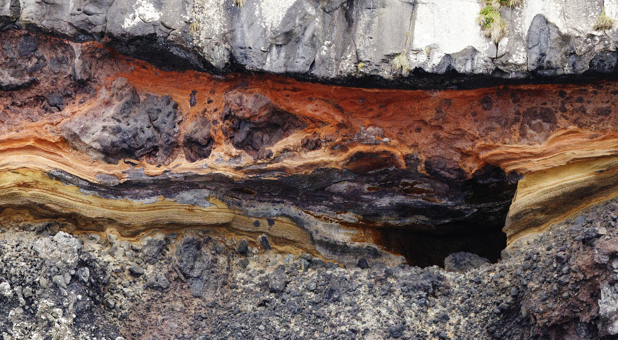
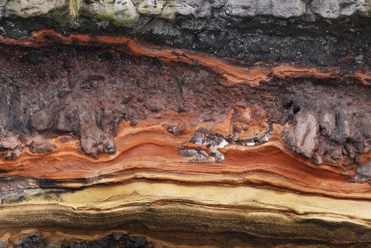
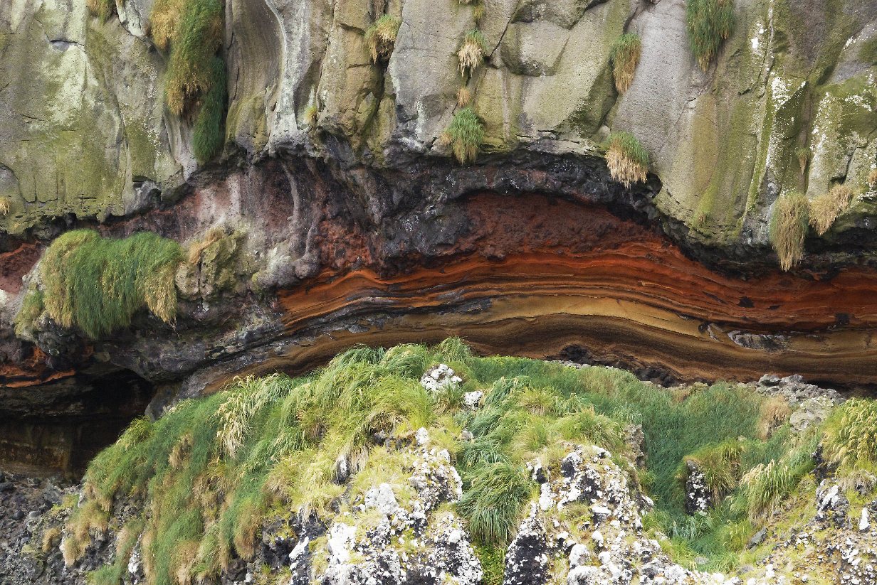
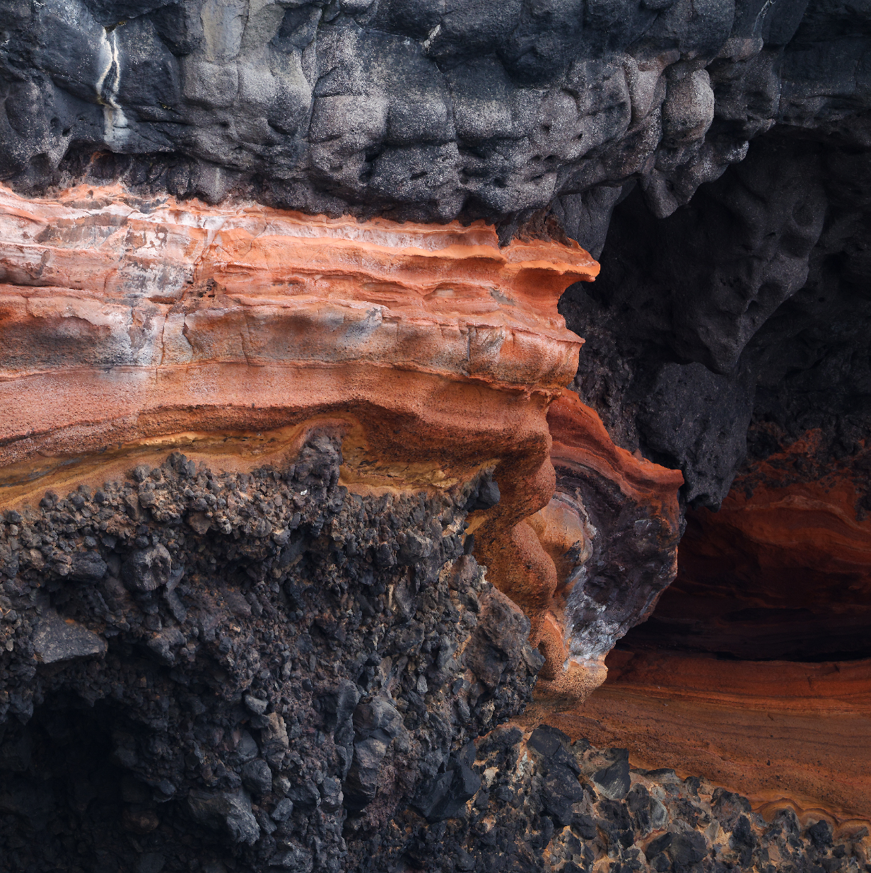
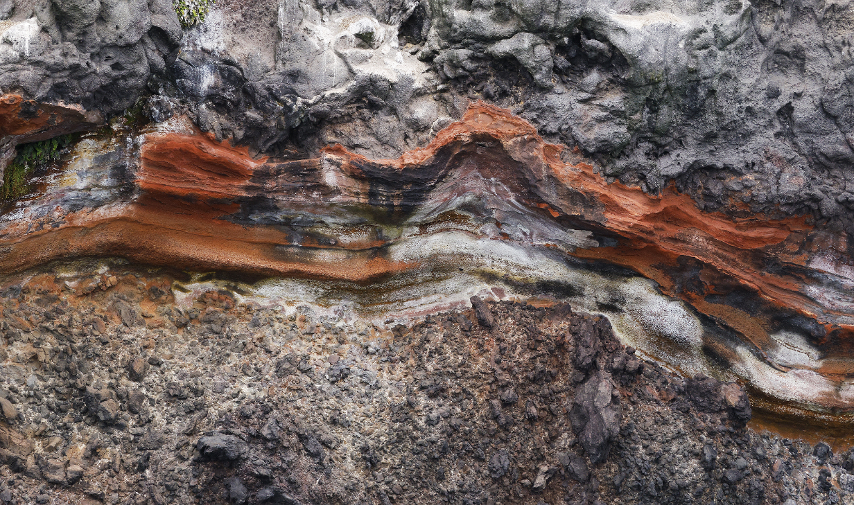
Artistry of the red rock layer
The ship's geologist concluded that this is a volcanic ash layer squeezed between lava layers and chemically modified by them to include iron oxide that provides the color. As always, layers of rock so universally seen in cliffs testify to many million years of history, here, as in many Pacific Ocean islands, dominated by the volcanic eruptions that built the islands.
Erect-crested penguin (This is my life bird, the 6th of the trip and the 2nd penguin.)
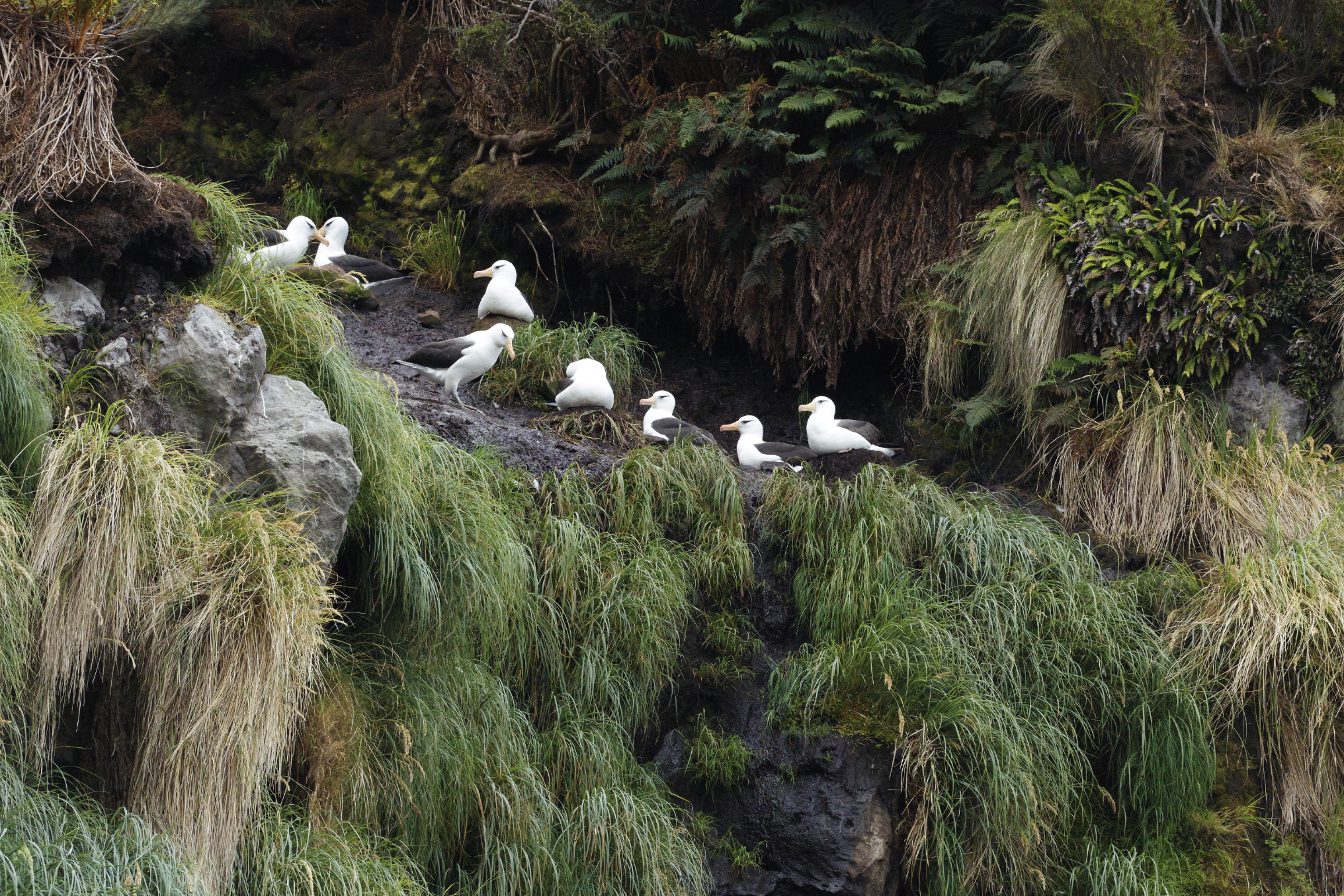
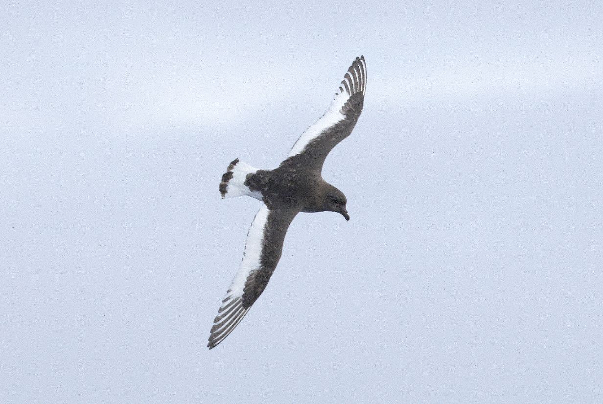
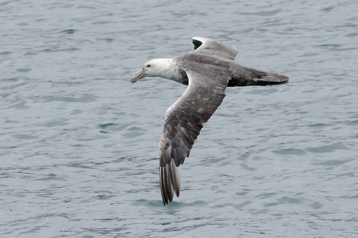
Campbell Island albatross (Thalassarche melanophris impavida) is a subspecies of Black-browed albatross (Thalassarche melanophris), which we have seen world-wide (off the Cape of Good Hope, in subantarctic waters off Ushuaia and the Falkland Islands, and around tropical Pacific islands). They breed only here, at Campbell Island, with >~ 24,000 breeding pairs according to Wikipedia. I saw many clusters of breeding nests all along this zodiac cruise.
Campbell Island Black-browed albatross nesting grounds, with startlingly light-eyed adults and fluffy chicks
I insert this picture here, out of sequence, to show what the bird looks like when it poses conveniently beside our cabin's balcony, at lunch time, between AM and PM zodiac cruises.
North Cape panorama (scroll right to see it all) Note the curvy red rock layer, which figures prominently in the 3-D art pictures above.
Another panorama a little farther around North Cape. With zodiac driver Howard Whelan.
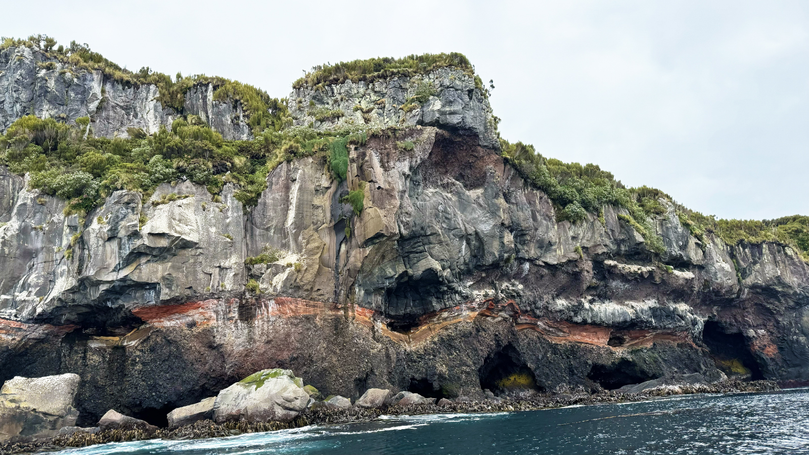
Closer-up view of the rugged cliffs around North Cape, with sea alcoves and caves and the remarkable warped layer of red rock. Campbell Island albatrosses nest high up above the cliffs but are not visible here. This is roughly where we turned around and headed back south to the ship.
One more closeup view of the rugged cliffs and sea caves near North Cape
In the afternoon, the ship stopped at (dead calm) Perseverance Harbor. Most people took a hike of up to about 7 miles round trip, up the hills from the landing to see Royal Albatross nesting up close. I told the shore crew that I was mostly interested in seeing what would be my 3rd new bird of the day, the flightless Campbell Island teal. They were kind enough to arrange a private zodiac ride along both sides of the fjord. I am exceedingly grateful to my cheerful and dedicated Russian guide, Ivan Klochkov,who had seen the bird here on his last voyage a few weeks ago and who tried hard to find one for me. We did not succeed, although the zodiac ride was very enjoyable and we saw a good number of other birds. Eventually, it started to rain; I got cold, and we gave up.
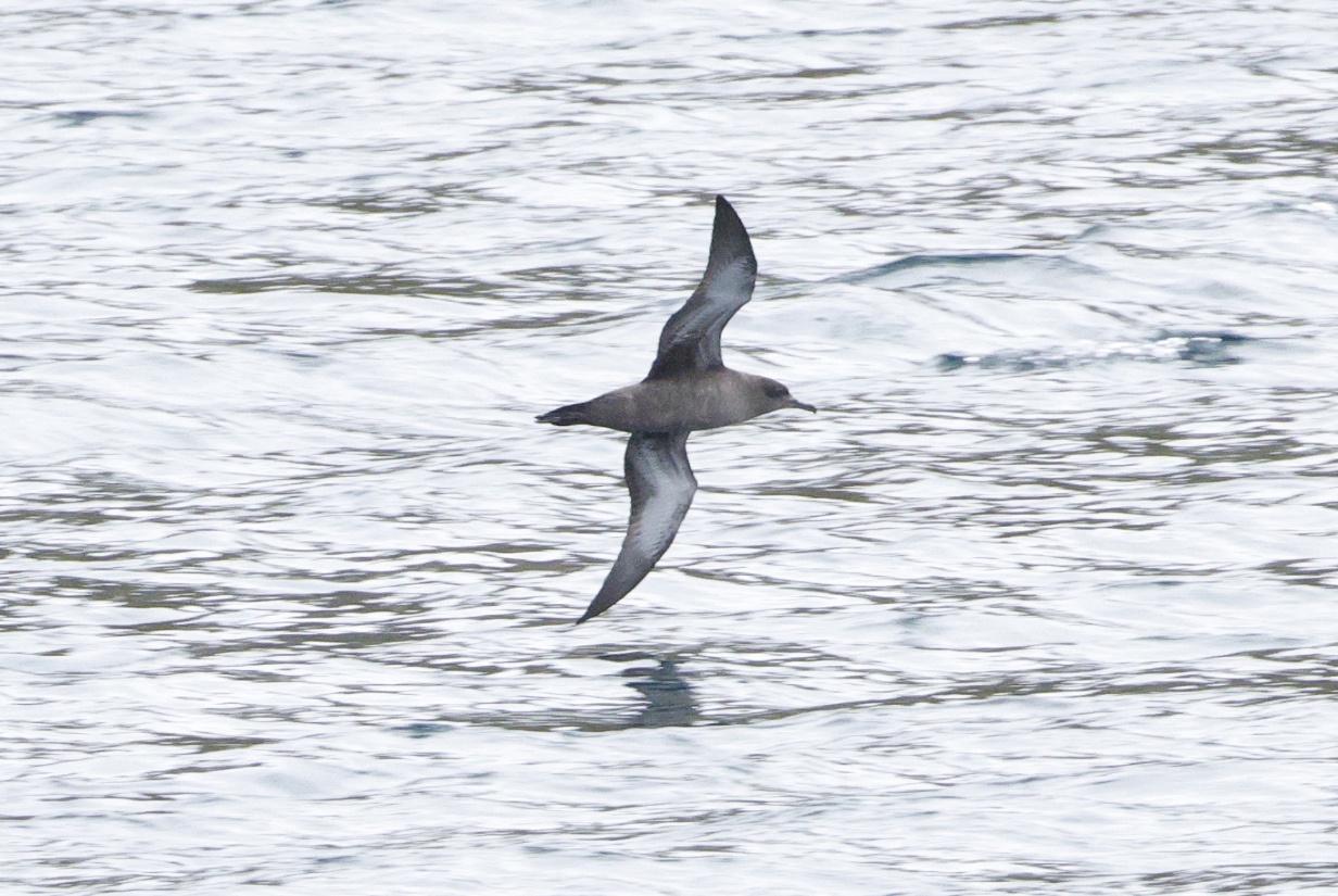
During lunch time, the ship was repositioned in Perseverance Harbor. Along the way, we saw hundreds of Sooty shearwaters in great flocks, congregating -- we assume -- in spots along the fjord where there is lots of food. They never came close, but they were unmistakeable.
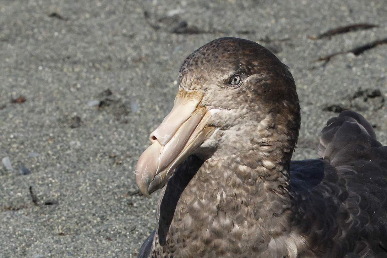
Southern giant petrel juvenile
Campbell Island shag: The relatively sheltered Perseverance Harbor is a good place to raise young. This is a juvenile.
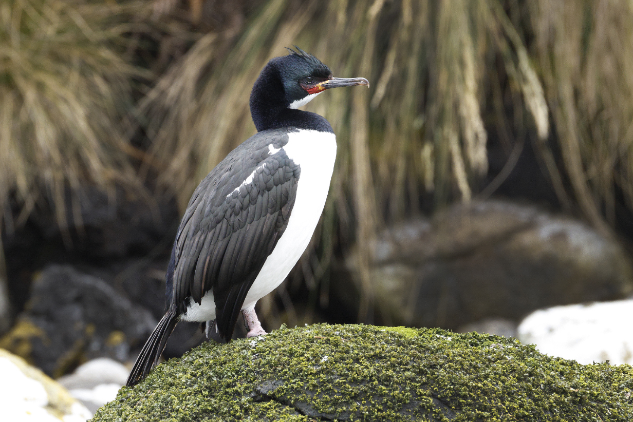
Campbell Island shag -- adult in breeding plumage
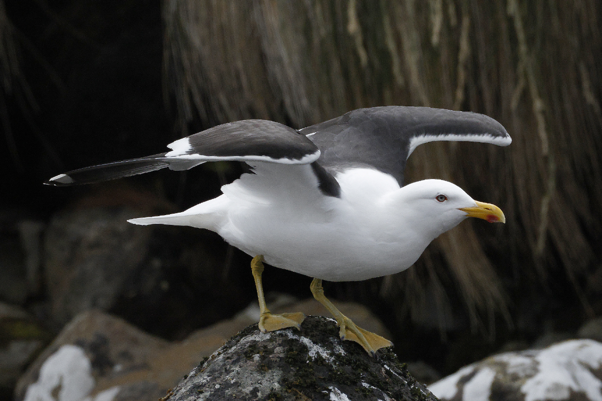
Kelp gull is the ubiquitous gull here.
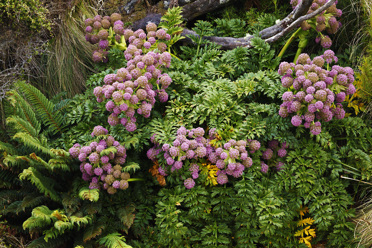
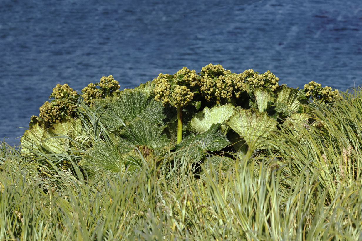
Campbell Island carrot (Anisotome latifolia) is a beautiful megaherb that contributes wonderfully to the wild and beautiful scenery.
New Zealand pipit at work -- last bird of the PM zodiac cruise before rain set in
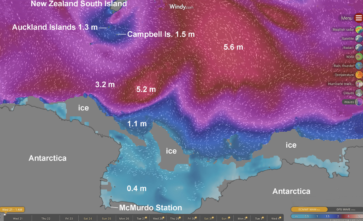
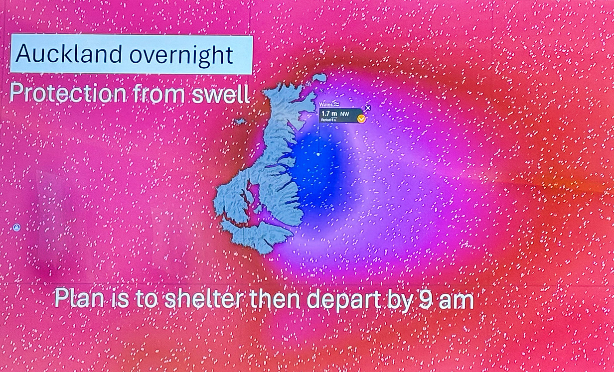
The following 4 days were scheduled for the run south from Campbell Island to the Ross Sea. The above Windy Waves map shows the situation during the evening of January 21. The numbers give the heights of typical swells in meters. So far, we have been remarkably lucky to have easy seas (blue in the map). Seas continued to be fairly favorable all the way to Antarctica: as the weather moves eastward (i. e., to the right), it looked like we would have a "window of opportunity" with wave swells not much bigger than 10 feet along the way. In the event, weather changed more quickly than this map might suggest ... although, as I write this on January 24th, most of the way to the Ross Sea, we continued to have moderate seas. We had only a brief period of roughly 10-foot swells this morning, and now (4 PM) conditions have eased again. All this is in part good luck and in part good planning by Aurora: They know how to juggle our schedule to take advantages of easy seas. Of course, we still need to sail back north from Antarctica to New Zealand. Nobody can predict what conditions will be like. But we trust Aurora to keep conditions as comfortable as possible.
January 22, 2026: At Sea
On most sea days, I worked on pictures and tried to keep this web site as up to date as possible.
January 23, 2026: At Sea
January 24, 2026: At Sea
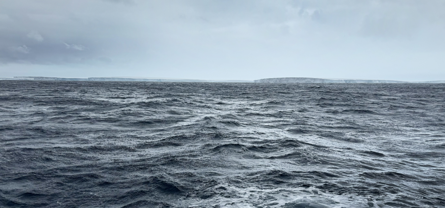
Today was another sea day, starting out in adventurous waters, with sea swells in excess -- I would guess -- of 3-4 m but calming by the end of the day. We crossed the Antarctic circle at 6 PM and should now not see another sunset for more than a week. We will see ... but we should get to nearly latitude 77 degrees 50 minutes south (McMurdo Station, which does not allow visitors). This is almost as far south as our northernmost point was north -- just over 81 degrees N latitude in Svalbard in 2024. But conditions will be more extreme here, because Antarctica is "continentally cold", whereas Svalbard -- like all of northern Europe -- feels the Gulf Stream warm ocean current. And because the North Pole is under an open ocean, not under a continent with typical ice sheet elevation of ~ 2500 m = 8200 feet.
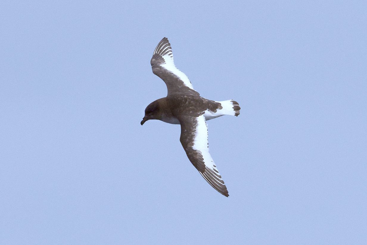

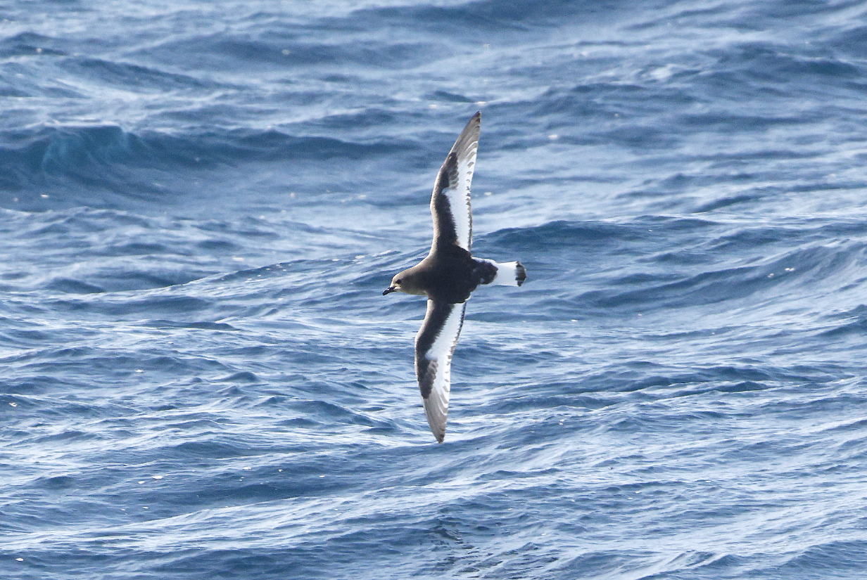
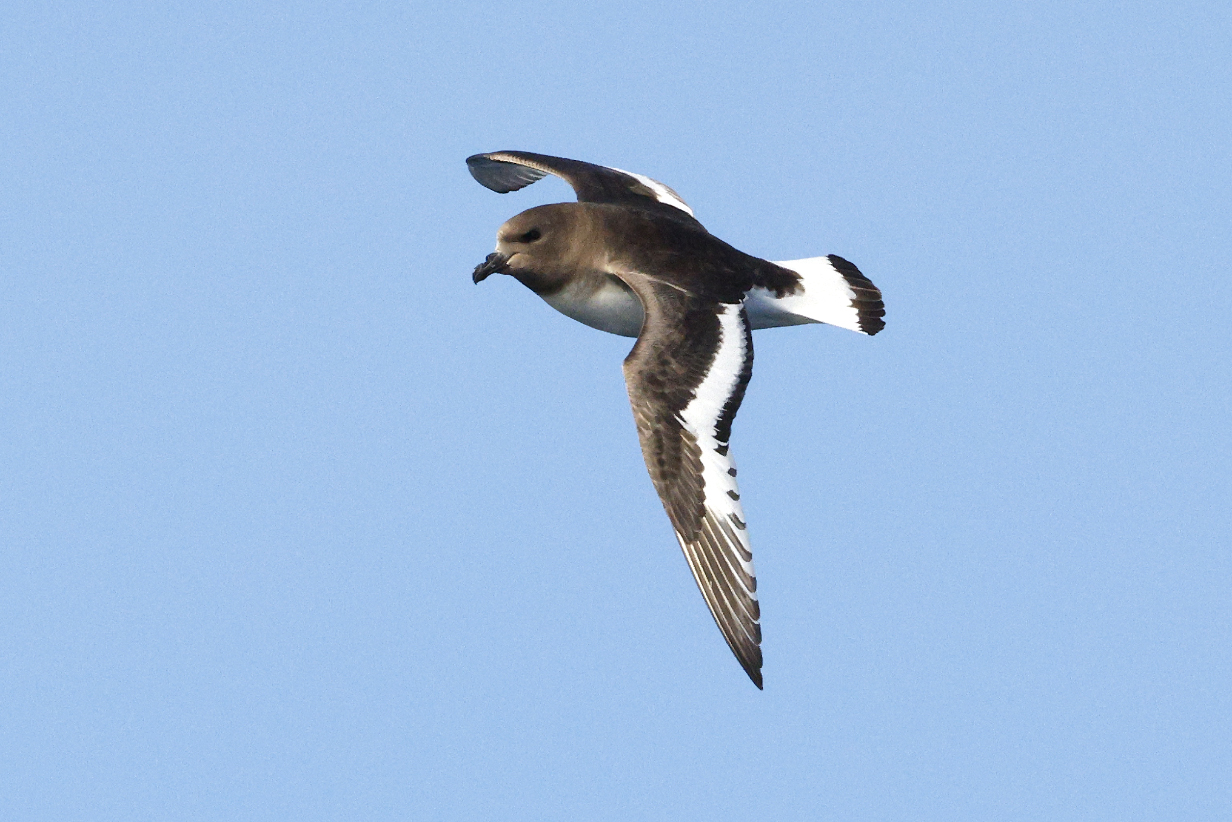
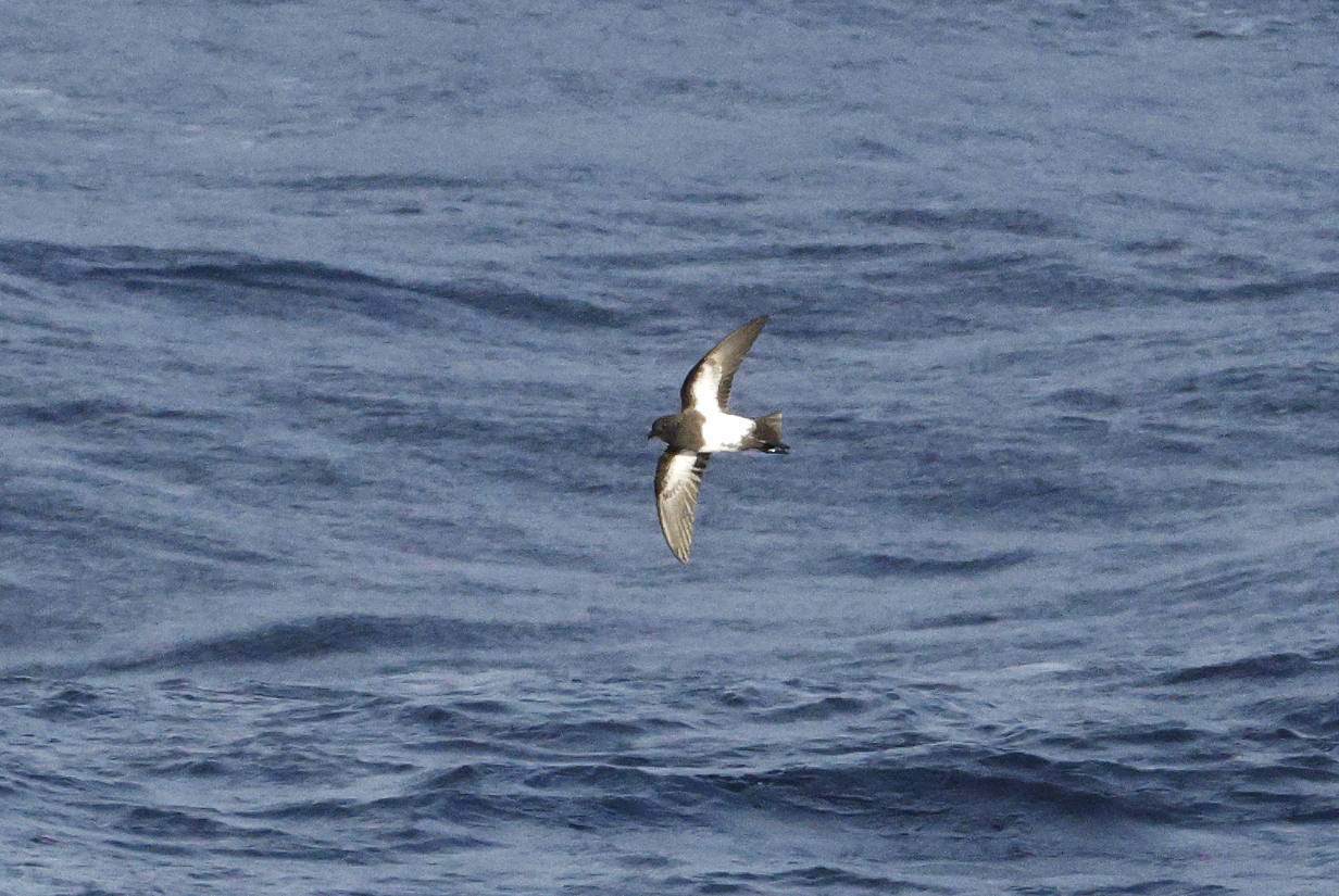
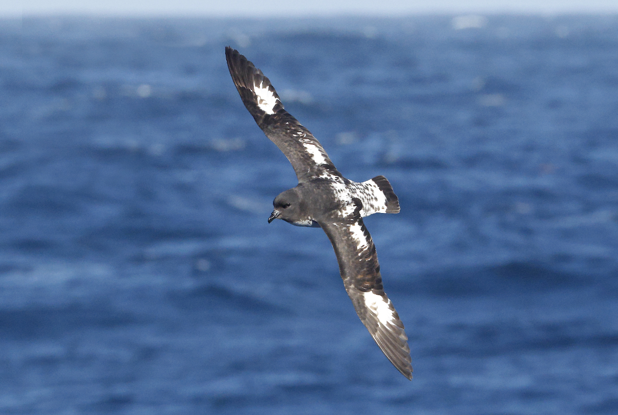
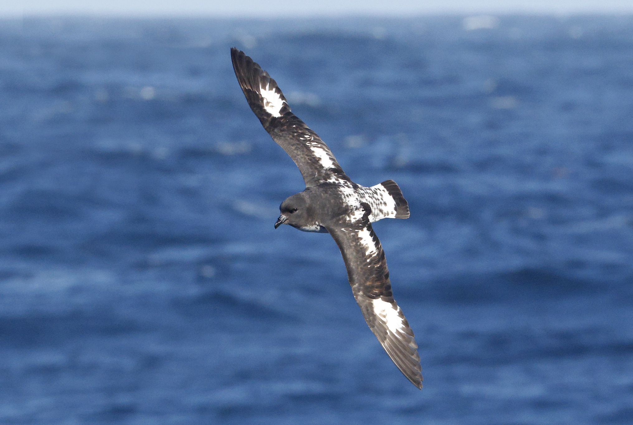
Antarctic petrel was the very easy first bird of the day. This is my 7th life bird of the trip. It flew around our starboard side of the ship, repeatedly giving me great looks. These are all pictures of the same bird.
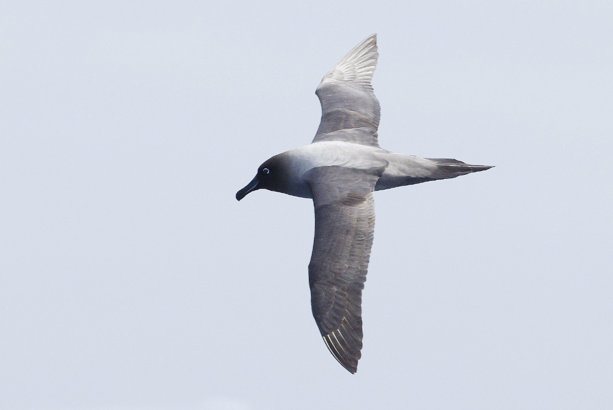
Light-mantled albatross (This morning was the second-last day that I saw one, as we sailed south.)
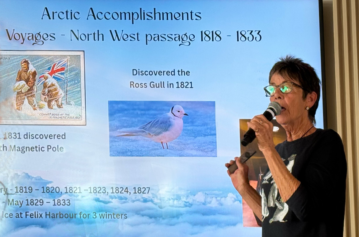
An honored guest on this voyage is Ms. Philippa Ross, the great, great, great granddaughter of Sir James Clark Ross, who discovered Earth's North magnetic pole in 1831 and the Ross Sea region in Antarctica in 1841. Today, she gave us a fascinating account of his life and accomplishments. One tidbit that I had missed -- but should not have missed -- is that he also discovered Ross's gull. It is a far-northern gull that few birders get to see. But I had the good fortune to see one -- as did my mother -- about 25 years ago, when it showed up as a very rare stray at Point Pelee National Park. A great crush of eager birders rushed to the south-pointing sand spit at Point Pelee to see one slightly pink-headed gull with black collar hiding among many other birds. I have cherished that sighting for many years ... having no idea that I would one day head far south to visit the Ross Sea and, along the way, have the privilege to meet Philippa Ross. She is an energetic and outspoken naturalist, environmentalist, and self-dsescribed enthusiologist and human ecologist.
January 25, 2026: At Sea
We were still at sea all day, reaching into the Ross Sea by evening. I did some pelagic birding twice for about 1/2 hour each, but the temperature was several degrees below freezing; the wind was brisk, and it felt very cold. Still, I got one life bird almost first thing in the morning:
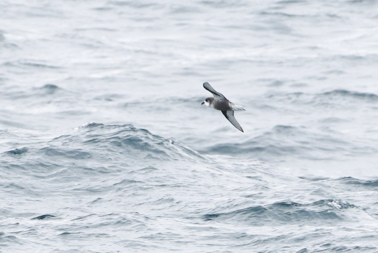
Mottled petrel (This not very good picture is my life bird, identified instantly by the ship's bird expert AK. I saw at least one more -- this time easily recognized by me -- during the 11 AM bird count (see below). Mottled petrel is my 8th new bird of the trip.
Mottled petrel from Deck 7, about an hour later. Again, I found it myself. Happily, it is easy to recognize, even far away.
Southern fulmars suddenly got common -- old friends from previous trips to Antarctica
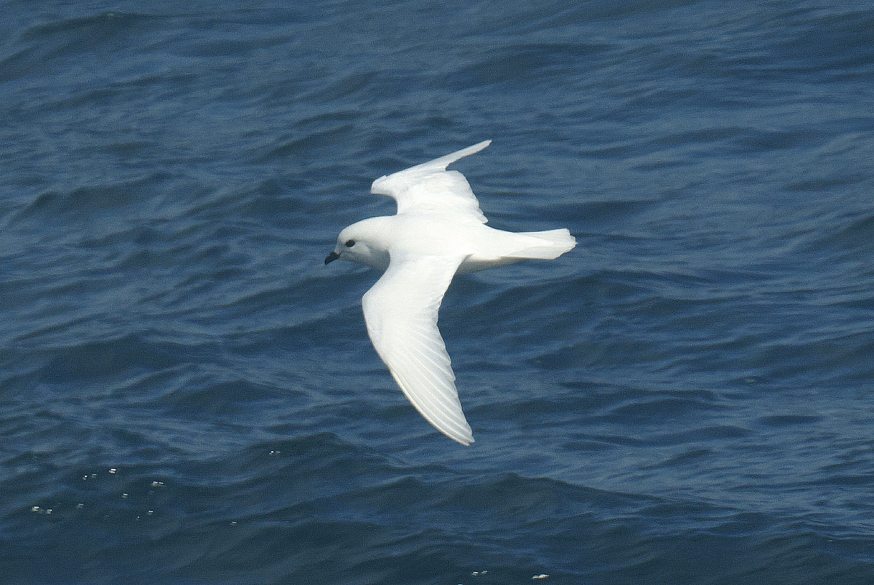
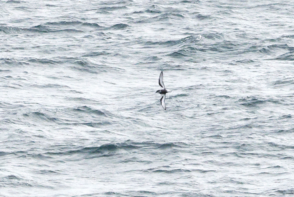
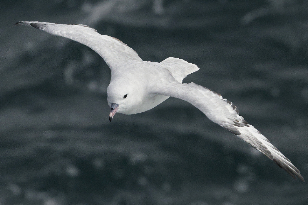
Snow petrels are beautiful, not very common or easy to see, and hard to photograph. So far, this is the best that I could do.
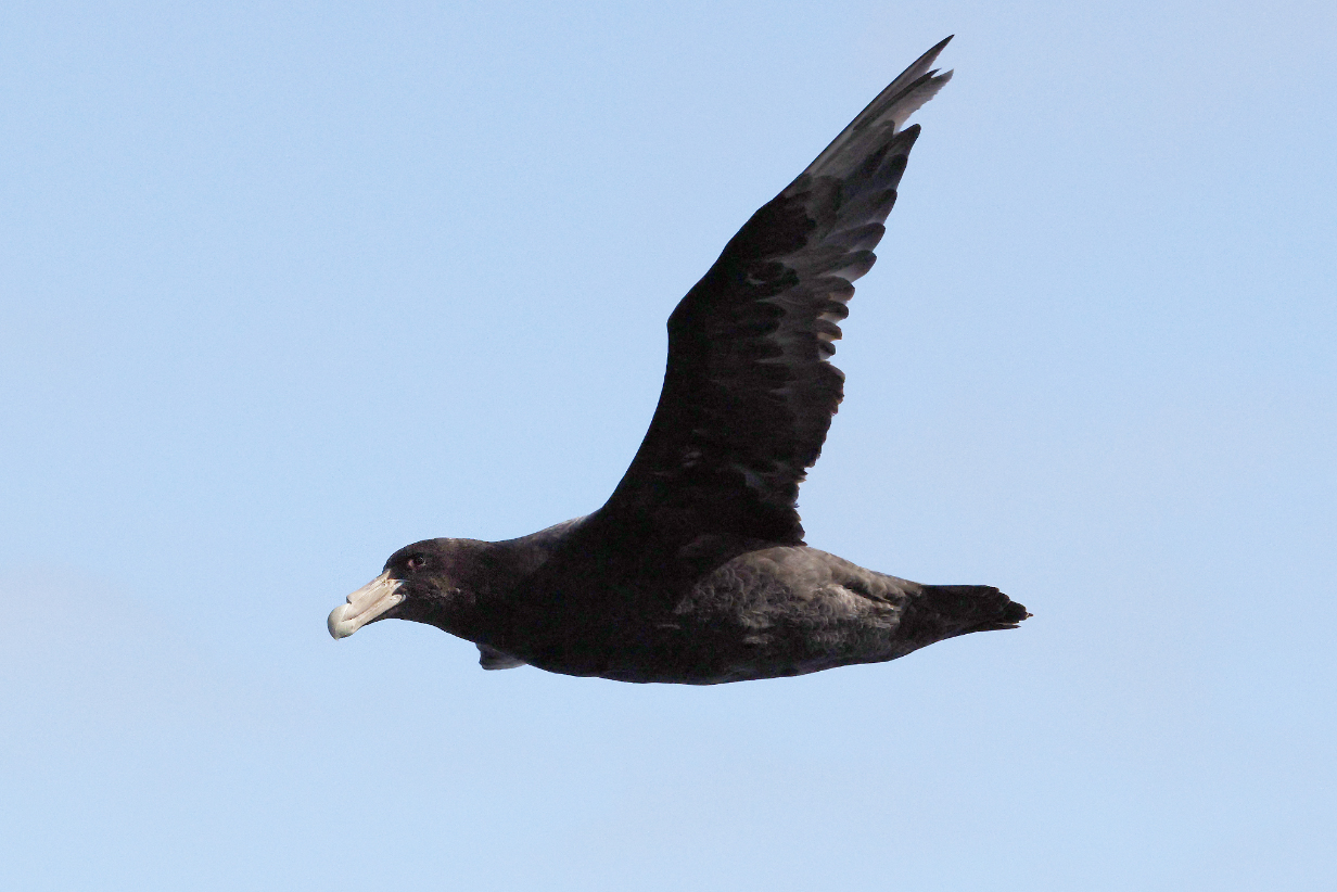
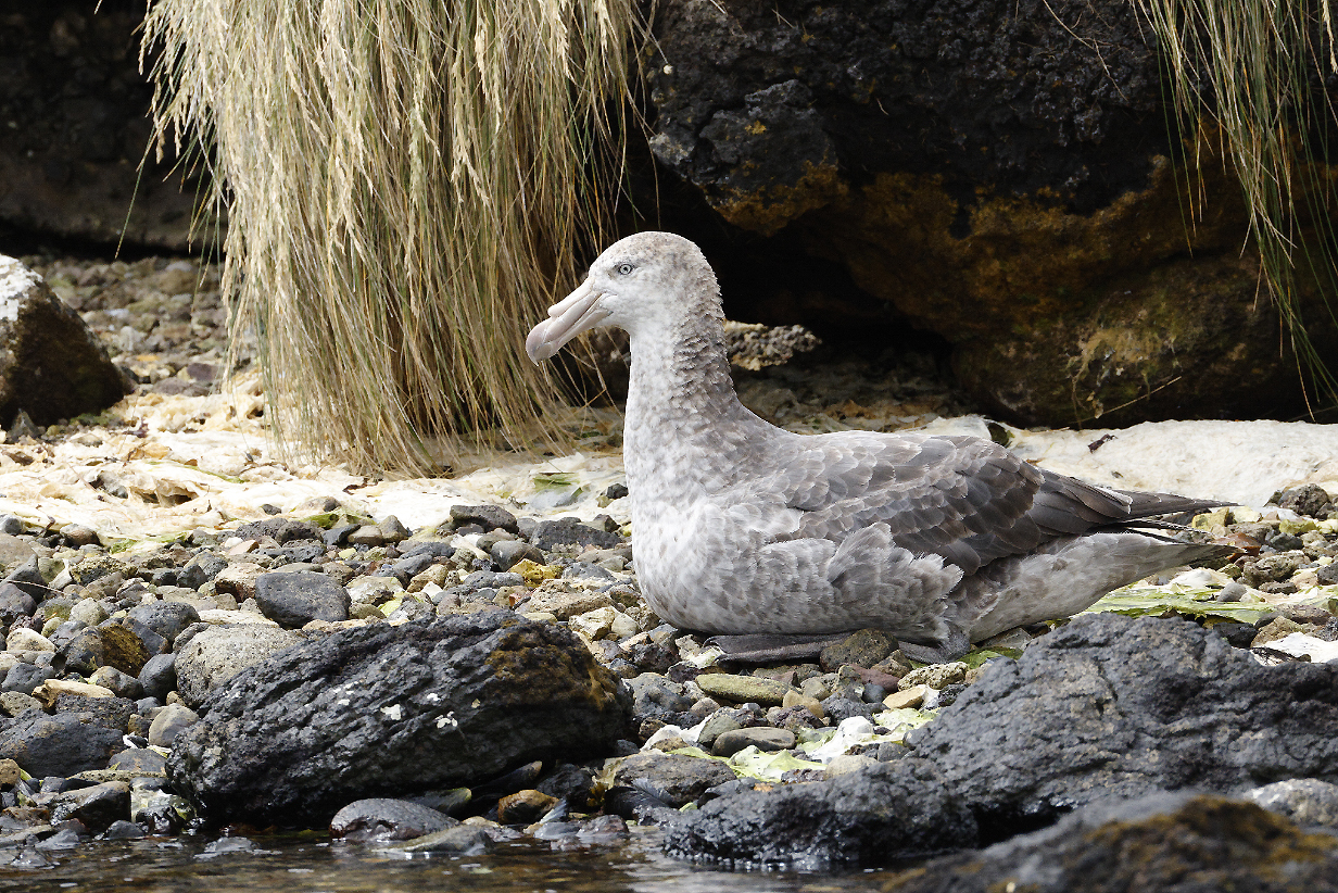
Southern giant petrel is gigantic ... and also hard to photograph when it is so dark.
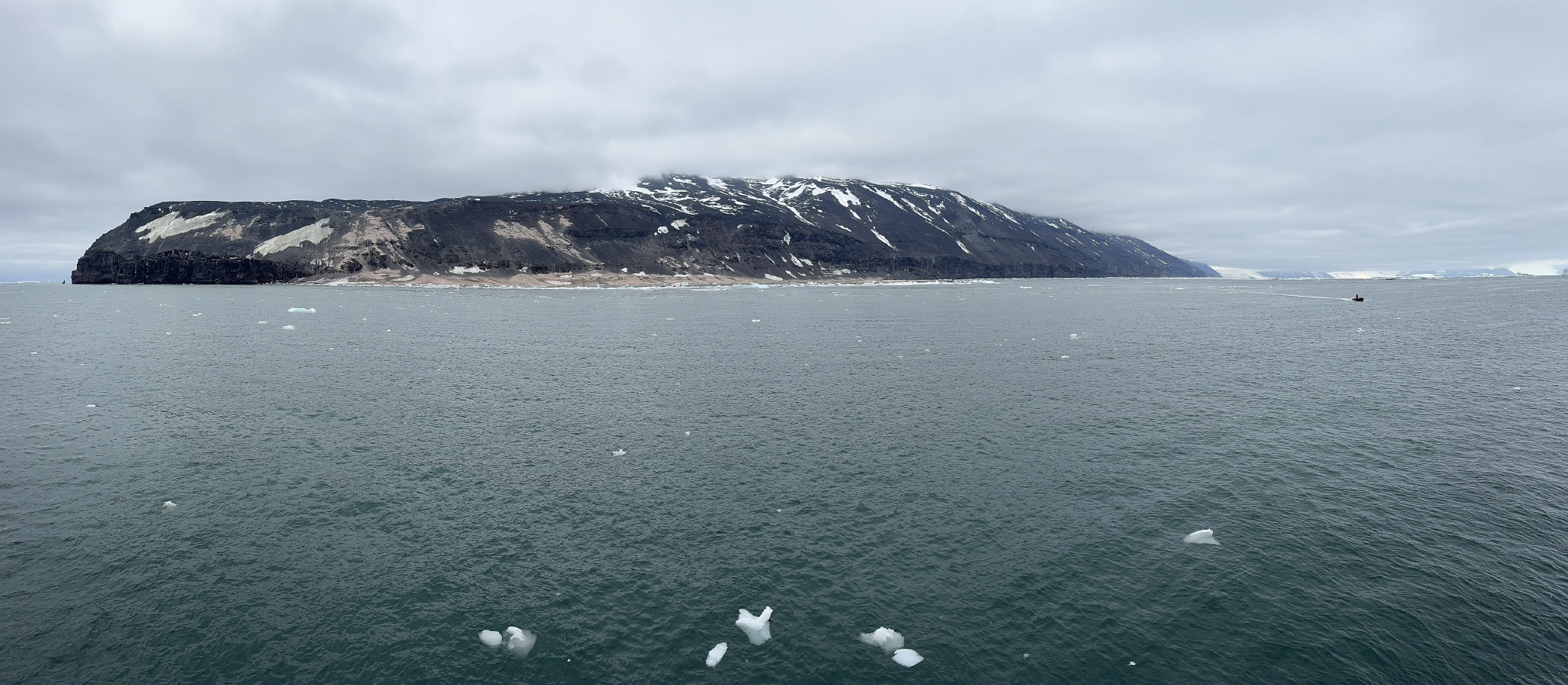
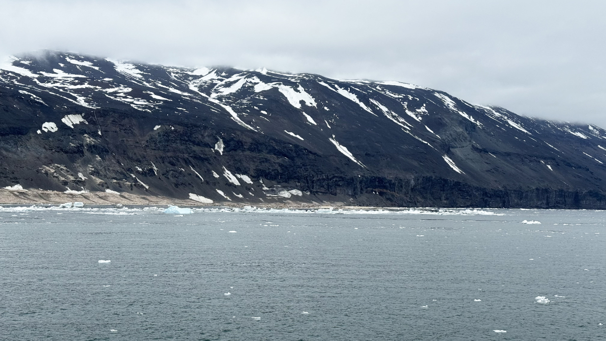
January 26, 2026: Cape Adare, Antarctica
Much of today was still spent at sea, sailing mostly westward after detouring somewhat east to take advantage of an opening in the pack ice that still partly blocks off the Ross Sea from the ocean farther north. That pack ice helps us a lot, because it blocks big ocean swells and results in very gentle ~ 1 m swells in the Ross Sea. We arrived at Cape Adare in mid-afternoon ... only to find that local ice floes made landing harder than expected. I had spent quite a lot of time outside in several-degrees-below-freezing cold, so I skipped the landings. All of the following scenery and bird pictures were taken from the balcony of our suite.
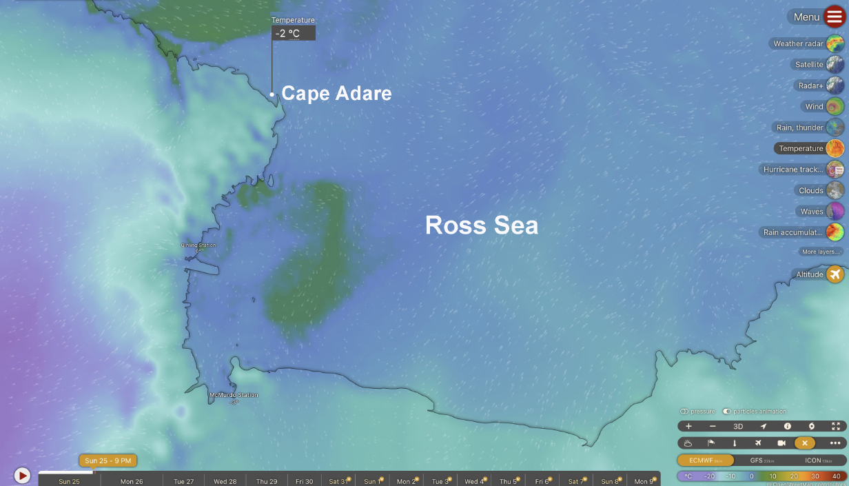
Windy Waves map of temperatures in the Ross Sea on the morning of January 26. (My laptop's clock is still set to American CST.) The location where the ship was parked for shore excursions is marked with the white dot at the bottom of the temperature flag.
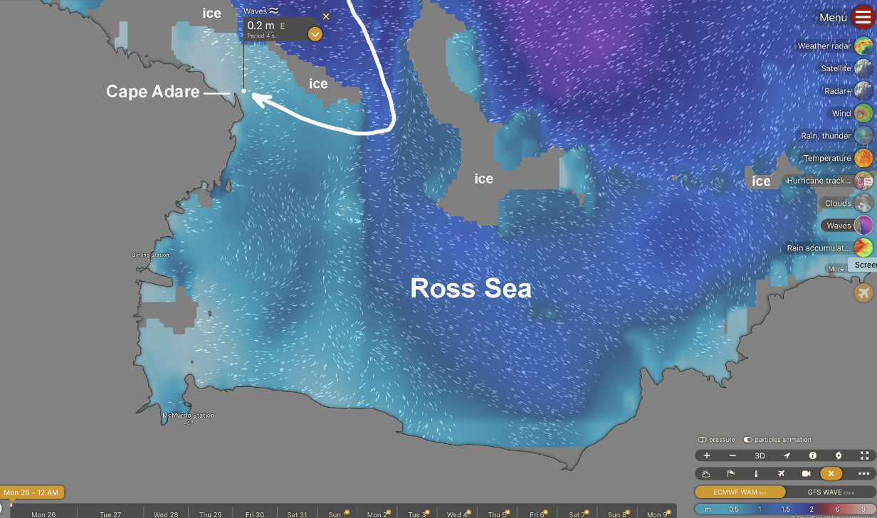
Windy Waves map of sea swell heights during the evening landings on January 26th. The white line with arrow at the end shows how we detoured around sea ice to get to Cape Adare. Situational awareness is critical to having a good trip to Antarctica, and Aurora crew are masters of it. In the coming days, we will sail down the western shore of the Ross Sea approximately as far as McMurdo Station.
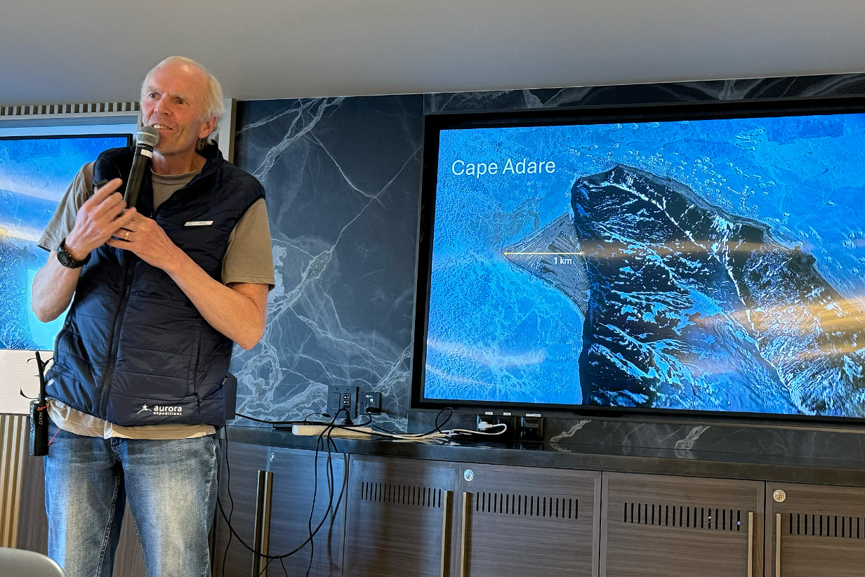
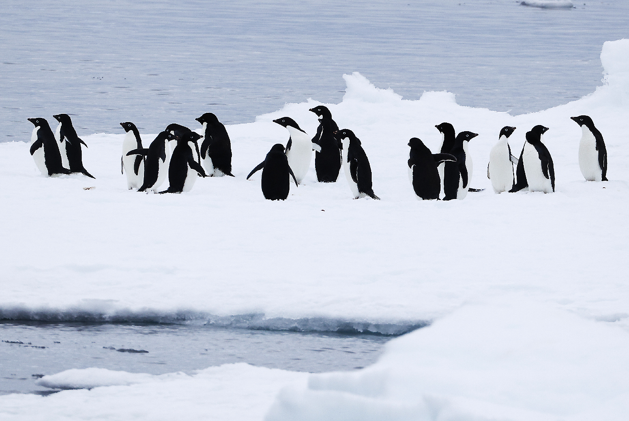
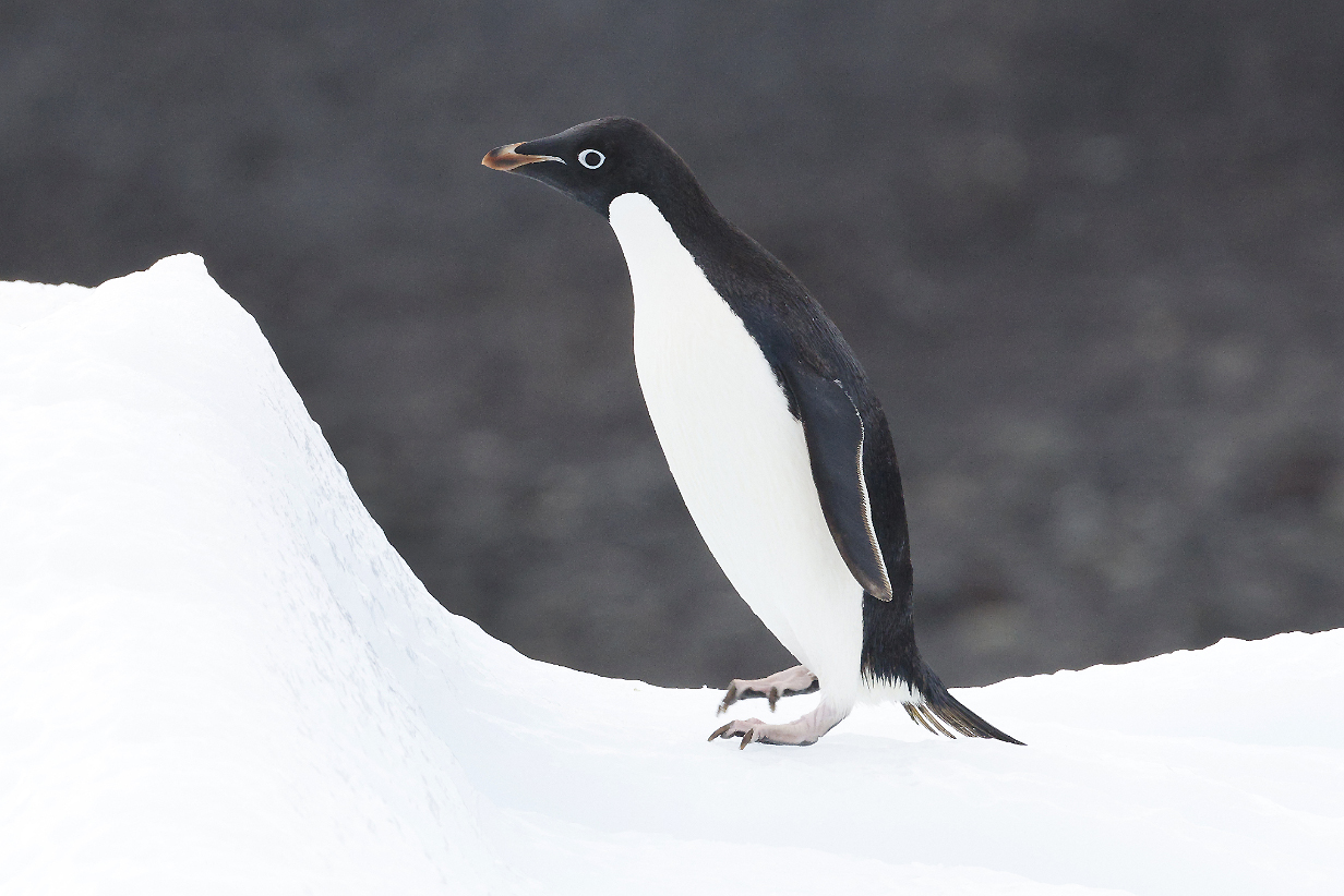
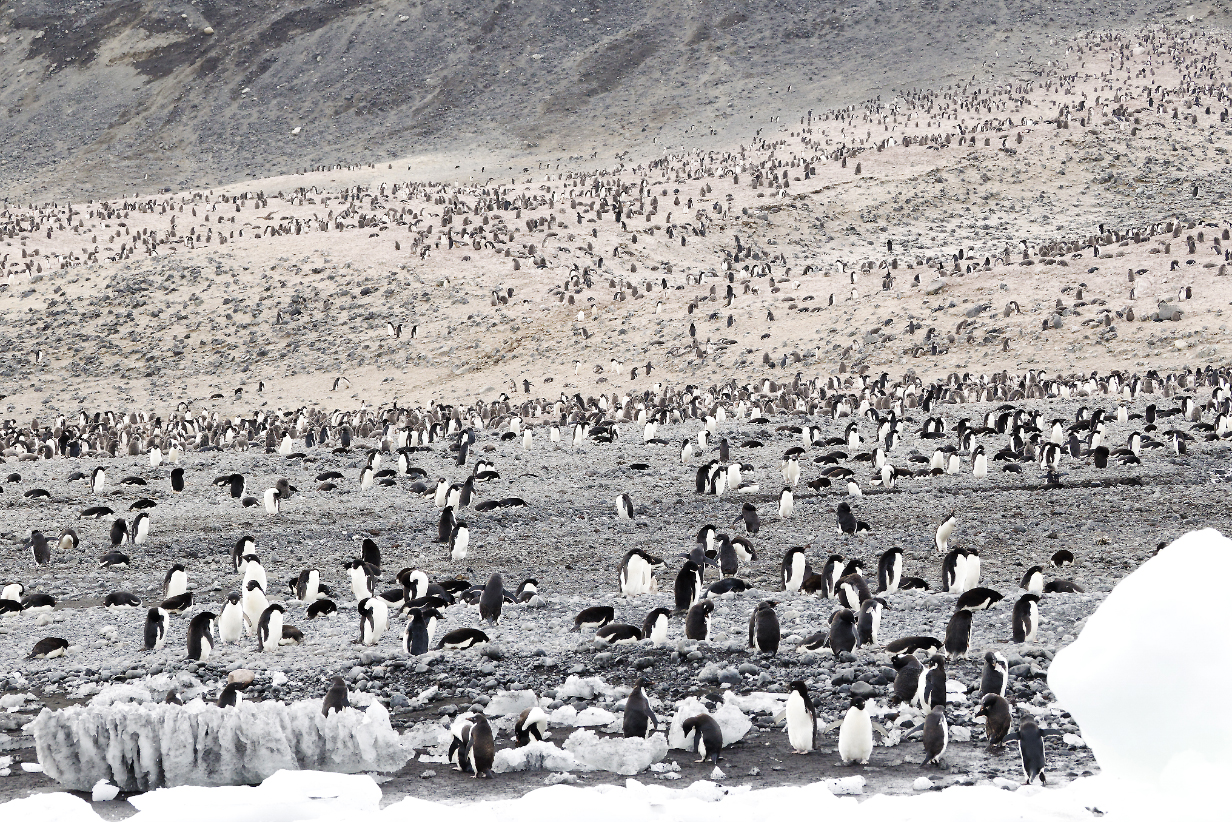
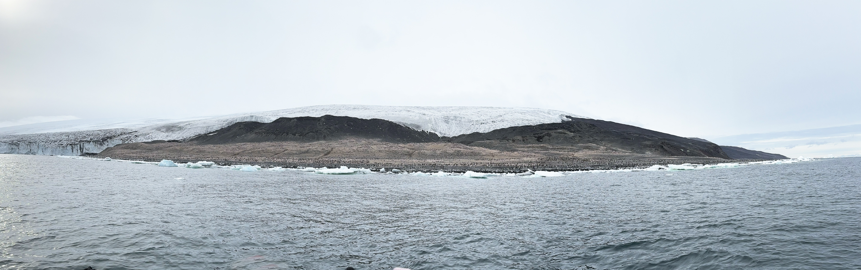
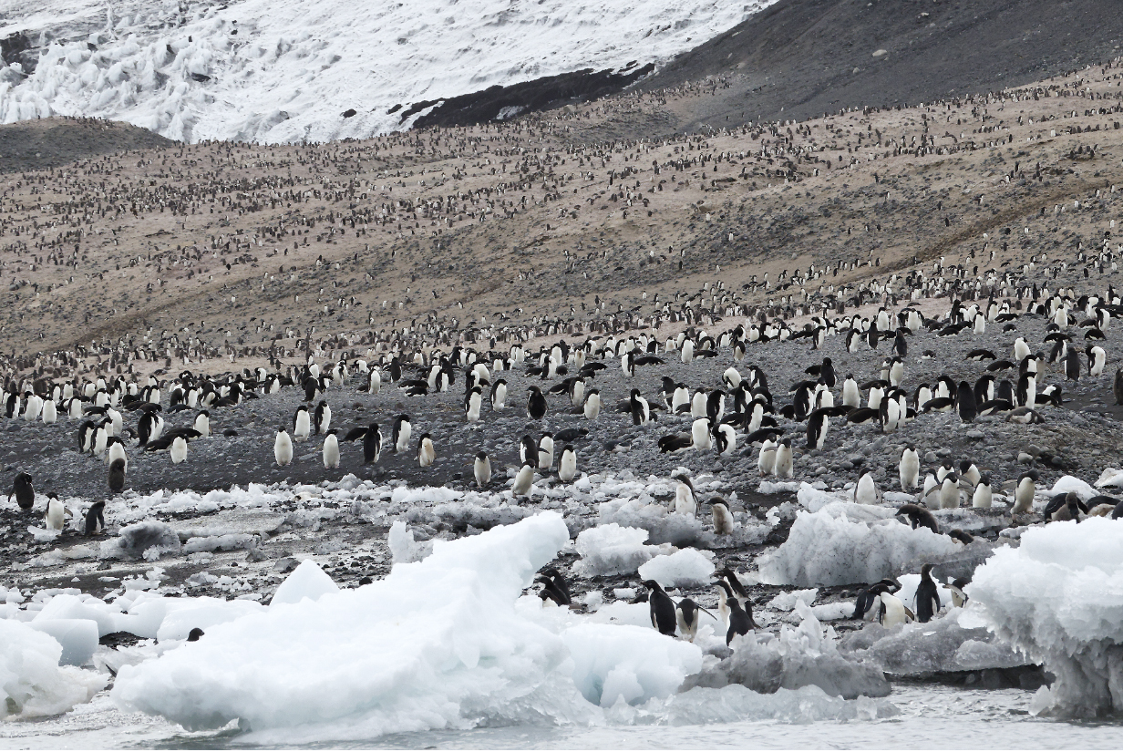
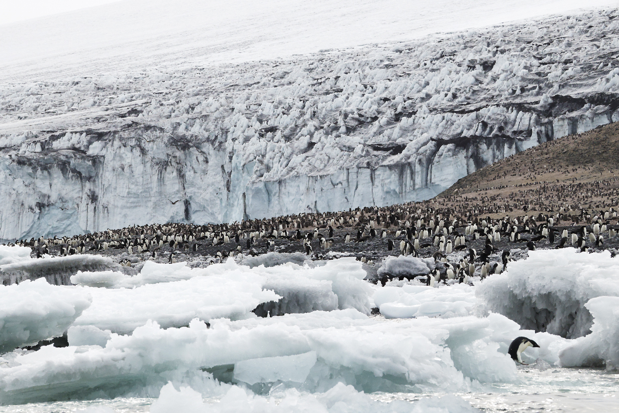
Expedition Leader Roger Kirkwood briefs us on the shore excursions at Cape Adare. The ship is positioned inside the bay that separates the cape from the rest of the mainland. Most of Cape Adare penninsula is steeply mountainous, but a triangle of sand about 1 km on a side was our destination: About 300,000 pairs of Adelie penguins nest there and on up the slopes. This is the biggest Adelie nesting colony in the world. Also on that triangle is the (restored) "Borchgrevink's Hut" from the British Antarctic expedition of 1898-1900. The hut is shown in some pictures below. Google AI notes that "it is the first, oldest, and only surviving example of humanity's first building on any continent." Since the closest side of the sand triangle is much closer to the ship than the far side or the farther hills, the nearest penguins in the pictures that follow look markedly bigger than the farthest ones.
Antarctic petrel in the morning, many hours before we got to Cape Adare.
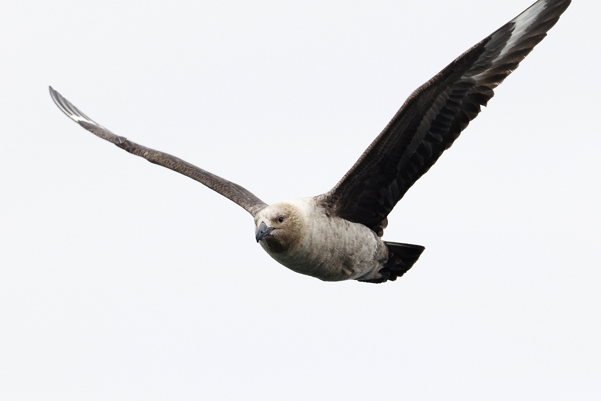
South Polar Skua, approaching Cape Adare, where there was abundant prey ... at least when Adelie penguin chicks were still smaller
Southern giant petrel, ditto
Cape Adare panorama from our suite's deck. Scroll right to see it all.
Cape Adare -- Borchgrevink's Hut is in the middle of the picture.
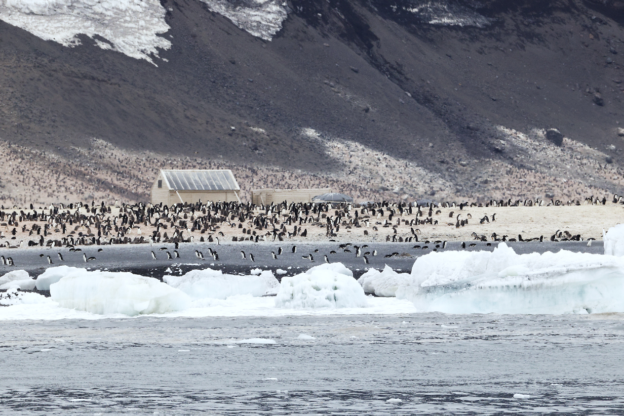
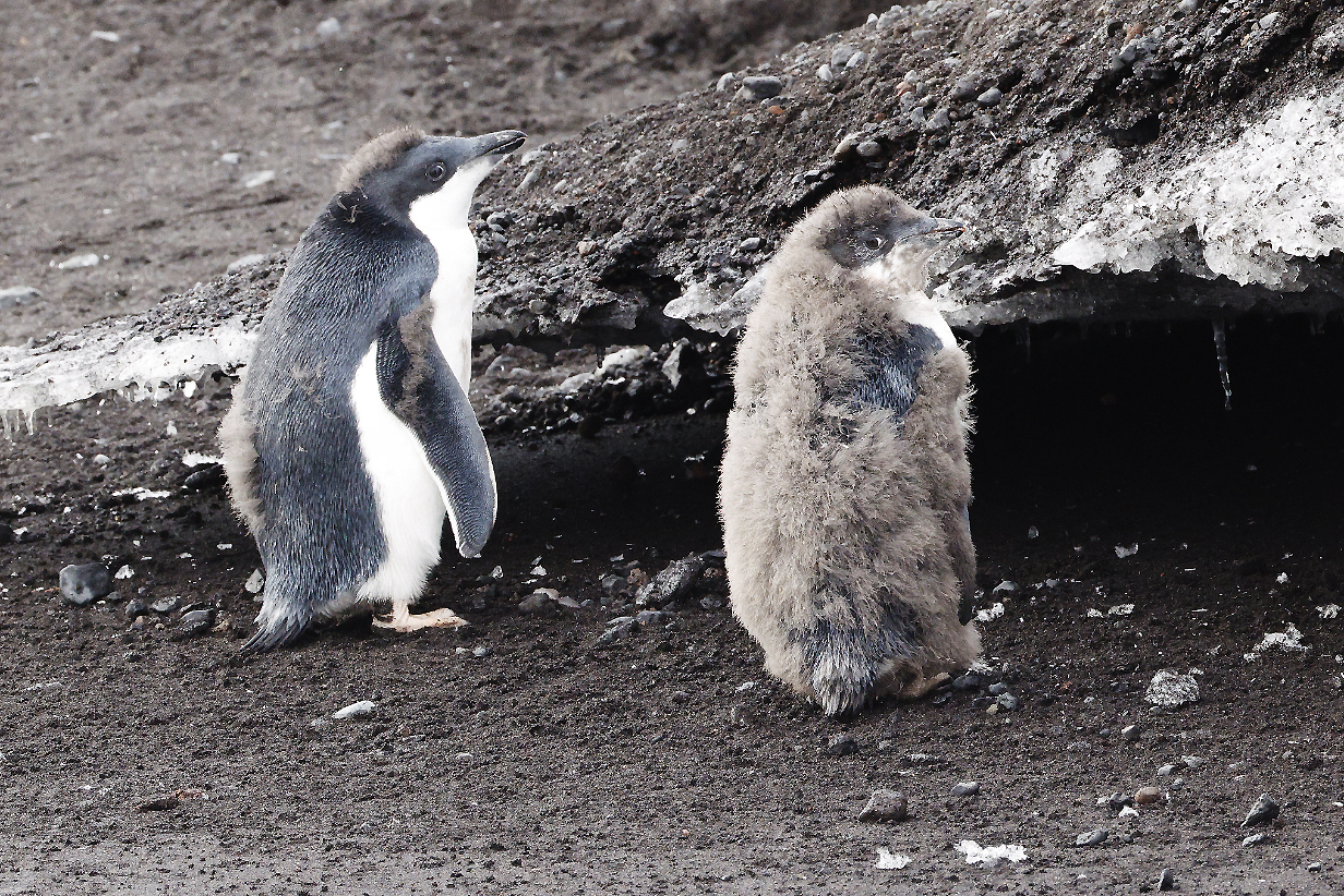
Borchgrevink's Hut and Adelie penguins.
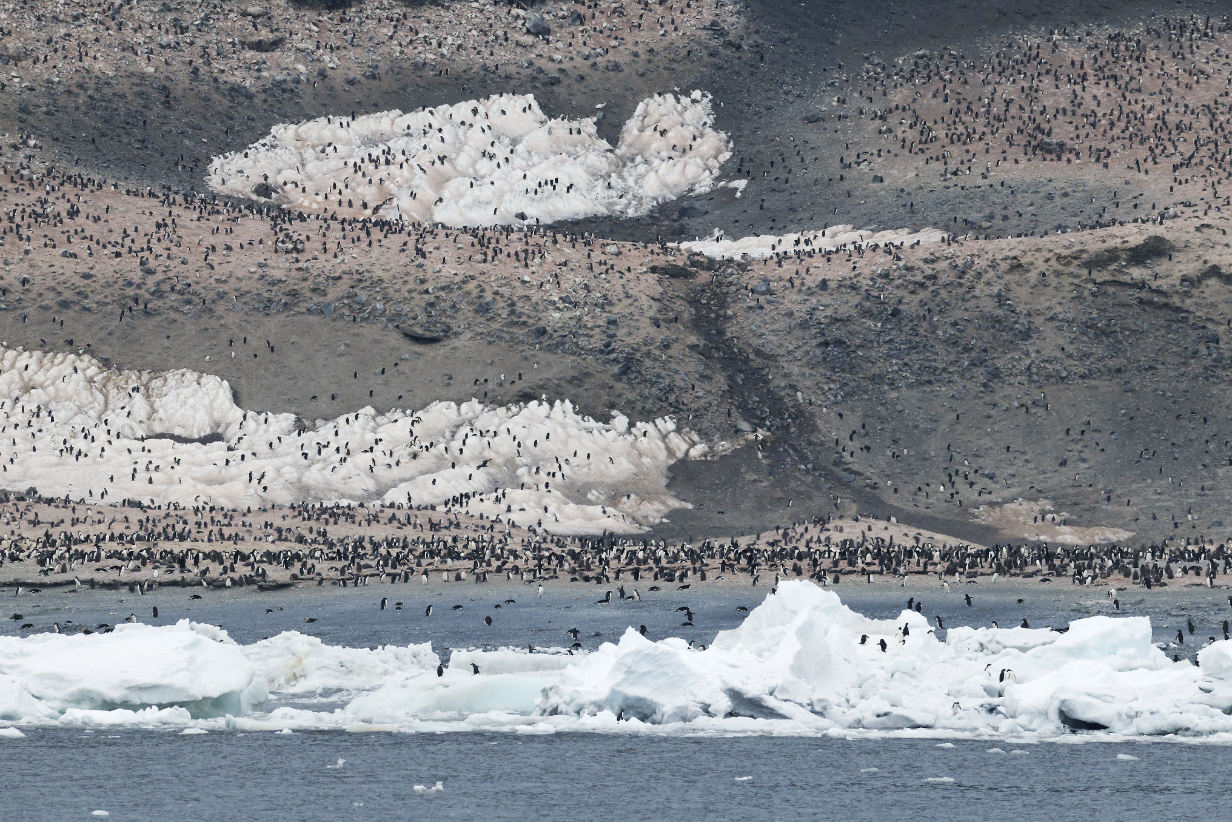
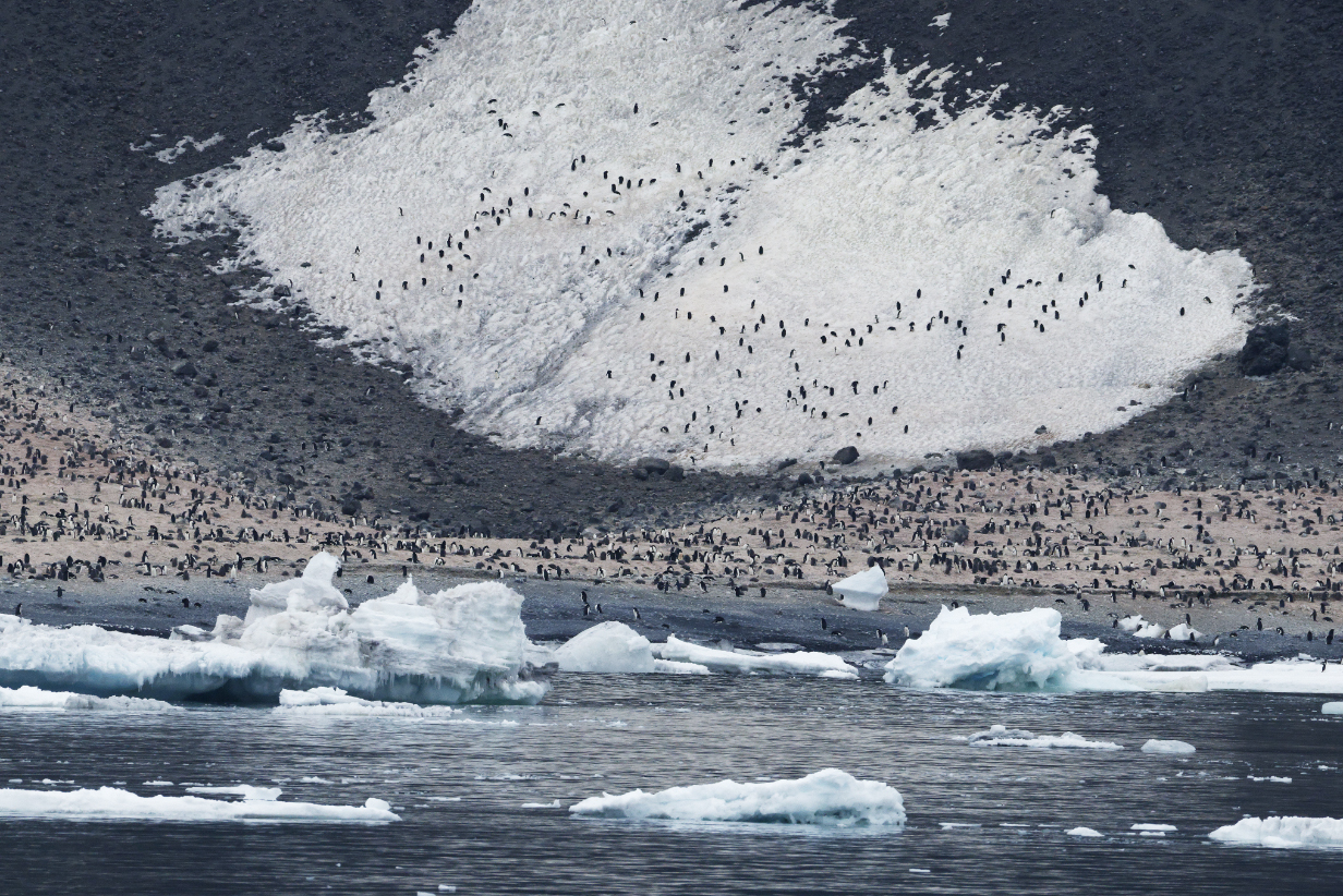
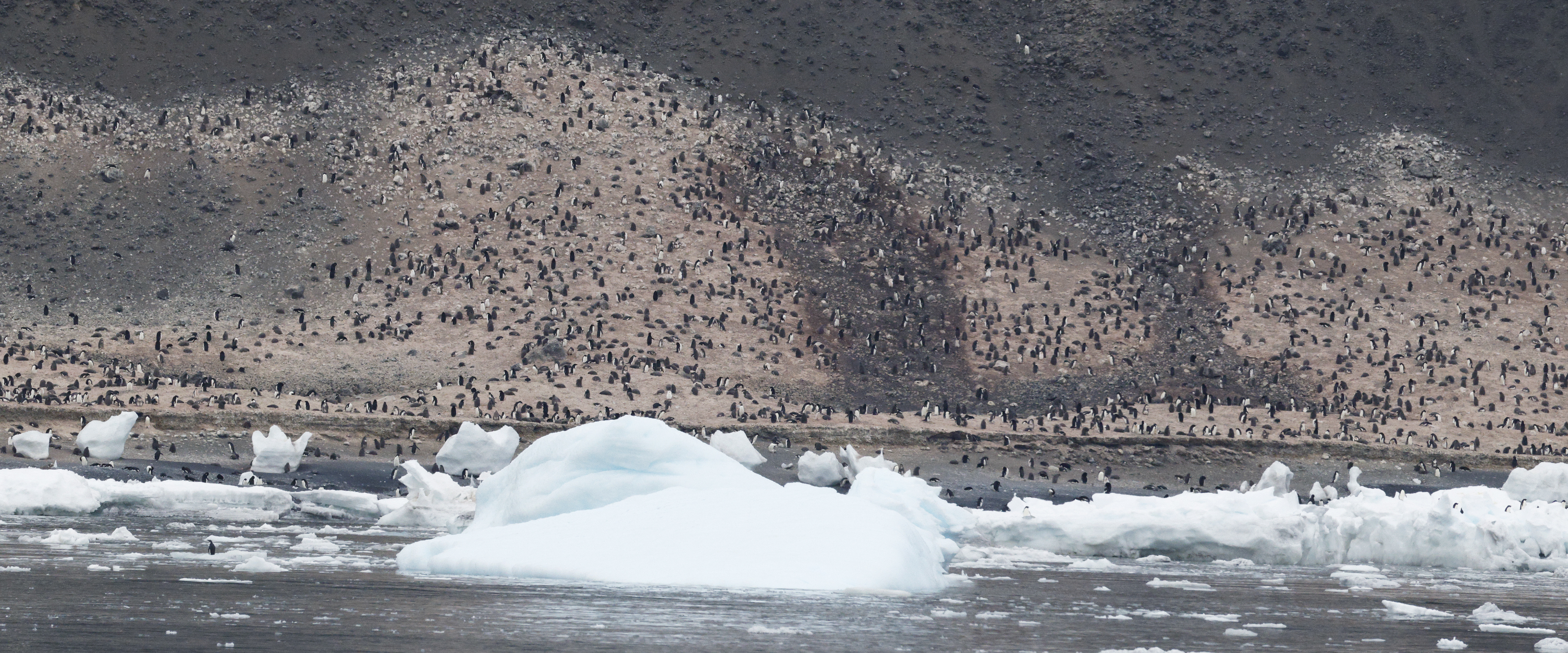
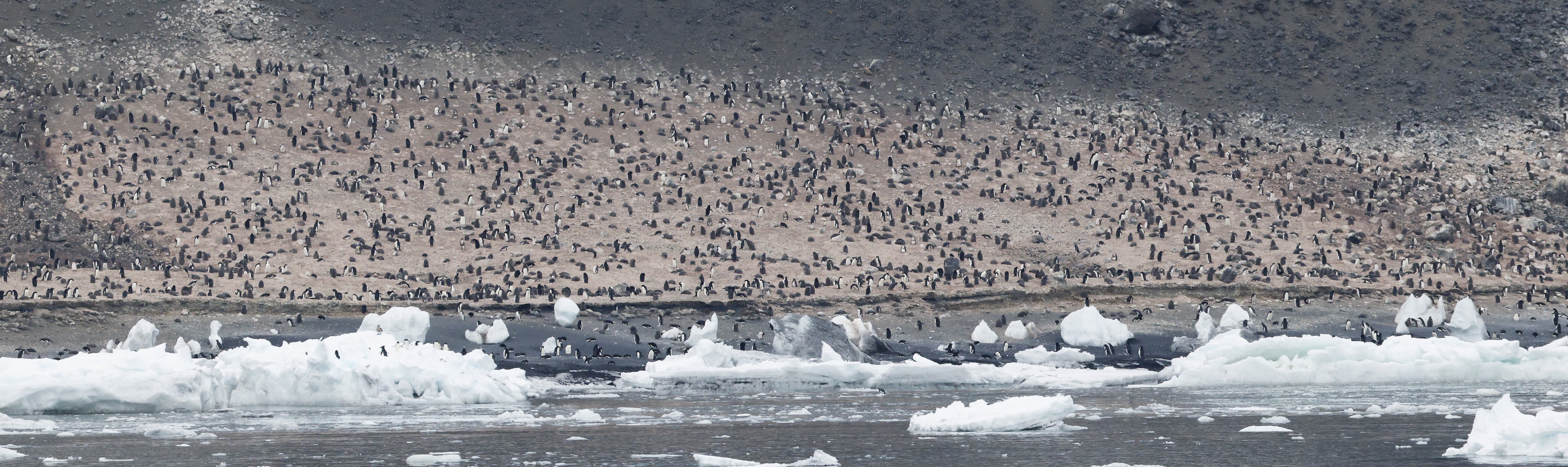
These pictures show just a few of the 300,000 pairs of Adelie penguins that nest at Cape Adare. It is late in the nesting season, so chicks are now dark brown fluffballs almost as big as their parents. They can be seen in some of the pictures. The last two pictures are enlarged panoramas: scroll right to see the whole picture. In the second = last panorama, a South Polar Skua sits in front of a high block of ice relatively near to the left end of the picture: you can see that it is not a lot smaller than an adult penguin.
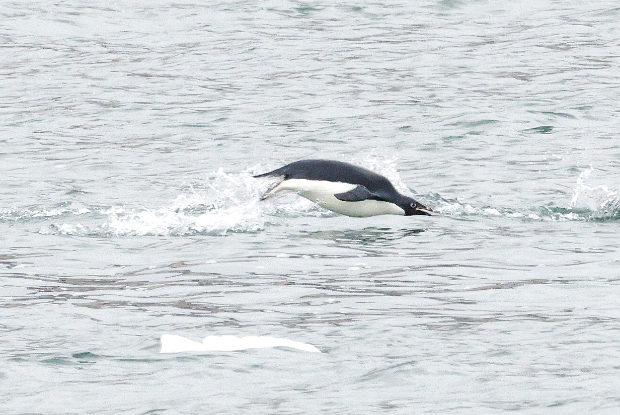
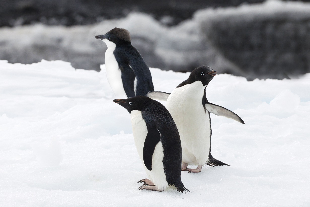
The birds on the shore were too far away, but closer birds such as this one were as close as the birds that were my life bird -- also on an ice floe -- in penninsular Antarctica during our 2022 VENT bird tour with Aurora. That happened late enough in the evening so that Mary was asleep. Now, she got Adelie penguin as her 4th life bird of the trip.
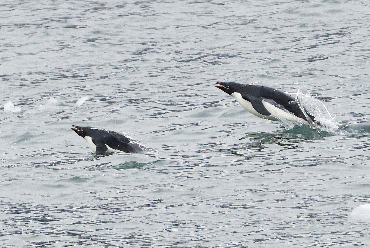
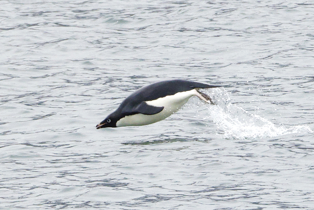
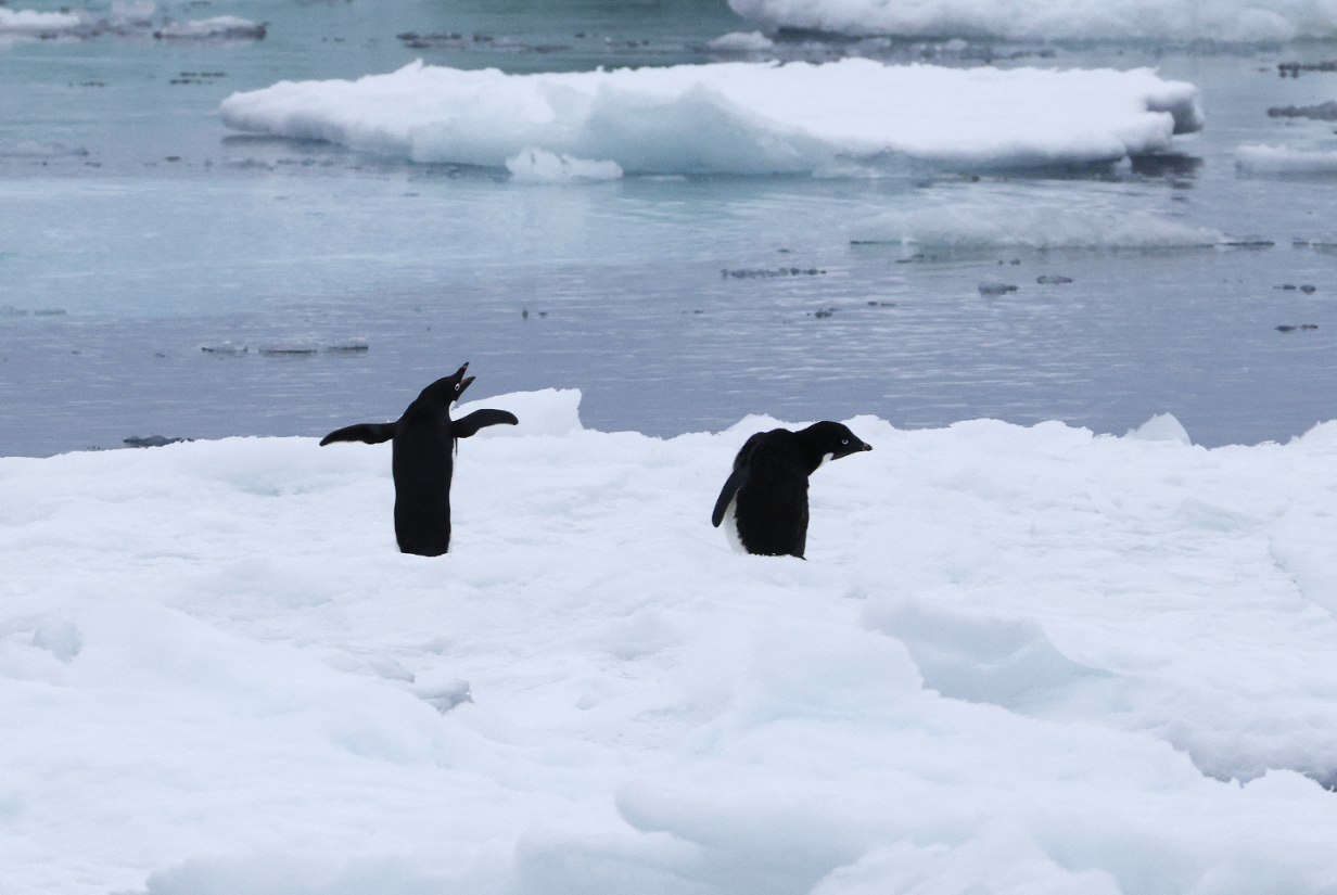
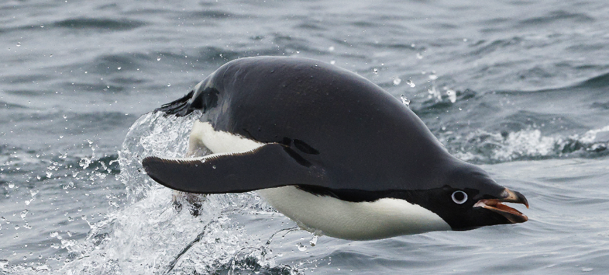
Adelies porpoising! Or maybe we should say that we have seen porpoises penguining. Anyway, they did this a lot, all around the ship during landings and elsewhere and elsewhen, for lots of reasons: at least to get a good breath of air, to see around them, perhaps -- in other circumstances -- to avoid and confuse predators, and just to have fun. So what is this gigantic ... thing ... that brings so many ... people ... including that dude taking pictures (wuzzat?) on the (what shall we call it?) balcony?
Note that they almost always have their beaks open when they ..... penguin.
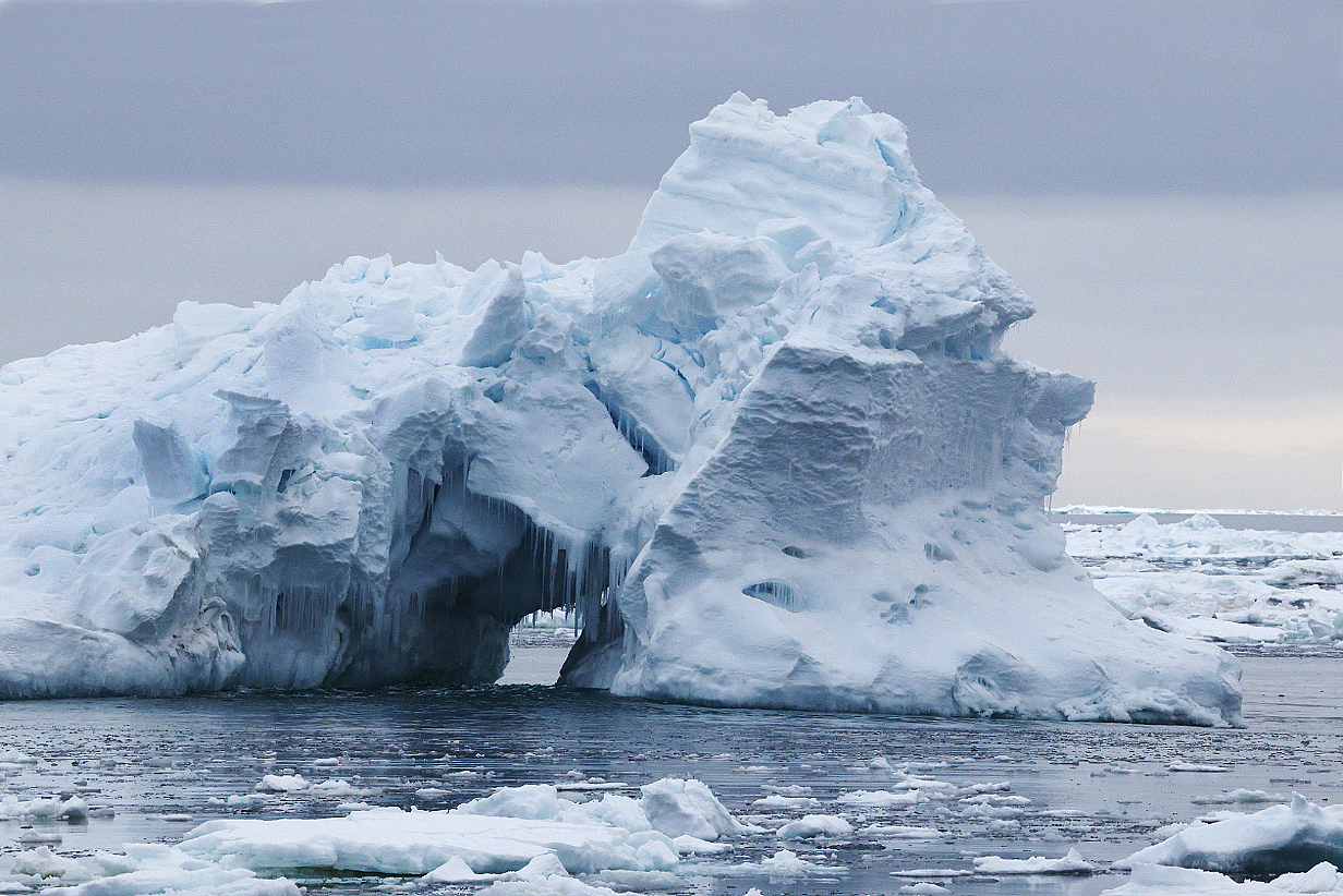
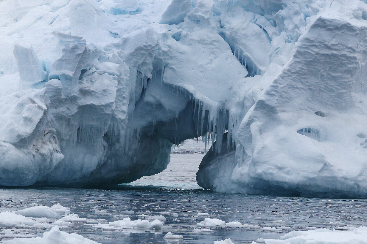
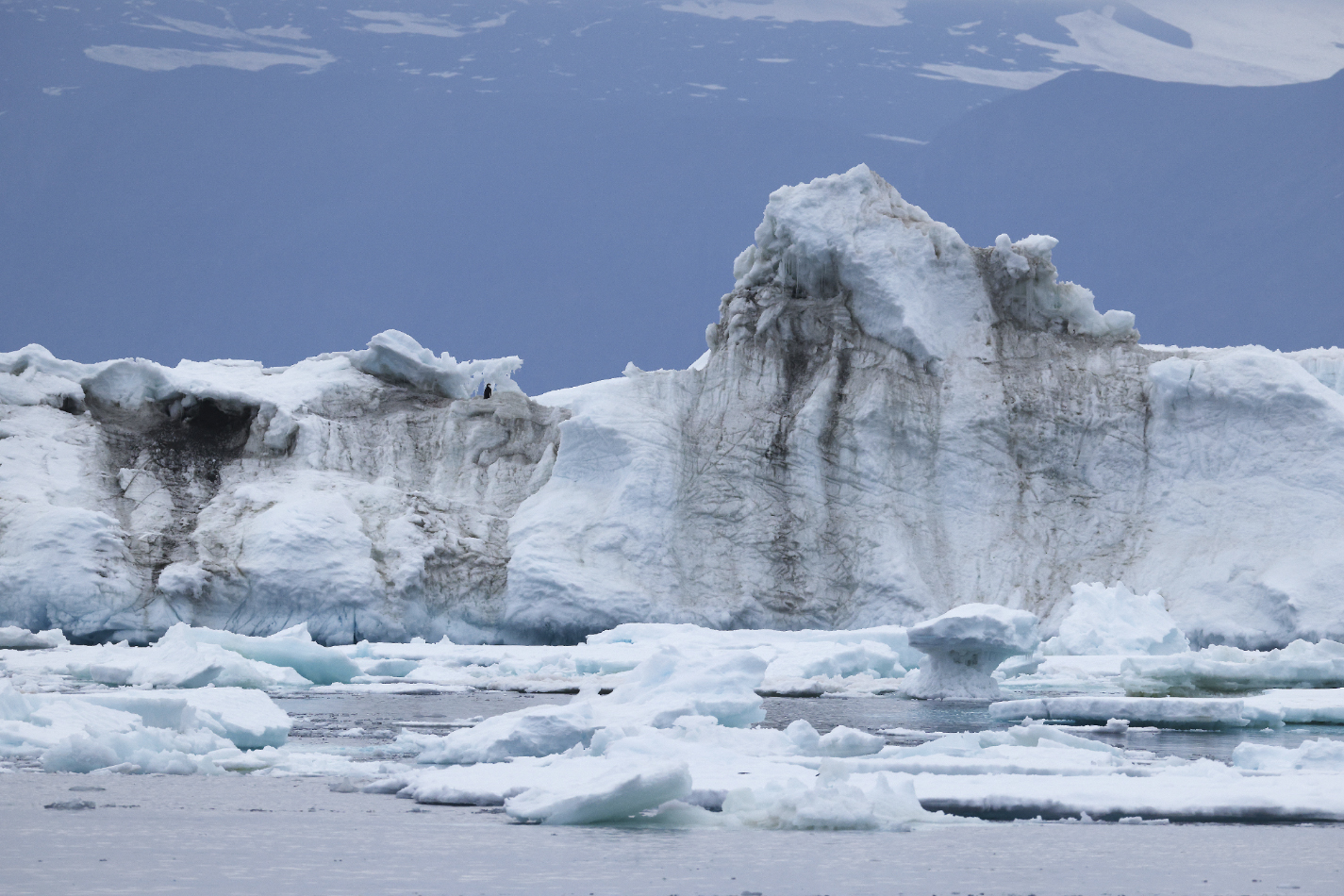
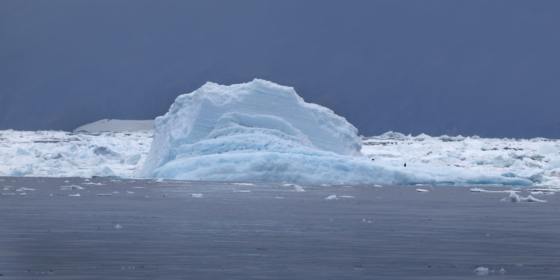
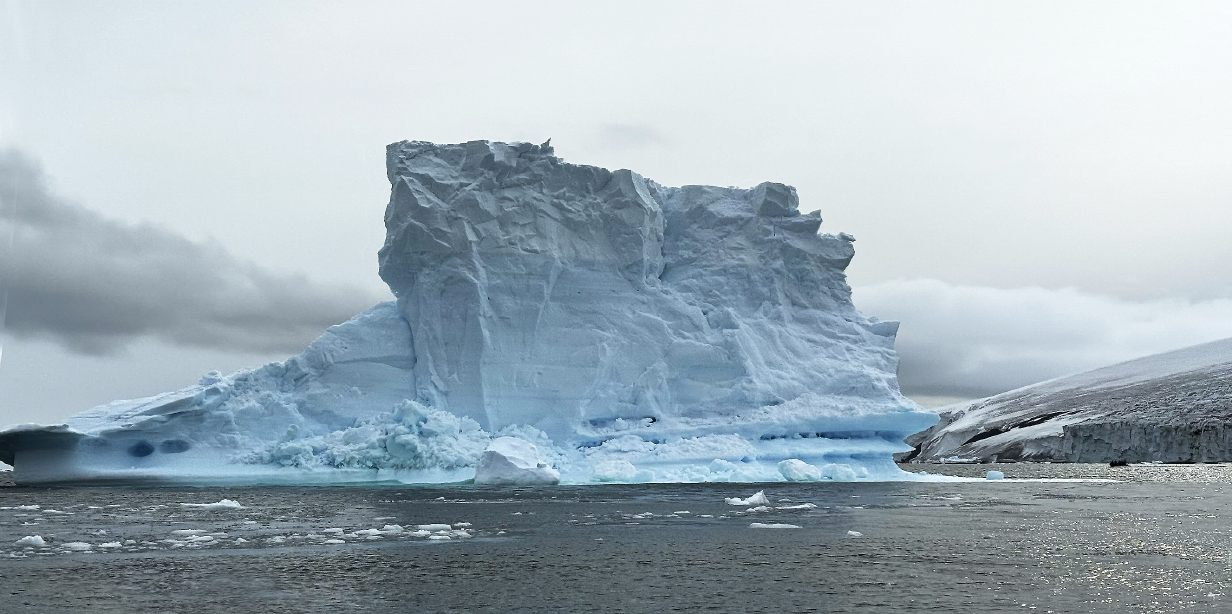
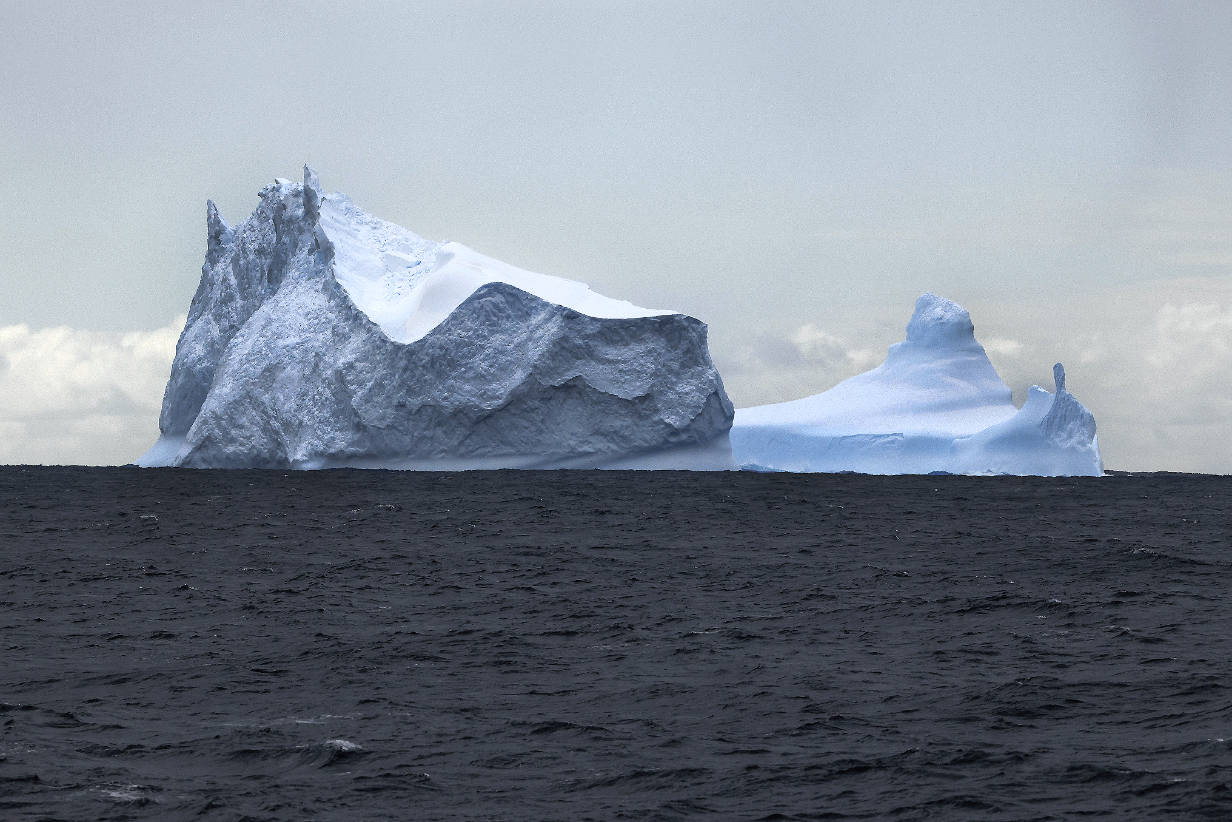
In the evening after supper, we started to sail away, first north and east to get past Cape Adare and then southward toward McMurdo Station. Close to the coast, we started to pass icebergs that put on a 3-D art show of their own. I will include only a few in these pages, starting with the one above.
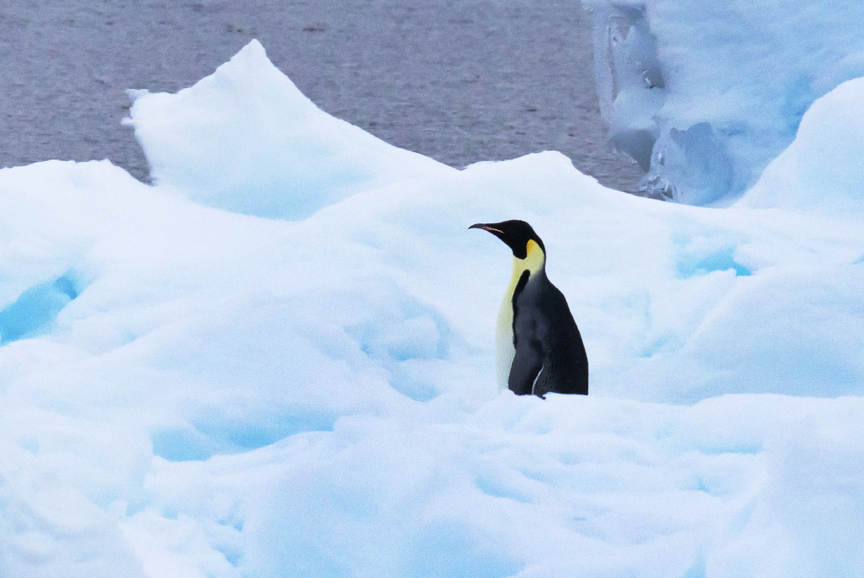
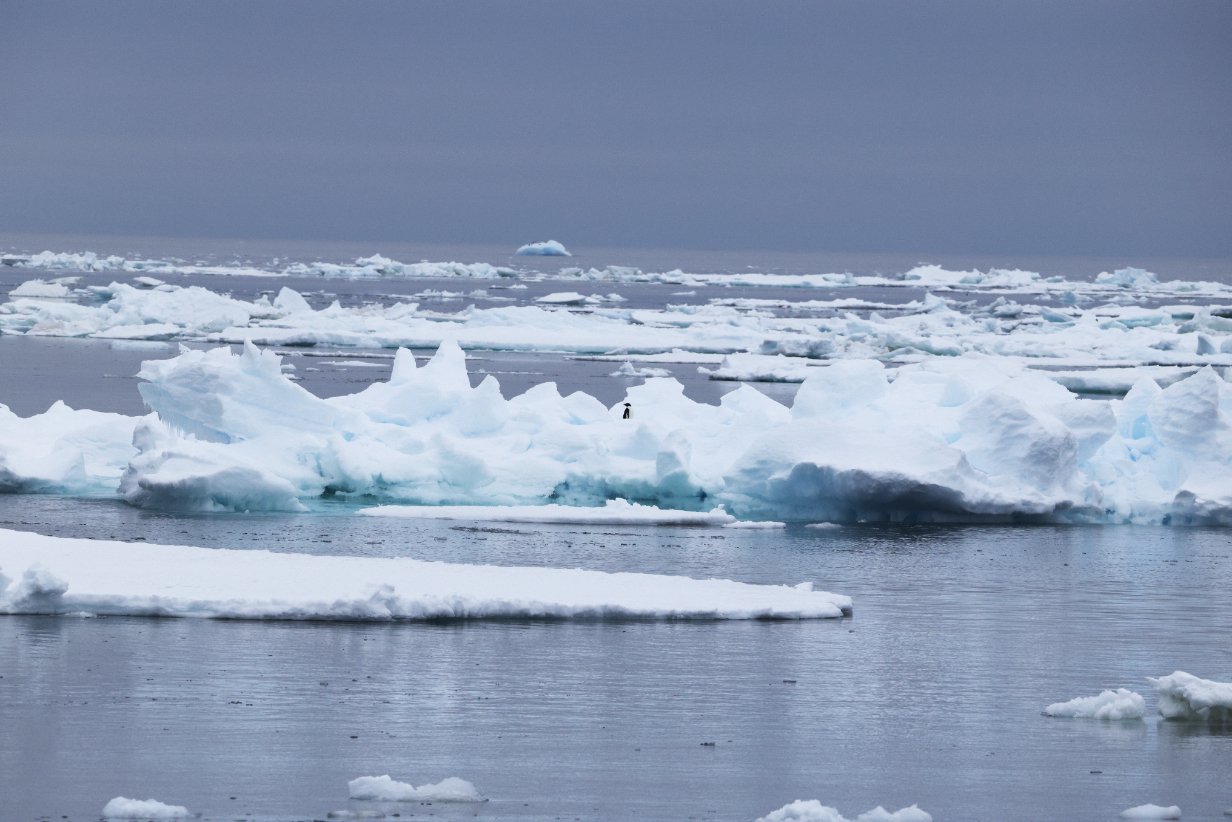
Emperor penguin ! This is my 9th life bird and surely the most wanted bird of the trip. It was a substantial jackpot to see it on an ice floe about 15 minutes after we passed the above iceberg. It was announced from the ship's loudspeakers: "This may be the only one that we see during the trip ... or it could be one of thousands." Safest to see it early, and a delight to discover it on my own, before it was announced.
As it turned out, we saw only one more Emperor penguin near the start of the Cape Bird zodiac cruise on January 29th. That bird was so far away that I did not get a useful picture. So it turned out to be very lucky that I got the above bird today.
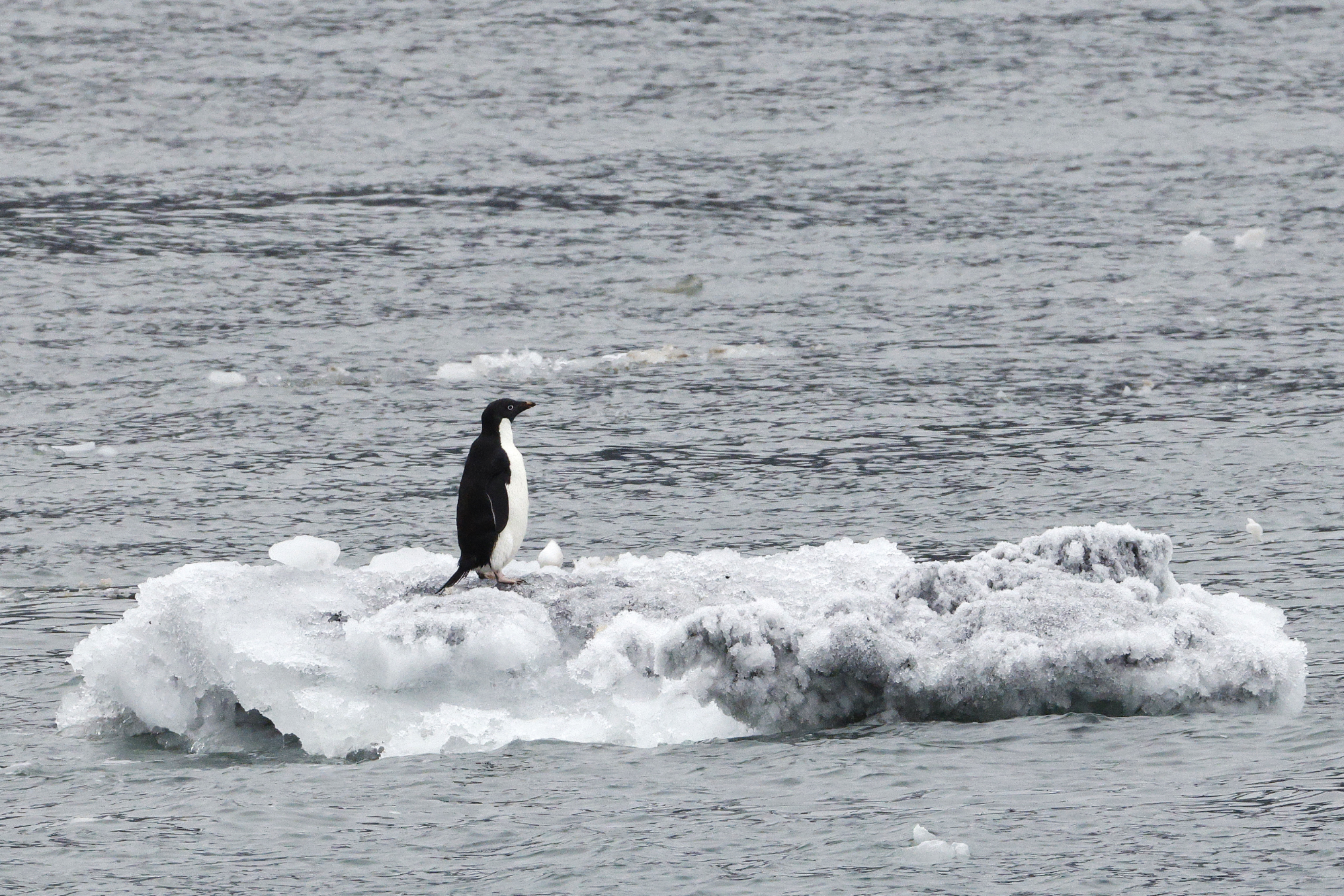
A lone Adelie penguin in the vastness of sea and ice
Actually, it was far from the only one. I say maybe 50 Adelies, some single or in pairs and others in groups of a dozen or more, on many different icebergs, as we sailed farther out into the Ross Sea.
Adelie penguins on ice floes and ice bergs
January 27, 2026: At Sea Sailing South Along the West Coast of the Ross Sea, Antarctica
January 28, 2026: Cape Royds and Cape Evans, Ross Island, Antarctica
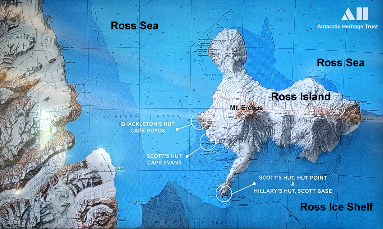
Today, we made two stops at Ross Island in the SW corner of the Ross Sea. The purpose was to allow visits to the Shackleton and Scott huts, used by those respective teams for overwinter stops. Dominating the island physically and this web site psychologically is the active volcano Mt. Erebus. This map was shown at ship's briefings and comes from the Antarctic Heritage Trust, which oversees the restoration of and safe visits to the huts and other historic and natural sites in the area.
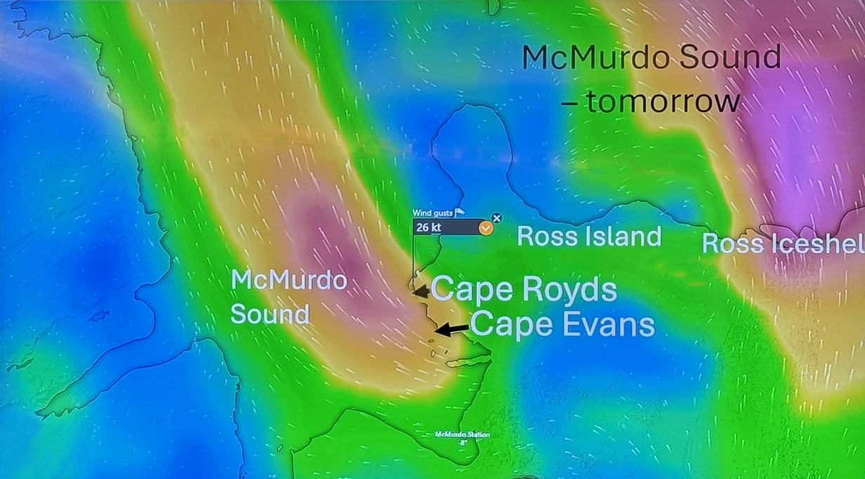
Here's the problem with today's landings: The rules for protecting historic sites in Antarctica are necessarily strict. They and weather conditions together created a situation that was dangerous for me. Today was forecast to have significant katabatic winds off the continental ice sheet; last night's Windy.com prediction (above) was for 26 knot winds at the Shackleton and Scott hut sites. The temperature was expected to be about -3 to -5 degrees C. Wind chills would be substantial. And there are rules that there cannot be more than ~ 40 people in the protected areas at a time, and only 8 people are allowed in a hut at one time. The ship budgeted 8 minutes for a person to see a hut. Last night's prediction therefore was that one person who visited one hut would spend about 1.5 hours doing each landing. Given the above conditions and the fact that I was already fighting a cold (with reasonable success in normal freezing conditions and with 1/2 hour outside at a time), I thought that I should not attempt today's landings.
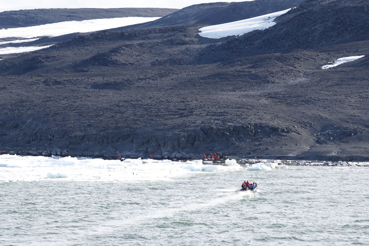
Landing site for the Shackleton hut excursion
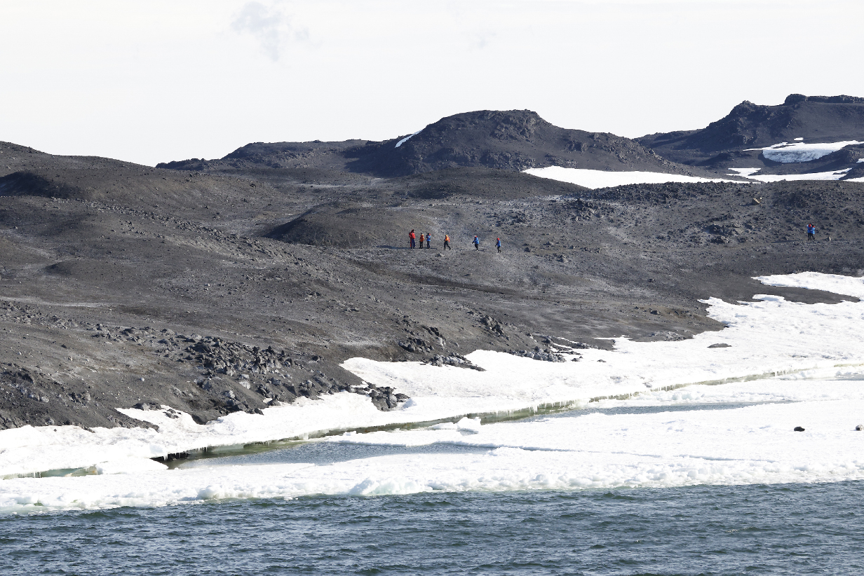
In the event, conditions proved to be both worse and better than predicted. The wind was a little less bad, maybe 15 knots -- still brisk. But ice forced us to land rather far from the Shackleton hut. When ship's crew estimate the walk as 1/2 hour for hardy Australians, I am sure that it would take longer for me. It looked to be more than a mile, up over the ridge shown above. Moreover, the walk was very exposed, up an unprotected slope facing the wind. (South is to the right, in the above picture.) So I skipped this landing as unsafe ... even though I have retraced bits of Shackleton's expeditions in previous trips and would have liked to see this early stop. A few published pictures (not mine!) are shown below for completeness. I meanwhile concentrated on the natural scenery, which tends to be my main interest anyway. And that was dominated by Mt. Erebus, below.
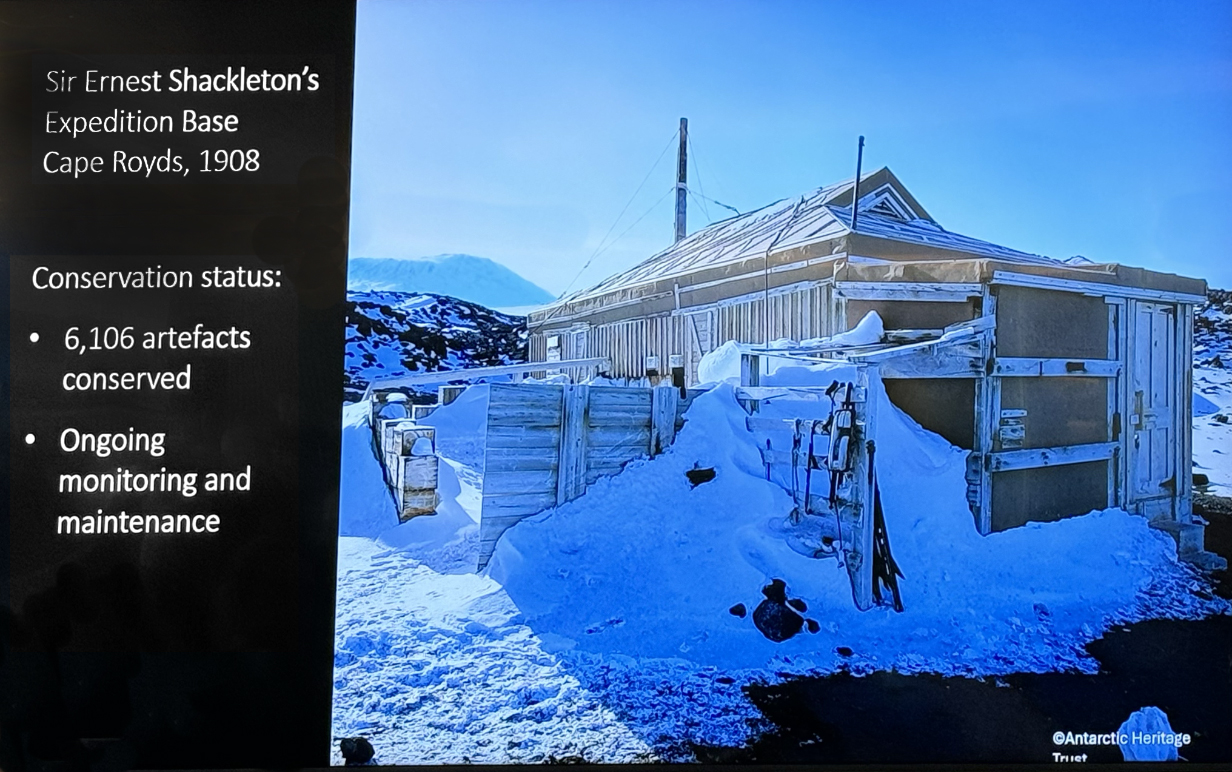
AntarcticHeritage Trust pictures of Shackleton's hut as presented during ship briefings
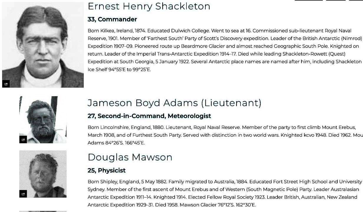
One more detail is worth emphasis: From this web site, these are the first 3 listed members of the 1907-1909 British Antarctic "Nimrod" Expedition. Led by Ernest Shackleton, it aimed to be the first to reach the South Pole. They fell 97 nautical miles short but set a new "farthest south" record at latitude 88° 23' S. They used the Shackleton hut as their base. They discovered the route up the Beardmore Glacier onto the Antarctic ice plateau. Douglas Mawson was among those who reached the South Magnetic Pole and made the first ascent of Mt. Erebus. Our Aurora ship is named in honor of Douglas Mawson.
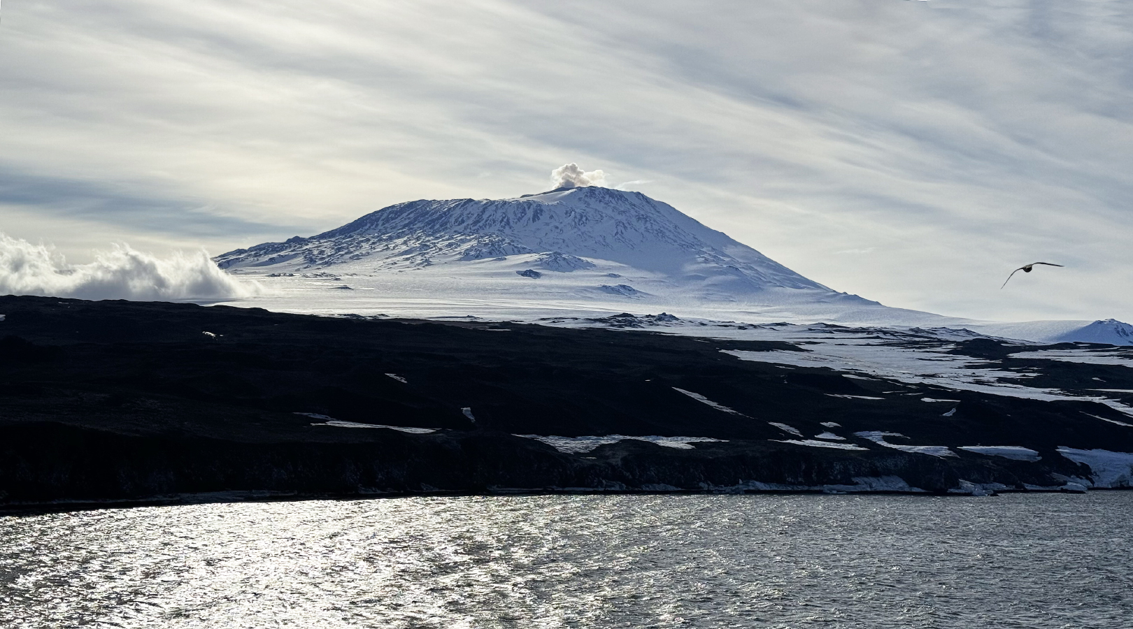
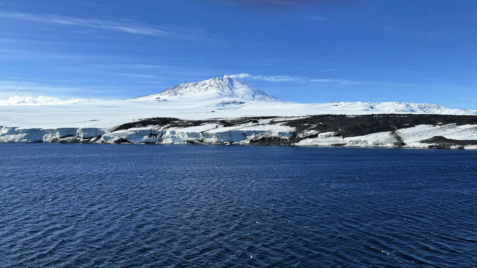
Mount Erebus backlit by morning sunlight as seen from Cape Royds, Ross Island. Mt. Erebus is the southernmost active volcano on Earth and puffed gently all day. Wikipedia tells us that it is 3,792 meters = 12,441 ft high. Erebus is the second most prominent mountain in Antarctica after the Vinson Massif, 4,892 meters = 16,050 ft high, far away, inland of the Antarctic penninsula. It is the second-highest volcano in Antarctica after the dormant Mount Sidley. It is the highest point on Ross Island, which also has 3 three inactive volcanoes: Mount Terror, Mount Bird, and Mount Terra Nova. Mt. Erebus is a "polygenetic stratovolcano"; i. e., the bottom half is a shield volcano and the top half is a stratocone. Note how the upper part of the mountain has substantially steeper slopes than the shield volcano of (e. g.) Mauna Loa and is more like the explosive volcanoes Mt. St. Helens (before its 1980 eruption) and Mt. Rainier. Erebus has a 500 m to 600 m wide and 100 m deep summit caldera including a persistent lava lake ~ 250 m across. Characteristic eruptions are Strombolian, from the lava lake or from subsidiary vents in the volcano's inner crater. Today's puffing was mild.
The bird, inevitably, is a South Polar Skua.
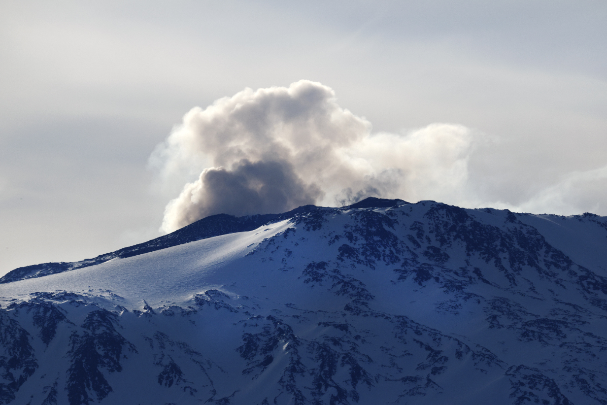
It probably didn't feel so mild from close up.
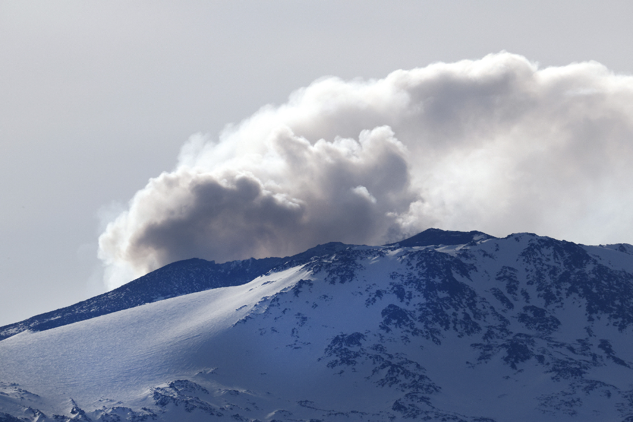
Looks like there were a few bigger bangs ...
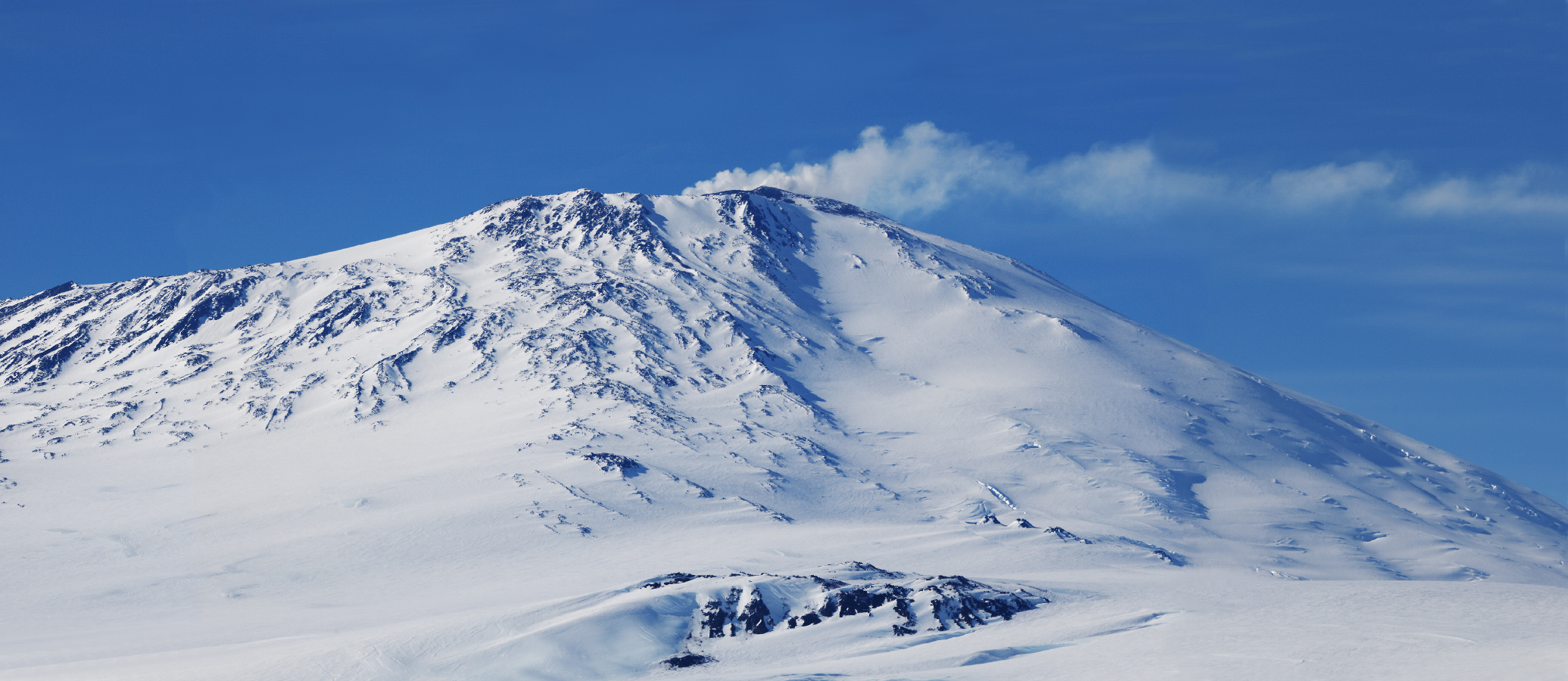
Mt. Erebus in afternoon sunlight, now from Cape Evans. Scroll right to see the full panoramas. Notice something very interesting: The plume of ash emitted by the volcano is being blown to the right. This is southward. In contrast, the catabatic winds blowing by us at sea level were blowing south to north, i. e., toward the left. Catabatic winds are famously a thin layer near ice and sea level. Only 12 and a half thousand feet up, winds are blowing in the opposite direction!
Our southernmost point of the trip, latitude 77° 47.386' south, was reached late in the evening of January 28th. For reference, McMurdo Station -- which cannot be visited -- is at 77° 50.73' south according to google.
January 29, 2026: Cape Bird, Ross Island, Antarctica
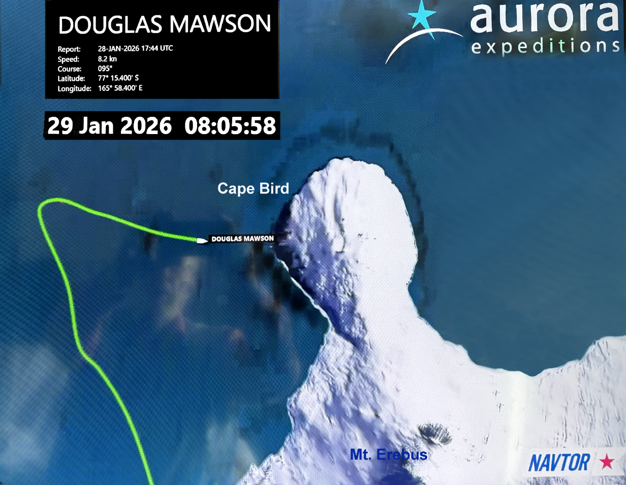
Today, I took a cold (~26° F), windy, and somewhat rough "birding zodiac" ride around Cape Bird at the NW corner of Ross Island. We started near the shore of the ship position shown above and "zodiaced" up to roughly the north point of Ross Island while the ship repositioned there. We say only 3 species, one distant Emperor penguin (no usable picture), a dozen or so South Polar Skuas, and thousands of Adelie penguins ... some of them as close as 20-30 feet when they "porpoised" around us in the water.
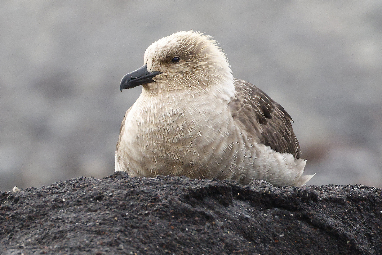
Penguins are the star of the show at Cape Bird. But where there's food, there are predators. South Polar Skuas are elegant and ferocious birds. Here, they are very "blonde", as compared to the darker brown birds on the Antarctic Penninsula. At this time of year, around the periphery of the nesting colony, they are relaxed and well fed.
An Adelie penguin outstanding in its field -- ichthyological culinary arts
One more good profile view ...
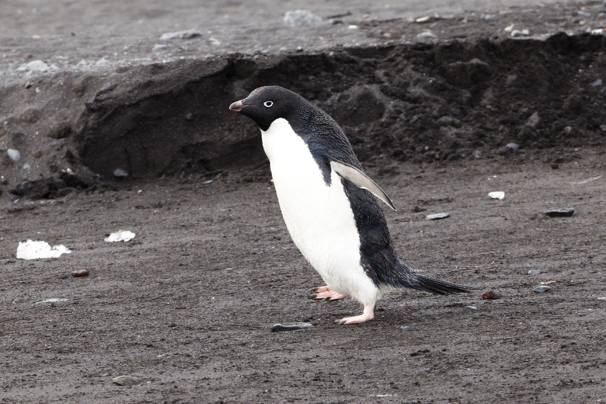
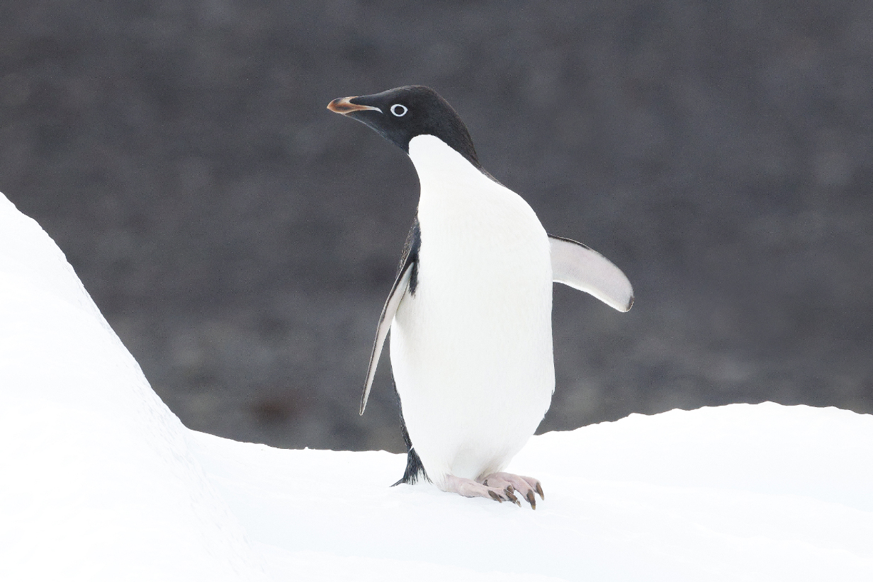
This is one of the best pictures that I got of an Adelie penguin from the far-away moving zodiac. Unlike some other penguins, Adelies are agile and good at running.
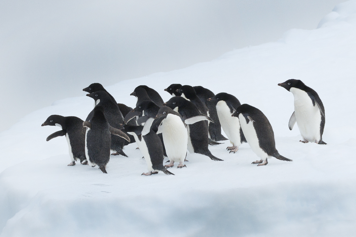
Adelies are gregarious and often congregate in tight little groups.
Brown, still downy-feathered juveniles often gather in creches until they finish moulting and go to sea.
Adelie chicks in different stages of moult to adult plumage. Ogden Nash said, "When they're moulting, they're pretty revolting." Actually, they are seriously cute.
Three Adelies -- two adults and a juvenile, in the back, who has not finished moulting his "cap"
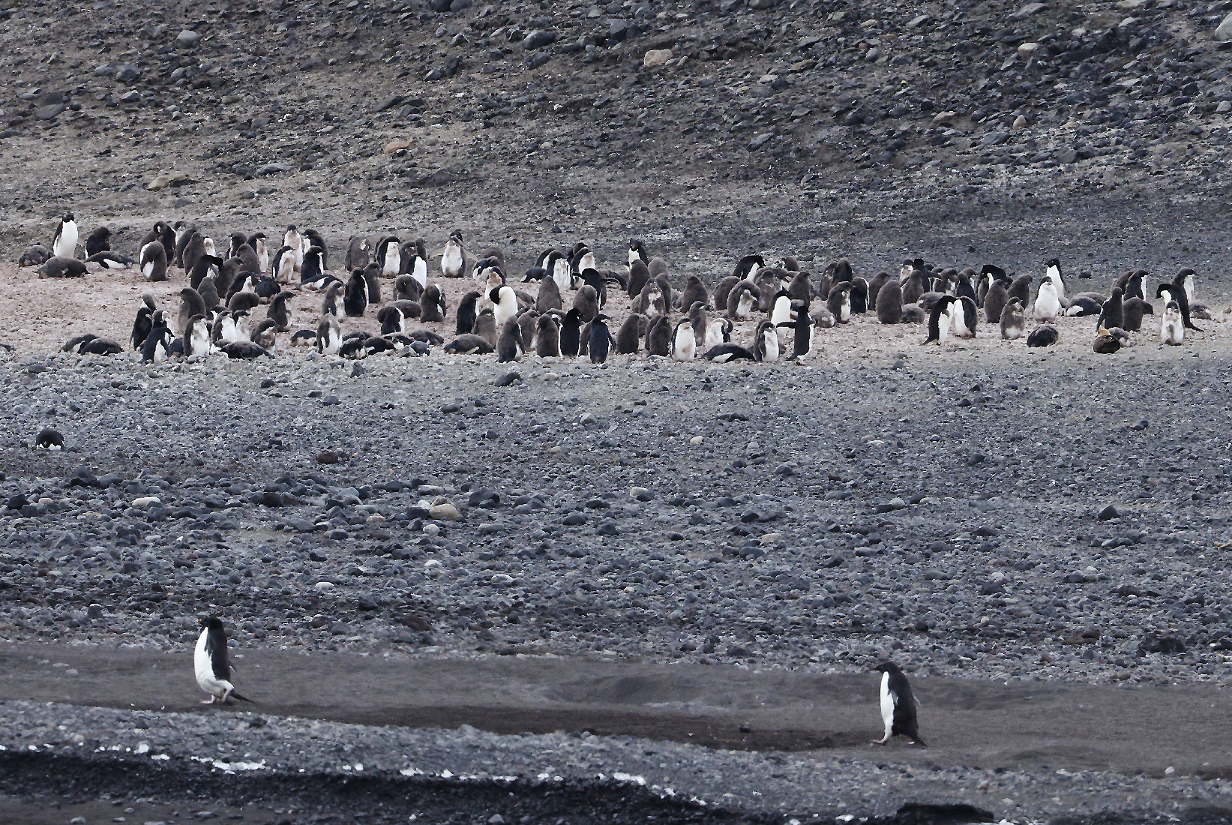
Thousands of Adelie penguins in this breeding colony. Note again the creche of young birds in the middle distance: they have not yet moulted from their brown downy feathers into adult "tuxedo" plumage.
Panorama of much of the Adelie nesting colony showing its relationship to nearby glaciers: these are illustrated in more detail below. Scroll right to see it all. The zodiac ride started out most of the way to the far right. The tabular iceberg shown below is just outside the present panorama to the left.
About 40,000 to 60,000 pairs of Adelie penguins nest at Cape Bird on Ross Island.
As we continued to zodiac our way around the north end of Ross Island, we started to approach the Ross Ice Shelf and the Adelie colony gave way to (here: pretty fragmented) glacier. At this point, the zodiac ride ended and we headed back toward the ship. One the way, one more surprise delighted us, close up:
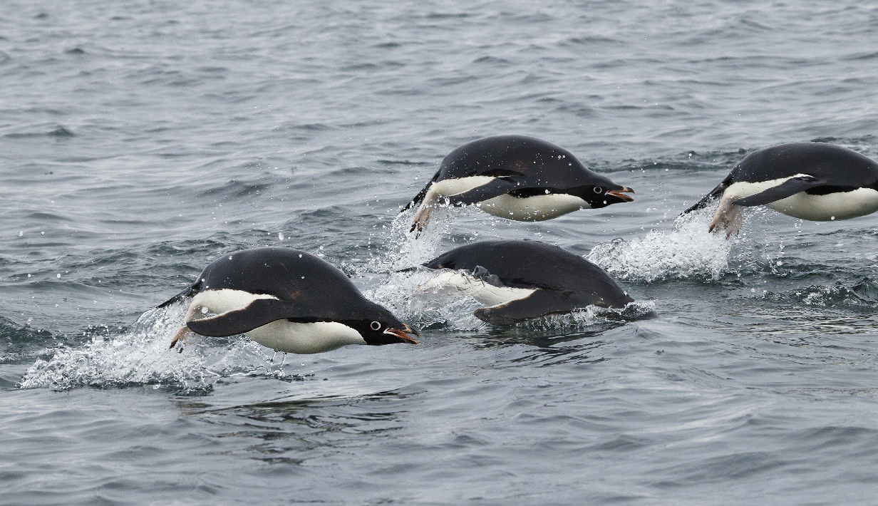
Adelie penguins were sometimes all around us, giving fleeting, great views. It is not easy to focus on and photograph a penguin that erupts out of the water in places and at times that are hard to predict and surely for less than a second. Hard, but satisfying, when -- once in a while -- it works.
We saw lots of big tabular icebergs while we were still north of the Ross Sea, but this smaller one is one of the few to which we got close during this trip.
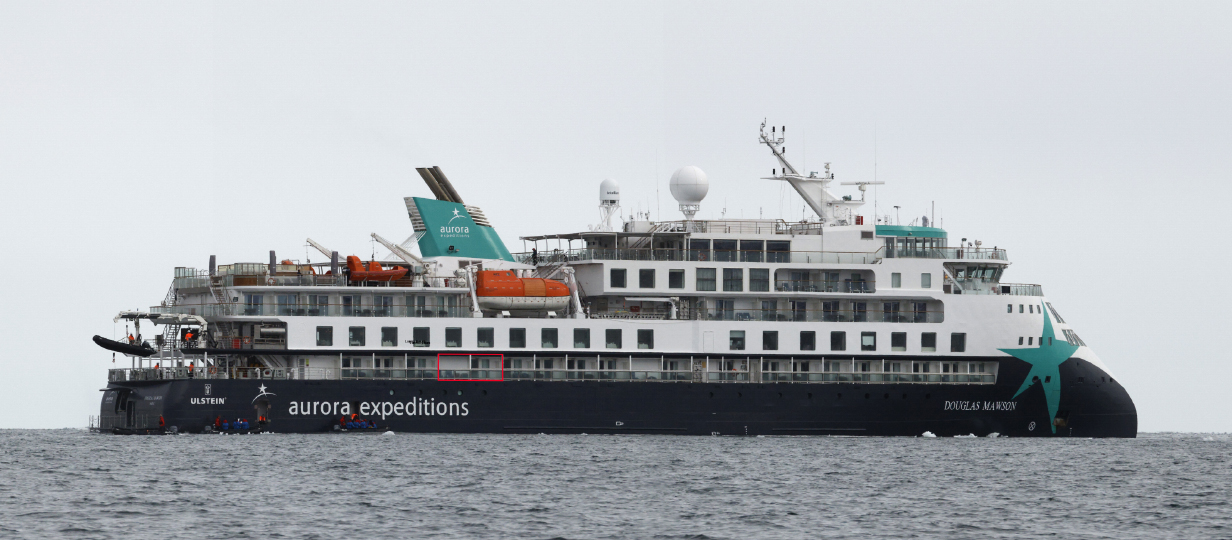
Douglas Mawson at the end of today's zodiac ride. As noted earlier, the red box outlines our cabin 429 balcony.
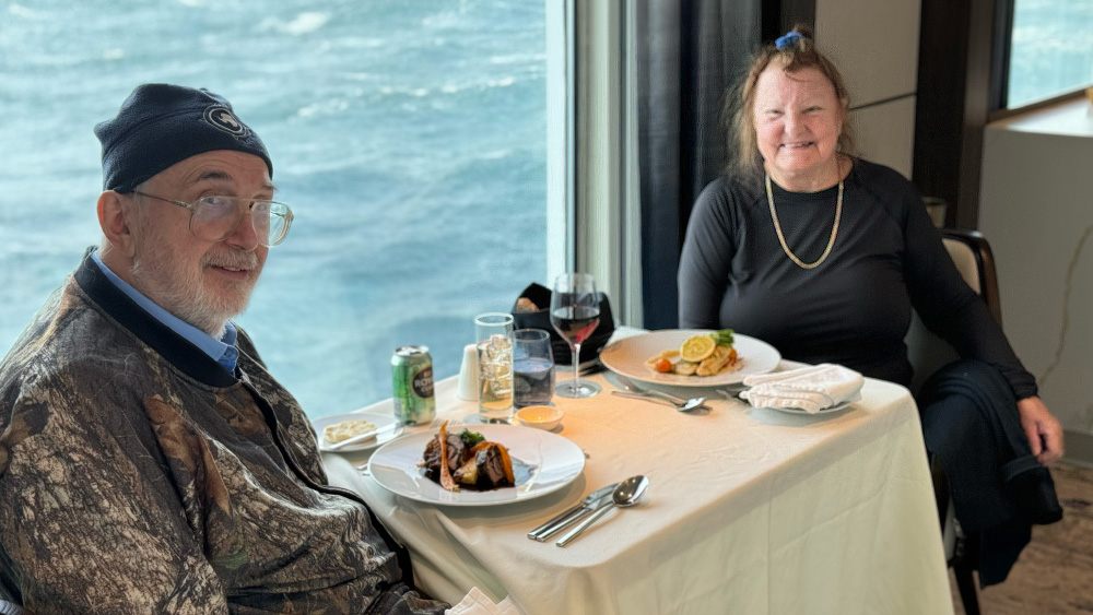
Dinner aboard Douglas Mawson on January 29, 2026. Apologies that Mary is out of focus. This turned out to be our last dinner in the southern Ross Sea. Given dangerous weather conditions, the captain and expedition team decided overnight to give up on the Antarctica part of the trip and to sail north in the coming 4-5 days to Macquarie Island and possibly a stop in the far south of New Zealand. The reasons are described below. Dinner tonight was characteristically excellent.
January 30, 2026: At Sea Sailing North Out of the Ross Sea
During the night, waves were pretty adventurous. Sometimes it was hard to walk across the room. Partly, this was due to the necessity to withdraw the ship's stabilizers, which could be damaged if we hit ice. By morning, the ship and expedition crew had decided to abandon the original plan for today, which was a ship cruise past Drygalski Ice Tongue. This is a roughly 30-mile-long extension of the David Glacier out into the Ross Sea. Its ice is 1000 or more feet thick, thickest near the grounding line, and most of it floats on water that is 2000 or more feet deep. Not surprisingly, it experiences major calving events and can vary in length. It would have been a worth while sight,intimately connected with the effects on sea levels of the melting of Antarctic ice. But:
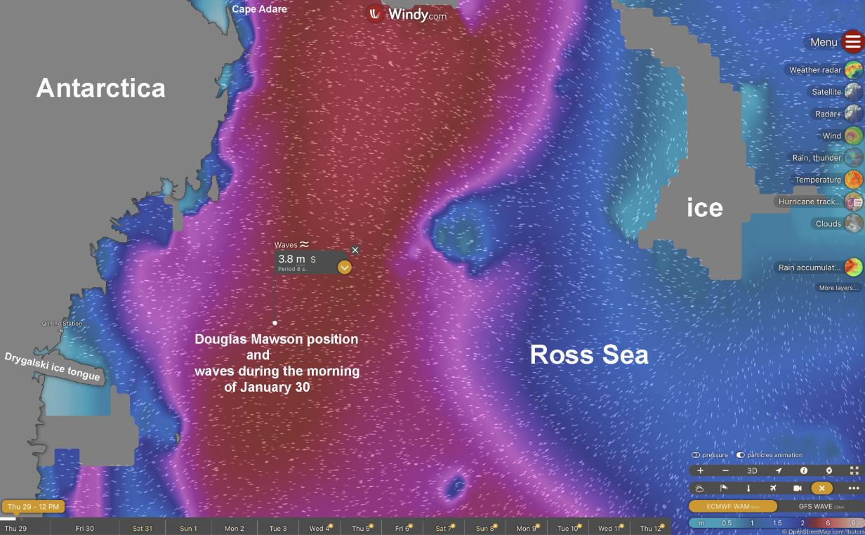
Windy Waves shows that wave sizes in the Ross Sea are challenging as of this morning.
Expedition leader Roger Kirkwood explained the plan during this morning's briefing. The big problem is that even the somewhat grim weather predictions fell short of reality: Sustained winds during the night were around 45 miles per hour, and gusts reached 80 miles per hour. These are not unusual for katabatic (gravity-driven) winds off the high-elevation Antarctic plateau down to the Ross Sea. Except for yesterday's excursion to Bird Cape, which was in the wind shadow of Mount Erebus, the winds have a long uninterrupted run up the west part of the Ross Sea and would drive 5-meter swells that hit our ship side-on if we went to the Drygalski Ice Tongue (left panel above). Moreover, the danger of hitting chunks of ice would make it unsafe to use the ship's stabilizers. So the captain gave up on Drygalski Ice Tongue in the middle of last night. The alternative of making a run straight north (middle panel above) would result in the swells hitting the ship from behind, which would be better, but this close to the coast, there is more ice and the passage through the slowly melting ice barrier at the top of the Ross Sea would again put the stabilizers under threat. So the decision was made to take the route in the right panel. Waves might be similarly high, but at least we could mostly use the stabilizers. As I write this at noon on January 30, the swells are adventurous, and sometimes our balcony gets whacked full-on with a big wave. But the stabilizers are working, and the ship is more comfortable than it was during the night. We are in neither case in danger of getting sea-sick. But it is nice to be comfortably rocked and not have to crash into walls when we try to walk around.
The danger is that we could easily have 3-5 foot swells at Macquarie Island, which may prevent landings. But we may also gain a day. So the bad news is that we don't get to experience so much of Antarctica. In the event, I did not set foot on the continent this time -- my planned landings were abandoned in favor of zodiac cruises. We did not get to see spectacular mountains apart from Erebus. We did not get to see spectacular glaciers or, close up, the remarkable Ross Ice Shelf. But we may get more chances for new birds at Macquarie Island and maybe -- if I am lucky -- even at Snares Island.
Anyway: We cannot argue with katabatic winds or with Antarctica's sometimes nasty weather. So I will concentrate on finishing the trip web site.
January 31, 2026: At Sea Sailing North Out of the Ross Sea into the Southern Ocean
The morning sail was adventurous, with 4 m swells and no ship stabilizer, given the danger of whacking ice. Stuff fell off of tables, closet doors banged open, and we occasionally crashed into a wall when the floor tilted. Around this time, we passed the above giant tabular icebergs which separate the Ross Sea from the ocean south of New Zealand. By evening, most ice has passed, although we still see the occasional berg. The ride has improved a lot. Windy Waves indicates that a drop in swell height to 2-3 m is coming tonight. By morning, we should be back into 4 m swells, hopefully with stabilizers keeping us comfortable.
Antarctic petrel later in the afternoon
Rare sight -- Antarctic petrel taking off after sitting briefly on the water
February 1, 2026: At Sea Sailing North Toward Macquarie Island
We continued all day in waters that gradually got less rough. Also, we have been using the stabilizers for some time now. We passed the Antarctic Circle going north at about 2-3 PM. I spent a total of about an hour on our balcony or on Deck7 aft looking for birds.
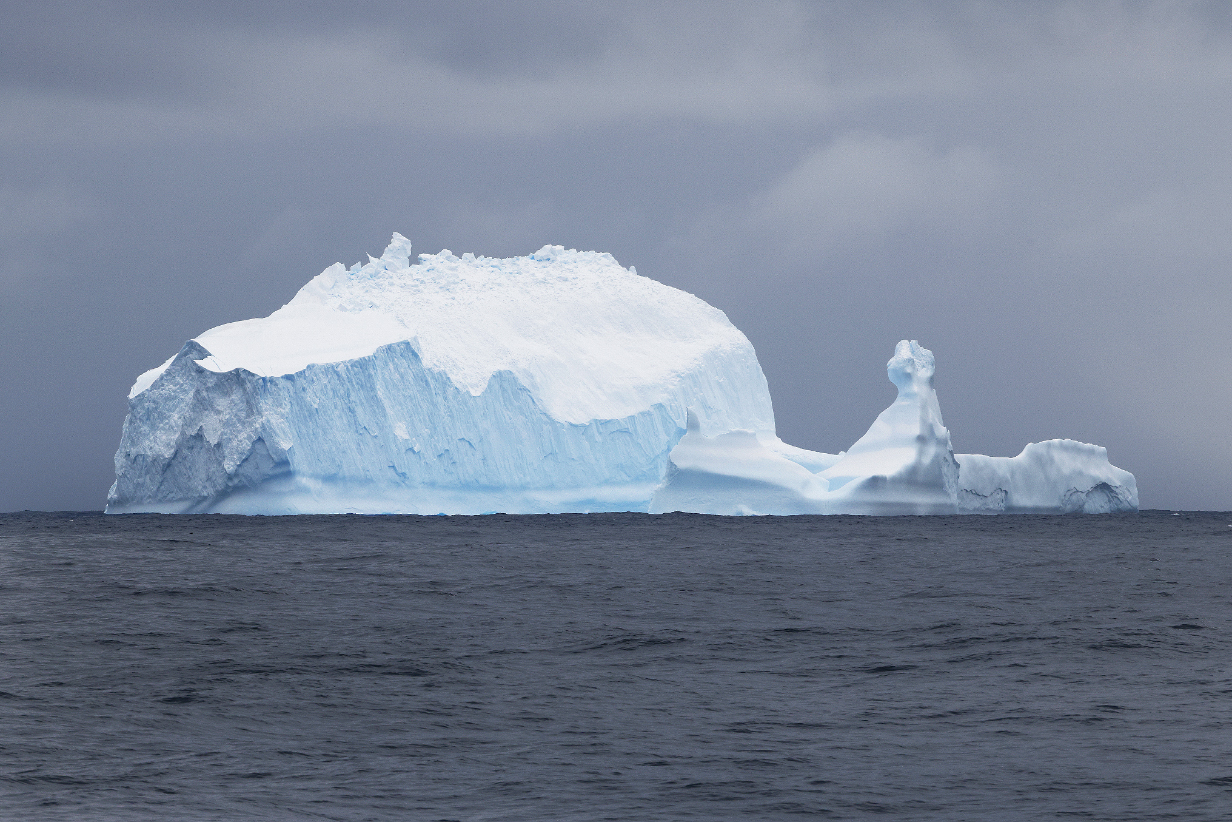
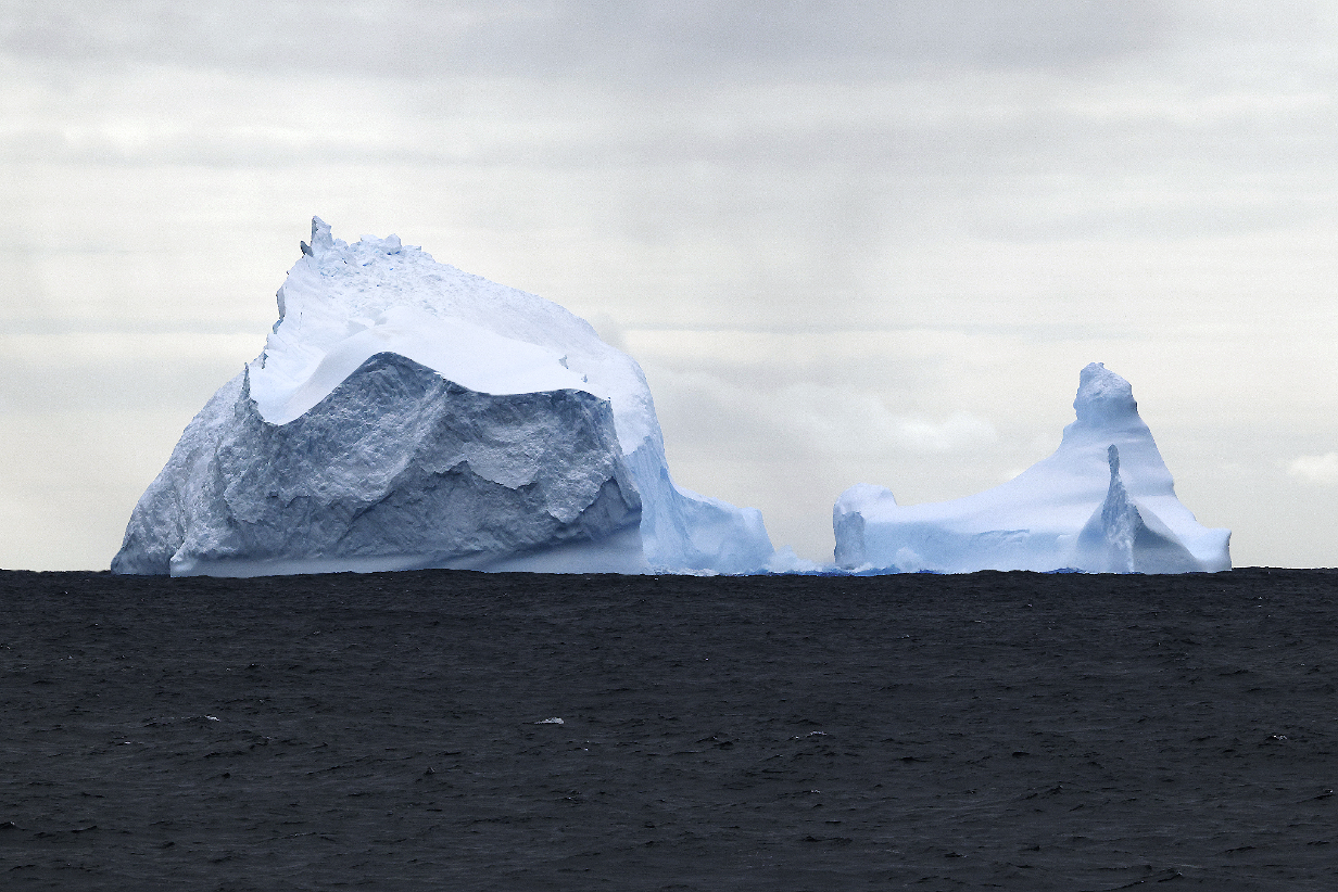
For a while, it looked like this "Neuschwanstein iceberg" would be the last major iceberg of the trip.
Southern fulmar have been surprisingly rare and hard to photograph. This picture is not sharp, but I include it to remind us of a bird that we like very much.
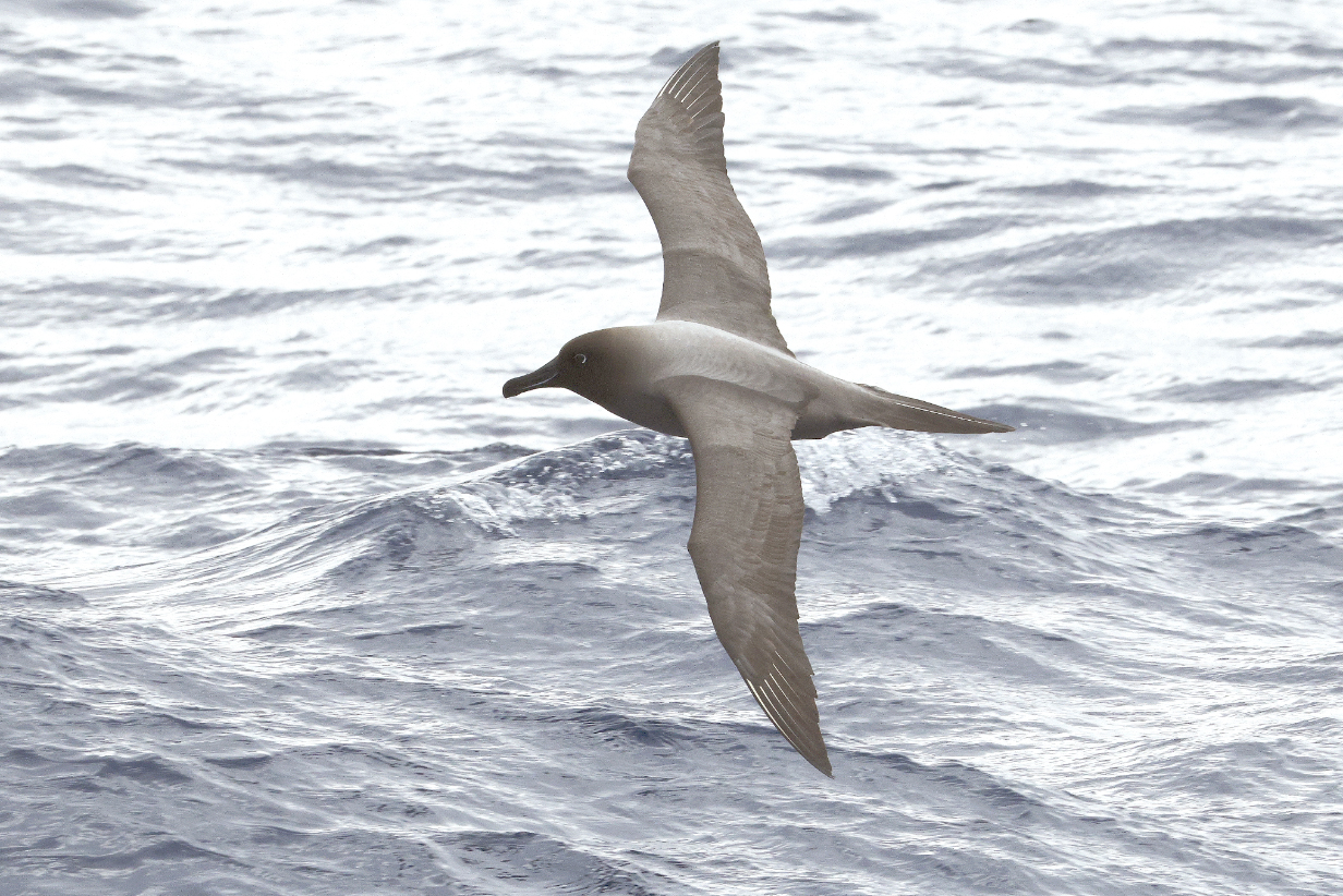
Light-mantled albatross was the most common bird this morning, often almost keeping pace with the ship and flying not far from our balcony. So Mary got her life bird today.
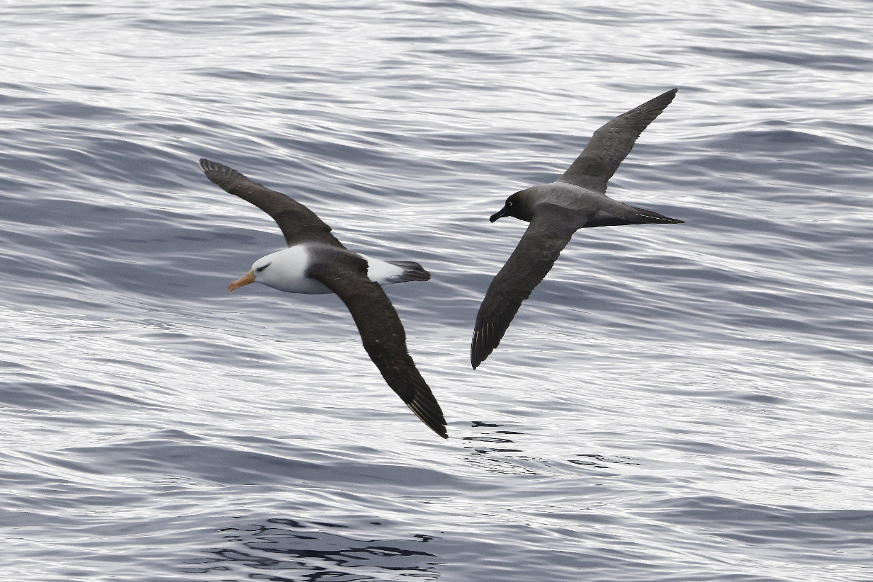
Around mid-day, the most common albatross switched from Light-mantled to Campbell Island Black-browed. Although both birds came by with some regularity all afternoon.
Campbell Island Black-browed albatross
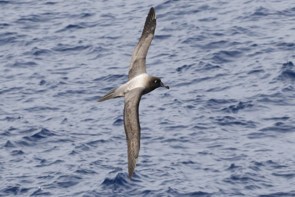
Light-mantled albatross looked much better in the afternoon, no longer backlit by the sun.
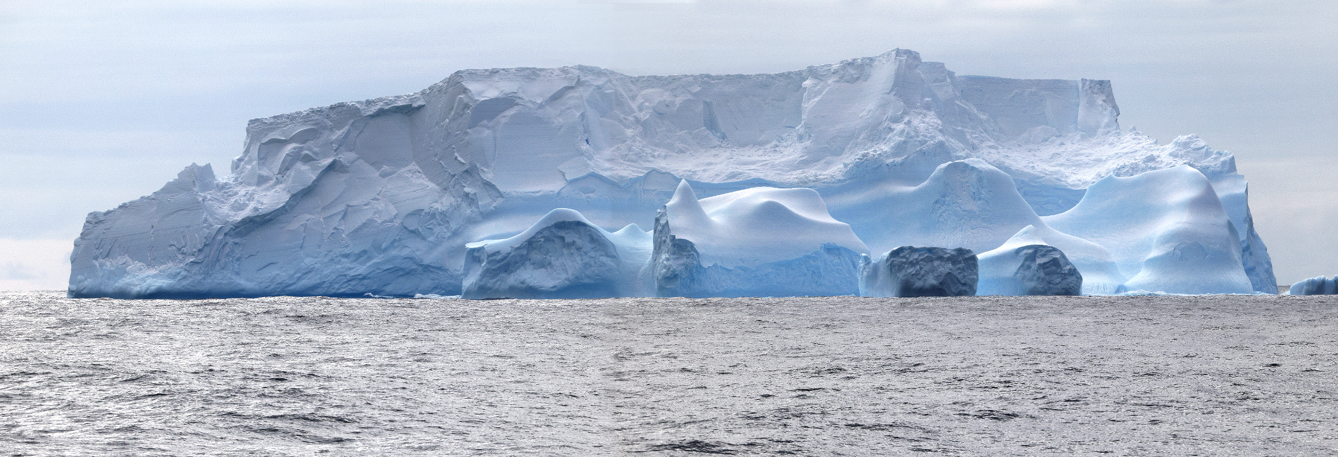
We again thought that this "mini-continent" iceberg" might be the last major iceberg of the trip. Scroll right to see the full panorama.
Of course, we were very wrong. The temperature was still around ~ 0° C. We continued to see icebergs for several more days. None were as photogenic and none came as close as these two.
February 2, 2026: At Sea Sailing North Toward Macquarie Island
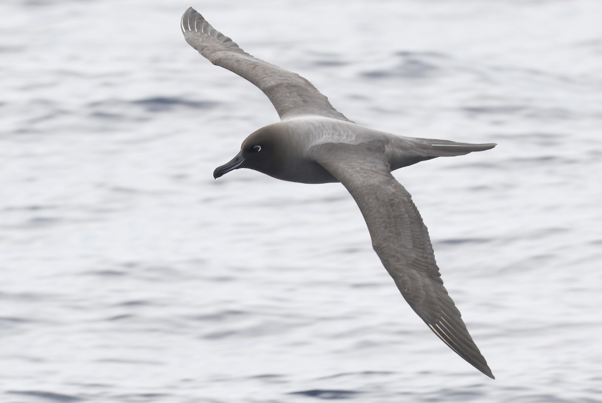
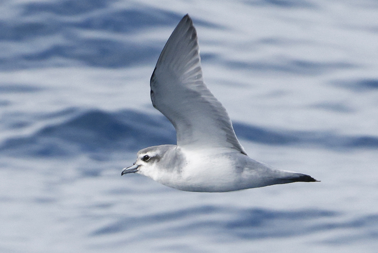
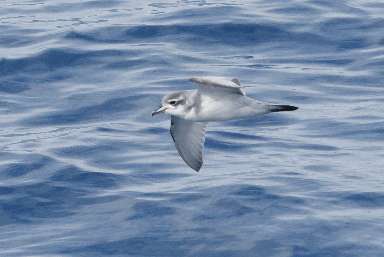
This was a day of quiet sailing in moderate seas with ~ 2 m swells. I spent more than an hour on our balcony, birding. Antarctic prions finally appeared, in large numbers, too. Plus I got one life bird:
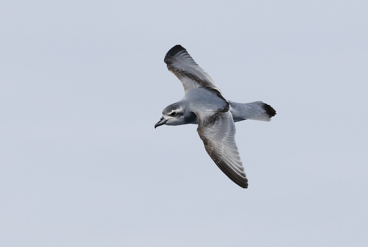
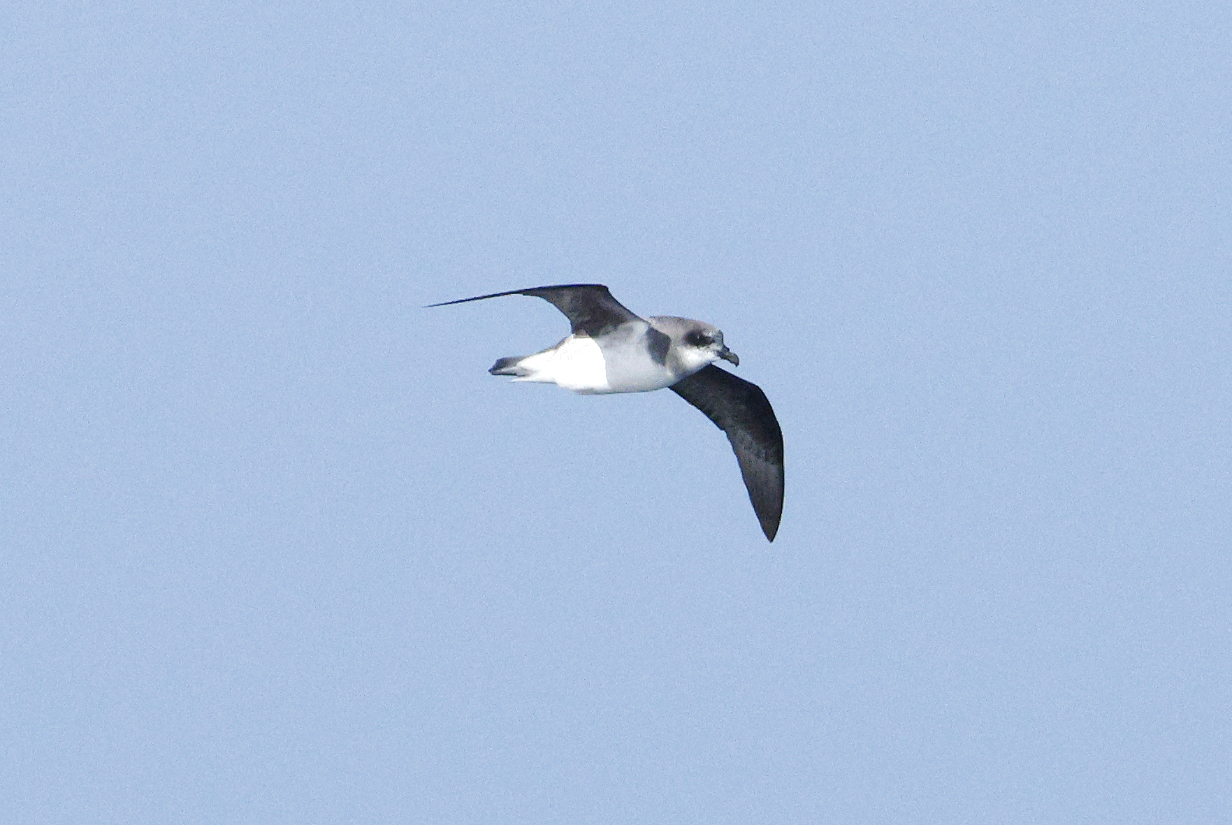
Prion 1: This is probably an Antarctic prion, but it may be a Salvin's prion. It has hints of a "handle-bar moustache", a bit like that on Prion 3, below. We were still in cold, Antarctic waters, with substantial icebergs visible, off and on, all day. We were about 1/3 of the way from the northern edge of the Ross Sea to Macquarie Island.
Prion 2: This was photographed just moments before the following bird. It has one of the clearest views of a bill that I photographed today. Note that the nail is clear and fairly prominent. The cutting edge of the bill looks almost straight. The white eye stripe is pinched at the eye, though not as much as on some other birds. Only the tip of the tail is black, clearly unlike the situation in the next bird. This looks to me like a standard Antarctic prion. In other words, it looks a lot like the birds that follow the next bird.
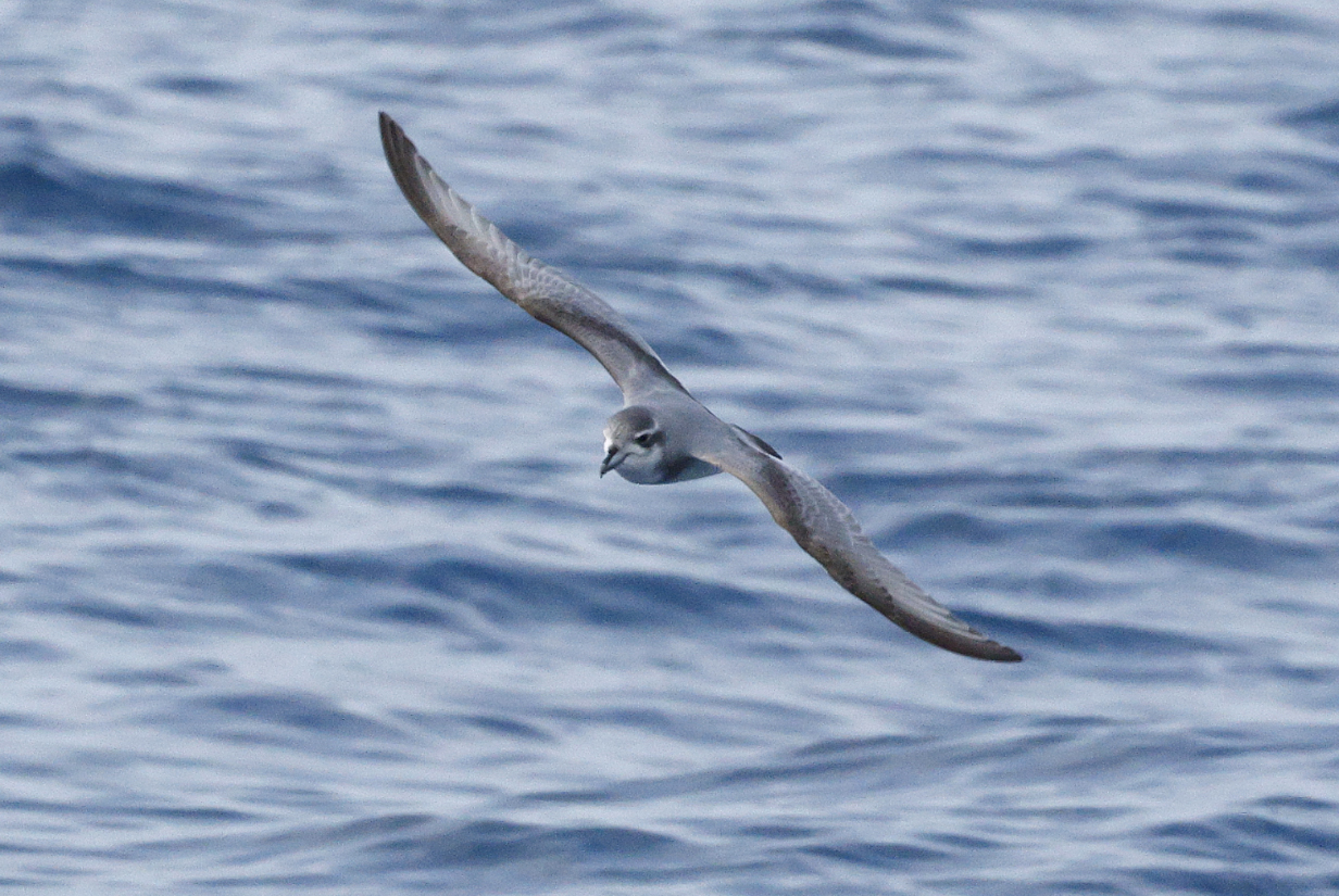
Prion 3: I think that this is Salvin's prion. The wide, S-sided bill is in stark contrast to the narrower bills of the many Antarctic prions that I saw today. But it is clearly not as wide as the suspected Broad-billed prions that I saw near peninsular Antarctica in 2022. Also, those birds had all-black bills. The two-toned (bluish-white and with black "edging") color seen here looks real, not an effect of weird lighting. It is said by many authorities to be most characteristic of Salvin's prion. I saw such 2-color bills in many birds today. I suspect that I saw several Salvin's prions, although this is the one about which I am most nearly sure. Note: In the above 2 pictures, the second one is more aggressively processed (e. g., sharpened in Photoshop). Necessarily, with 200-800 mm telephoto used mostly at 800 mm and with only moderately good lighting, I have to shoot at high ISO. This picture was shot at ISO 4000 with exposure time 1/2500 second at f/16.
I discussed this bird extensively with the ship's bird expert, to whom I am grateful for her care and finesse in trying to diagnose the prions that I photographed. She pointed out that the dark "handle-bar moustache" that is clearly seen in all 4 of the above pictures is characteristic of Salvin's prion. It is clearly seen in many of the 576 pictures of Salvin's prion that are posted by Cornell Lab's Macaulay Library. Also, note in the last of the 4 pictures of this bird (below) that the black in the tail of this bird is more extensive than that in pictures posted on ebird. Some of the Macaulay Library pictures show similarly extensive black in the tail. Our conversations supported the ID of this bird as Salvin's prion ... although I would be grateful for further judgment by pelagic birding experts. I would be grateful for email judgments sent to kormendy at astro dot as dot utexas dot edu or to kormendy at mpe dot mpg dot de.
If I am correct, then this is my 10th life bird of the trip.
This next picture was taken 2 seconds later than the above, so this is the same bird. The "nail" on the bill is much smaller than the biggest that I saw today; I gather that this is consistent with Salvin's prion. The "smile" in the bill is OK -- not as absent (straight biting surface to the bill) as in more extreme cases that I saw, which I assume were Antarctic prion. So I think that this picture provides a check of the above ID.
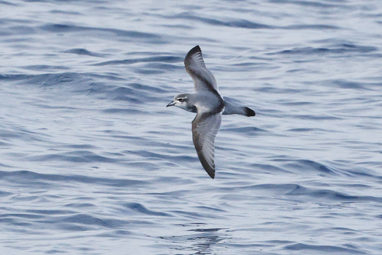
Salvin's prion -- still the same bird, about 5 seconds later: This shows the tail best. Potential issue: Lots of black in the tail. But see discussion above.
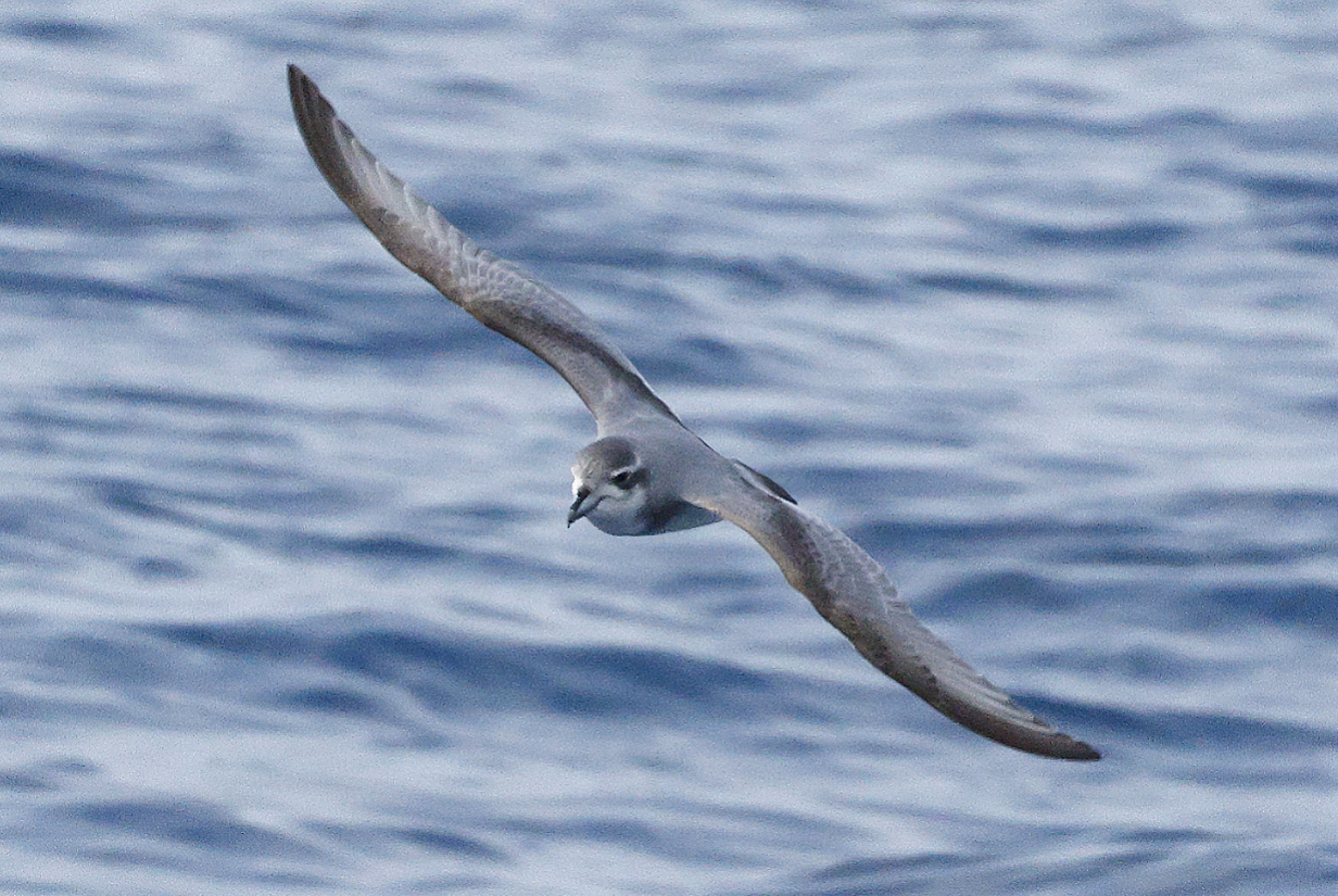
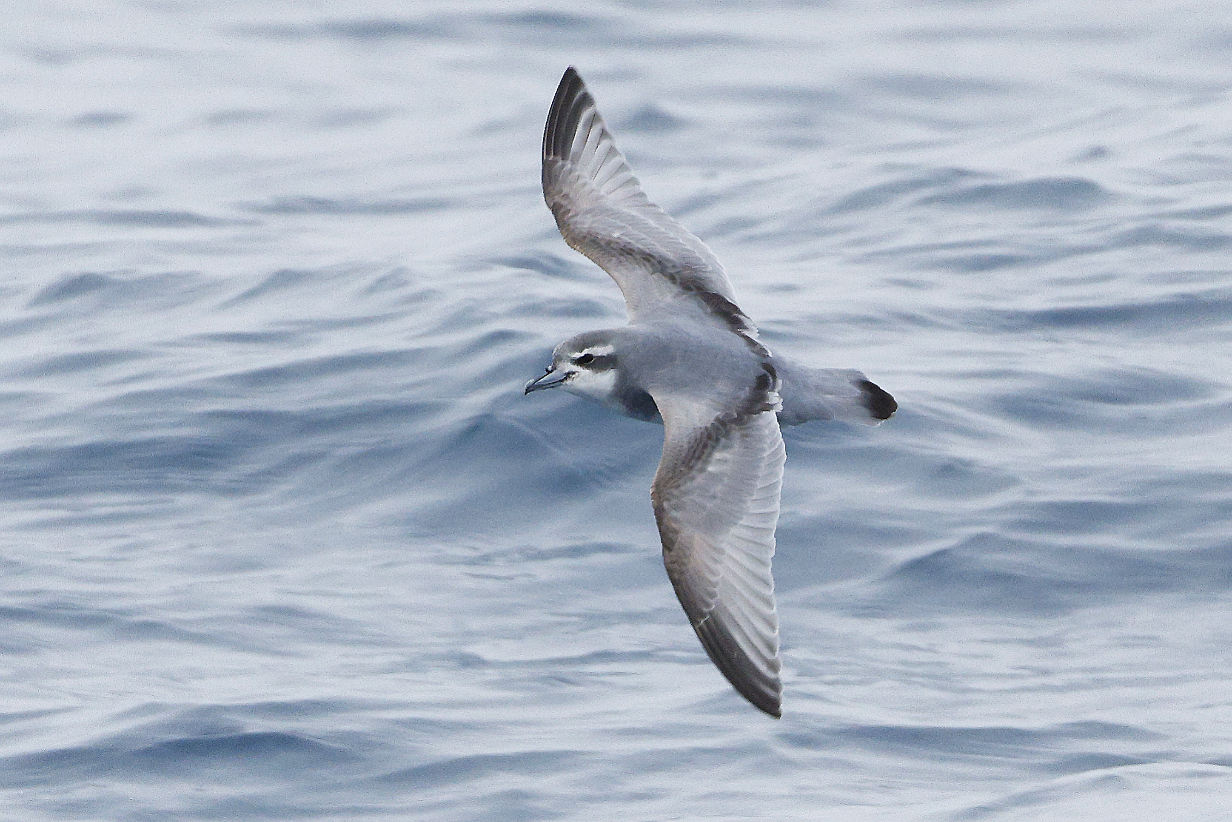
Prion 4: I suspect that this is Antarctic. The white eye stripe of this bird is completely pinched off at the eye ... but there is a hint of a "handle-bar moustache". Otherwise, this looks similar to the next birds.
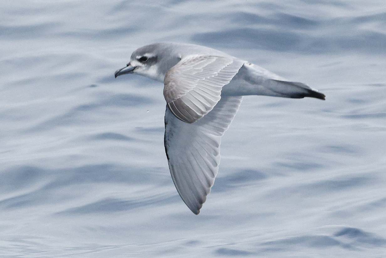
Prion 5: I think that this is Antarctic. It has one of the clearest 2-tone bills that I photographed today. Note that the nail is prominent (though not one of the longest that I saw later in the trip) and that the nose tube looks light, not black.
Prion 6: This was the last bird photographed today. The viewing angle is enough from the front to resemble that of the possible Salvin's prion above ... but the cutting edge of the bill here looks much more straight to me. Everything about this bird looks like a standard Antarctic prion. This includes the bill: it is conical, not S-edged, and it looks too robust (to me, anyway) to be Slender-billed. The tail tip is normally black.
So Prion 3 looks different from the others. Is it really Salvin's prion?
Pintado petrel came by occasionally but were not common today.
White-headed petrel was (modulo the above) the 11th life bird of the trip for me. It was immediately clear that this was a new bird, with its very white head and face, big black eye patch, stubby short bill, dark upper wings, and white tail tip. It never came close, but the ID looks definitive.
February 3, 2026: At Sea Sailing North Toward Macquarie Island
Quiet day sailing in not-so-quiet waters. Worked on pictures and bird IDs from yesterday.
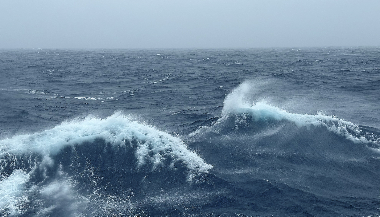
Mid-day waves on February 3: The wind was a bigger problem for me than the waves -- you can see how it tore off the top of waves. Pelagic birding was hard. The captain and expedition leaders were thinking about how to handle a possible landing on Macquarie Island tomorrow. It was expected to be -- and certainly turned out to be -- the highlight of the second half of the cruise.
Douglas Mawson position during the afternoon of February 3. Sitting on the edge of the boundary between two undersea crustal plates, Macquarie Island has a unique geologic history: it consists mostly of sea-floor rock, not continental or even newly volcanic rock.
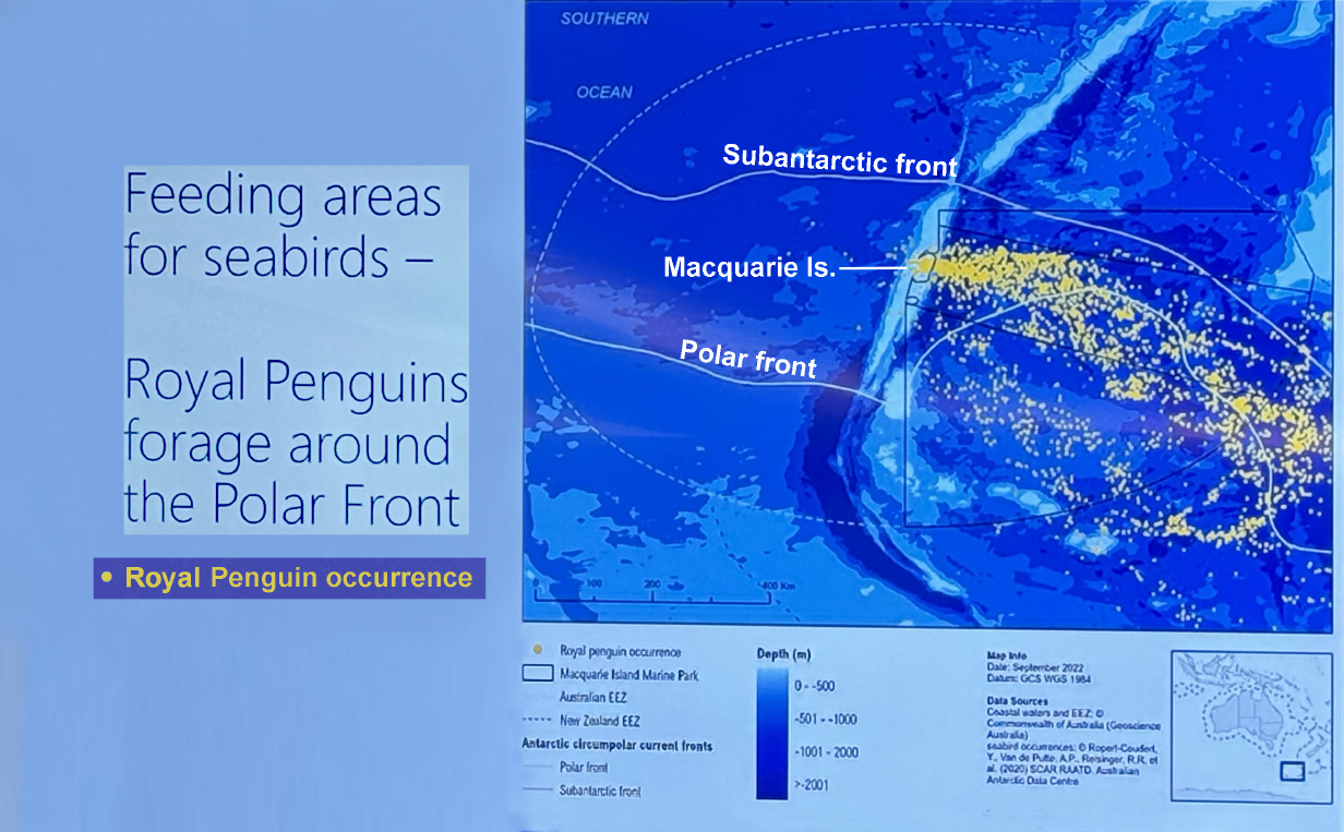
From the evening ship briefing, this shows where Royal penguins are observed to feed, near the "Polar front", which (via google AI) is the semi-permanent, moving boundary in the mid-latitudes that separates cold, dry polar air from warm, moist tropical air. As a major, sharp temperature gradient, it serves as a primary birthplace for mid-latitude cyclones and drives variable weather, shifting closer to the pole in summer and toward the equator in winter. ... Google AI continues: The Subantarctic Front (SAF) is a high-velocity jet in the Antarctic Circumpolar Current (ACC) that forms the northern boundary of the ACC in the Southern Ocean. It is characterized by sharp vertical gradients in temperature and salinity, separating warmer, subtropical waters to the north from colder Antarctic waters to the south. Found generally between 48°S and 58°S in the Pacific/Indian Oceans. it is a deep-reaching, vertical front extending from the sea surface to depths of 2000–4000 meters. Surface temperatures across the SAF can decrease southward by 5° C to 11° C within a narrow 50 to 100 km band. The front creates a zone of high biological diversity. Where there is food, there are birds. Birders tell us and my experience agrees that this region between the Subantarctic and Polar fronts is the prime region in which pelagic birding concentrates.
In the above map, sea depth encoding shows the sea-floor uplifting that culminates in Macquarie Island and the associated sea-floor subduction at the boundary between two ocean floor tectonic plates.
February 4, 2026: AM> Sea Sailing North; PM: Macquarie Island
This morning 08:30 - 09:30 I again tried to photograph birds, but winds were up at 25 knots; seas were rocking with 5-10 foot swells; at best, it was hard to stand let alone to focus on swooping birds. And birds fly at speeds that are more or less tied to the wind speed, so they were flying twice as fast as yesterday. Petrels were virtually impossible. Giant petrels sail more easily, and I got the local almost-all-white Giant petrel. Otherwise, for now, I gave up.

Windy waves summary of conditions at about 09:45 on Feb, 4. Winds gust well over 20 knots, and wave interference results in effective swells that are sometimes < 2 m but that can easily be > 5 m. Hard to photograph birds in these conditions. Landing on Macquarie Island will be difficult at best ... although we hope for better conditions in the evening and on the wind-sheltered, east side of the island.
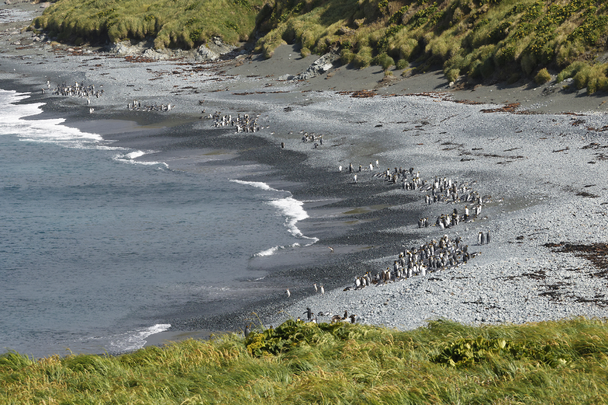
In the morning, we did a "ship cruise" past a colony of ~ 120,000 pairs of nesting King penguins. Scroll right to see the full panoramas. Close up, this might have been even more impressive than the giant breeding colonies on South Georgia Island ... but we could not land here.
In the eafternoon, we landed at Sandy Bay on Macquarie Island. John took part, and it was the same kind of magical experience as our previous landings at South Georgia Island.
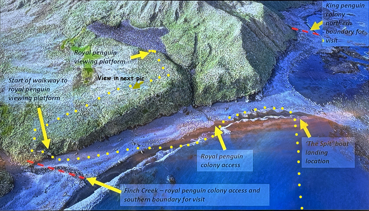
From the ship's briefing, this shows the landing site at Sandy Bay on Macquarie Island. We anchored out of sight below the bottom of the picture. My route is outlined in yellow dots, first to the shore via zodiac and then a slightly-less-than 1-mile walk to the left, out into the surf to avoid a cluster of penguins (shown), then up a steep stair to a well-made "boardwalk" on the hill above the sea cliff, and up to the right to a viewing platform from which we could see an amazingly crowded, busy, noisy, and (of course) smelly nesting colony of many of the roughly 750,000 Royal penguins that nest on the island. I was too rushed by the short warning when we were called to land and, unfortunately, I forgot my iphone. This was a major problem: I could not capture the wide-angle view of the scenery and the colony. I therefore include next another picture from the ship's briefing, showing the view back down the boardwalk from roughtly the point indicated by the dark yellow arrow above. Also, note that the Giant petrels fighting over a dead penguin, below, were in the gully of Finch Creek, identified above. Pictures of that scene were taken from the place where the boardwalk turns abruptly from the leftward gentle slope to the steeper drop to the staircase, just below the words "Start of walkway to ... viewing platform" in the picture above.
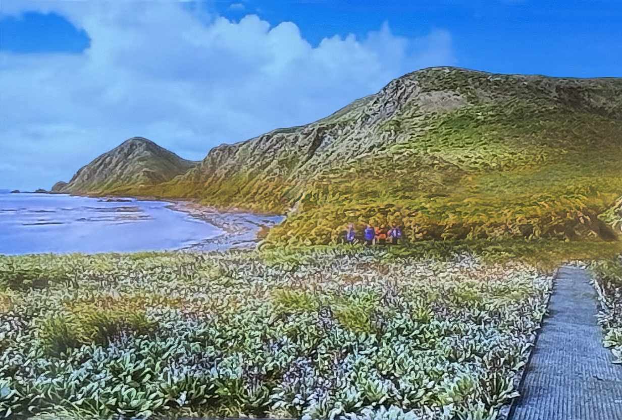
From the ship's briefing on the landing, this shows part of Sandy Bay (to the left of the picture of the landing site) and part of the boardwalk to the Royal penguin viewing platform. The view point is roughly that from the IDd dark yellow arrow in the Sandy Bay landing site picture above. I do not know the source of the picture, but it is not of our group.
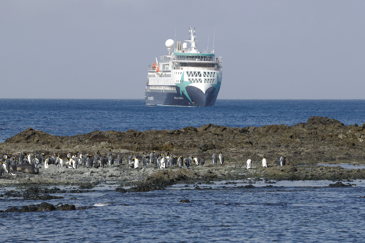
King penguins and Douglas Mawson from the beach at our landing site at Sandy Bay
Northern giant petrel on the beach at Sandy Bay. Formidable predator.
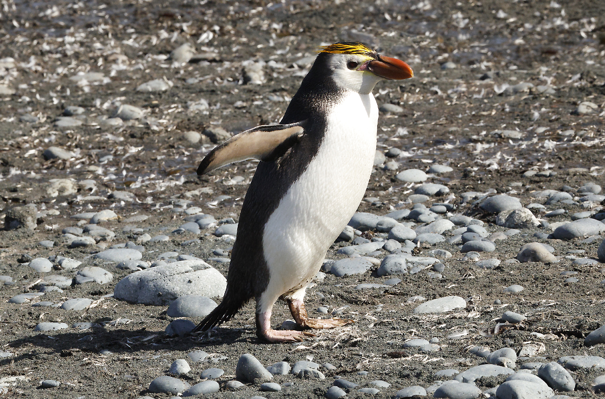
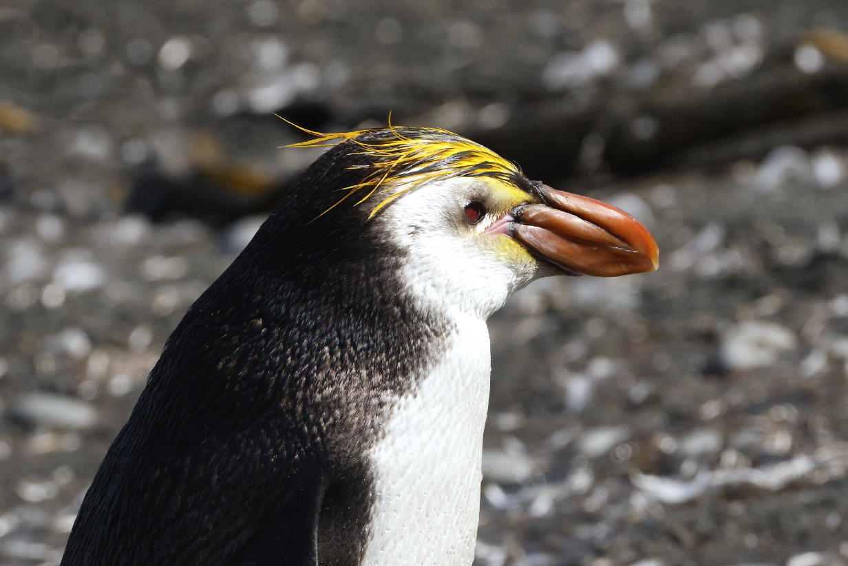
Royal penguin on the beach (This is my life bird, the 11th -- and 4th penguin -- of the trip.)
King penguins on the segment of beach shown in the ship's briefing picture above but now photographed by me at focal length 200 mm and from up the hill on the boardwalk to the Royal penguin viewing platform.
Our ship and a zodiac from the same vantage point up the hill, about half-way up the slope to the penguin viewing platform
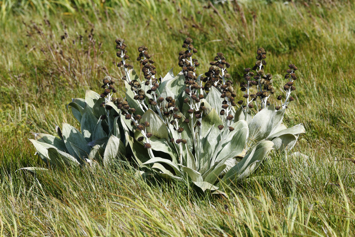
A luxurious proliferation of megaherbs surrounds the walkway. After the eradication of invasive plant and animal species, they are making a wonderful recovery. They are startlingly beautiful and different from plants that we are used to seeing elsewhere.
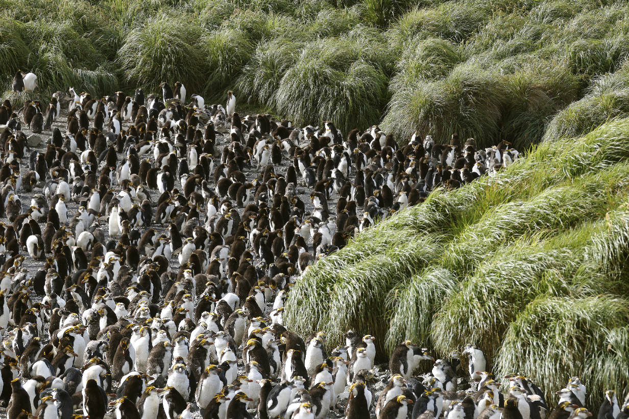
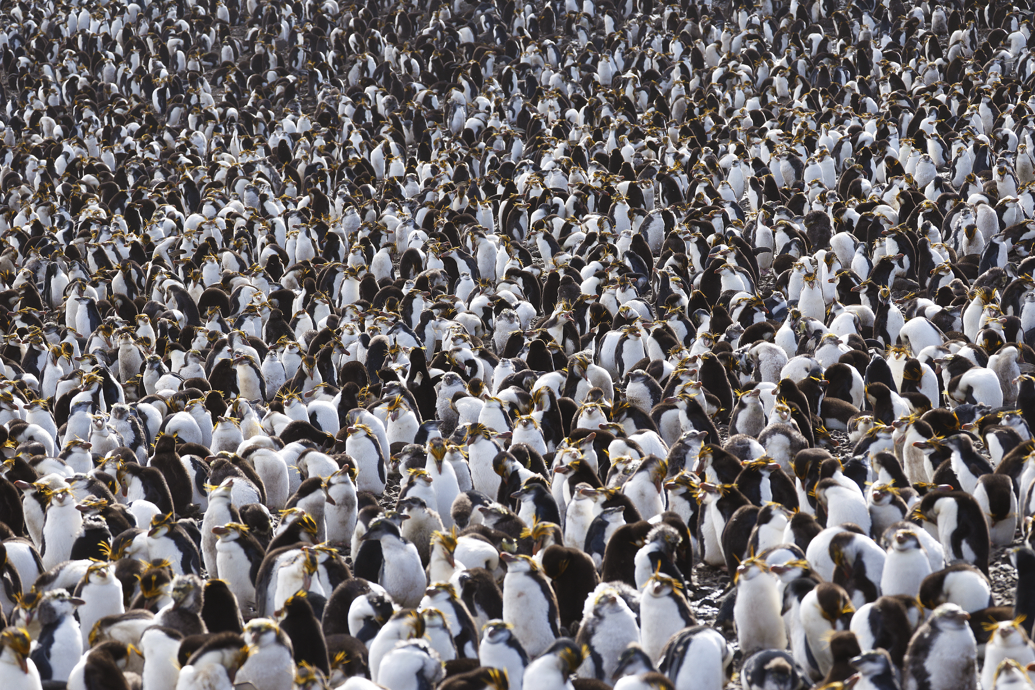
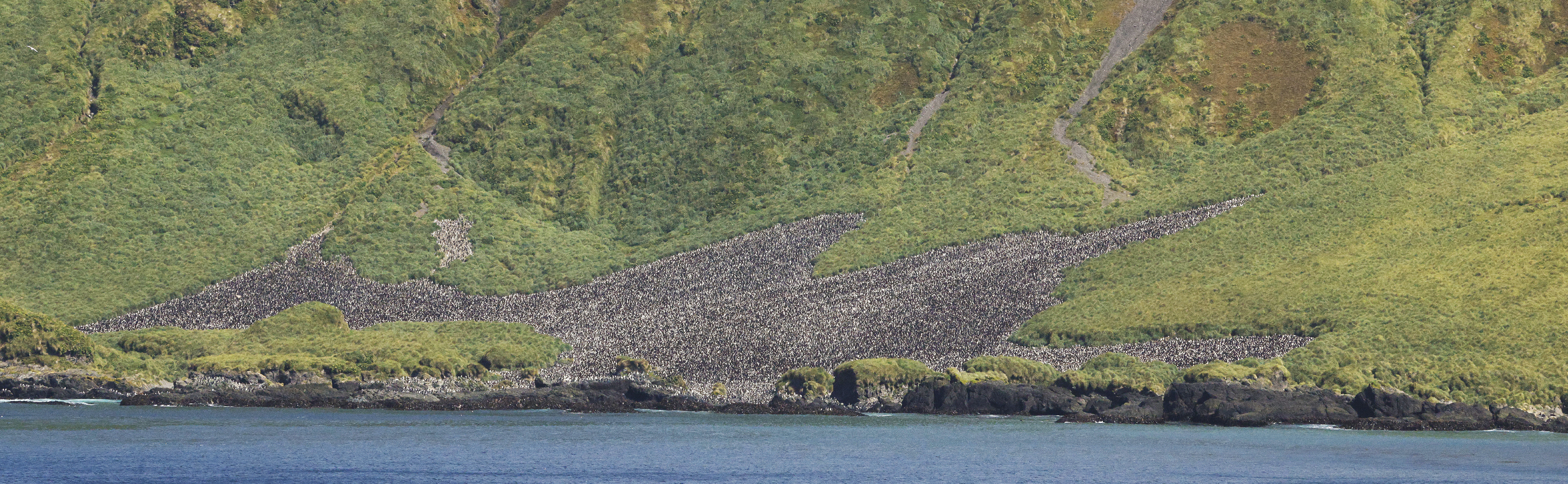
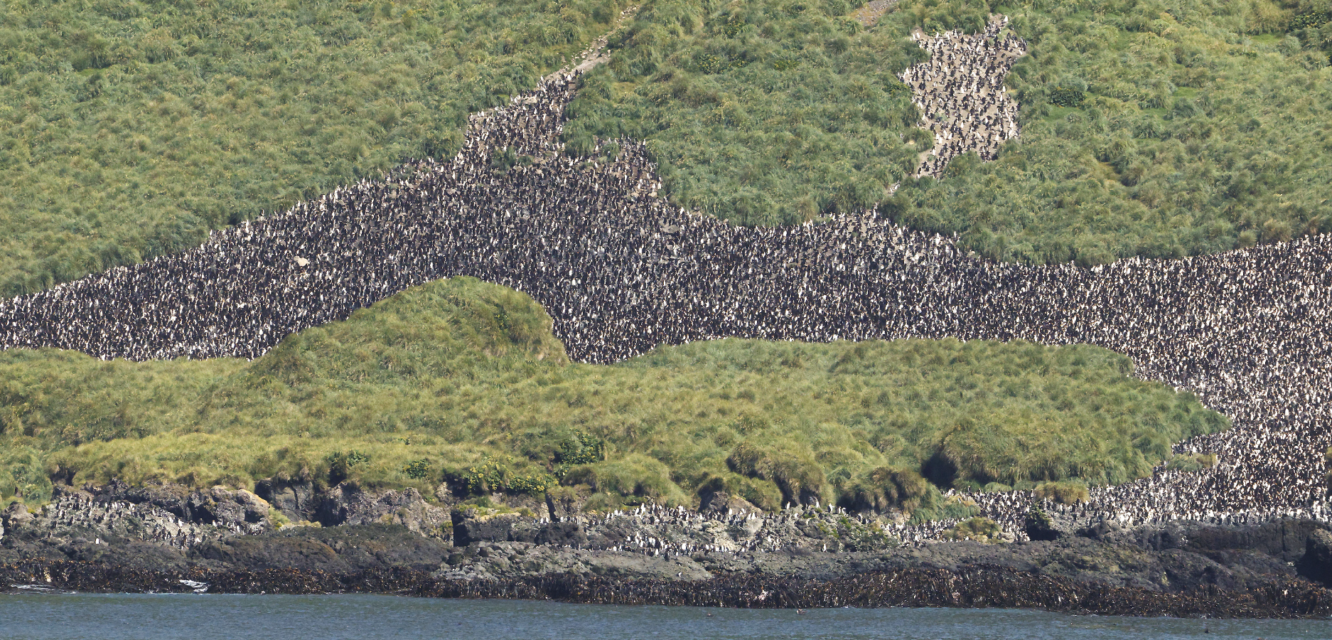
Just a few of the Royal penguins at the main nesting colony up the hill above the landing site. I don't know how many other nesting colonies are on the island, but the ship's briefing told us that about 750,000 pairs of Royal penguins -- essentially all of the world's population -- nest on Macquarie Island and on a few tiny nearby islands.
Royal penguins snoozing in the main rookery on Macquarie Island.
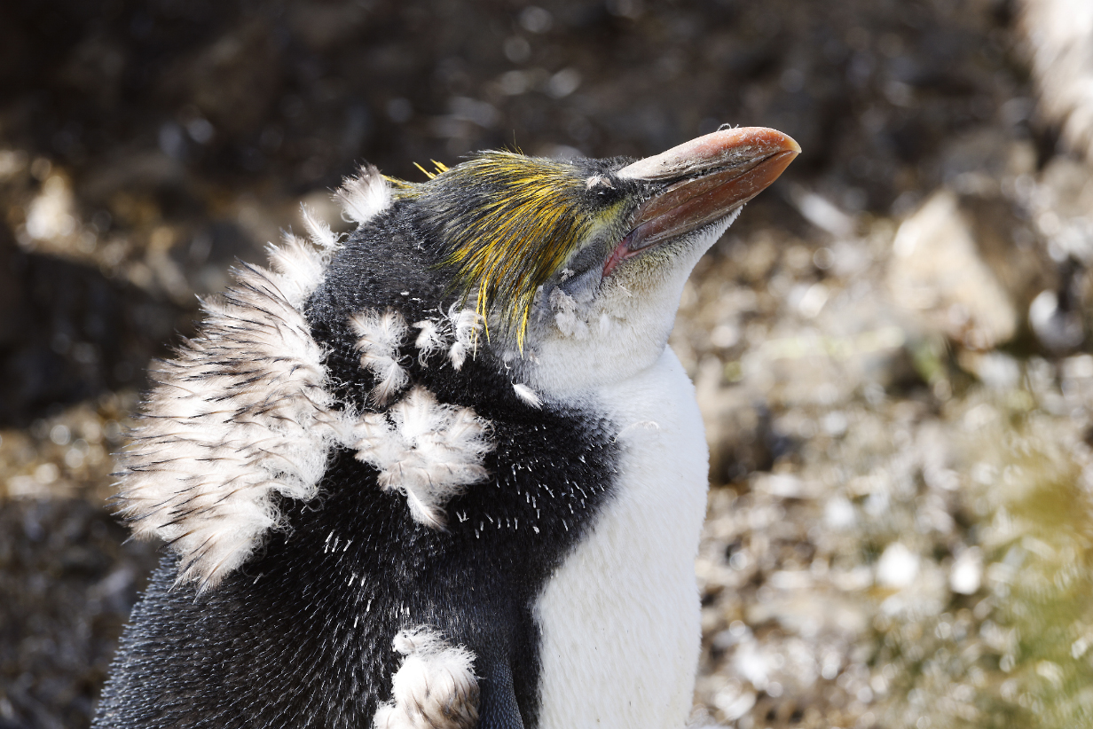
Royal penguin chick moulting (Like most penguins, Royals must, in a single summer, brood eggs, raise their chicks, and have them moult into adult plumage such that they can survive winter at sea. Mid-February in the south is equivalent to mid-August in the north: it is most of the way through the warm summer, and time is getting short to get full adult plumage.)
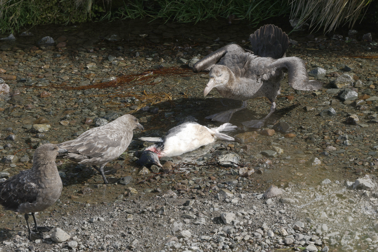
Brown skuas and a Northern giant petrel fighting over a dead penguin. It was not clear what happened to the penguin; perhaps it fell during the climb up to the Royal's rookery and was injured enough to be viable game. Either species of predator could take advantage. While we watched, the several Northern giant petrels won the battle and then argued with each other about the meal. We saw those battles and their aftermath but not the killing, down in the gully of Finch Creek, from the upper-left corner of our walkway, traced in yellow dots in the Sandy Bay landing site picture above.
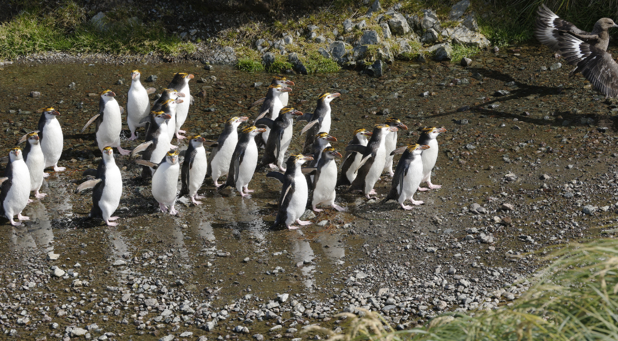
Meanwhile, a line of Royal penguins was gathering just downstream from the argument, clearly wanting to go up to the nesting colony but agitated and afraid to pass. They are shown here with Brown Skuas (top-right) with wings open in threat against the giant petrels. Eventually, perhaps with enough penguins accumulated, they dared to pass, obviously nervous and hurried, in single file.
Gentoo penguin, back at Sandy Beach. They look rather different from the ones around South Georgia Island and the Antarctic Peninsula; e. g., the bill is red there but yellow here. They could be candidate for a (sub)species split. Clements lists this as Pygoscelis papua taeniata, whereas the subspecies on South Georgia Island is Pygoscelis papua poncetii, and the subspecies on the Antarctic Peninsula is Pygoscelis papua ellsworthi. Finally, subspecies Pygoscelis papua papua breeds on the Falkland Islands and in Tierra del Fuego. We have not seen the latter subspecies, but I have seen the other three.
February 5, 2026: AM landing at the N Isthmus of Macquarie Island; PM: At Sea
This landing was not primarily about nature or wildlife: there is a research station there which cannot be visited, and there are the ruins of machinery used to render still-live penguins into oil in the early part of the 1900s. With no interest in being reminded of humanity's sordid history, I did not take part. Instead,I worked on pelagic birding pictures, on into the afternoon. After we left the wind-sheltered east side of the island, seas swells rose to typical heights of > 4 m and, with occasional constructive interference, dumped glass and other fragiles off of tables (crash!). This is the first time on Aurora that we have had furniture removed from our Deck 4 balcony. Which is something of a surprise, since the storms that we experienced between Iceland and Svalbard seemed more violent. Although I admit: We experienced no crash! then. As I write this, we rock a bit more than gently, and it is hard to walk, but we are OK. My main regret is that I don't feel safe in pelagic birding outside, even though birds love this kind of weather. We have been instructed to stay indoors.
White-headed petrel
February 6, 2026: At Sea Toward Dunedin
We were at sea in 4-4.5 m swells, 25-30 knot winds, and temperatures of 8-10 deg C all day. I tried pelagic birding, but with strong winds and unpredictable rocking, I did not have great success.
Birding today was dominated by Gray-headed albatross. Sometimes 5-10 were visible at once.
Soft-plumaged petrel was the best bird of the day.
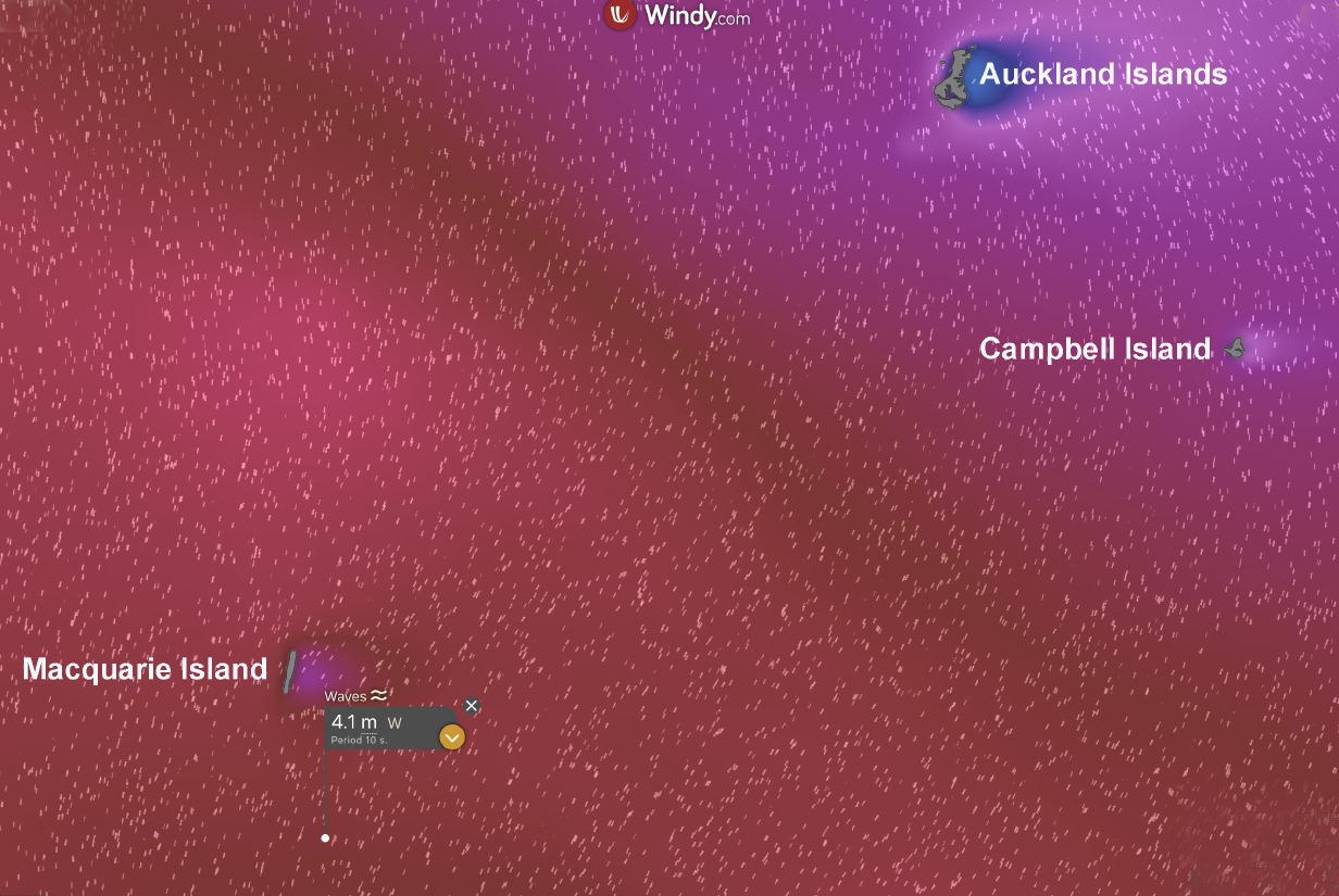
Late in the day, steady winds rose to ~ 32 knots as we neared the Auckland Islands. Swells are ~ 4.5 m, with the tops of waves ripped off by the wind. Conditions do not look good for Snares Island tomorrow. We "keep our fingers crossed" ... but the captain sounds uninclined to risk going there. For now (see above), we will shelter on the lee = east side of the Auckland Islands so that we have a fairly calm night's sleep. If predictions don't moderate by 9 AM tomorrow, the captain is likely to make a straight run for Dunedin.
February 7, 2026: At Sea Toward Dunedin
With swells at 4 to 4.5 m and winds steady at 18 to 22 knots, the captain decided this morning to give up on Snares Islands. We are making a straight run for Dunedin. It does not feel particularly bad outside ... but then: I don't know what it would be like on the slightly different heading to Snares. It is a shame to miss this once-in-a-lifetime opportunity because of weather that seems substantially gentler than what we navigated without much trouble between Iceland and Svalbard. But we have always appreciated Aurora's finesse in navigating bad weather, and we should not second-guess them now.
Pelagic birding is not going well: all I see are albatrosses and petrels that I know well. So the trip is effectively over.
Black-bellied storm petrel was the most interesting bird of the day. I thought at first that this was White-bellied, which would not have been new, either. But (1) we were somewhat out of range of White-bellied, whereas we were strongly in range for Black-bellied. Also (2) web sites clearly state that Black-bellied storm petrels in this area often do not have a black line in the belly connecting the black chest with the black tail. Finally, (3) the extent of black in the chest -- reaching farther toward the tail than in White-bellied -- and the fact that the legs clearly extend beyond the end of the tail nail the ID as Black-bellied.
February 8, 2026: At Sea to Dunedin
At breakfast time this morning, the (sunny and cheerful) skies were alive with Pintado petrels, many of which came within a few m of the ship. Also, porpoises were porpoising completely out of the water, in good numbers, again just a ship's width away. I spent about 40 min pelagic birding and got good pictures of Pintado petrel. But the porpoise "flights" were too short and too unpredictable for pictures. Thoroughly charming, though.
Pintado petrel (same picture, different sizes for readers who use different-sized computer screens)
We spend much of the morning and part of the afternoon packing -- an epic, almost impossible,job. In the evening, we docked overnight at the refueling port in Dunedin.
February 9, 2026: Disembark in Dunedin; Flight to Auckland
Panorama of our suite 429 on the morning of Feb. 9. With all our stuff packed, our "checked luggage" gone, and our "carry-on luggage" out of sight, the cabin looks unnaturally neat! But it served our purposes very well, and after (formally) 4 cruises, it feels like home to us.
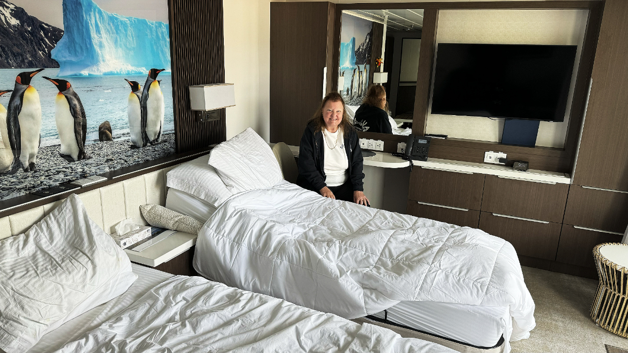
The table behind Mary served me very well as an "office" where I set up my laptop, processed daily pictures, and kept this web site pretty well up to date until nearly the end of the voyage. The main delay near the end was the difficulty in identifying pelagic birds, especially prions.
The most important pictures of the trip are processed and posted. This web site is essentially up to date until the start of Feb, 4, the first day at Macquarie Island. A few more pictures from that day are still to come. After that, few pictures have been posted, because I need to get ready for my trip to Singapore and Borneo, now just 2.5 weeks away.
February 10, 2026: Tawarhanui Reserve
Excellent birding mainly at Tawarhanui Reserve today and Tiritiri Matangi tomorow generated a lot of pictures that mostly will be posted in March and April 2026, after I get back from Borneo. Right now, this web site shows only a start on what I saw.
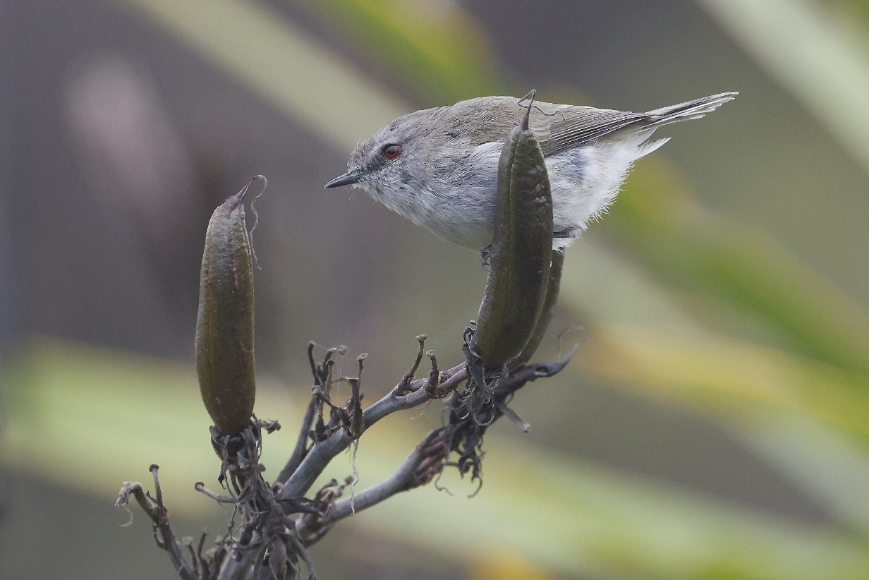
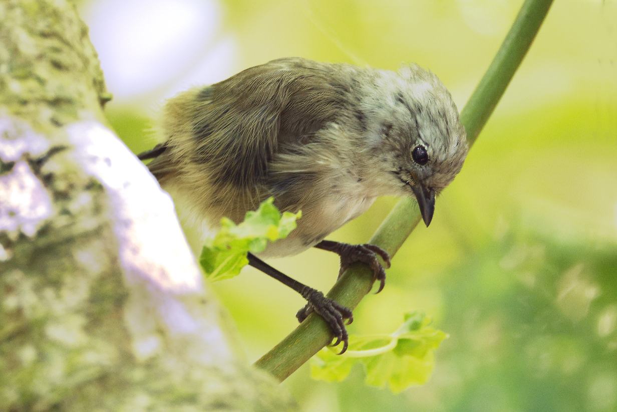
Gray gerygone (Gerygones are tiny warblers -- always flitting, hard to see well, and harder to photograph. I am always especially glad when I get one well.)
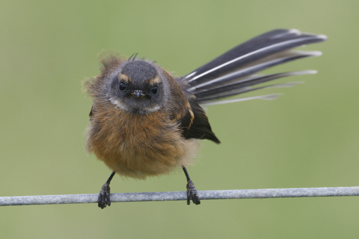
New Zealand fantail (This is a juvenile -- e. g., the eyebrow is not yet white. It was characteristically frenetic but remarkably trusting, posing from all angles as it looked for flying insects.)
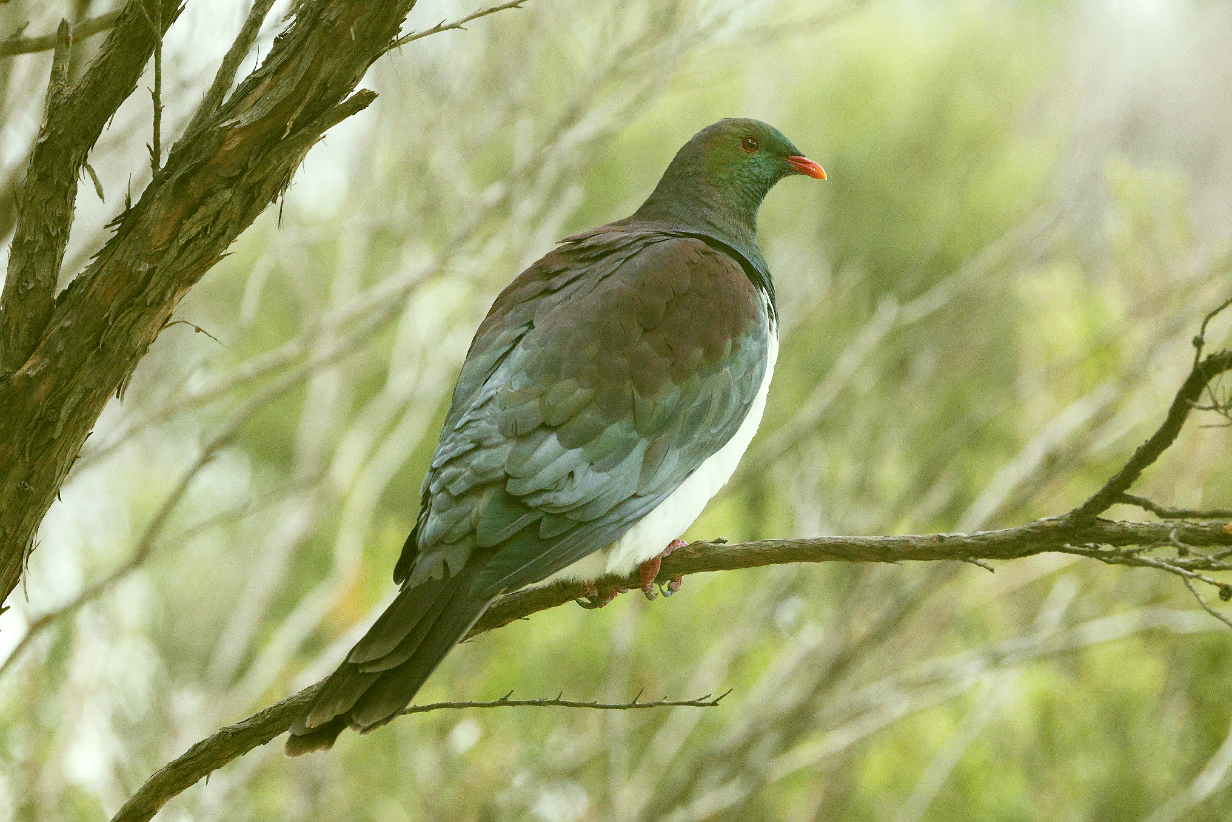
New Zealand pigeon in poor lighting
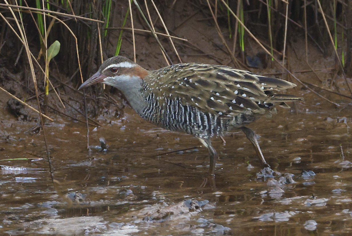
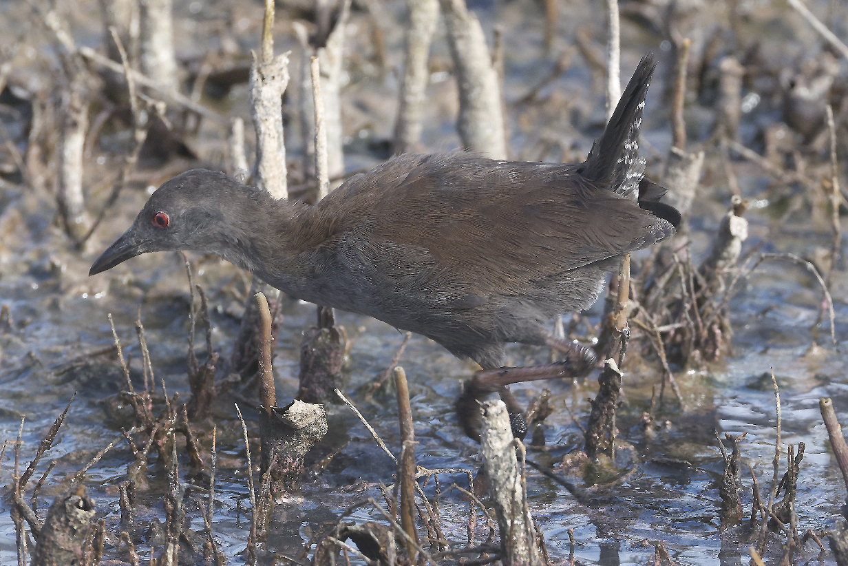
Buff-banded rail in the stream bed where I later got Spotless crake (see below).
Spotless crake: These are my life birds. I have been looking for this species for many years, but usually it is so difficult to see that most bird guides don't even try to look for it. But when I told my guide, Phil Hammond, my New Zealand wish list -- including Spotless crake almost as a pessimistic afterthought -- he said that there are several places where I could get this bird. One was this stream bed, in which the water level was just right to give a good stretch of muddy bank where the birds could dash briefly out of the grass. When we started to look, Phil got an almost immediate hit. I didn't see that bird. But we staked out the spot and waited there for about an hour, not a problem, given that we needed to wait for darkness anyway to look for North Island kiwi, nearby. I waited with the camera set up, mostly watching 3 Buff-banded rails working the stream bed. It got darker and darker, and I kept having to increase the ISO sensitivity of my camera. Finally, I had it set to ISO 512,000, just before it got too dark for even a ridiculously noise-dominated picture. I was about to give up when 2 Spotless crakes ambled into my field of view from below and walked slowly up along the stream bed. I got several ferociously noisy pictures of them. This is the best that I could do to process the pictures to slightly reduce noise. It was not exactly a satisfying view, but it might have to do. (Tomorrow, I got a different bird in daylight from ridiculously close, q. v., below.)
We then went to look for North Island brown kiwi. I got one brief look via binoculars and the faint illumination from a red flashlight. It was "takeable" -- I could see the shaggy fur and the long bill. The bird was a lot bigger than I expected. But I could not get a picture in time, and we never saw one again. Several dozen people wandered continually up and down the (obviously well known) trail through the kiwi's habitat, some with too much light flashing in all directions. My guess was that, once the hunt got well started, any kiwi that was close to the trail will have retreated out of sight. We heard both males and females calling, well away from the public trail. We probably succeeded because we were among the first people there. I was glad to "get" the bird but disappointed that I could not get a picture. Even though that would again have required a ridiculously high ISO sensitivity.
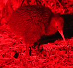
North Island brown kiwi: This is not my picture -- it is rendered from a picture posted at ebird and reduced in size and resolution to remind me of roughly what I saw in binoculars.
February 12, 2026: Tiritiri Matangi Island
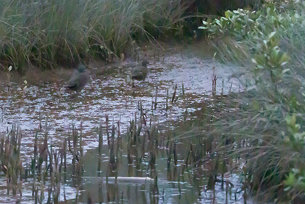
Spotless crake came within 15-20 feet of us in a swamp where we birded before we took the ferry to Tiritiri Matangi. I got 2 of them last night in deep twilight -- too dark for good pictures, but seeing one this close up was spectacularly good luck.
North Island saddleback, an iconic understory endemic that we saw also on our 2011 birding tour
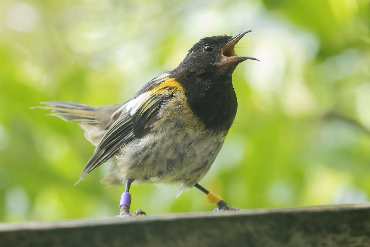
Stitchbird is another iconic New Zealand endemic that survives primarily because islands such as Tiritiri Matangi have been freed of alien predators.
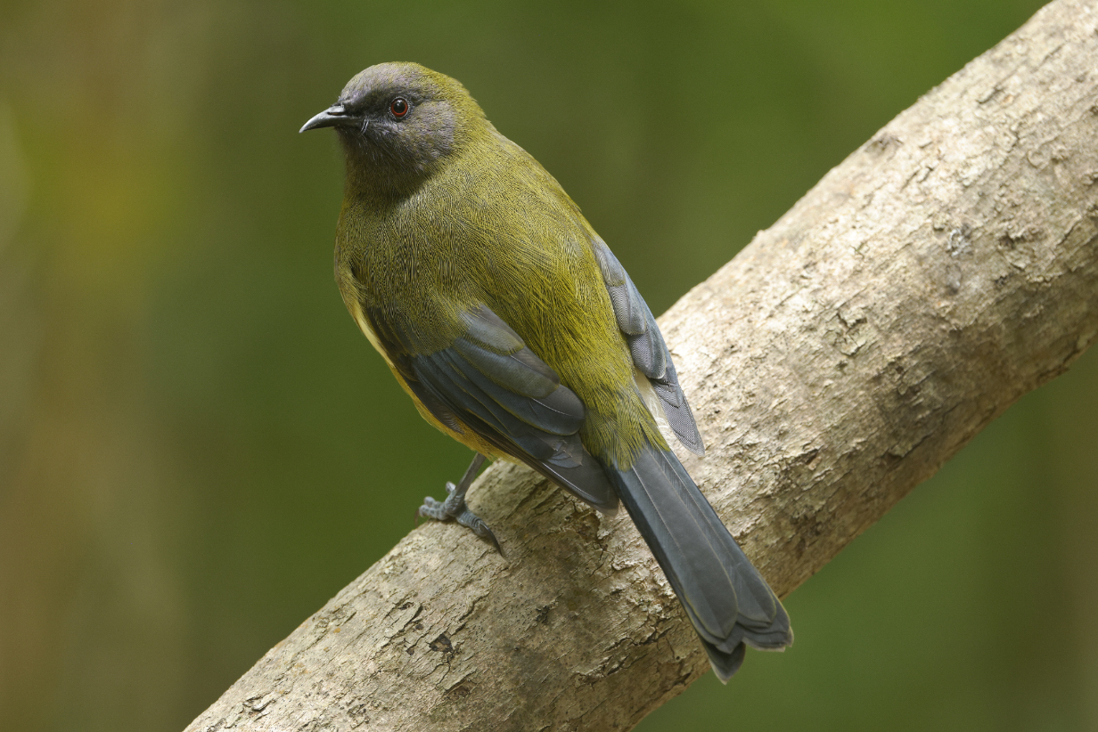
New Zealand bellbird looking spiffy. With a brown head, this looks like a female.
Whitehead -- another New Zealand North Island endemic. This one is a juvenile; an adult has an all-white head. I saw adult birds during our 2011 birding trip to New Zealand.
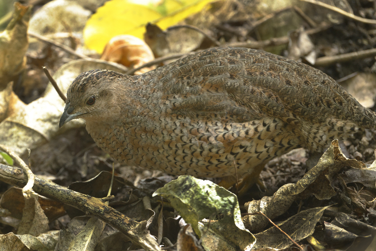
Brown quail (introduced and established but tolerated)
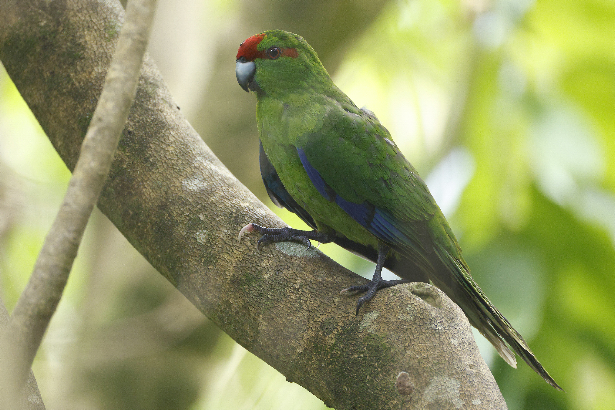
Red-crowned parakeet along the Wattle Track on Tiritiri Matangi
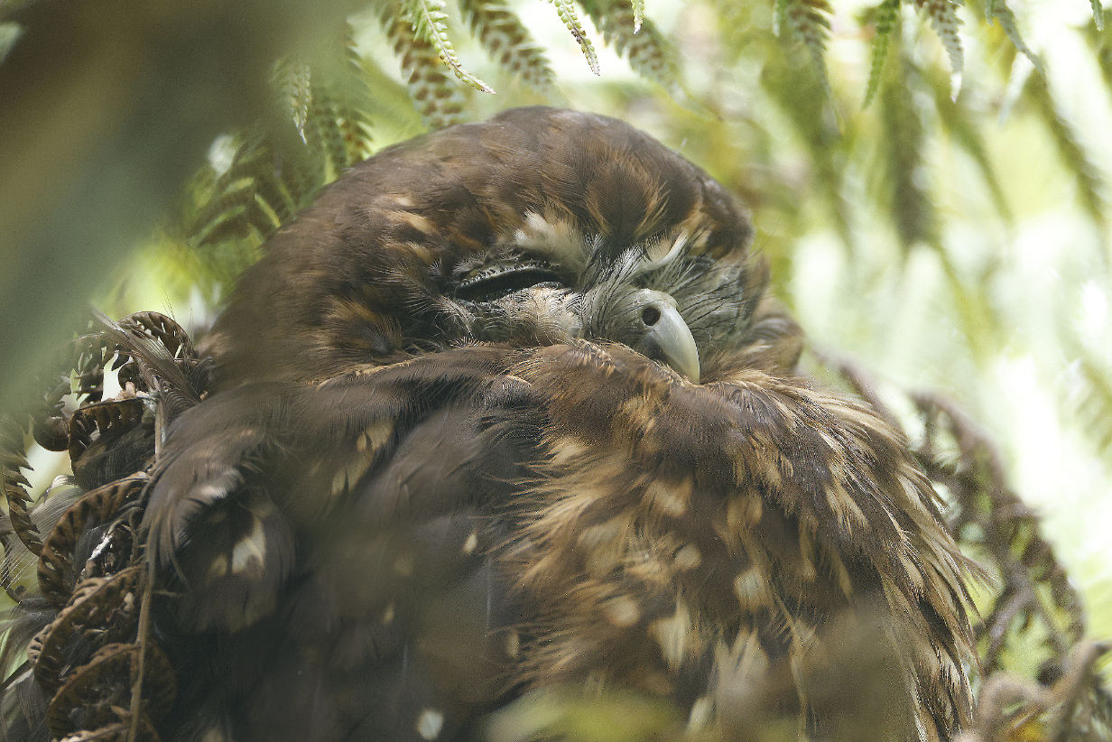
Morepork -- the New Zealand endemic owl -- roosting in a fern tree at mid-day. Great spotting by my guide, Phil Hammond.
Our bird pictures from around the world follow standard ecozones approximately but not exactly:
Birds from the USA and Canada: our house, Hornsby Bend and greater Austin, Texas, California, Hawaii, Canada,
Neotropic birds from Central America and the Caribbean: Honduras, Costa Rica, Panama, Trinidad and Tobago
Neotropic birds from South America: Ecuador, Ecuador 2017, Brazil.
Western palearctic birds: Europe: Germany, Finland, Norway, Europe: United Kingdom, Europe: Spain, the Canary Islands, Europe: Lesbos, Greece, Israel
Eastern palearctic birds: China
Birds from Africa: The Gambia, South Africa
Indo-Malayan birds from India: North-west (Delhi, Uttar Pradesh, Uttarakhand) India: North-east (Assam, Arunachal Pradesh, Meghalaya) India: Central (Maharashtra, Madhya Pradesh)
Birds from Australia, New Zealand.
For our 2014 December trip to India, see this travelog.
For our 2016 May-June trip to India, see this travelog.
For our 2017 April trip to High Island, Texas, see this web site.
For our 2018 March trip to India, see this travelog.
For our 2018 May trip to China, see this travelog.
For our 2018 October trip from Munich to Budapest, Hungary see this travelog.
For our 2018 November trip to China, see this travelog.
For our 2019 April trip to High Island, Texas, see this web site.
For our 2019 July trip to China, see this travelog.
For our 2021 April trip to High Island, Texas, see this web site.
For the 2021 August 3 & 4 migration of Purple martins through Austin, see this web site.
For our 2021 December trip to Ecuador, see this web site.
For our 2022 January-February trip to Peru, see this web site.
For our 2022 July/August trip to Australia and Papua New Guinea, see this web site.
For our 2022 September trip to Bolivia, see this web site.
For our 2022 November-December pre-trip to Argentina (before our Antarctic cruise), see this web site.
For our 2022 November-December cruise to Antarctica, see this web site.
For our 2023 January birding in Chile, see this web site.
For our 2023 January-March cruise from Chile to Antarctica and around South America to Miami, FL, see this web site.
For our 2023 March-April birding in south Florida (after the Seabourn cruise), see this web site.
For our 2023 November-December birding to Sri Lanka, the Andaman Islands, and South India, see this web site.
For John's 2024 February-March birding in Colombia, see this web site.
For our 2024 May-June cruise from Iceland to Jan Mayen Island to and around the Svalbard Archipelago, see this web site.
For our 2024 June 25-30 stay in Paris, see this web site.
For our 2025 April 21 - May 3 trip to High Island, Texas, see this web site.
For our 2025 July vacation and birding in Singapore, see this web site.
For our 2025 August birding in north-west Australia, see this web site.
For our 2025 August-October Seabourn cruise from Australia to Chile, see this web site.
For our 2026 January-February trip to New Zealand and 3rd cruise to Antarctica, see the present web site.
For my 2026 March-April trip to Borneo and Singapore, see this web site.
For my 2026 August trip to Kenya, see this web site.