Hawaii Vacation and IfA50 Conference 2017
These are scenery pictures (mostly) from our 2017 July vacation in Hawaii. We stayed first at our favorite romantic getaway, the Hapuna Beach Hotel on the Big Island. Mostly, this was a beach vacation for Mary, shared often by John. But we also had a spectacularly successful day of birding at Hakalau National Wildlife Refuge on the Hilo-facing slopes of Mauna Kea. We spent one day at Kilauea National Park and saw the churning, bubbling lava lake inside Halemaumau caldera. And John spent several days photographing birds elsewhere on the island. We then spent four days on Kauai, based in Poipu, with sightseeing and birding excursions to the north end of the island and several times up the interior road to the Pu'u o Kila lookout over the Na Pali coast. Finally, we had four days on Oahu, where we both attended the 50th anniversary celebration meeting of the Institute for Astronomy, University of Hawaii. Scenery pictures from many of these places are posted here. A few pictures from a 2008 December vacation to the same places are included. Hawaii bird pictures are here.
Many pictures are designed to be viewed on large computer monitors. If a picture overfills your screen, you can scroll to the right to see the rest of it.
The pictures are copyrighted and should not be used for commercial purposes without permission.
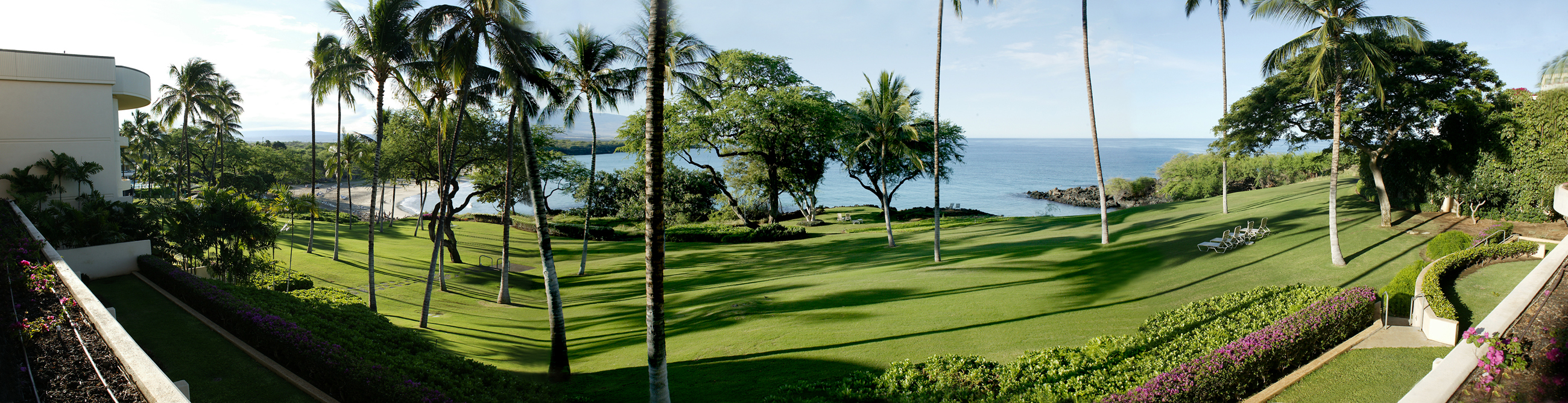
This was the view from our Hapuna Beach hotel room during our vacation there in 2008 December. We had a similar view in 2017. Hapuna Beach -- visible in the left background -- is the best sand beach on the Big Island. We spent a lot of time there.
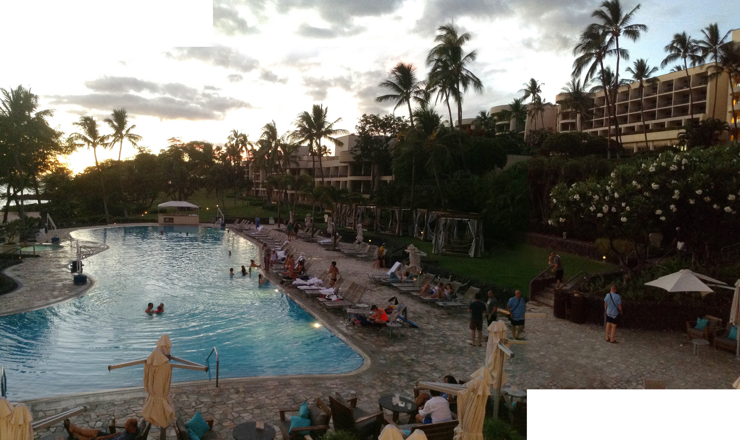
Hapuna Beach Hotel and its pool as seen from the dining pavilion. The pool is a great place to relax and (at the bottom) to have lunch.

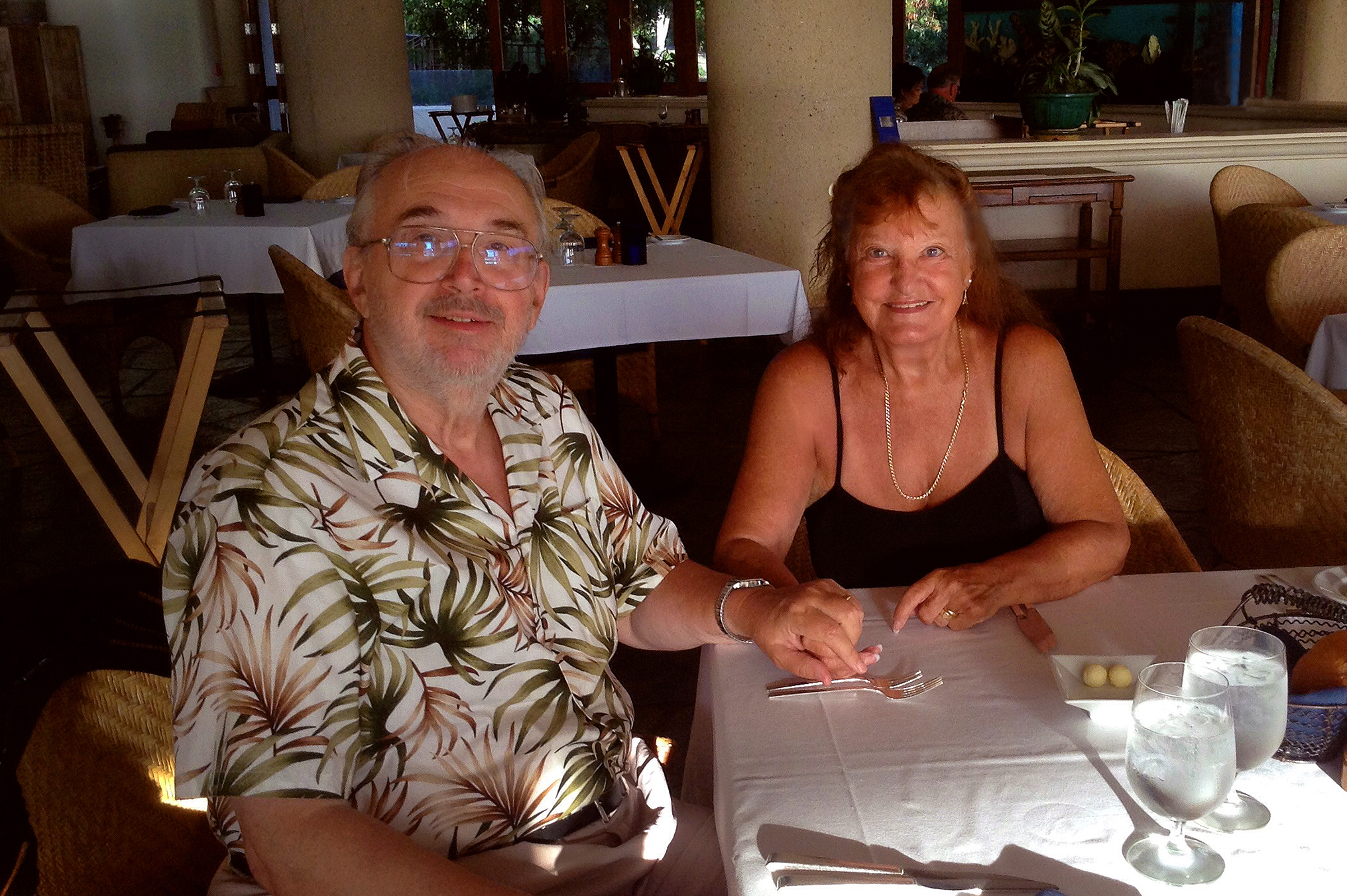
Dinner at the Hapuna Beach Hotel
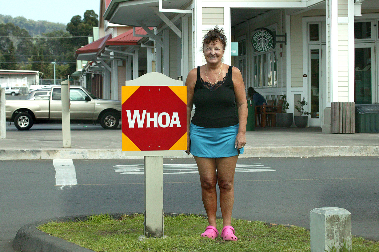
Waimea, on the saddle between Mauna Kea and Kohala volcano, is a cowboy town ... as well as hosting the headquarters of the Keck Telescopes and the Canada-France-Hawaii Telescope. So John has spent a lot of time there. This picture was taken in 2008, but the sign is still there in 2017.

Mauna Kea Observatories at sunset as seen from near Waimea in December 2008. At left is the 3.6 m aperture Canada-France-Hawaii Telescope, where John often observed and where he discovered 3 of the first 4 dynamically-detected supermassive black holes. Second and third from the right are the 10 m aperture Keck Telescopes.
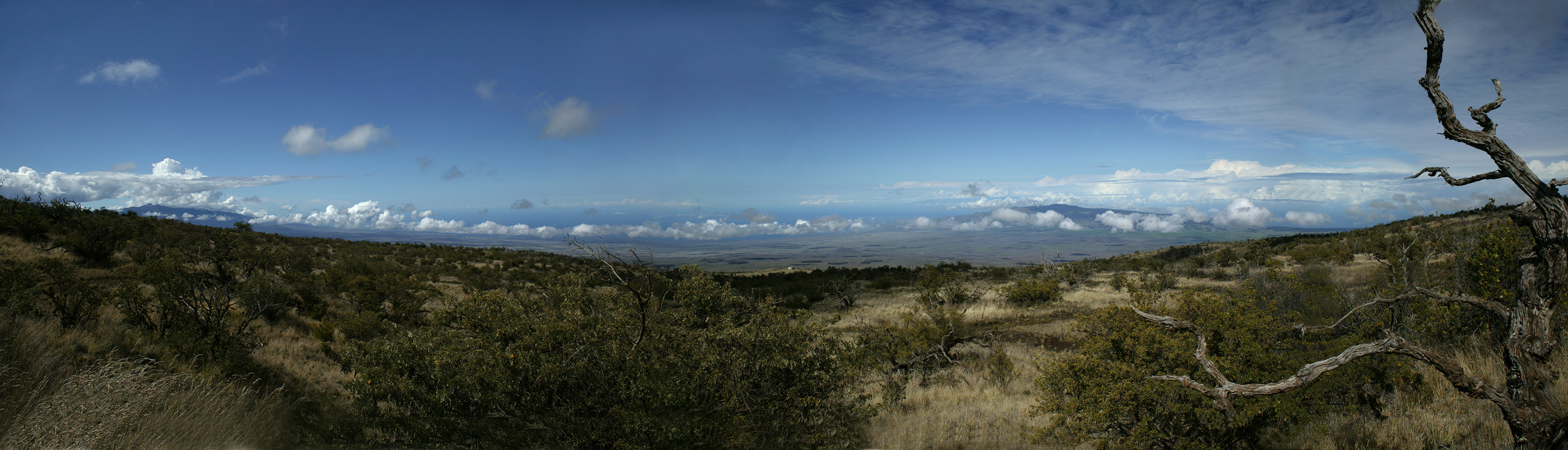
View north from Pu'u La'au at about 7500 feet altitude on Mauna Kea. In the distance is Kohala volcano at the north end of the Big Island; Waimea is on the saddle between Mauna Kea and Kohala, nestled up against the latter. Behind Kohala in the far distance, we can just see Haleakala on Maui. The foreground shows the dry Mamane-Naio forest where one rare forest endemic bird, the Palila, is most common. We saw it in 2008 December, when this picture was taken. But John did not manage to see it again in 2017: years of drought and other stresses have further reduced the population.
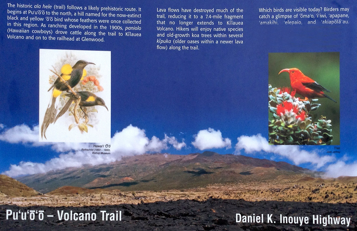
Sign at the trail head of Pu'u O'o trail, starting a few miles on the Hilo side of the high point on the Mauna Kea - Mauna Loa saddle road. John got pictures of Iiwi here in 2008 but saw almost nothing here in 2017.

Start of the Pu'u O'o trail.
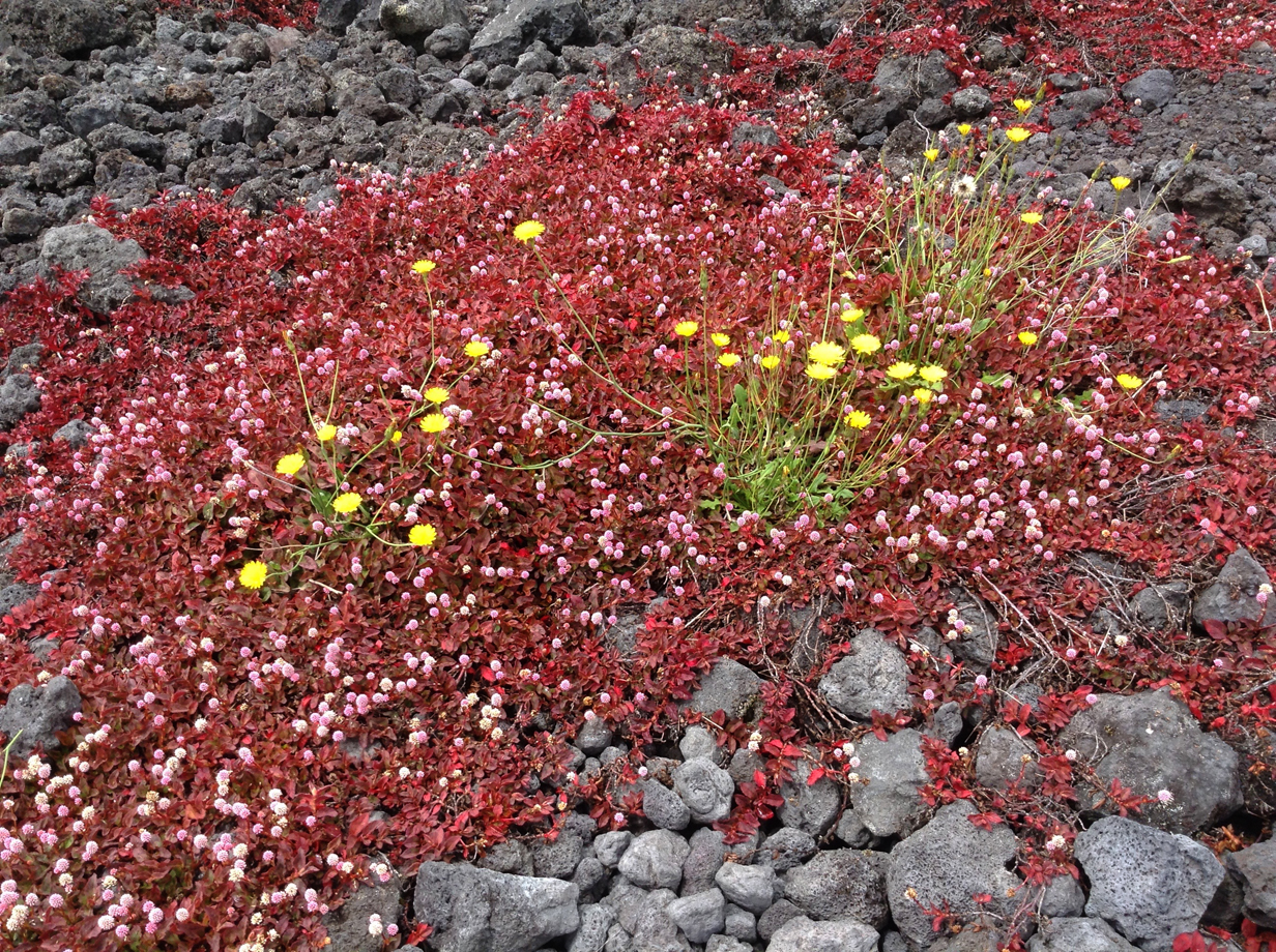
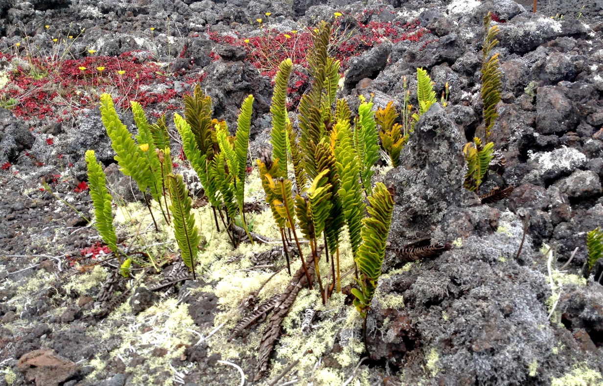
Flowers and ferns at the start of the Pu'u O'o trail.
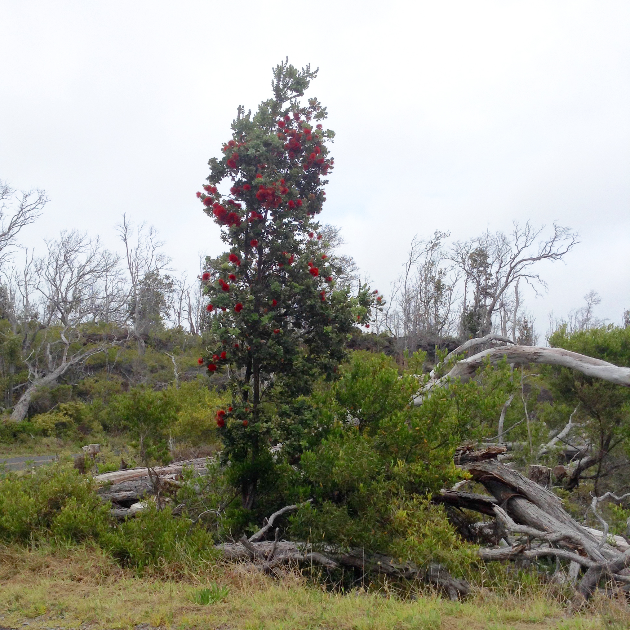
Blooming Ohia tree just off the road from the saddle to Mauna Loa volcano observatory. Our 2017 trip took place after most of the blooming of Ohia trees, so we saw few Apapane and only one Iiwi (at Hakalau NWR, not here). One picture of Apapane was taken near here in 2017.
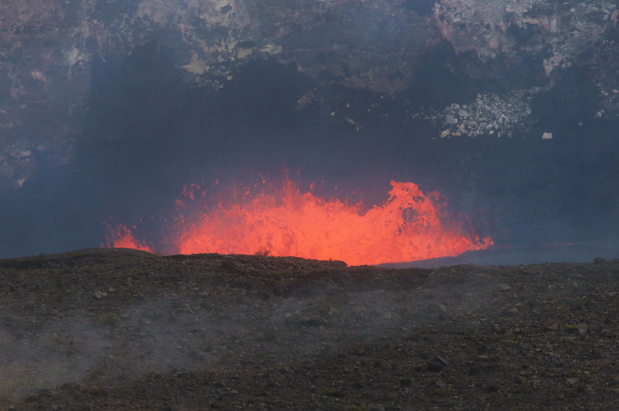
Kilauea volcano has been erupting almost continuously since January, 1983, mostly from a relatively inaccessible vent called Pu'u O'o. John has seen it fountain from the summit of Mauna Kea. We have stood within two feet of flowing lava on another occasion. In recent years, a new "sub-caldera" has opened up inside Halemaumau, which is itself a sub-caldera of the larger Kilauea caldera at the mountain's summit. The bottom of this sub-sub-caldera has been filled with a (molten) lava lake for some years. It rises and sinks by several hundred feet, driven by varying pressure from below. When we visited in 2017, the lake level was very high, not far under the floor of Halemaumau. This picture, taken with a 1130 mm telephoto lens, shows bubbling and churning in the lave lake. On this side of the lake, the higher-level flat region is the floor of Halemaumau, and the cliff behind the lava lake is the wall of Halemaumau, extending from the floor of Kilauea caldera (out of view at the top) down past the floor of Halemaumau to the lave lake. The eruption was far away from us (tourists are not allowed to get closer than the Volcano Observatory on the other side of Kilauea caldera) but impressive nonetheless. A long telephoto helps.

On the drive back to our hotel from Kilauea, we saw this sunset view from the saddle road to Kohala (near distance) and Haleakala (on Maui, in the left backround).
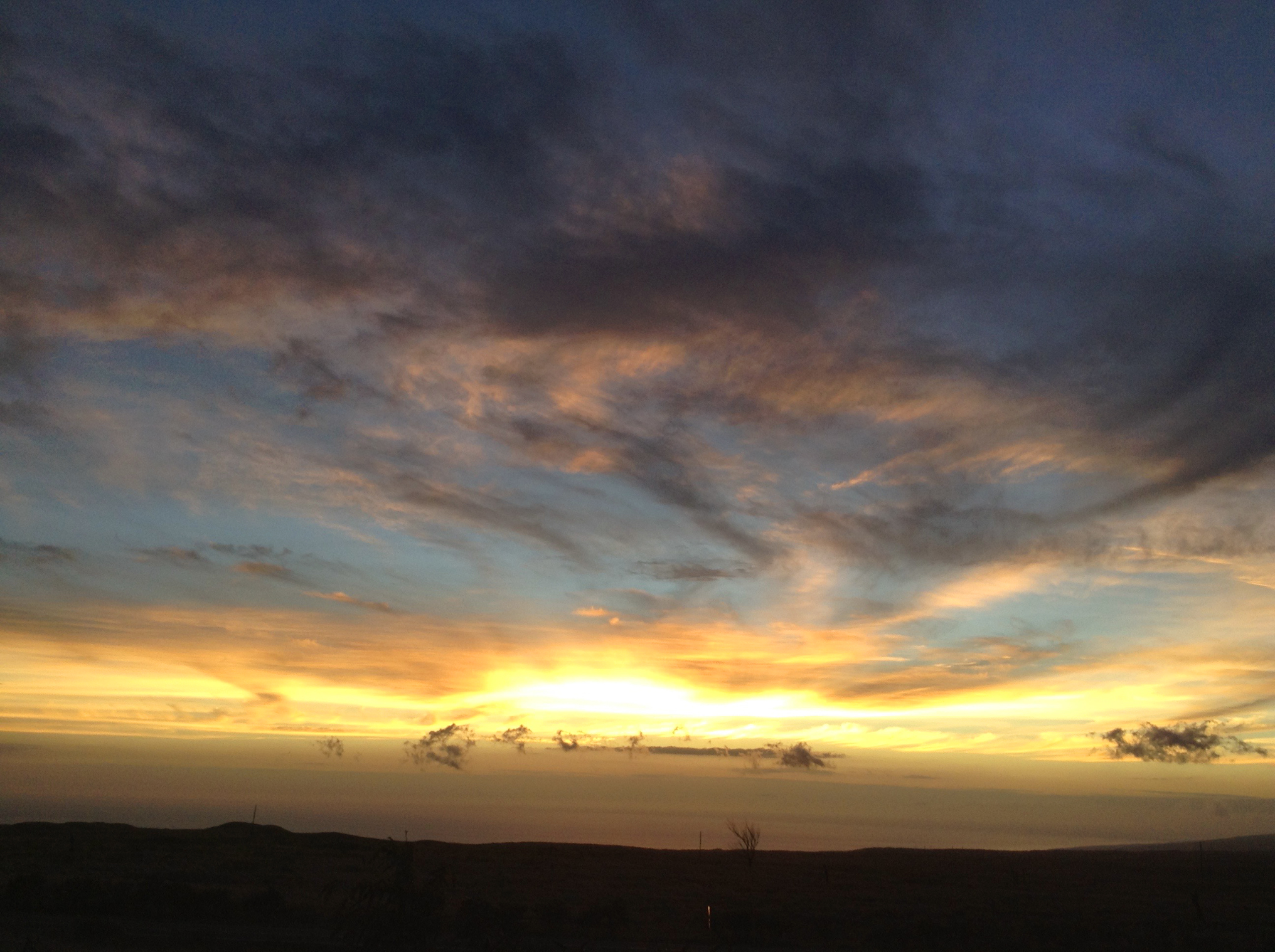
Sunset clouds over the Kohala coast. Our hotel was somewhere below the near horizon in the direction of this picture.

Spectacular view of Kohala volcano from the Saddle Road between Mauna Kea and Mauna Loa. Here, we look essentially along the line that divides the dry side of the Big Island (at left: Hapuna Beach Hotel is on the coast in that direction) and the wet side of the island (starting at right). This picture was taken in 2008.

Mary is about to have breakfast at our hotel in Poipu, on Kauai.
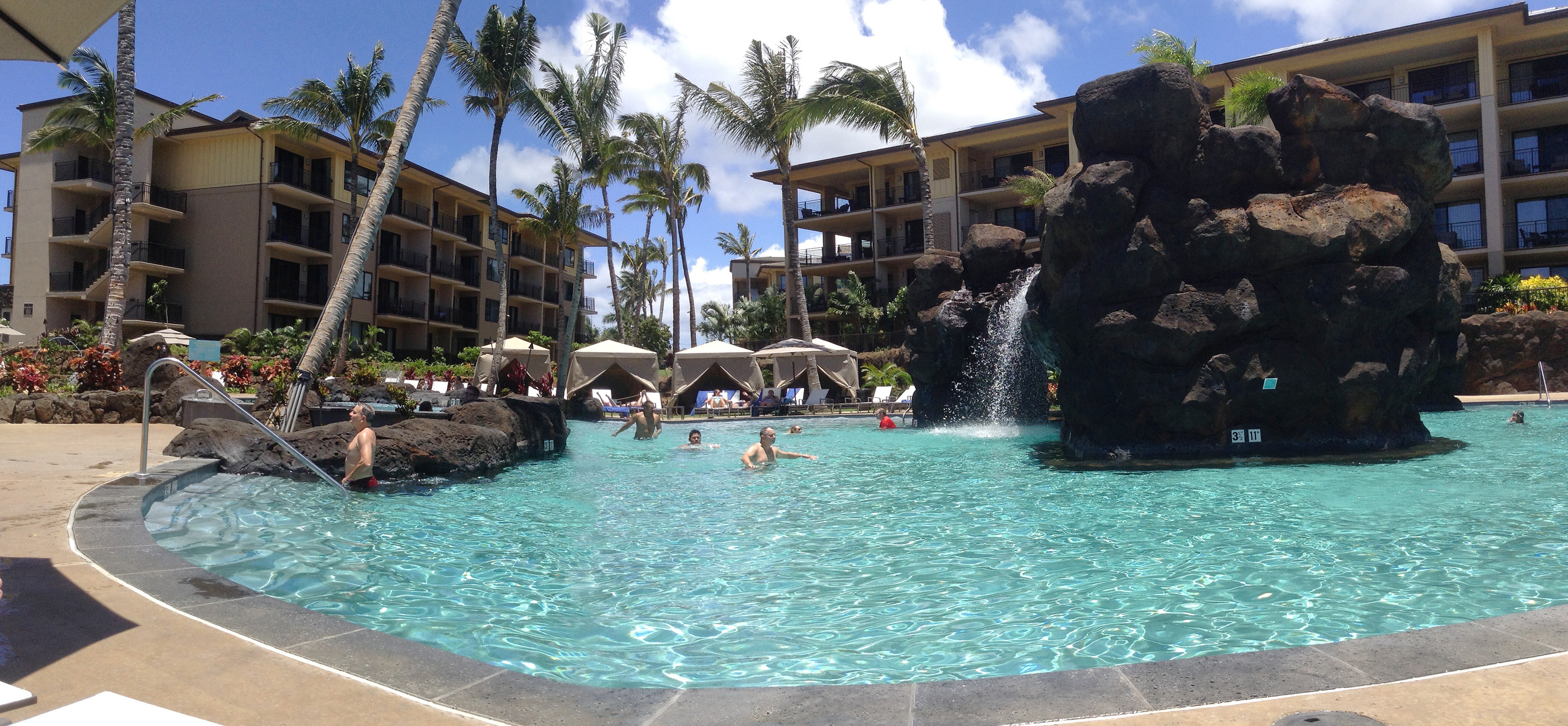
Swimming pool at our hotel on Kauai. Mary took this panorama.

Unusual flowers on the hotel grounds, Kauai
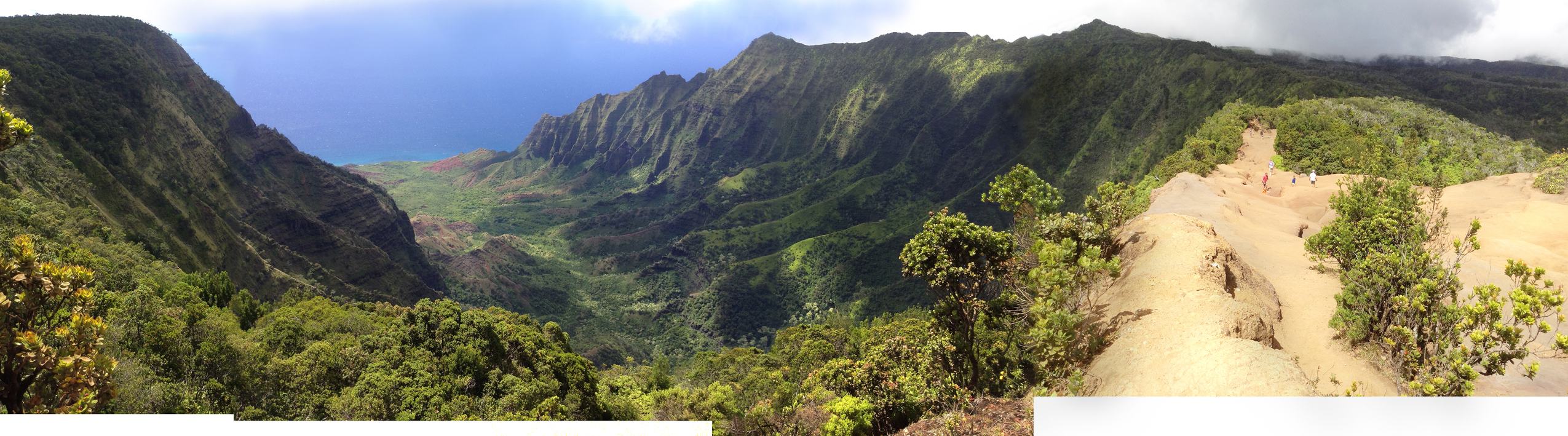
Pu'u o Kila lookout in Koke'e State Park, looking down into the Kalalau Valley and the Na Palu coast of Kauai. This is roughly a 240-degree panorama. At right along the ridge line is the start of the Pihea Trail that descends into the Alakai Swamp to the right. This is the last refuge of Kauai forest endemic birds. But there are now mosquitoes in the Alakai, and they carry avian pox and avian malaria. As a result, bird populations are crashing. John saw only two forest endemics here in 2017, despite much looking and despite the help of a good guide. Kauai elepaio and Anianiau are shown here.
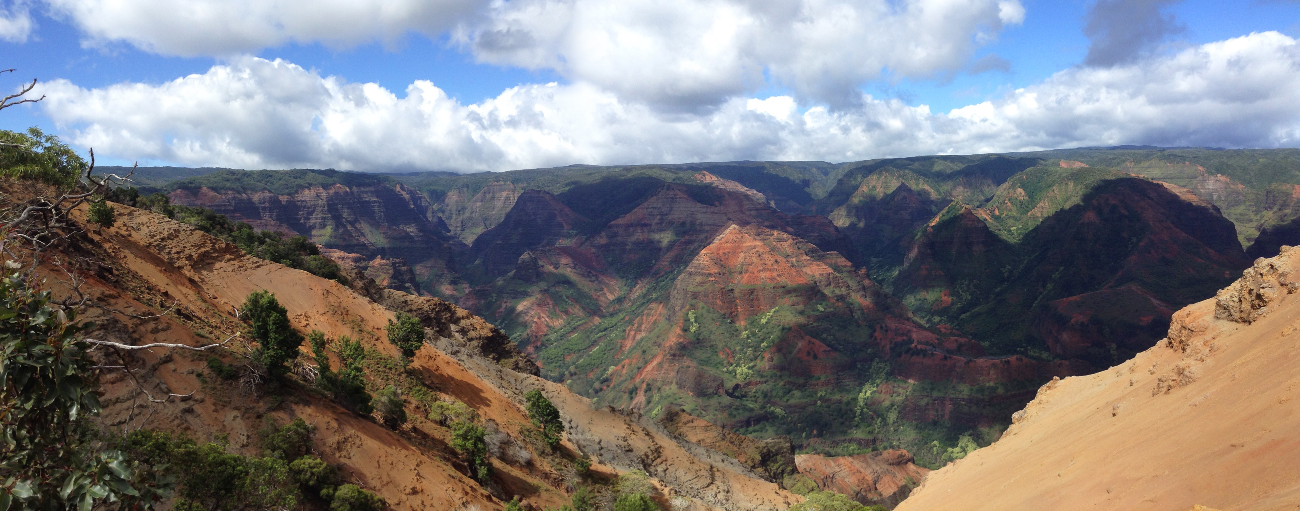
Waimea Canyon is the other truly spectacular view on Kauai. The rivers here are the watershed of the Alakai swamp.
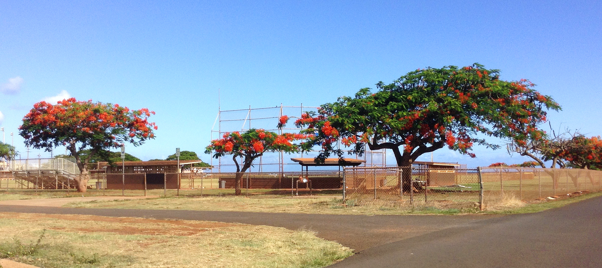
Some trees are flowering at almost any time of year, in Hawaii. Mary particularly liked these.
From Kauai, we flew to Honolulu for the IfA 50 Celebration Conference.
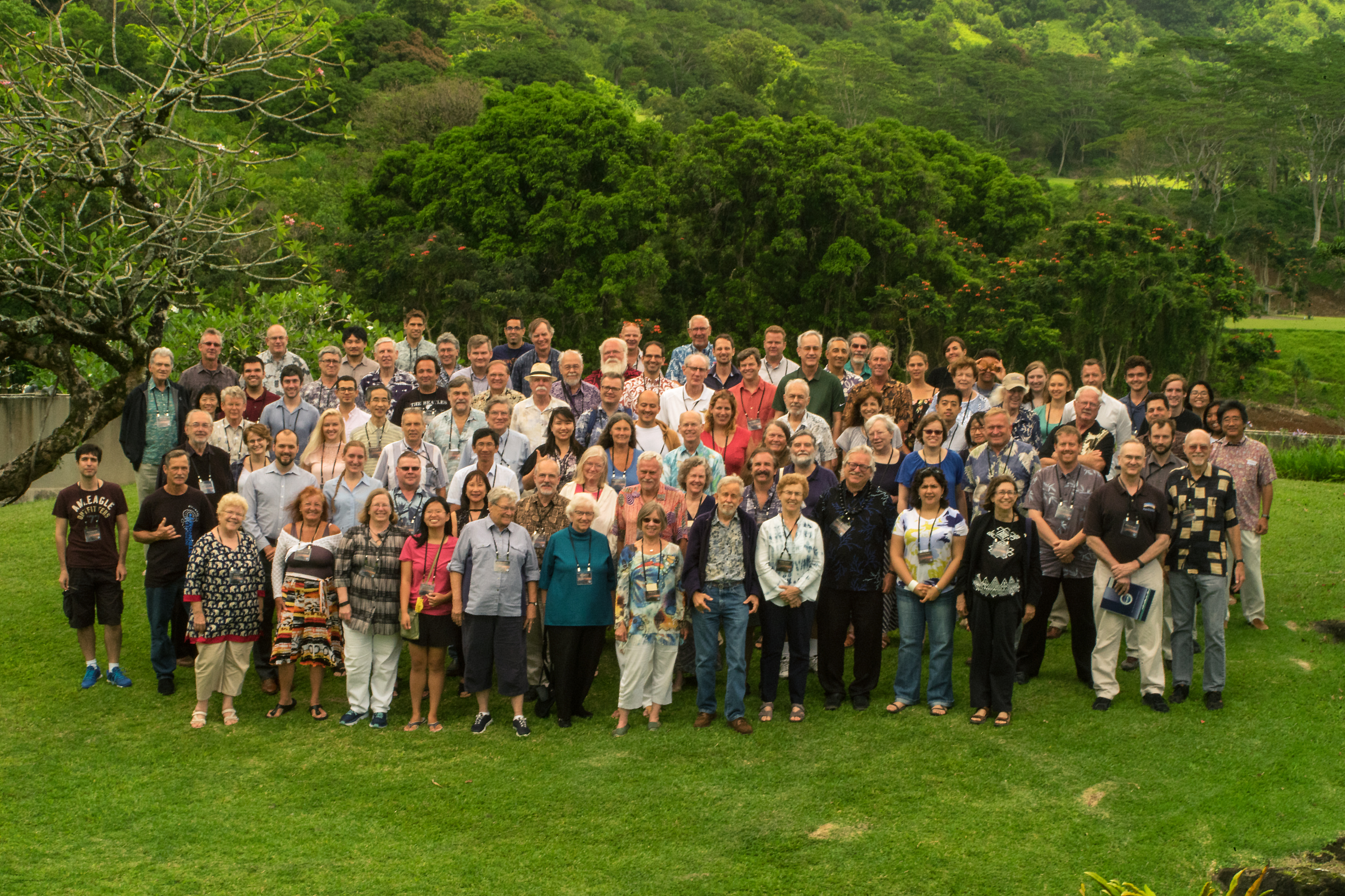
Group photo of most attendees at the IfA 50th Anniversary Celebration Conference (photo courtesy of the IfA). John is at the left end of the third row. Mary is second from left in the front row.
IfA Director Guenther Hasinger is third from the right end of the second row (black shirt and black lei). His predecessor as Director and the organizer of this meeting is Rolf-Peter Kudritzki (three people farther left in the second row). He is standing behind retired Director's Admin Assistant Nancy Lyttle, who was a good friend to Mary and John during our years at the IfA. Former IfA Librarian Kathleen Robertson is to Mary's left as we look at the picture. She was very helpful to John and a good friend to Mary while we lived in Hawaii. Other good friends: Nick Kaiser is fourth from the left end of the third row; Brent Tully is at the right end of the third row and Richard Wainscoat (blue and white shirt) is three people farther left. John and Richard wrote one paper together in the 1990s. Ken Chambers is third from left in the back row. John's best friends on the present faculty -- former Associate Director Len Cowie and David Sanders -- are missing. Don Hall, who hired John as an IfA Professor and who was Director during most of our time in Hawaii, is also missing.
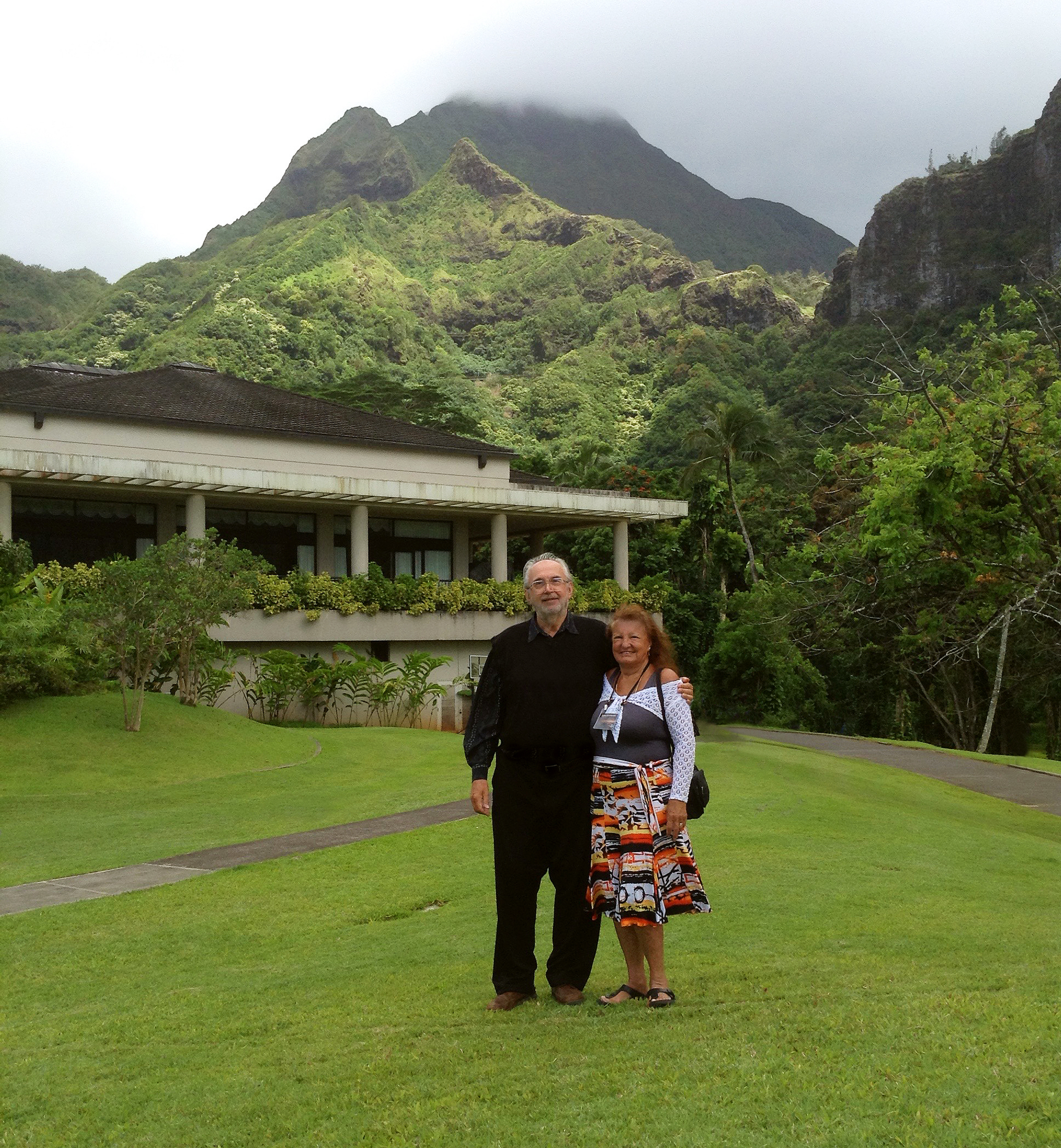
John and Mary at the IfA 50 Conference site, just below the Pali cliffs on the windward side of Oahu.

This was the view from the IfA 50 Conference venue. The cliffs have a fascinating history: Oahu formed 3 to 4 million years ago, when this part of the ocean floor (then and now moving toward the north-west) sat above the hot spot where Kilauea and Mauna Loa are now located. Volcanoes then built much bigger mountains than the present mountains on Oahu. But hardened lava is fragile and brittle, and -- many times in the history of the Hawaiian islands -- small or large chunks of mountains have broken loose, fallen down the volcanoe's slopes in a giant underwater landslide, and ended up as debris fields on the deep ocean floor. This happened on Oahu a million or more years ago. The Pali cliffs are part of the remnant of the bigger mountain, which is now on the ocean floor to the right of this picture. Erosion also helped to sculpt the islands. Together, these make the dramatic vistas seen here and at the Pu'u o Kila lookout and at many other places in Hawaii.
John Kormendy Home Page
University of Texas Astronomy Home Page
Last update: August 29, 2017. Total visits since Tuesday, August 29, 2017 =
John Kormendy (kormendy@astro.as.utexas.edu)